GALVESTON Aug 9
Climate Report:
High: None
Low: None
Precip: Missing
Snow: Missing
at Sun, 10 Aug 2025 07:04:55 +0000 via IEMbot
Additional Details Here.
10.08.2025 07:07 — 👍 0 🔁 0 💬 0 📌 0
HGX issues Area Forecast Discussion (AFD) at Aug 9, 11:37 PM CDT ...New KEY MESSAGES, DISCUSSION, MARINE... via IEMbot
Additional Details Here.
10.08.2025 04:47 — 👍 0 🔁 0 💬 0 📌 0
HGX issues A STRONG THUNDERSTORM WILL IMPACT NORTHWESTERN COLORADO COUNTY THROUGH 700 PM CDT [wind: 40 MPH, hail: 0.50 IN]
at Sat, 09 Aug 2025 23:36:58 +0000 via IEMbot
Additional Details Here.
09.08.2025 23:47 — 👍 0 🔁 0 💬 0 📌 0
HGX issues A STRONG THUNDERSTORM WILL IMPACT NORTH CENTRAL COLORADO AND NORTHWESTERN AUSTIN COUNTIES THROUGH 700 PM CDT [wind: 40 MPH, hail: 0.00 IN]
at Sat, 09 Aug 2025 23:45:10 +0000 via IEMbot
Additional Details Here.
09.08.2025 23:47 — 👍 0 🔁 0 💬 0 📌 0
At 636 PM CDT, Doppler radar was tracking a strong thunderstorm near
Columbus, moving west at 10 mph.
HAZARD...Wind gusts up to 40 mph and half inch hail.
SOURCE...Radar indicated.
IMPACT...Gusty winds could knock down tree limbs and blow around
unsecured objects. Minor hail damage to vegetation is
possible.
Locations impacted include...
Columbus and Weimar.
Special Weather Statement issued August 9 at 6:36PM CDT by NWS Houston/Galveston TX
Additional Details Here.
09.08.2025 23:45 — 👍 0 🔁 0 💬 0 📌 0
At 616 PM CDT, Doppler radar was tracking a strong thunderstorm near
Bellville, moving west at 10 mph.
HAZARD...Wind gusts up to 40 mph and half inch hail.
SOURCE...Radar indicated.
IMPACT...Gusty winds could knock down tree limbs and blow around
unsecured objects. Minor hail damage to vegetation is
possible.
Locations impacted include...
Bellville.
Special Weather Statement issued August 9 at 6:16PM CDT by NWS Houston/Galveston TX
Additional Details Here.
09.08.2025 23:30 — 👍 1 🔁 0 💬 0 📌 0
HGX issues A STRONG THUNDERSTORM WILL IMPACT EAST CENTRAL COLORADO COUNTY THROUGH 630 PM CDT [wind: 40 MPH, hail: 0.25 IN]
at Sat, 09 Aug 2025 23:15:20 +0000 via IEMbot
Additional Details Here.
09.08.2025 23:27 — 👍 0 🔁 0 💬 0 📌 0
HGX issues A STRONG THUNDERSTORM WILL IMPACT NORTH CENTRAL AUSTIN COUNTY THROUGH 645 PM CDT [wind: 40 MPH, hail: 0.50 IN]
at Sat, 09 Aug 2025 23:17:04 +0000 via IEMbot
Additional Details Here.
09.08.2025 23:27 — 👍 0 🔁 0 💬 0 📌 0
HGX issues A STRONG THUNDERSTORM WILL IMPACT EAST CENTRAL COLORADONORTH CENTRAL WHARTON AND SOUTHERN AUSTIN COUNTIES THROUGH 615 PM CDT [wind: 40 MPH, hail: 0.50 IN]
at Sat, 09 Au... at Sat, 09 Aug 2025 22:58:21 +0000 via IEMbot
Additional Details Here.
09.08.2025 23:07 — 👍 0 🔁 0 💬 0 📌 0
At 557 PM CDT, Doppler radar was tracking a strong thunderstorm near
Eagle Lake, moving west at 10 mph.
HAZARD...Wind gusts up to 40 mph and half inch hail.
SOURCE...Radar indicated.
IMPACT...Gusty winds could knock down tree limbs and blow around
unsecured objects. Minor hail damage to vegetation is
possible.
Locations impacted include...
Eagle Lake, Altair, and Garwood.
Special Weather Statement issued August 9 at 5:58PM CDT by NWS Houston/Galveston TX
Additional Details Here.
09.08.2025 23:00 — 👍 0 🔁 0 💬 0 📌 0
HGX issues A STRONG THUNDERSTORM WILL IMPACT NORTHERN FORT BEND [wind: 40 MPH, hail: 0.00 IN] for Fort Bend, Inland Harris, Waller [TX] till 5:30 PM CDT
at Sat, 09 Aug 2025 22:12:35 +0000 via IEMbot
Additional Details Here.
09.08.2025 22:27 — 👍 0 🔁 0 💬 0 📌 0
At 512 PM CDT, Doppler radar was tracking a strong thunderstorm near
Katy, moving southwest at 10 mph.
HAZARD...Wind gusts up to 40 mph.
SOURCE...Radar indicated.
IMPACT...Gusty winds could knock down tree limbs and blow around
unsecured objects.
Locations impacted include...
Katy.
Special Weather Statement issued August 9 at 5:12PM CDT by NWS Houston/Galveston TX
Additional Details Here.
09.08.2025 22:15 — 👍 0 🔁 0 💬 0 📌 0
HGX issues A STRONG THUNDERSTORM WILL IMPACT WESTERN HARRIS COUNTY THROUGH 515 PM CDT [wind: 40 MPH, hail: 0.00 IN] for Inland Harris [TX]
at Sat, 09 Aug 2025 21:53:08 +0000 via IEMbot
Additional Details Here.
09.08.2025 22:07 — 👍 0 🔁 0 💬 0 📌 0
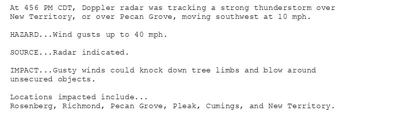
At 456 PM CDT, Doppler radar was tracking a strong thunderstorm over
New Territory, or over Pecan Grove, moving southwest at 10 mph.
HAZARD...Wind gusts up to 40 mph.
SOURCE...Radar indicated.
IMPACT...Gusty winds could knock down tree limbs and blow around
unsecured objects.
Locations impacted include...
Rosenberg, Richmond, Pecan Grove, Pleak, Cumings, and New Territory.
Special Weather Statement issued August 9 at 4:56PM CDT by NWS Houston/Galveston TX
Additional Details Here.
09.08.2025 22:00 — 👍 0 🔁 0 💬 0 📌 0
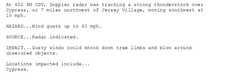
At 452 PM CDT, Doppler radar was tracking a strong thunderstorm over
Cypress, or 7 miles northwest of Jersey Village, moving southwest at
10 mph.
HAZARD...Wind gusts up to 40 mph.
SOURCE...Radar indicated.
IMPACT...Gusty winds could knock down tree limbs and blow around
unsecured objects.
Locations impacted include...
Cypress.
Special Weather Statement issued August 9 at 4:52PM CDT by NWS Houston/Galveston TX
Additional Details Here.
09.08.2025 22:00 — 👍 0 🔁 0 💬 0 📌 0
GALVESTON Aug 9
Climate Report:
High: None
Low: None
Precip: Missing
Snow: 0.0"
at Sat, 09 Aug 2025 21:26:14 +0000 via IEMbot
Additional Details Here.
09.08.2025 21:27 — 👍 0 🔁 0 💬 0 📌 0
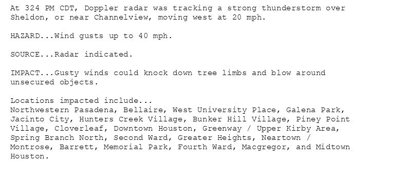
At 324 PM CDT, Doppler radar was tracking a strong thunderstorm over
Sheldon, or near Channelview, moving west at 20 mph.
HAZARD...Wind gusts up to 40 mph.
SOURCE...Radar indicated.
IMPACT...Gusty winds could knock down tree limbs and blow around
unsecured objects.
Locations impacted include...
Northwestern Pasadena, Bellaire, West University Place, Galena Park,
Jacinto City, Hunters Creek Village, Bunker Hill Village, Piney Point
Village, Cloverleaf, Downtown Houston, Greenway / Upper Kirby Area,
Spring Branch North, Second Ward, Greater Heights, Neartown /
Montrose, Barrett, Memorial Park, Fourth Ward, Macgregor, and Midtown
Houston.
Special Weather Statement issued August 9 at 3:25PM CDT by NWS Houston/Galveston TX
Additional Details Here.
09.08.2025 20:30 — 👍 1 🔁 0 💬 0 📌 0
HGX issues A STRONG THUNDERSTORM WILL IMPACT CENTRAL HARRIS COUNTY THROUGH 400 PM CDT [wind: 40 MPH, hail: 0.00 IN] for Coastal Harris, Inland Harris [TX]
at Sat, 09 Aug 2025 20:25:28 +0000 via IEMbot
Additional Details Here.
09.08.2025 20:27 — 👍 0 🔁 0 💬 0 📌 0
HGX issues Area Forecast Discussion (AFD) at Aug 9, 12:26 PM CDT ...New DISCUSSION, MARINE... via IEMbot
Additional Details Here.
09.08.2025 17:47 — 👍 0 🔁 0 💬 0 📌 0
HGX issues Area Forecast Discussion (AFD) at Aug 9, 6:16 AM CDT ...New AVIATION... via IEMbot
Additional Details Here.
09.08.2025 11:27 — 👍 0 🔁 0 💬 0 📌 0
GALVESTON Aug 8
Climate Report:
High: 92
Low: 80
Precip: 0.0"
Snow: 0.0"
at Sat, 09 Aug 2025 07:26:38 +0000 via IEMbot
Additional Details Here.
09.08.2025 07:27 — 👍 0 🔁 0 💬 0 📌 0
HGX issues Area Forecast Discussion (AFD) at Aug 8, 11:28 PM CDT ...New KEY MESSAGES, DISCUSSION, MARINE... via IEMbot
Additional Details Here.
09.08.2025 04:47 — 👍 0 🔁 0 💬 0 📌 0
HGX issues Area Forecast Discussion (AFD) at Aug 8, 6:47 PM CDT ...New AVIATION... via IEMbot
Additional Details Here.
09.08.2025 00:07 — 👍 0 🔁 0 💬 0 📌 0
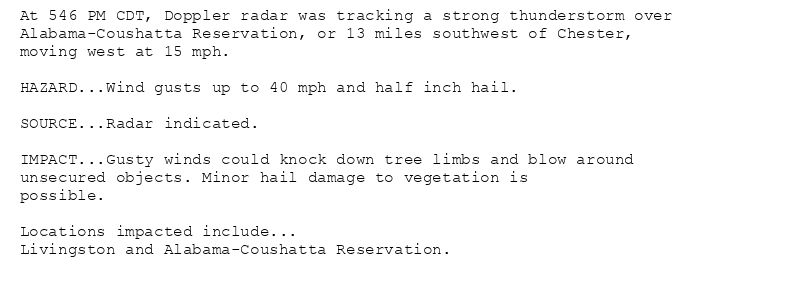
At 546 PM CDT, Doppler radar was tracking a strong thunderstorm over
Alabama-Coushatta Reservation, or 13 miles southwest of Chester,
moving west at 15 mph.
HAZARD...Wind gusts up to 40 mph and half inch hail.
SOURCE...Radar indicated.
IMPACT...Gusty winds could knock down tree limbs and blow around
unsecured objects. Minor hail damage to vegetation is
possible.
Locations impacted include...
Livingston and Alabama-Coushatta Reservation.
Special Weather Statement issued August 8 at 5:46PM CDT by NWS Houston/Galveston TX
Additional Details Here.
08.08.2025 23:00 — 👍 0 🔁 0 💬 0 📌 0
HGX issues A STRONG THUNDERSTORM WILL IMPACT SOUTHEASTERN POLK COUNTY THROUGH 615 PM CDT [wind: 40 MPH, hail: 0.50 IN]
at Fri, 08 Aug 2025 22:46:44 +0000 via IEMbot
Additional Details Here.
08.08.2025 22:47 — 👍 1 🔁 0 💬 0 📌 0
COLLEGE STATION Aug 8
Climate Report:
High: 94
Low: 76
Precip: 0.0"
Snow: 0.0"
at Fri, 08 Aug 2025 21:17:37 +0000 via IEMbot
Additional Details Here.
08.08.2025 21:27 — 👍 0 🔁 0 💬 0 📌 0
A Marine Weather Statement has been issued for the following areas...
Galveston Bay...
At 316 PM CDT, Doppler radar indicated an outflow boundary from
storms moving westward off the Chambers County coast along Galveston
Bay, capable of producing winds to around 30 knots. This boundary
will track west at 25 knots across most of the Bay. Mariners should
anticipate winds to briefly shift to the east and become gusty as it
passes. Showers and a few thunderstorms are possible behind the wind
shift, though the primary threat should be the initial gusty winds
along the outflow.
The front will be near...
Trinity Bay, Galveston Bay, western East Galveston Bay, Tabbs Bay,
and Smith Point around 320 PM CDT.
Black Duck Bay, Upper San Jacinto Bay, and Mitchell Bay around 325
PM CDT.
Scott Bay, Crystal Bay, and Burnet Bay around 330 PM CDT.
Eagle Point around 340 PM CDT.
Marine Weather Statement issued August 8 at 3:20PM CDT by NWS Houston/Galveston TX
Additional Details Here.
08.08.2025 20:30 — 👍 0 🔁 0 💬 0 📌 0
HGX issues Area Forecast Discussion (AFD) at Aug 8, 1:17 PM CDT ...New KEY MESSAGES, DISCUSSION, MARINE... via IEMbot
Additional Details Here.
08.08.2025 18:27 — 👍 0 🔁 0 💬 0 📌 0
HGX issues Area Forecast Discussion (AFD) at Aug 8, 6:49 AM CDT ...New AVIATION... via IEMbot
Additional Details Here.
08.08.2025 12:07 — 👍 0 🔁 0 💬 0 📌 0
GALVESTON Aug 7
Climate Report:
High: 91
Low: 81
Precip: 0.15"
Snow: 0.0"
at Fri, 08 Aug 2025 06:59:16 +0000 via IEMbot
Additional Details Here.
08.08.2025 07:07 — 👍 0 🔁 0 💬 0 📌 0