CORN-ADO CHASING! It was another hot, sunny day with record heat in the Midwest, ripe for dust devils. During the harvest season when cornbelt dust devils fill with corn stalks, I call them corn-adoes! Got my drone into a few of them today.
04.10.2025 01:29 — 👍 53 🔁 16 💬 5 📌 2

The impact extreme rainfall events can have in a year - check out Tescott, KS. They'd probably be running near average year-to-date, but a pair of 6"+ rain events Jul 22 and Sep 9 have them running a 10"+ surplus.
Recap your 2025 precip story: ag-wx.com
11.09.2025 14:23 — 👍 7 🔁 2 💬 1 📌 0

RE:PUBLIC
INDEPENDENT JOURNALISM FOR PUBLIC LANDS.
Something good: a new, nonprofit newsroom run by some wonderful, experienced folks (core crew from Outside mag's glory days) dedicated to journalism about American public lands! Looks like the plan is to collaborate a fair bit with other outlets.
10.09.2025 22:15 — 👍 249 🔁 93 💬 8 📌 6

View from a high point across dissected terrain with lots of trees toward amostly flat horizon withe a high summit rising above it just to the right of center of the photo. A two lane road drops down a hill in the foreground, rising to another summit in the middle ground. Another somewhat lower distinct summit is at the right edge of the photo.
West Blue Mound, highest point in southern Wisconsin, on the horizon from a ridgetop in Lafayette County, Wisconsin. East Blue Mound is also visible at the right edge of the photo.
06.09.2025 22:01 — 👍 13 🔁 2 💬 2 📌 0

Line graph time series of 2025's daily Arctic sea ice extent compared to decadal averages from the 1980s to the 2010s. The decadal averages are shown with different colored lines with purple for the 1980s, blue for the 1990s, green for the 2000s, and white for the 2010s. Thin white lines are also shown for each year from 2000 to 2024. 2025 is shown with a thick gold line. There is a long-term decreasing trend in ice extent for every day of the year shown on this graph between July and October by looking at the decadal average line positions.
Friday ice update - #Arctic sea ice extent is currently the 10th lowest on record (JAXA data)
• about 50,000 km² above the 2010s mean
• about 1,040,000 km² below the 2000s mean
• about 2,020,000 km² below the 1990s mean
• about 2,760,000 km² below the 1980s mean
More: zacklabe.com/arctic-sea-i...
29.08.2025 14:35 — 👍 68 🔁 30 💬 1 📌 0

3:15 PM: Severe-warned thunderstorm just east of Mt. St. Helens, with potential wind gusts up to 60 mph and up to 1" hail! #wawx
26.08.2025 22:24 — 👍 20 🔁 6 💬 1 📌 0

Something exciting is coming soon, stay tuned flyer
Welcome to our page! We are glad you are here.
Stay tuned for more exciting news to come.
In the meantime, check out our bio and follow us here and on our other social channels:
climate.us
26.08.2025 18:21 — 👍 125 🔁 43 💬 6 📌 21

Glacier du Pays Bâché (Neouvielle, Pyrénées) ✝️
1896 | 2023
This glacier east of Pic Long (3192 m) disappeared more than 15 years ago! 📈
Was 900 m-long and 30+ ha during the LIA! 🧊💪
Only witnesses: a magnificent moraine and a glacial lake!
Who's next? 🔥
📷1896: Lucien Briet
2023 Mathieu Lavi 🙏
26.08.2025 18:45 — 👍 32 🔁 14 💬 0 📌 1
I'm concerned about a potential uptick in fire activity across western Canada in late August and early September - risk has been trending up with dryness over the last week, upcoming week of hot + dry conditions will put pressure on early September rainfall opportunities.
25.08.2025 14:50 — 👍 4 🔁 2 💬 0 📌 0

Smoke plume in the distance with mountains and dried sagebrush flats in the foreground.
We saw this plume of smoke from a fire in the Wind River Mtns/Green River Lakes area today. It was reported this afternoon and within just a few hours was estimated at 600 acres. Insane. #wildfire
22.08.2025 03:02 — 👍 16 🔁 6 💬 1 📌 1

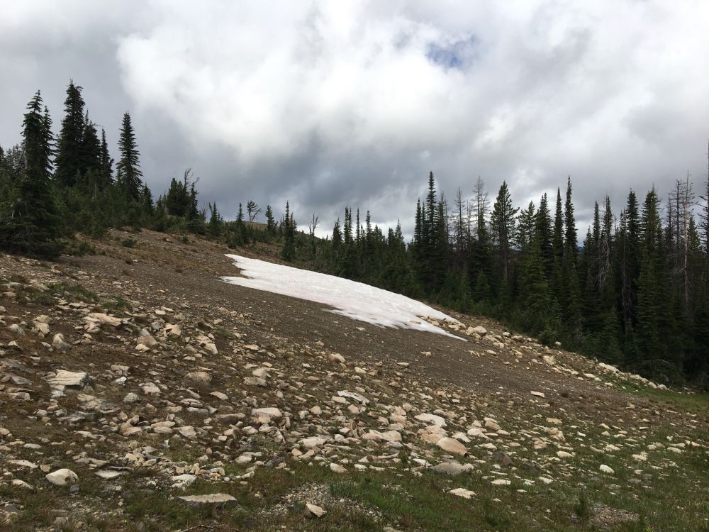
One lonesome snowpatch still shining in this high-country viewshed...
23.08.2025 17:24 — 👍 1 🔁 0 💬 0 📌 0
I'm thrilled to see this paper out, which I co-led with @ditchontologist.bsky.social, and featuring input from loads of excellent co-authors. It's our interdisciplinary perspective on ditches; what they do, why they matter, and how we should look after them.
23.08.2025 08:34 — 👍 13 🔁 3 💬 1 📌 0
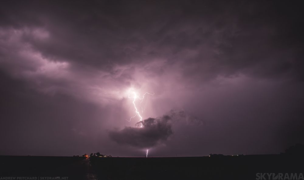
Cloud-to-ground lightning bolt pierces a scud tag ahead of storms in central Illinois on Saturday night. This was around 10 PM, looking north across the farm fields of Champaign County, IL.
18.08.2025 13:40 — 👍 10 🔁 2 💬 0 📌 0

A map of soil color at 125 cm, across the Midwest. There are reddish brown colors around Lake Superior and south and west from there for some distance into Minnesota and Wisconsin. Yellowish-greenish-gray colors predominate in the southwest and there are some bright white to orange colors in part of western Wisconsin, the northern Driftless Area.
Soil color at the scale of the Midwest. Two patterns depending on depth: 1. At 125 cm, it's about parent material. Greenish-gray Des Moines Lobe till to the west/southwest, and reddish-brown sediment of the Superior Lobe and others to the northeast. Sandstone colors in the northern Driftless Area.
17.08.2025 22:29 — 👍 15 🔁 3 💬 1 📌 0

Elk Mountain,
8/17/2025, 4:59:35 PM
17.08.2025 22:59 — 👍 2 🔁 1 💬 0 📌 0
Anvil crawler heaven here in the stratiform precip region of a thunderstorm cluster southeast of Champaign, IL
17.08.2025 05:04 — 👍 26 🔁 3 💬 1 📌 0
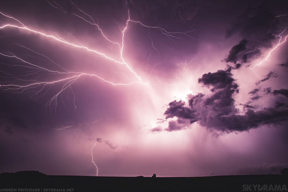
One of the most spectacular lightning displays I've seen in my backyard in many years. I felt like I was fumbling my way through shooting most of the show & was just hoping I'd capture one image that conveyed how insane the show felt.
Looking east from Urbana, IL around 12 AM:
17.08.2025 15:33 — 👍 50 🔁 9 💬 1 📌 0

Wildfire Fighters, Unmasked in Toxic Smoke, Are Getting Sick and Dying
Every paragraph in this story about smoke exposure is brutal. I'm starting to question how wildland firefighting is any different from Russian soldiers clearing debris at Chernobyl--except it's in much slower motion & we all keep doing things to make it worse. 1/ www.nytimes.com/2025/08/17/u...
17.08.2025 19:10 — 👍 57 🔁 18 💬 1 📌 0

A hand drawn map of a dense stream network with many fine branches.

The same stream network as the other image, this time mapped from the National Hydrography Dataset Plus, with only a few larger channels shown as blue lines.
Left: A map of the drainage network of Blockhouse Creek near Platteville, Wisconsin, hand-drawn by my Ph.D. advisor Jim Knox, I believe for his PhD research ca. 1967. Right, drainage network for the same basin, NHDPlus data. Pretty different definitions of "1st order" streams.
17.08.2025 02:37 — 👍 17 🔁 2 💬 1 📌 0

Photo of bedforms (ripples of sand), produced by runoff flowing along the edge of a street during a recent storm.
Gutter bedforms
17.08.2025 16:31 — 👍 17 🔁 1 💬 2 📌 0
I completely support Rep Garcia's effort here. It is past time that the facts of this matter come to light
17.08.2025 16:36 — 👍 16 🔁 7 💬 1 📌 0


Summit: weather-beaten Curl-leaf Mtn-Mahogany & Douglas-fir...distant N-face snowfield beacon across the valley
17.08.2025 19:04 — 👍 2 🔁 0 💬 0 📌 0
Box Elder Canyon and Bignell Table, in the loess canyons of western Nebraska, with shadows moving across the landscape as they would on August 9. Uses sun position calculated by {suntools} R package. Visualized with #rayshader. DEM via @opentopography.org
11.08.2025 23:07 — 👍 18 🔁 4 💬 1 📌 0
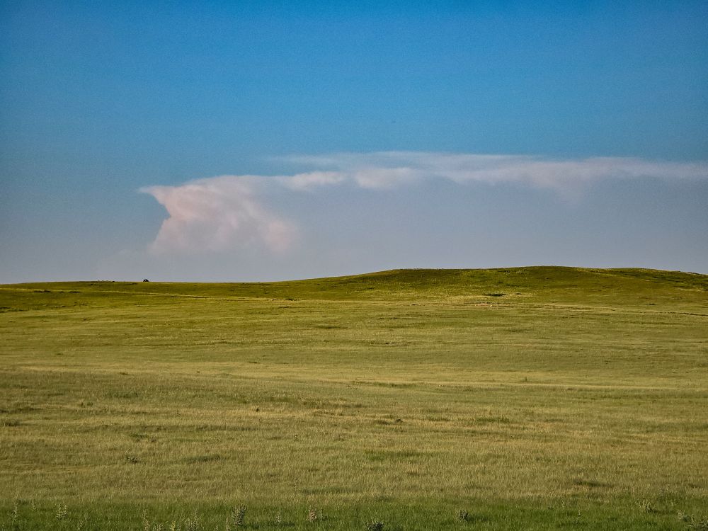
Distant, lone thunderstorm
07.08.2025 01:09 — 👍 35 🔁 6 💬 1 📌 0
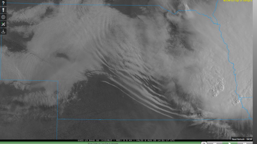
Lot going on in Nebraska this morning but the gravity waves being pushed southwest of the MCS are as spectacular as I can remember seeing on satellite.
06.08.2025 14:08 — 👍 19 🔁 5 💬 2 📌 0
Swirly little MCV that almost resembles a tropical system spinning over the border of Montana/Wyoming/the Dakotas this morning.
01.08.2025 15:43 — 👍 57 🔁 12 💬 4 📌 0

graph showing day of year against lightning efficiency ( flashes divided by number of fires)
https://fireecology.springeropen.com/counter/pdf/10.1186/s42408-025-00376-1.pdf

story from the Williams Lake Tribune on the lightning-caused wildfires in the Cariboo Fire Centre
https://www.wltribune.com/local-news/cariboo-fire-centre-receives-1245-lightning-strikes-july-30-8169598
Lightning-caused fire season is in full swing in BC. For central BC we expect about 1 fire per 100 lightning flashes for this time of year (graph below). The Cariboo had over 1200 strikes so would expect about 12 fires -
www.wltribune.com/local-news/c...
01.08.2025 15:33 — 👍 19 🔁 8 💬 1 📌 0

The last week of July has been another stormy one with nearly 1,500 reports of severe weather during the period spanning July 23-30, 2025.
31.07.2025 15:03 — 👍 8 🔁 2 💬 1 📌 0
Advocate for climate action, clean energy & democracy. Likes to play outside. Director with Sierra Club Foundation and Clean Energy Transition Institute and recently Director and Vice President with Sierra Club.
Dad, husband, host @Marketplace. IPAs. Soccer referee, trail runner, mountain biker. Veteran. kryssdal@marketplace.org
CHANGEOVER, my tennis book about Alcaraz & Sinner, just came out: https://www.simonandschuster.com/books/Changeover/Giri-Nathan/9781668076248
giri[at]defector[dot]com
🍃 Seeing beauty in everyday nature
👻 Creator of ‘Grimwood’: Video series on folklore, urban legends, and spooky tales.
Southwestern ON 🇨🇦
We are an independent, nonprofit successor to Climate(.)gov, safeguarding public access to trusted climate data, tools, and information.
Donate: https://donorbox.org/climate-us-protected-by-you
Personal account. Botanist. #TropicalBotany. 🌴 Author of "A Gardener's Guide to Botany.” 🐶 Henry's 2nd favorite dad. IG: Scott.Zona. Posting from North Carolina, USA. Trapped in Trumpistan. #IamaBotanist
Biogeochemist at University of Liverpool & SLU Uppsala. Greenhouse gases and water chemistry in peatlands, lakes, streams, ditches and ponds. Lover of mountains and wild places.
https://scholar.google.com/citations?user=GXE28xwAAAAJ&hl=en
Sometime aquatic (socio-)ecologist 💦🌱🦟👥🏖️🌽🐄🛣️🏡🛥️🛶⛲️👩🏻🔬👩🏻🏫
Also: 🤕♿️✊🤝🐈📘🥾🏞️🎨🎻🧘🏻♀️
She/her/hers
indie nostalgia by @chrisdeville.bsky.social
pre-order SUCH GREAT HEIGHTS: The Complete Cultural History of the Indie Rock Explosion: https://read.macmillan.com/lp/such-great-heights-9781250363381/
The events of exactly 250 years ago today (1775). A project in conjunction with America’s semiquincentennial. By Jon Blackwell, an editor at the Wall Street Journal. Also follow me @100yearsagonews.bsky.social
Jon Blackwell, an editor @wsj. Reporting events from a century ago. Also see my companion account @250yearsagonews.bsky.social
NWS Spokane, WA products syndicated by IEMBot. @akrherz.bsky.social is my father.
Bringing people together to strengthen collaborations, synthesize science, and enhance science application to fire management challenges. Part of the Joint Fire Science Program (JFSP) Fire Science Exchange Network https://nrfirescience.org
NWS Boise products syndicated by IEMBot. @akrherz.bsky.social is my father.
Climate impacts and adaptation for nature and people. Senior Scientist @ Climate Impacts Group & Univ. Director @ NW Climate Adaptation Science Center, U of Washington. Surfer/paddler. Settler on Coast Salish land. She/her. Personal account - views mine.
~ Podcast ~ Conversations with subject matter experts and activists from across the country who are working to protect and advocate for our public lands and their wildlife, wilderness, and cultural values. *Opinions are my own*
Natural resource economist, geographer, meanderer, informed agitator, immigrant.
Trans rights are human rights.
💧Dall’acqua salata a quella dolce e zozza💧
My views are my own and do not represent my employer.
I do not enjoy having to state the obvious.
Director of the School of Fisheries, Aquaculture & Aquatic Sciences @ Auburn University https://agriculture.auburn.edu/research/faas/ • 🧪 for Ecosystems, Fish, People & Ag https://sites.google.com/view/rypel-lab/home • ✍️ at TangledNature.com
Meteorologist & climate journalist. Dad. Birder. Minnesotan. Optimistic to a fault.
Science news with attitude for The Guardian. Author of The Future Earth.
Contact me securely on Signal: 3162958947


