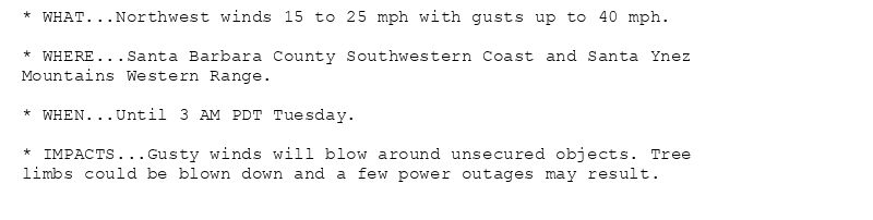
* WHAT...Northwest winds 15 to 25 mph with gusts up to 40 mph.
* WHERE...Santa Barbara County Southwestern Coast and Santa Ynez
Mountains Western Range.
* WHEN...Until 3 AM PDT Tuesday.
* IMPACTS...Gusty winds will blow around unsecured objects. Tree
limbs could be blown down and a few power outages may result.
Wind Advisory issued August 4 at 5:02AM PDT until August 5 at 3:00AM PDT by NWS Los Angeles/Oxnard CA
Additional Details Here.
04.08.2025 12:15 — 👍 0 🔁 0 💬 0 📌 0
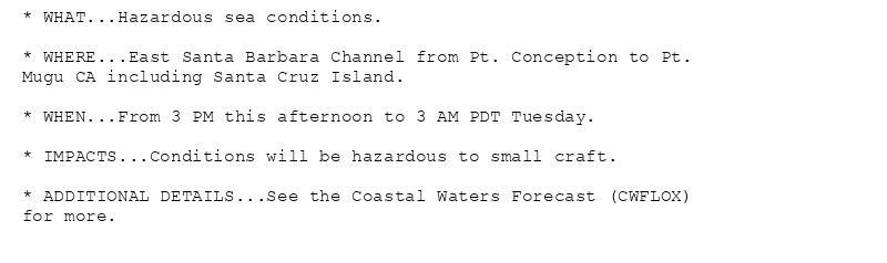
* WHAT...Hazardous sea conditions.
* WHERE...East Santa Barbara Channel from Pt. Conception to Pt.
Mugu CA including Santa Cruz Island.
* WHEN...From 3 PM this afternoon to 3 AM PDT Tuesday.
* IMPACTS...Conditions will be hazardous to small craft.
* ADDITIONAL DETAILS...See the Coastal Waters Forecast (CWFLOX)
for more.
Gale Warning issued August 4 at 2:32AM PDT until August 4 at 3:00AM PDT by NWS Los Angeles/Oxnard CA
Additional Details Here.(2/2)
04.08.2025 09:45 — 👍 0 🔁 0 💬 0 📌 0
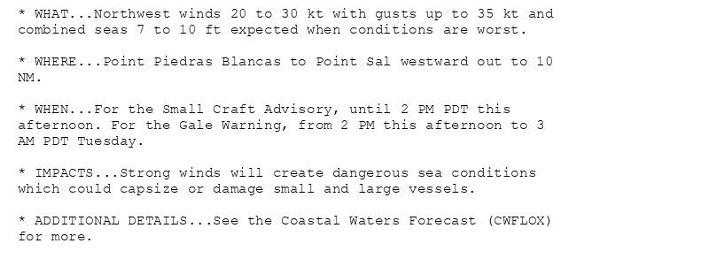
* WHAT...Northwest winds 20 to 30 kt with gusts up to 35 kt and
combined seas 7 to 10 ft expected when conditions are worst.
* WHERE...Point Piedras Blancas to Point Sal westward out to 10
NM.
* WHEN...For the Small Craft Advisory, until 2 PM PDT this
afternoon. For the Gale Warning, from 2 PM this afternoon to 3
AM PDT Tuesday.
* IMPACTS...Strong winds will create dangerous sea conditions
which could capsize or damage small and large vessels.
* ADDITIONAL DETAILS...See the Coastal Waters Forecast (CWFLOX)
for more.

* WHAT...Northwest winds 20 to 30 kt with gusts up to 35 kt and
combined seas 6 to 11 ft when conditions are worst.
* WHERE...Portions of the coastal waters of southwest
California.
* WHEN...Until 3 AM PDT Tuesday.
* IMPACTS...Strong winds will create dangerous sea conditions
which could capsize or damage small and large vessels.
* ADDITIONAL DETAILS...See the Coastal Waters Forecast (CWFLOX)
for more.
Gale Warning issued August 4 at 2:32AM PDT until August 4 at 3:00AM PDT by NWS Los Angeles/Oxnard CA
Additional Details Here.
(1/2)
04.08.2025 09:45 — 👍 0 🔁 0 💬 0 📌 0
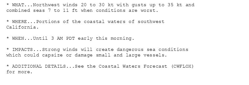
* WHAT...Northwest winds 20 to 30 kt with gusts up to 35 kt and
combined seas 7 to 11 ft when conditions are worst.
* WHERE...Portions of the coastal waters of southwest
California.
* WHEN...Until 3 AM PDT early this morning.
* IMPACTS...Strong winds will create dangerous sea conditions
which could capsize or damage small and large vessels.
* ADDITIONAL DETAILS...See the Coastal Waters Forecast (CWFLOX)
for more.
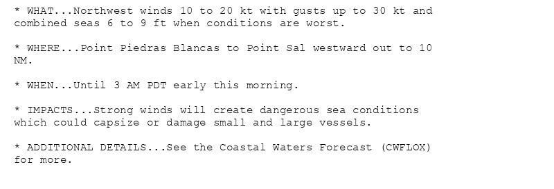
* WHAT...Northwest winds 10 to 20 kt with gusts up to 30 kt and
combined seas 6 to 9 ft when conditions are worst.
* WHERE...Point Piedras Blancas to Point Sal westward out to 10
NM.
* WHEN...Until 3 AM PDT early this morning.
* IMPACTS...Strong winds will create dangerous sea conditions
which could capsize or damage small and large vessels.
* ADDITIONAL DETAILS...See the Coastal Waters Forecast (CWFLOX)
for more.
Gale Warning issued August 4 at 12:57AM PDT until August 4 at 3:00AM PDT by NWS Los Angeles/Oxnard CA
Additional Details Here.
04.08.2025 08:00 — 👍 0 🔁 0 💬 0 📌 0
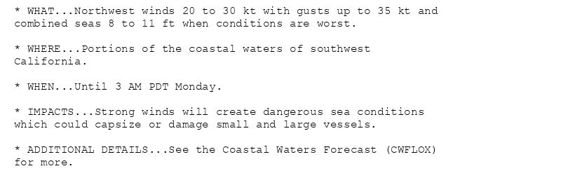
* WHAT...Northwest winds 20 to 30 kt with gusts up to 35 kt and
combined seas 8 to 11 ft when conditions are worst.
* WHERE...Portions of the coastal waters of southwest
California.
* WHEN...Until 3 AM PDT Monday.
* IMPACTS...Strong winds will create dangerous sea conditions
which could capsize or damage small and large vessels.
* ADDITIONAL DETAILS...See the Coastal Waters Forecast (CWFLOX)
for more.
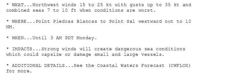
* WHAT...Northwest winds 15 to 25 kt with gusts up to 35 kt and
combined seas 7 to 10 ft when conditions are worst.
* WHERE...Point Piedras Blancas to Point Sal westward out to 10
NM.
* WHEN...Until 3 AM PDT Monday.
* IMPACTS...Strong winds will create dangerous sea conditions
which could capsize or damage small and large vessels.
* ADDITIONAL DETAILS...See the Coastal Waters Forecast (CWFLOX)
for more.
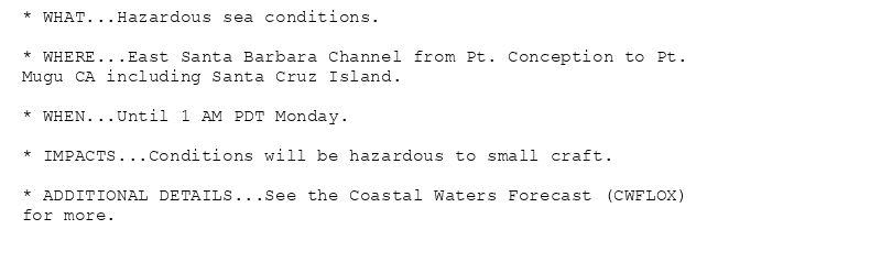
* WHAT...Hazardous sea conditions.
* WHERE...East Santa Barbara Channel from Pt. Conception to Pt.
Mugu CA including Santa Cruz Island.
* WHEN...Until 1 AM PDT Monday.
* IMPACTS...Conditions will be hazardous to small craft.
* ADDITIONAL DETAILS...See the Coastal Waters Forecast (CWFLOX)
for more.
Gale Warning issued August 3 at 6:34PM PDT until August 4 at 3:00AM PDT by NWS Los Angeles/Oxnard CA
Additional Details Here.
04.08.2025 01:45 — 👍 0 🔁 0 💬 0 📌 0
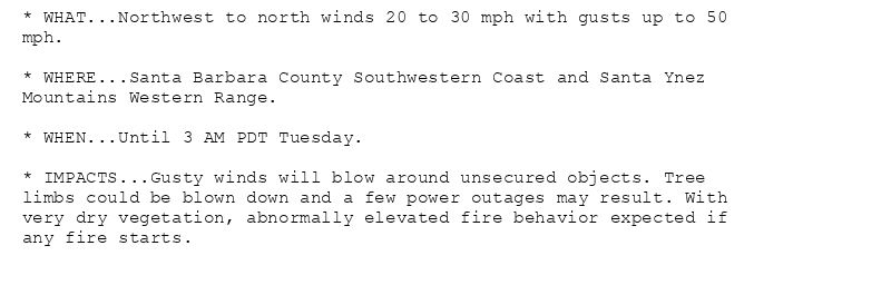
* WHAT...Northwest to north winds 20 to 30 mph with gusts up to 50
mph.
* WHERE...Santa Barbara County Southwestern Coast and Santa Ynez
Mountains Western Range.
* WHEN...Until 3 AM PDT Tuesday.
* IMPACTS...Gusty winds will blow around unsecured objects. Tree
limbs could be blown down and a few power outages may result. With
very dry vegetation, abnormally elevated fire behavior expected if
any fire starts.
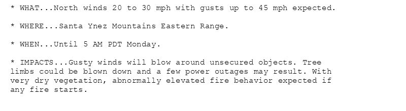
* WHAT...North winds 20 to 30 mph with gusts up to 45 mph expected.
* WHERE...Santa Ynez Mountains Eastern Range.
* WHEN...Until 5 AM PDT Monday.
* IMPACTS...Gusty winds will blow around unsecured objects. Tree
limbs could be blown down and a few power outages may result. With
very dry vegetation, abnormally elevated fire behavior expected if
any fire starts.
Wind Advisory issued August 3 at 6:05PM PDT until August 5 at 3:00AM PDT by NWS Los Angeles/Oxnard CA
Additional Details Here.
04.08.2025 01:15 — 👍 0 🔁 0 💬 0 📌 0
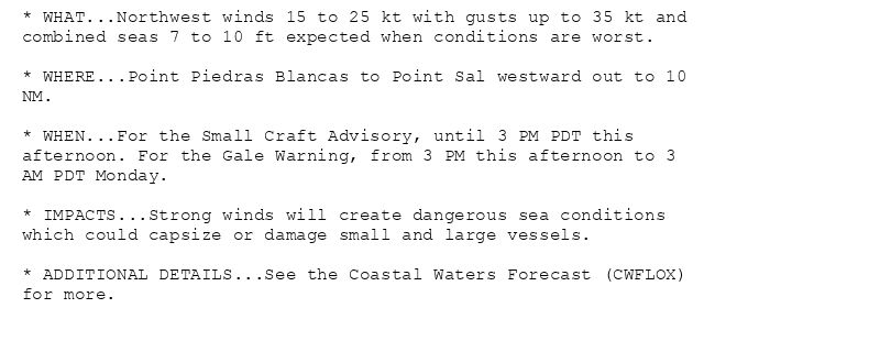
* WHAT...Northwest winds 15 to 25 kt with gusts up to 35 kt and
combined seas 7 to 10 ft expected when conditions are worst.
* WHERE...Point Piedras Blancas to Point Sal westward out to 10
NM.
* WHEN...For the Small Craft Advisory, until 3 PM PDT this
afternoon. For the Gale Warning, from 3 PM this afternoon to 3
AM PDT Monday.
* IMPACTS...Strong winds will create dangerous sea conditions
which could capsize or damage small and large vessels.
* ADDITIONAL DETAILS...See the Coastal Waters Forecast (CWFLOX)
for more.
* WHAT...Hazardous wind and sea conditions.
* WHERE...East Santa Barbara Channel from Pt. Conception to Pt.
Mugu CA including Santa Cruz Island.
* WHEN...From 3 PM this afternoon to 1 AM PDT Monday.
* IMPACTS...Conditions will be hazardous to small craft.
* ADDITIONAL DETAILS...See the Coastal Waters Forecast (CWFLOX)
for more.
Small Craft Advisory issued August 3 at 12:09PM PDT until August 3 at 3:00PM PDT by NWS Los Angeles/Oxnard CA
Additional Details Here.(2/2)
03.08.2025 19:15 — 👍 1 🔁 0 💬 0 📌 0
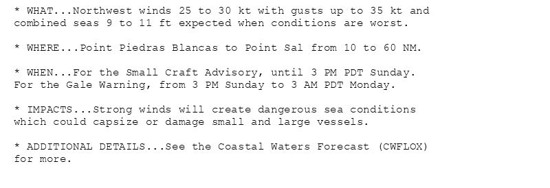
* WHAT...Northwest winds 20 to 30 kt with gusts up to 35 kt and
combined seas 9 to 11 ft expected when conditions are worst.
* WHERE...Point Piedras Blancas to Point Sal from 10 to 60 NM.
* WHEN...For the Small Craft Advisory, until 3 PM PDT this
afternoon. For the Gale Warning, from 3 PM this afternoon to 3
AM PDT Monday.
* IMPACTS...Strong winds will create dangerous sea conditions
which could capsize or damage small and large vessels.
* ADDITIONAL DETAILS...See the Coastal Waters Forecast (CWFLOX)
for more.
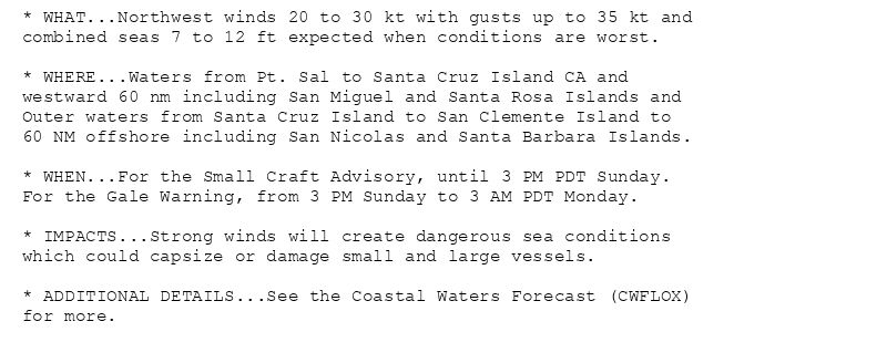
* WHAT...Northwest winds 20 to 30 kt with gusts up to 35 kt and
combined seas 7 to 11 ft expected when conditions are worst.
* WHERE...Waters from Pt. Sal to Santa Cruz Island CA and
westward 60 nm including San Miguel and Santa Rosa Islands and
Outer waters from Santa Cruz Island to San Clemente Island to
60 NM offshore including San Nicolas and Santa Barbara Islands.
* WHEN...For the Small Craft Advisory, until 3 PM PDT this
afternoon. For the Gale Warning, from 3 PM this afternoon to 3
AM PDT Monday.
* IMPACTS...Strong winds will create dangerous sea conditions
which could capsize or damage small and large vessels.
* ADDITIONAL DETAILS...See the Coastal Waters Forecast (CWFLOX)
for more.
Small Craft Advisory issued August 3 at 12:09PM PDT until August 3 at 3:00PM PDT by NWS Los Angeles/Oxnard CA
Additional Details Here.
(1/2)
03.08.2025 19:15 — 👍 1 🔁 0 💬 0 📌 0
* WHAT...Northwest winds 15 to 25 kt with gusts up to 35 kt and
combined seas 7 to 10 ft expected when conditions are worst.
* WHERE...Point Piedras Blancas to Point Sal westward out to 10
NM.
* WHEN...For the Small Craft Advisory, until 3 PM PDT this
afternoon. For the Gale Warning, from 3 PM this afternoon to 3
AM PDT Monday.
* IMPACTS...Strong winds will create dangerous sea conditions
which could capsize or damage small and large vessels.
* ADDITIONAL DETAILS...See the Coastal Waters Forecast (CWFLOX)
for more.
* WHAT...Hazardous wind and sea conditions.
* WHERE...East Santa Barbara Channel from Pt. Conception to Pt.
Mugu CA including Santa Cruz Island.
* WHEN...From 3 PM this afternoon to 1 AM PDT Monday.
* IMPACTS...Conditions will be hazardous to small craft.
* ADDITIONAL DETAILS...See the Coastal Waters Forecast (CWFLOX)
for more.
Small Craft Advisory issued August 3 at 7:38AM PDT until August 3 at 3:00PM PDT by NWS Los Angeles/Oxnard CA
Additional Details Here.(2/2)
03.08.2025 14:45 — 👍 0 🔁 0 💬 0 📌 0
* WHAT...Northwest winds 20 to 30 kt with gusts up to 35 kt and
combined seas 9 to 11 ft expected when conditions are worst.
* WHERE...Point Piedras Blancas to Point Sal from 10 to 60 NM.
* WHEN...For the Small Craft Advisory, until 3 PM PDT this
afternoon. For the Gale Warning, from 3 PM this afternoon to 3
AM PDT Monday.
* IMPACTS...Strong winds will create dangerous sea conditions
which could capsize or damage small and large vessels.
* ADDITIONAL DETAILS...See the Coastal Waters Forecast (CWFLOX)
for more.
* WHAT...Northwest winds 20 to 30 kt with gusts up to 35 kt and
combined seas 7 to 11 ft expected when conditions are worst.
* WHERE...Waters from Pt. Sal to Santa Cruz Island CA and
westward 60 nm including San Miguel and Santa Rosa Islands and
Outer waters from Santa Cruz Island to San Clemente Island to
60 NM offshore including San Nicolas and Santa Barbara Islands.
* WHEN...For the Small Craft Advisory, until 3 PM PDT this
afternoon. For the Gale Warning, from 3 PM this afternoon to 3
AM PDT Monday.
* IMPACTS...Strong winds will create dangerous sea conditions
which could capsize or damage small and large vessels.
* ADDITIONAL DETAILS...See the Coastal Waters Forecast (CWFLOX)
for more.
Small Craft Advisory issued August 3 at 7:38AM PDT until August 3 at 3:00PM PDT by NWS Los Angeles/Oxnard CA
Additional Details Here.
(1/2)
03.08.2025 14:45 — 👍 0 🔁 0 💬 0 📌 0
* WHAT...Northwest winds 20 to 30 kt with gusts up to 35 kt and
combined seas 7 to 11 ft expected when conditions are worst.
* WHERE...Waters from Pt. Sal to Santa Cruz Island CA and
westward 60 nm including San Miguel and Santa Rosa Islands and
Outer waters from Santa Cruz Island to San Clemente Island to
60 NM offshore including San Nicolas and Santa Barbara Islands.
* WHEN...For the Small Craft Advisory, until 3 PM PDT this
afternoon. For the Gale Warning, from 3 PM this afternoon to 3
AM PDT Monday.
* IMPACTS...Strong winds will create dangerous sea conditions
which could capsize or damage small and large vessels.
* ADDITIONAL DETAILS...See the Coastal Waters Forecast (CWFLOX)
for more.
* WHAT...Hazardous wind and sea conditions.
* WHERE...East Santa Barbara Channel from Pt. Conception to Pt.
Mugu CA including Santa Cruz Island.
* WHEN...From 3 PM this afternoon to 1 AM PDT Monday.
* IMPACTS...Conditions will be hazardous to small craft.
* ADDITIONAL DETAILS...See the Coastal Waters Forecast (CWFLOX)
for more.
Small Craft Advisory issued August 3 at 2:53AM PDT until August 3 at 3:00PM PDT by NWS Los Angeles/Oxnard CA
Additional Details Here.(2/2)
03.08.2025 10:00 — 👍 0 🔁 0 💬 0 📌 0
* WHAT...Northwest winds 15 to 25 kt with gusts up to 35 kt and
combined seas 7 to 10 ft expected when conditions are worst.
* WHERE...Point Piedras Blancas to Point Sal westward out to 10
NM.
* WHEN...For the Small Craft Advisory, until 3 PM PDT this
afternoon. For the Gale Warning, from 3 PM this afternoon to 3
AM PDT Monday.
* IMPACTS...Strong winds will create dangerous sea conditions
which could capsize or damage small and large vessels.
* ADDITIONAL DETAILS...See the Coastal Waters Forecast (CWFLOX)
for more.
* WHAT...Northwest winds 20 to 30 kt with gusts up to 35 kt and
combined seas 9 to 11 ft expected when conditions are worst.
* WHERE...Point Piedras Blancas to Point Sal from 10 to 60 NM.
* WHEN...For the Small Craft Advisory, until 3 PM PDT this
afternoon. For the Gale Warning, from 3 PM this afternoon to 3
AM PDT Monday.
* IMPACTS...Strong winds will create dangerous sea conditions
which could capsize or damage small and large vessels.
* ADDITIONAL DETAILS...See the Coastal Waters Forecast (CWFLOX)
for more.
* WHAT...Northwest winds 20 to 30 kt with gusts up to 35 kt and
combined seas 9 to 11 ft expected when conditions are worst.
* WHERE...Point Piedras Blancas to Point Sal from 10 to 60 NM.
* WHEN...For the Small Craft Advisory, until 3 PM PDT this
afternoon. For the Gale Warning, from 3 PM this afternoon to 3
AM PDT Monday.
* IMPACTS...Strong winds will create dangerous sea conditions
which could capsize or damage small and large vessels.
* ADDITIONAL DETAILS...See the Coastal Waters Forecast (CWFLOX)
for more.
Small Craft Advisory issued August 3 at 2:53AM PDT until August 3 at 3:00PM PDT by NWS Los Angeles/Oxnard CA
Additional Details Here.
(1/2)
03.08.2025 10:00 — 👍 0 🔁 0 💬 0 📌 0
* WHAT...Northwest winds 20 to 30 mph with gusts up to 45 mph
expected.
* WHERE...Santa Barbara County Southwestern Coast and Santa Ynez
Mountains Western Range.
* WHEN...From 5 PM this afternoon to 3 AM PDT Tuesday.
* IMPACTS...Gusty winds will blow around unsecured objects. Tree
limbs could be blown down and a few power outages may result.
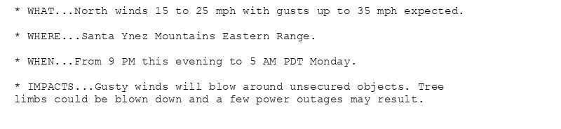
* WHAT...North winds 15 to 25 mph with gusts up to 35 mph expected.
* WHERE...Santa Ynez Mountains Eastern Range.
* WHEN...From 9 PM this evening to 5 AM PDT Monday.
* IMPACTS...Gusty winds will blow around unsecured objects. Tree
limbs could be blown down and a few power outages may result.
Wind Advisory issued August 3 at 2:45AM PDT until August 5 at 3:00AM PDT by NWS Los Angeles/Oxnard CA
Additional Details Here.
03.08.2025 10:00 — 👍 0 🔁 0 💬 0 📌 0
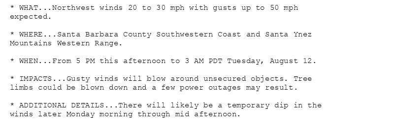
* WHAT...Northwest winds 20 to 30 mph with gusts up to 50 mph
expected.
* WHERE...Santa Barbara County Southwestern Coast and Santa Ynez
Mountains Western Range.
* WHEN...From 5 PM this afternoon to 3 AM PDT Tuesday, August 12.
* IMPACTS...Gusty winds will blow around unsecured objects. Tree
limbs could be blown down and a few power outages may result.
* ADDITIONAL DETAILS...There will likely be a temporary dip in the
winds later Monday morning through mid afternoon.
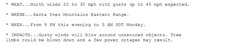
* WHAT...North winds 20 to 30 mph with gusts up to 45 mph expected.
* WHERE...Santa Ynez Mountains Eastern Range.
* WHEN...From 9 PM this evening to 5 AM PDT Monday.
* IMPACTS...Gusty winds will blow around unsecured objects. Tree
limbs could be blown down and a few power outages may result.
Wind Advisory issued August 3 at 12:08AM PDT until August 12 at 3:00AM PDT by NWS Los Angeles/Oxnard CA
Additional Details Here.
03.08.2025 07:15 — 👍 0 🔁 0 💬 0 📌 0
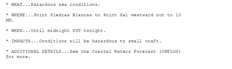
* WHAT...Hazardous sea conditions.
* WHERE...Point Piedras Blancas to Point Sal westward out to 10
NM.
* WHEN...Until midnight PDT tonight.
* IMPACTS...Conditions will be hazardous to small craft.
* ADDITIONAL DETAILS...See the Coastal Waters Forecast (CWFLOX)
for more.
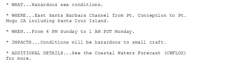
* WHAT...Hazardous sea conditions.
* WHERE...East Santa Barbara Channel from Pt. Conception to Pt.
Mugu CA including Santa Cruz Island.
* WHEN...From 4 PM Sunday to 1 AM PDT Monday.
* IMPACTS...Conditions will be hazardous to small craft.
* ADDITIONAL DETAILS...See the Coastal Waters Forecast (CWFLOX)
for more.
Small Craft Advisory issued August 2 at 7:49PM PDT until August 3 at 3:00PM PDT by NWS Los Angeles/Oxnard CA
Additional Details Here.(2/2)
03.08.2025 03:00 — 👍 0 🔁 0 💬 0 📌 0
* WHAT...Northwest winds 25 to 30 kt with gusts up to 35 kt and
combined seas 9 to 11 ft expected when conditions are worst.
* WHERE...Point Piedras Blancas to Point Sal from 10 to 60 NM.
* WHEN...For the Small Craft Advisory, until 3 PM PDT Sunday.
For the Gale Warning, from 3 PM Sunday to 3 AM PDT Monday.
* IMPACTS...Strong winds will create dangerous sea conditions
which could capsize or damage small and large vessels.
* ADDITIONAL DETAILS...See the Coastal Waters Forecast (CWFLOX)
for more.
* WHAT...Northwest winds 20 to 30 kt with gusts up to 35 kt and
combined seas 7 to 12 ft expected when conditions are worst.
* WHERE...Waters from Pt. Sal to Santa Cruz Island CA and
westward 60 nm including San Miguel and Santa Rosa Islands and
Outer waters from Santa Cruz Island to San Clemente Island to
60 NM offshore including San Nicolas and Santa Barbara Islands.
* WHEN...For the Small Craft Advisory, until 3 PM PDT Sunday.
For the Gale Warning, from 3 PM Sunday to 3 AM PDT Monday.
* IMPACTS...Strong winds will create dangerous sea conditions
which could capsize or damage small and large vessels.
* ADDITIONAL DETAILS...See the Coastal Waters Forecast (CWFLOX)
for more.
Small Craft Advisory issued August 2 at 7:49PM PDT until August 3 at 3:00PM PDT by NWS Los Angeles/Oxnard CA
Additional Details Here.
(1/2)
03.08.2025 03:00 — 👍 0 🔁 0 💬 0 📌 0
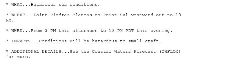
* WHAT...Hazardous sea conditions.
* WHERE...Point Piedras Blancas to Point Sal westward out to 10
NM.
* WHEN...From 3 PM this afternoon to 10 PM PDT this evening.
* IMPACTS...Conditions will be hazardous to small craft.
* ADDITIONAL DETAILS...See the Coastal Waters Forecast (CWFLOX)
for more.
Small Craft Advisory issued August 2 at 1:21PM PDT until August 3 at 3:00PM PDT by NWS Los Angeles/Oxnard CA
Additional Details Here.(2/2)
02.08.2025 20:30 — 👍 1 🔁 0 💬 0 📌 0

* WHAT...Northwest winds 20 to 30 kt with gusts up to 35 kt and
combined seas 9 to 11 ft expected when conditions are worst.
* WHERE...Point Piedras Blancas to Point Sal from 10 to 60 NM.
* WHEN...For the Small Craft Advisory, until 3 PM PDT Sunday.
For the Gale Warning, from 3 PM Sunday to 3 AM PDT Monday.
* IMPACTS...Strong winds will create dangerous sea conditions
which could capsize or damage small and large vessels.
* ADDITIONAL DETAILS...See the Coastal Waters Forecast (CWFLOX)
for more.
* WHAT...Northwest winds 20 to 30 kt with gusts up to 35 kt and
combined seas 7 to 12 ft expected when conditions are worst.
* WHERE...Waters from Pt. Sal to Santa Cruz Island CA and
westward 60 nm including San Miguel and Santa Rosa Islands and
Outer waters from Santa Cruz Island to San Clemente Island to
60 NM offshore including San Nicolas and Santa Barbara Islands.
* WHEN...For the Small Craft Advisory, until 3 PM PDT Sunday.
For the Gale Warning, from 3 PM Sunday to 3 AM PDT Monday.
* IMPACTS...Strong winds will create dangerous sea conditions
which could capsize or damage small and large vessels.
* ADDITIONAL DETAILS...See the Coastal Waters Forecast (CWFLOX)
for more.
Small Craft Advisory issued August 2 at 1:21PM PDT until August 3 at 3:00PM PDT by NWS Los Angeles/Oxnard CA
Additional Details Here.
(1/2)
02.08.2025 20:30 — 👍 1 🔁 0 💬 0 📌 0
* WHAT...Hazardous sea conditions.
* WHERE...Point Piedras Blancas to Point Sal westward out to 10
NM.
* WHEN...From 3 PM this afternoon to 10 PM PDT this evening.
* IMPACTS...Conditions will be hazardous to small craft.
* ADDITIONAL DETAILS...See the Coastal Waters Forecast (CWFLOX)
for more.
Small Craft Advisory issued August 2 at 7:41AM PDT until August 3 at 6:00AM PDT by NWS Los Angeles/Oxnard CA
Additional Details Here.(2/2)
02.08.2025 14:45 — 👍 1 🔁 0 💬 0 📌 0
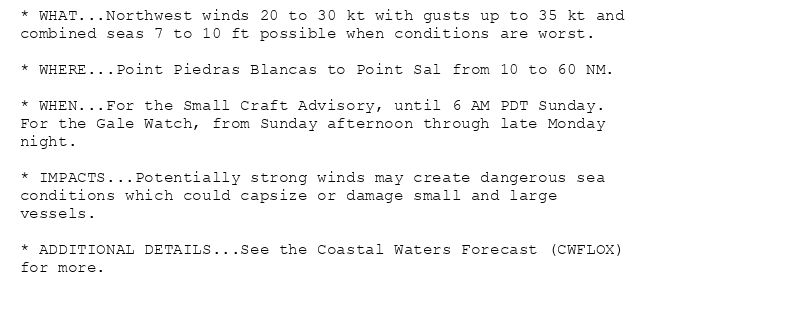
* WHAT...Northwest winds 20 to 30 kt with gusts up to 35 kt and
combined seas 7 to 10 ft possible when conditions are worst.
* WHERE...Point Piedras Blancas to Point Sal from 10 to 60 NM.
* WHEN...For the Small Craft Advisory, until 6 AM PDT Sunday.
For the Gale Watch, from Sunday afternoon through late Monday
night.
* IMPACTS...Potentially strong winds may create dangerous sea
conditions which could capsize or damage small and large
vessels.
* ADDITIONAL DETAILS...See the Coastal Waters Forecast (CWFLOX)
for more.
* WHAT...Northwest winds 20 to 30 kt with gusts up to 35 kt and
combined seas 7 to 10 ft possible when conditions are worst.
* WHERE...Waters from Pt. Sal to Santa Cruz Island CA and
westward 60 nm including San Miguel and Santa Rosa Islands and
Outer waters from Santa Cruz Island to San Clemente Island to
60 NM offshore including San Nicolas and Santa Barbara Islands.
* WHEN...For the Small Craft Advisory, until 6 AM PDT Sunday.
For the Gale Watch, from Sunday afternoon through late Monday
night.
* IMPACTS...Potentially strong winds may create dangerous sea
conditions which could capsize or damage small and large
vessels.
* ADDITIONAL DETAILS...See the Coastal Waters Forecast (CWFLOX)
for more.
Small Craft Advisory issued August 2 at 7:41AM PDT until August 3 at 6:00AM PDT by NWS Los Angeles/Oxnard CA
Additional Details Here.
(1/2)
02.08.2025 14:45 — 👍 1 🔁 0 💬 0 📌 0
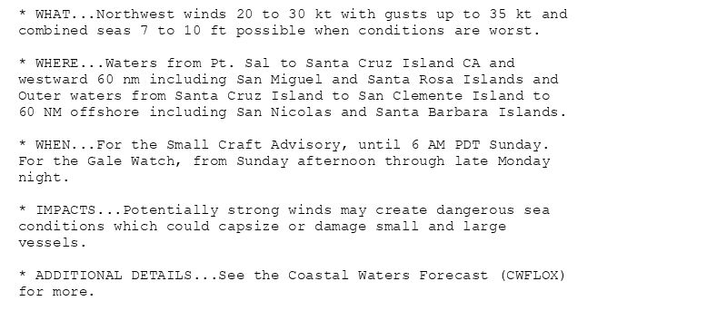
* WHAT...Northwest winds 20 to 30 kt with gusts up to 35 kt and
combined seas 7 to 10 ft possible when conditions are worst.
* WHERE...Waters from Pt. Sal to Santa Cruz Island CA and
westward 60 nm including San Miguel and Santa Rosa Islands and
Outer waters from Santa Cruz Island to San Clemente Island to
60 NM offshore including San Nicolas and Santa Barbara Islands.
* WHEN...For the Small Craft Advisory, until 6 AM PDT Sunday.
For the Gale Watch, from Sunday afternoon through late Monday
night.
* IMPACTS...Potentially strong winds may create dangerous sea
conditions which could capsize or damage small and large
vessels.
* ADDITIONAL DETAILS...See the Coastal Waters Forecast (CWFLOX)
for more.
Small Craft Advisory issued August 2 at 3:15AM PDT until August 2 at 10:00PM PDT by NWS Los Angeles/Oxnard CA
Additional Details Here.(2/2)
02.08.2025 10:30 — 👍 0 🔁 0 💬 0 📌 0
* WHAT...Hazardous sea conditions.
* WHERE...Point Piedras Blancas to Point Sal westward out to 10
NM.
* WHEN...From 3 PM this afternoon to 10 PM PDT this evening.
* IMPACTS...Conditions will be hazardous to small craft.
* ADDITIONAL DETAILS...See the Coastal Waters Forecast (CWFLOX)
for more.
* WHAT...Northwest winds 20 to 30 kt with gusts up to 35 kt and
combined seas 7 to 10 ft possible when conditions are worst.
* WHERE...Point Piedras Blancas to Point Sal from 10 to 60 NM.
* WHEN...For the Small Craft Advisory, until 6 AM PDT Sunday.
For the Gale Watch, from Sunday afternoon through late Monday
night.
* IMPACTS...Potentially strong winds may create dangerous sea
conditions which could capsize or damage small and large
vessels.
* ADDITIONAL DETAILS...See the Coastal Waters Forecast (CWFLOX)
for more.
* WHAT...Northwest winds 20 to 30 kt with gusts up to 35 kt and
combined seas 7 to 10 ft possible when conditions are worst.
* WHERE...Waters from Pt. Sal to Santa Cruz Island CA and
westward 60 nm including San Miguel and Santa Rosa Islands and
Outer waters from Santa Cruz Island to San Clemente Island to
60 NM offshore including San Nicolas and Santa Barbara Islands.
* WHEN...For the Small Craft Advisory, until 6 AM PDT Sunday.
For the Gale Watch, from Sunday afternoon through late Monday
night.
* IMPACTS...Potentially strong winds may create dangerous sea
conditions which could capsize or damage small and large
vessels.
* ADDITIONAL DETAILS...See the Coastal Waters Forecast (CWFLOX)
for more.
Small Craft Advisory issued August 2 at 3:15AM PDT until August 2 at 10:00PM PDT by NWS Los Angeles/Oxnard CA
Additional Details Here.
(1/2)
02.08.2025 10:30 — 👍 0 🔁 0 💬 0 📌 0
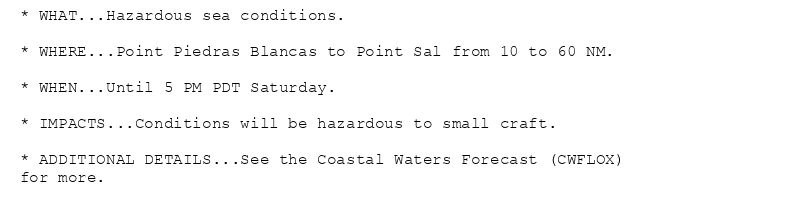
* WHAT...Hazardous sea conditions.
* WHERE...Point Piedras Blancas to Point Sal from 10 to 60 NM.
* WHEN...Until 5 PM PDT Saturday.
* IMPACTS...Conditions will be hazardous to small craft.
* ADDITIONAL DETAILS...See the Coastal Waters Forecast (CWFLOX)
for more.
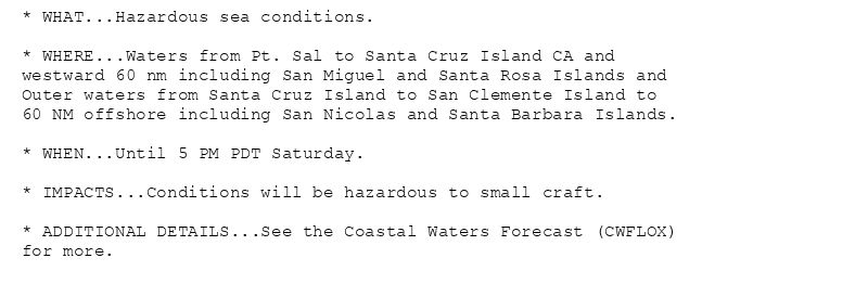
* WHAT...Hazardous sea conditions.
* WHERE...Waters from Pt. Sal to Santa Cruz Island CA and
westward 60 nm including San Miguel and Santa Rosa Islands and
Outer waters from Santa Cruz Island to San Clemente Island to
60 NM offshore including San Nicolas and Santa Barbara Islands.
* WHEN...Until 5 PM PDT Saturday.
* IMPACTS...Conditions will be hazardous to small craft.
* ADDITIONAL DETAILS...See the Coastal Waters Forecast (CWFLOX)
for more.
* WHAT...Hazardous sea conditions.
* WHERE...Point Piedras Blancas to Point Sal westward out to 10
NM.
* WHEN...Until 3 AM PDT Saturday.
* IMPACTS...Conditions will be hazardous to small craft.
* ADDITIONAL DETAILS...See the Coastal Waters Forecast (CWFLOX)
for more.
Small Craft Advisory issued August 1 at 8:33PM PDT until August 2 at 5:00PM PDT by NWS Los Angeles/Oxnard CA
Additional Details Here.
02.08.2025 03:45 — 👍 1 🔁 0 💬 0 📌 0
* WHAT...Hazardous sea conditions.
* WHERE...Point Piedras Blancas to Point Sal from 10 to 60 NM.
* WHEN...Until 5 PM PDT Saturday.
* IMPACTS...Conditions will be hazardous to small craft.
* ADDITIONAL DETAILS...See the Coastal Waters Forecast (CWFLOX)
for more.
* WHAT...Hazardous sea conditions.
* WHERE...Waters from Pt. Sal to Santa Cruz Island CA and
westward 60 nm including San Miguel and Santa Rosa Islands and
Outer waters from Santa Cruz Island to San Clemente Island to
60 NM offshore including San Nicolas and Santa Barbara Islands.
* WHEN...Until 5 PM PDT Saturday.
* IMPACTS...Conditions will be hazardous to small craft.
* ADDITIONAL DETAILS...See the Coastal Waters Forecast (CWFLOX)
for more.
* WHAT...Hazardous sea conditions.
* WHERE...Point Piedras Blancas to Point Sal westward out to 10
NM.
* WHEN...Until 3 AM PDT Saturday.
* IMPACTS...Conditions will be hazardous to small craft.
* ADDITIONAL DETAILS...See the Coastal Waters Forecast (CWFLOX)
for more.
Small Craft Advisory issued August 1 at 1:03PM PDT until August 2 at 5:00PM PDT by NWS Los Angeles/Oxnard CA
Additional Details Here.
01.08.2025 20:15 — 👍 0 🔁 0 💬 0 📌 0
* WHAT...Hazardous sea conditions.
* WHERE...Point Piedras Blancas to Point Sal from 10 to 60 NM.
* WHEN...Until 5 PM PDT Saturday.
* IMPACTS...Conditions will be hazardous to small craft.
* ADDITIONAL DETAILS...See the Coastal Waters Forecast (CWFLOX)
for more.
* WHAT...Hazardous sea conditions.
* WHERE...Waters from Pt. Sal to Santa Cruz Island CA and
westward 60 nm including San Miguel and Santa Rosa Islands and
Outer waters from Santa Cruz Island to San Clemente Island to
60 NM offshore including San Nicolas and Santa Barbara Islands.
* WHEN...Until 5 PM PDT Saturday.
* IMPACTS...Conditions will be hazardous to small craft.
* ADDITIONAL DETAILS...See the Coastal Waters Forecast (CWFLOX)
for more.
* WHAT...Hazardous sea conditions.
* WHERE...Point Piedras Blancas to Point Sal westward out to 10
NM.
* WHEN...Until 3 AM PDT Saturday.
* IMPACTS...Conditions will be hazardous to small craft.
* ADDITIONAL DETAILS...See the Coastal Waters Forecast (CWFLOX)
for more.
Small Craft Advisory issued August 1 at 7:35AM PDT until August 2 at 5:00PM PDT by NWS Los Angeles/Oxnard CA
Additional Details Here.
01.08.2025 14:45 — 👍 0 🔁 1 💬 0 📌 0
* WHAT...Hazardous sea conditions.
* WHERE...Point Piedras Blancas to Point Sal from 10 to 60 NM.
* WHEN...Until 5 PM PDT Saturday.
* IMPACTS...Conditions will be hazardous to small craft.
* ADDITIONAL DETAILS...See the Coastal Waters Forecast (CWFLOX)
for more.
* WHAT...Hazardous sea conditions.
* WHERE...Waters from Pt. Sal to Santa Cruz Island CA and
westward 60 nm including San Miguel and Santa Rosa Islands and
Outer waters from Santa Cruz Island to San Clemente Island to
60 NM offshore including San Nicolas and Santa Barbara Islands.
* WHEN...Until 5 PM PDT Saturday.
* IMPACTS...Conditions will be hazardous to small craft.
* ADDITIONAL DETAILS...See the Coastal Waters Forecast (CWFLOX)
for more.
* WHAT...Hazardous sea conditions.
* WHERE...Point Piedras Blancas to Point Sal westward out to 10
NM.
* WHEN...Until 3 AM PDT Saturday.
* IMPACTS...Conditions will be hazardous to small craft.
* ADDITIONAL DETAILS...See the Coastal Waters Forecast (CWFLOX)
for more.
Small Craft Advisory issued August 1 at 3:01AM PDT until August 2 at 5:00PM PDT by NWS Los Angeles/Oxnard CA
Additional Details Here.
01.08.2025 10:15 — 👍 0 🔁 0 💬 0 📌 0
* WHAT...Hazardous sea conditions.
* WHERE...Point Piedras Blancas to Point Sal from 10 to 60 NM.
* WHEN...Until 5 PM PDT Saturday.
* IMPACTS...Conditions will be hazardous to small craft.
* ADDITIONAL DETAILS...See the Coastal Waters Forecast (CWFLOX)
for more.
* WHAT...Hazardous sea conditions.
* WHERE...Waters from Pt. Sal to Santa Cruz Island CA and
westward 60 nm including San Miguel and Santa Rosa Islands and
Outer waters from Santa Cruz Island to San Clemente Island to
60 NM offshore including San Nicolas and Santa Barbara Islands.
* WHEN...Until 5 PM PDT Saturday.
* IMPACTS...Conditions will be hazardous to small craft.
* ADDITIONAL DETAILS...See the Coastal Waters Forecast (CWFLOX)
for more.
* WHAT...Hazardous sea conditions.
* WHERE...Point Piedras Blancas to Point Sal westward out to 10
NM.
* WHEN...Until 3 AM PDT Saturday.
* IMPACTS...Conditions will be hazardous to small craft.
* ADDITIONAL DETAILS...See the Coastal Waters Forecast (CWFLOX)
for more.
Small Craft Advisory issued July 31 at 8:32PM PDT until August 2 at 5:00PM PDT by NWS Los Angeles/Oxnard CA
Additional Details Here.
01.08.2025 03:45 — 👍 0 🔁 0 💬 0 📌 0

* WHAT...Hazardous sea conditions.
* WHERE...Point Piedras Blancas to Point Sal from 10 to 60 NM.
* WHEN...Until 3 AM PDT Saturday.
* IMPACTS...Conditions will be hazardous to small craft.
* ADDITIONAL DETAILS...See the Coastal Waters Forecast (CWFLOX)
for more.

* WHAT...Hazardous sea conditions.
* WHERE...Waters from Pt. Sal to Santa Cruz Island CA and
westward 60 nm including San Miguel and Santa Rosa Islands and
Outer waters from Santa Cruz Island to San Clemente Island to
60 NM offshore including San Nicolas and Santa Barbara Islands.
* WHEN...Until 3 AM PDT Saturday.
* IMPACTS...Conditions will be hazardous to small craft.
* ADDITIONAL DETAILS...See the Coastal Waters Forecast (CWFLOX)
for more.
* WHAT...Hazardous sea conditions.
* WHERE...Point Piedras Blancas to Point Sal westward out to 10
NM.
* WHEN...Until 3 AM PDT Friday.
* IMPACTS...Conditions will be hazardous to small craft.
* ADDITIONAL DETAILS...See the Coastal Waters Forecast (CWFLOX)
for more.
Small Craft Advisory issued July 31 at 1:35PM PDT until August 2 at 3:00AM PDT by NWS Los Angeles/Oxnard CA
Additional Details Here.
31.07.2025 20:45 — 👍 0 🔁 0 💬 0 📌 0
* WHAT...Hazardous sea conditions.
* WHERE...Point Piedras Blancas to Point Sal from 10 to 60 NM.
* WHEN...Until 3 AM PDT Saturday.
* IMPACTS...Conditions will be hazardous to small craft.
* ADDITIONAL DETAILS...See the Coastal Waters Forecast (CWFLOX)
for more.
* WHAT...Hazardous sea conditions.
* WHERE...Waters from Pt. Sal to Santa Cruz Island CA and
westward 60 nm including San Miguel and Santa Rosa Islands and
Outer waters from Santa Cruz Island to San Clemente Island to
60 NM offshore including San Nicolas and Santa Barbara Islands.
* WHEN...Until 3 AM PDT Saturday.
* IMPACTS...Conditions will be hazardous to small craft.
* ADDITIONAL DETAILS...See the Coastal Waters Forecast (CWFLOX)
for more.
* WHAT...Hazardous sea conditions.
* WHERE...Point Piedras Blancas to Point Sal westward out to 10
NM.
* WHEN...Until 3 AM PDT Friday.
* IMPACTS...Conditions will be hazardous to small craft.
* ADDITIONAL DETAILS...See the Coastal Waters Forecast (CWFLOX)
for more.
Small Craft Advisory issued July 31 at 9:13AM PDT until August 2 at 3:00AM PDT by NWS Los Angeles/Oxnard CA
Additional Details Here.
31.07.2025 16:15 — 👍 1 🔁 0 💬 0 📌 0

Winds are diminishing and the Small Craft Advisory will be allowed
to expire.
* WHAT...Hazardous sea conditions.
* WHERE...Point Piedras Blancas to Point Sal from 10 to 60 NM.
* WHEN...Until 3 AM PDT Saturday.
* IMPACTS...Conditions will be hazardous to small craft.
* ADDITIONAL DETAILS...See the Coastal Waters Forecast (CWFLOX)
for more.
* WHAT...Hazardous sea conditions.
* WHERE...Waters from Pt. Sal to Santa Cruz Island CA and
westward 60 nm including San Miguel and Santa Rosa Islands and
Outer waters from Santa Cruz Island to San Clemente Island to
60 NM offshore including San Nicolas and Santa Barbara Islands.
* WHEN...Until 3 AM PDT Saturday.
* IMPACTS...Conditions will be hazardous to small craft.
* ADDITIONAL DETAILS...See the Coastal Waters Forecast (CWFLOX)
for more.
* WHAT...Hazardous sea conditions.
* WHERE...Point Piedras Blancas to Point Sal westward out to 10
NM.
* WHEN...Until 3 AM PDT Friday.
* IMPACTS...Conditions will be hazardous to small craft.
* ADDITIONAL DETAILS...See the Coastal Waters Forecast (CWFLOX)
for more.
Small Craft Advisory issued July 31 at 2:32AM PDT until July 31 at 3:00AM PDT by NWS Los Angeles/Oxnard CA
Additional Details Here.(1/2)
31.07.2025 09:45 — 👍 0 🔁 0 💬 0 📌 0