The Storm Prediction Center issues Day 3 Marginal Convective Risk at Jul 18, 7:22z for portions of BOX
at Fri, 18 Jul 2025 07:23:41 +0000 via IEMbot
Additional Details Here.
18.07.2025 07:25 — 👍 0 🔁 0 💬 0 📌 0
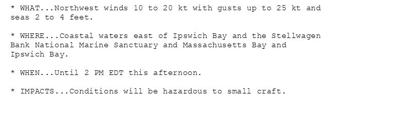
* WHAT...Northwest winds 10 to 20 kt with gusts up to 25 kt and
seas 2 to 4 feet.
* WHERE...Coastal waters east of Ipswich Bay and the Stellwagen
Bank National Marine Sanctuary and Massachusetts Bay and
Ipswich Bay.
* WHEN...Until 2 PM EDT this afternoon.
* IMPACTS...Conditions will be hazardous to small craft.
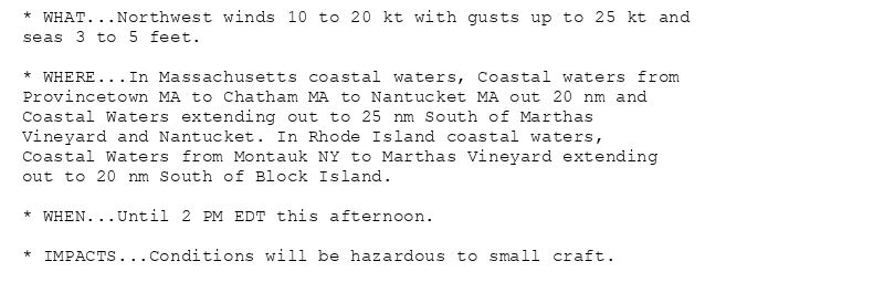
* WHAT...Northwest winds 10 to 20 kt with gusts up to 25 kt and
seas 3 to 5 feet.
* WHERE...In Massachusetts coastal waters, Coastal waters from
Provincetown MA to Chatham MA to Nantucket MA out 20 nm and
Coastal Waters extending out to 25 nm South of Marthas
Vineyard and Nantucket. In Rhode Island coastal waters,
Coastal Waters from Montauk NY to Marthas Vineyard extending
out to 20 nm South of Block Island.
* WHEN...Until 2 PM EDT this afternoon.
* IMPACTS...Conditions will be hazardous to small craft.
Small Craft Advisory issued July 18 at 2:47AM EDT until July 18 at 2:00PM EDT by NWS Boston/Norton MA
Additional Details Here.
18.07.2025 07:06 — 👍 0 🔁 0 💬 0 📌 0
BOX issues Area Forecast Discussion (AFD) at Jul 18, 2:24 AM EDT
at Fri, 18 Jul 2025 06:25:04 +0000 via IEMbot
Additional Details Here.
18.07.2025 06:41 — 👍 0 🔁 0 💬 0 📌 0
BOX issues Area Forecast Discussion (AFD) at Jul 18, 1:22 AM EDT
at Fri, 18 Jul 2025 05:29:33 +0000 via IEMbot
Additional Details Here.
18.07.2025 05:36 — 👍 0 🔁 0 💬 0 📌 0
HARTFORD CT Jul 17
Climate Report:
High: 90
Low: 77
Precip: Trace
Snow: 0.0" Snow Depth: 0"
at Fri, 18 Jul 2025 05:35:40 +0000 via IEMbot
Additional Details Here.
18.07.2025 05:36 — 👍 0 🔁 0 💬 0 📌 0
PROVIDENCE RI Jul 17
Climate Report:
High: 89
Low: 77
Precip: Trace
Snow: 0.0" Snow Depth: 0"
at Fri, 18 Jul 2025 05:35:40 +0000 via IEMbot
Additional Details Here.
18.07.2025 05:36 — 👍 0 🔁 0 💬 0 📌 0
WORCESTER MA Jul 17
Climate Report:
High: 85
Low: 73
Precip: Trace
Snow: 0.0"
at Fri, 18 Jul 2025 05:35:40 +0000 via IEMbot
Additional Details Here.
18.07.2025 05:36 — 👍 0 🔁 0 💬 0 📌 0
BOSTON MA Jul 17
Climate Report:
High: 91
Low: 72
Precip: 0.0"
Snow: 0.0"
at Fri, 18 Jul 2025 05:35:41 +0000 via IEMbot
Additional Details Here.
18.07.2025 05:36 — 👍 0 🔁 0 💬 0 📌 0
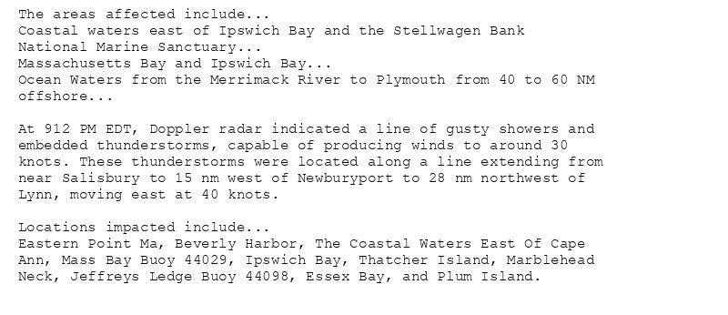
The areas affected include...
Coastal waters east of Ipswich Bay and the Stellwagen Bank
National Marine Sanctuary...
Massachusetts Bay and Ipswich Bay...
Ocean Waters from the Merrimack River to Plymouth from 40 to 60 NM
offshore...
At 912 PM EDT, Doppler radar indicated a line of gusty showers and
embedded thunderstorms, capable of producing winds to around 30
knots. These thunderstorms were located along a line extending from
near Salisbury to 15 nm west of Newburyport to 28 nm northwest of
Lynn, moving east at 40 knots.
Locations impacted include...
Eastern Point Ma, Beverly Harbor, The Coastal Waters East Of Cape
Ann, Mass Bay Buoy 44029, Ipswich Bay, Thatcher Island, Marblehead
Neck, Jeffreys Ledge Buoy 44098, Essex Bay, and Plum Island.
Marine Weather Statement issued July 17 at 9:12PM EDT by NWS Boston/Norton MA
Additional Details Here.
18.07.2025 01:20 — 👍 0 🔁 0 💬 0 📌 0
BOX issues Area Forecast Discussion (AFD) at Jul 17, 7:34 PM EDT
at Thu, 17 Jul 2025 23:34:54 +0000 via IEMbot
Additional Details Here.
17.07.2025 23:43 — 👍 0 🔁 0 💬 0 📌 0
BOX expires Heat Advisory for Hartford, Tolland, Windham [CT] and Central Middlesex County, Eastern Essex, Eastern Franklin, Eastern Hampden, Eastern Hampshire, Eastern Norfolk, Ea... at Thu, 17 Jul 2025 23:06:24 +0000 via IEMbot
Additional Details Here.
17.07.2025 23:21 — 👍 0 🔁 0 💬 0 📌 0

The Small Craft Advisory has been cancelled and is no longer in effect.
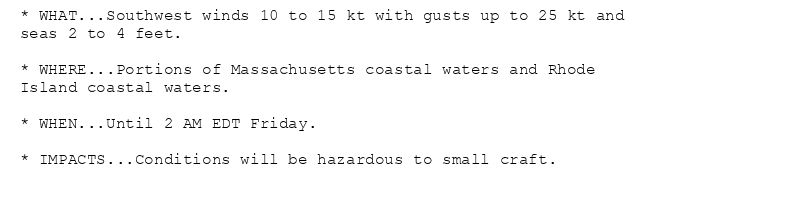
* WHAT...Southwest winds 10 to 15 kt with gusts up to 25 kt and
seas 2 to 4 feet.
* WHERE...Portions of Massachusetts coastal waters and Rhode
Island coastal waters.
* WHEN...Until 2 AM EDT Friday.
* IMPACTS...Conditions will be hazardous to small craft.
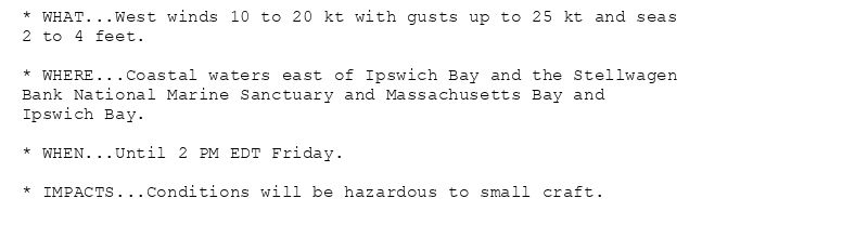
* WHAT...West winds 10 to 20 kt with gusts up to 25 kt and seas
2 to 4 feet.
* WHERE...Coastal waters east of Ipswich Bay and the Stellwagen
Bank National Marine Sanctuary and Massachusetts Bay and
Ipswich Bay.
* WHEN...Until 2 PM EDT Friday.
* IMPACTS...Conditions will be hazardous to small craft.
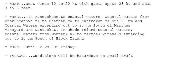
* WHAT...West winds 10 to 20 kt with gusts up to 25 kt and seas
3 to 5 feet.
* WHERE...In Massachusetts coastal waters, Coastal waters from
Provincetown MA to Chatham MA to Nantucket MA out 20 nm and
Coastal Waters extending out to 25 nm South of Marthas
Vineyard and Nantucket. In Rhode Island coastal waters,
Coastal Waters from Montauk NY to Marthas Vineyard extending
out to 20 nm South of Block Island.
* WHEN...Until 2 PM EDT Friday.
* IMPACTS...Conditions will be hazardous to small craft.
The Small Craft Advisory has been cancelled.
Additional Details Here.(1/2)
17.07.2025 22:13 — 👍 0 🔁 0 💬 0 📌 0
HARTFORD CT Jul 17
Climate Report:
High: 90
Low: 77
Precip: Trace
Snow: 0.0"
at Thu, 17 Jul 2025 21:25:54 +0000 via IEMbot
Additional Details Here.
17.07.2025 21:27 — 👍 1 🔁 0 💬 0 📌 0
WORCESTER MA Jul 17
Climate Report:
High: 84
Low: 73
Precip: Trace
Snow: 0.0"
at Thu, 17 Jul 2025 21:25:54 +0000 via IEMbot
Additional Details Here.
17.07.2025 21:27 — 👍 1 🔁 0 💬 0 📌 0
PROVIDENCE RI Jul 17
Climate Report:
High: 89
Low: 77
Precip: Trace
Snow: 0.0"
at Thu, 17 Jul 2025 21:25:54 +0000 via IEMbot
Additional Details Here.
17.07.2025 21:27 — 👍 0 🔁 0 💬 0 📌 0
BOSTON MA Jul 17
Climate Report:
High: 91
Low: 72
Precip: 0.0"
Snow: 0.0"
at Thu, 17 Jul 2025 21:25:54 +0000 via IEMbot
Additional Details Here.
17.07.2025 21:27 — 👍 0 🔁 0 💬 0 📌 0
The Storm Prediction Center issues Day 1 Marginal Convective Risk at Jul 17, 19:39z for portions of BOX
at Thu, 17 Jul 2025 19:41:12 +0000 via IEMbot
Additional Details Here.
17.07.2025 19:58 — 👍 0 🔁 0 💬 0 📌 0
BOX issues Area Forecast Discussion (AFD) at Jul 17, 3:07 PM EDT
at Thu, 17 Jul 2025 19:07:26 +0000 via IEMbot
Additional Details Here.
17.07.2025 19:13 — 👍 0 🔁 0 💬 0 📌 0
BOX issues Area Forecast Discussion (AFD) at Jul 17, 1:50 PM EDT
at Thu, 17 Jul 2025 17:51:52 +0000 via IEMbot
Additional Details Here.
17.07.2025 18:05 — 👍 0 🔁 0 💬 0 📌 0
BOX continues Heat Advisory for Hartford, Tolland, Windham [CT] and Central Middlesex County, Eastern Essex, Eastern Franklin, Eastern Hampden, Eastern Hampshire, Eastern Norfolk, ... at Thu, 17 Jul 2025 17:26:19 +0000 via IEMbot
Additional Details Here.
17.07.2025 17:43 — 👍 0 🔁 0 💬 0 📌 0
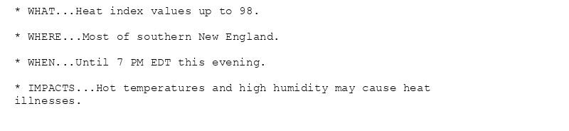
* WHAT...Heat index values up to 98.
* WHERE...Most of southern New England.
* WHEN...Until 7 PM EDT this evening.
* IMPACTS...Hot temperatures and high humidity may cause heat
illnesses.
Heat Advisory issued July 17 at 1:25PM EDT until July 17 at 7:00PM EDT by NWS Boston/Norton MA
Additional Details Here.
17.07.2025 17:31 — 👍 0 🔁 0 💬 0 📌 0
BOX issues Marine Warning [wind: >34 KTS, hail: 0.00 IN] for Coastal Waters extending out to 25 nm South of Marthas Vineyard and Nantucket, Coastal Waters from Montauk NY to Mar... at Thu, 17 Jul 2025 16:25:42 +0000 via IEMbot
Additional Details Here.
17.07.2025 16:38 — 👍 0 🔁 1 💬 0 📌 0
The Storm Prediction Center issues Day 1 Marginal Convective Risk at Jul 17, 16:25z for portions of BOX
at Thu, 17 Jul 2025 16:28:44 +0000 via IEMbot
Additional Details Here.
17.07.2025 16:38 — 👍 0 🔁 0 💬 0 📌 0
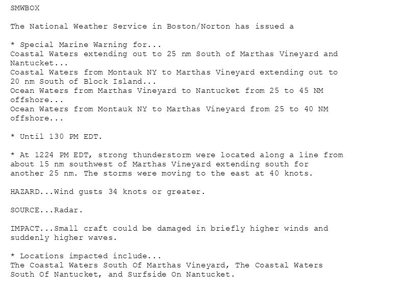
SMWBOX
The National Weather Service in Boston/Norton has issued a
* Special Marine Warning for...
Coastal Waters extending out to 25 nm South of Marthas Vineyard and
Nantucket...
Coastal Waters from Montauk NY to Marthas Vineyard extending out to
20 nm South of Block Island...
Ocean Waters from Marthas Vineyard to Nantucket from 25 to 45 NM
offshore...
Ocean Waters from Montauk NY to Marthas Vineyard from 25 to 40 NM
offshore...
* Until 130 PM EDT.
* At 1224 PM EDT, strong thunderstorm were located along a line from
about 15 nm southwest of Marthas Vineyard extending south for
another 25 nm. The storms were moving to the east at 40 knots.
HAZARD...Wind gusts 34 knots or greater.
SOURCE...Radar.
IMPACT...Small craft could be damaged in briefly higher winds and
suddenly higher waves.
* Locations impacted include...
The Coastal Waters South Of Marthas Vineyard, The Coastal Waters
South Of Nantucket, and Surfside On Nantucket.
🚨 Special Marine Warning issued July 17 at 12:25PM EDT until July 17 at 1:30PM EDT by NWS Boston/Norton MA 🚨
Additional Details Here.
17.07.2025 16:35 — 👍 1 🔁 0 💬 0 📌 0
BOX issues Marine Warning [wind: 49 KTS, hail: 0.00 IN] for Coastal Waters from Montauk NY to Marthas Vineyard extending out to 20 nm South of Block Island [AN] till Jul 17, 12:30 ... at Thu, 17 Jul 2025 15:11:28 +0000 via IEMbot
Additional Details Here.
17.07.2025 15:29 — 👍 0 🔁 0 💬 0 📌 0
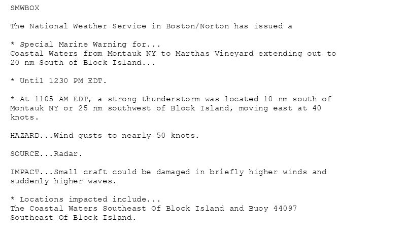
SMWBOX
The National Weather Service in Boston/Norton has issued a
* Special Marine Warning for...
Coastal Waters from Montauk NY to Marthas Vineyard extending out to
20 nm South of Block Island...
* Until 1230 PM EDT.
* At 1105 AM EDT, a strong thunderstorm was located 10 nm south of
Montauk NY or 25 nm southwest of Block Island, moving east at 40
knots.
HAZARD...Wind gusts to nearly 50 knots.
SOURCE...Radar.
IMPACT...Small craft could be damaged in briefly higher winds and
suddenly higher waves.
* Locations impacted include...
The Coastal Waters Southeast Of Block Island and Buoy 44097
Southeast Of Block Island.
🚨 Special Marine Warning issued July 17 at 11:11AM EDT until July 17 at 12:30PM EDT by NWS Boston/Norton MA 🚨
Additional Details Here.
17.07.2025 15:19 — 👍 0 🔁 0 💬 0 📌 0
The Storm Prediction Center issues Day 1 Marginal Convective Risk at Jul 17, 12:35z for portions of BOX
at Thu, 17 Jul 2025 12:38:12 +0000 via IEMbot
Additional Details Here.
17.07.2025 12:56 — 👍 0 🔁 0 💬 0 📌 0
BOX issues Area Forecast Discussion (AFD) at Jul 17, 7:41 AM EDT
at Thu, 17 Jul 2025 11:41:36 +0000 via IEMbot
Additional Details Here.
17.07.2025 11:47 — 👍 0 🔁 0 💬 0 📌 0
BOX continues Heat Advisory for Hartford, Tolland, Windham [CT] and Central Middlesex County, Eastern Essex, Eastern Franklin, Eastern Hampden, Eastern Hampshire, Eastern Norfolk, ... at Thu, 17 Jul 2025 06:35:24 +0000 via IEMbot
Additional Details Here.
17.07.2025 06:54 — 👍 0 🔁 0 💬 0 📌 0
BOX issues Area Forecast Discussion (AFD) at Jul 17, 2:53 AM EDT
at Thu, 17 Jul 2025 06:54:07 +0000 via IEMbot
Additional Details Here.
17.07.2025 06:54 — 👍 0 🔁 0 💬 0 📌 0