We took a hiatus from the daily posts, but hope to return to them in the next few weeks! Thanks for noticing!
25.05.2025 01:13 — 👍 5 🔁 0 💬 0 📌 0We took a hiatus from the daily posts, but hope to return to them in the next few weeks! Thanks for noticing!
25.05.2025 01:13 — 👍 5 🔁 0 💬 0 📌 0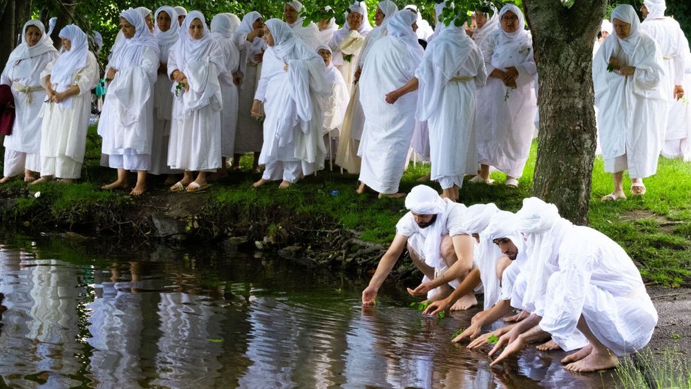
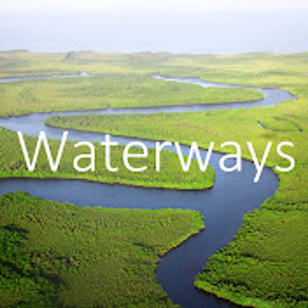
"The practice of goldsmithing, like many of our Mandaean rituals, is fading into history. The craft that had once flowed through the veins of our family like a confluence of streams, canals and waterways is now about to dry up."
18.05.2025 18:00 — 👍 8 🔁 7 💬 0 📌 0
As Twain wrote, the Mississippi River is well worth reading about. If you agree—and you should—check out @boyceupholt.bsky.social's book THE GREAT RIVER, which I had the pleasure of reviewing for H-environment.
www.h-net.org/reviews/show...
🗃️ #EnvHist
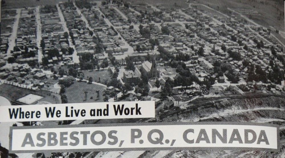
"Why would people still want to work at the mine? Practically speaking, this was more a question of home, and people wanting to stay living in the community where their families had lived, worked, and died for generations." - @historiamagoria.bsky.social
niche-canada.org/2020/10/29/t...
#envhist
To answer the obvious question yes we do cover the waterways filled with poop
13.05.2025 10:55 — 👍 10 🔁 2 💬 0 📌 0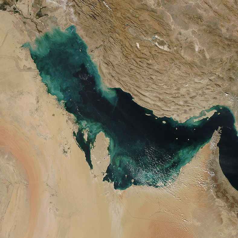
A satellite imagery of the Persian Gulf almost entirely sheltered by the surrounding Arabian Peninsula and Iran, with a small outlet at the Strait of Hormuz to the southeast
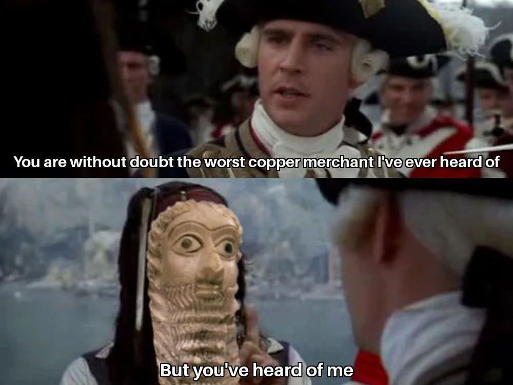
Screenshots from Pirates of the Caribbean. Top half: Captain Norrington saying "You are without doubt the worst copper mechant I've ever heard of." Bottom half: Jack Sparrow but with the face of a bearded Sumerian figurine saying "But you've heard of me." For more background on the meme: https://en.wikipedia.org/wiki/Complaint_tablet_to_Ea-n%C4%81%E1%B9%A3ir
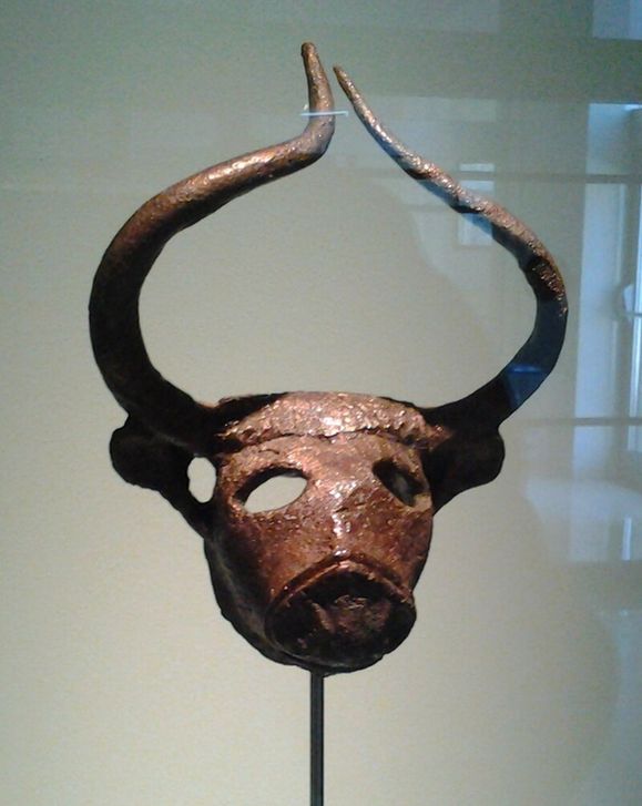
A bull's head made of copper found in Bahrain from the Dilmun period (c. 2000 BCE), a few hundred years before the infamous complaint letter to Ea-Nasir. Source: Ciacho5, https://commons.wikimedia.org/wiki/File:Coper_head_of_bull_Dilmun1.jpg
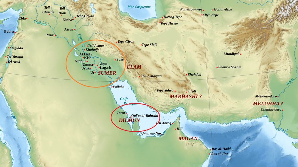
A map of the ancient Middle East around 2,500-2000 BCE, with Sumer in what is now southern Iraq circled in orange and Dilmun in what is now Bahrain, Qatar, and eastern Saudi Arabia circled in red. Source: https://commons.wikimedia.org/wiki/File:Moyen_Orient_3mil_aC.svg #MiddleEast #Sumer #AncientHistory #History #Bahrain #SaudiArabia #Qatar #Iraq #EaNasir #Meme #Copper
What resource comes to mind when you think of the Persian Gulf?
If you're the worst merchant in Ur, probably copper
A sheltered sea, the Gulf has long served as a mini-Mediterranean permitting seaborne trade
In 1750 BCE, that trade included Sumer and Dilmun, where Ea-Nasir got his subpar copper
The Gulf of Mexico, the Panama Canal, the Suez Canal, *and* the Persian Gulf
We're tired. So tired.
Follow @waterways-project.bsky.social
“our multitude of #rivers is another powerful image that represents what #Wales is about – connection, and people, and politics, and the use of resources, and where history is remembered and legends are made."
@raehowells.bsky.social
@arachnepress.bsky.social
www.theguardian.com/uk-news/2025...
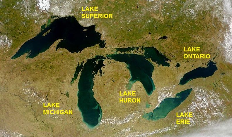
A map of the Great Lakes from space

A photo of US Senator Patrick Leahy greeting US President Bill Clinton in 1993
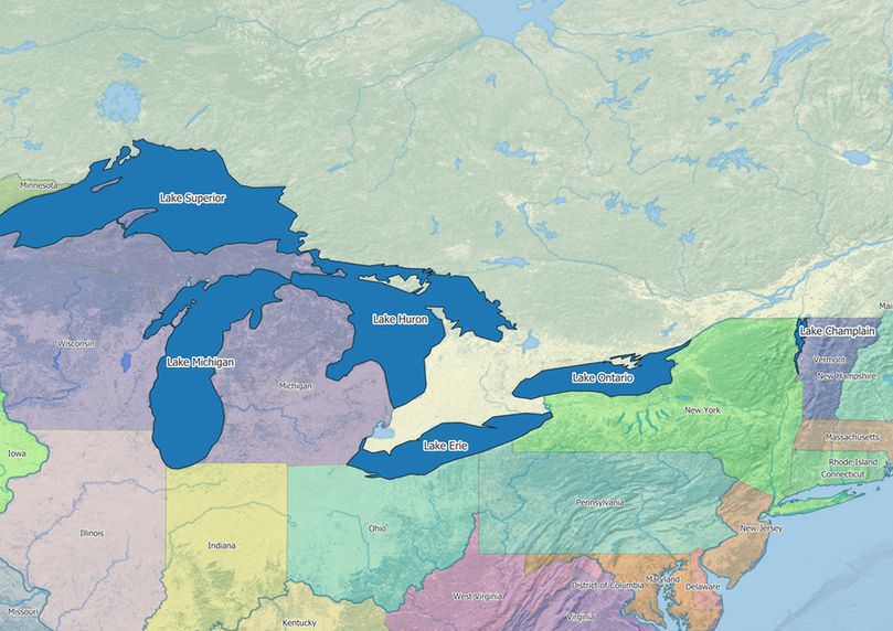
A map showing the five Great Lakes and Lake Champlain
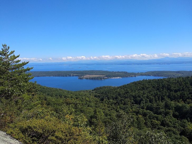
A photo of the Lake Champlain Valley from Rattlesnake Mountain, NY. Source: Annacecchini, https://commons.wikimedia.org/wiki/File:Lake_Champlain_Valley.jpg
Did you know there was a sixth Great Lake for three weeks?
In 1998, Vermont Senator Patrick Leahy passed a law naming Lake Champlain a Great Lake so Vermont could get money to study it under a Great Lakes program
An uproar from Midwest senators quickly reversed the move, but Vermont kept the money

A picture of a North American river otter looking cute as hell. Source: https://commons.wikimedia.org/wiki/File:North_American_river_otter.jpg
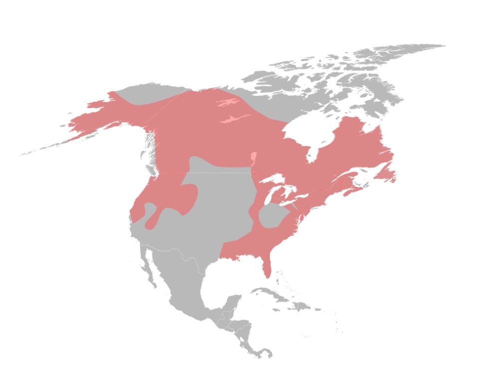
A map showing the distribution of the North American river otter across most of Canada, the Pacific Northwest, the Northeast US, and Southeast US. Source: https://commons.wikimedia.org/wiki/File:LontraCanadensisMap.svg
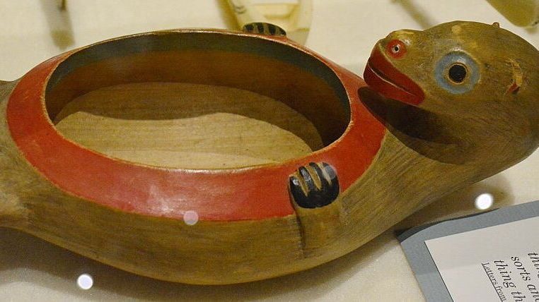
Bowl in the form of an otter, Sheldon Jackson Museum, Sitka, Alaska, U.S, 2023. Source: Joe Mabel, https://commons.wikimedia.org/wiki/File:Sheldon_Jackson_Museum_-_Otter_bowl_01.jpg

It may look cute, but did you know the North American river otter is kind of a dick?
Native to Canada and the US, it's a trickster in many Indigenous cultures
In an Ojibwe story, the otter tricked the bear into losing its tail by saying it could catch fish by sticking its tail into freezing water
A picture of a North American river otter looking cute as hell. Source: https://commons.wikimedia.org/wiki/File:North_American_river_otter.jpg
A map showing the distribution of the North American river otter across most of Canada, the Pacific Northwest, the Northeast US, and Southeast US. Source: https://commons.wikimedia.org/wiki/File:LontraCanadensisMap.svg
Bowl in the form of an otter, Sheldon Jackson Museum, Sitka, Alaska, U.S, 2023. Source: Joe Mabel, https://commons.wikimedia.org/wiki/File:Sheldon_Jackson_Museum_-_Otter_bowl_01.jpg
It may look cute, but did you know the North American river otter is kind of a dick?
Native to Canada and the US, it's a trickster in many Indigenous cultures
In an Ojibwe story, the otter tricked the bear into losing its tail by saying it could catch fish by sticking its tail into freezing water
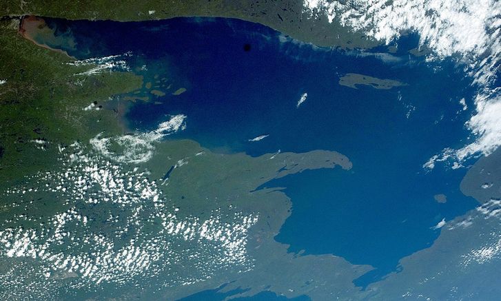
A satellite photo of Lake Superior with some cloud cover
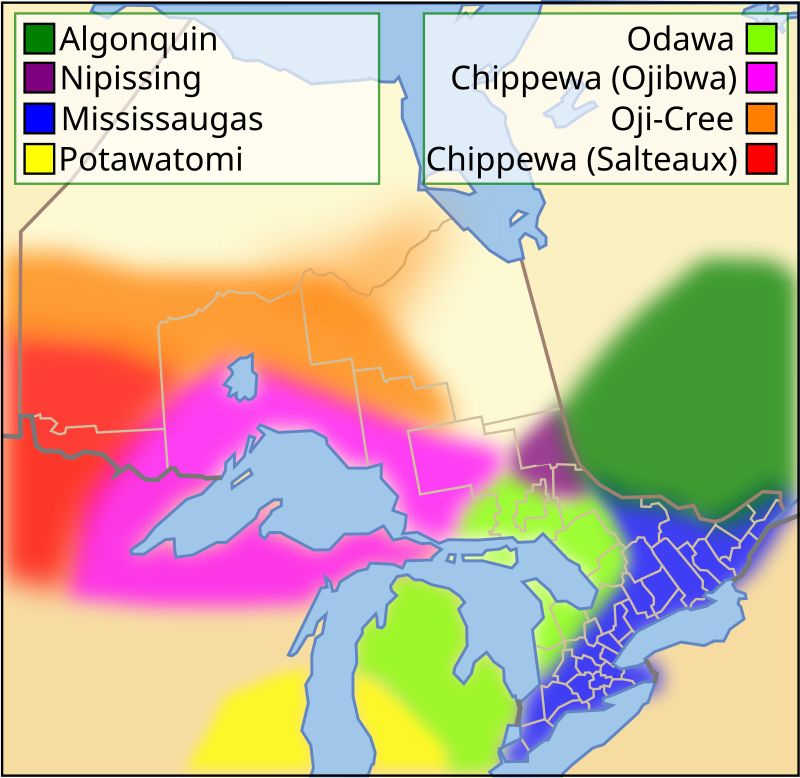
A map of the Native language families around the Great Lakes, with the Chippewa (Ojibwa) family surrounding Lake Superior
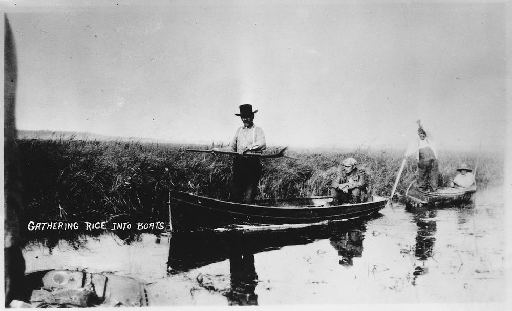
Ojibwe people gathering wild rice in boats in wetlands in Minnesota, 1934. Source: https://commons.wikimedia.org/wiki/File:Wild_rice_harvesting_and_processing_-_NARA_-_285184.tif?page=1
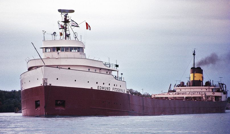
The SS Edmund Fitzgerald in 1971. Source: https://commons.wikimedia.org/wiki/File:Edmund_Fitzgerald,_1971,_3_of_4_(restored;_cropped).jpg #Minnesota #GreatLakes #Lakes #Rivers #EnvHistory #NativeHistory #Michigan #Wisconsin #EdmundFitzgerald #GordonLightfood #US #Canada #UnitedStates
Is Lake Superior actually a lake, or a sea pretending?
It's a lake in English, but it's “Ojibwa’s Great Sea” in Ojibwe, an apt name given it's the world's largest freshwater body
Superior's sea-ness has made it useful for shipping, with lakers like the Edmund Fitzgerald hauling Minnesota iron ore
Unbelievably on brand for Faneuil Hall to be built on trash lmao
01.05.2025 15:21 — 👍 5 🔁 3 💬 0 📌 0I was today years old when I learned this. HOLY CRAP.
01.05.2025 02:28 — 👍 9 🔁 2 💬 1 📌 0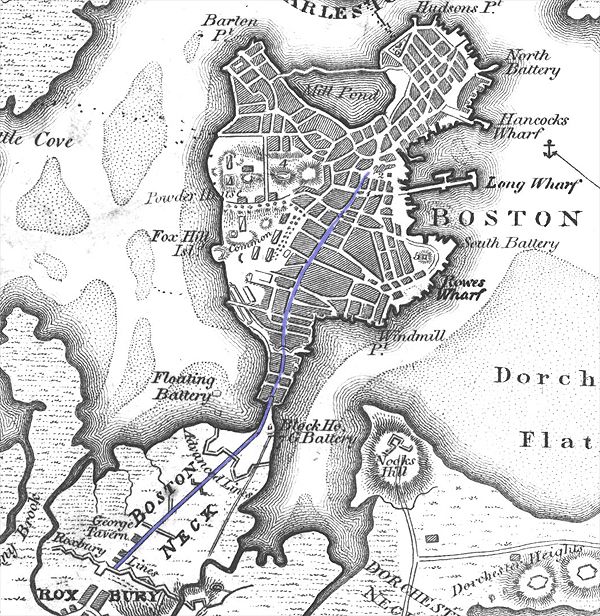
Early map of Boston showing the neck. From the collection of en:Historic New England. The blue line shows present-day Washington Street. Source: Historic New England, https://commons.wikimedia.org/wiki/File:BostonNeck.jpg
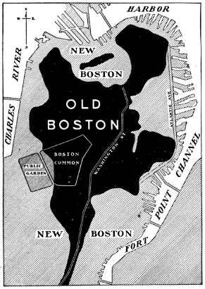
A map showing 'Old Boston' as it existed prior to land reclamation in the 19th century on the Shawmut Peninsula and 'New Boston,' all the land added during the 19th century land reclamations, including all of the modern-day waterfront and the Public Garden. Source: https://commons.wikimedia.org/wiki/File:Oldandnewboston.jpg
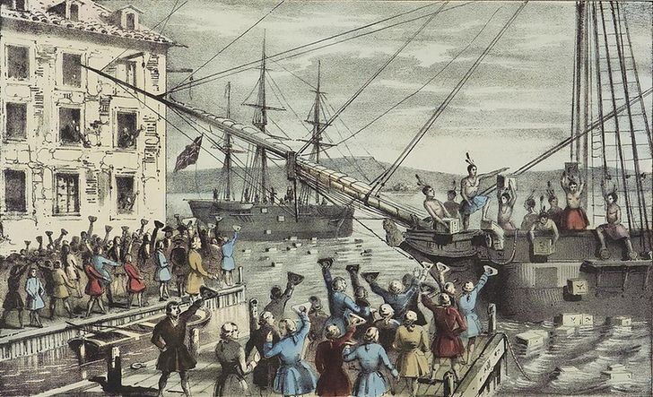
"The Destruction of Tea at Boston Harbor" by Nathayel Corrier, 1846. The portion of Boston Harbor in which the colonists threw tea is now on dry land.
An aerial view of Back Bay next to the Charles River in Boston, 2004. Prior to reclamation in the 1800s, the Back Bay was literally the bay back behind the Boston Peninsula. Source: Sfoskett https://commons.wikimedia.org/wiki/File:Boston_Back_Bay.jpg
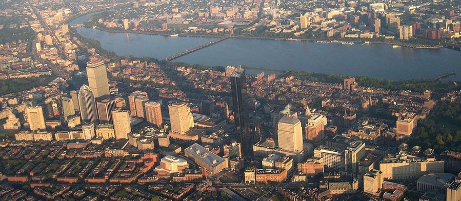
Did you know the Founding Fathers wouldn't recognize modern Boston?
Located on the Shawmut Peninsula, 1700s Boston was almost an island
Land reclamation in the 1800s changed the city's coastline, filling in the location of the Boston Tea Party and creating the entire Back Bay neighborhood
This reminds me of how I just learned on a @fullstorybaltimore.tours tour that Water Street in Baltimore is named Water Street because it just to be the street that abutted the water before they filled it in and created the land that is now south of there.
30.04.2025 16:37 — 👍 9 🔁 3 💬 2 📌 0
We have updated our Waterwork Tier rankings to include Maori Agricultural Adaptations, the Dambuster Raid, and Boston's Land Reclamations
What do you think?
Brb fixing the Bay area’s housing problem by filling in the bay and building houses there
01.05.2025 00:05 — 👍 15 🔁 3 💬 5 📌 0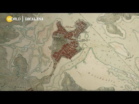
Boston almost certainly has more reclaimed land than any other city in North America
Here's historian Nancy Seasholes explaining how the city used trash and large chunks of Beacon Hill to fill in Back Bay and other areas of the city
this looks like a map of the Forbidden Sector of Boston, uninhabitable to baseline humans since the Calamity. none know the horrors that may be breeding within its unknown depths, but we keep watch day and night from outposts on the harbor, ever vigilant against its fell threat
30.04.2025 16:13 — 👍 72 🔁 20 💬 8 📌 0
Boston almost certainly has more reclaimed land than any other city in North America
Here's historian Nancy Seasholes explaining how the city used trash and large chunks of Beacon Hill to fill in Back Bay and other areas of the city
Early map of Boston showing the neck. From the collection of en:Historic New England. The blue line shows present-day Washington Street. Source: Historic New England, https://commons.wikimedia.org/wiki/File:BostonNeck.jpg
A map showing 'Old Boston' as it existed prior to land reclamation in the 19th century on the Shawmut Peninsula and 'New Boston,' all the land added during the 19th century land reclamations, including all of the modern-day waterfront and the Public Garden. Source: https://commons.wikimedia.org/wiki/File:Oldandnewboston.jpg
"The Destruction of Tea at Boston Harbor" by Nathayel Corrier, 1846. The portion of Boston Harbor in which the colonists threw tea is now on dry land.
An aerial view of Back Bay next to the Charles River in Boston, 2004. Prior to reclamation in the 1800s, the Back Bay was literally the bay back behind the Boston Peninsula. Source: Sfoskett https://commons.wikimedia.org/wiki/File:Boston_Back_Bay.jpg
Did you know the Founding Fathers wouldn't recognize modern Boston?
Located on the Shawmut Peninsula, 1700s Boston was almost an island
Land reclamation in the 1800s changed the city's coastline, filling in the location of the Boston Tea Party and creating the entire Back Bay neighborhood
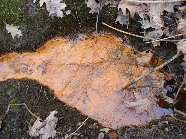
A photo of iron oxidizing bacteria visible in surface water with its reddish-brown color, 2006. Source: NH Estuaries Project, https://commons.wikimedia.org/wiki/File:Iron_bacteria_in_runoff.JPG
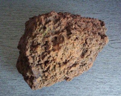
A lump of bog iron (limonite) ore, 2005. Source: Tomasz Kuran aka Meteor2017, https://commons.wikimedia.org/wiki/File:Limonite_bog_iron_cm02.jpg
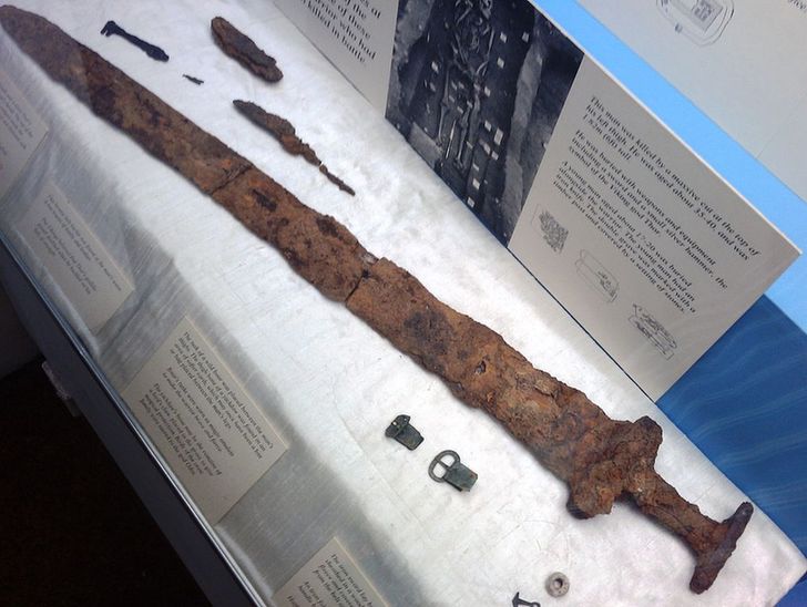
Derby Museum Viking Sword found in Repton. Source: Roger from Derby, UK, https://commons.wikimedia.org/wiki/File:Derby_Museum_Viking_Sword.jpg
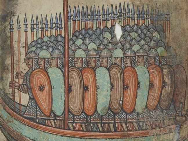
An excerpt from a c.1100 manuscript showing the Viking attack on Guérande, France, with the Vikings wearing identifiably iron armor and wileding iron swords. Source: https://commons.wikimedia.org/wiki/File:Viking_attack_on_Gu%C3%A9rande,_from_a_Saint-Aubin_MS_(cropped).jpg
Did you know the Vikings made swords from swamp water?
Groundwater from a spring carries dissolved iron; when this water reaches a bog, acidity and certain bacteria can turn it into iron oxide
Sifting this out, one gets ore to make "bog iron", the main source of iron in Scandinavia until ~1300 CE
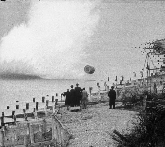
Movie still, showing an inert, practice version of the Upkeep bouncing bomb being dropped during a training flight by members of RAF 617 Squadron at Reculver bombing range, Kent. The bomb's designer, Barnes Wallis, and others watch the practice bomb strike the shoreline. Source: Imperial War Museums, https://commons.wikimedia.org/wiki/File:Bouncing_bomb_training_-_IWM_FLM_2343.jpg
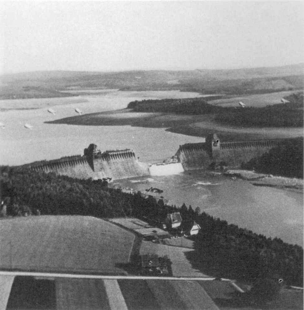
Photograph of the breached Möhne Dam taken by Flying Officer Jerry Fray of No. 542 Squadron from his Spitfire PR IX, six Barrage balloons are above the dam. Source: https://commons.wikimedia.org/wiki/File:Mohne_Dam_Breached.jpg

A still from 1955's 'The Dam Busters' showing a pilot in a cockpit during a bombing raid

A screenshot of Luke Skywalker in his X-Wing cockpit during his bombing raid in Star Wars: A New Hope (1977)
Did you know Star Wars' Death Star attack was inspired by exploding dams?
During WWII, the RAF launched Operation Chastise, which used 'bouncing' bombs to destroy Germany's Möhne and Eder dams
The raid was subject of the 1955 film 'The Dam Busters,' which inspired the climax of 1977's A New Hope
At least it didn't have a nuclear bomb on it this time
28.04.2025 20:42 — 👍 15 🔁 2 💬 1 📌 0At least it didn't have a nuclear bomb on it this time
28.04.2025 20:42 — 👍 0 🔁 0 💬 0 📌 0
Movie still, showing an inert, practice version of the Upkeep bouncing bomb being dropped during a training flight by members of RAF 617 Squadron at Reculver bombing range, Kent. The bomb's designer, Barnes Wallis, and others watch the practice bomb strike the shoreline. Source: Imperial War Museums, https://commons.wikimedia.org/wiki/File:Bouncing_bomb_training_-_IWM_FLM_2343.jpg
Photograph of the breached Möhne Dam taken by Flying Officer Jerry Fray of No. 542 Squadron from his Spitfire PR IX, six Barrage balloons are above the dam. Source: https://commons.wikimedia.org/wiki/File:Mohne_Dam_Breached.jpg
A still from 1955's 'The Dam Busters' showing a pilot in a cockpit during a bombing raid
A screenshot of Luke Skywalker in his X-Wing cockpit during his bombing raid in Star Wars: A New Hope (1977)
Did you know Star Wars' Death Star attack was inspired by exploding dams?
During WWII, the RAF launched Operation Chastise, which used 'bouncing' bombs to destroy Germany's Möhne and Eder dams
The raid was subject of the 1955 film 'The Dam Busters,' which inspired the climax of 1977's A New Hope
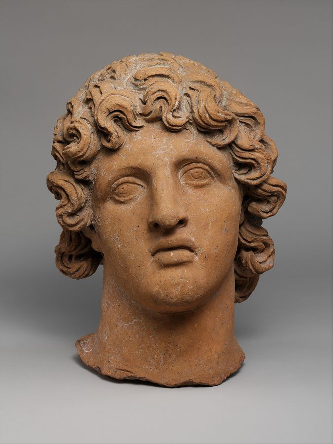
Etruscan; Head of a youth; Terracottas, 3rd-2nd century BCE. Source: Metropolitan Museum of Art, https://commons.wikimedia.org/wiki/File:Terracotta_head_of_a_youth_MET_DP119670.jpg
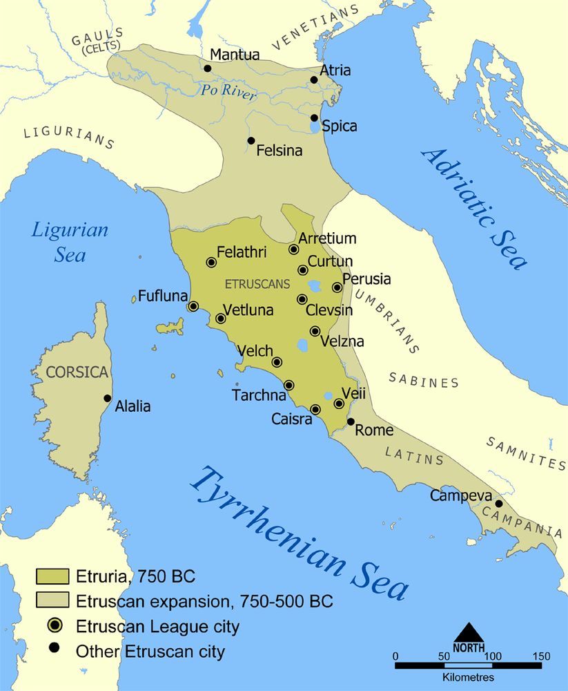
A map showing the extent of Etruria and the Etruscan civilization. The map includes the 12 cities of the Etruscan League and notable cities founded by the Etruscans, 750-500 BCE. Source: NormanEinstein, https://commons.wikimedia.org/wiki/File:Etruscan_civilization_map.png
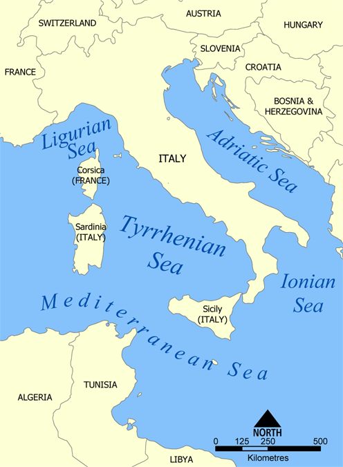
A map showing the central Mediterranean, with the Tyrrhenian Sea being the arm of the Mediterranean between Italy, Corsica, Sardinia, and Siciliy. Source: NormanEinstein, https://commons.wikimedia.org/wiki/File:Tyrrhenian_Sea_map.png
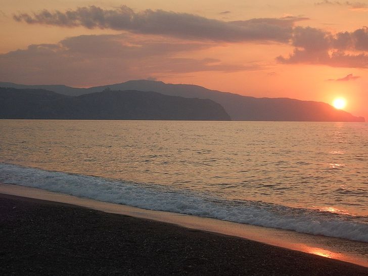
Sunset at Marchesana beach behind Tindari cape and Calavà Cape at Terme Vigliatore, Sicily. Source: https://commons.wikimedia.org/wiki/File:Merchesana_beach_in_Terme_Vigliatore,_Sicily.JPG
The Romans called the Mediterranean "Our Sea," but did the Etruscans get the last laugh?
A major power in Italy before Rome, the Etruscans ('Tyrrhenians' in Greek) were conquered by their more famous neighbor
But their name lives on in the arm of the Mediterranean west of Italy: the Tyrrhenian Sea