
Hiroto Goto presented his exciting work on drone‑based moose population surveys at #tws2025. Can’t wait to see his research develop further! 🌲🦌 #WildlifeScience #DroneTech
29.10.2025 18:33 — 👍 3 🔁 2 💬 0 📌 0Hiroto Goto presented his exciting work on drone‑based moose population surveys at #tws2025. Can’t wait to see his research develop further! 🌲🦌 #WildlifeScience #DroneTech
29.10.2025 18:33 — 👍 3 🔁 2 💬 0 📌 0
I presented my latest work on drone‑based surveys to estimate moose populations. Using simulations, we were able to:
- Compared various drone platforms
- Found that fixed‑wing drones equipped with a gimbal‑mounted camera provide a viable, safe alternative to conventional methods.
#TWS2025 #drone
I'm excited to present my work on surveying wildlife with drones and connect with the TWS community #TWS2025
Join me, Monday 9:15 in Salon 8
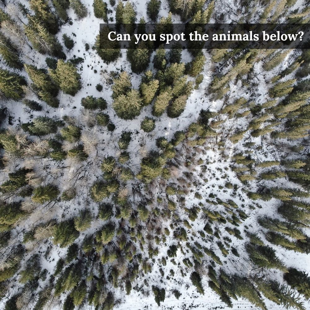
Visible light (RGB) image of a conifer forest.
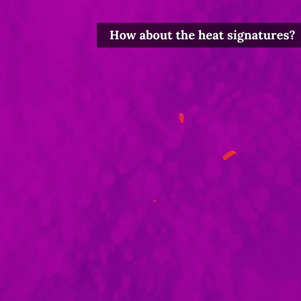
Thermal image showing two animals.
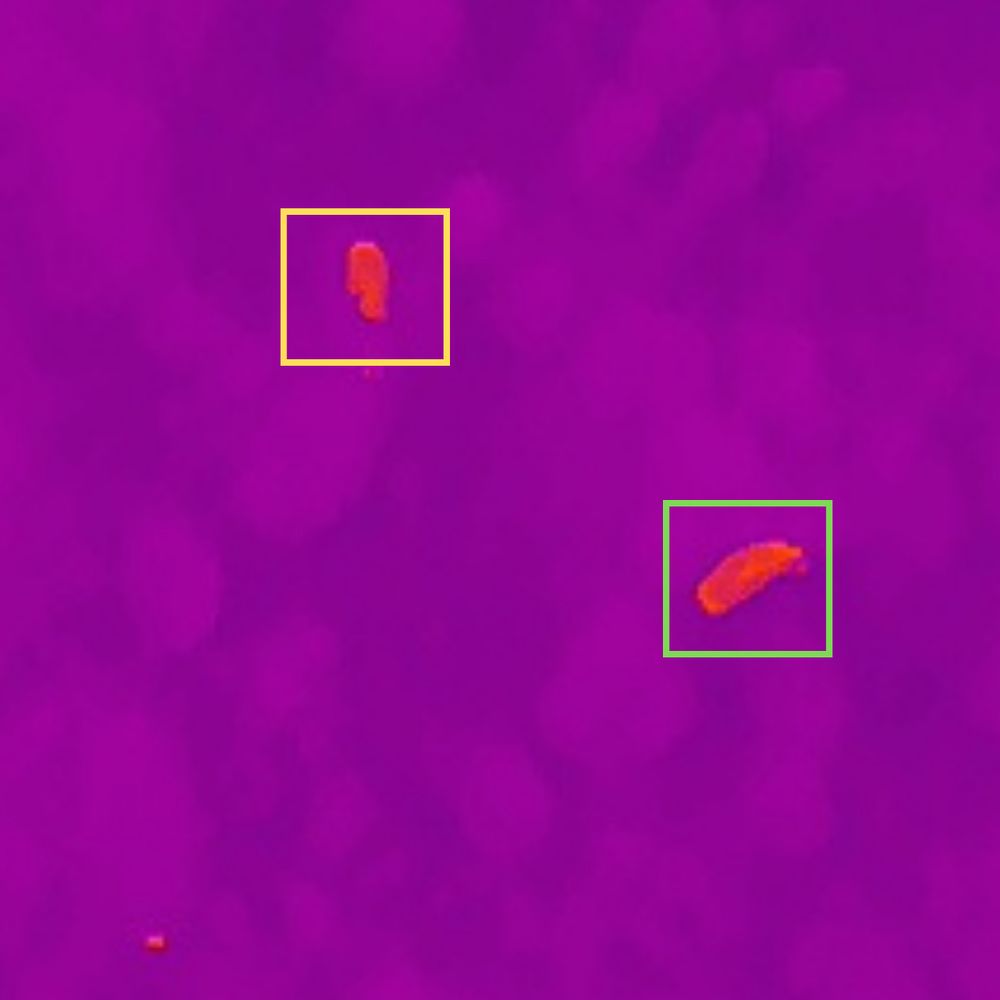
IR image zoomed in on the thermal signatures.
Preliminary results are in: Fixed-wing drones show strong potential for moose surveys.
Monitoring moose populations has been traditionally done by helicopter. Our partners at UBC are exploring if drones are a better alternative.
🔗Learn more: friresearch.ca/publications...
@irssubc.bsky.social
I am currently advertising a new 3-year research position in my TerraLuma team: Research Associate in Drone Field Operations (Academic Level A)
The position will support the Terrestrial Ecosystem Research Network’s (@TERN_Aus) Dronescape project.
careers.utas.edu.au/cw/en/job/50...

My PhD paper is out🤠We advance methods for mapping fractional vegetation cover using a CNN-based U-net on cm-scale UAS RGB & multispec imagery, capturing patterns in sparse, complex vegetation & enabling detailed, scalable mapping in semi-arid ecosystems.
[1/8]
doi.org/10.1007/s109...


If you don't think the IRSS flies #drones in the winter, you've never done field work with Leanna (@la-stack.bsky.social) & Kirk! ❄️
Leanna was out collecting leaf-off #lidar & #ThermalImagery of winder conditions for trout-bearing steams in Alberta with @friresearch.bsky.social!

@friresearch.bsky.social recaps postdoc @l-hambrecht.bsky.social's recent field work in Hinton, Alberta to test the use of thermal #drones over horses in the area 🐴
The horses were used as proxies for moose detection under various canopy cover to survey #moose populations
Stay tuned for findings!

For all our #RemoteSensing and #Lidar friends here on BlueSky, be sure to follow us for all the info relating to SilviLaser 2025!
📅 Sep 29 - Oct 3, 2025
🚩 Quebec City, Canada
📃 Call for abstracts is now open!
🖥️ Be sure to sign up for our newsletter!
www.silvilaser2025.com
@ubcforestry.bsky.social


High tech, meet the horses!
Folks from Integrated RS Studio came to test their tech for identifying ungulates under canopy cover. We’re short on trained moose that will stand around where we want them, so we used our biologist’s horses as test subjects!
📷 Arya Horon, Caroline Lesage

Unfortunately this is nothing new. I've worked on online IWT for 15yrs, others for 20yrs. I fear many 'initiatives' are treated as green washing by social media companies.
‘It shouldn’t be that easy’: inside the illegal wildlife trade booming on social media www.theguardian.com/environment/...
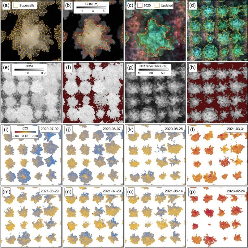
NEW PAPER📢 Seasonal vegetation dynamics for phenotype using multispectral #drone imagery: differentiation, #ClimateAdaptation & hybridization of #InteriorSpruce
🔓#OpenAccess: doi.org/10.1016/j.rs...
✍️Grubinger, Coops, O'Neill, Degner, Wang, Waite, Riofrio, Koch
🙏 NSERC
#UBCforestry #remotesensing
Are you a scientist that uses cameras, acoustics or drones to monitor wildlife? Are you using satellite imagery to assess forests? Join the Biodiversity Monitoring starter pack and let the world know! Reply below and point me to your research to be added. ECRs and PhDs welcome😊
go.bsky.app/eFMQQX
Hello! 👋 The IRSS is excited to try out this new platform!
We'll continue to share the latest new from IRSS, recent publications, job opportunities and everything fun related to #RemoteSensing and more! 🛰️
#RemoteSensing #Lidar #ALS #drones #SatelliteImagery