One of the most surprising (and exciting!) things about first getting into Carto/GIS work was discovering how accessible* NOAA, NWS, Landsat, Sentinel, etc. were.
Like yeah you had to find and learn how to process them, but all this data, yours to discover and use.
30.06.2025 22:42 —
👍 16
🔁 4
💬 1
📌 0
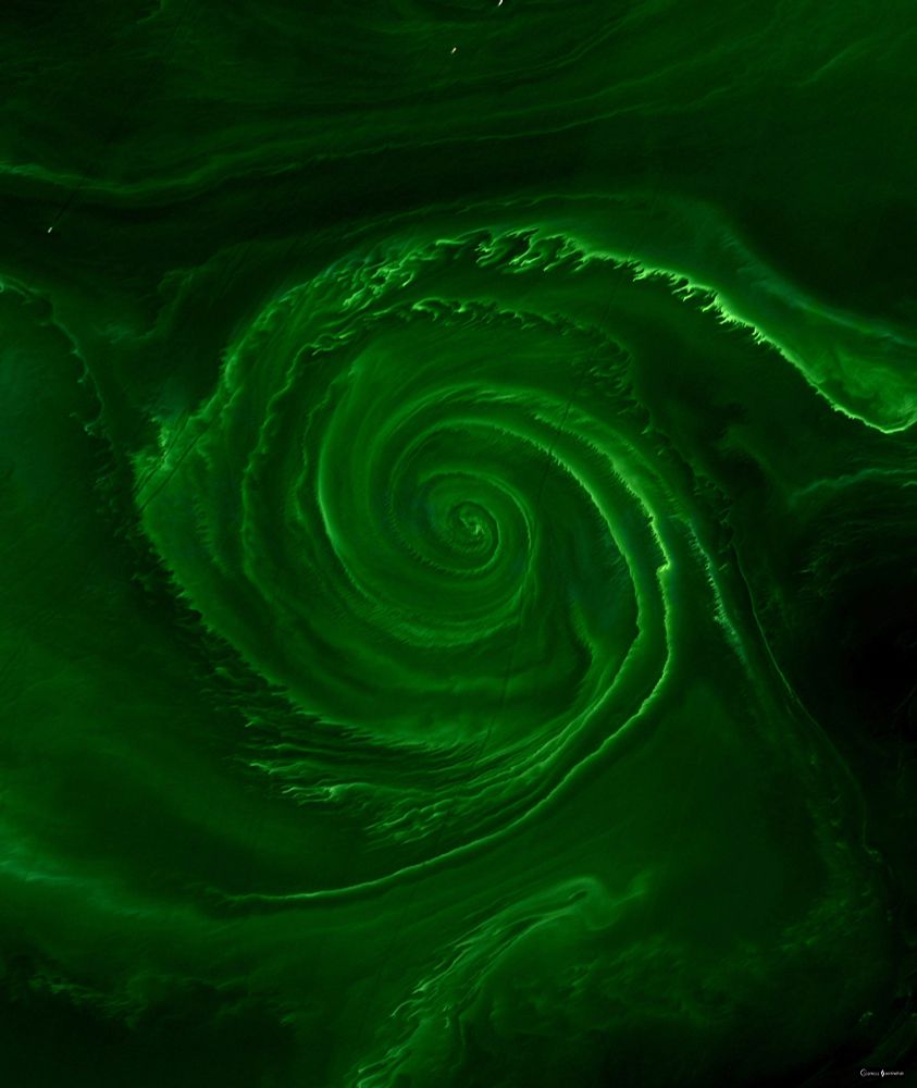
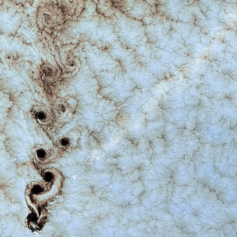
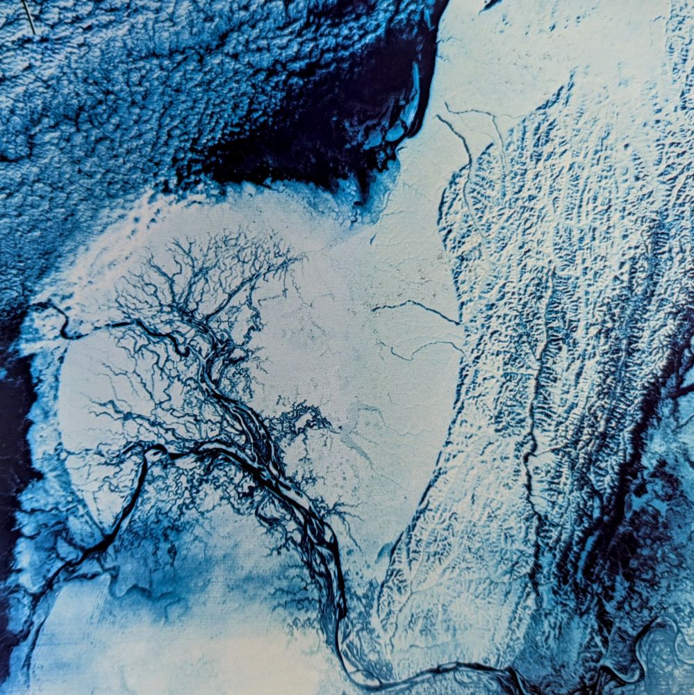
Algal vortex in The Baltic Sea.
Image taken by Landsat-8 on July 18, 2018.
27.06.2025 18:26 —
👍 119
🔁 36
💬 2
📌 1

Landsat false color image.

Landsat false color image of Middle East oil wells.

Landsat false color image of Ireland.

Landsat false color image of the US-Canadian border.
Landsat Images from "Mission to Earth", 1976. (2)
14.06.2025 13:26 —
👍 8
🔁 2
💬 1
📌 0
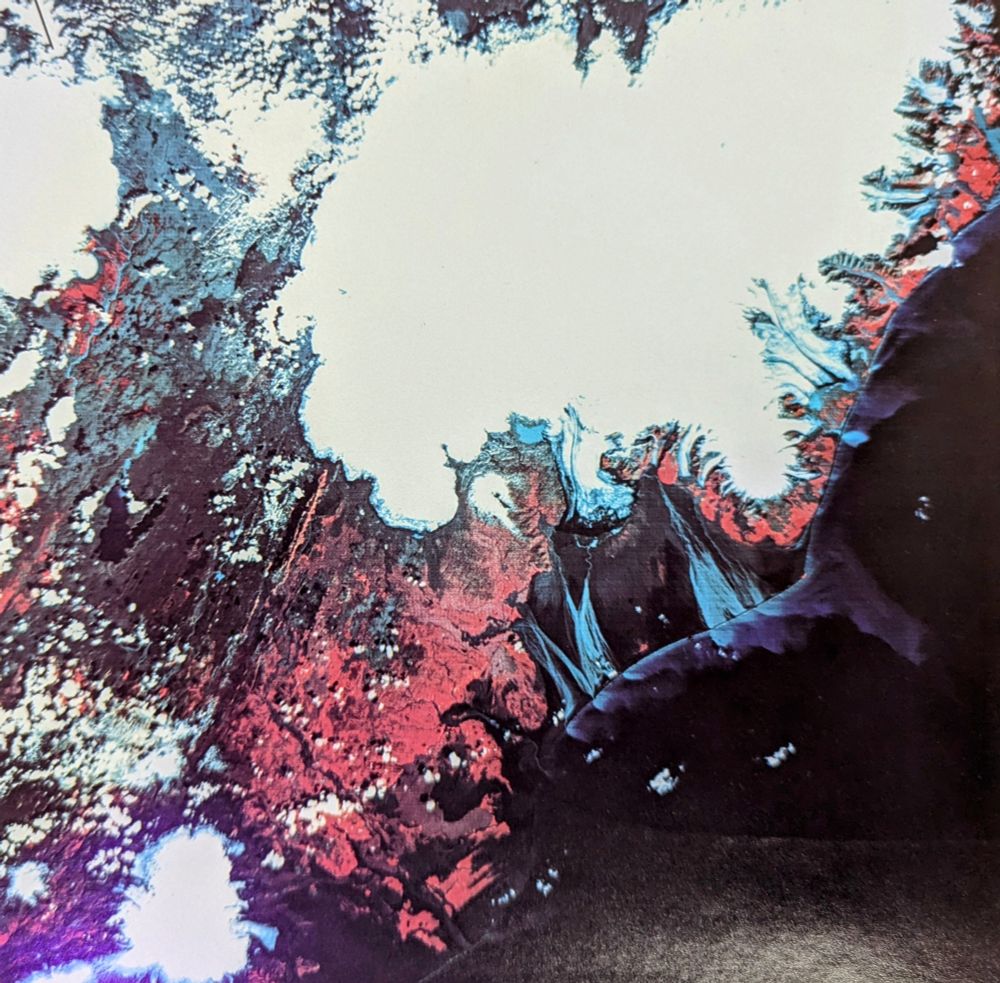
A Landsat false color image showing a big white ice patch and red landforms.
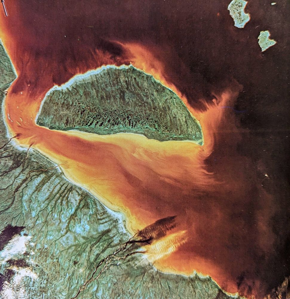
Landsat image, false color. Island in water, the silt giving a orange color.
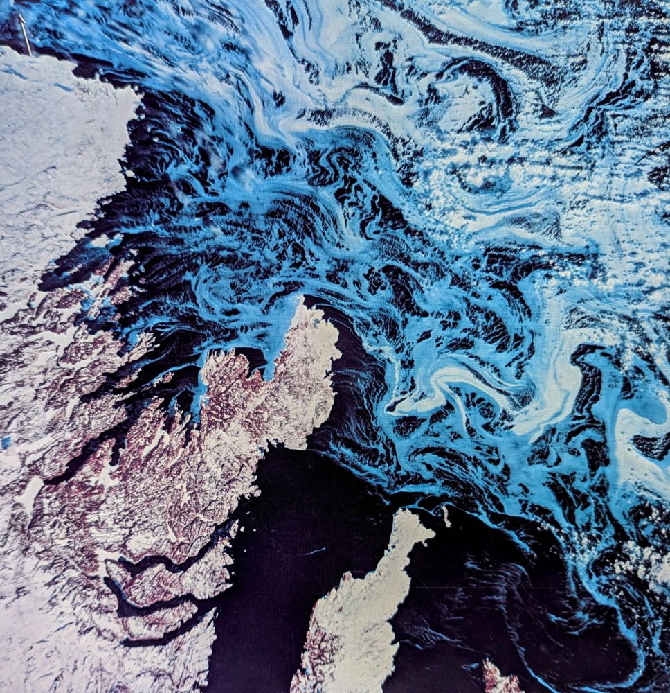
Landsat false color image showing swirling ice.
Landsat false color image showing ice and black rivers.
Landsat Images from "Mission to Earth", 1976.
14.06.2025 13:24 —
👍 62
🔁 16
💬 2
📌 0

Eyes on Earth
Eyes on Earth is a podcast on remote sensing, Earth observation, land change and science, brought to you by the USGS Earth Resources Observation and Science (EROS) Center.
Come along as we visit a #Landsat validation test site on the latest Eyes on Earth podcast episode. We’ll learn about why validation is important to maintaining Landsat’s gold standard, as well as hazards of the test site (ticks are one!). Listen: ow.ly/CEnh50W8muN
16.06.2025 18:05 —
👍 4
🔁 1
💬 0
📌 0

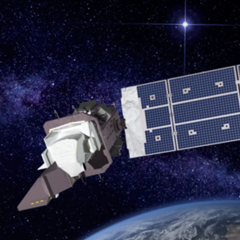
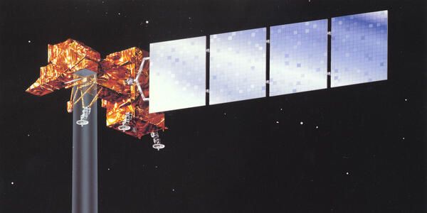
Remembering its quarter-century of faithful Earth observation, the USGS and NASA have announced the decommissioning of Landsat 7 from active service. Landsat 8 and Landsat 9 continue to collect images every day. Read more about Landsat 7: ow.ly/nz9k50W5CAQ
16.06.2025 18:03 —
👍 8
🔁 3
💬 0
📌 2

View of New Zealand taken by Landsat satellite Credit: NASA/USGS
Nov 14, 2014: This Landsat 8 image highlights Egmont National Park in New Zealand, revealing the contrast between its protected forests and surrounding pasturelands.
www.nasa.gov/image-article/exploring-worlds-protected-areas-from-space/
08.06.2025 12:00 —
👍 10
🔁 3
💬 1
📌 1
#Landsat 8 collected new images of these Canada fires on June 5, 2025. Image A shows a wildfire near the Petitot River in northeastern British Columbia. The Saskatchewan fire in image B is burning east of Mari Lake. More than 200 fires are currently active across Canada.
09.06.2025 04:56 —
👍 10
🔁 1
💬 2
📌 0
Wildfires fueled by high temperatures, winds and dry conditions are seen burning in Saskatchewan, Canada, captured by this Landsat 9 image on June 2, 2025. #gischat #eochat
03.06.2025 21:40 —
👍 9
🔁 1
💬 0
📌 0
Wildfires fueled by high temperatures, winds and dry conditions are seen burning in Saskatchewan, Canada, captured by this Landsat 9 image on June 2, 2025. #gischat #eochat
03.06.2025 21:40 —
👍 9
🔁 1
💬 0
📌 0
#Landsat 9 captured imagery of an area in southern Switzerland that was devastated by a landslide on May 28th caused by partial glacier collapse. These natural color panchromatic-sharpened images show the area on May 13th, and again on May 29th.
31.05.2025 12:49 —
👍 8
🔁 3
💬 0
📌 0
Dust storms contribute to the accumulation of PM2.5 and PM10—particulate air pollution that is associated with respiratory and cardiovascular health risks. They can also spread viruses and fungal diseases and drastically reduce visibility.
03.06.2025 03:51 —
👍 0
🔁 0
💬 0
📌 0


Fallow farmland is the main source of human-caused dust storms in California’s Central Valley region, according to a new study using data from NASA and others. From 2008-2022, 88% of major human-caused dust events were associated with fallow land.
03.06.2025 03:49 —
👍 1
🔁 0
💬 0
📌 2

What might be mistaken for dinosaur bones being unearthed at a paleontological dig are some of the individual reefs that make up the #GreatBarrierReef. Download the image here: ow.ly/6xl250S4wG2.
03.06.2025 03:47 —
👍 1
🔁 0
💬 0
📌 0
#Landsat 9 captured imagery of an area in southern Switzerland that was devastated by a landslide on May 28th caused by partial glacier collapse. These natural color panchromatic-sharpened images show the area on May 13th, and again on May 29th.
31.05.2025 12:49 —
👍 8
🔁 3
💬 0
📌 0

LC09_L1TP_106075_20250530_20250530_02_T1
Fresh #Landsat Imagery
Lake Mackay, Australia
5/29/2025
30.05.2025 07:26 —
👍 8
🔁 0
💬 0
📌 0

The Serra de Caldas is a monolithic oval-shaped plateau covered entirely by Cerrado, a biologically rich savanna and grassland ecosystem
The Cerrado is the 2nd largest biome in S. America, home to thousands of plant, bird, reptile, and mammal species🧪
26.05.2025 18:29 —
👍 34
🔁 6
💬 1
📌 0
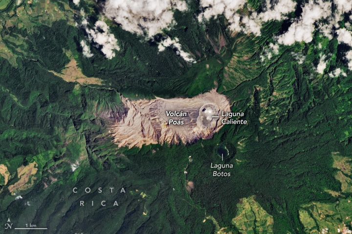

Volcán Poás, one of the most active in Costa Rica sustains a hot, ultra-acidic crater lake that shares similarities to Martian environments
The Poás system may be hostile to most forms of life we are familiar with. But for a microbe adapted to acid, heat, and toxic metals, it’s paradise 🧪
28.05.2025 05:48 —
👍 10
🔁 4
💬 2
📌 0
Episode 23 of the ongoing eruption at Kīlauea recently ended. Here's a video from the USGS showing a time-lapse of the fountaining.
🧪⚒️🌋
HVO
www.usgs.gov/observatorie...
USGS Volcano Hazards Program
www.usgs.gov/vhp
28.05.2025 05:12 —
👍 90
🔁 14
💬 2
📌 1

An Impact Crater Hiding in Plain Sight
Much of the Goyder impact structure has eroded away, but there are remnants in Australia’s Northern Territory.
Did you know there are 190 confirmed impact craters on Earth? #Landsat 8 captured an image of the Goyder impact structure in Australia—discovered in the 1990s—overlaid on a digital elevation model to give a sense of the topography.
🛰️ go.nasa.gov/3H6oPbP
29.05.2025 06:18 —
👍 3
🔁 0
💬 0
📌 0
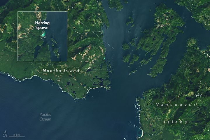
This is near Vancouver Island in British Columbia, Canada. And see that blue glow? That’s a herring spawn! Every spring, thousands of Pacific herring congregate in shallow, vegetated coastal areas around this area to spawn, like in this #Landsat 8 image from April 27.
(via NASA Earth)
29.05.2025 06:16 —
👍 9
🔁 1
💬 0
📌 0

Eruption of Kilauea as seen by Landsat-8/9 on May 16, 2025.
19.05.2025 11:43 —
👍 17
🔁 3
💬 0
📌 0

Scientists have discovered that trees near volcanoes can act as early warning systems before eruptions. As magma rises, it releases CO₂, which trees absorb—causing changes in leaf color and reflectance that satellites like NASA's Landsat 8 and ESA's Sentinel-2 can detect.
27.05.2025 18:10 —
👍 8
🔁 2
💬 1
📌 1