We value the benefits that diversity brings, and we encourage applications from all sectors of society and geographic regions. Though previous editorial experience is desirable, we encourage early career scientists to apply even if they have not previously worked as an editor.
20.06.2025 11:24 — 👍 0 🔁 0 💬 0 📌 0
- Development and validation of open‐source software or scripts for remote sensing analyses in ecology and conservation.
- Deep learning frameworks tailored for ecological or conservation remote‐sensing tasks.
20.06.2025 11:24 — 👍 0 🔁 0 💬 1 📌 0
Specifically, the Senior Editors are seeking researchers with the following expertise:
- Terrestrial, mobile, airborne and UAV lidar (and 3D close range sensing), for trees and forests, as well as other ecosystems
- Remote sensing applications for marine and/or coastal ecology
...
20.06.2025 11:24 — 👍 0 🔁 0 💬 1 📌 0
Open Call for Associate Editors
The Zoological Society of London is looking for active researchers to join the Editorial Board of RSEC.
zslpublications.onlinelibrary.wiley.com/hub/journal/...
20.06.2025 11:24 — 👍 2 🔁 4 💬 1 📌 0

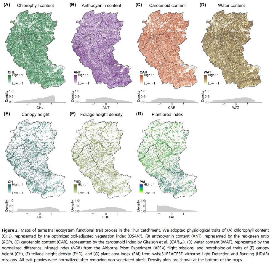
Hyperspectral imagery, #LiDAR point clouds 🛰️, #eDNA 🧬 to assess land-water 🟦–🟩 linkage of #biodiversity across aquatic functional feeding groups.
🦐🐟🐸🔬💧
Zhang et al. out now in @rsecjournal.bsky.social zslpublications.onlinelibrary.wiley.com/doi/10.1002/...
1/4 🧵 🌐🌍
02.06.2025 06:44 — 👍 15 🔁 4 💬 1 📌 0

(A) Input image, (B) output from the segmentation model used to infer a bounding box and body contour for each whale, (C) output from the keypoint detection model used to infer a bounding box and the axis for each whale and (D) final output by combining the outputs of both the models and calculating the widths along the axis at 5% intervals.
Automated extraction of right whale morphometric data from drone aerial photographs.
Bagchi et al.
Read the full paper here:
zslpublications.onlinelibrary.wiley.com/doi/full/10....
18.03.2025 12:29 — 👍 4 🔁 3 💬 0 📌 0

Remotely sensing coral bleaching in the Jeddah reef (Saudi Arabia) and mapping their severity levels. (A) and (B) RGB composite images acquired on October 3, 2023. (C) RGB image was acquired on January 22, 2020. (D) Coral bleaching map based on the least-squares approach on October 3, 2023 in the Jeddah region. (In (D) HB, high bleaching; LB, low bleaching; MB, moderate bleaching; NB, no bleaching; the white triangle indicates the sampling location highlighting the presence of a moderate bleaching event).
New paper:
Remotely sensing coral bleaching in the Red Sea.
Elamurugu Alias Gokul et al.
Read the full paper here:
zslpublications.onlinelibrary.wiley.com/doi/full/10....
11.03.2025 14:30 — 👍 2 🔁 1 💬 0 📌 0
Distinguished Researcher ATRAE @CSIC, Professor @UNColombia, #landscapeecology #fireecology #deforestation #degradation #biodiversity #globalchange #sciencepolicy Fulbrighter @UNCCD @theamazonwewant
🎮 Gamer
🧱 Lego Enthusiast
⌨️ Software Engineer
https://maxiujun.com
Geographer @ Humboldt-University Berlin | working on land use and its impact on biodiversity
Lecturer in Ecology I University of South Wales
Conservation I Ecology I Remote Sensing🦎🌳
Course Leader BSc (Hons) International Wildlife Biology @ Uni South Wales | research vertebrates | conservation ecology | dad | nerd | lifter | part-time manticore | he/him 🌍🌎🌎
Conservation scientist, wildlife monitoring, camera traps, technology, modelling, professor at ZSL Institute of Zoology
Managing the Knowledge Centre for Biodiversity of the EC.
More about my work at https://knowledge4policy.ec.europa.eu/biodiversity_en
My wildlife pictures are freely available from https://www.flickr.com/photos/wildlifepictures/
Posting my own views
A science-driven conservation charity, creating a future where nature and wildlife thrive together.
https://www.zsl.org/
The ZSL Institute of Zoology is a world-leading conservation science research centre. Part of @zslofficial.bsky.social
https://www.zsl.org/what-we-do/science-research
This account is currently not monitored.
Prof; RSEC Ed in Chief; Soapbox Science co-founder; views are my own
official Bluesky account (check username👆)
Bugs, feature requests, feedback: support@bsky.app


