


So much fungus amongus 🍄😁
All in a relatively small area in our school grounds. I feel a biodiversity hunt coming on.
@gis4schools.bsky.social
Global Schools Manager at Esri. Supporting schools to teach with and about GIS. Working on the new National Geographic MapMaker app www.esri.com/mapmaker. #GIS4Good #Equity #CTE #XR He/Him/His. Views are my own


So much fungus amongus 🍄😁
All in a relatively small area in our school grounds. I feel a biodiversity hunt coming on.
Flawless 10/10
06.10.2025 18:40 — 👍 30 🔁 10 💬 0 📌 1New! Cassetteboy vs Keir Starmer.
This took absolutely ages, so if you'd like to buy us a coffee at ko-fi.com/cassetteboy we'd really appreciate it. Thanks!

Picture of a Fly Agaric fungus. Bright red cap with white spots in a woodland setting
Beautiful Fly Agaric fungus on this morning’s walk.
05.10.2025 12:58 — 👍 4 🔁 0 💬 0 📌 0
At Climate Week NYC, the message was clear: progress is underway. While none of us can do this alone, the number of people who are committed to tackling climate together is growing every day.
Read on Mailchimp: shorturl.at/yXmnn
Read on LinkedIn: shorturl.at/bssRq

I’m sad to hear the news that the wonderful Jane Goodall is no longer in the world. Her work with chimpanzees at Gombe in Tanzania taught us to look at other apes - and ourselves - differently. I was privileged to meet her later in life and tell her what an inspiration she was to me.
01.10.2025 19:10 — 👍 1710 🔁 323 💬 26 📌 19

"Only if we understand, can we care. Only if we care, we will help. Only if we help, we shall be saved."
"What you do makes a difference, and you have to decide what kind of difference you want to make."
Jane Goodall was the best of us.

A screenshot of a post by the Jane Goodall Institute on LinkedIn stating that they learned that Dr. Goodall passed away due to natural causes in California while on her speaking to her current speaking tour there.
The world has lost its most powerful advocate for nature and hope. Yet many remain who will continue her legacy and I know she will continue to inspire generations more.
01.10.2025 18:01 — 👍 1607 🔁 476 💬 37 📌 63
At yesterday's 80th @UN General Assembly, the High Seas Treaty was FINALLY ratified! 🌊 🦑
Aka the Biodiversity Beyond National Jurisdictions (BBNJ) Agreement, it now officially enters into force in 120 days, becoming international law in Jan 2026.
highseasalliance.org/treaty-ratif...
@ediggeo.bsky.social are now on BlueSky! bsky.app/profile/edig...
19.09.2025 15:53 — 👍 4 🔁 1 💬 0 📌 0
On my way to the amazing @anjanakhatwa.bsky.social’s book launch of The Whispers of Rock www.hachette.co.uk/titles/anjan...
18.09.2025 15:52 — 👍 3 🔁 0 💬 0 📌 0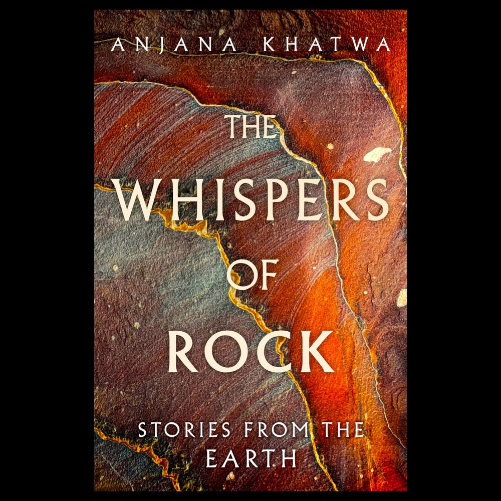
the front cover of a book called the whispers of rock: stories from the earth. behind the text is a multicoloured sandstone rock with lots of bands.
Welcome to The Whispers of Rock: Stories from the Earth. A secret world that whispers stories of creation & destruction, of magic & mystery, of beauty & power. The keepers of such extraordinary tales are the rocks around us. Out 4th Sept 2025, pre-order: tinyurl.com/3m3vnzex
#naturewriting #geology

Watching a #NationalInclusivityWeek talk by Poggy Murray Whitham…and it’s genuinely one of the best EDI-related talks I’ve *ever* heard.
It’s deeply triggering, and I’m disappointed only 30-40 of my colleagues have heard their important messages. Check out Equal Engineers: equalengineers.com
𝗟𝗲𝘁'𝘀 𝗴𝗮𝗺𝗶𝗳𝘆 𝗯𝗮𝘀𝗲𝗺𝗮𝗽 𝘁𝗶𝗹𝗲𝘀! 🗺️🎲
For International Sudoku Day I built Mapdoku, a simple demo app that mixes numbers with the ArcGIS Static Basemap Tiles service.
👉 Try it: codepen.io/cyatteau/pen...
(use your own ArcGIS Location Platform API key)
#ArcGIS #Gamification #Maps #Sudoku

Data-sharing in Africa needs bonds of trust ...
Hoarding of health data is common across Africa owing to well-founded concerns about exploitation. Could a charter guaranteeing responsible data stewardship be the answer?
www.nature.com/articles/d41...
h/t @floragraham.bsky.social
#blacksky

🌍 We're looking for schools in England to take part in new research on how climate change & Net Zero concepts are taught in KS3.
Schools will benefit from CPD opportunities and early access to the Oxford Net Zero Education Framework.
📩 Register interest by 12 Sept: bit.ly/3VywHGY #Edusky

Ace paper here on #autism, the impact it can have on #academic attainment, and ways in which #geoscience educators can be more inclusive. #EDI
link.springer.com/article/10.1...

Join me on Sept. 14 at 3:00 EST for this SSP Curiosity lab talk “Living with Earthquakes: how can science help keep us safe when the Earth shakes?”
Register: ssp.org/events/curio...
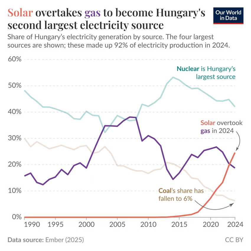
Solar power is taking off quickly in Hungary ☀️⚡️
Our latest data insight: ourworldindata.org/data-insight...

Me too, and for the avoidance of doubt, they are not patriots: hopenothate.org.uk/2025/08/22/o...
01.09.2025 16:52 — 👍 0 🔁 0 💬 0 📌 0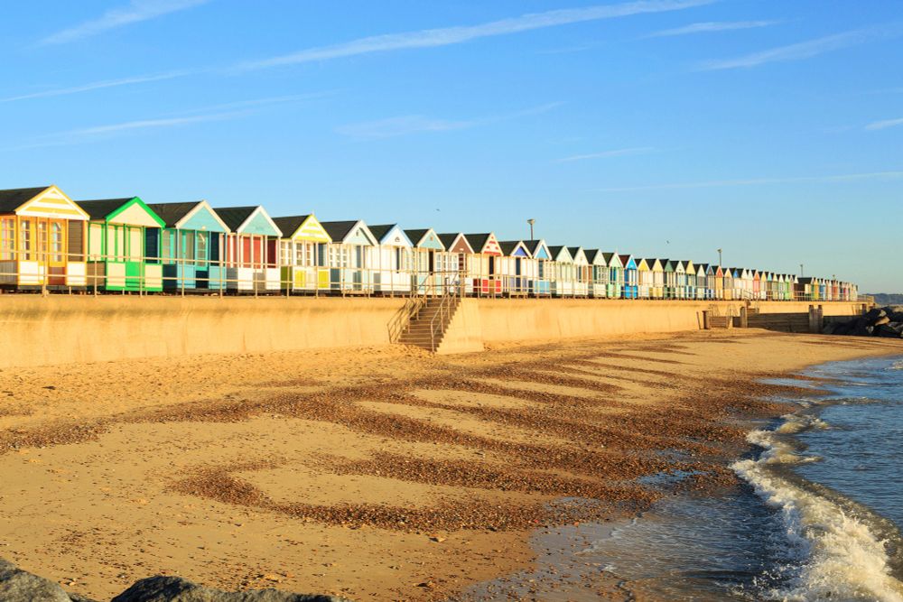
Met Office stats confirm summer 2025 is officially the warmest summer on record for the UK.
The UK’s mean temp of 16.10°C surpasses the previous record of 15.76°C and pushes the summer of 1976 out of the top 5 warmest summers.
www.metoffice.gov.uk/about-us/new...

Flyer for 2025 Esri Equity & Social Justice Seminar - Minneapolis Registration for this event is complimentary, but space is limited. October 9, 2025 8:00 AM - 5:30 PM (CDT) Esri Minneapolis 880 Blue Gentian Road, Suite 200 St. Paul, MN 55121 We will start the seminar at 8:00 a.m. with a chance to sign in, network, and grab coffee at Esri’s Minneapolis regional office. Our main program will begin at 9:00 a.m. and end at 3:00 p.m., followed directly by a social. We hope you will join us and learn more about location-based solutions for achieving equity!
Join the Esri Equity & Social Justice user community for a day of learning, networking, and inspiration, via a series of free in-person sessions and tech demos that explore the ways that organizations can apply GIS to make an equitable impact.
registration.esri.com/flow/esri/25...
#GISchat #geogsky
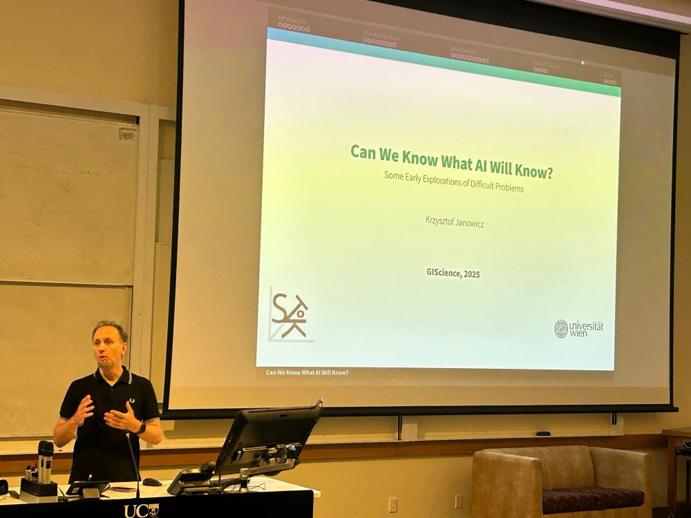


Jano kicked ass again in his keynote talk at GI Science 2025. Deep thinking on how LLMs work and are biased, and on possible spatial angles to improving them.
29.08.2025 00:22 — 👍 6 🔁 2 💬 0 📌 0@metjam.co.uk
27.08.2025 05:58 — 👍 2 🔁 0 💬 1 📌 0
Reading Telling Stories with Maps from Allen Carroll while on the train to an event to talk with professors about GIS
27.08.2025 05:34 — 👍 3 🔁 1 💬 2 📌 0My mate just sent me this lol
24.08.2025 20:19 — 👍 51 🔁 10 💬 3 📌 1