GGW issues Area Forecast Discussion (AFD) at Nov 4, 12:54 PM MST
at Tue, 04 Nov 2025 19:54:16 +0000 via IEMbot
Additional Details Here.
04.11.2025 20:07 — 👍 0 🔁 0 💬 0 📌 0
GGW issues Area Forecast Discussion (AFD) at Nov 4, 9:14 AM MST
at Tue, 04 Nov 2025 16:14:56 +0000 via IEMbot
Additional Details Here.
04.11.2025 16:27 — 👍 0 🔁 0 💬 0 📌 0
GGW issues Area Forecast Discussion (AFD) at Nov 4, 9:06 AM MST
at Tue, 04 Nov 2025 16:06:35 +0000 via IEMbot
Additional Details Here.
04.11.2025 16:07 — 👍 0 🔁 0 💬 0 📌 0
GGW issues Area Forecast Discussion (AFD) at Nov 4, 4:43 AM MST
at Tue, 04 Nov 2025 11:43:55 +0000 via IEMbot
Additional Details Here.
04.11.2025 11:47 — 👍 0 🔁 0 💬 0 📌 0
GLASGOW MT Nov 3
Climate Report:
High: 49
Low: 23
Precip: 0.0"
Snow: 0.0" Snow Depth: 0"
at Tue, 04 Nov 2025 08:42:31 +0000 via IEMbot
Additional Details Here.
04.11.2025 08:47 — 👍 0 🔁 0 💬 0 📌 0
JORDAN ASOS MT Nov 3
Climate Report:
High: 54
Low: 25
Precip: 0.0"
Snow: Missing
at Tue, 04 Nov 2025 01:20:18 +0000 via IEMbot
Additional Details Here.
04.11.2025 01:27 — 👍 0 🔁 0 💬 0 📌 0
WOLF POINT MT Nov 3
Climate Report:
High: 53
Low: 21
Precip: 0.0"
Snow: Missing
at Tue, 04 Nov 2025 01:20:18 +0000 via IEMbot
Additional Details Here.
04.11.2025 01:27 — 👍 0 🔁 0 💬 0 📌 0
GGW issues Area Forecast Discussion (AFD) at Nov 3, 1:25 PM MST
at Mon, 03 Nov 2025 20:26:07 +0000 via IEMbot
Additional Details Here.
03.11.2025 20:27 — 👍 0 🔁 0 💬 0 📌 0
JORDAN ASOS MT Nov 3
Climate Report:
High: 33
Low: 26
Precip: 0.0"
Snow: Missing
at Mon, 03 Nov 2025 15:38:33 +0000 via IEMbot
Additional Details Here.
03.11.2025 15:47 — 👍 0 🔁 0 💬 0 📌 0
GLASGOW MT Nov 3
Climate Report:
High: 37
Low: 23
Precip: 0.0"
Snow: 0.0" Snow Depth: 0"
at Mon, 03 Nov 2025 15:38:33 +0000 via IEMbot
Additional Details Here.
03.11.2025 15:47 — 👍 0 🔁 0 💬 0 📌 0
GGW issues Area Forecast Discussion (AFD) at Nov 3, 2:27 AM MST
at Mon, 03 Nov 2025 09:27:59 +0000 via IEMbot
Additional Details Here.
03.11.2025 09:47 — 👍 0 🔁 0 💬 0 📌 0
GGW cancels Lake Wind Advisory for Central and Southeast Phillips, Central and Southern Valley, Garfield, McCone, Petroleum [MT]
at Mon, 03 Nov 2025 09:01:12 +0000 via IEMbot
Additional Details Here.
03.11.2025 09:07 — 👍 0 🔁 0 💬 0 📌 0
WOLF POINT MT Nov 2
Climate Report:
High: 60
Low: 32
Precip: 0.0"
Snow: Missing
at Mon, 03 Nov 2025 08:45:28 +0000 via IEMbot
Additional Details Here.
03.11.2025 08:47 — 👍 0 🔁 0 💬 0 📌 0
GGW extends time of Lake Wind Advisory for Central and Southeast Phillips, Central and Southern Valley, Garfield, McCone, Petroleum [MT] till Nov 3, 4:00 AM MST
at Mon, 03 Nov 2025 05:30:21 +0000 via IEMbot
Additional Details Here.
03.11.2025 05:47 — 👍 0 🔁 0 💬 0 📌 0
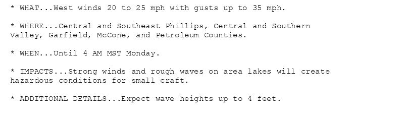
* WHAT...West winds 20 to 25 mph with gusts up to 35 mph.
* WHERE...Central and Southeast Phillips, Central and Southern
Valley, Garfield, McCone, and Petroleum Counties.
* WHEN...Until 4 AM MST Monday.
* IMPACTS...Strong winds and rough waves on area lakes will create
hazardous conditions for small craft.
* ADDITIONAL DETAILS...Expect wave heights up to 4 feet.
Lake Wind Advisory issued November 2 at 10:30PM MST until November 3 at 4:00AM MST by NWS Glasgow MT
Additional Details Here.
03.11.2025 05:45 — 👍 0 🔁 0 💬 0 📌 0
JORDAN ASOS MT Nov 2
Climate Report:
High: 60
Low: 44
Precip: 0.0"
Snow: Missing
at Mon, 03 Nov 2025 01:39:19 +0000 via IEMbot
Additional Details Here.
03.11.2025 01:47 — 👍 0 🔁 0 💬 0 📌 0
GGW cancels Red Flag Warning for Southern Petroleum and Southern Garfield Counties, The Lower Missouri River Breaks including the Charles M Russell National Wildlife Refuge [MT]
a... at Sun, 02 Nov 2025 23:37:41 +0000 via IEMbot
Additional Details Here.
02.11.2025 23:47 — 👍 0 🔁 0 💬 0 📌 0
GGW issues Area Forecast Discussion (AFD) at Nov 2, 4:07 PM MST
at Sun, 02 Nov 2025 23:07:24 +0000 via IEMbot
Additional Details Here.
02.11.2025 23:27 — 👍 0 🔁 0 💬 0 📌 0
GGW issues Summary Local Storm Report
at Sun, 02 Nov 2025 18:27:23 +0000 via IEMbot
Additional Details Here.
02.11.2025 18:47 — 👍 0 🔁 0 💬 0 📌 0

* WHAT...West winds 20 to 30 mph with gusts up to 45 mph.
* WHERE...Central and Southeast Phillips, Central and Southern
Valley, Garfield, McCone, and Petroleum Counties.
* WHEN...Until midnight MST tonight.
* IMPACTS...Strong winds and rough waves on area lakes will create
hazardous conditions for small craft.
Lake Wind Advisory issued November 2 at 11:33AM MST until November 3 at 12:00AM MST by NWS Glasgow MT
Additional Details Here.
02.11.2025 18:45 — 👍 0 🔁 0 💬 0 📌 0
The Storm Prediction Center issues Day 1 Elevated Fire Weather Risk at Nov 2, 15:12z for portions of GGW
at Sun, 02 Nov 2025 15:13:14 +0000 via IEMbot
Additional Details Here.
02.11.2025 15:27 — 👍 0 🔁 0 💬 0 📌 0
GGW issues Area Forecast Discussion (AFD) at Nov 2, 1:31 AM MDT
at Sun, 02 Nov 2025 07:32:05 +0000 via IEMbot
Additional Details Here.
02.11.2025 07:47 — 👍 0 🔁 0 💬 0 📌 0

* WHAT...West winds 25 to 40 mph with gusts up to 60 mph expected.
* WHERE...Southwest Phillips County.
* WHEN...Until noon MST today.
* IMPACTS...High winds may move loose debris, damage property, and
cause power bumps. Travel could be difficult, especially for high
profile vehicles.

* WHAT...West winds 20 to 30 mph with gusts up to 50 mph.
* WHERE...Fort Peck Lake.
* WHEN...Until midnight MST tonight.
* IMPACTS...Strong winds and rough waves on area lakes will create
hazardous conditions for small craft.
* ADDITIONAL DETAILS...Expect wave heights as high as 6 feet.
🚨 High Wind Warning issued November 2 at 1:06AM MDT until November 2 at 12:00PM MST by NWS Glasgow MT 🚨
Additional Details Here.
02.11.2025 07:15 — 👍 0 🔁 0 💬 0 📌 0

* AFFECTED AREA...Fire weather zones 136 and 137.
* WIND...Northwest at 25 to 35 mph with gusts to 50 mph.
* HUMIDITY...As low as 20 percent.
* IMPACTS...Any fires that develop will likely spread rapidly.
Outdoor burning is not recommended.
🚨 Red Flag Warning issued November 2 at 1:08AM MDT until November 2 at 5:00PM MST by NWS Glasgow MT 🚨
Additional Details Here.
02.11.2025 07:15 — 👍 0 🔁 0 💬 0 📌 0
GGW continues High Wind Warning for Southwest Phillips [MT] till Nov 2, 12:00 PM MDT
at Sun, 02 Nov 2025 07:06:16 +0000 via IEMbot
Additional Details Here.
02.11.2025 07:07 — 👍 0 🔁 0 💬 0 📌 0
The Storm Prediction Center issues Day 1 Elevated Fire Weather Risk at Nov 2, 4:50z for portions of GGW
at Sun, 02 Nov 2025 04:51:07 +0000 via IEMbot
Additional Details Here.
02.11.2025 05:07 — 👍 0 🔁 0 💬 0 📌 0
JORDAN ASOS MT Nov 1
Climate Report:
High: 72
Low: 32
Precip: 0.0"
Snow: Missing
at Sun, 02 Nov 2025 00:37:36 +0000 via IEMbot
Additional Details Here.
02.11.2025 00:47 — 👍 0 🔁 0 💬 0 📌 0
GGW issues Area Forecast Discussion (AFD) at Nov 1, 2:56 PM MDT
at Sat, 01 Nov 2025 20:56:57 +0000 via IEMbot
Additional Details Here.
01.11.2025 21:07 — 👍 0 🔁 0 💬 0 📌 0
GGW continues Red Flag Warning valid at Nov 2, 11:00 AM MDT for Southern Petroleum and Southern Garfield Counties, The Lower Missouri River Breaks including the Charles M Russell N... at Sat, 01 Nov 2025 19:53:23 +0000 via IEMbot
Additional Details Here.
01.11.2025 20:07 — 👍 0 🔁 0 💬 0 📌 0
* AFFECTED AREA...Fire weather zones 136 and 137.
* WIND...Northwest at 25 to 35 mph with gusts to 50 mph.
* HUMIDITY...As low as 20 percent.
* IMPACTS...Any fires that develop will likely spread rapidly.
Outdoor burning is not recommended.
🚨 Red Flag Warning issued November 1 at 1:52PM MDT until November 2 at 5:00PM MST by NWS Glasgow MT 🚨
Additional Details Here.
01.11.2025 20:00 — 👍 0 🔁 0 💬 0 📌 0