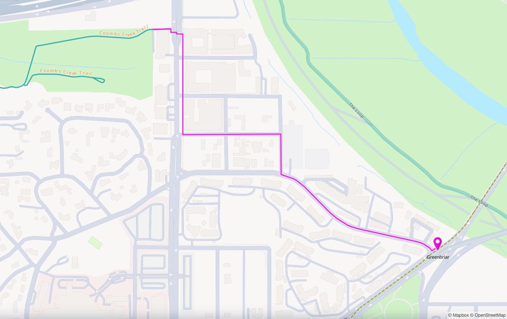
A map showing a low-stress bike route between the east end of the Coombs Creek Trail in Oak Cliff and the Greenbriar stop on the Dallas Streetcar line.
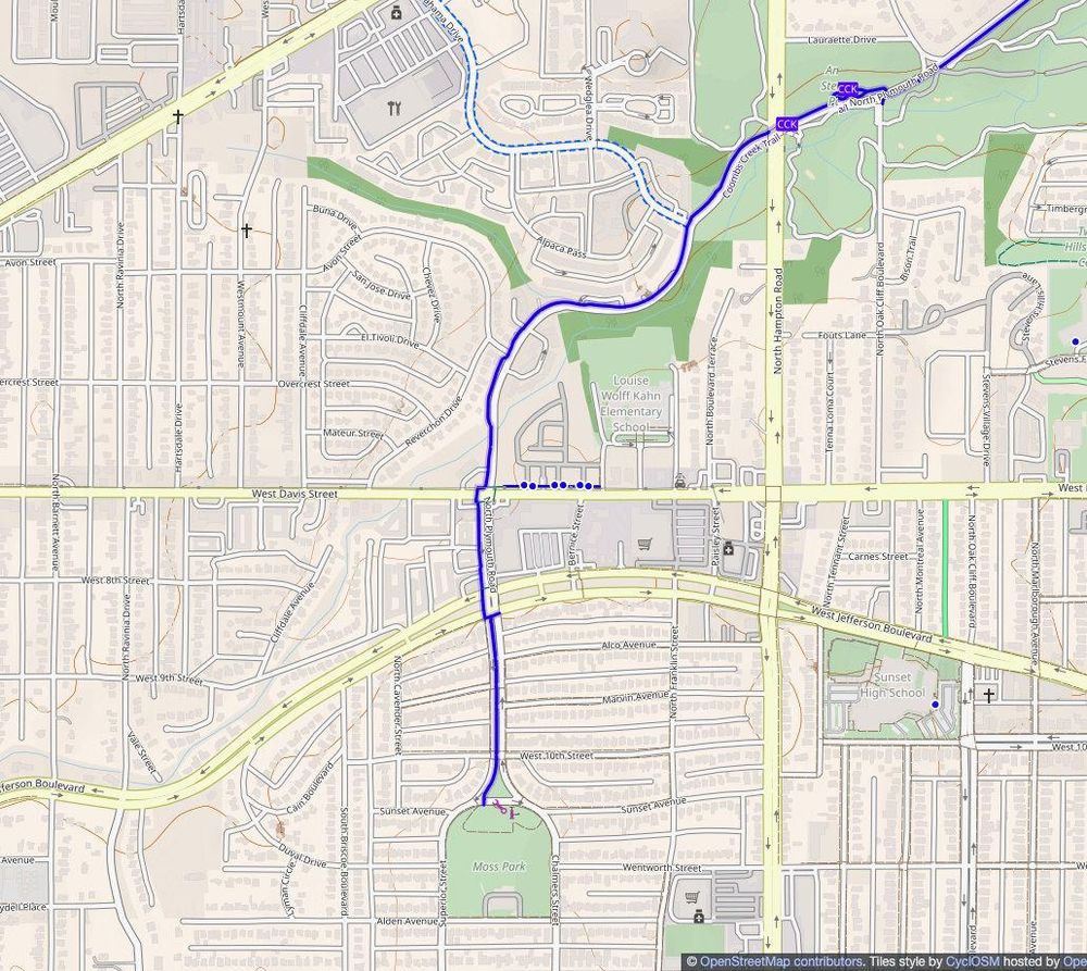
Thanks to a mapping project #DallasBicycleCoalition is working on, we've found another rail-to-trail connection, this one between Greenbriar stop on the #Dallas Streetcar line and Coombs Creek Trail. A bit long at 1.2 km, but otherwise nice and low stress. Takes […]
[Original post on en.osm.town]
26.07.2025 18:09 — 👍 0 🔁 0 💬 0 📌 0
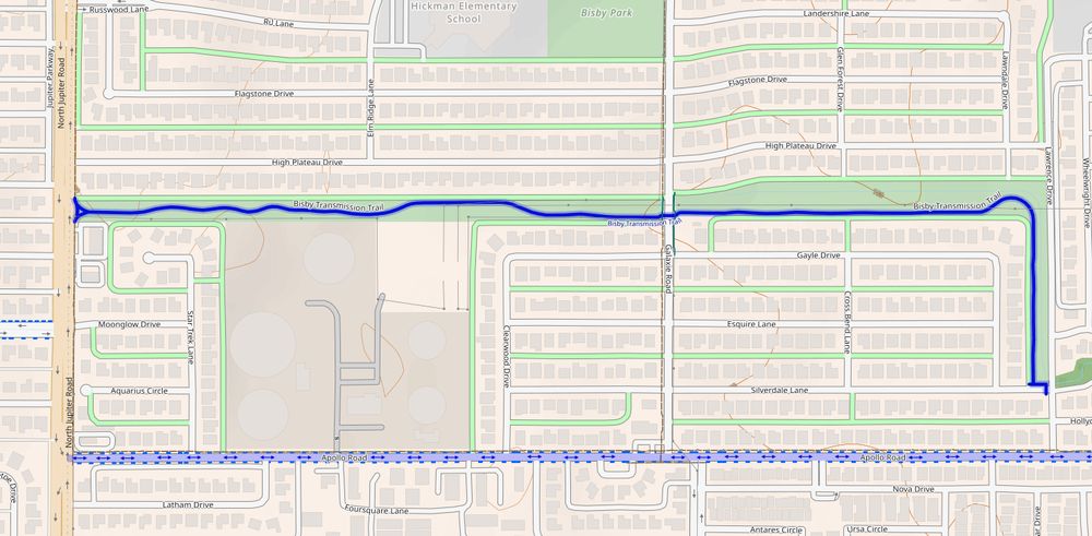
A CyclOSM map of the recently built Bisby Transmission Trail in Garland, Texas. One of those "snake" trails through an easement for high-voltage power lines.
Not especially useful for transportation, but it's still nice to see a new trail built. This one's in #Garland, between Jupiter and Shiloh Roads, south of Arapaho. The Bisby Transmission Trail. Electric transmission, not automotive […]
[Original post on en.osm.town]
24.07.2025 16:01 — 👍 0 🔁 0 💬 0 📌 0
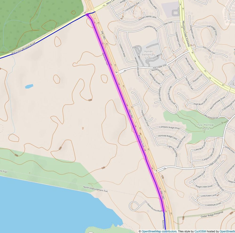
CyclOSM map showing the extension of Balcones Trail north from Dam Access Road up to West Camp Wisdom Road, where it meets with another trail going west. The new section of the trail is highlighted.
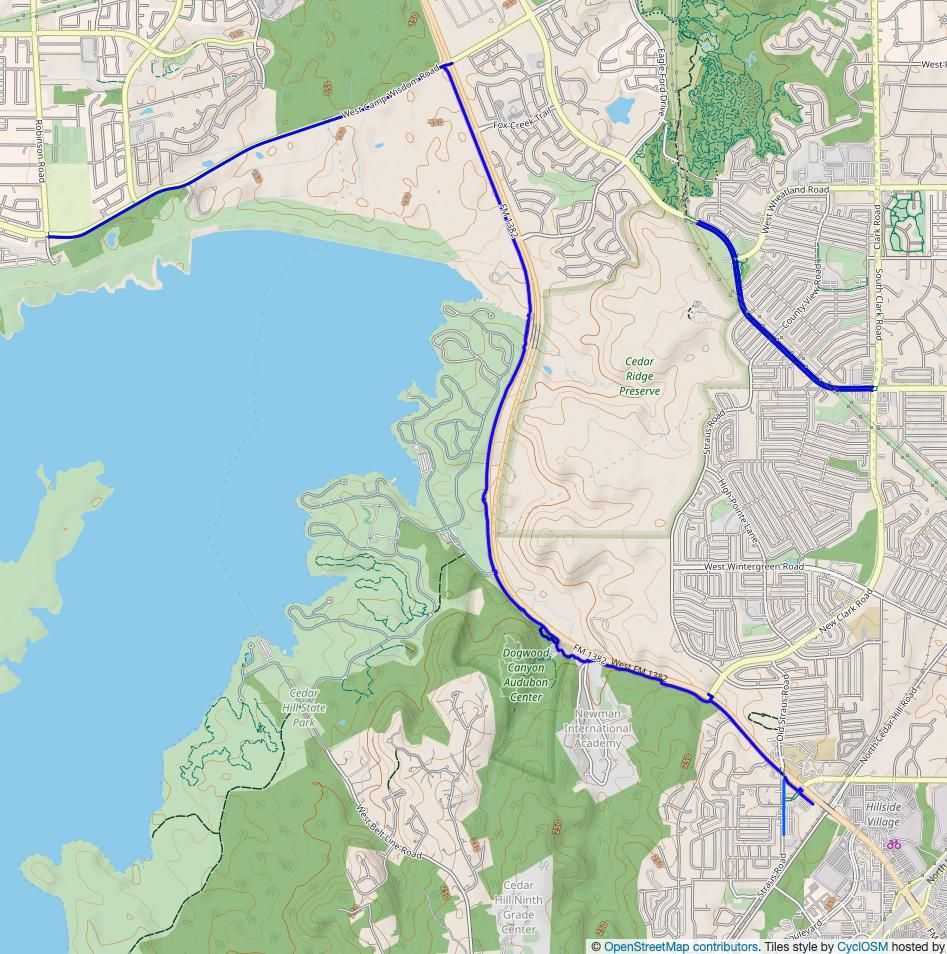
Map showing the entire Balcones Trail, and path along Camp Wisdom Road from FM 1382 to Robinson Road.
Balcones Trail in Cedar Hill has been extended north into southwest #Dallas, from Dam Access Road along FM 1382 up to W Camp Wisdom Road, were it meets with an existing shared-use path extending west to Robinson Road in Grand Prairie.
This is an especially […]
[Original post on en.osm.town]
16.07.2025 21:40 — 👍 0 🔁 0 💬 0 📌 0
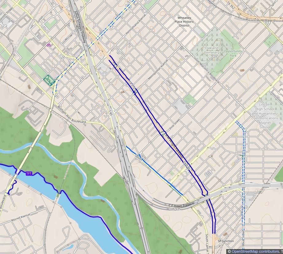
A CyclOSM map of South Dallas, highlighting the 12' shared-use paths on either side of S M Wright Boulevard, which used to be Freeway.
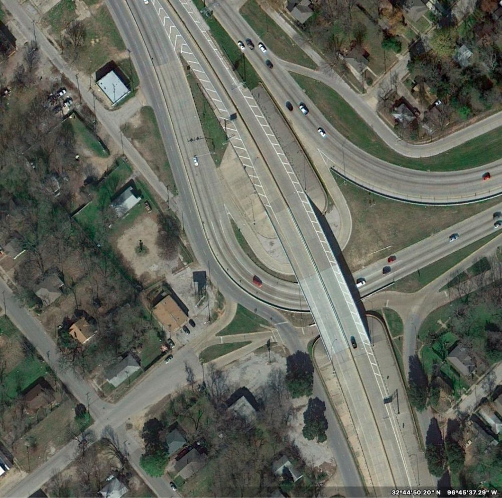
A 2009 aerial photo of S M Wright Freeway & US 175 junction. Here Wright is an elevated freeway while 175 still isn't. West of the interchange are city streets and a neighborhood.
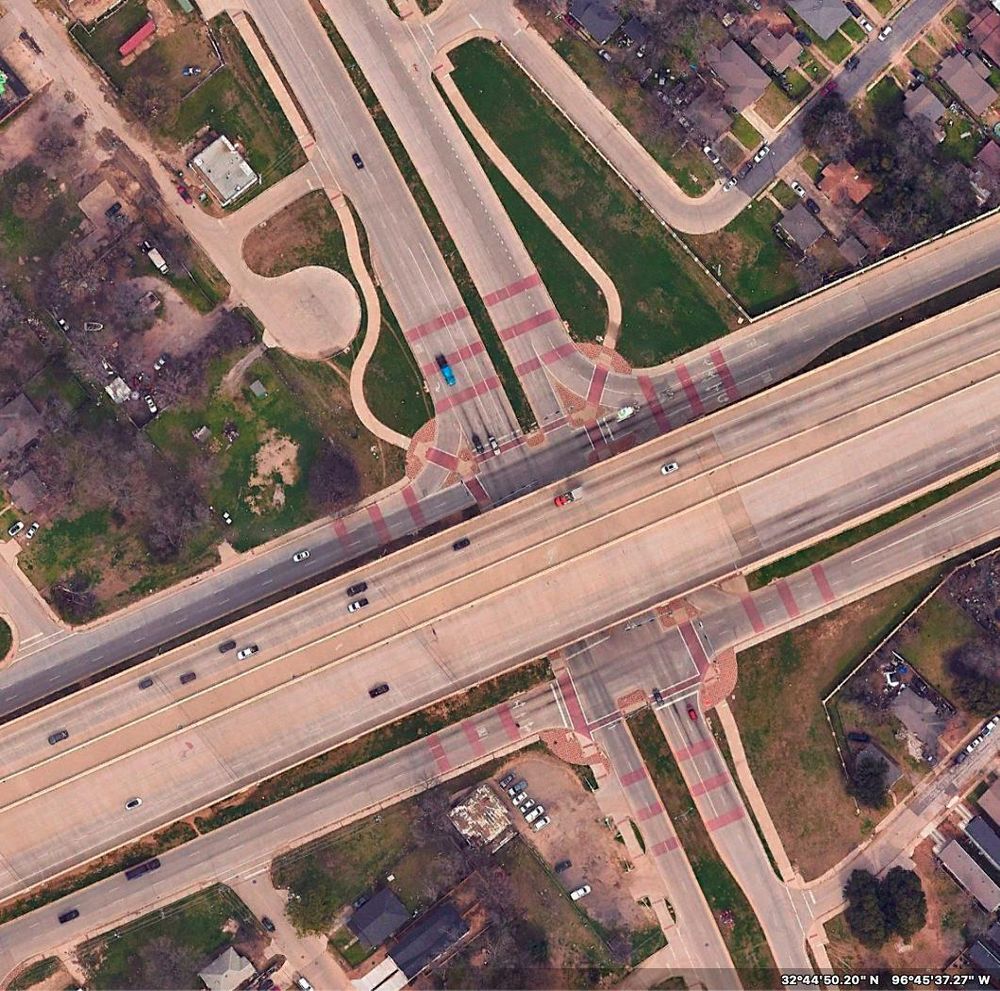
A 2023 aerial photo of the same interchange. Now S M Wright Freeway has been turned into an at-grade "boulevard" (but 175 is now an elevated freeway, and has been extended west.) Also visible are the shared-use paths on either side of Wright for walking and rolling. Nice. And an interesting visual treatment of the intersection, with red bands added to the road surface.
#TxDOT would like you to know that they in fact do freeway removals. In this case, the conversion of S M Wright Freeway to Boulevard, in #SouthDallas.
Now, one can argue that the "boulevard" is still 6–7 lanes wide, that they turned US 175 into an elevated […]
[Original post on en.osm.town]
12.07.2025 03:59 — 👍 0 🔁 1 💬 0 📌 0
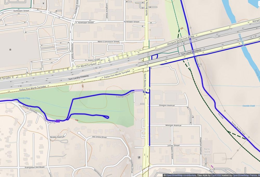
A CycleOSM map of the east end of the Coombs Creek Trail in Dallas, Texas, showing the new extension to North Beckley Avenue and connecting with some bicycle infrastructure there.
A CyclOSM map showing the west end of the Coombs Creek Trail in Dallas, Texas showing two recent extensions: from Hampton to Davis, then this year from Davis south to Moss Park.
Not quite new, but Coombs Creek Trail in #OakCliff has been getting some nice extensions.
Last year the east end got extended to Beckley Ave, which means it now ties in with the quality bike lanes on the south side of the I-30 Margarett McDermott bridge (which […]
[Original post on en.osm.town]
08.07.2025 03:27 — 👍 0 🔁 0 💬 0 📌 0
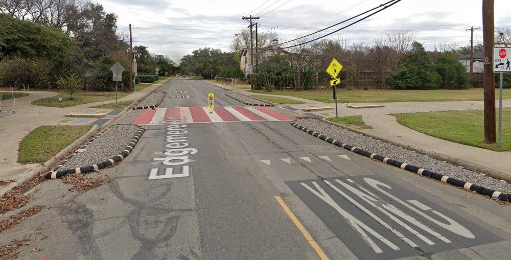
A photo of Northaven Trail in Dallas crossing Edgemere Road. The crossing has several safety features, besides a painted crosswalk and other visual elements. Bump outs from the curbs on either side of the crossing narrow the roadway and compel drivers to slow down and pay more attention. A stop-sign flexpost in the middle of the crossing does the same. An example of a good—by local standards—unsignalized intersection.
#Dallas Trail Coalition wants to improve safety at road crossings on our trail system, starting at intersections without traffic lights. They'll be advocating for physical traffic-calming measures, not just paint. Example below.
Which crossings need this most? […]
[Original post on en.osm.town]
04.07.2025 01:41 — 👍 0 🔁 1 💬 0 📌 0
A map showing the new shared-use path constructed along the east side of Harry Hines Boulevard between Webb Chapel Extension and Manana Drive.
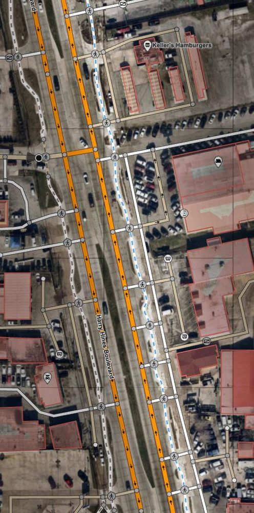
An aerial photo of part of Harry Hines with a map overlayed, showing just a silly number of driveways along the road, which chops the path up into tiny bits.
Continuing with the #Dallas Bachman Lake area, this year brings a 10' sidepath along the east side of Harry Hines Blvd, from #DART Bachman Station north up to Manana Dr, plus a new 8' sidewalk on the west side of the road too.
Now, Harry Hines is miserable […]
[Original post on en.osm.town]
01.07.2025 03:09 — 👍 0 🔁 1 💬 0 📌 0
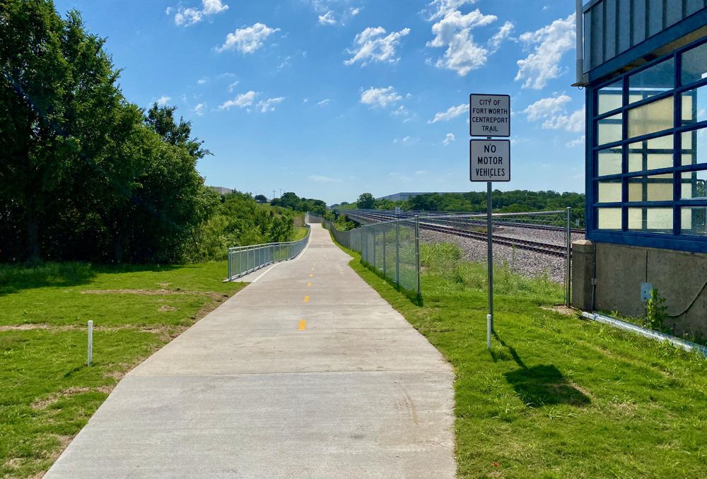
A photo of the newly built CentrePort Trail, connecting the CentrePort/DFW Airport ail station with the River Legacy East Trail. Concrete surface typical for the area.
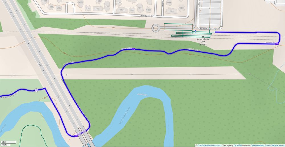
A CyclOSM map showing the length of the trail, and connections on either end. Trail length: 1.5km.
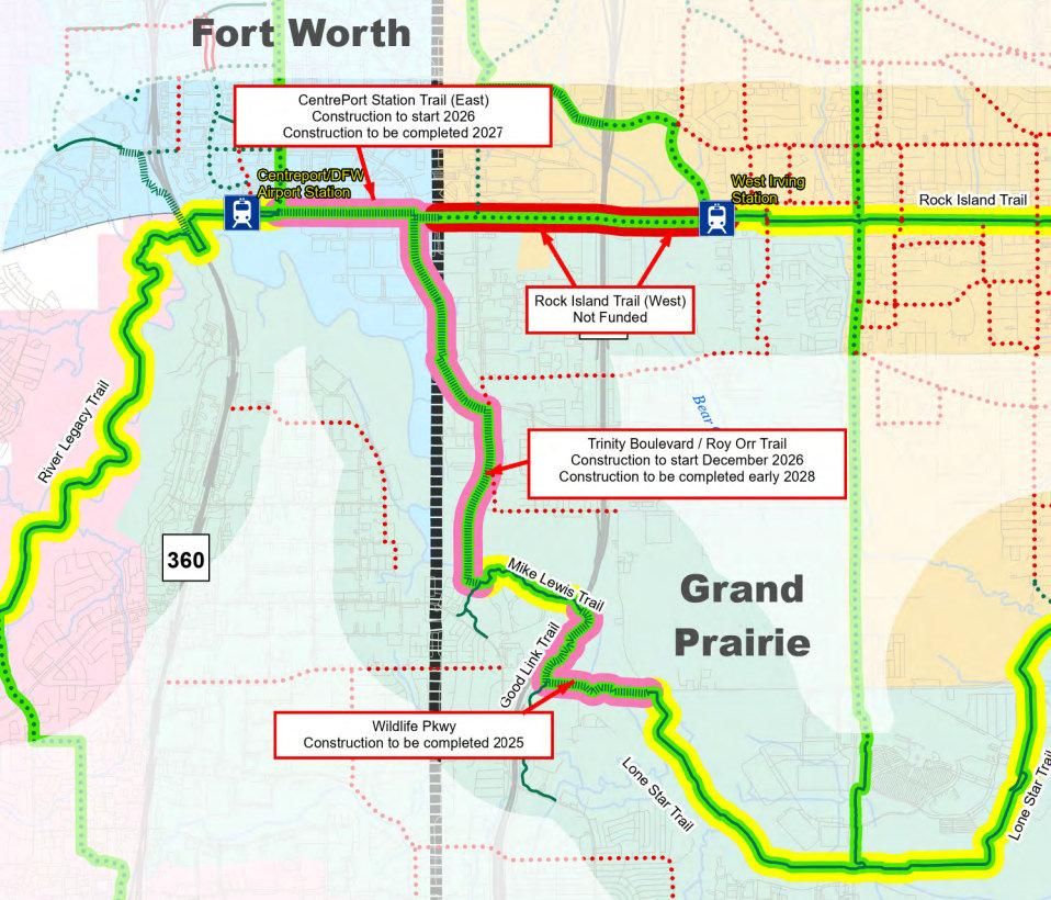
NCTCOG map of this section of the DFW Discovery Trail, showing funding status and estimated construction dates for several missing segments.
Phase I of CentrePort Trail is done. A short, but key connector between the CentrePort/DFW Airport #TRE station and River Legacy trails in #ArlingtonTX. Now you can get to River Legacy Park by train!
#NCTCOG shows an extension planned for construction in '26–27 […]
[Original post on en.osm.town]
27.06.2025 22:19 — 👍 3 🔁 1 💬 1 📌 0
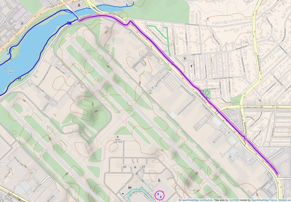
A map showing Love Field Airport in Dallas, with a newly constructed shared-use trail along Lemon Avenue on the north side, extending from the Bachman Lake Trail down Shorecrest Drive, then Lemon down to West University Boulevard. Also covered bike parking highlighted near the terminal.
A new trail built by the airport. No, BY the airport, not the Parks Dept. like usual.
Connects to Bachman Lake at the north, and the south end is due to be extended a bit farther, with some streetscape enhancements along the way. Completion date this fall, but […]
[Original post on en.osm.town]
27.06.2025 11:59 — 👍 1 🔁 0 💬 0 📌 0