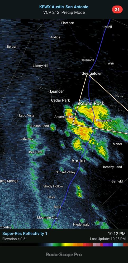
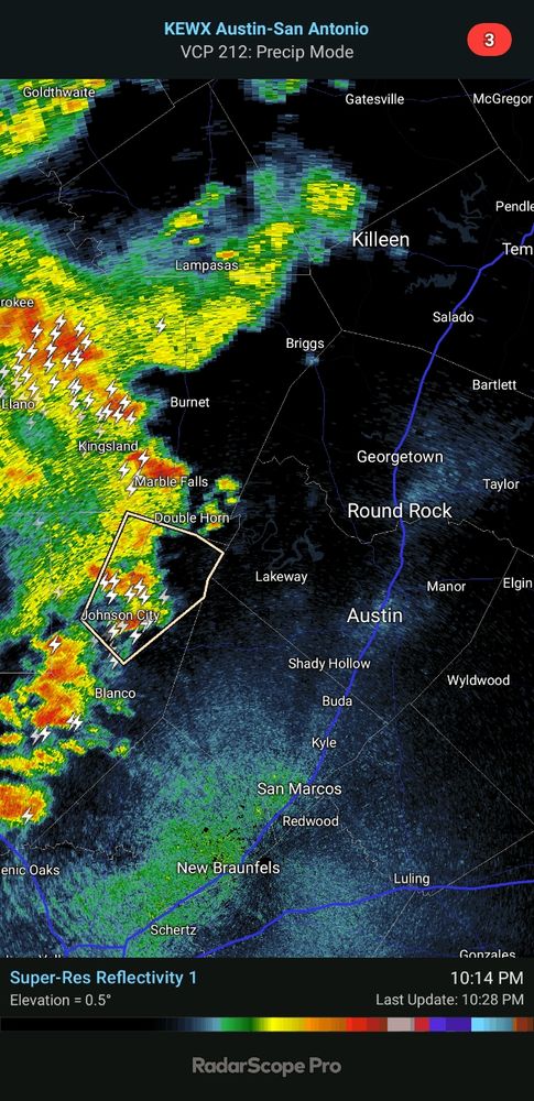
Thunderstorms are popping up along an outflow boundary moving east to west. Some gusty winds and some lightning are the biggest threats with these storms. Polygon represents a Special Weather Statement for central Travis County. Winds to 40 mph are possible in that area.
25.06.2025 21:51 — 👍 3 🔁 0 💬 1 📌 1
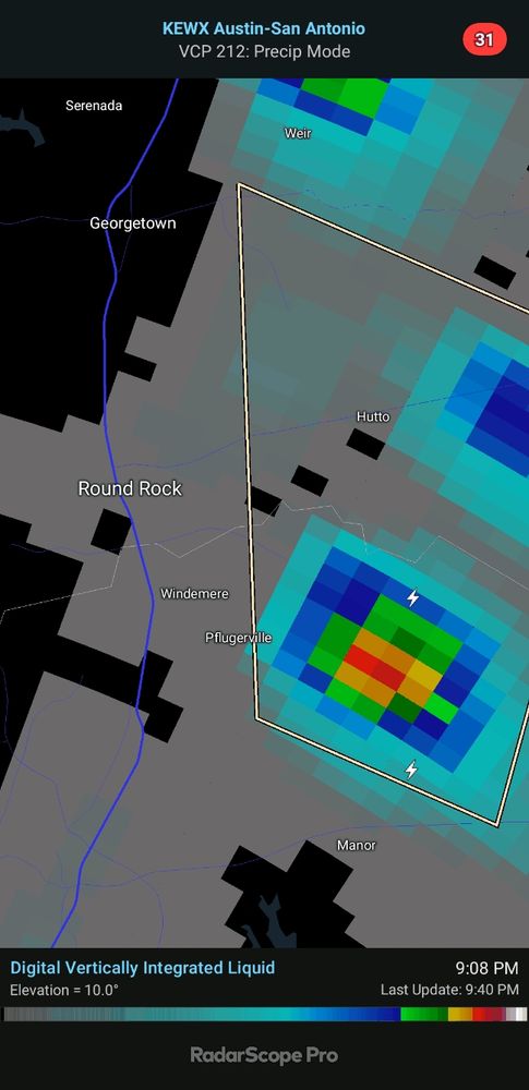
Storms in Pflugerville area have lost their steam. Outflow boundary just about out of the county now. Loss of daytime heating likely means storms are done for today
14.06.2025 03:30 — 👍 1 🔁 0 💬 0 📌 0
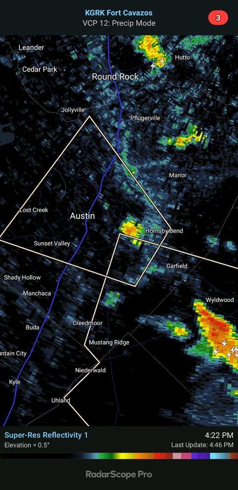
Hail core gradually moving westward into Pflugerville proper. 1/2" to 3/4" hail possible in this area.
14.06.2025 02:43 — 👍 0 🔁 0 💬 0 📌 0
Small thunderstorm has kicked up in the area north of Manor and east of Pflugerville. Lightning looks to be the biggest threat from this storm right now, but it might put out some hail and eventually gusty winds.
14.06.2025 02:12 — 👍 1 🔁 0 💬 0 📌 0
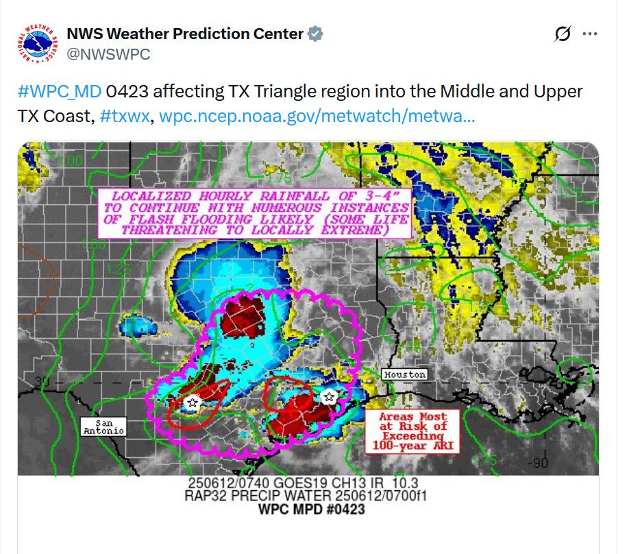
New discussion on flooding potential in the "TX Triangle" Houston to San Antonio to Dallas area.
www.wpc.ncep.noaa.gov/metwatch/met...
12.06.2025 08:09 — 👍 1 🔁 0 💬 0 📌 0
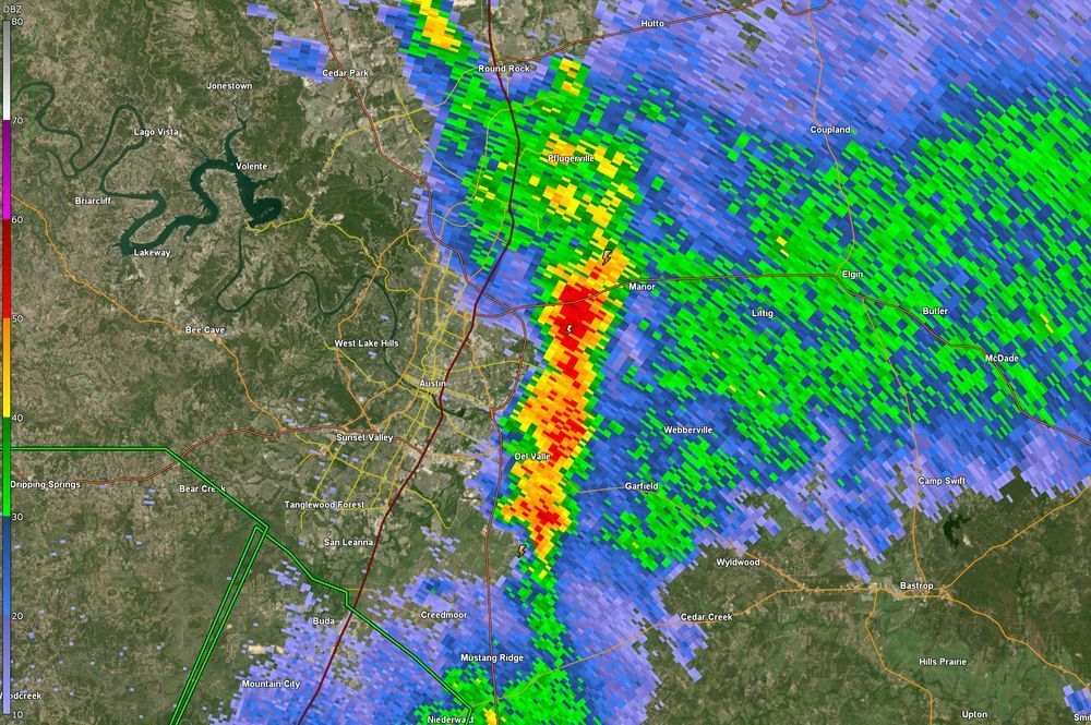
Still not a lot has happened in our county, but now seeing some development in east Austin around 183 over to SH 130. Main concern will be rainfall rates due to slow moving cells that might lead to some flooding.
12.06.2025 07:53 — 👍 2 🔁 0 💬 0 📌 0
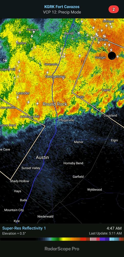
Radar update: so far not much here in Travis County, but flash flood warnings just to our south. Some storms look to be entering the southern part of the county. Also expect more develop in the area over the next couple of hours.
12.06.2025 05:39 — 👍 2 🔁 0 💬 0 📌 0
Early elements of rain showers and storms closing in on western parts of the county.
12.06.2025 03:31 — 👍 3 🔁 1 💬 0 📌 0
WPC Met Watch
Just off the presses, a new discussion from the Weather Prediction Center regarding possible heavy rainfall with flash flooding over Central Texas.
www.wpc.ncep.noaa.gov/metwatch/met...
11.06.2025 21:59 — 👍 3 🔁 1 💬 0 📌 1
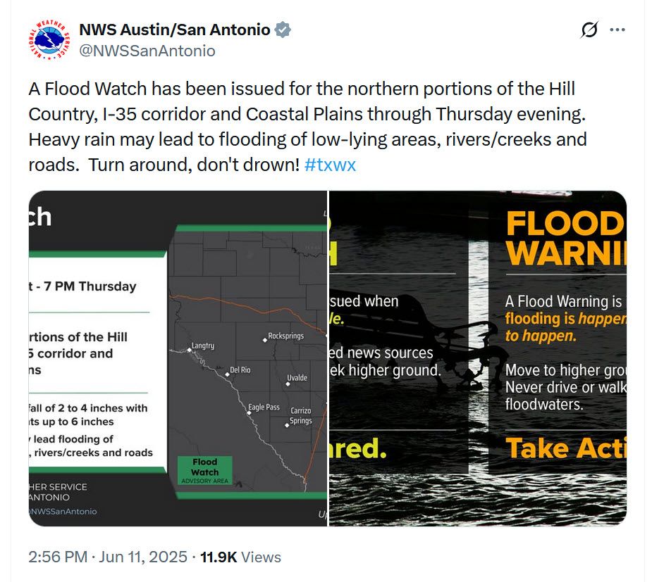
FYI - Flood Watch has been issued that begins at 7 PM this evening and runs thru 7 PM on Thursday. Additional heavy rains are expected in our area which can lead to flooding.
11.06.2025 21:28 — 👍 1 🔁 0 💬 0 📌 1
Flash flooding reminders from National Weather Service. Please follow guidance in the graphic and always remember: Turn Around, Don't Drown!
11.06.2025 08:01 — 👍 1 🔁 0 💬 0 📌 0
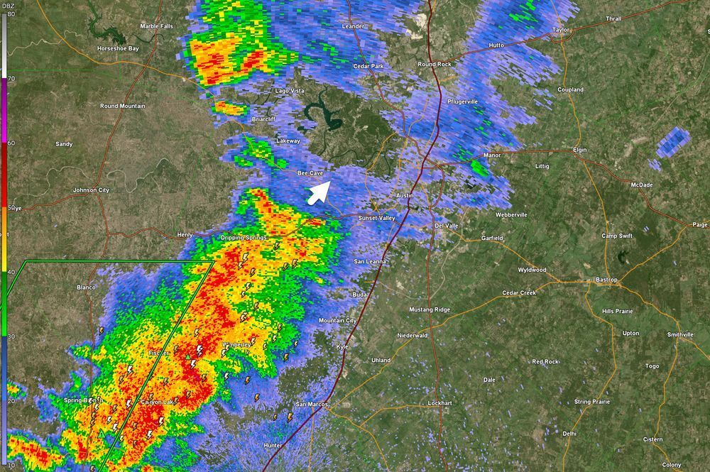
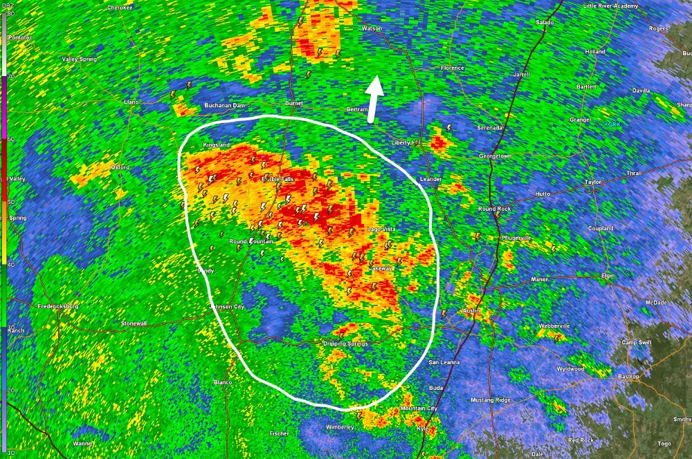
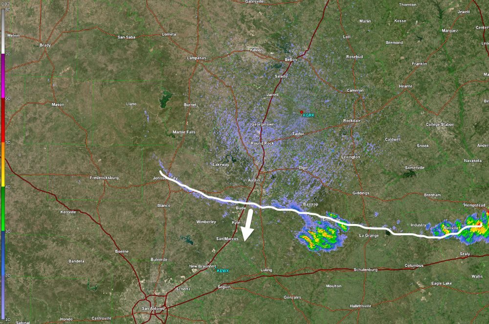
Radar update: heaviest rainfall now in an arc from Kingsland down to Kyle. Moving north/northeast around 20 MPH. Great rainfall into the Lake Travis watershed!
11.06.2025 08:00 — 👍 1 🔁 0 💬 0 📌 0
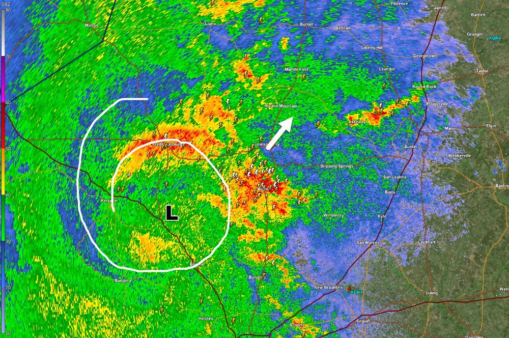
A mesoscale system that is centered just east of Kerrville is spinning up some heavy rains to its north and northeast. Area from Fredericksburg to Austin is likely going to see heavy rainfall and flooding over the next few hours. Remember: Turn Around, Don't Drown!
11.06.2025 07:06 — 👍 0 🔁 0 💬 0 📌 0

Earlier than originally expected storms are a to begin marching into the county. Frequent lightning and heavy rain can be expected as these storms are moving slowly.
11.06.2025 06:01 — 👍 1 🔁 0 💬 0 📌 0
Latest high resolution model shows overnight storms that will likely affect us early tomorrow morning. Hopefully this time they won't miss us.
10.06.2025 23:45 — 👍 2 🔁 0 💬 0 📌 0
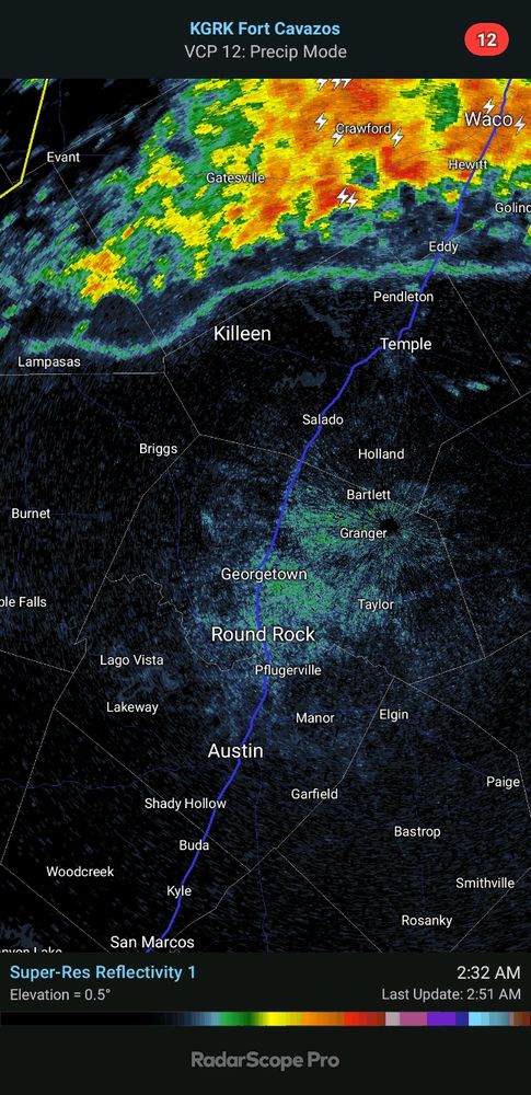
Line of thunderstorms moving towards us from the northwest will impact us later this morning. This is the first of several rounds of rain/storms we expect over the next few days. These storms should arrive 10-11 am time frame.
10.06.2025 11:57 — 👍 4 🔁 1 💬 0 📌 1
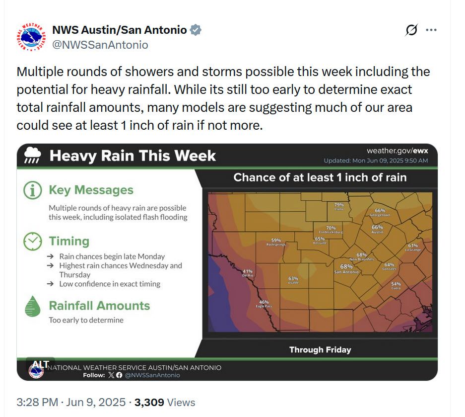
Head's up for a pattern change for this week.
09.06.2025 21:58 — 👍 2 🔁 0 💬 0 📌 0
Frontal boundary pushing thru the country right now. Was hoping it might trigger some showers but so far only seeing some activity in Bastrop County.
09.06.2025 21:54 — 👍 1 🔁 0 💬 0 📌 0
Strongest storms are now east of I-35 and will be leaving the county soon. Areas east of I-35 should expect wind gusts up to 50 MPH and small hail. Occasional lightning will also be possible.
09.06.2025 10:16 — 👍 0 🔁 1 💬 0 📌 0
Storms are moving rapidly through the county. Some Special Weather Statements are in place for winds 40-50 mph, penny size hail. Also expect some heavy rains and occasional lightning.
09.06.2025 09:54 — 👍 1 🔁 0 💬 0 📌 0
Storms are about to enter the county. Currently not severe but will still pack some punch. Expect wind gusts to 40 mph, half dollar size hail and frequent lightning
09.06.2025 09:32 — 👍 1 🔁 0 💬 0 📌 1
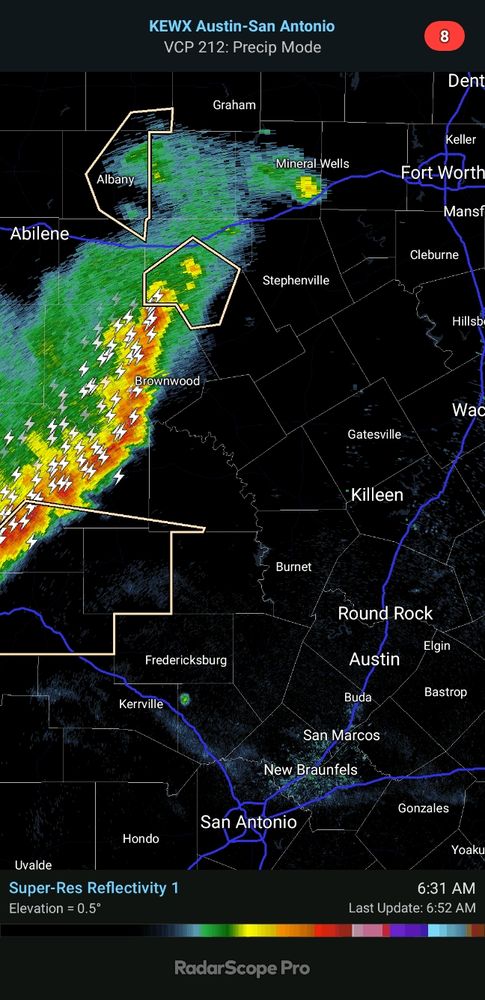
Keeping an eye on these storms sliding our way from north Texas. Previous model guidance had suggested they would fall apart before reaching us, but we may see some impacts from them during the early morning hours.
09.06.2025 07:51 — 👍 0 🔁 0 💬 0 📌 0
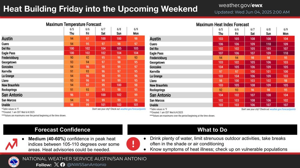
Heat builds this weekend. Expect temperatures to rise to near the 100 degree mark. With humidity factored in, max heat index values rise into the 105 to 110 degree range for some areas. Heat Advisories could be needed. Practice heat safety and know symptoms of heat illness. #txwx
04.06.2025 09:50 — 👍 1 🔁 0 💬 0 📌 0
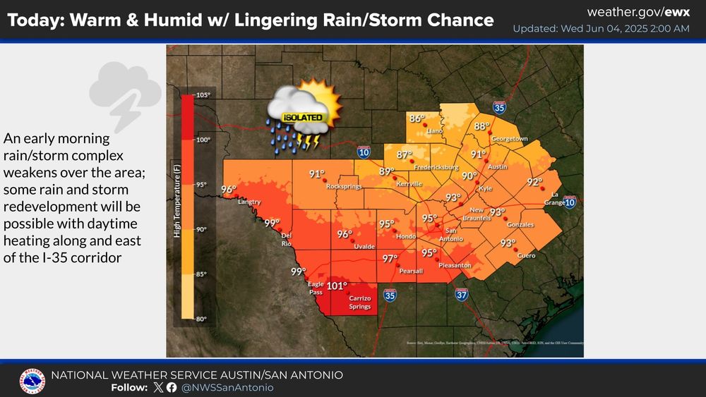
Forecast for today per NWS San Antonio/Austin:
An early morning rain and storm complex will continue to weaken as it moves south over the region. Otherwise, some storm redevelopment is possible in the afternoon for locations along/east of I-35.
04.06.2025 09:49 — 👍 1 🔁 0 💬 0 📌 0
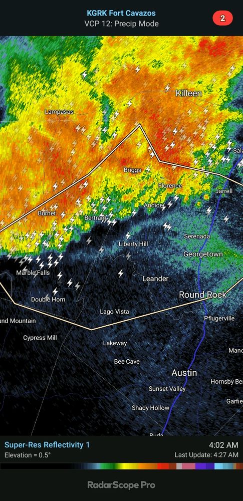
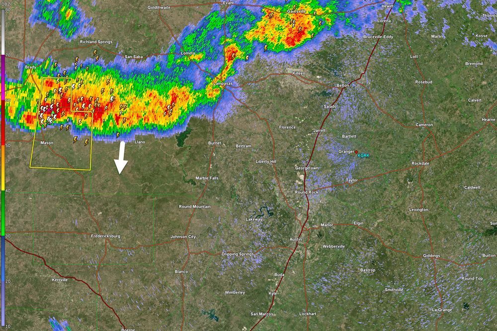
That line of storms has pretty much broken apart and does not seem a threat at this time unless there is some redevelopment. Front will continue to move thru the area and may produce some areas of showers.
04.06.2025 09:35 — 👍 1 🔁 0 💬 0 📌 0
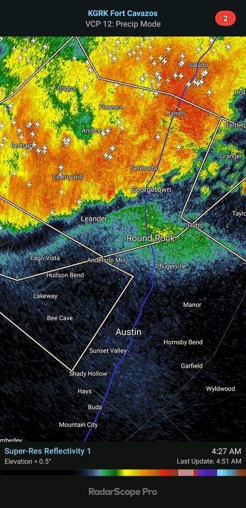
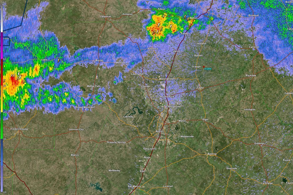
Radar view of storms now moving into the area. At the moment the strongest of these storms seems to be turning more to the south and away from our county. Still going to have to watch storms more to our north as they are still pretty strong.
04.06.2025 07:50 — 👍 2 🔁 0 💬 0 📌 0
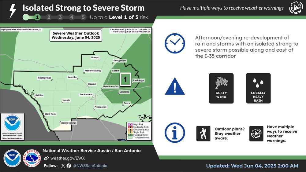
New discussion from Storm Prediction Center on threat for severe weather in our area. Watch not likely due to wind and hail threat being isolated. Still, potential exists for some storms to be severe and carry a significant threat.
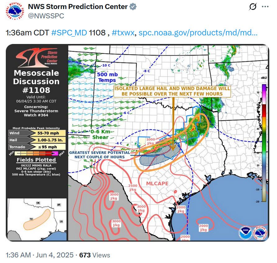
04.06.2025 06:46 — 👍 2 🔁 0 💬 0 📌 0
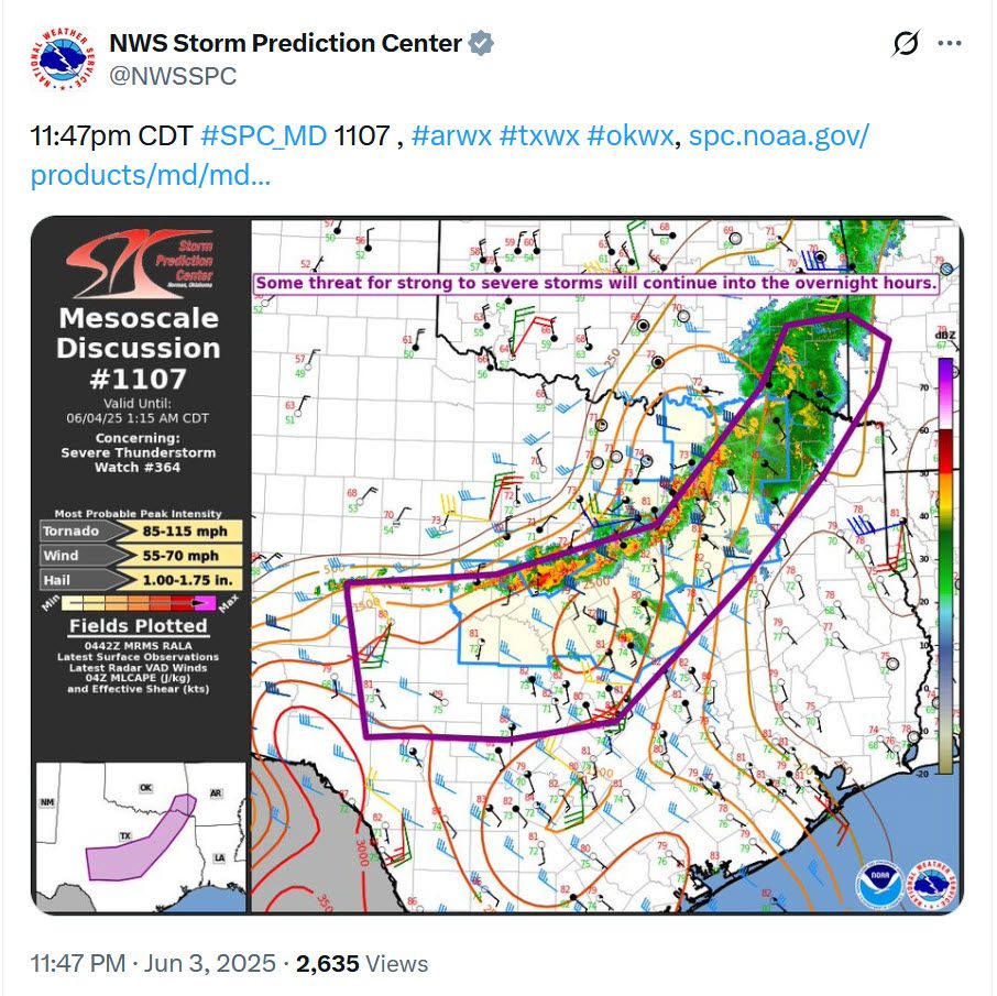
Discussion from Storm Prediction Center regarding severe potential in our area tonight.
04.06.2025 05:04 — 👍 1 🔁 0 💬 0 📌 0
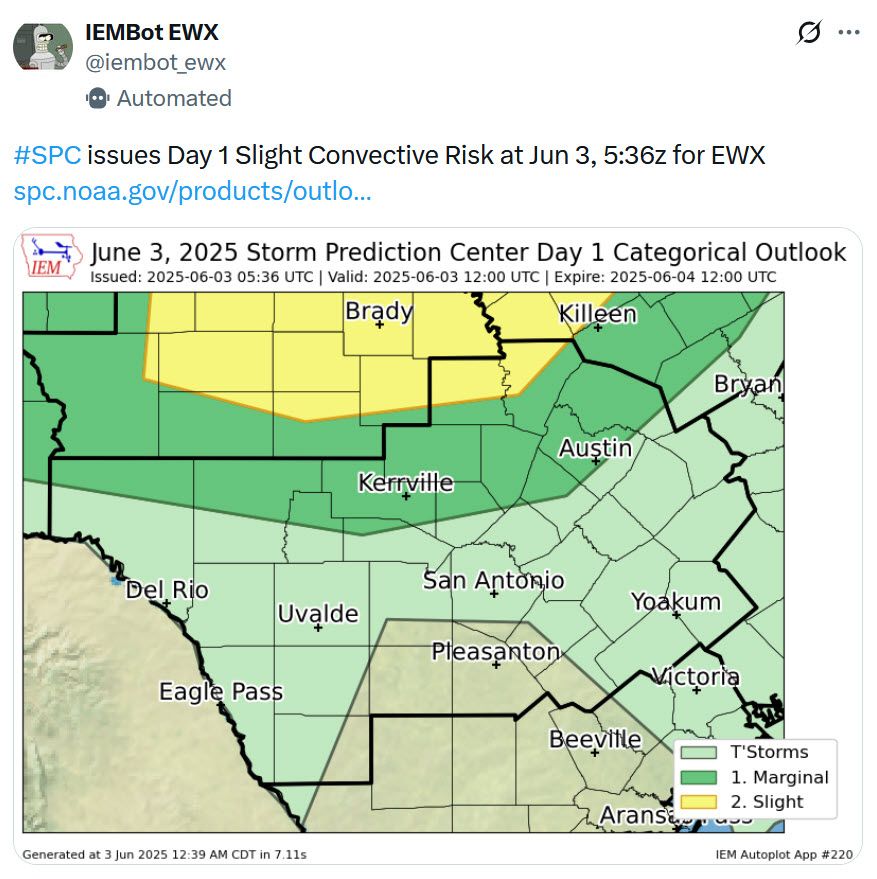
Day 1 outlook for possible thunderstorms and severe weather is out and most of the county now in a Level 1 (out of 5) risk for severe storms. We will have more on this in the morning but just be aware that chances for some thunderstorms this afternoon has increased.
03.06.2025 06:54 — 👍 2 🔁 0 💬 0 📌 0