
If you want a higher res version of the Mount St. Helens patent map, you can get it here:
drive.google.com/file/d/1dtHw...
#pnw #mountsthelens #arcgispro #b3d

@geospatialist.bsky.social
If you want a higher res version of the Mount St. Helens patent map, you can get it here:
drive.google.com/file/d/1dtHw...
#pnw #mountsthelens #arcgispro #b3d
Should also add the tags #arcgispro #b3d #photoshop
06.10.2025 14:49 — 👍 0 🔁 0 💬 0 📌 0
2/2
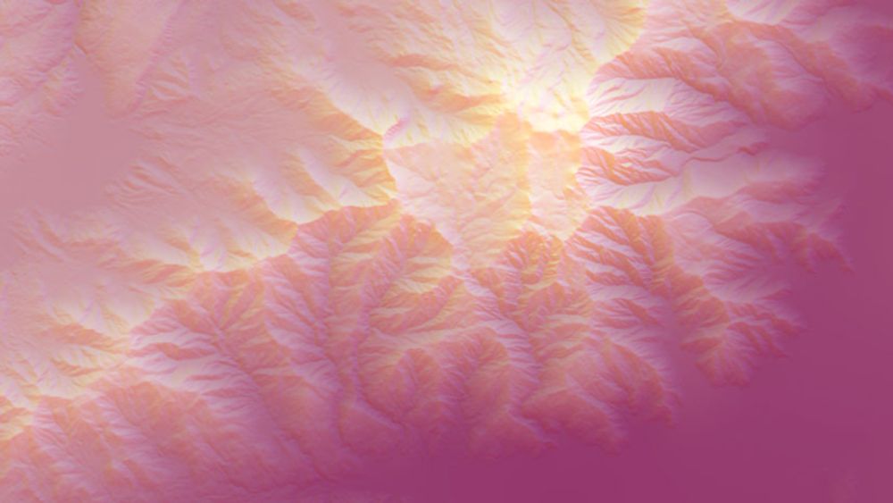
If you plan on producing your own stratovolcano, please be sure your subduction zone creates it in such a way it is legally distinct from my patent, or I may have to sue for IP infringement.
Here a shot of it in the 3D software before I rendered and labeled it.


1/2
I was thinking of using patent application style call-out arrows in a map, when I thought "just make a patent application map".
Patent date is the day Mount St. Helens was made a National Volcanic Monument. I'm sure you can figure out the patent #.
#pnw #mountsainthelens
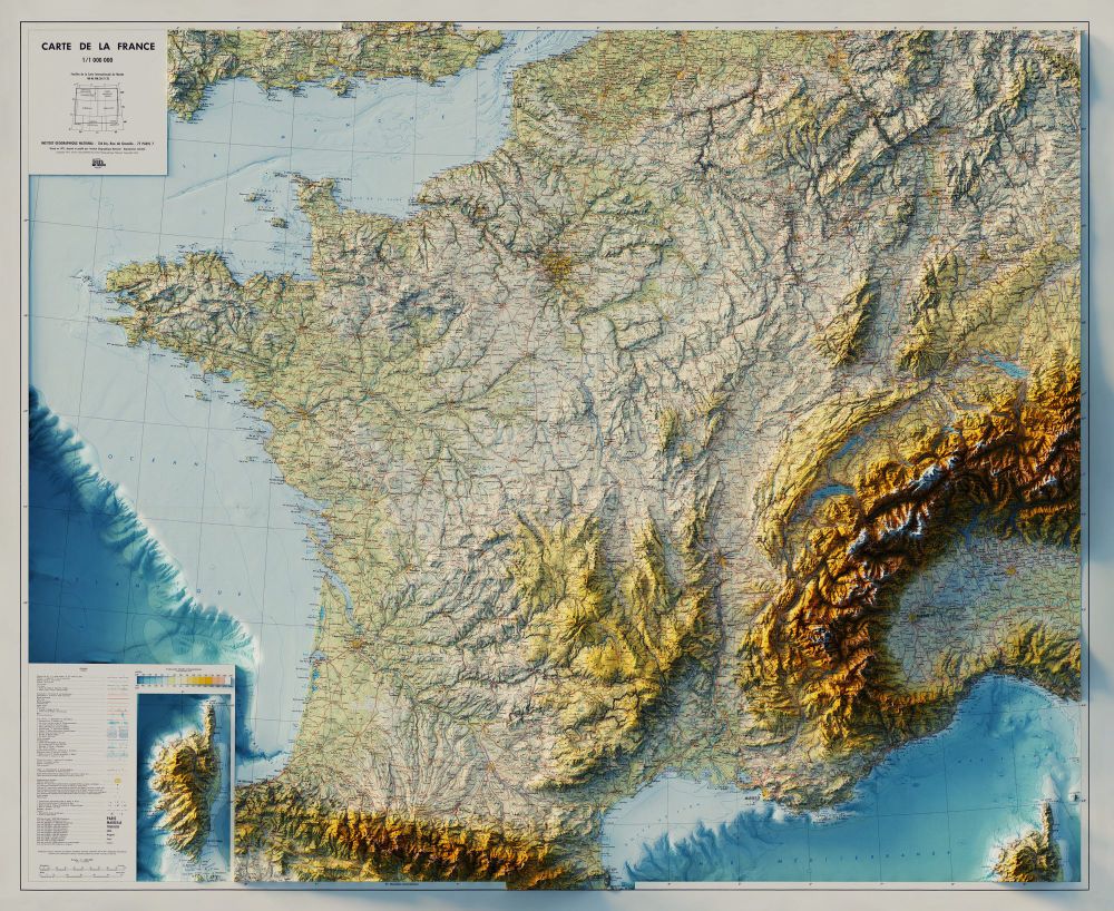


Carte de la France - Institut Géographique National - 1971
3D Render with Bathymetry
#France #ArcGISPro #cartography #b3d

Happy little Acadia cloud.
#AcadiaNationalPark #Acadia #AcadiaMaine #ArcGISPro #cartography #b3d


Topographic Map, Acadia National Park and Vicinity, Hancock County Maine - US Geological Survey - 1942
3D Render
#AcadiaNationalPark #Acadia #AcadiaMaine #BarHarborMaine #BarHarbor #ArcGISPro #cartography #b3d


Ketchikan, Alaska - 1955 - US Geological Survey - 1955, limited revisions 1976
3D Render
#Alaska #Ketchikan #KetchikanAlaska #ArcGISPro #cartography #b3d
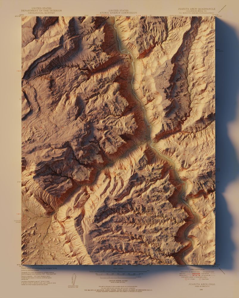
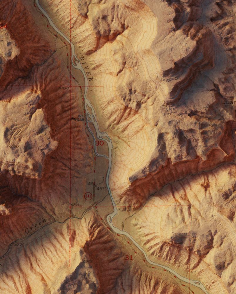


Juanita Arch - Colorado, Mesa Co. - USGS / US Atomic Energy Commission - 1949
3D Render
#colorado #ArcGISPro #cartography #b3d

Partly cloudy over Katahdin Lake.
A little noisy preview image.
#mtkatahdin #maine #arcgispro #b3d

No. I’ve actually never heard of that website. For USGS maps, I usually go straight to the source.
ngmdb.usgs.gov/topoview/vie...


Mount Baker, WA - USGS - 1979
3D Render
#washingtonstate #pnw #mtbaker #ArcGISPro #cartography #b3d


A few more close ups of Svalbard.
08.09.2025 12:03 — 👍 2 🔁 0 💬 0 📌 0


Svalbard, Norway - Norsk Polarinstitutt - 1980
3D Render
#Svalbard #Norway #ArcGISPro #cartography #b3d
2/2 Maybe a little too simple, though. I feel like there's too much empty space, but if I do more, I want them all to be square. Now off to see if I can make this a multicolor 3D print.
17.08.2025 21:53 — 👍 2 🔁 0 💬 0 📌 0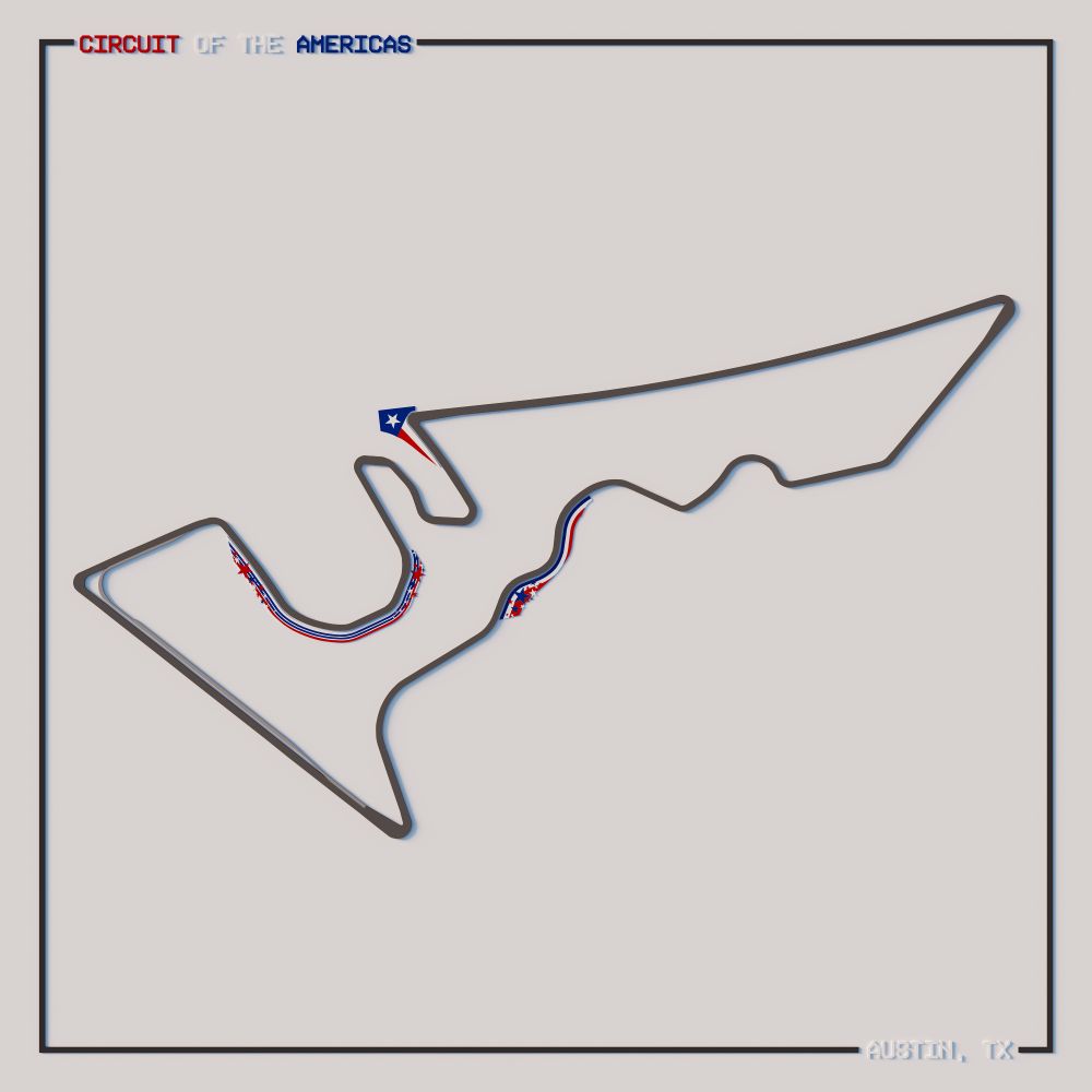


1/2 Most F1 maps seem to be of centerlines of the track, but I wanted to try to get the actual track shape/width in a polygon (along with the pit lane) and the unique decorations at the track.
#F1 #ArcGISPro #Blender #Illustrator #CircuitOfTheAmericas
And immediately gets bookmarked into my inspirations folder.
www.esri.com/arcgis-blog/...
When one of your favorite science communicators convinces you that that the best science podcast was a show you loved to laugh with. As soon as I’m done with the video, I’m firing up the NPR app for some memories.
30.05.2025 20:09 — 👍 2 🔁 0 💬 0 📌 0If you look close you can spot Hells Canyon Dam in the shots.
30.05.2025 00:08 — 👍 2 🔁 0 💬 0 📌 0
I was reading this @npr.org story and decided to take a look at Hells Canyon (the deepest river gorge in the United States) in 3D.
www.npr.org/2025/05/27/n...
#arcgispro #b3d #hellscanyon #Idaho #Oregon
Made from NYC LiDAR, processed in ArcGIS Pro and rendered in blender.
29.05.2025 20:54 — 👍 2 🔁 0 💬 0 📌 0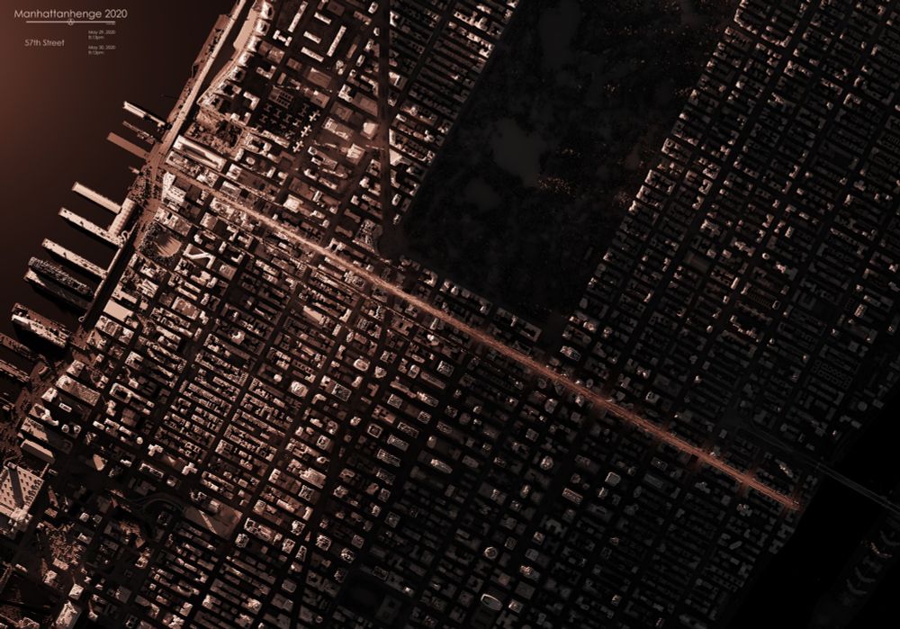
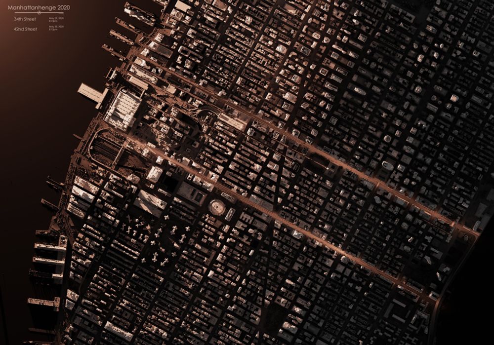
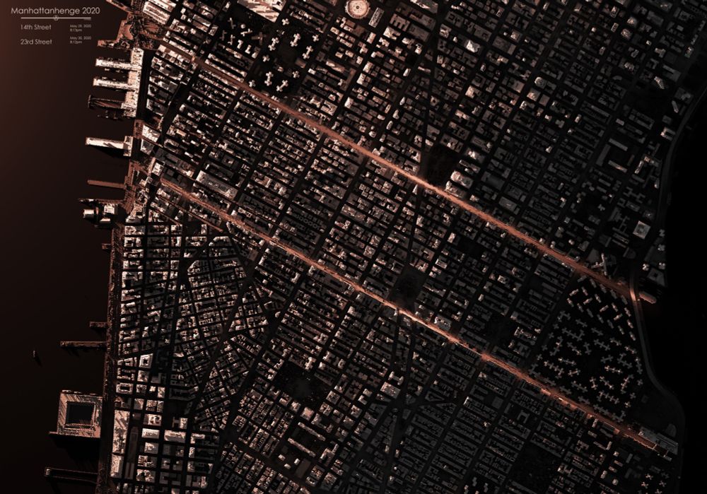
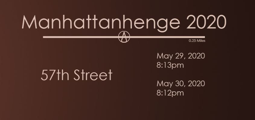
That time of year again - resharing this map of Manhattanhenge from 2020. Same day and time every year.
These maps indicate the 5 best streets with unobstructed views and the best times to experience Manhattanhenge.
#arcgispro #blender #LiDAR #manhattan #NYC #manhattanhenge

Father’s Day sale for the next 3 days only, buy any print and get the second for 50% off when you use code BOGO50.
muir-way.com/collections/...
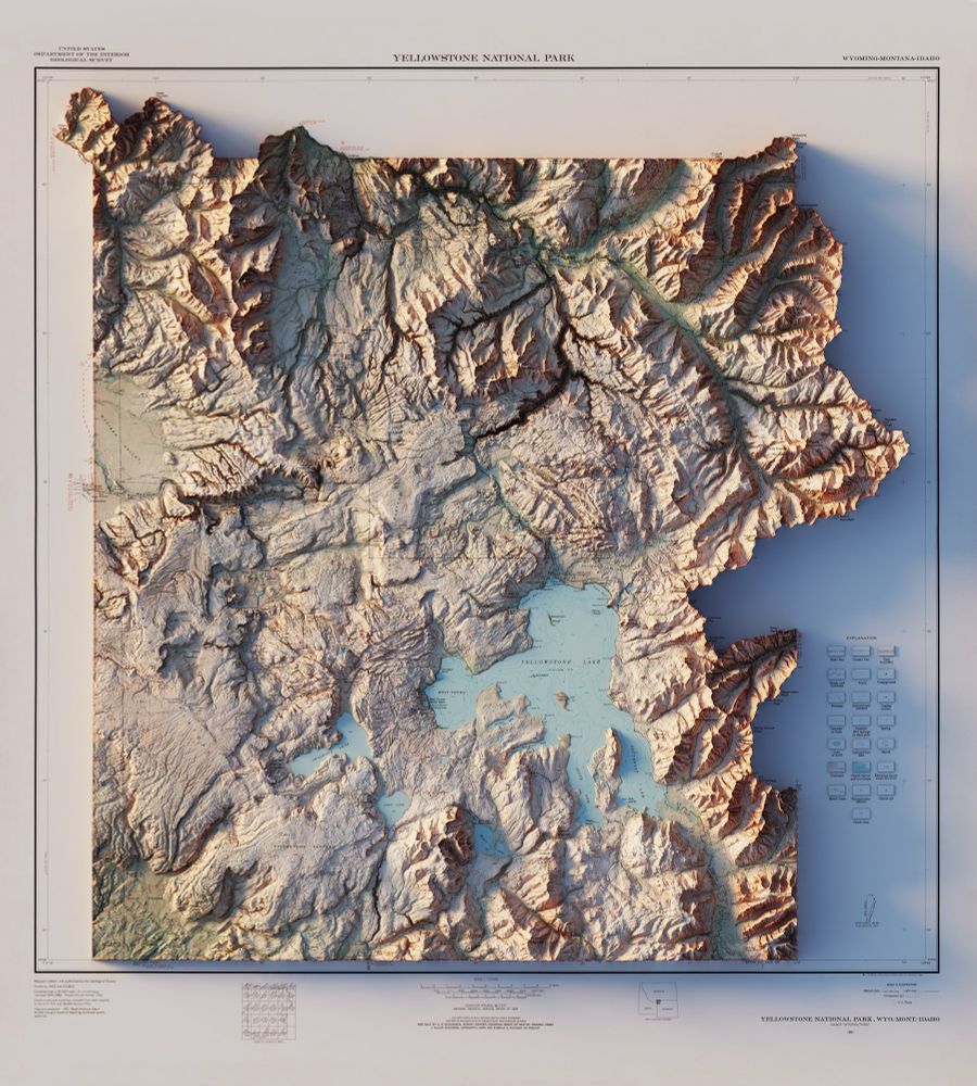
And one more of Yellowstone without clouds
01.05.2025 15:40 — 👍 2 🔁 1 💬 0 📌 0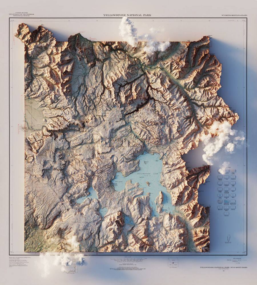
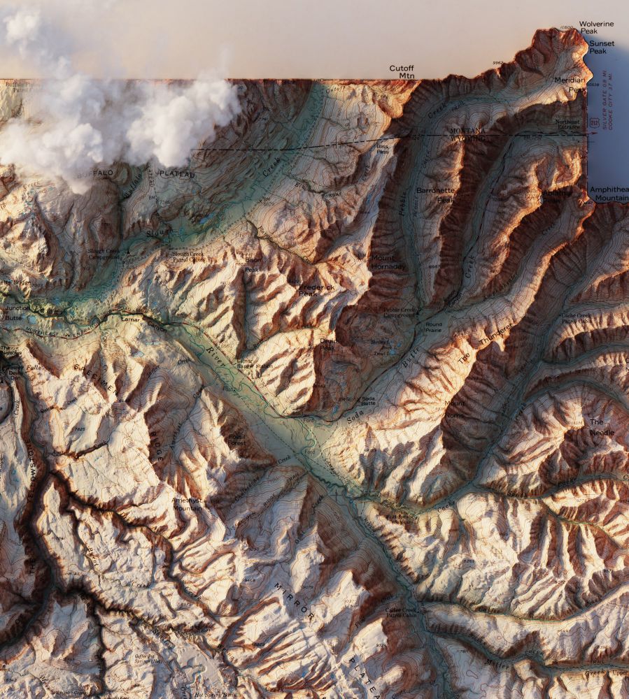
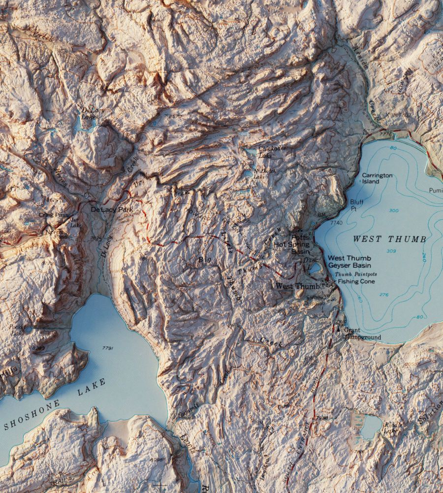
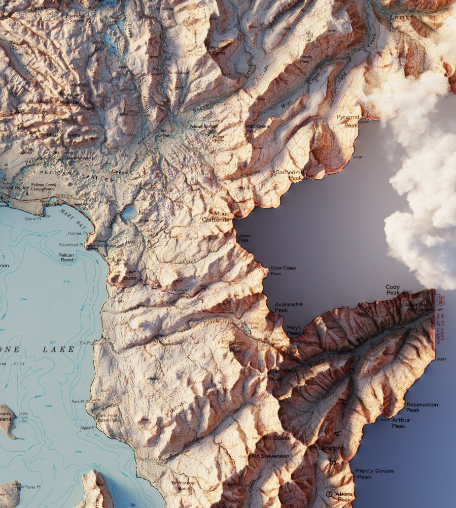
Yellowstone National Park, WY - MT - ID – USGS – 1961
3D Render
#Yellowstone #YellowstoneNationalPark #Wyoming #Montana #Idaho #ArcGISPro #b3d
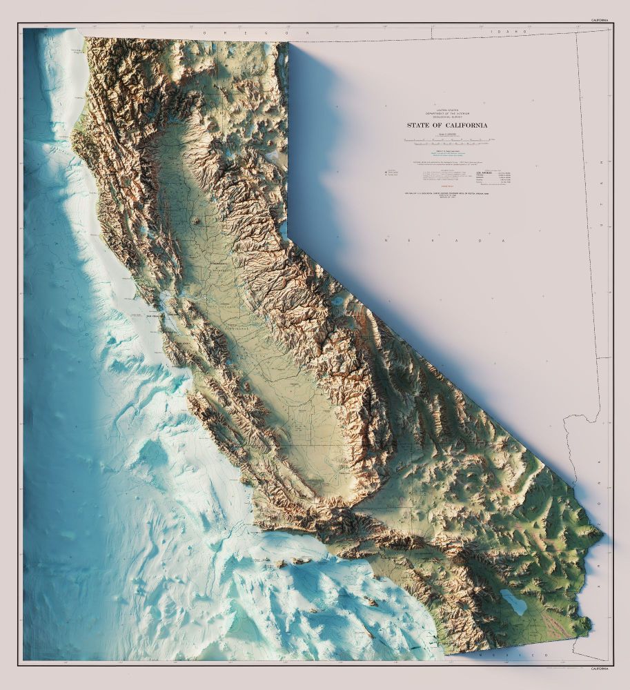
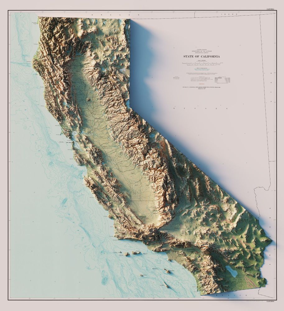
State of California - US Dept. of the Interior - Geological Survey - 1971
3D Render - with and without bathymetry.
#California #arcgispro #geography #b3d
2/2
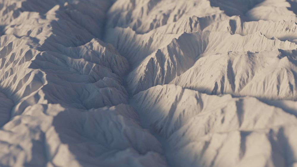
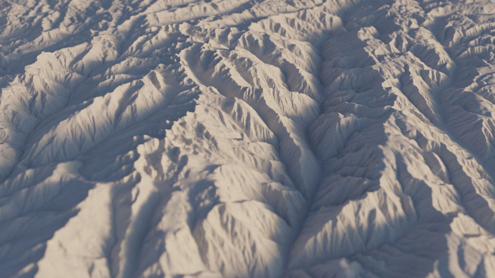
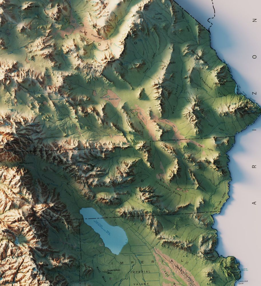
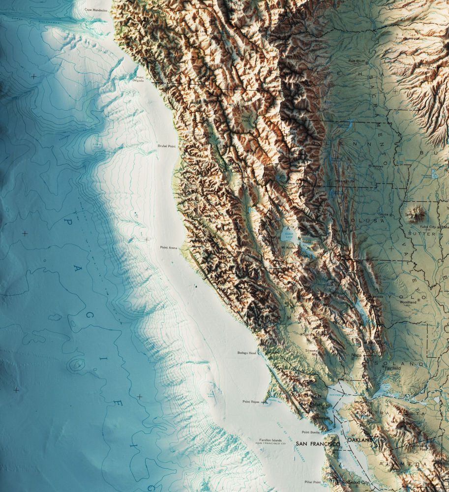
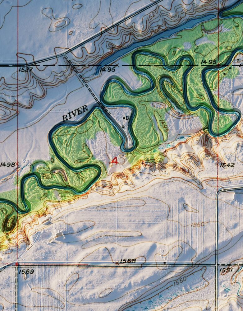
A few more closeups.
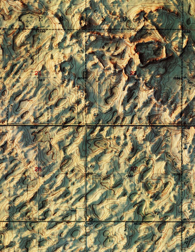
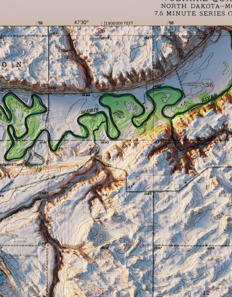
1/2
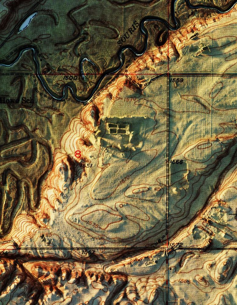
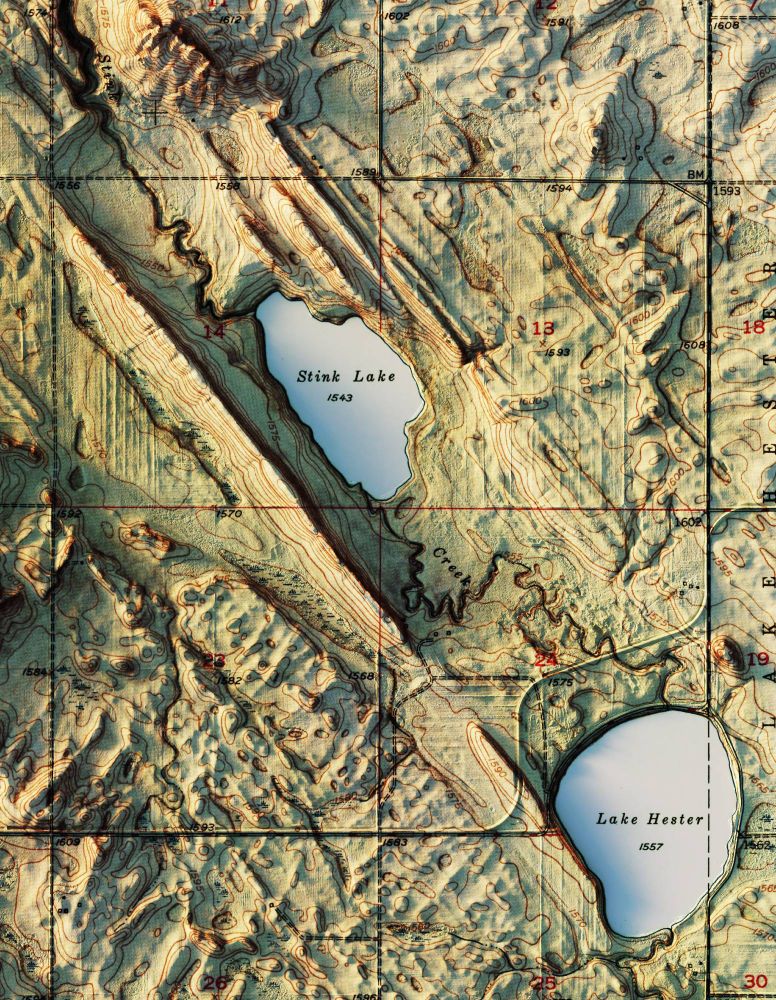
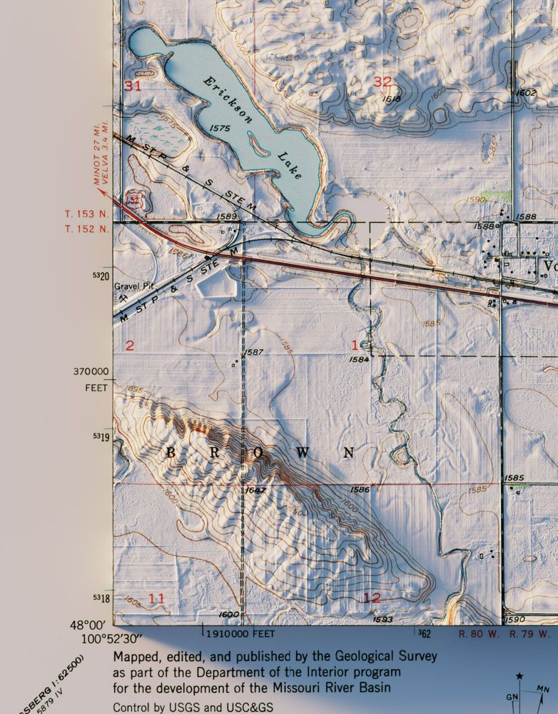
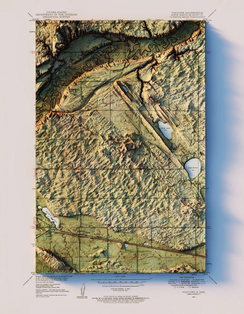
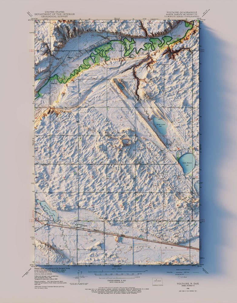
Another two pack of interesting topography. Both a colorized shaded relief and standard topo quads. The elevation data is nice and high res to even see the furrows in the fields.
Voltaire, ND - USGS - 1948
3D Render
#NorthDakota #geography #geology #gis #arcgispro #b3d
USGS 3DEP at 1m resolution.
26.04.2025 22:14 — 👍 3 🔁 0 💬 0 📌 0Yes. Look back through some of my posts for more...hope you like them.
26.04.2025 03:58 — 👍 0 🔁 0 💬 0 📌 0