Pretty exceptional gust recorded in Plateau, Nova Scotia from Les Suêtes winds. Gust of 209 km/h was just recorded. That’s 130 mph. While unofficial, still historical. Data from CB Mesonet (capebretonweather.ca) @yhzweatherguy.bsky.social @allisteraalders.bsky.social @ryansnoddon.bsky.social
14.02.2025 03:41 — 👍 11 🔁 5 💬 0 📌 1

Interestingly, temps are staying far below forecast. Still -8° in the valley with the forecast at -2,-3°. Just over 5 cm down in #Kentville. #NSstorm #Nswx #NSsnow
29.01.2025 18:34 — 👍 2 🔁 0 💬 0 📌 0

Cold front very visible on Mesonet data. Snow to begin soon for the Valley, and then Halifax. Stronger NW winds expected could cause blowing snow. And if in heavy snow: maybe white-out conditions
28.01.2025 13:12 — 👍 3 🔁 0 💬 0 📌 0
Greenwood airport obs also reporting mix
20.01.2025 03:59 — 👍 1 🔁 0 💬 0 📌 0
1.3° and mixing in Kentville #NSstorm #NSwx
20.01.2025 03:56 — 👍 1 🔁 0 💬 0 📌 1


After a rain event Sun., Mon is looking to be snowy. HFX area and east will likely see trace amounts of snowfall (mostly rain); however western NS and northern NS could see 5-15 cm by noon Mon. Heaviest snow in the morn may cause travel disruptions. Keep an eye on it. #NSstorm #NSwx #NSsnow
17.01.2025 00:25 — 👍 2 🔁 0 💬 0 📌 0

Picture-perfect weather on what is a true white Christmas for the first time in several years. Merry Christmas! 🎅🎄
25.12.2024 14:02 — 👍 8 🔁 1 💬 0 📌 0
On my very sheltered deck I measured 27 cm. Greenwood airport measured 28 cm...must've blown around for you
22.12.2024 21:09 — 👍 0 🔁 0 💬 0 📌 0
Make sure to add units to the map! Could be inches, centimenters, decameters, who knows.
21.12.2024 17:43 — 👍 0 🔁 0 💬 0 📌 0
Woke up to 4 cm in Kentville. Under a winter storm warning originally for 30-40 cm. Dry air the culprit?
21.12.2024 17:42 — 👍 1 🔁 0 💬 1 📌 0
Snow has started to fall here in Kentville! Will continue to fall for 24 more hours amounting to up to 40 cm. Expecting to wake up to 15-20 cm. #NSstorm #NSwx
21.12.2024 03:07 — 👍 1 🔁 0 💬 0 📌 0


Not much change in the outlook for Friday night - Saturday. A general 15 to 30 cm central/western N.S., P.E.I., southeast N.B., and N.L's Northern Peninsula. Mixing looks to limit amounts in eastern Nova Scotia and N.L. Moving south and east in N.L. it will be more rain than snow. #NS #NB #PEI #NL
19.12.2024 21:17 — 👍 5 🔁 2 💬 0 📌 1

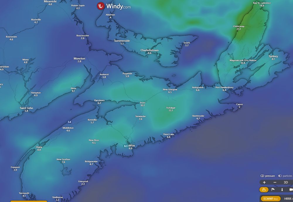
Some gusty winds from the northeast are likely (50-60 km/h) which will hinder visibility further and make the road conditions even worse. (2/2) #NSstorm #NSwx
19.12.2024 19:46 — 👍 1 🔁 0 💬 0 📌 0

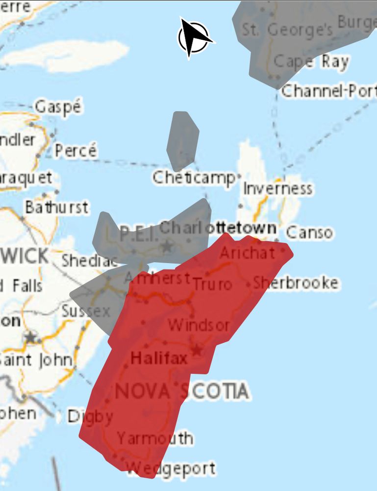
A snowfall warning has been released for mainland Nova Scotia. 15-30 cm is expected across the province (CB and Eastern Shore may see a change to rain) starting Fri eve/night dwindling Sat. For the Valley, Bay-enhanced/back-end snow could occur after the storm. (1/2) #Nsstorm #NSwx #NSsnow #wxbsky
19.12.2024 19:46 — 👍 1 🔁 0 💬 1 📌 0

Summary of Fri night/Sat morning snow system here in the Maritimes. Snow could have a 'stick factor' (hard to predict the extent of that though) and winds will become gusty so keep that in mind. Our official alerts: weather.gc.ca?layers=alert... #nswx #nsstorm #pewx #pestorm #nbwx
19.12.2024 14:37 — 👍 7 🔁 1 💬 1 📌 1


Pre-Christmas travel plans this weekend?
Heads up that we have system tracking into the region that may bring snow on Saturday.
Track of the system will be key & has yet to be ironed out, however this has the potential to bring an impactful snowfall.
Stay tuned for updates.
#nsstorm #nbstorm
17.12.2024 19:02 — 👍 20 🔁 5 💬 0 📌 0


Consensus for a snowstorm effecting Atlantic Canada on Saturday is growing. While specifics can’t be ruled out, 10-30+ cm is possible across the whole region. Some models show it more offshore (GFS) but they seem to be trending back. Details TBD. Euro and Canadian models below ⬇️ #NSstorm #Nsstorm
17.12.2024 12:18 — 👍 2 🔁 0 💬 0 📌 0


High pressure builds into the region allowing for fair conditions for much of Atlantic Canada. However, some onshore snow for parts of Cape Breton tonight - Saturday. Onshore flurries for Newfoundland's west-facing coastlines tonight - Sat., except squalls on the west coast. #NSwx #NBwx #PEwx #NLwx
13.12.2024 21:49 — 👍 2 🔁 1 💬 0 📌 0
What will the frequency be on the Gulf Coast service? Just one rt a day?
12.12.2024 19:30 — 👍 1 🔁 0 💬 1 📌 0

Winds are starting to pick up this evening as temps rise. 14.3°C at my house and some parts of the province are around 17°!! Truly feels like spring! #NSstorm #Nswx
12.12.2024 02:06 — 👍 2 🔁 0 💬 0 📌 0

Freezing Rain Warning in effect for the Annapolis Valley and Northern NS along the Gulf. Freezing rain is ongoing here in Kentville and it's slippery out there. Freezing rain continues into the early evening where it will be replaced by normal rain when temps rise. Warmer tomorrow. #NSwx #NSstorm
10.12.2024 17:54 — 👍 1 🔁 0 💬 0 📌 0

Schools are closed today across the Anna. Valley as snow starts to move in to the region. This morning: light snow and freezing drizzle changing to ice pellets in the afternoon. #NSStorm #NSwx
10.12.2024 10:35 — 👍 1 🔁 0 💬 0 📌 0

Snow is turning to a mix of rain and snow here in Kentville as temps increase above 0. Before rain started I measured 5 cm here in Kentville. #nsstorm #Nswx
08.12.2024 17:53 — 👍 1 🔁 0 💬 0 📌 0

As the strongest of the #winds ease through today across NFLD, snow & blowing snow continues across Labrador. Meanwhile, snow #squalls could be quite persistent across Cape Breton & NL as colder air blows across the Gulf. Expect rough travel & poor visibility. On Sunday, widespread snowfall.
06.12.2024 14:27 — 👍 23 🔁 4 💬 0 📌 0

Watching Sunday the 8th for a small NS-wide snow event likely 👀. EURO & GFS models have a widespread 5 cm across the province with higher totals inland and higher elevation. Up to 20 possible for CB Highlands. Details TBD... #nswx #nsstorm #wxbsky #wxsky #snow #novascotia
06.12.2024 02:05 — 👍 1 🔁 1 💬 0 📌 0


An Alberta clipper will bring a mix of rain and snow to Atlantic Canada Thursday to Friday. Strong winds also in the forecast. My full update is posted on Facebook here: www.facebook.com/share/p/15bX... #NSwx #NBwx #PEwx #NLwx
04.12.2024 22:11 — 👍 6 🔁 1 💬 0 📌 0
Waiting For The Wipe Out Asteroid.....
Tornado guru at uwo.ca/ntp & the new CSSL.ca in #Londontario, #GreatLakes sailor, my debut album is 'Fifty' (bit.ly/40WqxUy), my latest album (all videos) is 'Cover Me' (bit.ly/3V1MnCG), ECCC & YorkU alumnus #WorkForPeace #GoJays!
Weatherman ☀️Entrepreneur 📊Husband 👬 Traveler ✈️ CEO of NorCast Media Group
Canada’s independent and community-driven weather organization. Providing context to severe weather since 2013. Visit our website: instantweather.ca
A musician, bass player for the Otis Wack Band. I have a couple Davis weather stations, love photography, Nikon camera's, Drone photography.
Founded in 2017 by Western University with ImpactWX, NTP aims to detect and document all tornadoes in Canada and uncover Canada’s true tornado climatology. See uwo.ca/ntp & cssl.ca.
🍁 #Canada 🇨🇦 Visual storyteller, wife, mom, nana! Visit my website: https://karencook.pixels.com/ Nature photography Photos are copyrighted. Proceeds from sales go to #charity #KindnessMatters Proud to live in Canada ♥️🇨🇦
Manitoba Weather Updates and Weather Documentation!
Operating year round.
Founded by Lead Weather Forecaster:
Justin Oertel.
Based out of Brandon and Winnipeg Manitoba.
Join us on Facebook:
http://www.facebook.com/MBWeatherCentre
🍁Vive Le Canada 🟥🍁 🟥
The Resistance, Adventurer, Climate Change is real, fighting for Canada’s democracy, VOTE ABC #NDP #LIB #GREEN #Canada 🇨🇦 I Nova Scotia is HOME🏡 , Cape Breton Island is a hidden gem. #TeamCanada
Solidarity with Greenland and Ukraine.
Weather Jokes, Weather Memes, Photoshops, GIFs, Sarcastic, #WxGeek, #CTwx, #Cincywx, #WxSky
Meteorologist. Started Canada’s hurricane research and forecast program. Past-President CMOS: https://www.cmos.ca/site/about/cmos?nav=sidebar
Born 314ppm CO2; we're now 425ppm!
Middle-aged pet parent. // Higher-ed IT systems analyst. // Weather enthusiast. #NSwx // https://vincent.grovestine.com
Meteorologist/Manager at the Canadian Hurricane Centre
@ECCC_CHC
| Tropical cyclone (hurricane) and many weather related topics | postings are own not employer
⚠️ MIRROR OF https://x.com/ECMWFbot
⚠️ If you own the original account and want to claim this, please contact @twttr-mirrors.bsky.social
[FR/EN] Météorologue à MétéoMédia | PhD Candidate at Dalhousie University | Intérêts: Canadian weather maps, stats and news
Retired Environment Canada meteorologist. Niagara region, Canada
⚠️ MIRROR OF twitter.com/NHC_Atlantic
⚠️ If you own the original account and want to claim this, please contact @twttr-mirrors.bsky.social
- 24 - They/Them - Pan - Amtrak's Strongest warrior, ACAB, Single ASF - I love the Midwest - MN
Writer, Learning Enthusiast, Urbanist, Optimist, Traveller, Canadian.
Passionate about making the world better.
https://cinqpersonnes.substack.com/
https://nextmetro.substack.com/