* WHAT...East winds up to 25 kt.
* WHERE...Maalaea Bay, Pailolo Channel, Alenuihaha Channel, Big
Island Leeward Waters and Big Island Southeast Waters.
* WHEN...Until 6 PM HST Wednesday.
* IMPACTS...Conditions will be hazardous to small craft.
Small Craft Advisory issued August 12 at 3:11AM HST until August 13 at 6:00PM HST by NWS Honolulu HI
Additional Details Here.
12.08.2025 13:15 — 👍 0 🔁 0 💬 0 📌 0
...HIGH SURF ADVISORY REMAINS IN EFFECT TODAY FOR SOUTH FACING
SHORES OF ALL HAWAIIAN ISLANDS...
The ongoing south swell will gradually subside today as it
produces advisory level surf along south facing shores.
* WHAT...Large breaking waves of 7 to 10 feet today.
* WHERE...South facing shores of all Hawaiian Islands.
* WHEN...Until 6 PM HST Monday.
* IMPACTS...Moderate. Strong breaking waves and strong currents
will make swimming dangerous. Flooding of beaches that are
normally dry, minor coastal erosion, and saltwater inundation.
* ADDITIONAL DETAILS...
High Surf Advisory issued August 11 at 3:30AM HST until August 11 at 6:00PM HST by NWS Honolulu HI
Additional Details Here.
11.08.2025 13:45 — 👍 0 🔁 0 💬 0 📌 0

The Coastal Flood Statement has been cancelled and is no longer in effect.
...HIGH SURF ADVISORY REMAINS IN EFFECT FOR SOUTH FACING SHORES
OF ALL HAWAIIAN ISLANDS THROUGH MONDAY...
The ongoing south swell has peaked and will gradually subside as
it produces advisory level surf along south facing shores through
Monday.
* WHAT...Large breaking waves of 8 to 12 feet this afternoon
decreasing to 7 to 10 feet by Monday.
* WHERE...South facing shores of all Hawaiian Islands.
* WHEN...Until 6 PM HST Monday.
* IMPACTS...Moderate. Strong breaking waves and strong currents
will make swimming dangerous. Flooding of beaches that are
normally dry, minor coastal erosion, and saltwater inundation.
* ADDITIONAL DETAILS...
The Coastal Flood Statement has been cancelled and is no longer in effect.
The Coastal Flood Statement has been cancelled.
Additional Details Here.
11.08.2025 03:30 — 👍 1 🔁 0 💬 0 📌 0
...HIGH SURF ADVISORY REMAINS IN EFFECT FOR THE SOUTH FACING
SHORES OF ALL HAWAIIAN ISLANDS THROUGH MONDAY...
...COASTAL FLOOD STATEMENT REMAINS IN EFFECT FOR ALL SHORES OF
ALL HAWAIIAN ISLANDS THROUGH TONIGHT...
A large south swell will produce high end advisory level surf
along all south facing shores. Surf heights will begin to
gradually decline today and tonight. The High Surf Advisory was
extended in time through Monday.
Peak afternoon high tides, combined with elevated water levels
running about a half a foot higher than normal, will lead to
minor flooding along most shorelines and low lying coastal areas
today. Water levels should fall below thresholds by Monday.
Corrected the surf heights in the WHAT section to show decreasing
High Surf Advisory trends through Monday.
* WHAT...For the High Surf Advisory, large breaking waves of 10 to
14 feet this morning, decreasing to 8 to 12 feet this afternoon,
and 7 to 10 feet by Monday. For the Coastal Flood Statement,
Flood prone low lying coastal areas.
* WHERE...South facing shores of all Hawaiian Islands.
* WHEN...For the High Surf Advisory, until 6 PM HST Monday. For
the Coastal Flood Statement, through late tonight.
* IMPACTS...Moderate. Strong breaking waves and strong currents
will make swimming dangerous. Flooding of beaches that are
normally dry, minor coastal erosion, and saltwater inundation.
...HIGH SURF ADVISORY REMAINS IN EFFECT FOR THE SOUTH FACING
SHORES OF ALL HAWAIIAN ISLANDS THROUGH MONDAY...
...COASTAL FLOOD STATEMENT REMAINS IN EFFECT FOR ALL SHORES OF
ALL HAWAIIAN ISLANDS THROUGH TONIGHT...
A large south swell will produce high end advisory level surf
along all south facing shores. Surf heights will begin to
gradually decline today and tonight. The High Surf Advisory was
extended in time through Monday.
Peak afternoon high tides, combined with elevated water levels
running about a half a foot higher than normal, will lead to
minor flooding along most shorelines and low lying coastal areas
today. Water levels should fall below thresholds by Monday.
Corrected the surf heights in the WHAT section to show decreasing
High Surf Advisory trends through Monday.
* WHAT...Isolated minor coastal flooding.
* WHERE...Flood prone low lying coastal areas.
* WHEN...Through late tonight.
* IMPACTS...Flooding of beaches that are normally dry, minor
coastal erosion, and saltwater inundation.
High Surf Advisory issued August 10 at 3:35AM HST until August 11 at 6:00PM HST by NWS Honolulu HI
Additional Details Here.
10.08.2025 13:45 — 👍 2 🔁 0 💬 0 📌 0
...HIGH SURF ADVISORY REMAINS IN EFFECT FOR THE SOUTH FACING
SHORES OF ALL HAWAIIAN ISLANDS THROUGH MONDAY...
...COASTAL FLOOD STATEMENT REMAINS IN EFFECT FOR ALL SHORES OF
ALL HAWAIIAN ISLANDS THROUGH TONIGHT...
A large south swell will produce high end advisory level surf
along all south facing shores. Surf heights will begin to
gradually decline today and tonight. The High Surf Advisory was
extended in time through Monday.
Peak afternoon high tides, combined with elevated water levels
running about a half a foot higher than normal, will lead to
minor flooding along most shorelines and low lying coastal areas
today. Water levels should fall below thresholds by Monday.
* WHAT...For the High Surf Advisory, large breaking waves of 10 to
14 feet. For the Coastal Flood Statement, Flood prone low lying
coastal areas.
* WHERE...South facing shores of all Hawaiian Islands.
* WHEN...For the High Surf Advisory, until 6 PM HST Monday. For
the Coastal Flood Statement, through late tonight.
* IMPACTS...Moderate. Strong breaking waves and strong currents
will make swimming dangerous. Flooding of beaches that are
normally dry, minor coastal erosion, and saltwater inundation.
...HIGH SURF ADVISORY REMAINS IN EFFECT FOR THE SOUTH FACING
SHORES OF ALL HAWAIIAN ISLANDS THROUGH MONDAY...
...COASTAL FLOOD STATEMENT REMAINS IN EFFECT FOR ALL SHORES OF
ALL HAWAIIAN ISLANDS THROUGH TONIGHT...
A large south swell will produce high end advisory level surf
along all south facing shores. Surf heights will begin to
gradually decline today and tonight. The High Surf Advisory was
extended in time through Monday.
Peak afternoon high tides, combined with elevated water levels
running about a half a foot higher than normal, will lead to
minor flooding along most shorelines and low lying coastal areas
today. Water levels should fall below thresholds by Monday.
* WHAT...Isolated minor coastal flooding.
* WHERE...Flood prone low lying coastal areas.
* WHEN...Through late tonight.
* IMPACTS...Flooding of beaches that are normally dry, minor
coastal erosion, and saltwater inundation.
High Surf Advisory issued August 10 at 3:28AM HST until August 11 at 6:00PM HST by NWS Honolulu HI
Additional Details Here.
10.08.2025 13:30 — 👍 0 🔁 0 💬 0 📌 0
...HIGH SURF ADVISORY FOR THE SOUTH FACING SHORES OF ALL HAWAIIAN
ISLANDS...
...COASTAL FLOOD STATEMENT REMAINS IN EFFECT FOR ALL
SHORES OF ALL HAWAIIAN ISLANDS...
A large south swell will peak tonight producing high end advisory
level surf along all south facing shores.
Peak afternoon high tides, combined with elevated water levels
running about a half a foot higher, will lead to minor flooding
along most shorelines and low lying coastal areas through today.
Water levels should fall below thresholds during peak afternoon
high tides Sunday.
* WHAT...For the High Surf Advisory, large breaking waves of 10 to
14 feet. For the Coastal Flood Statement, isolated minor coastal
flooding.
* WHERE...For the High Surf Advisory, south facing shores of all
islands. For the Coastal Flood Statement, flood prone low
lying coastal areas.
* WHEN...For the High Surf Advisory, until 6 AM HST Monday. For
the Coastal Flood Statement, through late Sunday night.
* IMPACTS...Moderate. Strong breaking waves and strong currents
will make swimming dangerous. Flooding of beaches that are
normally dry, minor coastal erosion, and saltwater inundation.
...HIGH SURF ADVISORY FOR THE SOUTH FACING SHORES OF ALL HAWAIIAN
ISLANDS...
...COASTAL FLOOD STATEMENT REMAINS IN EFFECT FOR ALL
SHORES OF ALL HAWAIIAN ISLANDS...
A large south swell will peak tonight producing high end advisory
level surf along all south facing shores.
Peak afternoon high tides, combined with elevated water levels
running about a half a foot higher, will lead to minor flooding
along most shorelines and low lying coastal areas through today.
Water levels should fall below thresholds during peak afternoon
high tides Sunday.
* WHAT...Isolated minor coastal flooding.
* WHERE...Flood prone low lying coastal areas.
* WHEN...Through late Sunday night.
* IMPACTS...Flooding of beaches that are normally dry, minor
coastal erosion, and saltwater inundation.
High Surf Advisory issued August 9 at 3:25PM HST until August 11 at 6:00AM HST by NWS Honolulu HI
Additional Details Here.
10.08.2025 01:30 — 👍 0 🔁 0 💬 0 📌 0
...HIGH SURF ADVISORY FOR THE SOUTH FACING SHORES OF ALL HAWAIIAN
ISLANDS...
...COASTAL FLOOD STATEMENT REMAINS IN EFFECT FOR ALL SHORES OF
ALL HAWAIIAN ISLANDS...
A large south swell will peak toady producing high end advisory
level surf along all south facing shores.
Peak afternoon high tides, combined with elevated water levels
running about a half a foot higher, will lead to minor flooding
along most shorelines and low lying coastal areas through today.
Water levels should fall below thresholds during peak afternoon
high tides Sunday.
* WHAT...For the High Surf Advisory, large breaking waves of 10 to
14 feet. For the Coastal Flood Statement, isolated minor
coastal flooding.
* WHERE...For the High Surf Advisory, south facing shores of all
islands. For the Coastal Flood Statement, flood prone low
lying coastal areas.
* WHEN...For the High Surf Advisory, until 6 AM HST Monday. For
the Coastal Flood Statement, through late Sunday night.
* IMPACTS...Moderate. Strong breaking waves and strong currents
will make swimming dangerous. Flooding of beaches that are
normally dry, minor coastal erosion, and saltwater inundation.
* ADDITIONAL DETAILS...
...HIGH SURF ADVISORY FOR THE SOUTH FACING SHORES OF ALL HAWAIIAN
ISLANDS...
...COASTAL FLOOD STATEMENT REMAINS IN EFFECT FOR ALL SHORES OF
ALL HAWAIIAN ISLANDS...
A large south swell will peak toady producing high end advisory
level surf along all south facing shores.
Peak afternoon high tides, combined with elevated water levels
running about a half a foot higher, will lead to minor flooding
along most shorelines and low lying coastal areas through today.
Water levels should fall below thresholds during peak afternoon
high tides Sunday.
* WHAT...Isolated minor coastal flooding.
* WHERE...Flood prone low lying coastal areas.
* WHEN...Through late Sunday night.
* IMPACTS...Flooding of beaches that are normally dry, minor
coastal erosion, and saltwater inundation.
* ADDITIONAL DETAILS...
High Surf Advisory issued August 9 at 3:34AM HST until August 11 at 6:00AM HST by NWS Honolulu HI
Additional Details Here.
09.08.2025 13:45 — 👍 0 🔁 0 💬 0 📌 0
...HIGH SURF ADVISORY FOR THE SOUTH FACING SHORES OF ALL HAWAIIAN
ISLANDS...
...COASTAL FLOOD STATEMENT IN EFFECT FOR ALL SHORES OF
ALL HAWAIIAN ISLANDS...
A large south swell will continue to fill in tonight and peak
Saturday. This will result in above advisory level surf along
south facing shores this evening. Surf may reach warning levels
along south facing shores Saturday.
Peak afternoon high tides, combined with elevated water levels
running about a half a foot higher, will lead to minor flooding
along most shorelines and low lying coastal areas through
Saturday. Water levels should fall below thresholds during peak
afternoon high tides Sunday.
* WHAT...For the High Surf Advisory, large breaking waves of 8 to
12 feet tonight increasing to 10 to 14 feet Saturday. For the
Coastal Flood Statement, isolated minor coastal flooding.
* WHERE...For the High Surf Advisory, south facing shores of all
islands. For the Coastal Flood Statement, flood prone low lying
coastal areas.
* WHEN...For the High Surf Advisory, until 6 AM HST Monday. For
the Coastal Flood Statement, through late Sunday night.
* IMPACTS...Moderate. Strong breaking waves and strong currents
will make swimming dangerous. Flooding of beaches that are
normally dry, minor coastal erosion, and saltwater inundation.
...HIGH SURF ADVISORY FOR THE SOUTH FACING SHORES OF ALL HAWAIIAN
ISLANDS...
...COASTAL FLOOD STATEMENT IN EFFECT FOR ALL SHORES OF
ALL HAWAIIAN ISLANDS...
A large south swell will continue to fill in tonight and peak
Saturday. This will result in above advisory level surf along
south facing shores this evening. Surf may reach warning levels
along south facing shores Saturday.
Peak afternoon high tides, combined with elevated water levels
running about a half a foot higher, will lead to minor flooding
along most shorelines and low lying coastal areas through
Saturday. Water levels should fall below thresholds during peak
afternoon high tides Sunday.
* WHAT...Isolated minor coastal flooding.
* WHERE...Flood prone low lying coastal areas.
* WHEN...Through late Sunday night.
* IMPACTS...Flooding of beaches that are normally dry, minor
coastal erosion, and saltwater inundation.
High Surf Advisory issued August 8 at 3:18PM HST until August 11 at 6:00AM HST by NWS Honolulu HI
Additional Details Here.
09.08.2025 01:30 — 👍 0 🔁 0 💬 0 📌 0
* WHAT...East winds up to 25 knots.
* WHERE...Maalaea Bay, Pailolo and Alenuihaha Channels, Big
Island Leeward Waters and Big Island Southeast Waters.
* WHEN...Until 6 PM HST.
* IMPACTS...Conditions will be hazardous to small craft.
Small Craft Advisory issued August 8 at 3:16AM HST until August 8 at 6:00PM HST by NWS Honolulu HI
Additional Details Here.
08.08.2025 13:30 — 👍 0 🔁 0 💬 0 📌 0
...HIGH SURF ADVISORY FOR THE SOUTH FACING SHORES OF ALL HAWAIIAN
ISLANDS...
...COASTAL FLOOD STATEMENT IN EFFECT FOR ALL SHORES OF ALL
HAWAIIAN ISLANDS...
A large south swell will fill in today and peak Saturday. This
will result in advisory level surf along south facing shores this
afternoon. Surf may reach warning levels along south facing
shores Saturday.
Peak afternoon high tides, combined with elevated water levels
running about a half a foot higher, will lead to minor flooding
along most shorelines and low lying coastal areas through
Saturday. Water levels should fall below thresholds during peak
afternoon high tides Sunday.
* WHAT...For the High Surf Advisory, surf 7 to 10 feet today
increasing 10 to 14 feet Saturday. For the Coastal Flood
Statement, isolated minor coastal flooding.
* WHERE...For the High Surf Advisory, south facing shores of all
islands. For the Coastal Flood Statement, flood prone low lying
coastal areas.
* WHEN...For the High Surf Advisory, until 6 AM HST Monday. For
the Coastal Flood Statement, through late Sunday night.
* IMPACTS...Moderate. Strong breaking waves and strong currents
will make swimming dangerous. Flooding of beaches that are
normally dry, minor coastal erosion, and saltwater inundation.
...HIGH SURF ADVISORY FOR THE SOUTH FACING SHORES OF ALL HAWAIIAN
ISLANDS...
...COASTAL FLOOD STATEMENT IN EFFECT FOR ALL SHORES OF ALL
HAWAIIAN ISLANDS...
A large south swell will fill in today and peak Saturday. This
will result in advisory level surf along south facing shores this
afternoon. Surf may reach warning levels along south facing
shores Saturday.
Peak afternoon high tides, combined with elevated water levels
running about a half a foot higher, will lead to minor flooding
along most shorelines and low lying coastal areas through
Saturday. Water levels should fall below thresholds during peak
afternoon high tides Sunday.
* WHAT...Isolated minor coastal flooding.
* WHERE...Flood prone low lying coastal areas.
* WHEN...Through late Sunday night.
* IMPACTS...Flooding of beaches that are normally dry, minor
coastal erosion, and saltwater inundation.
High Surf Advisory issued August 8 at 3:21AM HST until August 11 at 6:00AM HST by NWS Honolulu HI
Additional Details Here.
08.08.2025 13:30 — 👍 0 🔁 0 💬 0 📌 0
...HIGH SURF ADVISORY FOR THE SOUTH FACING SHORES OF ALL HAWAIIAN
ISLANDS...
...COASTAL FLOOD STATEMENT IN EFFECT FOR ALL SHORES OF ALL
HAWAIIAN ISLANDS...
A large south swell will gradually fill in on Friday and peak this
weekend. This will result in advisory level surf along south
facing shores. Surf may reach warning levels along south facing
shores this weekend.
Peak afternoon high tides, combined with elevated water levels
running about a half a foot higher, will lead to minor flooding
along most shorelines and low lying coastal areas through
Saturday. Water levels should fall below thresholds during peak
afternoon high tides Sunday.
* WHAT...For the Coastal Flood Statement, isolated minor coastal
flooding.
* WHERE...Flood prone low lying coastal areas.
* WHEN...Through late Sunday night.
* IMPACTS...Flooding of beaches that are normally dry, minor
coastal erosion, and saltwater inundation.
...HIGH SURF ADVISORY FOR THE SOUTH FACING SHORES OF ALL HAWAIIAN
ISLANDS...
...COASTAL FLOOD STATEMENT IN EFFECT FOR ALL SHORES OF ALL
HAWAIIAN ISLANDS...
A large south swell will gradually fill in on Friday and peak this
weekend. This will result in advisory level surf along south
facing shores. Surf may reach warning levels along south facing
shores this weekend.
Peak afternoon high tides, combined with elevated water levels
running about a half a foot higher, will lead to minor flooding
along most shorelines and low lying coastal areas through
Saturday. Water levels should fall below thresholds during peak
afternoon high tides Sunday.
* WHAT...For the High Surf Advisory, surf 7 to 10 feet on Friday
increasing to 10 to 14 feet Saturday. For the Coastal Flood
Statement, isolated minor coastal flooding.
* WHERE...South facing shores of all islands.
* WHEN...For the High Surf Advisory, from 6 AM Friday to 6 AM
HST Monday. For the Coastal Flood Statement, through late
Sunday night.
* IMPACTS...Moderate. Strong breaking waves and strong currents
will make swimming dangerous. Flooding of beaches that are
normally dry, minor coastal erosion, and saltwater inundation.
...HIGH SURF ADVISORY FOR THE SOUTH FACING SHORES OF ALL HAWAIIAN
ISLANDS...
...COASTAL FLOOD STATEMENT IN EFFECT FOR ALL SHORES OF ALL
HAWAIIAN ISLANDS...
A large south swell will gradually fill in on Friday and peak this
weekend. This will result in advisory level surf along south
facing shores. Surf may reach warning levels along south facing
shores this weekend.
Peak afternoon high tides, combined with elevated water levels
running about a half a foot higher, will lead to minor flooding
along most shorelines and low lying coastal areas through
Saturday. Water levels should fall below thresholds during peak
afternoon high tides Sunday.
* WHAT...For the High Surf Advisory, surf 7 to 10 feet on Friday
increasing to 10 to 14 feet Saturday. For the Coastal Flood
Statement, isolated minor coastal flooding.
* WHERE...South facing shores of all islands.
* WHEN...For the High Surf Advisory, from 6 AM Friday to 6 AM
HST Monday. For the Coastal Flood Statement, through late
Sunday night.
* IMPACTS...Moderate. Strong breaking waves and strong currents
will make swimming dangerous. Flooding of beaches that are
normally dry, minor coastal erosion, and saltwater inundation.
Coastal Flood Statement issued August 7 at 7:30PM HST until August 11 at 6:00AM HST by NWS Honolulu HI
Additional Details Here.
08.08.2025 05:45 — 👍 2 🔁 0 💬 0 📌 0
* WHAT...East winds 15 to 25 kt.
* WHERE...Maalaea Bay, Pailolo Channel, Alenuihaha Channel, Big
Island Leeward Waters and Big Island Southeast Waters.
* WHEN...Until 6 PM HST Friday.
* IMPACTS...Conditions will be hazardous to small craft.
Small Craft Advisory issued August 7 at 4:06PM HST until August 8 at 6:00PM HST by NWS Honolulu HI
Additional Details Here.
08.08.2025 02:15 — 👍 1 🔁 0 💬 0 📌 0
...HIGH SURF ADVISORY FOR SOUTH FACING SHORES OF ALL HAWAIIAN
ISLANDS...
...COASTAL FLOOD STATEMENT IN EFFECT FOR ALL HAWAIIAN ISLANDS...
A large south swell will gradually fill in on Friday and peak on
Saturday near warning thresholds. Peak afternoon high tides,
combined with elevated water levels running about a half a foot
higher than predicted and a large south swell filling in, will
lead to minor flooding along shoreline and low lying coastal areas
through Saturday. Water levels should fall below thresholds
during peak afternoon high tides Sunday.
* WHAT...For the High Surf Advisory, large breaking waves of 7 to
10 feet on Friday rising to 10 to 14 feet on Saturday. For the
Coastal Flood Statement, isolated minor coastal flooding.
* WHERE...Portions of Kahoolawe, Kauai, Lanai, Maui, Molokai,
Niihau, Oahu and the Big Island.
* WHEN...For the High Surf Advisory, from 6 AM Friday to 6 AM
HST Monday. For the Coastal Flood Statement, through late
Sunday night.
* IMPACTS...Flooding of beaches that are normally dry, minor
coastal erosion, and saltwater inundation. Moderate. Strong
breaking waves and strong currents will make swimming
dangerous.
High Surf Advisory issued August 7 at 3:49PM HST until August 11 at 6:00AM HST by NWS Honolulu HI
Additional Details Here.
08.08.2025 02:00 — 👍 0 🔁 0 💬 0 📌 0
...MINOR COASTAL FLOODING DURING HIGH TIDES...
Peak afternoon high tides, combined with elevated water levels
running about a half a foot higher than predicted and a large
south swell filling in, will lead to minor flooding along
shoreline and low lying coastal areas through Saturday. Water
levels should fall below thresholds during peak afternoon high
tides Sunday.
* WHAT...Isolated minor coastal flooding.
* WHERE...Portions of Kahoolawe, Kauai, Lanai, Maui, Molokai,
Niihau, Oahu and the Big Island.
* WHEN...Through Saturday afternoon.
* IMPACTS...Flooding of beaches that are normally dry, minor
coastal erosion, and saltwater inundation.
Coastal Flood Statement issued August 7 at 6:25AM HST until August 9 at 6:00PM HST by NWS Honolulu HI
Additional Details Here.
07.08.2025 16:30 — 👍 0 🔁 0 💬 0 📌 0
* WHAT...Northeast to east winds up to 25 knots.
* WHERE...Maalaea Bay, Pailolo and Alenuihaha Channels, Big
Island Leeward Waters and Big Island Southeast Waters.
* WHEN...Until 6 AM HST Friday.
* IMPACTS...Conditions will be hazardous to small craft.
Small Craft Advisory issued August 7 at 4:06AM HST until August 8 at 6:00AM HST by NWS Honolulu HI
Additional Details Here.
07.08.2025 14:15 — 👍 1 🔁 0 💬 0 📌 0
...MINOR COASTAL FLOODING DURING HIGH TIDES...
Peak afternoon high tides, combined with elevated water levels
running about a half a foot higher than predicted and a large
south swell filling in, will lead to minor flooding along
shoreline and low lying coastal areas through Saturday. Water
levels should fall below thresholds during peak afternoon high
tides Sunday.
* WHAT...Isolated minor coastal flooding.
* WHERE...Flood prone low lying coastal areas.
* WHEN...During periods of Thursday through Saturday high tides.
* IMPACTS...Flooding of beaches that are normally dry, minor
coastal erosion, and saltwater inundation.
Coastal Flood Statement issued August 6 at 10:18PM HST until August 9 at 6:00PM HST by NWS Honolulu HI
Additional Details Here.
07.08.2025 08:30 — 👍 0 🔁 0 💬 0 📌 0
* WHAT...Northeast winds 15 to 25 kt with gusts up to 35 kt and
seas 6 to 9 feet expected.
* WHERE...Maalaea Bay, Pailolo Channel, Alenuihaha Channel, Big
Island Leeward Waters and Big Island Southeast Waters.
* WHEN...From 6 AM Thursday to 6 AM HST Friday.
* IMPACTS...Conditions will be hazardous to small craft.
Small Craft Advisory issued August 6 at 3:20PM HST until August 8 at 6:00AM HST by NWS Honolulu HI
Additional Details Here.
07.08.2025 01:30 — 👍 1 🔁 0 💬 0 📌 0
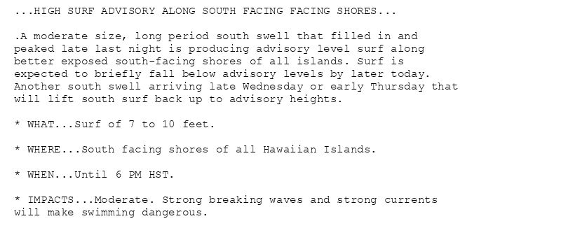
...HIGH SURF ADVISORY ALONG SOUTH FACING FACING SHORES...
.A moderate size, long period south swell that filled in and
peaked late last night is producing advisory level surf along
better exposed south-facing shores of all islands. Surf is
expected to briefly fall below advisory levels by later today.
Another south swell arriving late Wednesday or early Thursday that
will lift south surf back up to advisory heights.
* WHAT...Surf of 7 to 10 feet.
* WHERE...South facing shores of all Hawaiian Islands.
* WHEN...Until 6 PM HST.
* IMPACTS...Moderate. Strong breaking waves and strong currents
will make swimming dangerous.
High Surf Advisory issued August 5 at 3:25AM HST until August 5 at 6:00PM HST by NWS Honolulu HI
Additional Details Here.
05.08.2025 13:30 — 👍 0 🔁 0 💬 0 📌 0
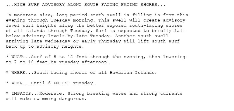
...HIGH SURF ADVISORY ALONG SOUTH FACING FACING SHORES...
.A moderate size, long period south swell is filling in from this
evening through Tuesday morning. This swell will create advisory
level surf heights along the better exposed south-facing shores
of all islands through Tuesday. Surf is expected to briefly fall
below advisory levels by late Tuesday. Another south swell
arriving late Wednesday or early Thursday will lift south surf
back up to advisory heights.
* WHAT...Surf of 8 to 12 feet through the evening, then lowering
to 7 to 10 feet by Tuesday afternoon.
* WHERE...South facing shores of all Hawaiian Islands.
* WHEN...Until 6 PM HST Tuesday.
* IMPACTS...Moderate. Strong breaking waves and strong currents
will make swimming dangerous.
High Surf Advisory issued August 4 at 9:30PM HST until August 5 at 6:00PM HST by NWS Honolulu HI
Additional Details Here.
05.08.2025 07:45 — 👍 0 🔁 0 💬 0 📌 0
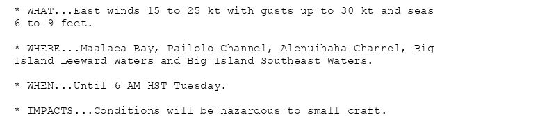
* WHAT...East winds 15 to 25 kt with gusts up to 30 kt and seas
6 to 9 feet.
* WHERE...Maalaea Bay, Pailolo Channel, Alenuihaha Channel, Big
Island Leeward Waters and Big Island Southeast Waters.
* WHEN...Until 6 AM HST Tuesday.
* IMPACTS...Conditions will be hazardous to small craft.
Small Craft Advisory issued August 4 at 3:10PM HST until August 5 at 6:00AM HST by NWS Honolulu HI
Additional Details Here.
05.08.2025 01:15 — 👍 2 🔁 1 💬 0 📌 0
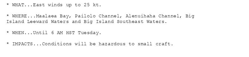
* WHAT...East winds up to 25 kt.
* WHERE...Maalaea Bay, Pailolo Channel, Alenuihaha Channel, Big
Island Leeward Waters and Big Island Southeast Waters.
* WHEN...Until 6 AM HST Tuesday.
* IMPACTS...Conditions will be hazardous to small craft.
Small Craft Advisory issued August 4 at 3:04AM HST until August 5 at 6:00AM HST by NWS Honolulu HI
Additional Details Here.
04.08.2025 13:15 — 👍 0 🔁 0 💬 0 📌 0
* WHAT...East winds up to 30 kt and seas up to 10 feet.
* WHERE...Maalaea Bay, Pailolo Channel, Alenuihaha Channel, Big
Island Leeward Waters and Big Island Southeast Waters.
* WHEN...Until 6 PM HST Monday.
* IMPACTS...Conditions will be hazardous to small craft.
Small Craft Advisory issued August 3 at 3:19PM HST until August 4 at 6:00PM HST by NWS Honolulu HI
Additional Details Here.
04.08.2025 01:30 — 👍 1 🔁 0 💬 0 📌 0
* WHAT...Northeast winds 20 to 30 mph with gusts up to 50 mph.
* WHERE...Portions of Lanai, Maui, Molokai, and the Big Island
Hawaii.
* WHEN...Until 6 PM HST this evening.
* IMPACTS...Winds this strong can tear off shingles, knock down tree
branches, blow away tents and awnings and make it difficult to
steer, especially for drivers of high profile vehicles.
Wind Advisory issued August 3 at 5:29AM HST until August 3 at 6:00PM HST by NWS Honolulu HI
Additional Details Here.
03.08.2025 15:45 — 👍 0 🔁 0 💬 0 📌 0
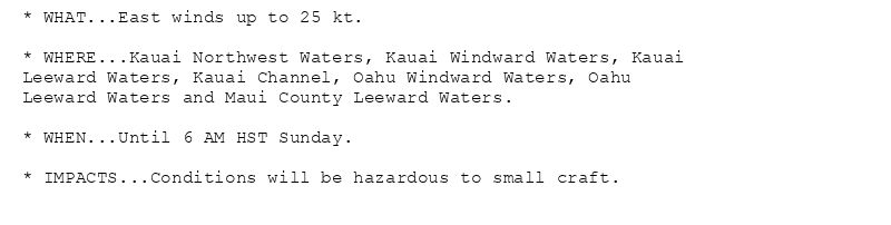
* WHAT...East winds up to 25 kt.
* WHERE...Kauai Northwest Waters, Kauai Windward Waters, Kauai
Leeward Waters, Kauai Channel, Oahu Windward Waters, Oahu
Leeward Waters, Kaiwi Channel, Maui County Windward Waters,
Maui County Leeward Waters and Big Island Windward Waters.
* WHEN...Until 6 PM HST this evening.
* IMPACTS...Conditions will be hazardous to small craft.
* WHAT...East winds up to 30 kt and seas up to 10 feet.
* WHERE...Maalaea Bay, Pailolo Channel, Alenuihaha Channel, Big
Island Leeward Waters and Big Island Southeast Waters.
* WHEN...Until 6 AM HST Monday.
* IMPACTS...Conditions will be hazardous to small craft.
Small Craft Advisory issued August 3 at 5:28AM HST until August 3 at 6:00PM HST by NWS Honolulu HI
Additional Details Here.
03.08.2025 15:30 — 👍 0 🔁 0 💬 0 📌 0
...A RED FLAG WARNING REMAINS IN EFFECT THROUGH THIS AFTERNOON
FOR GUSTY WINDS AND LOW HUMIDITIES...
.Dry and locally windy trade winds will produce critical fire
weather conditions through this afternoon. Winds will be
strongest over and downwind of higher terrain...especially this
afternoon. While winds will begin a slowly decline later today,
critical fire weather conditions are expected as dry weather
persists over leeward areas.
* AFFECTED AREA...Leeward areas of the Hawaiian Islands and
interior sections of Big Island.
* TIMING...Until 6 PM HST this evening.
* WINDS...East 15 to 25 mph with gusts up to 40 mph.
* RELATIVE HUMIDITY...Lower 40s to near 50 percent.
* IMPACTS...A combination of strong winds, low relative humidity,
and dry fuels can contribute to extreme fire behavior. Any fires
that develop will rapidly spread. A Red Flag Warning does not
predict the commencement of new fires.
🚨 Red Flag Warning issued August 3 at 3:18AM HST until August 3 at 6:00PM HST by NWS Honolulu HI 🚨
Additional Details Here.
03.08.2025 13:30 — 👍 0 🔁 0 💬 0 📌 0
* WHAT...Northeast winds 20 to 30 mph with gusts up to 50 mph.
* WHERE...Portions of Lanai, Maui, Molokai, and the Big Island
Hawaii.
* WHEN...Until 6 PM HST this evening.
* IMPACTS...Winds this strong can knock down tree branches, blow
away tents and awnings and make it difficult to steer, especially
for drivers of high profile vehicles.
* WHAT...Northeast winds 20 to 30 mph with gusts up to 50 mph.
* WHERE...Koolau Leeward.
* WHEN...Until 6 AM HST early this morning.
* IMPACTS...Winds this strong can tear off shingles, knock down tree
branches, blow away tents and awnings and make it difficult to
steer, especially for drivers of high profile vehicles.
Wind Advisory issued August 3 at 2:33AM HST until August 3 at 6:00PM HST by NWS Honolulu HI
Additional Details Here.
03.08.2025 12:45 — 👍 0 🔁 0 💬 0 📌 0
* WHAT...Northeast winds 30 to 40 mph with gusts up to 55 mph.
* WHERE...Koolau Leeward.
* WHEN...Until 6 AM HST Sunday.
* IMPACTS...Winds this strong can tear off shingles, knock down tree
branches, blow away tents and awnings and make it difficult to
steer, especially for drivers of high profile vehicles.

* WHAT...Northeast winds 30 to 40 mph with gusts up to 55 mph.
* WHERE...Portions of Lanai, Maui, Molokai, and the Big Island
Hawaii.
* WHEN...Until 6 AM HST Sunday.
* IMPACTS...Winds this strong can tear off shingles, knock down tree
branches, blow away tents and awnings and make it difficult to
steer, especially for drivers of high profile vehicles.
Wind Advisory issued August 2 at 8:57PM HST until August 3 at 6:00AM HST by NWS Honolulu HI
Additional Details Here.
03.08.2025 07:00 — 👍 0 🔁 0 💬 0 📌 0
* WHAT...East winds up to 25 kt.
* WHERE...Kauai Northwest Waters, Kauai Windward Waters, Kauai
Leeward Waters, Kauai Channel, Oahu Windward Waters, Oahu
Leeward Waters and Maui County Leeward Waters.
* WHEN...Until 6 AM HST Sunday.
* IMPACTS...Conditions will be hazardous to small craft.
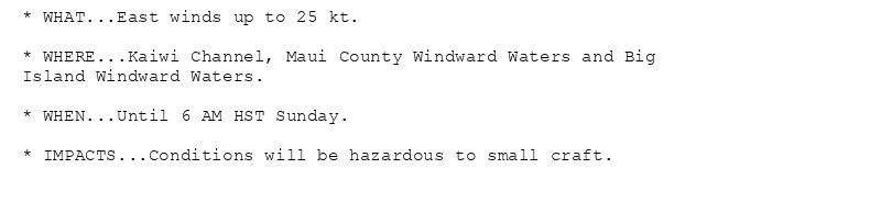
* WHAT...East winds up to 25 kt.
* WHERE...Kaiwi Channel, Maui County Windward Waters and Big
Island Windward Waters.
* WHEN...Until 6 AM HST Sunday.
* IMPACTS...Conditions will be hazardous to small craft.
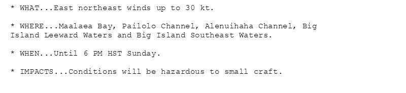
* WHAT...East northeast winds up to 30 kt.
* WHERE...Maalaea Bay, Pailolo Channel, Alenuihaha Channel, Big
Island Leeward Waters and Big Island Southeast Waters.
* WHEN...Until 6 PM HST Sunday.
* IMPACTS...Conditions will be hazardous to small craft.
Small Craft Advisory issued August 2 at 3:42PM HST until August 3 at 6:00AM HST by NWS Honolulu HI
Additional Details Here.
03.08.2025 01:45 — 👍 2 🔁 0 💬 0 📌 0
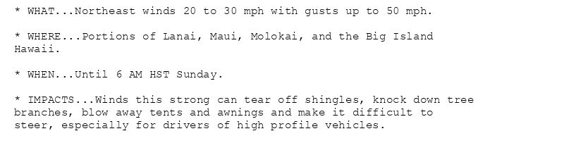
* WHAT...Northeast winds 20 to 30 mph with gusts up to 50 mph.
* WHERE...Portions of Lanai, Maui, Molokai, and the Big Island
Hawaii.
* WHEN...Until 6 AM HST Sunday.
* IMPACTS...Winds this strong can tear off shingles, knock down tree
branches, blow away tents and awnings and make it difficult to
steer, especially for drivers of high profile vehicles.
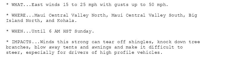
* WHAT...East winds 15 to 25 mph with gusts up to 50 mph.
* WHERE...Maui Central Valley North, Maui Central Valley South, Big
Island North, and Kohala.
* WHEN...Until 6 AM HST Sunday.
* IMPACTS...Winds this strong can tear off shingles, knock down tree
branches, blow away tents and awnings and make it difficult to
steer, especially for drivers of high profile vehicles.
Wind Advisory issued August 2 at 3:21PM HST until August 3 at 6:00AM HST by NWS Honolulu HI
Additional Details Here.
03.08.2025 01:30 — 👍 1 🔁 1 💬 0 📌 0
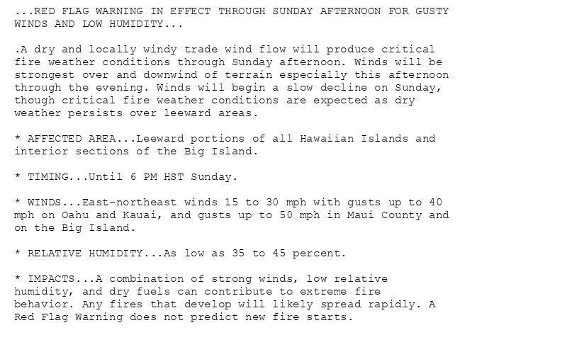
...RED FLAG WARNING IN EFFECT THROUGH SUNDAY AFTERNOON FOR GUSTY
WINDS AND LOW HUMIDITY...
.A dry and locally windy trade wind flow will produce critical
fire weather conditions through Sunday afternoon. Winds will be
strongest over and downwind of terrain especially this afternoon
through the evening. Winds will begin a slow decline on Sunday,
though critical fire weather conditions are expected as dry
weather persists over leeward areas.
* AFFECTED AREA...Leeward portions of all Hawaiian Islands and
interior sections of the Big Island.
* TIMING...Until 6 PM HST Sunday.
* WINDS...East-northeast winds 15 to 30 mph with gusts up to 40
mph on Oahu and Kauai, and gusts up to 50 mph in Maui County and
on the Big Island.
* RELATIVE HUMIDITY...As low as 35 to 45 percent.
* IMPACTS...A combination of strong winds, low relative
humidity, and dry fuels can contribute to extreme fire
behavior. Any fires that develop will likely spread rapidly. A
Red Flag Warning does not predict new fire starts.
🚨 Red Flag Warning issued August 2 at 3:02PM HST until August 3 at 6:00PM HST by NWS Honolulu HI 🚨
Additional Details Here.
03.08.2025 01:15 — 👍 0 🔁 0 💬 0 📌 0