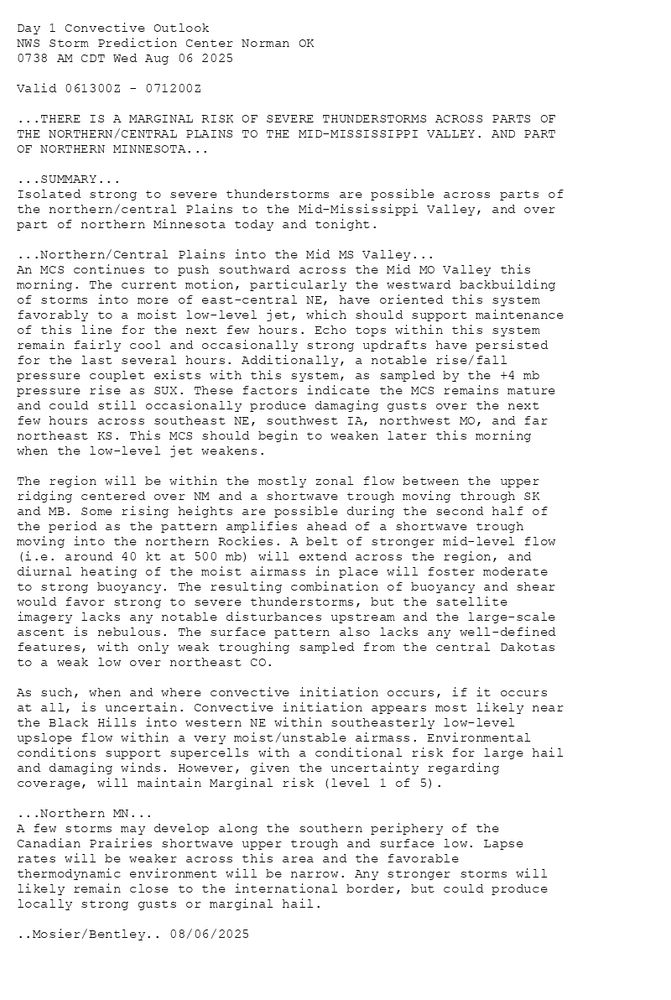
Day 1 Convective Outlook
NWS Storm Prediction Center Norman OK
0738 AM CDT Wed Aug 06 2025
Valid 061300Z - 071200Z
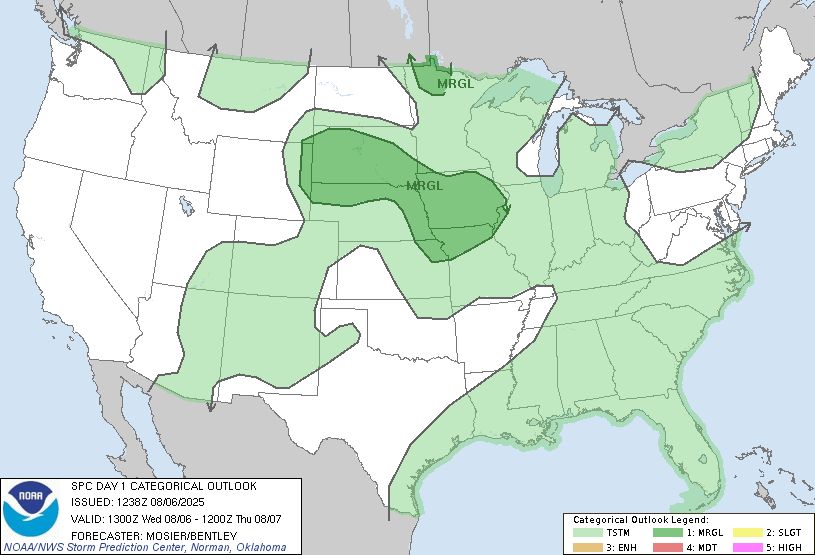
...THERE IS A MARGINAL RISK OF SEVERE THUNDERSTORMS ACROSS PARTS OF
THE NORTHERN/CENTRAL PLAINS TO THE MID-MISSISSIPPI VALLEY. AND PART
OF NORTHERN MINNESOTA...
...SUMMARY...
Isolated strong to severe thunderstorms are possible across parts of
the northern/central Plains to the Mid-Mississippi Valley, and over
part of northern Minnesota today and tonight.
...Northern/Central Plains into the Mid MS Valley...
An MCS continues to push southward across the Mid MO Valley this
morning. The current motion, particularly the westward backbuilding
of storms into more of east-central NE, have oriented this system
favorably to a moist low-level jet, which should support maintenance
of this line for the next few hours. Echo tops within this system
remain fairly cool and occasionally strong updrafts have persisted
for the last several hours. Additionally, a notable rise/fall
pressure couplet exists with this system, as sampled by the +4 mb
pressure rise as SUX. These factors indicate the MCS remains mature
and could still occasionally produce damaging gusts over the next
few hours across southeast NE, southwest IA, northwest MO, and far
northeast KS. This MCS should begin to weaken later this morning
when the low-level jet weakens.
The region will be within the mostly zonal flow between the upper
ridging centered over NM and a shortwave trough moving through SK
and MB. Some rising heights are possible during the second half of
the period as the pattern amplifies ahead of a shortwave trough
moving into the northern Rockies. A belt of stronger mid-level flow
(i.e. around 40 kt at 500 mb) will extend across the region, and
diurnal heating of the moist airmass in place will foster moderate
to strong buoyancy. The resulting combination of buoyancy and shear
would favor strong to severe thunderstorms, but the satellite
imagery lacks any notable disturbances upstream and the large-scale
ascent is nebulous. The surface pattern also lacks any well-defined
features, with only weak troughing sampled from the central Dakotas
to a weak low over northeast CO.
As such, when and where convective initiation occurs, if it occurs
at all, is uncertain. Convective initiation appears most likely near
the Black Hills into western NE within southeasterly low-level
upslope flow within a very moist/unstable airmass. Environmental
conditions support supercells with a conditional risk for large hail
and damaging winds. However, given the uncertainty regarding
coverage, will maintain Marginal risk (level 1 of 5).
...Northern MN...
A few storms may develop along the southern periphery of the
Canadian Prairies shortwave upper trough and surface low. Lapse
rates will be weaker across this area and the favorable
thermodynamic environment will be narrow. Any stronger storms will
likely remain close to the international border, but could produce
locally strong gusts or marginal hail.
..Mosier/Bentley.. 08/06/2025
Day 1 Outlook Image
SPC Aug 6, 2025 1300 UTC Day 1 Convective Outlook
⛈️THERE IS A MARGINAL RISK OF SEVERE THUNDERSTORMS ACROSS PARTS OF
THE NORTHERN/CENTRAL PLAINS TO THE MID-MISSISSIPPI VALLEY. AND PART
OF NORTHERN MINNESOTA🌪️
Additional Details Here.
06.08.2025 13:00 — 👍 0 🔁 0 💬 0 📌 0
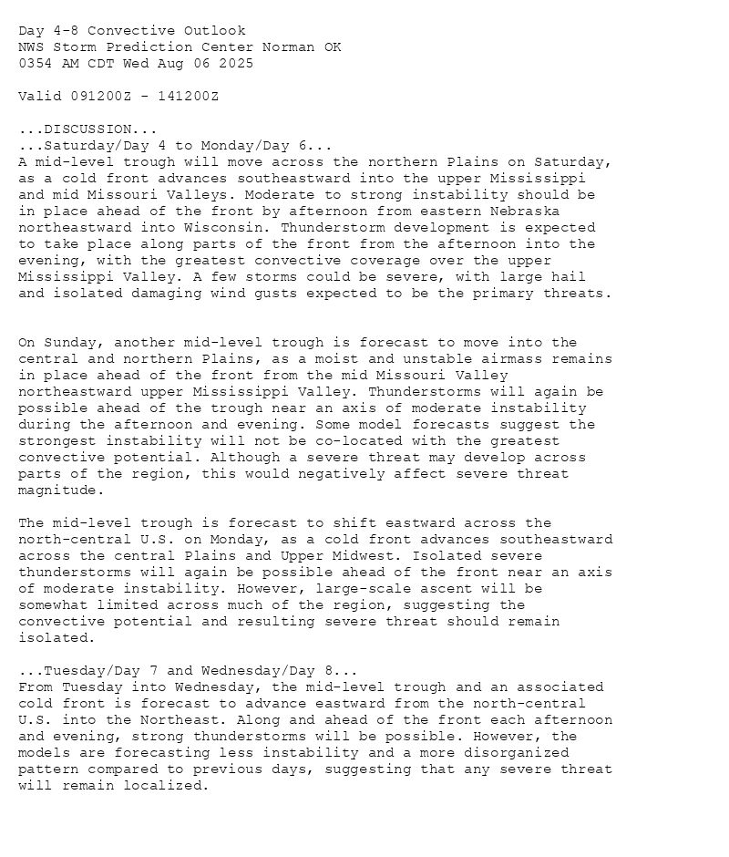
Day 4-8 Convective Outlook
NWS Storm Prediction Center Norman OK
0354 AM CDT Wed Aug 06 2025
Valid 091200Z - 141200Z
...DISCUSSION...
...Saturday/Day 4 to Monday/Day 6...
A mid-level trough will move across the northern Plains on Saturday,
as a cold front advances southeastward into the upper Mississippi
and mid Missouri Valleys. Moderate to strong instability should be
in place ahead of the front by afternoon from eastern Nebraska
northeastward into Wisconsin. Thunderstorm development is expected
to take place along parts of the front from the afternoon into the
evening, with the greatest convective coverage over the upper
Mississippi Valley. A few storms could be severe, with large hail
and isolated damaging wind gusts expected to be the primary threats.
On Sunday, another mid-level trough is forecast to move into the
central and northern Plains, as a moist and unstable airmass remains
in place ahead of the front from the mid Missouri Valley
northeastward upper Mississippi Valley. Thunderstorms will again be
possible ahead of the trough near an axis of moderate instability
during the afternoon and evening. Some model forecasts suggest the
strongest instability will not be co-located with the greatest
convective potential. Although a severe threat may develop across
parts of the region, this would negatively affect severe threat
magnitude.
The mid-level trough is forecast to shift eastward across the
north-central U.S. on Monday, as a cold front advances southeastward
across the central Plains and Upper Midwest. Isolated severe
thunderstorms will again be possible ahead of the front near an axis
of moderate instability. However, large-scale ascent will be
somewhat limited across much of the region, suggesting the
convective potential and resulting severe threat should remain
isolated.
...Tuesday/Day 7 and Wednesday/Day 8...
From Tuesday into Wednesday, the mid-level trough and an associated
cold front is forecast to advance eastward from the north-central
U.S. into the Northeast. Along and ahead of the front each afternoon
and evening, strong thunderstorms will be possible. However, the
models are forecasting less instability and a more disorganized
pattern compared to previous days, suggesting that any severe threat
will remain localized.
Day 4-8 Outlook Image
SPC Aug 6, 2025 Day 4-8 Severe Weather Outlook
⛈️DISCUSSION🌪️
Additional Details Here.
06.08.2025 09:00 — 👍 1 🔁 1 💬 0 📌 0
Day 3 Convective Outlook
NWS Storm Prediction Center Norman OK
0230 AM CDT Wed Aug 06 2025
Valid 081200Z - 091200Z
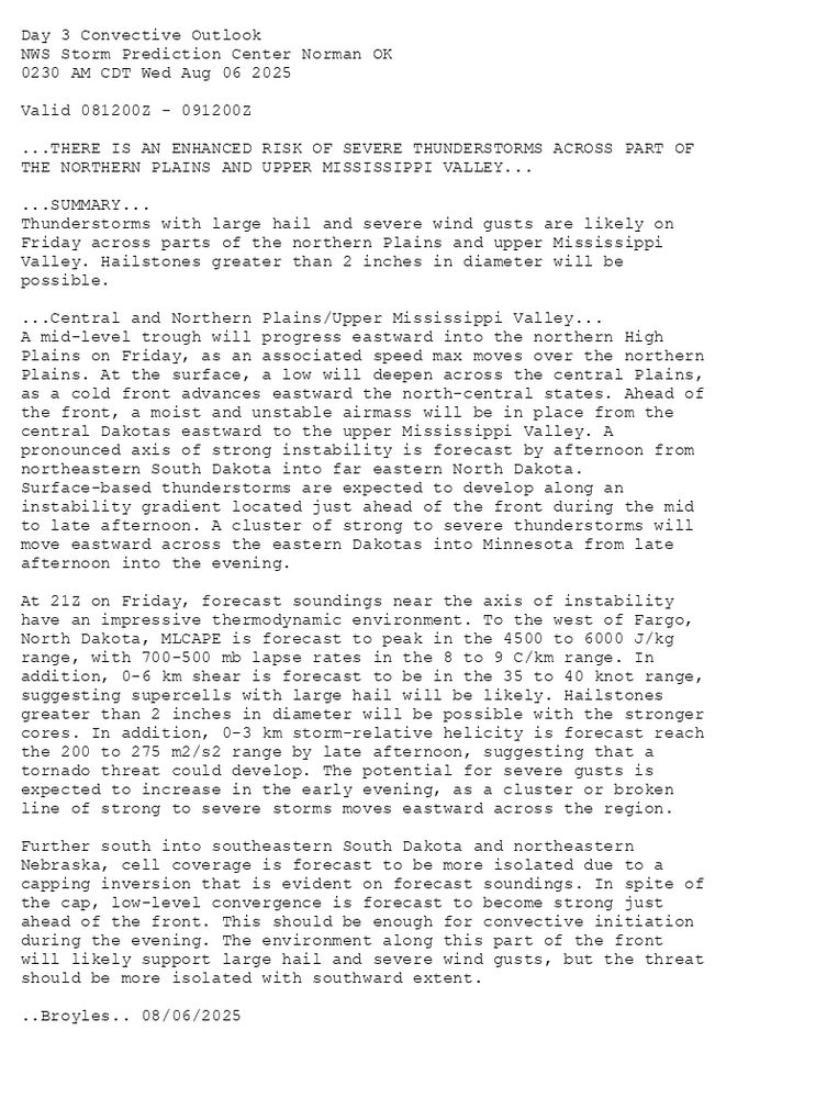
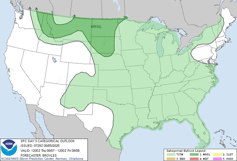
...THERE IS AN ENHANCED RISK OF SEVERE THUNDERSTORMS ACROSS PART OF
THE NORTHERN PLAINS AND UPPER MISSISSIPPI VALLEY...
...SUMMARY...
Thunderstorms with large hail and severe wind gusts are likely on
Friday across parts of the northern Plains and upper Mississippi
Valley. Hailstones greater than 2 inches in diameter will be
possible.
...Central and Northern Plains/Upper Mississippi Valley...
A mid-level trough will progress eastward into the northern High
Plains on Friday, as an associated speed max moves over the northern
Plains. At the surface, a low will deepen across the central Plains,
as a cold front advances eastward the north-central states. Ahead of
the front, a moist and unstable airmass will be in place from the
central Dakotas eastward to the upper Mississippi Valley. A
pronounced axis of strong instability is forecast by afternoon from
northeastern South Dakota into far eastern North Dakota.
Surface-based thunderstorms are expected to develop along an
instability gradient located just ahead of the front during the mid
to late afternoon. A cluster of strong to severe thunderstorms will
move eastward across the eastern Dakotas into Minnesota from late
afternoon into the evening.
At 21Z on Friday, forecast soundings near the axis of instability
have an impressive thermodynamic environment. To the west of Fargo,
North Dakota, MLCAPE is forecast to peak in the 4500 to 6000 J/kg
range, with 700-500 mb lapse rates in the 8 to 9 C/km range. In
addition, 0-6 km shear is forecast to be in the 35 to 40 knot range,
suggesting supercells with large hail will be likely. Hailstones
greater than 2 inches in diameter will be possible with the stronger
cores. In addition, 0-3 km storm-relative helicity is forecast reach
the 200 to 275 m2/s2 range by late afternoon, suggesting that a
tornado threat could develop. The potential for severe gusts is
expected to increase in the early evening, as a cluster or broken
line of strong to severe storms moves eastward across the region.
Further south into southeastern South Dakota and northeastern
Nebraska, cell coverage is forecast to be more isolated due to a
capping inversion that is evident on forecast soundings. In spite of
the cap, low-level convergence is forecast to become strong just
ahead of the front. This should be enough for convective initiation
during the evening. The environment along this part of the front
will likely support large hail and severe wind gusts, but the threat
should be more isolated with southward extent.
..Broyles.. 08/06/2025
Day 3 Outlook Image
SPC Aug 6, 2025 0730 UTC Day 3 Severe Thunderstorm Outlook
⛈️THERE IS AN ENHANCED RISK OF SEVERE THUNDERSTORMS ACROSS PART OF
THE NORTHERN PLAINS AND UPPER MISSISSIPPI VALLEY🌪️
Additional Details Here.
06.08.2025 07:40 — 👍 4 🔁 1 💬 0 📌 1
Day 2 Convective Outlook
NWS Storm Prediction Center Norman OK
0101 AM CDT Wed Aug 06 2025
Valid 071200Z - 081200Z
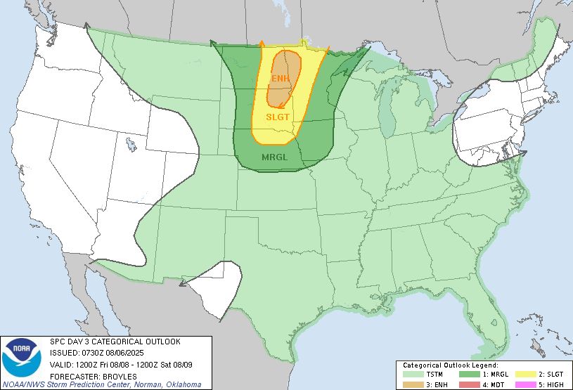
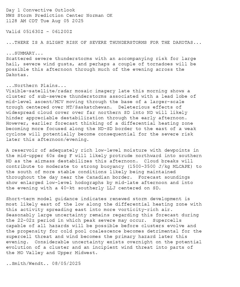
...THERE IS A SLIGHT RISK OF SEVERE THUNDERSTORMS ACROSS PARTS OF
THE NORTHERN PLAINS...
...SUMMARY...
Scattered severe thunderstorms are possible Thursday afternoon and
evening across the northern Plains. Isolated very large hail and
severe gusts will be the primary threats.
...Northern Plains...
A mid-level shortwave ridge will move eastward across the northern
Plains on Thursday, as southwesterly flow becomes established across
the northern High Plains. At the surface, a low will deepen in
western South Dakota, as a cold front moves southward across western
North Dakota. To the southeast of the front, a moist and unstable
airmass will be in place across most of the northern Plains. Surface
dewpoints across this airmass should be from the mid 60s to the
lower 70s F. Ahead of the front and near the surface low, an axis of
strong instability is forecast to develop over the western Dakotas
by afternoon. Isolated convective initiation will likely take place
near the instability axis and front in the afternoon. Surface-based
thunderstorms are expected to develop and move eastward across the
northern Plains during the late afternoon and evening. A severe
threat appears likely.
Forecast soundings near the instability axis at 21Z are impressive,
with MLCAPE near 5000 J/kg, 0-6 km shear around 40 knots, and
700-500 mb lapse rates near 8.5 C/km. This environment will be
favorable for supercells with large hail. Hailstones greater than 2
inches in diameter will be possible with the more intense cores. A
potential for severe gusts will also exist, with a greater threat in
the evening if cells can congeal into a short line segment. An
isolated tornado threat could also develop. Any severe threat is
expected to persist into the mid to late evening.
Further to the east-southeastward into Minnesota, and southward into
South Dakota, large-scale ascent is forecast to be weak. For this
reason, convective coverage is forecast to be limited. However,
isolated convection could initiate along zones of low-level
convergence and maximized surface heating. Any cell that could
develop and persist, could obtain an isolated threat for hail and
severe gusts.
...Montana...
A mid-level trough will move eastward across the northern Rockies on
Thursday, as the exit region of an associated jet max moves into the
northern High Plains. The western edge of a moist and unstable
airmass will likely be in place across parts of central Montana,
where model forecast suggest MLCAPE could reach the 1200 to 2500
J/kg range. Convective initiation is expected in the higher terrain
of west-central Montana, and this activity will move eastward into
the stronger instability during the evening. Additional storms
appear likely to develop in northeastern Montana during the mid to
late evening, within an upslope flow regime. In addition to the
instability, moderate to strong deep-layer shear will be in place
over the northern High Plains, mainly due to influence of the
mid-level jet. This environment should be favorable for severe
storms, with large hail and severe gusts possible in the late
afternoon and evening.
..Broyles.. 08/06/2025
Day 2 Outlook Image
SPC Aug 6, 2025 0600 UTC Day 2 Convective Outlook
⛈️THERE IS A SLIGHT RISK OF SEVERE THUNDERSTORMS ACROSS PARTS OF
THE NORTHERN PLAINS🌪️
Additional Details Here.
06.08.2025 06:40 — 👍 1 🔁 0 💬 0 📌 0
Day 1 Convective Outlook
NWS Storm Prediction Center Norman OK
1213 AM CDT Wed Aug 06 2025
Valid 061200Z - 071200Z
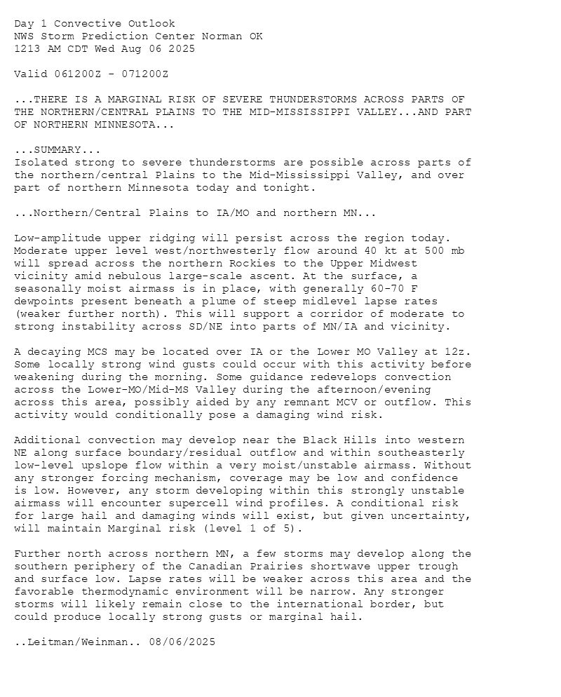
...THERE IS A MARGINAL RISK OF SEVERE THUNDERSTORMS ACROSS PARTS OF
THE NORTHERN/CENTRAL PLAINS TO THE MID-MISSISSIPPI VALLEY...AND PART
OF NORTHERN MINNESOTA...
...SUMMARY...
Isolated strong to severe thunderstorms are possible across parts of
the northern/central Plains to the Mid-Mississippi Valley, and over
part of northern Minnesota today and tonight.
...Northern/Central Plains to IA/MO and northern MN...
Low-amplitude upper ridging will persist across the region today.
Moderate upper level west/northwesterly flow around 40 kt at 500 mb
will spread across the northern Rockies to the Upper Midwest
vicinity amid nebulous large-scale ascent. At the surface, a
seasonally moist airmass is in place, with generally 60-70 F
dewpoints present beneath a plume of steep midlevel lapse rates
(weaker further north). This will support a corridor of moderate to
strong instability across SD/NE into parts of MN/IA and vicinity.
A decaying MCS may be located over IA or the Lower MO Valley at 12z.
Some locally strong wind gusts could occur with this activity before
weakening during the morning. Some guidance redevelops convection
across the Lower-MO/Mid-MS Valley during the afternoon/evening
across this area, possibly aided by any remnant MCV or outflow. This
activity would conditionally pose a damaging wind risk.
Additional convection may develop near the Black Hills into western
NE along surface boundary/residual outflow and within southeasterly
low-level upslope flow within a very moist/unstable airmass. Without
any stronger forcing mechanism, coverage may be low and confidence
is low. However, any storm developing within this strongly unstable
airmass will encounter supercell wind profiles. A conditional risk
for large hail and damaging winds will exist, but given uncertainty,
will maintain Marginal risk (level 1 of 5).
Further north across northern MN, a few storms may develop along the
southern periphery of the Canadian Prairies shortwave upper trough
and surface low. Lapse rates will be weaker across this area and the
favorable thermodynamic environment will be narrow. Any stronger
storms will likely remain close to the international border, but
could produce locally strong gusts or marginal hail.
..Leitman/Weinman.. 08/06/2025

Day 1 Outlook Image
SPC Aug 6, 2025 0600 UTC Day 1 Convective Outlook
⛈️THERE IS A MARGINAL RISK OF SEVERE THUNDERSTORMS ACROSS PARTS OF
THE NORTHERN/CENTRAL PLAINS TO THE MID-MISSISSIPPI VALLEY🌪️
Additional Details Here.
06.08.2025 06:40 — 👍 1 🔁 0 💬 0 📌 0
STATUS REPORT ON WW 574
SEVERE WEATHER THREAT CONTINUES RIGHT OF A LINE FROM 45 NNE PHP
TO 40 ENE MBG TO 45 WNW ABR TO 50 NE ABR.
..JEWELL..08/06/25
ATTN...WFO...BIS...ABR...UNR...
STATUS REPORT FOR WT 574
SEVERE WEATHER THREAT CONTINUES FOR THE FOLLOWING AREAS
SDC013-025-029-037-039-045-049-051-057-059-065-069-089-091-107-
109-115-117-119-129-060240-
SD
. SOUTH DAKOTA COUNTIES INCLUDED ARE
BROWN CLARK CODINGTON
DAY DEUEL EDMUNDS
FAULK GRANT HAMLIN
HAND HUGHES HYDE
MCPHERSON MARSHALL POTTER
ROBERTS SPINK STANLEY
SULLY WALWORTH
THE WATCH STATUS MESSAGE IS FOR GUIDANCE PURPOSES ONLY. PLEASE
REFER TO WATCH COUNTY NOTIFICATION STATEMENTS FOR OFFICIAL
INFORMATION ON COUNTIES...INDEPENDENT CITIES AND MARINE ZONES
CLEARED FROM SEVERE THUNDERSTORM AND TORNADO WATCHES.
WW 0574 Status Image
SPC Tornado Watch 574 Status Reports
⛈️WFO...BIS🌪️
Additional Details Here.
06.08.2025 02:00 — 👍 2 🔁 1 💬 0 📌 0
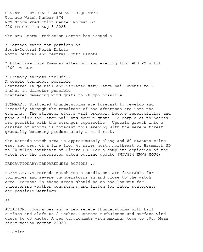
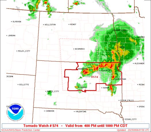
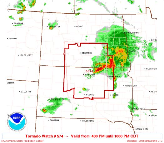
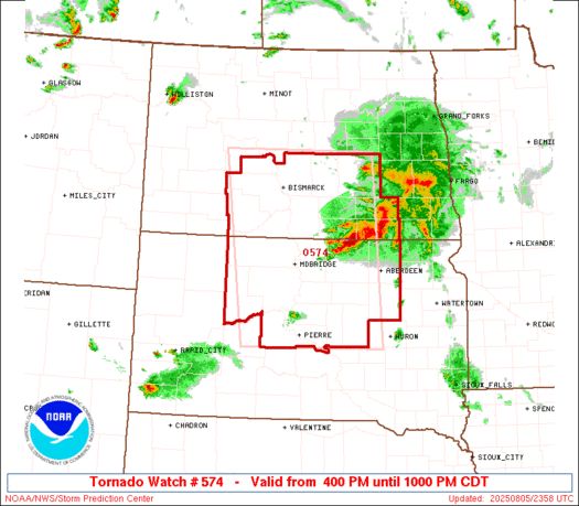
URGENT - IMMEDIATE BROADCAST REQUESTED
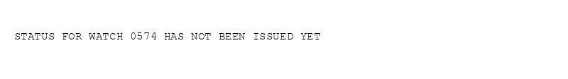
Tornado Watch Number 574
NWS Storm Prediction Center Norman OK
400 PM CDT Tue Aug 5 2025
The NWS Storm Prediction Center has issued a
* Tornado Watch for portions of
South-Central North Dakota
North-Central and Central South Dakota
* Effective this Tuesday afternoon and evening from 400 PM until
1000 PM CDT.
* Primary threats include...
A couple tornadoes possible
Scattered large hail and isolated very large hail events to 2
inches in diameter possible
Scattered damaging wind gusts to 70 mph possible
SUMMARY...Scattered thunderstorms are forecast to develop and
intensify through the remainder of the afternoon and into the
evening. The stronger storms will probably become supercellular and
pose a risk for large hail and severe gusts. A couple of tornadoes
are possible with the stronger supercells. Upscale growth into a
cluster of storms is forecast this evening with the severe threat
gradually becoming predominately a wind risk.
The tornado watch area is approximately along and 80 statute miles
east and west of a line from 45 miles north northeast of Bismarck ND
to 20 miles southeast of Pierre SD. For a complete depiction of the
watch see the associated watch outline update (WOUS64 KWNS WOU4).
PRECAUTIONARY/PREPAREDNESS ACTIONS...
REMEMBER...A Tornado Watch means conditions are favorable for
tornadoes and severe thunderstorms in and close to the watch
area. Persons in these areas should be on the lookout for
threatening weather conditions and listen for later statements
and possible warnings.
&&
AVIATION...Tornadoes and a few severe thunderstorms with hail
surface and aloft to 2 inches. Extreme turbulence and surface wind
gusts to 60 knots. A few cumulonimbi with maximum tops to 500. Mean
storm motion vector 24020.
...Smith
WW 0574 Image
SPC Tornado Watch 574
⛈️
A couple tornadoes possible
Scattered large hail and isolated very large hail events to 2
inches in diameter possible
Scattered damaging wind gusts to 70 mph possible
SUMMARY🌪️
Additional Details Here.
06.08.2025 02:00 — 👍 2 🔁 1 💬 0 📌 0
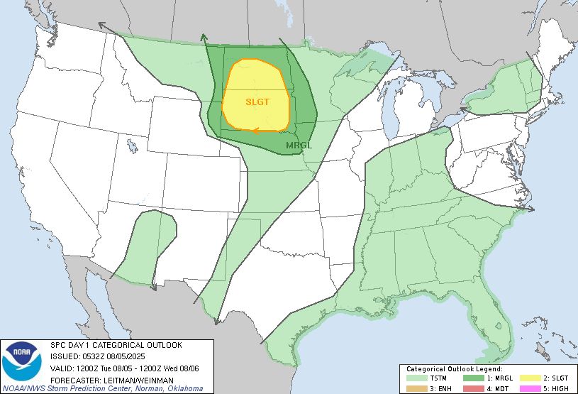
Day 1 Convective Outlook
NWS Storm Prediction Center Norman OK
0745 PM CDT Tue Aug 05 2025
Valid 060100Z - 061200Z
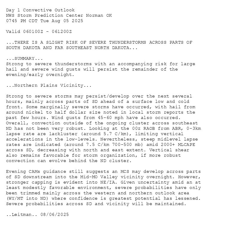
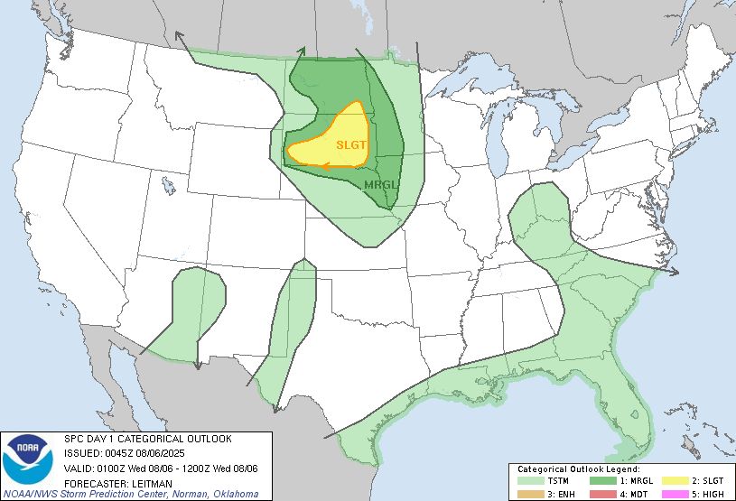
...THERE IS A SLIGHT RISK OF SEVERE THUNDERSTORMS ACROSS PARTS OF
SOUTH DAKOTA AND FAR SOUTHEAST NORTH DAKOTA...
...SUMMARY...
Strong to severe thunderstorms with an accompanying risk for large
hail and severe wind gusts will persist the remainder of the
evening/early overnight.
...Northern Plains Vicinity...
Strong to severe storms may persist/develop over the next several
hours, mainly across parts of SD ahead of a surface low and cold
front. Some marginally severe storms have occurred, with hail from
around nickel to half dollar size noted in local storm reports the
past few hours. Wind gusts from 45-60 mph have also occurred.
Overall, convection outside of the ongoing cluster across southeast
ND has not been very robust. Looking at the 00z RAOB from ABR, 0-3km
lapse rate are lackluster (around 5.7 C/km), limiting vertical
accelerations in the low-levels. Nevertheless, steep midlevel lapse
rates are indicated (around 7.5 C/km 700-500 mb) amid 2000+ MLCAPE
across SD, decreasing with north and east extent. Vertical shear
also remains favorable for storm organization, if more robust
convection can evolve behind the ND cluster.
Evening CAMs guidance still suggests an MCS may develop across parts
of SD downstream into the Mid-MO Valley vicinity overnight. However,
stronger capping is evident into NE/IA. Given uncertainty amid an at
least modestly favorable environment, severe probabilities have only
been trimmed mainly across the western and northern outlook area
(WY/MT into ND) where confidence is greatest potential has lessened.
Severe probabilities across SD and vicinity will be maintained.
..Leitman.. 08/06/2025
Day 1 Outlook Image
SPC Aug 6, 2025 0100 UTC Day 1 Convective Outlook
⛈️THERE IS A SLIGHT RISK OF SEVERE THUNDERSTORMS ACROSS PARTS OF
SOUTH DAKOTA AND FAR SOUTHEAST NORTH DAKOTA🌪️
Additional Details Here.
06.08.2025 01:00 — 👍 2 🔁 1 💬 0 📌 0
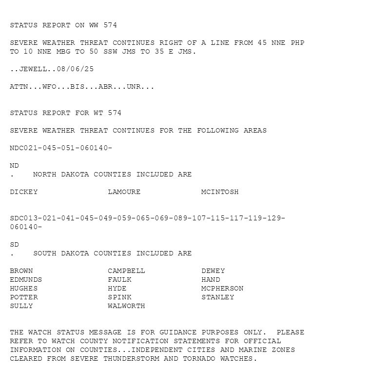
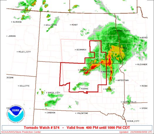
STATUS REPORT ON WW 574
SEVERE WEATHER THREAT CONTINUES RIGHT OF A LINE FROM 45 NNE PHP
TO 10 NNE MBG TO 50 SSW JMS TO 35 E JMS.
..JEWELL..08/06/25
ATTN...WFO...BIS...ABR...UNR...
STATUS REPORT FOR WT 574
SEVERE WEATHER THREAT CONTINUES FOR THE FOLLOWING AREAS
NDC021-045-051-060140-
ND
. NORTH DAKOTA COUNTIES INCLUDED ARE
DICKEY LAMOURE MCINTOSH
SDC013-021-041-045-049-059-065-069-089-107-115-117-119-129-
060140-
SD
. SOUTH DAKOTA COUNTIES INCLUDED ARE
BROWN CAMPBELL DEWEY
EDMUNDS FAULK HAND
HUGHES HYDE MCPHERSON
POTTER SPINK STANLEY
SULLY WALWORTH
THE WATCH STATUS MESSAGE IS FOR GUIDANCE PURPOSES ONLY. PLEASE
REFER TO WATCH COUNTY NOTIFICATION STATEMENTS FOR OFFICIAL
INFORMATION ON COUNTIES...INDEPENDENT CITIES AND MARINE ZONES
CLEARED FROM SEVERE THUNDERSTORM AND TORNADO WATCHES.
WW 0574 Status Image
SPC Tornado Watch 574 Status Reports
⛈️WFO...BIS🌪️
Additional Details Here.
06.08.2025 01:00 — 👍 2 🔁 1 💬 0 📌 0
URGENT - IMMEDIATE BROADCAST REQUESTED
Tornado Watch Number 574
NWS Storm Prediction Center Norman OK
400 PM CDT Tue Aug 5 2025
The NWS Storm Prediction Center has issued a
* Tornado Watch for portions of
South-Central North Dakota
North-Central and Central South Dakota
* Effective this Tuesday afternoon and evening from 400 PM until
1000 PM CDT.
* Primary threats include...
A couple tornadoes possible
Scattered large hail and isolated very large hail events to 2
inches in diameter possible
Scattered damaging wind gusts to 70 mph possible
SUMMARY...Scattered thunderstorms are forecast to develop and
intensify through the remainder of the afternoon and into the
evening. The stronger storms will probably become supercellular and
pose a risk for large hail and severe gusts. A couple of tornadoes
are possible with the stronger supercells. Upscale growth into a
cluster of storms is forecast this evening with the severe threat
gradually becoming predominately a wind risk.
The tornado watch area is approximately along and 80 statute miles
east and west of a line from 45 miles north northeast of Bismarck ND
to 20 miles southeast of Pierre SD. For a complete depiction of the
watch see the associated watch outline update (WOUS64 KWNS WOU4).
PRECAUTIONARY/PREPAREDNESS ACTIONS...
REMEMBER...A Tornado Watch means conditions are favorable for
tornadoes and severe thunderstorms in and close to the watch
area. Persons in these areas should be on the lookout for
threatening weather conditions and listen for later statements
and possible warnings.
&&
AVIATION...Tornadoes and a few severe thunderstorms with hail
surface and aloft to 2 inches. Extreme turbulence and surface wind
gusts to 60 knots. A few cumulonimbi with maximum tops to 500. Mean
storm motion vector 24020.
...Smith
WW 0574 Image
SPC Tornado Watch 574
⛈️
A couple tornadoes possible
Scattered large hail and isolated very large hail events to 2
inches in diameter possible
Scattered damaging wind gusts to 70 mph possible
SUMMARY🌪️
Additional Details Here.
06.08.2025 01:00 — 👍 2 🔁 1 💬 0 📌 0
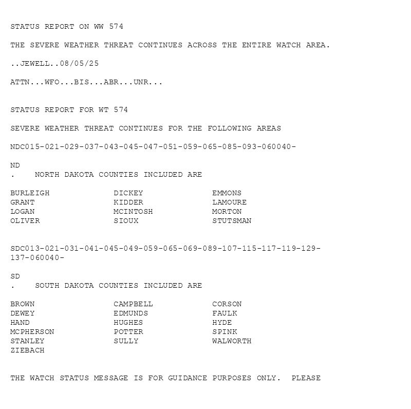
STATUS REPORT ON WW 574
THE SEVERE WEATHER THREAT CONTINUES ACROSS THE ENTIRE WATCH AREA.
..JEWELL..08/05/25
ATTN...WFO...BIS...ABR...UNR...
STATUS REPORT FOR WT 574
SEVERE WEATHER THREAT CONTINUES FOR THE FOLLOWING AREAS
NDC015-021-029-037-043-045-047-051-059-065-085-093-060040-
ND
. NORTH DAKOTA COUNTIES INCLUDED ARE
BURLEIGH DICKEY EMMONS
GRANT KIDDER LAMOURE
LOGAN MCINTOSH MORTON
OLIVER SIOUX STUTSMAN
SDC013-021-031-041-045-049-059-065-069-089-107-115-117-119-129-
137-060040-
SD
. SOUTH DAKOTA COUNTIES INCLUDED ARE
BROWN CAMPBELL CORSON
DEWEY EDMUNDS FAULK
HAND HUGHES HYDE
MCPHERSON POTTER SPINK
STANLEY SULLY WALWORTH
ZIEBACH
THE WATCH STATUS MESSAGE IS FOR GUIDANCE PURPOSES ONLY. PLEASE
WW 0574 Status Image
SPC Tornado Watch 574 Status Reports
⛈️WFO...BIS🌪️
Additional Details Here.
06.08.2025 00:20 — 👍 2 🔁 1 💬 0 📌 0
URGENT - IMMEDIATE BROADCAST REQUESTED
Tornado Watch Number 574
NWS Storm Prediction Center Norman OK
400 PM CDT Tue Aug 5 2025
The NWS Storm Prediction Center has issued a
* Tornado Watch for portions of
South-Central North Dakota
North-Central and Central South Dakota
* Effective this Tuesday afternoon and evening from 400 PM until
1000 PM CDT.
* Primary threats include...
A couple tornadoes possible
Scattered large hail and isolated very large hail events to 2
inches in diameter possible
Scattered damaging wind gusts to 70 mph possible
SUMMARY...Scattered thunderstorms are forecast to develop and
intensify through the remainder of the afternoon and into the
evening. The stronger storms will probably become supercellular and
pose a risk for large hail and severe gusts. A couple of tornadoes
are possible with the stronger supercells. Upscale growth into a
cluster of storms is forecast this evening with the severe threat
gradually becoming predominately a wind risk.
The tornado watch area is approximately along and 80 statute miles
east and west of a line from 45 miles north northeast of Bismarck ND
to 20 miles southeast of Pierre SD. For a complete depiction of the
watch see the associated watch outline update (WOUS64 KWNS WOU4).
PRECAUTIONARY/PREPAREDNESS ACTIONS...
REMEMBER...A Tornado Watch means conditions are favorable for
tornadoes and severe thunderstorms in and close to the watch
area. Persons in these areas should be on the lookout for
threatening weather conditions and listen for later statements
and possible warnings.
&&
AVIATION...Tornadoes and a few severe thunderstorms with hail
surface and aloft to 2 inches. Extreme turbulence and surface wind
gusts to 60 knots. A few cumulonimbi with maximum tops to 500. Mean
storm motion vector 24020.
...Smith
WW 0574 Image
SPC Tornado Watch 574
⛈️
A couple tornadoes possible
Scattered large hail and isolated very large hail events to 2
inches in diameter possible
Scattered damaging wind gusts to 70 mph possible
SUMMARY🌪️
Additional Details Here.
06.08.2025 00:20 — 👍 2 🔁 1 💬 0 📌 0
STATUS REPORT ON WW 574
THE SEVERE WEATHER THREAT CONTINUES ACROSS THE ENTIRE WATCH AREA.
..JEWELL..08/05/25
ATTN...WFO...BIS...ABR...UNR...
STATUS REPORT FOR WT 574
SEVERE WEATHER THREAT CONTINUES FOR THE FOLLOWING AREAS
NDC015-021-029-037-043-045-047-051-059-065-085-093-060040-
ND
. NORTH DAKOTA COUNTIES INCLUDED ARE
BURLEIGH DICKEY EMMONS
GRANT KIDDER LAMOURE
LOGAN MCINTOSH MORTON
OLIVER SIOUX STUTSMAN
SDC013-021-031-041-045-049-059-065-069-089-107-115-117-119-129-
137-060040-
SD
. SOUTH DAKOTA COUNTIES INCLUDED ARE
BROWN CAMPBELL CORSON
DEWEY EDMUNDS FAULK
HAND HUGHES HYDE
MCPHERSON POTTER SPINK
STANLEY SULLY WALWORTH
ZIEBACH
THE WATCH STATUS MESSAGE IS FOR GUIDANCE PURPOSES ONLY. PLEASE
WW 0574 Status Image
SPC Tornado Watch 574 Status Reports
⛈️WFO...BIS🌪️
Additional Details Here.
06.08.2025 00:00 — 👍 1 🔁 0 💬 0 📌 0
URGENT - IMMEDIATE BROADCAST REQUESTED
Tornado Watch Number 574
NWS Storm Prediction Center Norman OK
400 PM CDT Tue Aug 5 2025
The NWS Storm Prediction Center has issued a
* Tornado Watch for portions of
South-Central North Dakota
North-Central and Central South Dakota
* Effective this Tuesday afternoon and evening from 400 PM until
1000 PM CDT.
* Primary threats include...
A couple tornadoes possible
Scattered large hail and isolated very large hail events to 2
inches in diameter possible
Scattered damaging wind gusts to 70 mph possible
SUMMARY...Scattered thunderstorms are forecast to develop and
intensify through the remainder of the afternoon and into the
evening. The stronger storms will probably become supercellular and
pose a risk for large hail and severe gusts. A couple of tornadoes
are possible with the stronger supercells. Upscale growth into a
cluster of storms is forecast this evening with the severe threat
gradually becoming predominately a wind risk.
The tornado watch area is approximately along and 80 statute miles
east and west of a line from 45 miles north northeast of Bismarck ND
to 20 miles southeast of Pierre SD. For a complete depiction of the
watch see the associated watch outline update (WOUS64 KWNS WOU4).
PRECAUTIONARY/PREPAREDNESS ACTIONS...
REMEMBER...A Tornado Watch means conditions are favorable for
tornadoes and severe thunderstorms in and close to the watch
area. Persons in these areas should be on the lookout for
threatening weather conditions and listen for later statements
and possible warnings.
&&
AVIATION...Tornadoes and a few severe thunderstorms with hail
surface and aloft to 2 inches. Extreme turbulence and surface wind
gusts to 60 knots. A few cumulonimbi with maximum tops to 500. Mean
storm motion vector 24020.
...Smith
WW 0574 Image
SPC Tornado Watch 574
⛈️
A couple tornadoes possible
Scattered large hail and isolated very large hail events to 2
inches in diameter possible
Scattered damaging wind gusts to 70 mph possible
SUMMARY🌪️
Additional Details Here.
06.08.2025 00:00 — 👍 2 🔁 1 💬 0 📌 0
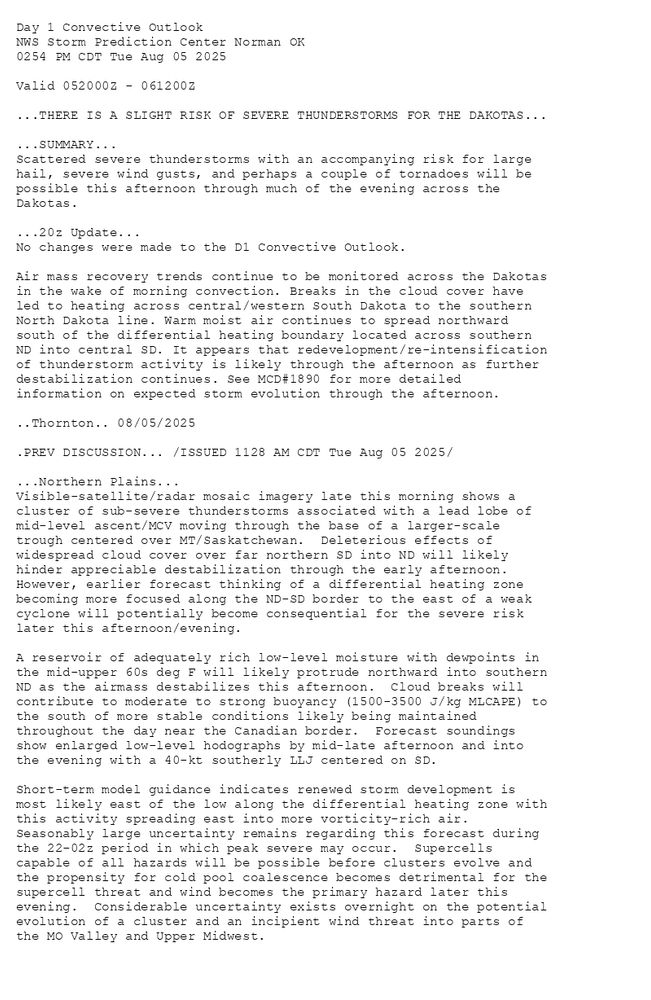
Day 1 Convective Outlook
NWS Storm Prediction Center Norman OK
0254 PM CDT Tue Aug 05 2025
Valid 052000Z - 061200Z
...THERE IS A SLIGHT RISK OF SEVERE THUNDERSTORMS FOR THE DAKOTAS...
...SUMMARY...
Scattered severe thunderstorms with an accompanying risk for large
hail, severe wind gusts, and perhaps a couple of tornadoes will be
possible this afternoon through much of the evening across the
Dakotas.
...20z Update...
No changes were made to the D1 Convective Outlook.
Air mass recovery trends continue to be monitored across the Dakotas
in the wake of morning convection. Breaks in the cloud cover have
led to heating across central/western South Dakota to the southern
North Dakota line. Warm moist air continues to spread northward
south of the differential heating boundary located across southern
ND into central SD. It appears that redevelopment/re-intensification
of thunderstorm activity is likely through the afternoon as further
destabilization continues. See MCD#1890 for more detailed
information on expected storm evolution through the afternoon.
..Thornton.. 08/05/2025
.PREV DISCUSSION... /ISSUED 1128 AM CDT Tue Aug 05 2025/
...Northern Plains...
Visible-satellite/radar mosaic imagery late this morning shows a
cluster of sub-severe thunderstorms associated with a lead lobe of
mid-level ascent/MCV moving through the base of a larger-scale
trough centered over MT/Saskatchewan. Deleterious effects of
widespread cloud cover over far northern SD into ND will likely
hinder appreciable destabilization through the early afternoon.
However, earlier forecast thinking of a differential heating zone
becoming more focused along the ND-SD border to the east of a weak
cyclone will potentially become consequential for the severe risk
later this afternoon/evening.
A reservoir of adequately rich low-level moisture with dewpoints in
the mid-upper 60s deg F will likely protrude northward into southern
ND as the airmass destabilizes this afternoon. Cloud breaks will
contribute to moderate to strong buoyancy (1500-3500 J/kg MLCAPE) to
the south of more stable conditions likely being maintained
throughout the day near the Canadian border. Forecast soundings
show enlarged low-level hodographs by mid-late afternoon and into
the evening with a 40-kt southerly LLJ centered on SD.
Short-term model guidance indicates renewed storm development is
most likely east of the low along the differential heating zone with
this activity spreading east into more vorticity-rich air.
Seasonably large uncertainty remains regarding this forecast during
the 22-02z period in which peak severe may occur. Supercells
capable of all hazards will be possible before clusters evolve and
the propensity for cold pool coalescence becomes detrimental for the
supercell threat and wind becomes the primary hazard later this
evening. Considerable uncertainty exists overnight on the potential
evolution of a cluster and an incipient wind threat into parts of
the MO Valley and Upper Midwest.
Day 1 Outlook Image
SPC Aug 5, 2025 2000 UTC Day 1 Convective Outlook
⛈️THERE IS A SLIGHT RISK OF SEVERE THUNDERSTORMS FOR THE DAKOTAS🌪️
Additional Details Here.
05.08.2025 22:00 — 👍 3 🔁 1 💬 0 📌 0
STATUS FOR WATCH 0574 HAS NOT BEEN ISSUED YET
WW 0574 Status Image
SPC Tornado Watch 574 Status Reports
⛈️🌪️
Additional Details Here.
05.08.2025 21:20 — 👍 2 🔁 1 💬 0 📌 0
URGENT - IMMEDIATE BROADCAST REQUESTED
Tornado Watch Number 574
NWS Storm Prediction Center Norman OK
400 PM CDT Tue Aug 5 2025
The NWS Storm Prediction Center has issued a
* Tornado Watch for portions of
South-Central North Dakota
North-Central and Central South Dakota
* Effective this Tuesday afternoon and evening from 400 PM until
1000 PM CDT.
* Primary threats include...
A couple tornadoes possible
Scattered large hail and isolated very large hail events to 2
inches in diameter possible
Scattered damaging wind gusts to 70 mph possible
SUMMARY...Scattered thunderstorms are forecast to develop and
intensify through the remainder of the afternoon and into the
evening. The stronger storms will probably become supercellular and
pose a risk for large hail and severe gusts. A couple of tornadoes
are possible with the stronger supercells. Upscale growth into a
cluster of storms is forecast this evening with the severe threat
gradually becoming predominately a wind risk.
The tornado watch area is approximately along and 80 statute miles
east and west of a line from 45 miles north northeast of Bismarck ND
to 20 miles southeast of Pierre SD. For a complete depiction of the
watch see the associated watch outline update (WOUS64 KWNS WOU4).
PRECAUTIONARY/PREPAREDNESS ACTIONS...
REMEMBER...A Tornado Watch means conditions are favorable for
tornadoes and severe thunderstorms in and close to the watch
area. Persons in these areas should be on the lookout for
threatening weather conditions and listen for later statements
and possible warnings.
&&
AVIATION...Tornadoes and a few severe thunderstorms with hail
surface and aloft to 2 inches. Extreme turbulence and surface wind
gusts to 60 knots. A few cumulonimbi with maximum tops to 500. Mean
storm motion vector 24020.
...Smith
WW 0574 Image
SPC Tornado Watch 574
⛈️
A couple tornadoes possible
Scattered large hail and isolated very large hail events to 2
inches in diameter possible
Scattered damaging wind gusts to 70 mph possible
SUMMARY🌪️
Additional Details Here.
05.08.2025 21:20 — 👍 2 🔁 2 💬 0 📌 0
Day 3 Convective Outlook
NWS Storm Prediction Center Norman OK
0227 PM CDT Tue Aug 05 2025
Valid 071200Z - 081200Z
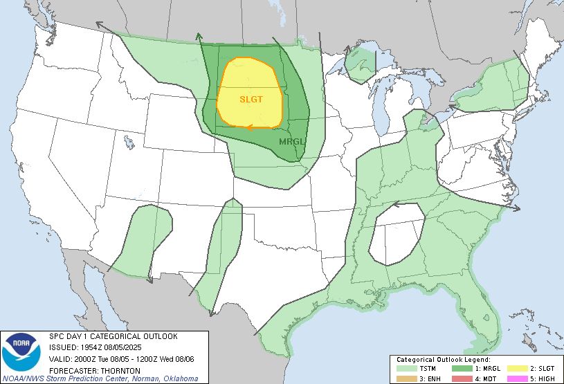
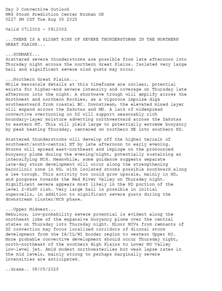
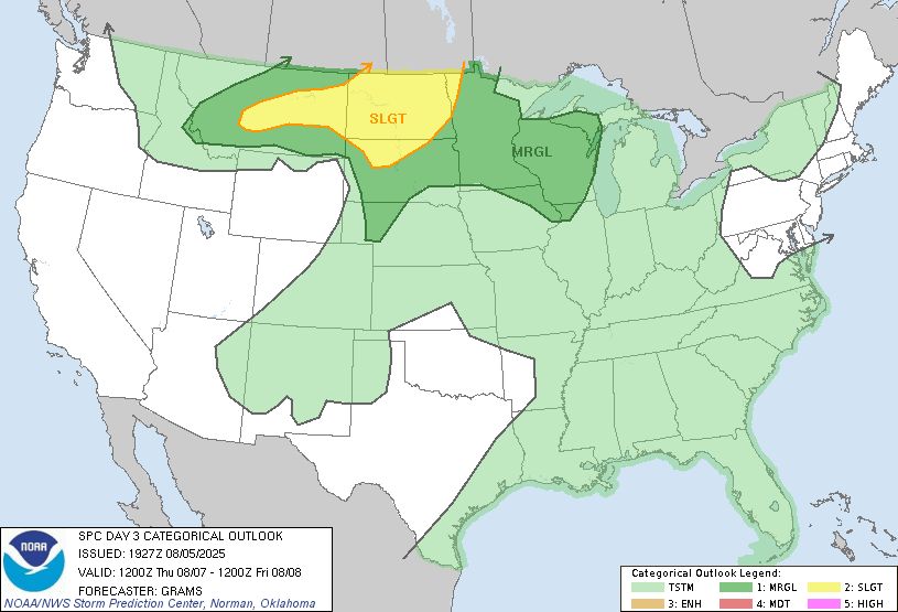
...THERE IS A SLIGHT RISK OF SEVERE THUNDERSTORMS IN THE NORTHERN
GREAT PLAINS...
...SUMMARY...
Scattered severe thunderstorms are possible from late afternoon into
Thursday night across the northern Great Plains. Isolated very large
hail and significant severe wind gusts may occur.
...Northern Great Plains...
While mesoscale details at this timeframe are unclear, potential
exists for higher-end severe intensity and coverage on Thursday late
afternoon into the night. A shortwave trough will amplify across the
Northwest and northern Rockies, as a vigorous impulse digs
southeastward from coastal BC. Downstream, the elevated mixed layer
will expand across the Dakotas and MN. A lack of widespread
convective overturning on D2 will support seasonably rich
boundary-layer moisture advecting northwestward across the Dakotas
to eastern MT. This will yield large to potentially extreme buoyancy
by peak heating Thursday, centered on northern NE into southern ND.
Scattered thunderstorms will develop off the higher terrain of
southwest/south-central MT by late afternoon to early evening.
Storms will spread east-northeast and impinge on the pronounced
buoyancy plume during the evening/night, potentially sustaining an
intensifying MCS. Meanwhile, some guidance suggests separate
late-day storm development will occur along the strengthening
baroclinic zone in ND, with isolated storms possible southward along
a lee trough. This activity too could grow upscale, mainly in ND,
and progress towards the Red River Valley on Thursday night.
Significant severe appears most likely in the ND portion of the
level 2-SLGT risk. Very large hail is possible in initial
supercells, in addition to significant severe gusts during the
downstream cluster/MCS phase.
...Upper Midwest...
Nebulous, low-probability severe potential is evident along the
northeast lobe of the expansive buoyancy plume over the central
states on Thursday into Thursday night. Minor MCVs from remnants of
D2 convection may focus localized corridors of diurnal storm
development from the IA/IL/WI border region to western Upper MI.
More probable convective development should occur Thursday night,
north-northeast of the southern High Plains to Lower MO Valley
low-level jet. Amid modest northwesterlies but weak lapse rates in
the mid levels, mainly strong to perhaps marginally severe
intensities are anticipated.
..Grams.. 08/05/2025
Day 3 Outlook Image
SPC Aug 5, 2025 1930 UTC Day 3 Severe Thunderstorm Outlook
⛈️THERE IS A SLIGHT RISK OF SEVERE THUNDERSTORMS IN THE NORTHERN
GREAT PLAINS🌪️
Additional Details Here.
05.08.2025 19:40 — 👍 2 🔁 1 💬 0 📌 0
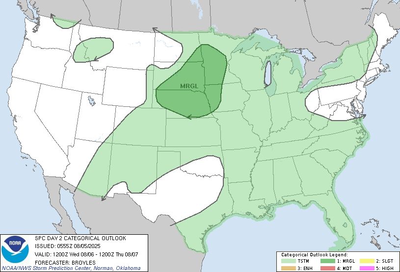
Day 2 Convective Outlook
NWS Storm Prediction Center Norman OK
1224 PM CDT Tue Aug 05 2025
Valid 061200Z - 071200Z
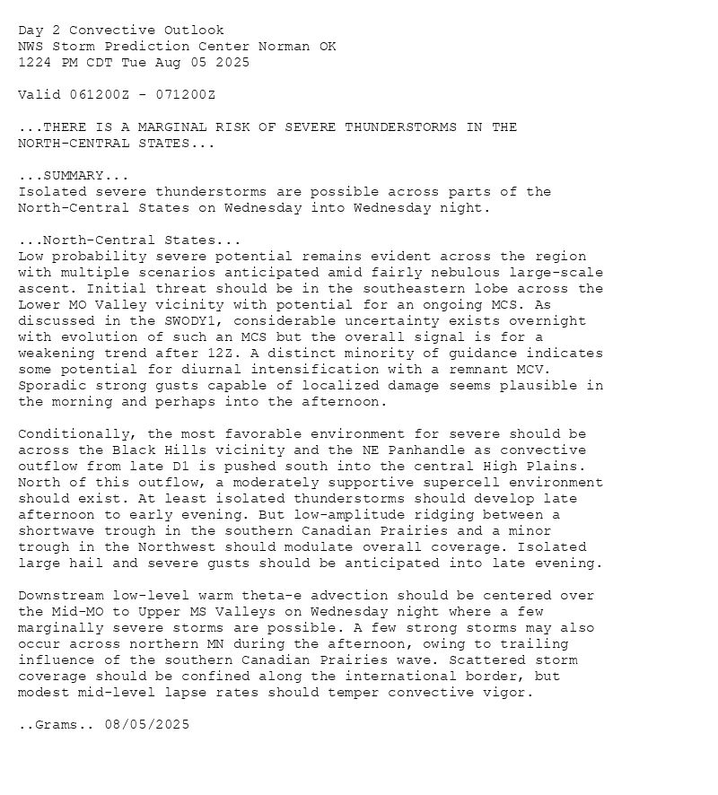
...THERE IS A MARGINAL RISK OF SEVERE THUNDERSTORMS IN THE
NORTH-CENTRAL STATES...
...SUMMARY...
Isolated severe thunderstorms are possible across parts of the
North-Central States on Wednesday into Wednesday night.
...North-Central States...
Low probability severe potential remains evident across the region
with multiple scenarios anticipated amid fairly nebulous large-scale
ascent. Initial threat should be in the southeastern lobe across the
Lower MO Valley vicinity with potential for an ongoing MCS. As
discussed in the SWODY1, considerable uncertainty exists overnight
with evolution of such an MCS but the overall signal is for a
weakening trend after 12Z. A distinct minority of guidance indicates
some potential for diurnal intensification with a remnant MCV.
Sporadic strong gusts capable of localized damage seems plausible in
the morning and perhaps into the afternoon.
Conditionally, the most favorable environment for severe should be
across the Black Hills vicinity and the NE Panhandle as convective
outflow from late D1 is pushed south into the central High Plains.
North of this outflow, a moderately supportive supercell environment
should exist. At least isolated thunderstorms should develop late
afternoon to early evening. But low-amplitude ridging between a
shortwave trough in the southern Canadian Prairies and a minor
trough in the Northwest should modulate overall coverage. Isolated
large hail and severe gusts should be anticipated into late evening.
Downstream low-level warm theta-e advection should be centered over
the Mid-MO to Upper MS Valleys on Wednesday night where a few
marginally severe storms are possible. A few strong storms may also
occur across northern MN during the afternoon, owing to trailing
influence of the southern Canadian Prairies wave. Scattered storm
coverage should be confined along the international border, but
modest mid-level lapse rates should temper convective vigor.
..Grams.. 08/05/2025
Day 2 Outlook Image
SPC Aug 5, 2025 1730 UTC Day 2 Convective Outlook
⛈️THERE IS A MARGINAL RISK OF SEVERE THUNDERSTORMS IN THE
NORTH-CENTRAL STATES🌪️
Additional Details Here.
05.08.2025 17:40 — 👍 2 🔁 1 💬 0 📌 0
Day 1 Convective Outlook
NWS Storm Prediction Center Norman OK
1128 AM CDT Tue Aug 05 2025
Valid 051630Z - 061200Z
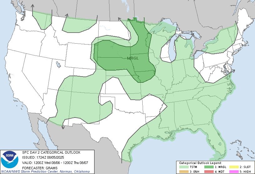
...THERE IS A SLIGHT RISK OF SEVERE THUNDERSTORMS FOR THE DAKOTAS...
...SUMMARY...
Scattered severe thunderstorms with an accompanying risk for large
hail, severe wind gusts, and perhaps a couple of tornadoes will be
possible this afternoon through much of the evening across the
Dakotas.
...Northern Plains...
Visible-satellite/radar mosaic imagery late this morning shows a
cluster of sub-severe thunderstorms associated with a lead lobe of
mid-level ascent/MCV moving through the base of a larger-scale
trough centered over MT/Saskatchewan. Deleterious effects of
widespread cloud cover over far northern SD into ND will likely
hinder appreciable destabilization through the early afternoon.
However, earlier forecast thinking of a differential heating zone
becoming more focused along the ND-SD border to the east of a weak
cyclone will potentially become consequential for the severe risk
later this afternoon/evening.
A reservoir of adequately rich low-level moisture with dewpoints in
the mid-upper 60s deg F will likely protrude northward into southern
ND as the airmass destabilizes this afternoon. Cloud breaks will
contribute to moderate to strong buoyancy (1500-3500 J/kg MLCAPE) to
the south of more stable conditions likely being maintained
throughout the day near the Canadian border. Forecast soundings
show enlarged low-level hodographs by mid-late afternoon and into
the evening with a 40-kt southerly LLJ centered on SD.
Short-term model guidance indicates renewed storm development is
most likely east of the low along the differential heating zone with
this activity spreading east into more vorticity-rich air.
Seasonably large uncertainty remains regarding this forecast during
the 22-02z period in which peak severe may occur. Supercells
capable of all hazards will be possible before clusters evolve and
the propensity for cold pool coalescence becomes detrimental for the
supercell threat and wind becomes the primary hazard later this
evening. Considerable uncertainty exists overnight on the potential
evolution of a cluster and an incipient wind threat into parts of
the MO Valley and Upper Midwest.
..Smith/Wendt.. 08/05/2025

Day 1 Outlook Image
SPC Aug 5, 2025 1630 UTC Day 1 Convective Outlook
⛈️THERE IS A SLIGHT RISK OF SEVERE THUNDERSTORMS FOR THE DAKOTAS🌪️
Additional Details Here.
05.08.2025 16:40 — 👍 2 🔁 1 💬 0 📌 0
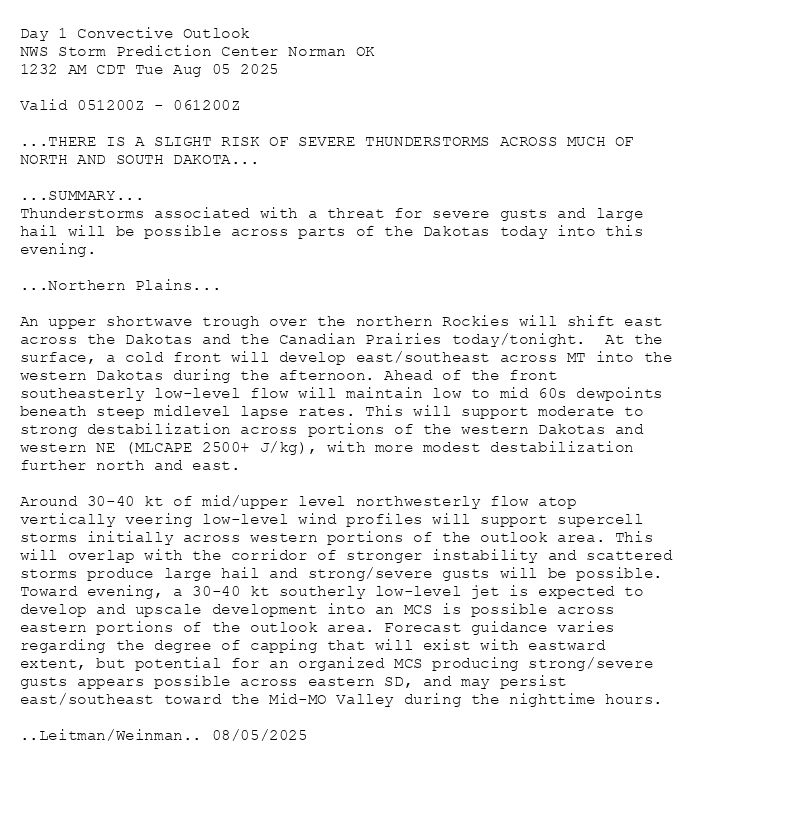
Day 1 Convective Outlook
NWS Storm Prediction Center Norman OK
0742 AM CDT Tue Aug 05 2025
Valid 051300Z - 061200Z
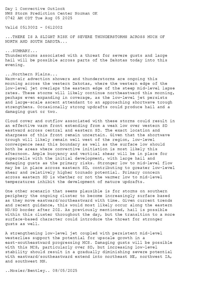
...THERE IS A SLIGHT RISK OF SEVERE THUNDERSTORMS ACROSS MUCH OF
NORTH AND SOUTH DAKOTA...
...SUMMARY...
Thunderstorms associated with a threat for severe gusts and large
hail will be possible across parts of the Dakotas today into this
evening.
...Northern Plains...
Warm-air advection showers and thunderstorms are ongoing this
morning across the western Dakotas, where the western edge of the
low-level jet overlaps the eastern edge of the steep mid-level lapse
rates. These storms will likely continue northeastward this morning,
perhaps even expanding in coverage, as the low-level jet persists
and large-scale ascent attendant to an approaching shortwave trough
strengthens. Occasionally strong updrafts could produce hail and a
damaging gust or two.
Cloud cover and outflow associated with these storms could result in
an effective warm front extending from a weak low over western SD
eastward across central and eastern SD. The exact location and
sharpness of this front remain uncertain. Given that the shortwave
trough will likely remain well west of the region, low-level
convergence near this boundary as well as the surface low should
both be areas where convective initiation is most likely this
afternoon. Ample buoyancy and vertical shear will be in place for
supercells with the initial development, with large hail and
damaging gusts as the primary risks. Stronger low to mid-level flow
may be in place across eastern SD, contributing to greater low-level
shear and relatively higher tornado potential. Primary concern
across eastern SD is whether or not the warmer low to mid-level
temperatures inhibit the development of mature updrafts.
One other scenario that seems plausible is for storms on southern
periphery the ongoing cluster to become increasingly surface based
as they move eastward/northeastward with time. Given current trends
and recent guidance, this would most likely occur along the eastern
ND/SD border after 20Z. As previously mentioned, hail is possible
within this cluster throughout the day, but the transition to a more
surface-based character could introduce the threat for stronger
gusts as well.
A strengthening low-level jet coupled with persistent mid-level
westerlies support the potential for upscale growth in a
east-southeastward progressing MCS. Damaging gusts will be possible
with this MCS, particularly over SD, but increasing low-level
stability should result in a gradually diminishing severe potential
with eastward/southeastward extend into northeast NE, northwest IA,
and southwest MN.
..Mosier/Bentley.. 08/05/2025

Day 1 Outlook Image
SPC Aug 5, 2025 1300 UTC Day 1 Convective Outlook
⛈️THERE IS A SLIGHT RISK OF SEVERE THUNDERSTORMS ACROSS MUCH OF
NORTH AND SOUTH DAKOTA🌪️
Additional Details Here.
05.08.2025 13:00 — 👍 3 🔁 1 💬 0 📌 0
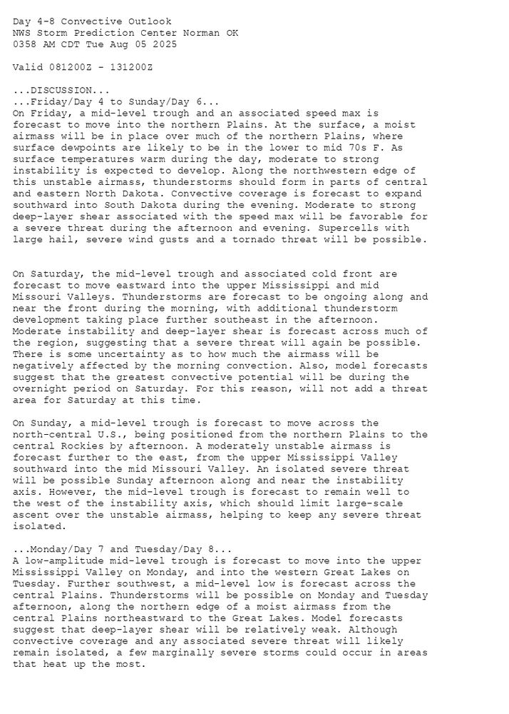
Day 4-8 Convective Outlook
NWS Storm Prediction Center Norman OK
0358 AM CDT Tue Aug 05 2025
Valid 081200Z - 131200Z
...DISCUSSION...
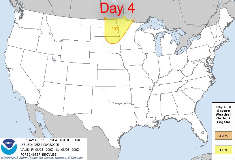
...Friday/Day 4 to Sunday/Day 6...
On Friday, a mid-level trough and an associated speed max is
forecast to move into the northern Plains. At the surface, a moist
airmass will be in place over much of the northern Plains, where
surface dewpoints are likely to be in the lower to mid 70s F. As
surface temperatures warm during the day, moderate to strong
instability is expected to develop. Along the northwestern edge of
this unstable airmass, thunderstorms should form in parts of central
and eastern North Dakota. Convective coverage is forecast to expand
southward into South Dakota during the evening. Moderate to strong
deep-layer shear associated with the speed max will be favorable for
a severe threat during the afternoon and evening. Supercells with
large hail, severe wind gusts and a tornado threat will be possible.
On Saturday, the mid-level trough and associated cold front are
forecast to move eastward into the upper Mississippi and mid
Missouri Valleys. Thunderstorms are forecast to be ongoing along and
near the front during the morning, with additional thunderstorm
development taking place further southeast in the afternoon.
Moderate instability and deep-layer shear is forecast across much of
the region, suggesting that a severe threat will again be possible.
There is some uncertainty as to how much the airmass will be
negatively affected by the morning convection. Also, model forecasts
suggest that the greatest convective potential will be during the
overnight period on Saturday. For this reason, will not add a threat
area for Saturday at this time.
On Sunday, a mid-level trough is forecast to move across the
north-central U.S., being positioned from the northern Plains to the
central Rockies by afternoon. A moderately unstable airmass is
forecast further to the east, from the upper Mississippi Valley
southward into the mid Missouri Valley. An isolated severe threat
will be possible Sunday afternoon along and near the instability
axis. However, the mid-level trough is forecast to remain well to
the west of the instability axis, which should limit large-scale
ascent over the unstable airmass, helping to keep any severe threat
isolated.
...Monday/Day 7 and Tuesday/Day 8...
A low-amplitude mid-level trough is forecast to move into the upper
Mississippi Valley on Monday, and into the western Great Lakes on
Tuesday. Further southwest, a mid-level low is forecast across the
central Plains. Thunderstorms will be possible on Monday and Tuesday
afternoon, along the northern edge of a moist airmass from the
central Plains northeastward to the Great Lakes. Model forecasts
suggest that deep-layer shear will be relatively weak. Although
convective coverage and any associated severe threat will likely
remain isolated, a few marginally severe storms could occur in areas
that heat up the most.
Day 4-8 Outlook Image
SPC Aug 5, 2025 Day 4-8 Severe Weather Outlook
⛈️DISCUSSION🌪️
Additional Details Here.
05.08.2025 09:40 — 👍 2 🔁 1 💬 0 📌 0
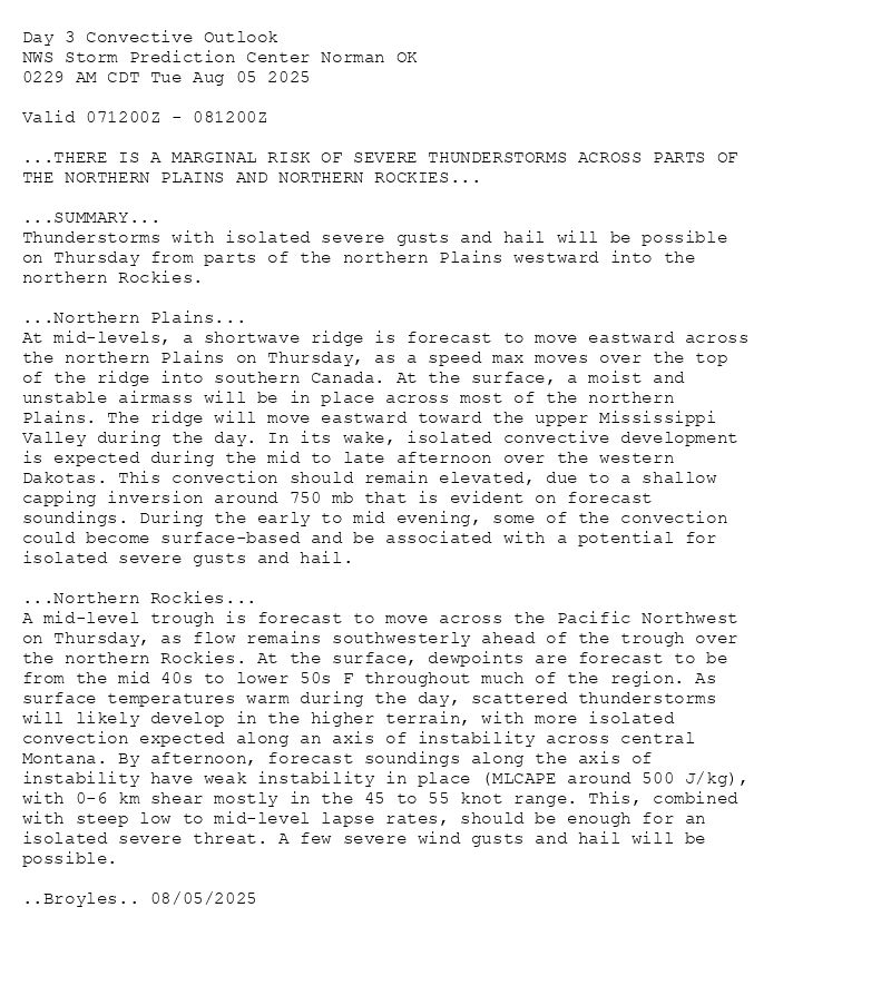
Day 3 Convective Outlook
NWS Storm Prediction Center Norman OK
0229 AM CDT Tue Aug 05 2025
Valid 071200Z - 081200Z
...THERE IS A MARGINAL RISK OF SEVERE THUNDERSTORMS ACROSS PARTS OF
THE NORTHERN PLAINS AND NORTHERN ROCKIES...
...SUMMARY...
Thunderstorms with isolated severe gusts and hail will be possible
on Thursday from parts of the northern Plains westward into the
northern Rockies.
...Northern Plains...
At mid-levels, a shortwave ridge is forecast to move eastward across
the northern Plains on Thursday, as a speed max moves over the top
of the ridge into southern Canada. At the surface, a moist and
unstable airmass will be in place across most of the northern
Plains. The ridge will move eastward toward the upper Mississippi
Valley during the day. In its wake, isolated convective development
is expected during the mid to late afternoon over the western
Dakotas. This convection should remain elevated, due to a shallow
capping inversion around 750 mb that is evident on forecast
soundings. During the early to mid evening, some of the convection
could become surface-based and be associated with a potential for
isolated severe gusts and hail.
...Northern Rockies...
A mid-level trough is forecast to move across the Pacific Northwest
on Thursday, as flow remains southwesterly ahead of the trough over
the northern Rockies. At the surface, dewpoints are forecast to be
from the mid 40s to lower 50s F throughout much of the region. As
surface temperatures warm during the day, scattered thunderstorms
will likely develop in the higher terrain, with more isolated
convection expected along an axis of instability across central
Montana. By afternoon, forecast soundings along the axis of
instability have weak instability in place (MLCAPE around 500 J/kg),
with 0-6 km shear mostly in the 45 to 55 knot range. This, combined
with steep low to mid-level lapse rates, should be enough for an
isolated severe threat. A few severe wind gusts and hail will be
possible.
..Broyles.. 08/05/2025
Day 3 Outlook Image
SPC Aug 5, 2025 0730 UTC Day 3 Severe Thunderstorm Outlook
⛈️THERE IS A MARGINAL RISK OF SEVERE THUNDERSTORMS ACROSS PARTS OF
THE NORTHERN PLAINS AND NORTHERN ROCKIES🌪️
Additional Details Here.
05.08.2025 07:40 — 👍 2 🔁 1 💬 0 📌 0
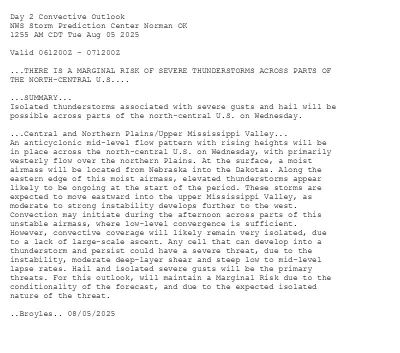
Day 2 Convective Outlook
NWS Storm Prediction Center Norman OK
1255 AM CDT Tue Aug 05 2025
Valid 061200Z - 071200Z
...THERE IS A MARGINAL RISK OF SEVERE THUNDERSTORMS ACROSS PARTS OF
THE NORTH-CENTRAL U.S....
...SUMMARY...
Isolated thunderstorms associated with severe gusts and hail will be
possible across parts of the north-central U.S. on Wednesday.
...Central and Northern Plains/Upper Mississippi Valley...
An anticyclonic mid-level flow pattern with rising heights will be
in place across the north-central U.S. on Wednesday, with primarily
westerly flow over the northern Plains. At the surface, a moist
airmass will be located from Nebraska into the Dakotas. Along the
eastern edge of this moist airmass, elevated thunderstorms appear
likely to be ongoing at the start of the period. These storms are
expected to move eastward into the upper Mississippi Valley, as
moderate to strong instability develops further to the west.
Convection may initiate during the afternoon across parts of this
unstable airmass, where low-level convergence is sufficient.
However, convective coverage will likely remain very isolated, due
to a lack of large-scale ascent. Any cell that can develop into a
thunderstorm and persist could have a severe threat, due to the
instability, moderate deep-layer shear and steep low to mid-level
lapse rates. Hail and isolated severe gusts will be the primary
threats. For this outlook, will maintain a Marginal Risk due to the
conditionality of the forecast, and due to the expected isolated
nature of the threat.
..Broyles.. 08/05/2025
Day 2 Outlook Image
SPC Aug 5, 2025 0600 UTC Day 2 Convective Outlook
⛈️THERE IS A MARGINAL RISK OF SEVERE THUNDERSTORMS ACROSS PARTS OF
THE NORTH-CENTRAL U.S🌪️
Additional Details Here.
05.08.2025 06:20 — 👍 2 🔁 0 💬 0 📌 0
Day 1 Convective Outlook
NWS Storm Prediction Center Norman OK
1232 AM CDT Tue Aug 05 2025
Valid 051200Z - 061200Z
...THERE IS A SLIGHT RISK OF SEVERE THUNDERSTORMS ACROSS MUCH OF
NORTH AND SOUTH DAKOTA...
...SUMMARY...
Thunderstorms associated with a threat for severe gusts and large
hail will be possible across parts of the Dakotas today into this
evening.
...Northern Plains...
An upper shortwave trough over the northern Rockies will shift east
across the Dakotas and the Canadian Prairies today/tonight. At the
surface, a cold front will develop east/southeast across MT into the
western Dakotas during the afternoon. Ahead of the front
southeasterly low-level flow will maintain low to mid 60s dewpoints
beneath steep midlevel lapse rates. This will support moderate to
strong destabilization across portions of the western Dakotas and
western NE (MLCAPE 2500+ J/kg), with more modest destabilization
further north and east.
Around 30-40 kt of mid/upper level northwesterly flow atop
vertically veering low-level wind profiles will support supercell
storms initially across western portions of the outlook area. This
will overlap with the corridor of stronger instability and scattered
storms produce large hail and strong/severe gusts will be possible.
Toward evening, a 30-40 kt southerly low-level jet is expected to
develop and upscale development into an MCS is possible across
eastern portions of the outlook area. Forecast guidance varies
regarding the degree of capping that will exist with eastward
extent, but potential for an organized MCS producing strong/severe
gusts appears possible across eastern SD, and may persist
east/southeast toward the Mid-MO Valley during the nighttime hours.
..Leitman/Weinman.. 08/05/2025
Day 1 Outlook Image
SPC Aug 5, 2025 0600 UTC Day 1 Convective Outlook
⛈️THERE IS A SLIGHT RISK OF SEVERE THUNDERSTORMS ACROSS MUCH OF
NORTH AND SOUTH DAKOTA🌪️
Additional Details Here.
05.08.2025 05:40 — 👍 2 🔁 1 💬 0 📌 0
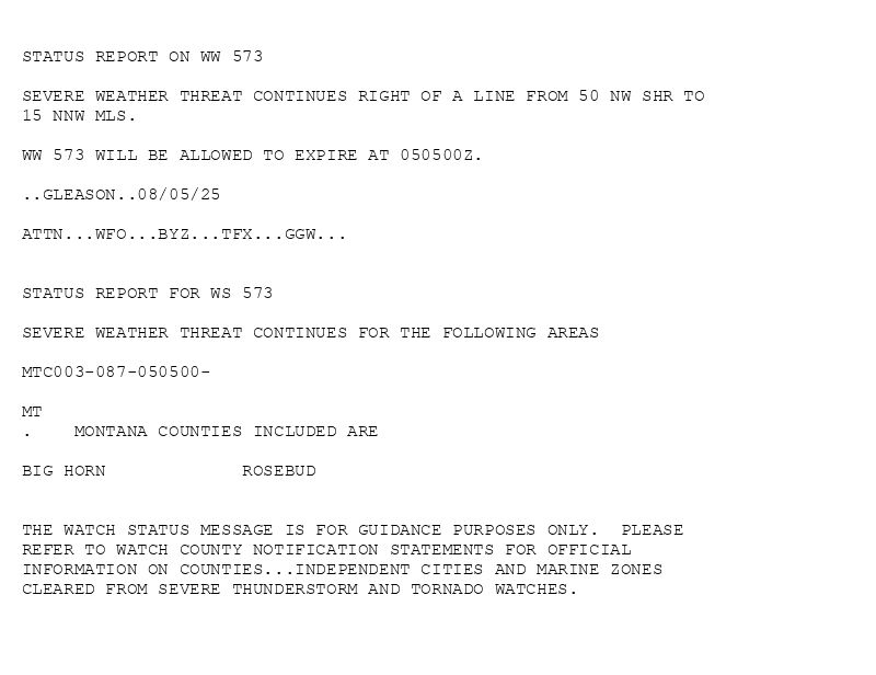
STATUS REPORT ON WW 573
SEVERE WEATHER THREAT CONTINUES RIGHT OF A LINE FROM 50 NW SHR TO
15 NNW MLS.
WW 573 WILL BE ALLOWED TO EXPIRE AT 050500Z.
..GLEASON..08/05/25
ATTN...WFO...BYZ...TFX...GGW...
STATUS REPORT FOR WS 573
SEVERE WEATHER THREAT CONTINUES FOR THE FOLLOWING AREAS
MTC003-087-050500-
MT
. MONTANA COUNTIES INCLUDED ARE
BIG HORN ROSEBUD
THE WATCH STATUS MESSAGE IS FOR GUIDANCE PURPOSES ONLY. PLEASE
REFER TO WATCH COUNTY NOTIFICATION STATEMENTS FOR OFFICIAL
INFORMATION ON COUNTIES...INDEPENDENT CITIES AND MARINE ZONES
CLEARED FROM SEVERE THUNDERSTORM AND TORNADO WATCHES.

WW 0573 Status Image
SPC Severe Thunderstorm Watch 573 Status Reports
⛈️WFO...BYZ🌪️
Additional Details Here.
05.08.2025 04:40 — 👍 1 🔁 0 💬 0 📌 0
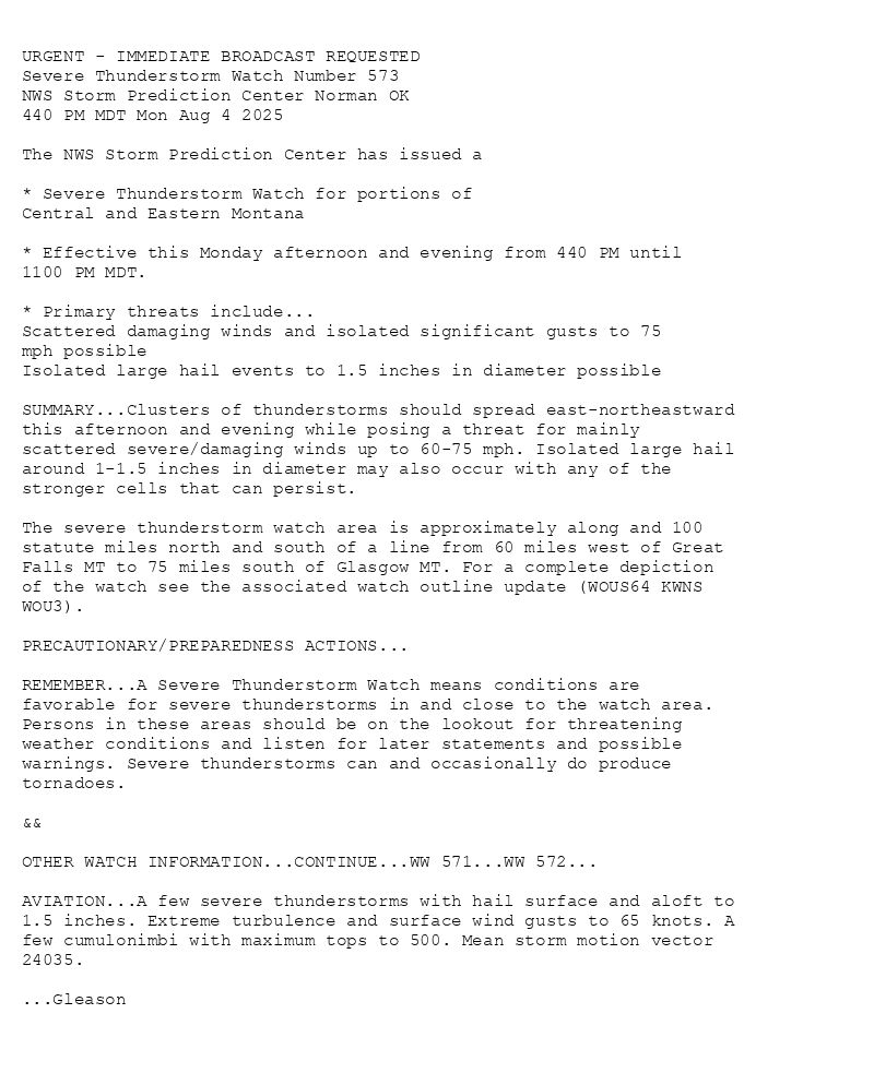
URGENT - IMMEDIATE BROADCAST REQUESTED
Severe Thunderstorm Watch Number 573
NWS Storm Prediction Center Norman OK
440 PM MDT Mon Aug 4 2025
The NWS Storm Prediction Center has issued a
* Severe Thunderstorm Watch for portions of
Central and Eastern Montana
* Effective this Monday afternoon and evening from 440 PM until
1100 PM MDT.
* Primary threats include...
Scattered damaging winds and isolated significant gusts to 75
mph possible
Isolated large hail events to 1.5 inches in diameter possible
SUMMARY...Clusters of thunderstorms should spread east-northeastward
this afternoon and evening while posing a threat for mainly
scattered severe/damaging winds up to 60-75 mph. Isolated large hail
around 1-1.5 inches in diameter may also occur with any of the
stronger cells that can persist.
The severe thunderstorm watch area is approximately along and 100
statute miles north and south of a line from 60 miles west of Great
Falls MT to 75 miles south of Glasgow MT. For a complete depiction
of the watch see the associated watch outline update (WOUS64 KWNS
WOU3).
PRECAUTIONARY/PREPAREDNESS ACTIONS...
REMEMBER...A Severe Thunderstorm Watch means conditions are
favorable for severe thunderstorms in and close to the watch area.
Persons in these areas should be on the lookout for threatening
weather conditions and listen for later statements and possible
warnings. Severe thunderstorms can and occasionally do produce
tornadoes.
&&
OTHER WATCH INFORMATION...CONTINUE...WW 571...WW 572...
AVIATION...A few severe thunderstorms with hail surface and aloft to
1.5 inches. Extreme turbulence and surface wind gusts to 65 knots. A
few cumulonimbi with maximum tops to 500. Mean storm motion vector
24035.
...Gleason
WW 0573 Image
SPC Severe Thunderstorm Watch 573
⛈️
Scattered damaging winds and isolated significant gusts to 75
mph possible
Isolated large hail events to 1.5 inches in diameter possible
SUMMARY🌪️
Additional Details Here.
05.08.2025 04:40 — 👍 1 🔁 0 💬 0 📌 0
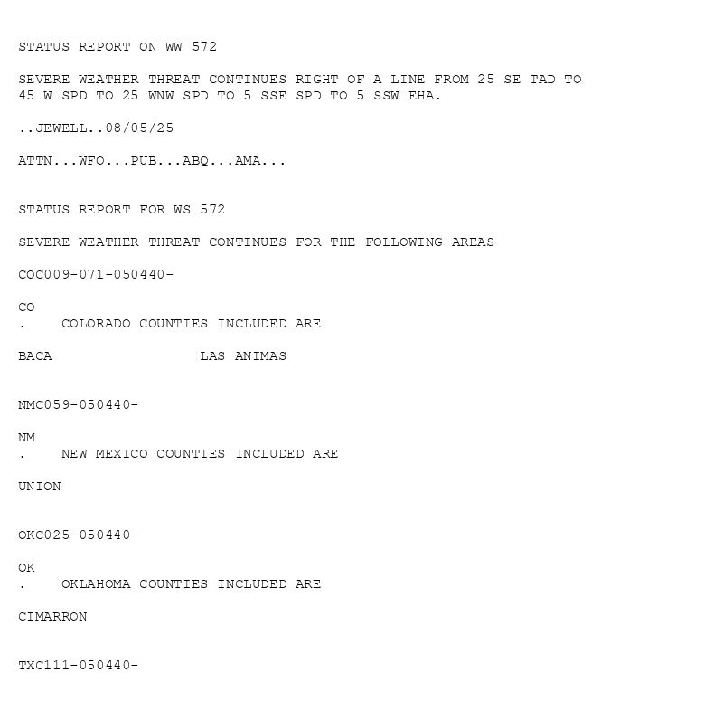
STATUS REPORT ON WW 572
SEVERE WEATHER THREAT CONTINUES RIGHT OF A LINE FROM 25 SE TAD TO
45 W SPD TO 25 WNW SPD TO 5 SSE SPD TO 5 SSW EHA.
..JEWELL..08/05/25
ATTN...WFO...PUB...ABQ...AMA...
STATUS REPORT FOR WS 572
SEVERE WEATHER THREAT CONTINUES FOR THE FOLLOWING AREAS
COC009-071-050440-
CO
. COLORADO COUNTIES INCLUDED ARE
BACA LAS ANIMAS
NMC059-050440-
NM
. NEW MEXICO COUNTIES INCLUDED ARE
UNION
OKC025-050440-
OK
. OKLAHOMA COUNTIES INCLUDED ARE
CIMARRON
TXC111-050440-
WW 0572 Status Image
SPC Severe Thunderstorm Watch 572 Status Reports
⛈️WFO...PUB🌪️
Additional Details Here.
05.08.2025 03:20 — 👍 2 🔁 1 💬 0 📌 0
URGENT - IMMEDIATE BROADCAST REQUESTED
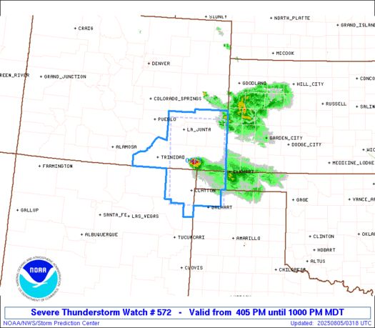
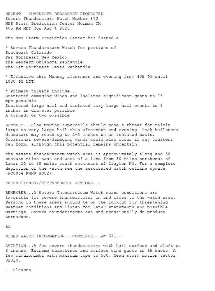
Severe Thunderstorm Watch Number 572
NWS Storm Prediction Center Norman OK
405 PM MDT Mon Aug 4 2025
The NWS Storm Prediction Center has issued a
* Severe Thunderstorm Watch for portions of
Southeast Colorado
Far Northeast New Mexico
The Western Oklahoma Panhandle
The Far Northwest Texas Panhandle
* Effective this Monday afternoon and evening from 405 PM until
1000 PM MDT.
* Primary threats include...
Scattered damaging winds and isolated significant gusts to 75
mph possible
Scattered large hail and isolated very large hail events to 3
inches in diameter possible
A tornado or two possible
SUMMARY...Slow-moving supercells should pose a threat for mainly
large to very large hail this afternoon and evening. Peak hailstone
diameters may reach up to 2-3 inches on an isolated basis.
Occasional severe/damaging winds could also occur if any clusters
can form, although this potential remains uncertain.
The severe thunderstorm watch area is approximately along and 50
statute miles east and west of a line from 30 miles northwest of
Lamar CO to 30 miles south southeast of Clayton NM. For a complete
depiction of the watch see the associated watch outline update
(WOUS64 KWNS WOU2).
PRECAUTIONARY/PREPAREDNESS ACTIONS...
REMEMBER...A Severe Thunderstorm Watch means conditions are
favorable for severe thunderstorms in and close to the watch area.
Persons in these areas should be on the lookout for threatening
weather conditions and listen for later statements and possible
warnings. Severe thunderstorms can and occasionally do produce
tornadoes.
&&
OTHER WATCH INFORMATION...CONTINUE...WW 571...
AVIATION...A few severe thunderstorms with hail surface and aloft to
3 inches. Extreme turbulence and surface wind gusts to 65 knots. A
few cumulonimbi with maximum tops to 500. Mean storm motion vector
32010.
...Gleason
WW 0572 Image
SPC Severe Thunderstorm Watch 572
⛈️
Scattered damaging winds and isolated significant gusts to 75
mph possible
Scattered large hail and isolated very large hail events to 3
inches in diameter possible
A tornado or two possible
SUMMARY🌪️
Additional Details Here.
05.08.2025 03:20 — 👍 2 🔁 1 💬 0 📌 0
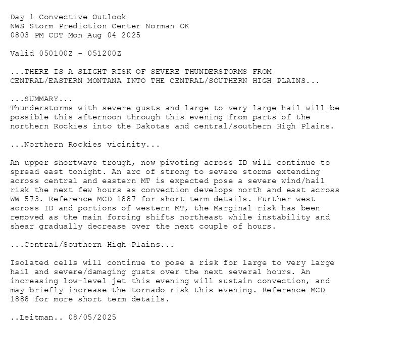
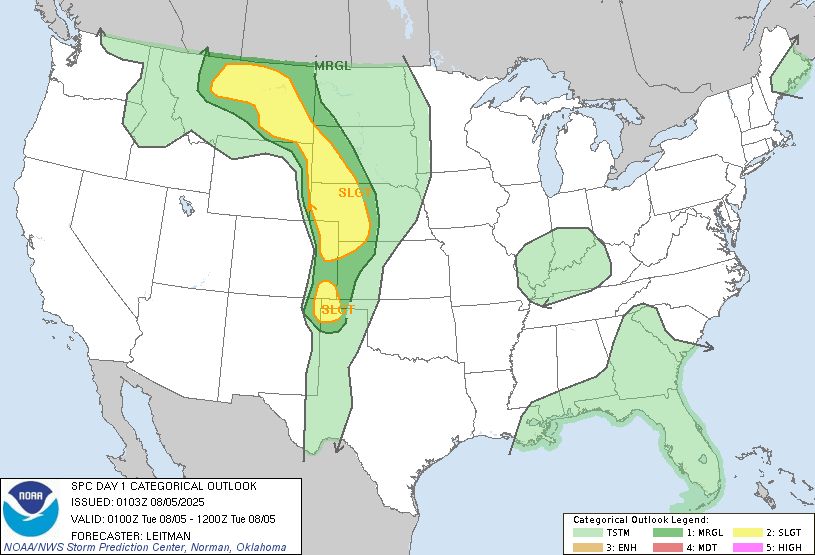
Day 1 Convective Outlook
NWS Storm Prediction Center Norman OK
0803 PM CDT Mon Aug 04 2025
Valid 050100Z - 051200Z
...THERE IS A SLIGHT RISK OF SEVERE THUNDERSTORMS FROM
CENTRAL/EASTERN MONTANA INTO THE CENTRAL/SOUTHERN HIGH PLAINS...
...SUMMARY...
Thunderstorms with severe gusts and large to very large hail will be
possible this afternoon through this evening from parts of the
northern Rockies into the Dakotas and central/southern High Plains.
...Northern Rockies vicinity...
An upper shortwave trough, now pivoting across ID will continue to
spread east tonight. An arc of strong to severe storms extending
across central and eastern MT is expected pose a severe wind/hail
risk the next few hours as convection develops north and east across
WW 573. Reference MCD 1887 for short term details. Further west
across ID and portions of western MT, the Marginal risk has been
removed as the main forcing shifts northeast while instability and
shear gradually decrease over the next couple of hours.
...Central/Southern High Plains...
Isolated cells will continue to pose a risk for large to very large
hail and severe/damaging gusts over the next several hours. An
increasing low-level jet this evening will sustain convection, and
may briefly increase the tornado risk this evening. Reference MCD
1888 for more short term details.
..Leitman.. 08/05/2025
Day 1 Outlook Image
SPC Aug 5, 2025 0100 UTC Day 1 Convective Outlook
⛈️THERE IS A SLIGHT RISK OF SEVERE THUNDERSTORMS FROM
CENTRAL/EASTERN MONTANA INTO THE CENTRAL/SOUTHERN HIGH PLAINS🌪️
Additional Details Here.
05.08.2025 03:00 — 👍 2 🔁 1 💬 0 📌 0