✋
17.09.2025 13:11 — 👍 0 🔁 0 💬 0 📌 0John Marquee
@johnmarquee.bsky.social
Observer. OSINT/IMINT. Geolocation. GIS. Usual caveats.
@johnmarquee.bsky.social
Observer. OSINT/IMINT. Geolocation. GIS. Usual caveats.
✋
17.09.2025 13:11 — 👍 0 🔁 0 💬 0 📌 0My first mechanical keyboard was a Das with browns, great keyboard
23.06.2025 04:44 — 👍 2 🔁 0 💬 0 📌 0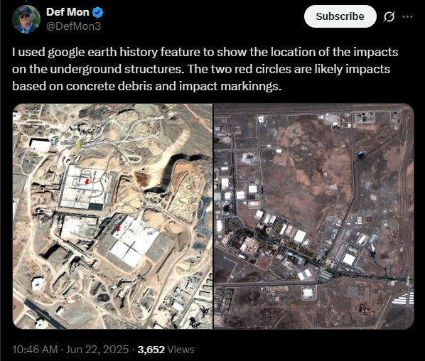
It looks like there were two entry points after all - visible on high-resolution imagery - that align with underground structures.
22.06.2025 17:57 — 👍 2 🔁 0 💬 1 📌 0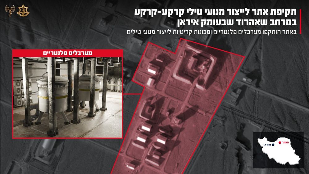
IDF has now posted a video claiming to describe what they struck at Shahrud:
x.com/idfonline/st...
Before/after low-resolution satellite imagery (via Copernicus Sentinel-2) of damage to support facility structures at Shahroud Space Center. The structure on the right side of the highlighted area was previously targeted by Israel in October 2024 and subsequently rebuilt.
22.06.2025 17:25 — 👍 8 🔁 0 💬 1 📌 0FWIW I only found one entry point at Natanz, which would align with 2x GBU-57 per entry point like at Fordow.
bsky.app/profile/john...
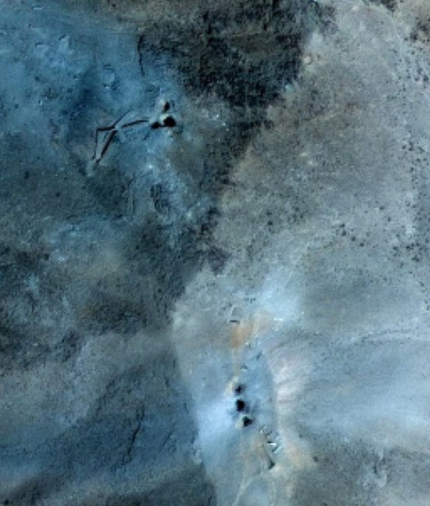
With the GBU-57 there isn't much visible on the surface - see the high-resolution imagery from Fordow.
22.06.2025 13:24 — 👍 1 🔁 0 💬 0 📌 0Before/after false color low-resolution satellite imagery of Natanz following the US strike reportedly with two GBU-57 'bunker buster' bombs.
22.06.2025 13:15 — 👍 16 🔁 6 💬 0 📌 9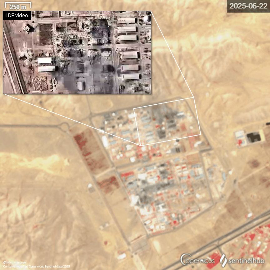
Low-resolution satellite imagery of the Isfahan Nuclear Technology Center showing damage with an insert of a screengrab from an IDF video showing damage to the site.
Some of the damage visible in the false color satellite imagery was shown in an IDF video yesterday.
22.06.2025 13:14 — 👍 3 🔁 0 💬 0 📌 0Before/after false color low-resolution satellite imagery of the Isfahan Nuclear Technology Center following Israeli and US strikes. Any possible damage to the tunnel entrances would likely not be visible at this resolution.
22.06.2025 13:14 — 👍 10 🔁 3 💬 1 📌 1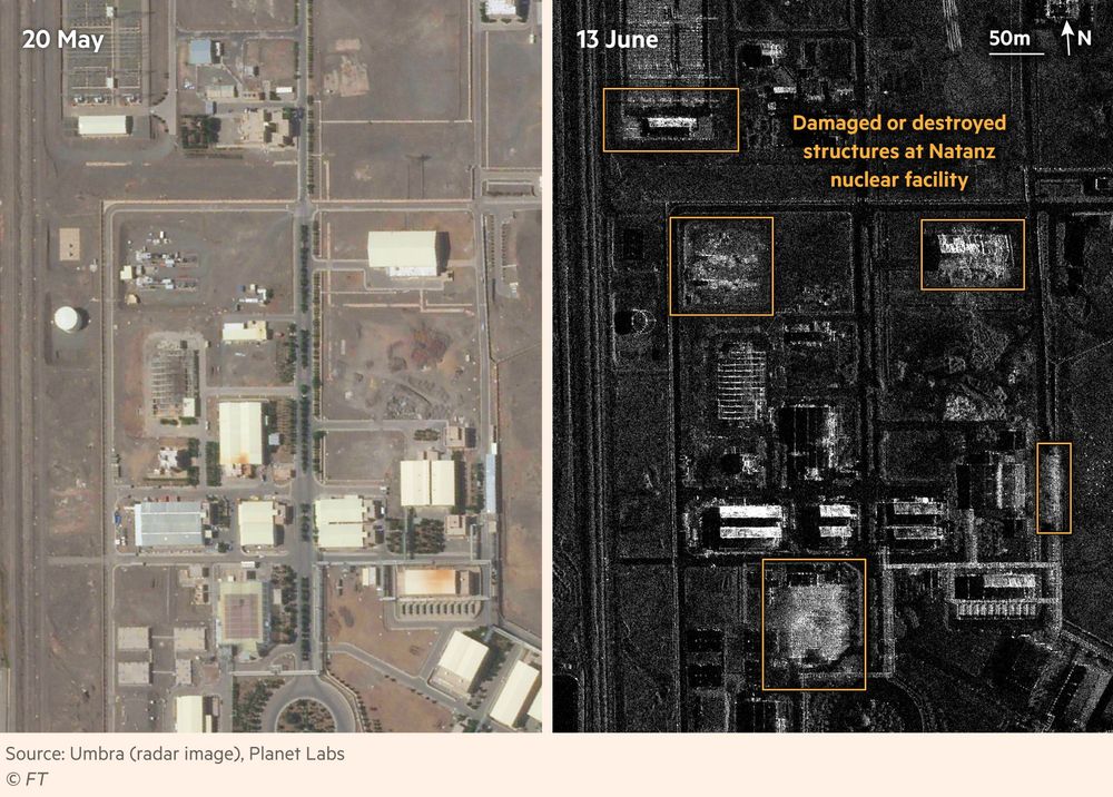
Satellite images of Natanz nuclear facility in Iran, from May 20 and June 13 2025. The recent images shows several damaged and destroyed structures.
Radar satellite imagery from Umbra shows several damaged and destroyed structures at the Natanz nuclear facility in Iran, following Israeli strikes this morning
More maps and videos of the multiple attacks in our story here: on.ft.com/445zvPR
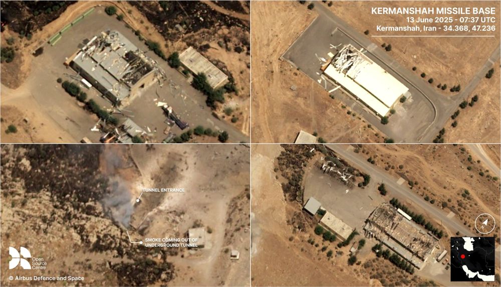
Kermanshah missile base imagery
13.06.2025 14:28 — 👍 21 🔁 5 💬 0 📌 0Congrats!
22.04.2025 19:45 — 👍 1 🔁 0 💬 0 📌 0👋
17.04.2025 04:03 — 👍 1 🔁 0 💬 0 📌 0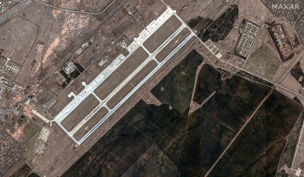
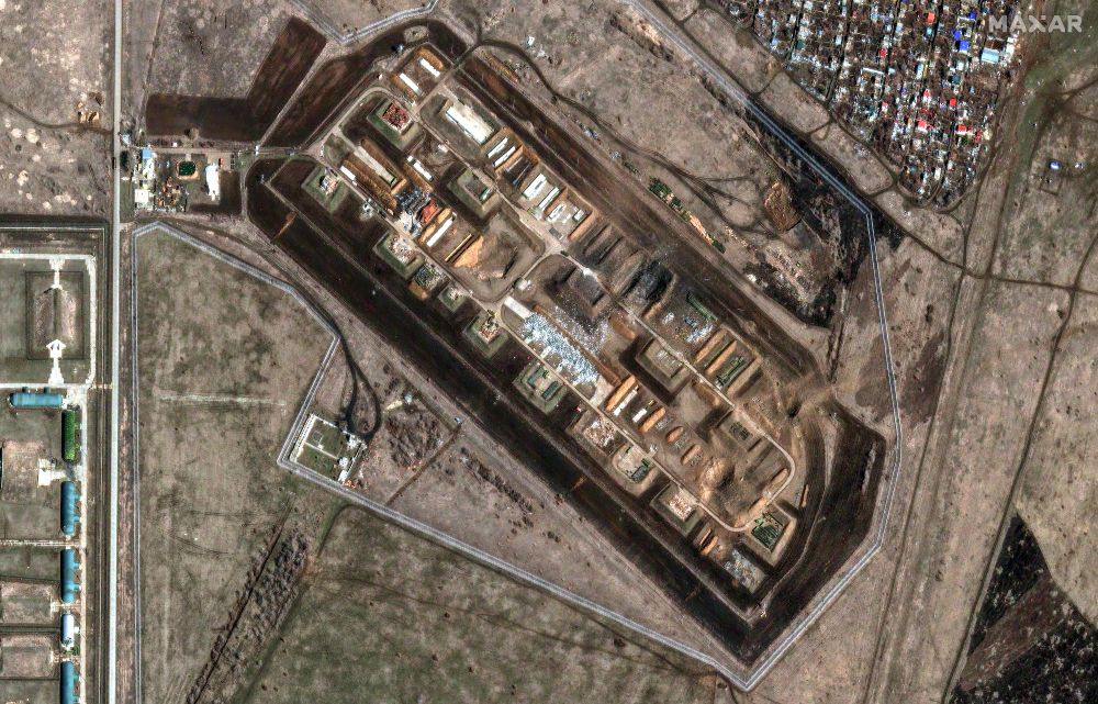
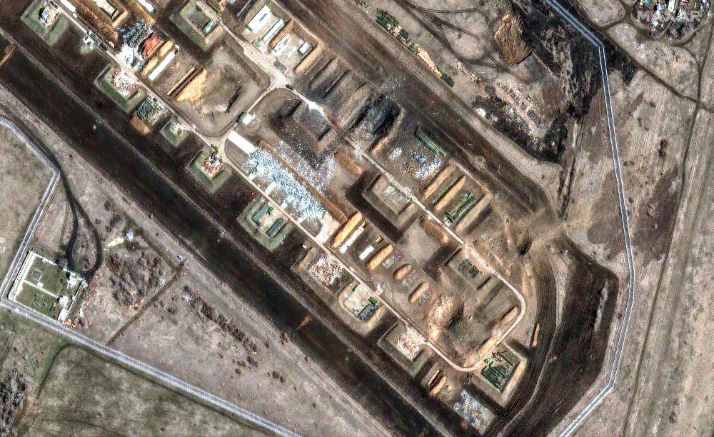
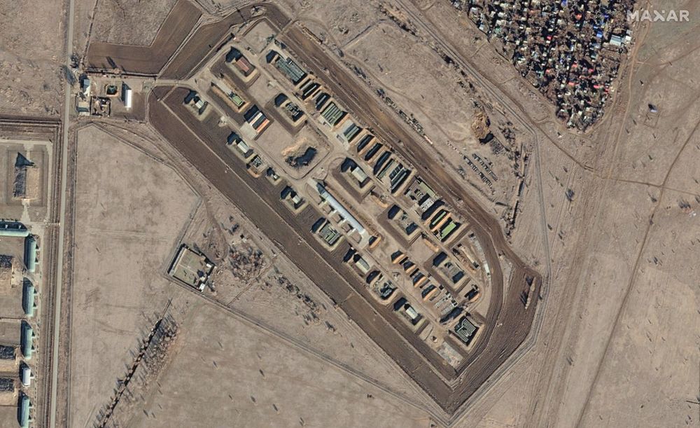
new satellite imagery (from this morning) of Russia's Engles Air Base, which was hit by Ukrainian drones a day earlier. Craters and destroyed buildings are visible. Images 1-3 from March 21; Image 4 from Dec. 2024. By Maxar Technologies.
21.03.2025 16:24 — 👍 136 🔁 18 💬 5 📌 2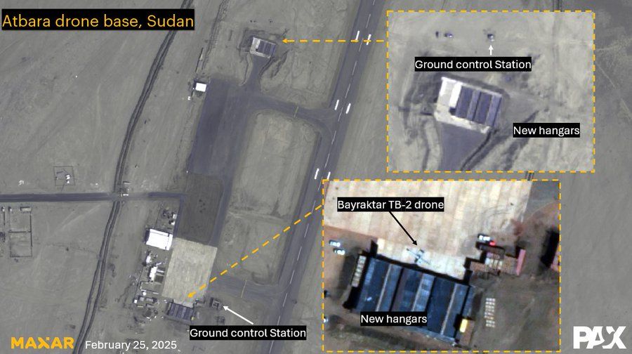
New scoop based on leak docs by the @washingtonpost.com
shows how Bayraktar delivered at least 6 TB-2 armed #drones to the SAF in #Sudan in 2024. Here's our confirmation of TB-2 drones seen at Atbara airbase on satellite imagery from February 2025 www.washingtonpost.com/world/2025/0...
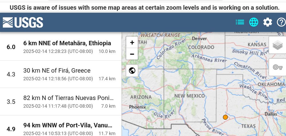
USGS error: USGS is aware of issues with some map areas at certain zoom levels and is working on a solution.
USGS breaking already. This is probably related to the Gulf of Tomfoolery.
"USGS is aware of issues with some map areas at certain zoom levels and is working on a solution. "
15.64022, 32.55183
23.12.2024 16:09 — 👍 10 🔁 1 💬 0 📌 0OSINT comes and goes. Straight-up, there are days, weeks where nothing really interesting happens worth note in your field. That's okay and actually really good. Use that time to read books, or find new resources on the background of your subject/topic of interest. Always always always be learning.
20.12.2024 15:05 — 👍 6 🔁 1 💬 1 📌 0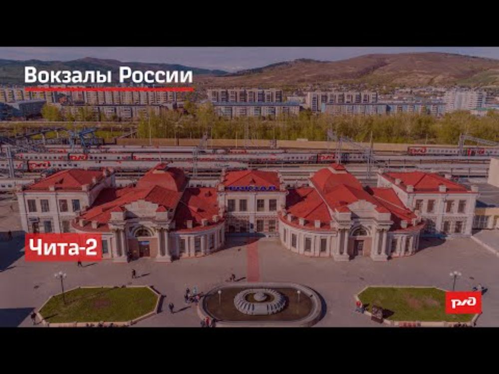
Resources shown:
youtu.be/S5kjiPScNh4
maps.app.goo.gl/dEw1AFxsZRsN...
Also used but not shown:
youtu.be/pTjxuR9tg4I
www.youtube.com/watch?v=qikV...
(Probable) Geolocation of North Korean SPH being transported by rail in Chita, Zabaykalsky Krai, Russia.
52.02835, 113.49426
Difficult to be completely sure on this one; I welcome more input.
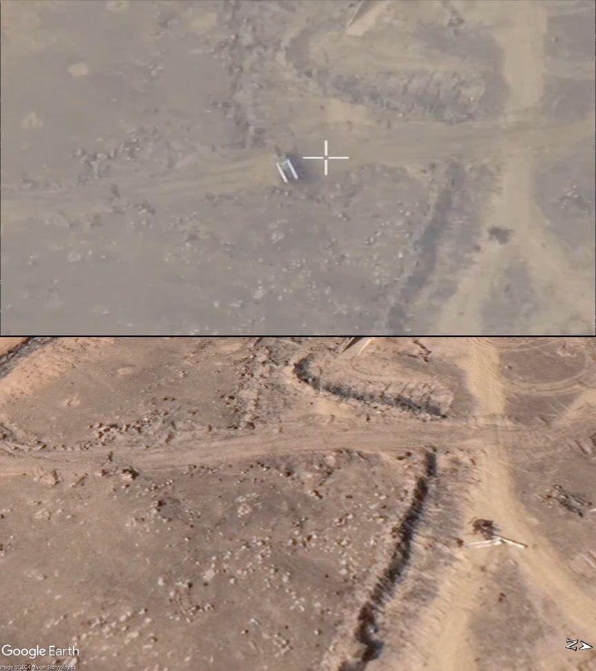
Geolocation of Israeli airstrike on a Syrian air defense site near Damascus.
33.35143, 36.54928
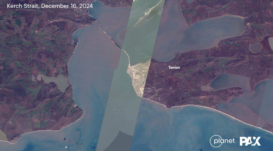
Satellite imagery by Planet of today, Dec 16, so far doesn't show a massive leak of heavy fuel oil, as feared after two aging Russian oil tankers sunk or were damaged in the Kerch Strait. We'll keep monitoring to see if the situation develops.
edition.cnn.com/2024/12/16/e...
Video still from here: x.com/manniefabian...
13.12.2024 21:18 — 👍 1 🔁 1 💬 0 📌 0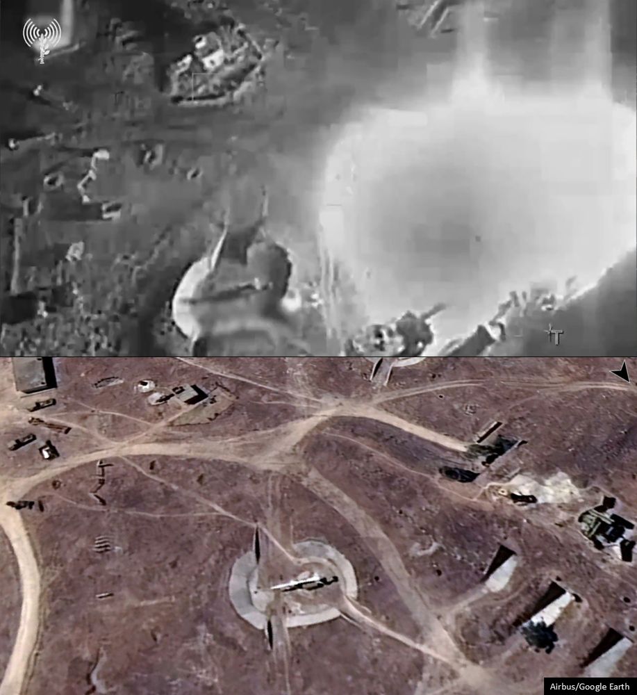
Geolocation of Israeli airstrike on a Syrian air defense site west of Homs.
34.7078, 36.5510
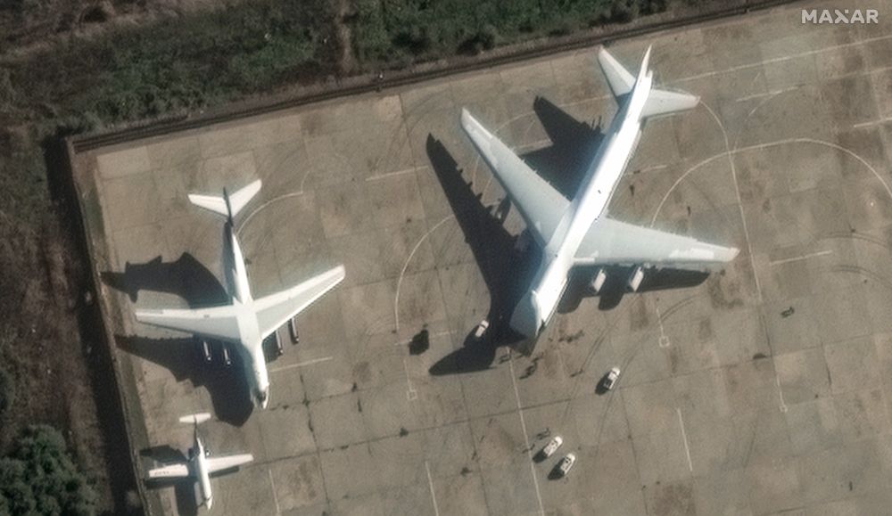
NEW: Maxar is out with new images of Russia's Khmeimim airbase showing transport planes loading gear, and Ka-52 attack helos & an S-400 air defense unit being dismantled
13.12.2024 17:51 — 👍 9 🔁 6 💬 0 📌 0New Thread.🇸🇾vehicle losses in Hama city.
On 05.12 Rebels moved into the city. Some fighting but SAA largely melt away.
Source says here they unexpectedly met a 🇸🇾tank then flee AA MG from it.
Enroute an abandoned 🇸🇾ZSU-23-4 Shilka (seen elsewhere later).
I didn't count the T-55 as unclear affiliation.
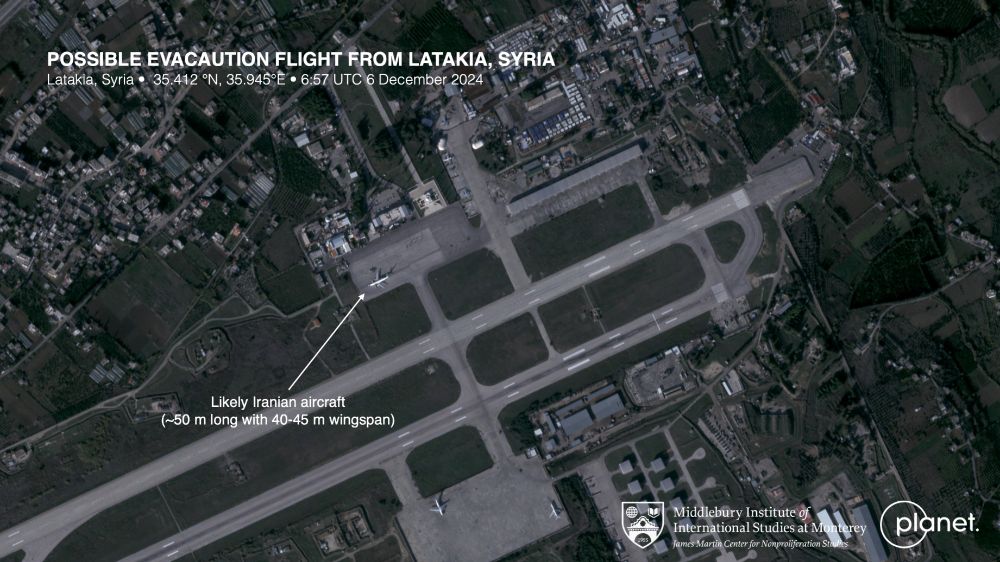
Our friends at @planet captured an unusual -- likely Iranian -- aircraft at Latakia (Khmeimim Air Base/OSLK) earlier today. We think its likely an evacuation flight. Rats fleeing a sinking ship.
07.12.2024 02:35 — 👍 199 🔁 31 💬 5 📌 1This appears to be Idlib, not Hama. Building in the background resembles the Shawarma House in Idlib at 35.9322, 36.6240 as seen in one of their Facebook videos here: www.facebook.com/Shawarmahome...
Filming location would perhaps be across the street at another shawarma spot at 35.9319, 36.6240.
I've put together an OSINT starter kit. Let's unite the OSINT community on Bluesky!
go.bsky.app/GaTRbT3