Want to learn more about our plans for our Humanitarian Satellite Constellation, Join us tomorrow or Thursday!
#humanitarian #emergencyresponse #satellites #space4good #remotesensing
Want to learn more about our plans for our Humanitarian Satellite Constellation, Join us tomorrow or Thursday!
#humanitarian #emergencyresponse #satellites #space4good #remotesensing
Just published this community needs assessment for an independent humanitarian satellite mission, I'd love your support in sharing this around, getting feedback on it, and any good vibes: www.commonspace.world/_files/ugd/1...
#remotesensing #space #satellites #humanitarian #climate #conflict

One analytical model shows that, as of November 5th, the dismantling of U.S.A.I.D. has already caused the deaths of 600,000 people, two-thirds of them children. https://newyorkermag.visitlink.me/jUzNSc
06.11.2025 21:00 — 👍 9264 🔁 6021 💬 436 📌 1284
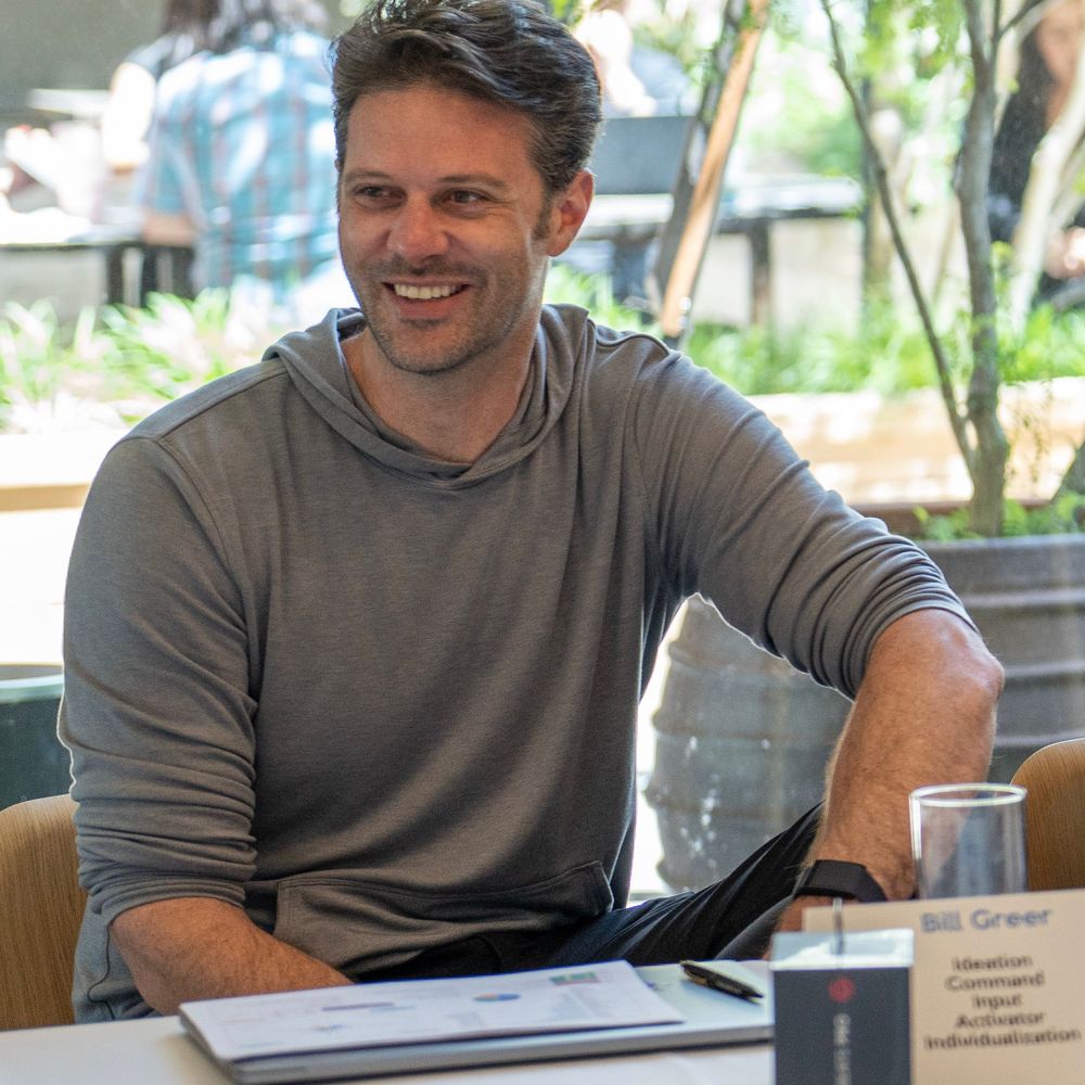
We're honored to serve as fiscal sponsor for Common Space, as they work to build a high-res satellite constellation for humanitarian aid. If you use sat imagery for social good, fill out their survey to help shape their 🛰️ mission requirements @billfgreer.bsky.social
docs.google.com/forms/d/e/1F...

@commonspace.bsky.social Just won the Kluz Prize for Peace Tech! www.kluzprize.org/updates/from...
We're humbled and completely stoked to have won this prize, which validates the need for the data, the mission we've set up to accomplish, but also highlights the massive challenges ahead! Lets Go!

I was on a podcast talking about Common Space: www.youtube.com/watch?v=xQof...
I can't stand listening to myself speak, so let me know if i was any good.

Posting for reach because I dont know how the Blue Sky Algorithm works: The Moral Case for a Humanitarian Satellite: www.linkedin.com/pulse/moral-...
It's about time that the space race included missions that actually help the people.
#Remotesensing #CivilSociety #humanitarian #GIS

Making the moral case for a humanitarian satellite: www.linkedin.com/pulse/moral-...
#remotesensing #space #GIS #geospatial #GIS4Good

Hi @bsky.app, At @commonspace.bsky.social we’re building a hi-res satellite for humanitarian aid & disaster response. If you use satellite imagery for good, help us validate the need by taking our survey: docs.google.com/forms/d/e/1F... #Sat4Good #HumanitarianTech #geospatial #remotesensing
19.05.2025 20:29 — 👍 3 🔁 3 💬 0 📌 0


Went to Yemen, it was nice #socotra
10.04.2025 01:47 — 👍 1 🔁 0 💬 1 📌 0
The New York Times is the first to put out comprehensive estimates on the cost of a year without U.S.A.I.D. and they’re higher than I thought:
- 1.65 million deaths from AIDS
- 500,000 from lack of vaccines
- 550,000 from lack of food aid
- 290,000 from malaria
- 310,000 from TB
Hell Yea! You're going to be amazing!
16.03.2025 00:36 — 👍 0 🔁 0 💬 1 📌 0Life is about to make a big change for me. I will be leaving my full time graphic design job (that I have worked in for the past 14 years) in early April to vend and freelance full time. I am scared, but really desperate to make art. I love drawing.
15.03.2025 20:25 — 👍 514 🔁 14 💬 47 📌 1
Arrrrrrrr you feeling better? 🏴☠️
Seriously though, heal up quick!

And like a silly goose i forgot to link to the article!
www.thenewhumanitarian.org/opinion/2025...
Common Space (@commonspace.bsky.social ) is trying to create a new, consistent and reliable data stream (Satellite Imagery) to support and create a new baseline for humanitarian action. This article by @newhumanitarian.bsky.social calls out exactly why that mission is so important. Time to step up!
10.03.2025 18:35 — 👍 3 🔁 2 💬 1 📌 0
Unclear if Maxar will be able to sell the imagery to Ukraine outside of the GEGD contract, but it would get complicated. Where should Ukraine get data now?
Airbus - VHR data from 🇫🇷
Wyvern Space - 🇨🇦 Hyper spectral
MDA - 🇨🇦 SAR
SkyWatch - 🇨🇦 Imagery platform
ICEYE - 🇫🇮 SAR
Who did I miss?
ESA satellites can be used, but they are 10meter resolution as compared to Maxars 30cm Resolution... so very different use cases. If you want operational data you are generally going to need high resolution, higher revisit, and lower latency.
07.03.2025 23:00 — 👍 0 🔁 0 💬 0 📌 0We’re making it happen… but the need and timing seems to be accelerating, EO data is an incredible value, and the barriers to entry have been lowering for a while now. The time is now!
07.03.2025 17:00 — 👍 1 🔁 1 💬 0 📌 03/ Please share your thoughts here! And if you're interested in how you can help, please read our concept notes on building a dedicated Humanitarian Satellite Constellation here: www.commonspace.world/_files/ugd/2...
07.03.2025 16:57 — 👍 3 🔁 0 💬 0 📌 02/ The commercial market cannot be expected to act independently of its primary defense and intelligence customers. As a result, humanitarian organizations and independent actors cannot rely on the current systems, even when we know this data has the power to save lives.
07.03.2025 16:56 — 👍 1 🔁 0 💬 1 📌 0
One of the reasons we started Common Space was to make high-resolution optical data open & accessible for humanitarian aid. Right now, the commercial imagery market is dominated by defense & intelligence—which means access is limited, even when lives are at stake.
kyivindependent.com/maxar-techno...
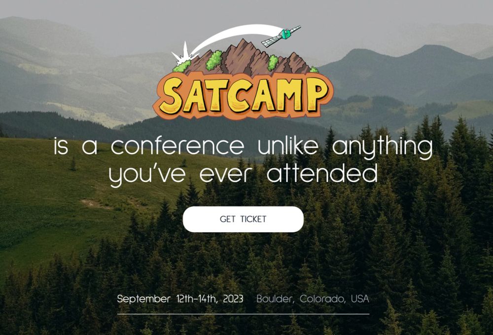
SatCamp Tickets are Live! Join us for SatCamp 2025: Resilience Through Uncharted Terrain!
📍 Boulder, CO | Sept 24-26
🎟️ Register now: satcamp.xyz
Let’s shape the future of geospatial together! 🌍🔥 #SatCamp2025
I dont normally re-read books, but just re-read these:
The Death of Expertise by @radiofreetom.bsky.social
The End is Just the Beginning by @peterzeihan.bsky.social
Winner Takes All by @anandwrites.bsky.social
Capital and Ideology by Thomas Piketty
All Bangers, all relevant, and recommended.
Things that know where they are can act on their location. Spatially enabled things have increased financial and functional utility. So far that has been people, with the hope that AI will get there soon, with #geoAI. Is spatial reasoning necessary for General AI?
24.02.2025 16:08 — 👍 0 🔁 0 💬 0 📌 0Talking about a vibrant Denver, while also returning that one block on Larimer back to car traffic. god forbid we have a part of town where we can actually walk around.
16.02.2025 19:57 — 👍 0 🔁 0 💬 0 📌 0
This is me… come hang out at the North51 Conference (www.n51.ca) in Canmore, Canada 🇨🇦 This conference has been one of the most consistently thought-provoking conferences in the geospatial schedule. Let me know if you’ll be there as well! @north51conference.bsky.social
10.02.2025 21:26 — 👍 2 🔁 1 💬 0 📌 0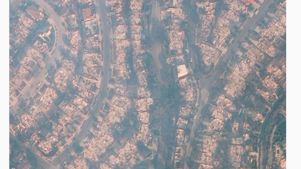
When my house and community burned - where was the satellite information? A very raw blog post I am putting up so folks in the satellite, geospatial and tech fields can listen firsthand why I think we are failing the situations that need us the most.
www.linkedin.com/pulse/when-o...

Satellite Imagery is used extensively in open-source investigative research, in this guide tech-fellow Agnes Cameron explains how some satellite images reveal more than the eye can see. www.bellingcat.com/resources/20...
10.01.2025 15:40 — 👍 311 🔁 88 💬 7 📌 5