The MnGeo 2023-2025 report cover and open page illustrate the information one can find in this latest edition.
MnGeo’s latest report celebrates major achievements in advancing geospatial technology across Minnesota. From boosting data sharing to delivering high-quality geospatial data, the team is helping build a stronger, more connected state. See the progress and what’s next
https://mn.pulse.ly/ndmdiobgz2
23.07.2025 14:15 — 👍 2 🔁 1 💬 0 📌 0
Today is the final day to submit your map to the U-Spatial Mapping Prize! Open to University of Minnesota grad and undergrad students on the Crookston, Duluth, Morris, Rochester, and Twin Cities campuses! You have until 11:59pm; get clicking! #UMN #SpatialThinking #UniversityofMinnesota
16.05.2025 15:42 — 👍 1 🔁 0 💬 0 📌 0
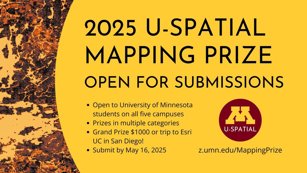
The 2025 U-Spatial Mapping Prize is open for submissions!
Open to University of Minnesota students on all five campuses
Prizes in multiple categories
Grand Prize $1000 or trip to Esri UC in San Diego!
Submit by May 16, 2025
The 2025 U-Spatial Mapping Prize is open for submissions! Open to undergrad and grad students on all five University of Minnesota campuses. Submit your map by 5/16/25 to win up to $1000 or a trip to Esri UC! Full details at z.umn.edu/MappingPrize #UMN #SpatialThinking
07.04.2025 21:27 — 👍 1 🔁 0 💬 0 📌 1
Convergence Curriculum for Geospatial Data Science: Overview and Q&A : I-GUIDE
Coming up today at noon! UMN's Eric Shook will provide an overview of I-GUIDE's Convergence Curriculum for Geospatial Data Science, discussing
- design & structure
- open & freely available materials for in- & out-of-classroom education
- training activities
- plus Q&A! i-guide.io/i-guide-vco/...
19.03.2025 15:49 — 👍 0 🔁 0 💬 0 📌 0
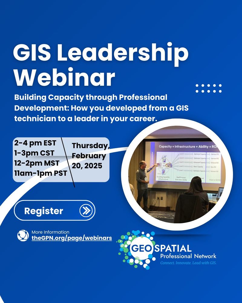
Need some leadership inspiration?
Grab a spot at our free webinar on Thursday: Building Capacity through Professional Development: How you developed from a GIS technician to a leader in your career. Phenomenal panelists! thegpn.org/page/webinars
@gpn-org.bsky.social
17.02.2025 18:27 — 👍 3 🔁 2 💬 0 📌 0
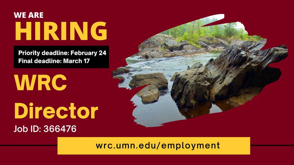
We are hiring! WRC Director
Priority deadline: February 24
Final deadline: March 17
Job ID: 366476
Our friends at the University of Minnesota Water Resources Center are hiring a new director! Priority deadline Feb 24; final deadline Mar 17. #UMNjobs wrc.umn.edu/employment
13.02.2025 16:58 — 👍 1 🔁 1 💬 0 📌 0
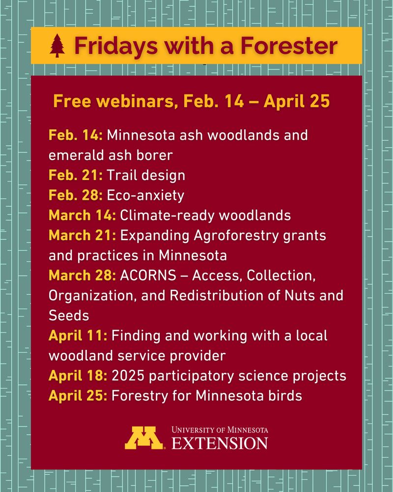
A list of webinars that reads: Feb. 14: Minnesota ash woodlands and emerald ash borer. Feb. 21: Trail design. Feb. 28: Eco-anxiety. March 14: Climate-ready woodlands. March 21: Expanding Agroforestry grants and practices in Minnesota. March 28: ACORNS – Access, Collection, Organization, and Redistribution of Nuts and Seeds. April 11: Finding and working with a local woodland service provider. April 18: 2025 participatory science projects. April 25: Forestry for Minnesota birds.
🌲🪵 Join us for the 2025 Fridays with a Forester webinar series! In these free online sessions, Extension foresters will discuss key issues and questions around forest and woodlands facing Minnesota landowners. Register now: https://buff.ly/4jYdhGm
#Forestry #NaturalResources #Trees #Minnesota
12.02.2025 20:55 — 👍 3 🔁 2 💬 0 📌 0
2025 Spring Workshop Instructor Agreement - Minnesota GIS/LIS Consortium
Our Mission: To develop and support the GIS/LIS community in Minnesota for the benefit of our people and contributors.
Interested in teaching a course for the Minnesota GIS/LIS Consortium Spring Workshops? Workshops are scheduled for May 15, 2025, either online or on the #UMN Twin Cities campus. More info on the MN GIS/LIS website:
www.mngislis.org/page/2025_Sp...
12.02.2025 19:18 — 👍 0 🔁 0 💬 0 📌 0
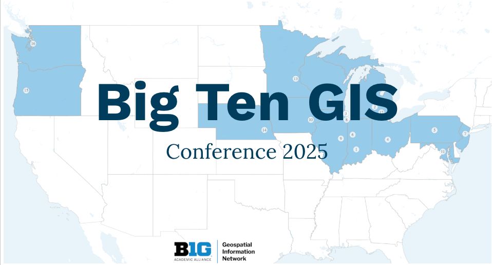
A map of the lower 48 United States showing states with Big Ten Academic Alliance Universities: Washington, Oregon, Nebraska, Minnesota, Iowa, Wisconsin, Illinois, Indiana, Michigan, Ohio, Pennsylvania, Maryland, and New Jersey but for some reason not California.
Submissions are open for the @bigtenacademic.bsky.social GIS conference! BTAA-GIN invites presentations, lightning talks, and map gallery submissions from any discipline. You do not need to be a Big Ten affiliate, just interested in geospatial research! #GISchat #GeoSky
gin.btaa.org/conference/2...
12.02.2025 00:11 — 👍 1 🔁 0 💬 0 📌 0
The LakeBrowser provides satellite-derived lake water quality data for over 10,000 Minnesota lakes since 2002. Check out our newly released update: Minnesota monthly and daily data when clear imagery is available 2017-2024!
https://lakes.rs.umn.edu/
Official account of the Minnesota Department of Transportation. For the latest road conditions and answers to your questions, visit http://mndot.gov/topics.
Independent, member-supported journalism for Minnesota.
🔗 minnpost.com
📧 minnpost.com/newsletters
Dad, husband, teacher, coach, veteran. Governor of Minnesota. Working to move our state forward as #OneMinnesota.
Official Bluesky for the City of Minneapolis.
https://linktr.ee/cityminneapolis
https://www.minneapolismn.gov
Minnesota Public Radio produces programming for radio, digital and live audiences. Follow our stations: @mprnews.org, @thecurrent.org
Advancing the power of facts, globally 🌎
Serving the University of Minnesota community since 1900.
Minnesota IT Services (MNIT) is the IT agency for MN's executive branch, creating an innovative digital government that works for everyone. https://mn.gov/mnit/
Forest Climate Adaptation, Biodiversity Conservation, & Disturbance
Climate and Conservation Manager at Friends of the Boundary Waters 🛶
Assistant Professor in Sociology at the University of Minnesota studying housing, climate, racism, and population health.
Fellow at @cplusc.bsky.social
https://ncgraetz.com/
The official Blue Sky account of the University of Minnesota Law School. law.umn.edu
Provider of census and survey data from around the world integrated across time and space. Use it for good, never for evil. ipums.org
Translational Immunology Research Lab at University of Minnesota Duluth.
The Institute for Geospatial Understanding through an Integrative Discovery Environment (I-GUIDE, https://i-guide.io) advances convergence and geospatial sciences for sustainability solutions. Platform, Summer Schools, Spatial AI.
A national leader in advancing community-engaged research, teaching, and outreach throughout the University of Minnesota.
State of the Map US is the largest gathering of OpenStreetMap community members from across the country. And this year we're meeting in Madison, Wisconsin, June 11 - 13th.
https://openstreetmap.us/events/state-of-the-map-us/2026/
We develop research-based solutions that can reduce the impacts of aquatic invasive species in Minnesota. #UMNProud #CFANS #FWCB https://linktr.ee/maisrc
The Geospatial Professional Network (formerly URISA) is a vibrant community uniting emerging and experienced GIS professionals through top-tier education, networking, and career development. Learn more: geospatialprofessionalnetwork.org