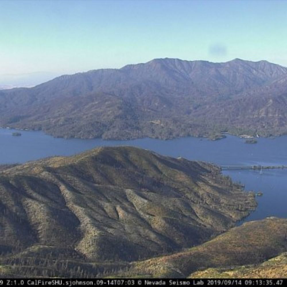
Blue Canyon, Placer County, CA
🗺39.2560, -120.7212 🧭140° ⛰5039 ft
https://ops.alertcalifornia.org/cam-console/1620
23.02.2026 21:41 — 👍 0 🔁 0 💬 0 📌 0

An image from AlertWildfire: Toro Peak 1, Riverside County, CA
🗺33.5235, -116.4257 🧭320° ⛰8681 ft
https://ops.alertcalifornia.org/cam-console/2459
Toro Peak 1, Riverside County, CA
🗺33.5235, -116.4257 🧭320° ⛰8681 ft
https://ops.alertcalifornia.org/cam-console/2459
23.02.2026 21:10 — 👍 0 🔁 0 💬 0 📌 0
Los Pinos South, SanDiego County, CA
🗺32.7347, -116.5778 🧭212° ⛰4774 ft
https://ops.alertcalifornia.org/cam-console/2087
23.02.2026 20:40 — 👍 1 🔁 0 💬 0 📌 0

An image from AlertWildfire: Moccasin Peak 2, Tuolumne County, CA
🗺37.8052, -120.3281 🧭240° ⛰2943 ft
https://ops.alertcalifornia.org/cam-console/2130
Moccasin Peak 2, Tuolumne County, CA
🗺37.8052, -120.3281 🧭240° ⛰2943 ft
https://ops.alertcalifornia.org/cam-console/2130
23.02.2026 20:10 — 👍 1 🔁 0 💬 0 📌 0
Wolf Mtn 2, Nevada County, CA
🗺39.1340, -121.0997 🧭145° ⛰2625 ft
https://ops.alertcalifornia.org/cam-console/1747
23.02.2026 19:40 — 👍 1 🔁 0 💬 0 📌 0

An image from AlertWildfire: Ridgewood, eldorado County, CA
🗺38.7313, -120.9867 🧭90° ⛰1647 ft
https://ops.alertcalifornia.org/cam-console/2316
Ridgewood, eldorado County, CA
🗺38.7313, -120.9867 🧭90° ⛰1647 ft
https://ops.alertcalifornia.org/cam-console/2316
23.02.2026 19:10 — 👍 1 🔁 0 💬 0 📌 0
Bear Mtn Shasta 2, Shasta County, CA
🗺40.7199, -122.2682 🧭196° ⛰2110 ft
https://ops.alertcalifornia.org/cam-console/1778
23.02.2026 18:41 — 👍 1 🔁 0 💬 0 📌 0

An image from AlertWildfire: Las Virgenes 2, Ventura County, CA
🗺34.1726, -118.6790 🧭36° ⛰1365 ft
https://ops.alertcalifornia.org/cam-console/15831
Las Virgenes 2, Ventura County, CA
🗺34.1726, -118.6790 🧭36° ⛰1365 ft
https://ops.alertcalifornia.org/cam-console/15831
23.02.2026 18:10 — 👍 0 🔁 0 💬 0 📌 0
Kenwood Ranch Upper 1, Sonoma County, CA
🗺38.4472, -122.5550 🧭112° ⛰1447 ft
https://ops.alertcalifornia.org/cam-console/2049
23.02.2026 17:40 — 👍 0 🔁 0 💬 0 📌 0

An image from AlertWildfire: Magic Mountain 2, LosAngeles County, CA
🗺34.3862, -118.3293 🧭60° ⛰4839 ft
https://ops.alertcalifornia.org/cam-console/2097
Magic Mountain 2, LosAngeles County, CA
🗺34.3862, -118.3293 🧭60° ⛰4839 ft
https://ops.alertcalifornia.org/cam-console/2097
23.02.2026 17:10 — 👍 0 🔁 0 💬 0 📌 0
Zinfandel 2, Napa County, CA
🗺38.4687, -122.4776 🧭20° ⛰1325 ft
https://ops.alertcalifornia.org/cam-console/2523
23.02.2026 16:41 — 👍 0 🔁 0 💬 0 📌 0

An image from AlertWildfire: Chilcoot, Lassen County, CA
🗺39.7746, -120.1084 🧭340° ⛰6001 ft
https://ops.alertcalifornia.org/cam-console/1626
Chilcoot, Lassen County, CA
🗺39.7746, -120.1084 🧭340° ⛰6001 ft
https://ops.alertcalifornia.org/cam-console/1626
23.02.2026 16:10 — 👍 1 🔁 0 💬 0 📌 0
Keig Yankee Point, Monterey County, CA
🗺36.4897, -121.9205 🧭102° ⛰1568 ft
https://ops.alertcalifornia.org/cam-console/2043
23.02.2026 15:41 — 👍 0 🔁 0 💬 0 📌 0

An image from AlertWildfire: Top Of The World 1, Orange County, CA
🗺33.5576, -117.7607 🧭124° ⛰997 ft
https://ops.alertcalifornia.org/cam-console/16232
Top Of The World 1, Orange County, CA
🗺33.5576, -117.7607 🧭124° ⛰997 ft
https://ops.alertcalifornia.org/cam-console/16232
23.02.2026 15:10 — 👍 0 🔁 0 💬 0 📌 0
Atlas Peak 2, Napa County, CA
🗺38.4528, -122.2668 🧭347° ⛰2651 ft
https://ops.alertcalifornia.org/cam-console/1796
23.02.2026 14:40 — 👍 1 🔁 0 💬 0 📌 0

An image from AlertWildfire: Sierra Vista 2, Calaveras County, CA
🗺38.2299, -120.6143 🧭240° ⛰2756 ft
https://ops.alertcalifornia.org/cam-console/2386
Sierra Vista 2, Calaveras County, CA
🗺38.2299, -120.6143 🧭240° ⛰2756 ft
https://ops.alertcalifornia.org/cam-console/2386
23.02.2026 14:10 — 👍 0 🔁 0 💬 0 📌 0
Mt Hamilton SCC 3, SantaClara County, CA
🗺37.3415, -121.6424 🧭157° ⛰4213 ft
https://ops.alertcalifornia.org/cam-console/2167
23.02.2026 13:41 — 👍 1 🔁 0 💬 0 📌 0

An image from AlertWildfire: Signal Peak NVCO 2, Nevada County, CA
🗺39.3388, -120.5358 🧭0° ⛰7789 ft
https://ops.alertcalifornia.org/cam-console/1723
Signal Peak NVCO 2, Nevada County, CA
🗺39.3388, -120.5358 🧭0° ⛰7789 ft
https://ops.alertcalifornia.org/cam-console/1723
23.02.2026 13:10 — 👍 0 🔁 0 💬 0 📌 0
SDSU Chapultepec 1, SanDiego County, CA
🗺32.7758, -117.0788 🧭17° ⛰443 ft
https://ops.alertcalifornia.org/cam-console/18273
23.02.2026 12:41 — 👍 1 🔁 0 💬 0 📌 0

An image from AlertWildfire: Wildcat Canyon, ContraCosta County, CA
🗺37.9568, -122.3166 🧭154° ⛰502 ft
https://ops.alertcalifornia.org/cam-console/2507
Wildcat Canyon, ContraCosta County, CA
🗺37.9568, -122.3166 🧭154° ⛰502 ft
https://ops.alertcalifornia.org/cam-console/2507
23.02.2026 12:10 — 👍 0 🔁 0 💬 0 📌 0
San Vicente 1, LosAngeles County, CA
🗺34.1287, -118.5129 🧭167° ⛰1890 ft
https://ops.alertcalifornia.org/cam-console/2359
23.02.2026 11:40 — 👍 0 🔁 0 💬 0 📌 0

An image from AlertWildfire: El Rancho 2, Kern County, CA
🗺35.1641, -118.5806 🧭47° ⛰5879 ft
https://ops.alertcalifornia.org/cam-console/1958
El Rancho 2, Kern County, CA
🗺35.1641, -118.5806 🧭47° ⛰5879 ft
https://ops.alertcalifornia.org/cam-console/1958
23.02.2026 11:10 — 👍 0 🔁 0 💬 0 📌 0
Top Of The World 2, Orange County, CA
🗺33.5576, -117.7607 🧭325° ⛰997 ft
https://ops.alertcalifornia.org/cam-console/16233
23.02.2026 10:41 — 👍 1 🔁 0 💬 0 📌 0

An image from AlertWildfire: Las Virgenes 1, Ventura County, CA
🗺34.1726, -118.6790 🧭278° ⛰1365 ft
https://ops.alertcalifornia.org/cam-console/15830
Las Virgenes 1, Ventura County, CA
🗺34.1726, -118.6790 🧭278° ⛰1365 ft
https://ops.alertcalifornia.org/cam-console/15830
23.02.2026 10:10 — 👍 0 🔁 0 💬 0 📌 0
Bear Clover 1, Fresno County, CA
🗺36.6929, -119.0910 🧭122° ⛰3323 ft
https://ops.alertcalifornia.org/cam-console/2711
23.02.2026 09:41 — 👍 0 🔁 0 💬 0 📌 0

An image from AlertWildfire: Mt Wilson West, LosAngeles County, CA
🗺34.2245, -118.0587 🧭322° ⛰5689 ft
https://ops.alertcalifornia.org/cam-console/2196
Mt Wilson West, LosAngeles County, CA
🗺34.2245, -118.0587 🧭322° ⛰5689 ft
https://ops.alertcalifornia.org/cam-console/2196
23.02.2026 09:10 — 👍 0 🔁 0 💬 0 📌 0
Palo Escrito 2, Monterey County, CA
🗺36.4064, -121.4914 🧭105° ⛰4416 ft
https://ops.alertcalifornia.org/cam-console/2238
23.02.2026 08:41 — 👍 0 🔁 0 💬 0 📌 0

An image from AlertWildfire: Bald Mtn Napa, Napa County, CA
🗺38.4263, -122.4903 🧭113° ⛰1775 ft
https://ops.alertcalifornia.org/cam-console/1804
Bald Mtn Napa, Napa County, CA
🗺38.4263, -122.4903 🧭113° ⛰1775 ft
https://ops.alertcalifornia.org/cam-console/1804
23.02.2026 08:10 — 👍 0 🔁 0 💬 0 📌 0
Sierra Peak 1, Riverside County, CA
🗺33.8499, -117.6541 🧭169° ⛰3005 ft
https://ops.alertcalifornia.org/cam-console/2381
23.02.2026 07:41 — 👍 0 🔁 0 💬 0 📌 0

An image from AlertWildfire: Burnt Peak 2, LosAngeles County, CA
🗺34.6820, -118.5741 🧭240° ⛰5561 ft
https://ops.alertcalifornia.org/cam-console/5561
Burnt Peak 2, LosAngeles County, CA
🗺34.6820, -118.5741 🧭240° ⛰5561 ft
https://ops.alertcalifornia.org/cam-console/5561
23.02.2026 07:10 — 👍 1 🔁 0 💬 0 📌 0