
Photo of Beach Mart covered in snow
Snow my gosh, look at Beach Mart! #HoldenBeach #BeachMart #NorthCarolina #USA
01.02.2026 22:18 — 👍 2 🔁 1 💬 0 📌 0
@beachmart.bsky.social
We're the original, old-school beach shop in Holden Beach, NC--Family owned since 1974. For over 50 years it has been "The Store With More" for locals & tourists alike. #HoldenBeach #NorthCarolina #USA #Brunsco #ShopSmall #BeachShop #FamilyBusiness
Photo of Beach Mart covered in snow
Snow my gosh, look at Beach Mart! #HoldenBeach #BeachMart #NorthCarolina #USA
01.02.2026 22:18 — 👍 2 🔁 1 💬 0 📌 0
Winter Weather Advisory
The Holden Beach bridge is closed due to the extreme weather conditions. Authorities will continue to monitor the situation and an email will be sent when the bridge is open.
Town Hall will be closed tomorrow due to the storm.
#HoldenBeach #NorthCarolina #Brunsco #Weather

Photo of snow at Holden Beach, NC at night
Dunes of snow blowing in the night at Holden Beach #HoldenBeach #NorthCarolina #USA #Weather
01.02.2026 10:21 — 👍 116 🔁 15 💬 4 📌 1
Brunswick County Libraries, Parks, Landfill & Convenience Centers closed this weekend #HoldenBeach #NorthCarolina #Brunsco #USA #Weather
brunswickcountync.gov/m/newsflash/...

Photo of a smiling guy wearing new Goodr sunglasses
🔴⚪️🔵 New Goodr sunglasses just delivered! #HoldenBeach #BeachMart #NorthCarolina #USA
22.01.2026 15:20 — 👍 1 🔁 1 💬 0 📌 0
Holden Beach Turtle Watch Program volunteers patrol from May to October the Brunswick island’s ocean shoreline for turtle crawls, locate nests, relocate eggs from nests that are in unsafe locations, mark and nests, and monitor them until hatchlings are released.
coastalreview.org/2026/01/appl...

Seashell on the Seashore.
Holden Beach, North Carolina (1980).
Pentax K1000, Kodak film.
#EastCoastKin #Scape #FilmPhotography 🎞️ #HoldenBeach #NorthCarolina #VintagePhoto #PentaxPhotography #PentaxK1000 #SeaScape #Beaches #SeaShell #Waves #Sand
As always thank you for any likes and shares. ❤️

The North Carolina Coastal Federation is launching a six-month leadership and professional development program focused on coastal issues.
coastalreview.org/2026/01/regi...

Sunscreen: Because we make it for the ones we love.
www.youtube.com/watch?v=lzz3...
#SunBum #BeachMart #NorthCarolina #NorthCarolina #Brunsco

Photo of sunset at Holden Beach, NC
❤️ Holden Beach, NC #HoldenBeach #NorthCarolina #USA
11.01.2026 22:04 — 👍 5 🔁 2 💬 0 📌 0
Photo of shelling accessories like shell scoops and shell bags
It’s a beautiful day for shelling & Beach Mart is OPEN! Grab a shell scoop on your way to the beach. #HoldenBeach #BeachMart #NorthCarolina #USA
09.01.2026 14:54 — 👍 4 🔁 1 💬 0 📌 0
Photo of the interior of Beach Mart in Holden Beach, NC
We’re closed today and tomorrow (Jan 7 & 8) while we clean and polish the floors. Then, we’ll see you again this weekend! #HoldenBeach #BeachMart #NorthCarolina #USA
07.01.2026 13:53 — 👍 3 🔁 1 💬 0 📌 0
A hazy morning in Holden Beach
A hazy morning in Holden Beach #HoldenBeach #NorthCarolina
06.01.2026 14:13 — 👍 4 🔁 2 💬 0 📌 0
Photo of Fahlo at BEACH MART

Photo of Dune jewelry at BEACH MART

Photo of gift ideas at BEACH MART
Stop in for last minute stocking stuffers: Fahlo bracelets, Goodr sunglasses, Dune jewelry and much more! #HoldenBeach #BeachMart #NorthCarolina #USA
23.12.2025 20:20 — 👍 3 🔁 1 💬 0 📌 0
Photo of Sandcloud towels on display at BEACH MART in Holden Beach, NC
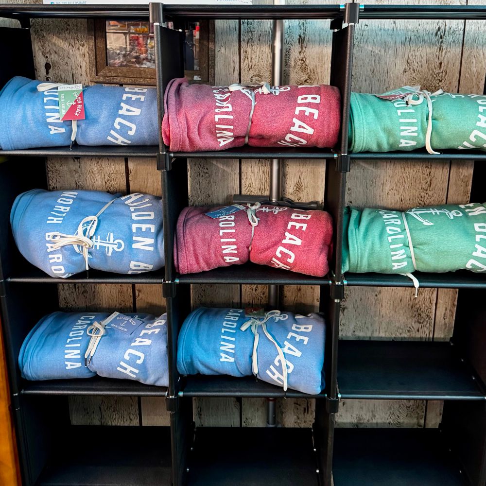
Photo of beach blankets on display at BEACH MART in Holden Beach, NC

Photo of fun socks on display at BEACH MART in Holden Beach, NC
Give a little comfort under the Christmas tree with towels, blankets and socks from BEACH MART! Store hours this weekend: 10am-3pm. #HoldenBeach #BeachMart #NorthCarolina #Brunsco #USA #BeachLife
12.12.2025 19:16 — 👍 4 🔁 1 💬 0 📌 0
Stop in and shop local Holden Beach creations at BEACH MART! #HoldenBeach #NorthCarolina #USA #Brunsco #BeachLife
thebeachmart.com/about-beach-...

Shop gifts from Holden Beach, NC this Christmas — thebeachmart.com/beach-mart-o...
#HoldenBeach #BeachMart #NorthCarolina #BrunsCo #BeachLife


It’s beginning to look at lot like Christmas! Stop in and shop with us today. We’ll be open from 10am to 4pm.
#HoldenBeach #BeachMart #Brunsco #NorthCarolina #USA
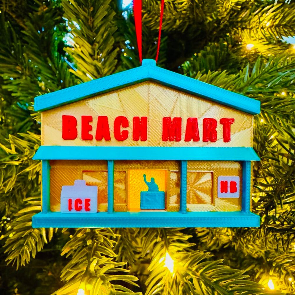
Bring a little piece of Holden Beach home for the holidays with this Beach Mart 50th Anniversary Christmas Ornament #HoldenBeach #NorthCarolina #USA #Christmas #BeachLife
thebeachmart.com/product/beac...
The Town of Holden Beach is taking an interest list for beginner shag lessons running for six weeks, January 8th -February 12th. It will be held at Town Hall at 6pm. $60 (residents) & $70 (non-res). Email Christy christy.ferguson@hbtownhall.com if interested.
#HoldenBeach #NorthCarolina

Stella and Snapper. They’re so cute. #tyinc #BeachMart #HoldenBeach
22.11.2025 17:36 — 👍 4 🔁 1 💬 0 📌 0
Holden Beach Tree Lighting —
Join us for our annual Christmas Tree Lighting on Thursday, December 4th at 6:00 p.m. at Bridgeview Park. Entertainment starts at 5:30 p.m.
Come visit with Santa, Mrs. Claus and the Grinch.
#HoldenBeach #NorthCarolina #USA #BeachLife #BrunsCo


This is a late Cretaceous echinoid, Hardournia mortonis, from the Peedee Fm. near Holden Beach, NC. The mouth structure is preserved with 5 beak-like teeth called Aristotle's lantern.
#FossilFriday

Holden beach sunsets are the best!
10.11.2025 03:54 — 👍 6 🔁 3 💬 0 📌 0
Voters to decide future of Holden Beach Pier with referendum #NCnews
04.11.2025 19:50 — 👍 3 🔁 2 💬 0 📌 0
Thinking about Christmas gifts yet? Get Holden Beach History books shipped to you!
thebeachmart.com/product/hold...
#HoldenBeach #NorthCarolina #USA #BeachMart #LocalHistory #SmallBusiness
Thinking about Christmas gifts yet? Get Holden Beach History books shipped to you!
thebeachmart.com/product/hold...
#HoldenBeach #NorthCarolina #USA #BeachMart #LocalHistory #SmallBusiness

Photo of a house being moved off Holden Beach
House being moved off the island today! #HoldenBeach #NorthCarolina #USA
02.10.2025 14:30 — 👍 4 🔁 2 💬 0 📌 0
Photo of a sunset at Holden Beach, Noeth Carolina with the town water tower
Good night Holden Beach #HoldenBeach #NorthCarolina #USA
01.10.2025 23:25 — 👍 6 🔁 2 💬 0 📌 0
Photo of card games sold at BEACH MART

Photo of Books sold at BEACH MART

Photo of kids books sold at BEACH MART
Shop rainy-day fun! #BeachMart #HoldenBeach #NorthCarolina #USA #BeachLife
27.09.2025 16:38 — 👍 4 🔁 1 💬 0 📌 0