SHV issues Area Forecast Discussion (AFD) at Aug 14, 7:51 PM CDT ...New AVIATION... via IEMbot
Additional Details Here.
15.08.2025 01:08 — 👍 0 🔁 0 💬 0 📌 0
SHV issues A STRONG THUNDERSTORM WILL IMPACT WEST CENTRAL CADDO AND WEST CENTRAL BOSSIER PARISHES UNTIL 815 PM CDT [wind: 50 MPH, hail: 0.00 IN]
at Fri, 15 Aug 2025 00:40:11 +0000 via IEMbot
Additional Details Here.
15.08.2025 00:48 — 👍 0 🔁 0 💬 0 📌 0
At 739 PM CDT, Doppler radar was tracking a strong thunderstorm just
southeast of Blanchard, or 8 miles north of Shreveport, moving north
northeast at 15 mph.
HAZARD...Wind gusts up to 50 mph.
SOURCE...Radar indicated.
IMPACT...Gusty winds could knock down tree limbs and blow around
unsecured objects.
Locations impacted include...
Shreveport, Blanchard, Benton and Dixie.
Special Weather Statement issued August 14 at 7:39PM CDT by NWS Shreveport LA
Additional Details Here.
15.08.2025 00:45 — 👍 0 🔁 0 💬 0 📌 0
At 716 PM CDT, Doppler radar was tracking a strong thunderstorm near
Downtown Shreveport, or just west of Bossier City, moving east
northeast at 20 mph.
HAZARD...Wind gusts up to 40 mph and pea size hail.
SOURCE...Radar indicated.
IMPACT...Gusty winds could knock down tree limbs and blow around
unsecured objects. Minor damage to outdoor objects is possible.
Locations impacted include...
Shreveport, Bossier City, Haughton, Fosters, Eastwood, Ferguson,
Red Chute, Bodcau and Fillmore.
Special Weather Statement issued August 14 at 7:16PM CDT by NWS Shreveport LA
Additional Details Here.
15.08.2025 00:30 — 👍 0 🔁 0 💬 0 📌 0
SHV issues A STRONG THUNDERSTORM WILL IMPACT EAST CENTRAL HARRISON COUNTY UNTIL 8 PM CDT [wind: 50 MPH, hail: 0.50 IN] till 8:00 PM CDT
at Fri, 15 Aug 2025 00:13:11 +0000 via IEMbot
Additional Details Here.
15.08.2025 00:28 — 👍 0 🔁 0 💬 0 📌 0
At 713 PM CDT, Doppler radar was tracking a strong thunderstorm just
west of Waskom, or 13 miles east of Marshall, moving east southeast
at 5 mph.
HAZARD...Wind gusts up to 50 mph and half inch size hail.
SOURCE...Radar indicated.
IMPACT...Gusty winds could knock down tree limbs and blow around
unsecured objects. Minor damage to outdoor objects is possible.
Locations impacted include...
Waskom and Jonesville.
Special Weather Statement issued August 14 at 7:13PM CDT by NWS Shreveport LA
Additional Details Here.
15.08.2025 00:15 — 👍 0 🔁 0 💬 0 📌 0
SHV issues A STRONG THUNDERSTORM WILL IMPACT WEST CENTRAL CADDO PARISH AND EAST CENTRAL HARRISON COUNTY UNTIL 715 PM CDT [wind: 40 MPH, hail: 0.25 IN]
at Thu, 14 Aug 2025 23:39:16 +0000 via IEMbot
Additional Details Here.
14.08.2025 23:48 — 👍 0 🔁 0 💬 0 📌 0
At 638 PM CDT, Doppler radar was tracking a strong thunderstorm near
Waskom, or 15 miles west of Shreveport, moving southwest at 5 mph.
HAZARD...Wind gusts up to 40 mph and pea size hail.
SOURCE...Radar indicated.
IMPACT...Gusty winds could knock down tree limbs and blow around
unsecured objects. Minor damage to outdoor objects is possible.
Locations impacted include...
Greenwood, Waskom, Jonesville and Bethany.
Special Weather Statement issued August 14 at 6:38PM CDT by NWS Shreveport LA
Additional Details Here.
14.08.2025 23:45 — 👍 0 🔁 0 💬 0 📌 0
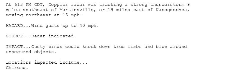
At 613 PM CDT, Doppler radar was tracking a strong thunderstorm 9
miles southeast of Martinsville, or 19 miles east of Nacogdoches,
moving northeast at 15 mph.
HAZARD...Wind gusts up to 40 mph.
SOURCE...Radar indicated.
IMPACT...Gusty winds could knock down tree limbs and blow around
unsecured objects.
Locations impacted include...
Chireno.
Special Weather Statement issued August 14 at 6:13PM CDT by NWS Shreveport LA
Additional Details Here.
14.08.2025 23:30 — 👍 0 🔁 0 💬 0 📌 0
SHV issues A STRONG THUNDERSTORM WILL IMPACT EAST CENTRAL NACOGDOCHES AND NORTHWESTERN SAN AUGUSTINE COUNTIES UNTIL 645 PM CDT [wind: 40 MPH, hail: 0.00 IN]
at Thu, 14 Aug 2025 23:13:44 +0000 via IEMbot
Additional Details Here.
14.08.2025 23:29 — 👍 0 🔁 0 💬 0 📌 0
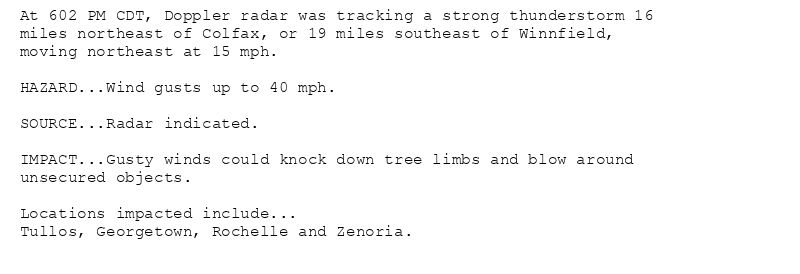
At 602 PM CDT, Doppler radar was tracking a strong thunderstorm 16
miles northeast of Colfax, or 19 miles southeast of Winnfield,
moving northeast at 15 mph.
HAZARD...Wind gusts up to 40 mph.
SOURCE...Radar indicated.
IMPACT...Gusty winds could knock down tree limbs and blow around
unsecured objects.
Locations impacted include...
Tullos, Georgetown, Rochelle and Zenoria.
Special Weather Statement issued August 14 at 6:02PM CDT by NWS Shreveport LA
Additional Details Here.
14.08.2025 23:15 — 👍 0 🔁 0 💬 0 📌 0
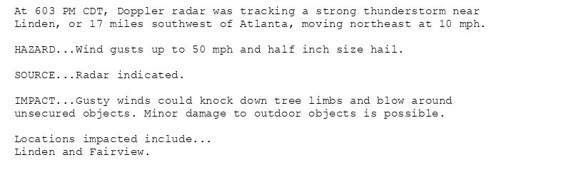
At 603 PM CDT, Doppler radar was tracking a strong thunderstorm near
Linden, or 17 miles southwest of Atlanta, moving northeast at 10 mph.
HAZARD...Wind gusts up to 50 mph and half inch size hail.
SOURCE...Radar indicated.
IMPACT...Gusty winds could knock down tree limbs and blow around
unsecured objects. Minor damage to outdoor objects is possible.
Locations impacted include...
Linden and Fairview.
Special Weather Statement issued August 14 at 6:03PM CDT by NWS Shreveport LA
Additional Details Here.
14.08.2025 23:15 — 👍 0 🔁 0 💬 0 📌 0
SHV issues A STRONG THUNDERSTORM WILL IMPACT NORTHWESTERN LA SALLE [wind: 40 MPH, hail: 0.00 IN] for Grant, La Salle, Winn [LA] till 6:30 PM CDT
at Thu, 14 Aug 2025 23:02:09 +0000 via IEMbot
Additional Details Here.
14.08.2025 23:08 — 👍 0 🔁 0 💬 0 📌 0
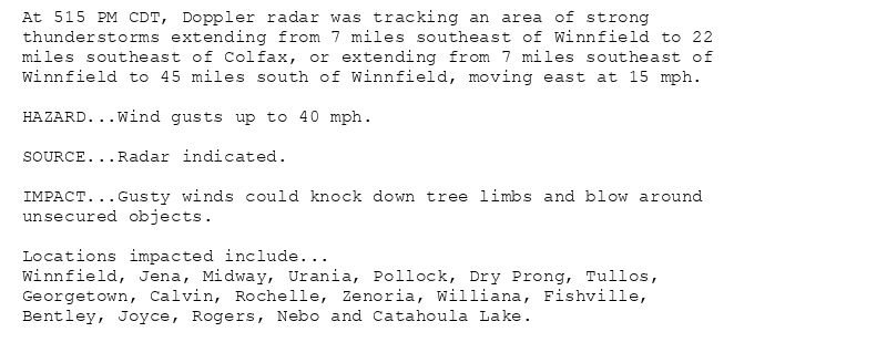
At 515 PM CDT, Doppler radar was tracking an area of strong
thunderstorms extending from 7 miles southeast of Winnfield to 22
miles southeast of Colfax, or extending from 7 miles southeast of
Winnfield to 45 miles south of Winnfield, moving east at 15 mph.
HAZARD...Wind gusts up to 40 mph.
SOURCE...Radar indicated.
IMPACT...Gusty winds could knock down tree limbs and blow around
unsecured objects.
Locations impacted include...
Winnfield, Jena, Midway, Urania, Pollock, Dry Prong, Tullos,
Georgetown, Calvin, Rochelle, Zenoria, Williana, Fishville,
Bentley, Joyce, Rogers, Nebo and Catahoula Lake.
Special Weather Statement issued August 14 at 5:15PM CDT by NWS Shreveport LA
Additional Details Here.
14.08.2025 22:30 — 👍 0 🔁 0 💬 0 📌 0
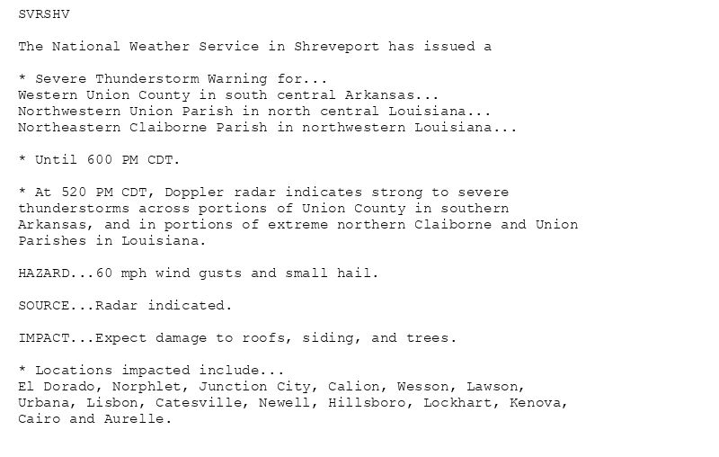
SVRSHV
The National Weather Service in Shreveport has issued a
* Severe Thunderstorm Warning for...
Western Union County in south central Arkansas...
Northwestern Union Parish in north central Louisiana...
Northeastern Claiborne Parish in northwestern Louisiana...
* Until 600 PM CDT.
* At 520 PM CDT, Doppler radar indicates strong to severe
thunderstorms across portions of Union County in southern
Arkansas, and in portions of extreme northern Claiborne and Union
Parishes in Louisiana.
HAZARD...60 mph wind gusts and small hail.
SOURCE...Radar indicated.
IMPACT...Expect damage to roofs, siding, and trees.
* Locations impacted include...
El Dorado, Norphlet, Junction City, Calion, Wesson, Lawson,
Urbana, Lisbon, Catesville, Newell, Hillsboro, Lockhart, Kenova,
Cairo and Aurelle.
🚨 Severe Thunderstorm Warning issued August 14 at 5:20PM CDT until August 14 at 6:00PM CDT by NWS Shreveport LA 🚨
Additional Details Here.
14.08.2025 22:30 — 👍 0 🔁 0 💬 0 📌 0
SHV issues AN AREA OF STRONG THUNDERSTORMS WILL IMPACT CENTRAL LA SALLE [wind: 40 MPH, hail: 0.00 IN] for Grant, La Salle, Winn [LA] till 6:00 PM CDT
at Thu, 14 Aug 2025 22:15:31 +0000 via IEMbot
Additional Details Here.
14.08.2025 22:28 — 👍 0 🔁 0 💬 0 📌 0
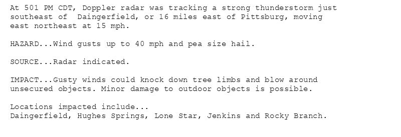
At 501 PM CDT, Doppler radar was tracking a strong thunderstorm just
southeast of Daingerfield, or 16 miles east of Pittsburg, moving
east northeast at 15 mph.
HAZARD...Wind gusts up to 40 mph and pea size hail.
SOURCE...Radar indicated.
IMPACT...Gusty winds could knock down tree limbs and blow around
unsecured objects. Minor damage to outdoor objects is possible.
Locations impacted include...
Daingerfield, Hughes Springs, Lone Star, Jenkins and Rocky Branch.
Special Weather Statement issued August 14 at 5:01PM CDT by NWS Shreveport LA
Additional Details Here.
14.08.2025 22:15 — 👍 0 🔁 0 💬 0 📌 0
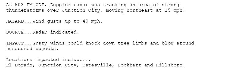
At 503 PM CDT, Doppler radar was tracking an area of strong
thunderstorms over Junction City, moving northeast at 15 mph.
HAZARD...Wind gusts up to 40 mph.
SOURCE...Radar indicated.
IMPACT...Gusty winds could knock down tree limbs and blow around
unsecured objects.
Locations impacted include...
El Dorado, Junction City, Catesville, Lockhart and Hillsboro.
Special Weather Statement issued August 14 at 5:03PM CDT by NWS Shreveport LA
Additional Details Here.
14.08.2025 22:15 — 👍 0 🔁 0 💬 0 📌 0
SHV cancels Severe Thunderstorm Warning for Caldwell, La Salle, Winn [LA]
at Thu, 14 Aug 2025 22:00:28 +0000 via IEMbot
Additional Details Here.
14.08.2025 22:08 — 👍 0 🔁 0 💬 0 📌 0
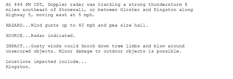
At 444 PM CDT, Doppler radar was tracking a strong thunderstorm 8
miles southeast of Stonewall, or between Gloster and Kingston along
Highway 5, moving east at 5 mph.
HAZARD...Wind gusts up to 40 mph and pea size hail.
SOURCE...Radar indicated.
IMPACT...Gusty winds could knock down tree limbs and blow around
unsecured objects. Minor damage to outdoor objects is possible.
Locations impacted include...
Kingston.
Special Weather Statement issued August 14 at 4:44PM CDT by NWS Shreveport LA
Additional Details Here.
14.08.2025 22:00 — 👍 0 🔁 0 💬 0 📌 0
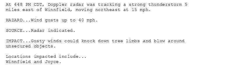
At 448 PM CDT, Doppler radar was tracking a strong thunderstorm 5
miles east of Winnfield, moving northeast at 15 mph.
HAZARD...Wind gusts up to 40 mph.
SOURCE...Radar indicated.
IMPACT...Gusty winds could knock down tree limbs and blow around
unsecured objects.
Locations impacted include...
Winnfield and Joyce.
Special Weather Statement issued August 14 at 4:48PM CDT by NWS Shreveport LA
Additional Details Here.
14.08.2025 22:00 — 👍 0 🔁 0 💬 0 📌 0
SHV issues A STRONG THUNDERSTORM WILL IMPACT NORTHEASTERN DE SOTO [wind: 50 MPH, hail: 0.50 IN] for Bossier, Caddo, De Soto [LA] till 5:15 PM CDT
at Thu, 14 Aug 2025 21:30:43 +0000 via IEMbot
Additional Details Here.
14.08.2025 21:49 — 👍 1 🔁 0 💬 0 📌 0
SHV issues A STRONG THUNDERSTORM WILL IMPACT NORTH CENTRAL DE SOTO PARISH UNTIL 515 PM CDT [wind: 40 MPH, hail: 0.25 IN]
at Thu, 14 Aug 2025 21:44:50 +0000 via IEMbot
Additional Details Here.
14.08.2025 21:49 — 👍 0 🔁 0 💬 0 📌 0
DE QUEEN Aug 14
Climate Report:
High: 96
Low: 69
Precip: 0.0"
Snow: Missing
at Thu, 14 Aug 2025 21:46:41 +0000 via IEMbot
Additional Details Here.
14.08.2025 21:49 — 👍 0 🔁 0 💬 0 📌 0
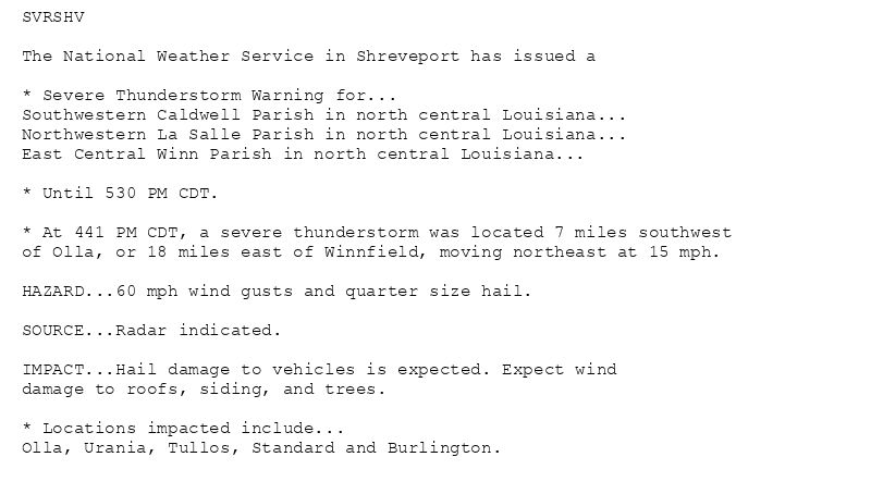
SVRSHV
The National Weather Service in Shreveport has issued a
* Severe Thunderstorm Warning for...
Southwestern Caldwell Parish in north central Louisiana...
Northwestern La Salle Parish in north central Louisiana...
East Central Winn Parish in north central Louisiana...
* Until 530 PM CDT.
* At 441 PM CDT, a severe thunderstorm was located 7 miles southwest
of Olla, or 18 miles east of Winnfield, moving northeast at 15 mph.
HAZARD...60 mph wind gusts and quarter size hail.
SOURCE...Radar indicated.
IMPACT...Hail damage to vehicles is expected. Expect wind
damage to roofs, siding, and trees.
* Locations impacted include...
Olla, Urania, Tullos, Standard and Burlington.
🚨 Severe Thunderstorm Warning issued August 14 at 4:41PM CDT until August 14 at 5:30PM CDT by NWS Shreveport LA 🚨
Additional Details Here.
14.08.2025 21:45 — 👍 0 🔁 0 💬 0 📌 0
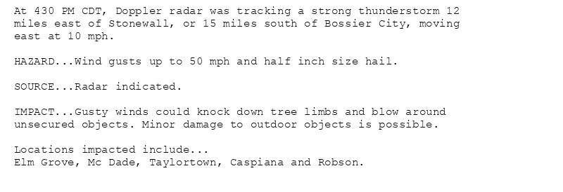
At 430 PM CDT, Doppler radar was tracking a strong thunderstorm 12
miles east of Stonewall, or 15 miles south of Bossier City, moving
east at 10 mph.
HAZARD...Wind gusts up to 50 mph and half inch size hail.
SOURCE...Radar indicated.
IMPACT...Gusty winds could knock down tree limbs and blow around
unsecured objects. Minor damage to outdoor objects is possible.
Locations impacted include...
Elm Grove, Mc Dade, Taylortown, Caspiana and Robson.
Special Weather Statement issued August 14 at 4:30PM CDT by NWS Shreveport LA
Additional Details Here.
14.08.2025 21:45 — 👍 0 🔁 0 💬 0 📌 0
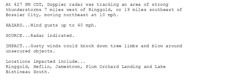
At 427 PM CDT, Doppler radar was tracking an area of strong
thunderstorms 7 miles west of Ringgold, or 19 miles southeast of
Bossier City, moving northeast at 10 mph.
HAZARD...Wind gusts up to 40 mph.
SOURCE...Radar indicated.
IMPACT...Gusty winds could knock down tree limbs and blow around
unsecured objects.
Locations impacted include...
Ringgold, Heflin, Jamestown, Plum Orchard Landing and Lake
Bistineau South.
Special Weather Statement issued August 14 at 4:27PM CDT by NWS Shreveport LA
Additional Details Here.
14.08.2025 21:30 — 👍 1 🔁 0 💬 0 📌 0
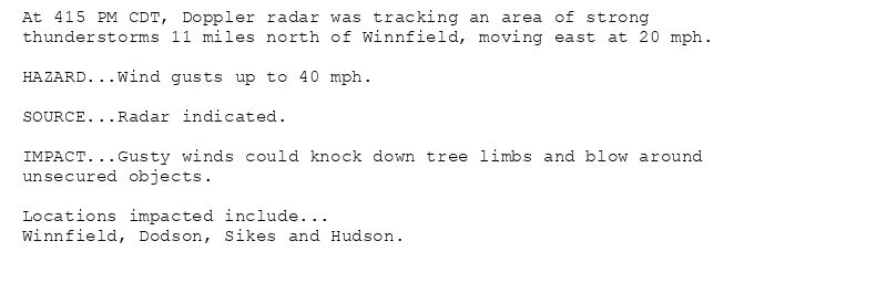
At 415 PM CDT, Doppler radar was tracking an area of strong
thunderstorms 11 miles north of Winnfield, moving east at 20 mph.
HAZARD...Wind gusts up to 40 mph.
SOURCE...Radar indicated.
IMPACT...Gusty winds could knock down tree limbs and blow around
unsecured objects.
Locations impacted include...
Winnfield, Dodson, Sikes and Hudson.
Special Weather Statement issued August 14 at 4:15PM CDT by NWS Shreveport LA
Additional Details Here.
14.08.2025 21:30 — 👍 0 🔁 0 💬 0 📌 0
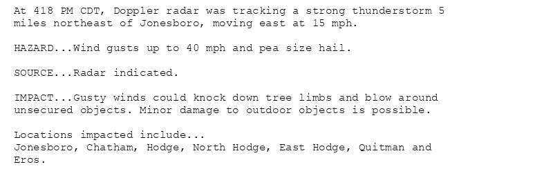
At 418 PM CDT, Doppler radar was tracking a strong thunderstorm 5
miles northeast of Jonesboro, moving east at 15 mph.
HAZARD...Wind gusts up to 40 mph and pea size hail.
SOURCE...Radar indicated.
IMPACT...Gusty winds could knock down tree limbs and blow around
unsecured objects. Minor damage to outdoor objects is possible.
Locations impacted include...
Jonesboro, Chatham, Hodge, North Hodge, East Hodge, Quitman and
Eros.
Special Weather Statement issued August 14 at 4:18PM CDT by NWS Shreveport LA
Additional Details Here.
14.08.2025 21:30 — 👍 0 🔁 0 💬 0 📌 0
SHV issues AN AREA OF STRONG THUNDERSTORMS WILL IMPACT SOUTHEASTERN JACKSON AND NORTHEASTERN WINN PARISHES UNTIL 5 PM CDT [wind: 40 MPH, hail: 0.00 IN] till 5:00 PM CDT
at Thu, 1... at Thu, 14 Aug 2025 21:15:39 +0000 via IEMbot
Additional Details Here.
14.08.2025 21:28 — 👍 0 🔁 0 💬 0 📌 0