FLAGSTAFF AZ AIRPORT Aug 23
Climate Report:
High: None
Low: None
Precip: 0.0"
Snow: Missing
at Sun, 24 Aug 2025 02:16:14 +0000 via IEMbot
Additional Details Here.
24.08.2025 02:28 — 👍 1 🔁 0 💬 0 📌 0
WINSLOW AZ AIRPORT Aug 23
Climate Report:
High: 99
Low: 72
Precip: 0.0"
Snow: Missing
at Sun, 24 Aug 2025 02:16:14 +0000 via IEMbot
Additional Details Here.
24.08.2025 02:28 — 👍 0 🔁 0 💬 0 📌 0
PRESCOTT AZ AIRPORT Aug 23
Climate Report:
High: 91
Low: 69
Precip: Trace
Snow: Missing
at Sun, 24 Aug 2025 02:16:17 +0000 via IEMbot
Additional Details Here.
24.08.2025 02:28 — 👍 0 🔁 0 💬 0 📌 0
FGZ expires Flash Flood Warning for Coconino [AZ]
at Sun, 24 Aug 2025 01:56:05 +0000 via IEMbot
Additional Details Here.
24.08.2025 02:08 — 👍 1 🔁 0 💬 0 📌 0
FGZ continues Flash Flood Warning [flash flood: radar indicated, flash flood damage threat: considerable] for Coconino [AZ] till Aug 23, 7:00 PM MST
at Sun, 24 Aug 2025 00:10:01 +0000 via IEMbot
Additional Details Here.
24.08.2025 00:28 — 👍 1 🔁 0 💬 0 📌 0
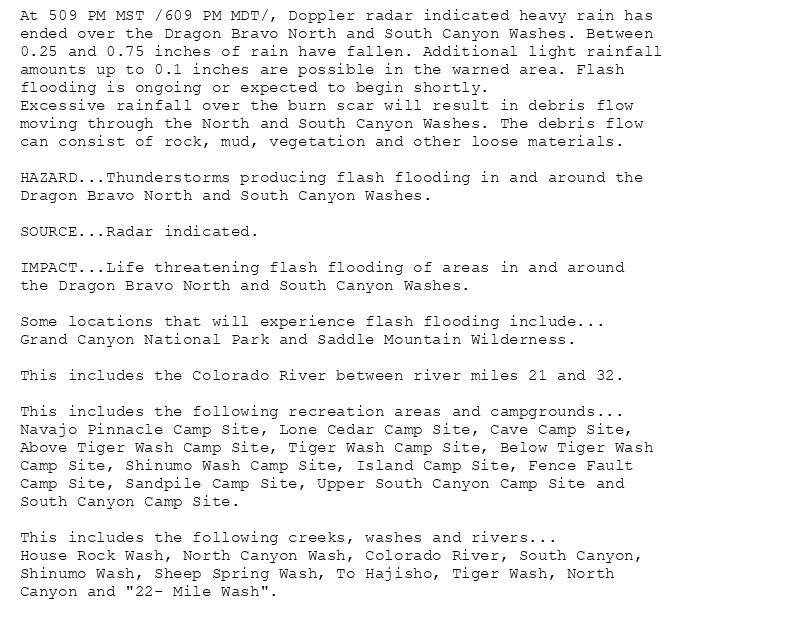
At 509 PM MST /609 PM MDT/, Doppler radar indicated heavy rain has
ended over the Dragon Bravo North and South Canyon Washes. Between
0.25 and 0.75 inches of rain have fallen. Additional light rainfall
amounts up to 0.1 inches are possible in the warned area. Flash
flooding is ongoing or expected to begin shortly.
Excessive rainfall over the burn scar will result in debris flow
moving through the North and South Canyon Washes. The debris flow
can consist of rock, mud, vegetation and other loose materials.
HAZARD...Thunderstorms producing flash flooding in and around the
Dragon Bravo North and South Canyon Washes.
SOURCE...Radar indicated.
IMPACT...Life threatening flash flooding of areas in and around
the Dragon Bravo North and South Canyon Washes.
Some locations that will experience flash flooding include...
Grand Canyon National Park and Saddle Mountain Wilderness.
This includes the Colorado River between river miles 21 and 32.
This includes the following recreation areas and campgrounds...
Navajo Pinnacle Camp Site, Lone Cedar Camp Site, Cave Camp Site,
Above Tiger Wash Camp Site, Tiger Wash Camp Site, Below Tiger Wash
Camp Site, Shinumo Wash Camp Site, Island Camp Site, Fence Fault
Camp Site, Sandpile Camp Site, Upper South Canyon Camp Site and
South Canyon Camp Site.
This includes the following creeks, washes and rivers...
House Rock Wash, North Canyon Wash, Colorado River, South Canyon,
Shinumo Wash, Sheep Spring Wash, To Hajisho, Tiger Wash, North
Canyon and "22- Mile Wash".
🚨 Flash Flood Warning issued August 23 at 5:09PM MST until August 23 at 7:00PM MST by NWS Flagstaff AZ 🚨
Additional Details Here.
24.08.2025 00:15 — 👍 0 🔁 0 💬 0 📌 0
FGZ issues Area Forecast Discussion (AFD) at Aug 23, 4:42 PM MST
at Sat, 23 Aug 2025 23:42:33 +0000 via IEMbot
Additional Details Here.
23.08.2025 23:47 — 👍 0 🔁 0 💬 0 📌 0
FGZ cancels Flash Flood Warning for Coconino [AZ]
at Sat, 23 Aug 2025 23:09:57 +0000 via IEMbot
Additional Details Here.
23.08.2025 23:28 — 👍 1 🔁 0 💬 0 📌 0
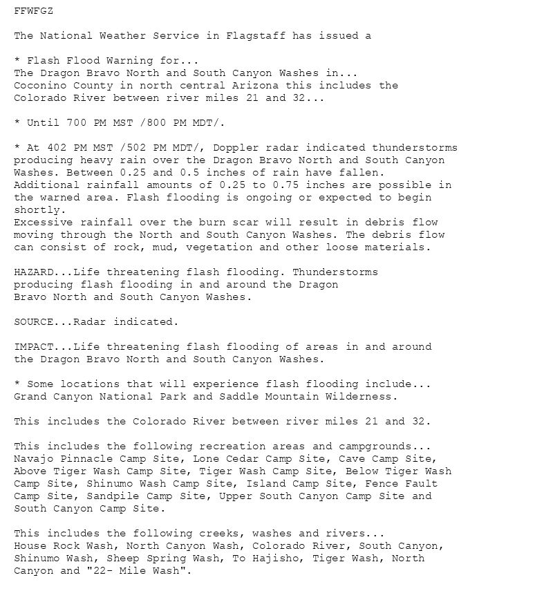
FFWFGZ
The National Weather Service in Flagstaff has issued a
* Flash Flood Warning for...
The Dragon Bravo North and South Canyon Washes in...
Coconino County in north central Arizona this includes the
Colorado River between river miles 21 and 32...
* Until 700 PM MST /800 PM MDT/.
* At 402 PM MST /502 PM MDT/, Doppler radar indicated thunderstorms
producing heavy rain over the Dragon Bravo North and South Canyon
Washes. Between 0.25 and 0.5 inches of rain have fallen.
Additional rainfall amounts of 0.25 to 0.75 inches are possible in
the warned area. Flash flooding is ongoing or expected to begin
shortly.
Excessive rainfall over the burn scar will result in debris flow
moving through the North and South Canyon Washes. The debris flow
can consist of rock, mud, vegetation and other loose materials.
HAZARD...Life threatening flash flooding. Thunderstorms
producing flash flooding in and around the Dragon
Bravo North and South Canyon Washes.
SOURCE...Radar indicated.
IMPACT...Life threatening flash flooding of areas in and around
the Dragon Bravo North and South Canyon Washes.
* Some locations that will experience flash flooding include...
Grand Canyon National Park and Saddle Mountain Wilderness.
This includes the Colorado River between river miles 21 and 32.
This includes the following recreation areas and campgrounds...
Navajo Pinnacle Camp Site, Lone Cedar Camp Site, Cave Camp Site,
Above Tiger Wash Camp Site, Tiger Wash Camp Site, Below Tiger Wash
Camp Site, Shinumo Wash Camp Site, Island Camp Site, Fence Fault
Camp Site, Sandpile Camp Site, Upper South Canyon Camp Site and
South Canyon Camp Site.
This includes the following creeks, washes and rivers...
House Rock Wash, North Canyon Wash, Colorado River, South Canyon,
Shinumo Wash, Sheep Spring Wash, To Hajisho, Tiger Wash, North
Canyon and "22- Mile Wash".
🚨 Flash Flood Warning issued August 23 at 4:02PM MST until August 23 at 7:00PM MST by NWS Flagstaff AZ 🚨
Additional Details Here.
23.08.2025 23:15 — 👍 0 🔁 0 💬 0 📌 0
FGZ issues Flash Flood Warning [flash flood: radar indicated, flash flood damage threat: considerable] for Coconino [AZ] till Aug 23, 7:00 PM MST
at Sat, 23 Aug 2025 23:02:59 +0000 via IEMbot
Additional Details Here.
23.08.2025 23:07 — 👍 0 🔁 0 💬 0 📌 0
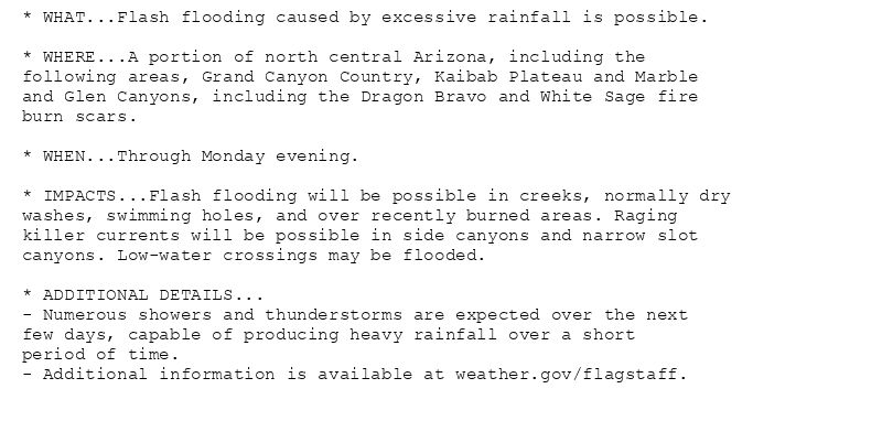
* WHAT...Flash flooding caused by excessive rainfall is possible.
* WHERE...A portion of north central Arizona, including the
following areas, Grand Canyon Country, Kaibab Plateau and Marble
and Glen Canyons, including the Dragon Bravo and White Sage fire
burn scars.
* WHEN...Through Monday evening.
* IMPACTS...Flash flooding will be possible in creeks, normally dry
washes, swimming holes, and over recently burned areas. Raging
killer currents will be possible in side canyons and narrow slot
canyons. Low-water crossings may be flooded.
* ADDITIONAL DETAILS...
- Numerous showers and thunderstorms are expected over the next
few days, capable of producing heavy rainfall over a short
period of time.
- Additional information is available at weather.gov/flagstaff.
🚨 Flood Watch issued August 23 at 3:02PM MST until August 25 at 8:00PM MST by NWS Flagstaff AZ 🚨
Additional Details Here.
23.08.2025 22:15 — 👍 0 🔁 0 💬 0 📌 0
FGZ continues Flash Flood Warning [flash flood: radar indicated, flash flood damage threat: considerable] for Coconino [AZ] till Aug 23, 4:45 PM MST
at Sat, 23 Aug 2025 21:51:01 +0000 via IEMbot
Additional Details Here.
23.08.2025 22:07 — 👍 0 🔁 0 💬 0 📌 0
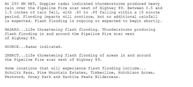
At 250 PM MST, Doppler radar indicated thunderstorms produced heavy
rain over the Pipeline Fire scar west of Highway 89. Between 0.5 and
1.5 inches of rain fell, with .60 to .85 falling within a 15 minute
period. Flooding impacts will continue, but no additional rainfall
is expected. Flash flooding is ongoing or expected to begin shortly.
HAZARD...Life threatening flash flooding. Thunderstorms producing
flash flooding in and around the Pipeline Fire scar west
of Highway 89.
SOURCE...Radar indicated.
IMPACT...Life threatening flash flooding of areas in and around
the Pipeline Fire scar west of Highway 89.
Some locations that will experience flash flooding include...
Schultz Pass, Pine Mountain Estates, Timberline, Hutchison Acres,
Fernwood, Doney Park and Kachina Peaks Wilderness.
🚨 Flash Flood Warning issued August 23 at 2:50PM MST until August 23 at 4:45PM MST by NWS Flagstaff AZ 🚨
Additional Details Here.
23.08.2025 22:00 — 👍 0 🔁 0 💬 0 📌 0
FGZ issues Flash Flood Warning [flash flood: radar indicated, flash flood damage threat: considerable] for Coconino [AZ] till Aug 23, 4:45 PM MST
at Sat, 23 Aug 2025 20:54:51 +0000 via IEMbot
Additional Details Here.
23.08.2025 21:08 — 👍 1 🔁 0 💬 0 📌 0
FGZ issues Area Forecast Discussion (AFD) at Aug 23, 2:00 PM MST
at Sat, 23 Aug 2025 21:00:28 +0000 via IEMbot
Additional Details Here.
23.08.2025 21:08 — 👍 1 🔁 0 💬 0 📌 0
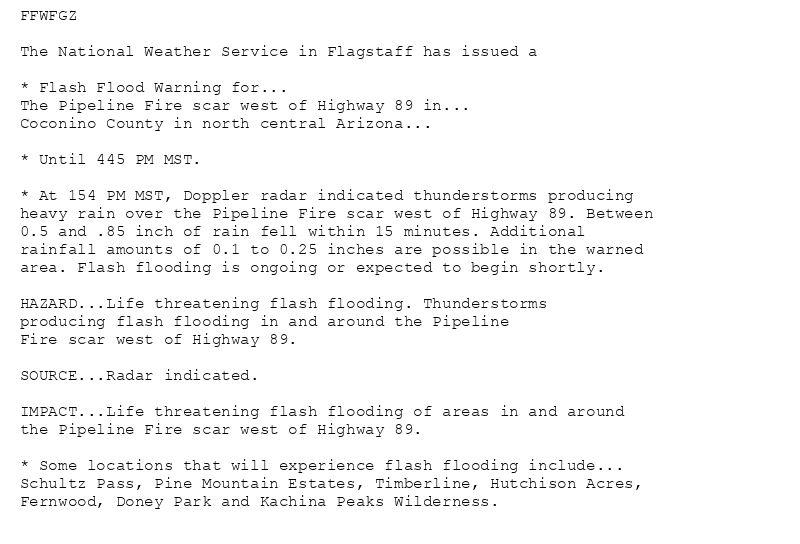
FFWFGZ
The National Weather Service in Flagstaff has issued a
* Flash Flood Warning for...
The Pipeline Fire scar west of Highway 89 in...
Coconino County in north central Arizona...
* Until 445 PM MST.
* At 154 PM MST, Doppler radar indicated thunderstorms producing
heavy rain over the Pipeline Fire scar west of Highway 89. Between
0.5 and .85 inch of rain fell within 15 minutes. Additional
rainfall amounts of 0.1 to 0.25 inches are possible in the warned
area. Flash flooding is ongoing or expected to begin shortly.
HAZARD...Life threatening flash flooding. Thunderstorms
producing flash flooding in and around the Pipeline
Fire scar west of Highway 89.
SOURCE...Radar indicated.
IMPACT...Life threatening flash flooding of areas in and around
the Pipeline Fire scar west of Highway 89.
* Some locations that will experience flash flooding include...
Schultz Pass, Pine Mountain Estates, Timberline, Hutchison Acres,
Fernwood, Doney Park and Kachina Peaks Wilderness.
🚨 Flash Flood Warning issued August 23 at 1:54PM MST until August 23 at 4:45PM MST by NWS Flagstaff AZ 🚨
Additional Details Here.
23.08.2025 21:00 — 👍 2 🔁 0 💬 0 📌 0
Weather Prediction Center issues Mesoscale Precipitation Discussion #985 concerning HEAVY RAINFALL...FLASH FLOODING LIKELY
at Sat, 23 Aug 2025 19:32:34 +0000 via IEMbot
Additional Details Here.
23.08.2025 19:48 — 👍 1 🔁 0 💬 0 📌 0
[Delayed Report] 3 WSW Dewey-Humboldt [Yavapai Co, AZ] Public reports Hail of quarter size (M1.00 Inch) at 3 Jul, 1:50 PM MST -- Corrects previous hail report from 3 WSW Dewey-Humb... at Sat, 23 Aug 2025 18:27:52 +0000 via IEMbot
Additional Details Here.
23.08.2025 18:28 — 👍 1 🔁 0 💬 0 📌 0
FGZ issues Area Forecast Discussion (AFD) at Aug 23, 11:02 AM MST
at Sat, 23 Aug 2025 18:02:16 +0000 via IEMbot
Additional Details Here.
23.08.2025 18:08 — 👍 0 🔁 0 💬 0 📌 0
FGZ issues Area Forecast Discussion (AFD) at Aug 23, 4:20 AM MST
at Sat, 23 Aug 2025 11:20:15 +0000 via IEMbot
Additional Details Here.
23.08.2025 11:28 — 👍 1 🔁 0 💬 0 📌 0
FGZ issues Area Forecast Discussion (AFD) at Aug 23, 2:22 AM MST
at Sat, 23 Aug 2025 09:22:13 +0000 via IEMbot
Additional Details Here.
23.08.2025 09:28 — 👍 0 🔁 0 💬 0 📌 0
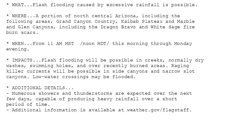
* WHAT...Flash flooding caused by excessive rainfall is possible.
* WHERE...A portion of north central Arizona, including the
following areas, Grand Canyon Country, Kaibab Plateau and Marble
and Glen Canyons, including the Dragon Bravo and White Sage fire
burn scars.
* WHEN...From 11 AM MST /noon MDT/ this morning through Monday
evening.
* IMPACTS...Flash flooding will be possible in creeks, normally dry
washes, swimming holes, and over recently burned areas. Raging
killer currents will be possible in side canyons and narrow slot
canyons. Low-water crossings may be flooded.
* ADDITIONAL DETAILS...
- Numerous showers and thunderstorms are expected over the next
few days, capable of producing heavy rainfall over a short
period of time.
- Additional information is available at weather.gov/flagstaff.
🚨 Flood Watch issued August 23 at 1:18AM MST until August 25 at 8:00PM MST by NWS Flagstaff AZ 🚨
Additional Details Here.
23.08.2025 08:30 — 👍 1 🔁 0 💬 0 📌 0
FGZ continues Flood Watch valid at Aug 23, 11:00 AM MST for Grand Canyon Country, Kaibab Plateau, Marble and Glen Canyons [AZ] till Aug 25, 8:00 PM MST
at Sat, 23 Aug 2025 08:18:24 +0000 via IEMbot
Additional Details Here.
23.08.2025 08:28 — 👍 0 🔁 0 💬 0 📌 0
FGZ issues Record Event Report (RER) at Aug 23, 12:28 AM MST ...RECORD HIGH TEMPERATURE TIED AT THE PRESCOTT AIRPORT... via IEMbot
Additional Details Here.
23.08.2025 07:48 — 👍 1 🔁 0 💬 0 📌 0
[Delayed Report] 3 NE Poland Junction [Yavapai Co, AZ] Other Federal reports Flash Flood at 21 Aug, 6:00 PM MST -- The gauge at the Agua Fria River near Humboldt recorded a rise of... at Sat, 23 Aug 2025 07:20:48 +0000 via IEMbot
Additional Details Here.
23.08.2025 07:27 — 👍 0 🔁 0 💬 0 📌 0
FGZ issues Area Forecast Discussion (AFD) at Aug 22, 9:56 PM MST
at Sat, 23 Aug 2025 04:56:31 +0000 via IEMbot
Additional Details Here.
23.08.2025 05:08 — 👍 0 🔁 0 💬 0 📌 0
WINSLOW AZ AIRPORT Aug 22
Climate Report:
High: 100
Low: 69
Precip: 0.0"
Snow: Missing
at Sat, 23 Aug 2025 02:16:01 +0000 via IEMbot
Additional Details Here.
23.08.2025 02:27 — 👍 0 🔁 0 💬 0 📌 0
FLAGSTAFF AZ AIRPORT Aug 22
Climate Report:
High: 88
Low: 59
Precip: 0.0"
Snow: Missing
at Sat, 23 Aug 2025 02:16:01 +0000 via IEMbot
Additional Details Here.
23.08.2025 02:27 — 👍 0 🔁 0 💬 0 📌 0
FGZ expires Flash Flood Warning for Coconino [AZ]
at Sat, 23 Aug 2025 00:57:16 +0000 via IEMbot
Additional Details Here.
23.08.2025 01:08 — 👍 0 🔁 0 💬 0 📌 0
FGZ continues Flash Flood Warning [flash flood: radar indicated, flash flood damage threat: considerable] for Coconino [AZ] till 6:00 PM MST
at Sat, 23 Aug 2025 00:12:08 +0000 via IEMbot
Additional Details Here.
23.08.2025 00:28 — 👍 0 🔁 0 💬 0 📌 0