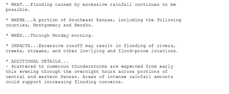
* WHAT...Flooding caused by excessive rainfall continues to be
possible.
* WHERE...A portion of Southeast Kansas, including the following
counties, Montgomery and Neosho.
* WHEN...Through Monday morning.
* IMPACTS...Excessive runoff may result in flooding of rivers,
creeks, streams, and other low-lying and flood-prone locations.
* ADDITIONAL DETAILS...
- Scattered to numerous thunderstorms are expected from early
this evening through the overnight hours across portions of
central and eastern Kansas. Areas of intense rainfall amounts
could support increasing flooding concerns.
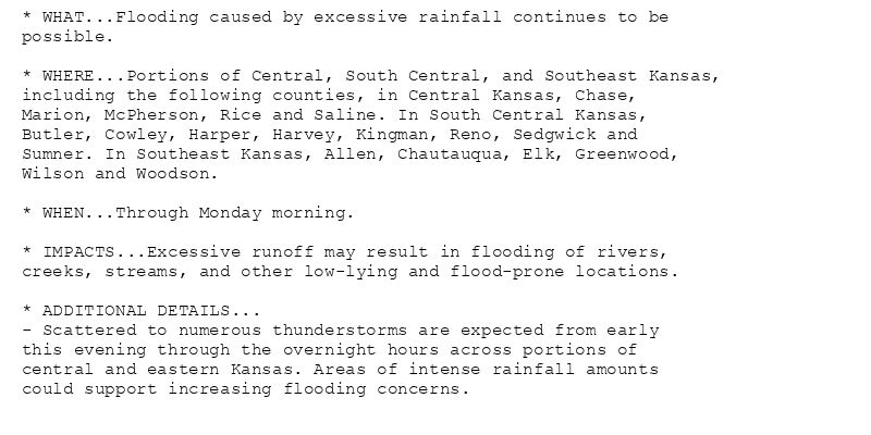
* WHAT...Flooding caused by excessive rainfall continues to be
possible.
* WHERE...Portions of Central, South Central, and Southeast Kansas,
including the following counties, in Central Kansas, Chase,
Marion, McPherson, Rice and Saline. In South Central Kansas,
Butler, Cowley, Harper, Harvey, Kingman, Reno, Sedgwick and
Sumner. In Southeast Kansas, Allen, Chautauqua, Elk, Greenwood,
Wilson and Woodson.
* WHEN...Through Monday morning.
* IMPACTS...Excessive runoff may result in flooding of rivers,
creeks, streams, and other low-lying and flood-prone locations.
* ADDITIONAL DETAILS...
- Scattered to numerous thunderstorms are expected from early
this evening through the overnight hours across portions of
central and eastern Kansas. Areas of intense rainfall amounts
could support increasing flooding concerns.
🚨 Flood Watch issued August 10 at 2:28PM CDT until August 11 at 7:00AM CDT by NWS Wichita KS 🚨
Additional Details Here.
10.08.2025 19:30 — 👍 0 🔁 0 💬 0 📌 0
Weather Prediction Center issues Mesoscale Precipitation Discussion #895 concerning HEAVY RAINFALL...FLASH FLOODING POSSIBLE
at Sun, 10 Aug 2025 18:53:17 +0000 via IEMbot
Additional Details Here.
10.08.2025 19:08 — 👍 0 🔁 0 💬 0 📌 0
ICT issues Area Forecast Discussion (AFD) at Aug 10, 12:50 PM CDT
at Sun, 10 Aug 2025 17:52:14 +0000 via IEMbot
Additional Details Here.
10.08.2025 18:08 — 👍 0 🔁 0 💬 0 📌 0
ICT updates Flood Watch valid at Aug 10, 5:00 PM CDT (expands area to include Saline [KS], continues Allen, Butler, Chase, Chautauqua, Cowley, Elk, Greenwood, Harper, Harvey, Kingm... at Sun, 10 Aug 2025 17:39:40 +0000 via IEMbot
Additional Details Here.
10.08.2025 17:48 — 👍 0 🔁 0 💬 0 📌 0
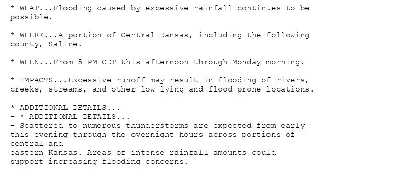
* WHAT...Flooding caused by excessive rainfall continues to be
possible.
* WHERE...A portion of Central Kansas, including the following
county, Saline.
* WHEN...From 5 PM CDT this afternoon through Monday morning.
* IMPACTS...Excessive runoff may result in flooding of rivers,
creeks, streams, and other low-lying and flood-prone locations.
* ADDITIONAL DETAILS...
- * ADDITIONAL DETAILS...
- Scattered to numerous thunderstorms are expected from early
this evening through the overnight hours across portions of
central and
eastern Kansas. Areas of intense rainfall amounts could
support increasing flooding concerns.
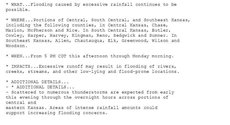
* WHAT...Flooding caused by excessive rainfall continues to be
possible.
* WHERE...Portions of Central, South Central, and Southeast Kansas,
including the following counties, in Central Kansas, Chase,
Marion, McPherson and Rice. In South Central Kansas, Butler,
Cowley, Harper, Harvey, Kingman, Reno, Sedgwick and Sumner. In
Southeast Kansas, Allen, Chautauqua, Elk, Greenwood, Wilson and
Woodson.
* WHEN...From 5 PM CDT this afternoon through Monday morning.
* IMPACTS...Excessive runoff may result in flooding of rivers,
creeks, streams, and other low-lying and flood-prone locations.
* ADDITIONAL DETAILS...
- * ADDITIONAL DETAILS...
- Scattered to numerous thunderstorms are expected from early
this evening through the overnight hours across portions of
central and
eastern Kansas. Areas of intense rainfall amounts could
support increasing flooding concerns.
🚨 Flood Watch issued August 10 at 12:39PM CDT until August 11 at 7:00AM CDT by NWS Wichita KS 🚨
Additional Details Here.
10.08.2025 17:45 — 👍 0 🔁 0 💬 0 📌 0
The Storm Prediction Center issues Day 1 Slight Convective Risk at Aug 10, 16:21z for portions of ICT
at Sun, 10 Aug 2025 16:22:59 +0000 via IEMbot
Additional Details Here.
10.08.2025 16:28 — 👍 0 🔁 0 💬 0 📌 0
ICT issues Public Information Statement (PNS) at Aug 10, 9:10 AM CDT
at Sun, 10 Aug 2025 14:19:27 +0000 via IEMbot
Additional Details Here.
10.08.2025 14:28 — 👍 0 🔁 0 💬 0 📌 0
The Storm Prediction Center issues Day 1 Slight Convective Risk at Aug 10, 12:34z for portions of ICT
at Sun, 10 Aug 2025 12:36:23 +0000 via IEMbot
Additional Details Here.
10.08.2025 12:48 — 👍 0 🔁 0 💬 0 📌 0
ICT issues Public Information Statement (PNS) at Aug 10, 7:10 AM CDT
at Sun, 10 Aug 2025 12:25:17 +0000 via IEMbot
Additional Details Here.
10.08.2025 12:28 — 👍 0 🔁 0 💬 0 📌 0
ICT issues Area Forecast Discussion (AFD) at Aug 10, 6:50 AM CDT ...Updated Aviation Discussion... via IEMbot
Additional Details Here.
10.08.2025 12:08 — 👍 0 🔁 0 💬 0 📌 0
ICT issues Public Information Statement (PNS) at Aug 10, 6:12 AM CDT ...ON THIS DATE IN WEATHER HISTORY... via IEMbot
Additional Details Here.
10.08.2025 11:28 — 👍 0 🔁 0 💬 0 📌 0
ICT issues Grassland Fire Danger (RFD) at Aug 10, 4:51 AM CDT
at Sun, 10 Aug 2025 09:51:47 +0000 via IEMbot
Additional Details Here.
10.08.2025 10:08 — 👍 0 🔁 0 💬 0 📌 0
ICT continues Severe Thunderstorm Warning [wind: 60 MPH (RADAR INDICATED), hail: <.75 IN (RADAR INDICATED)] for Russell [KS] till 5:15 AM CDT
at Sun, 10 Aug 2025 09:41:34 +0000 via IEMbot
Additional Details Here.
10.08.2025 09:48 — 👍 0 🔁 0 💬 0 📌 0
At 441 AM CDT, severe thunderstorms were located along a line
extending from near Luray to 9 miles southwest of Dorrance, moving
east at 55 mph.
HAZARD...60 mph wind gusts.
SOURCE...Radar indicated.
IMPACT...Expect damage to roofs, siding, and trees.
Locations impacted include...
Russell, Lucas, Gorham, Luray, Dorrance, Milberger, Bunker Hill,
Paradise, Waldo, Wilson State Park, Wilson Lake, and Russell Airport.
This includes Interstate 70 between Mile Markers 175 and 204.
🚨 Severe Thunderstorm Warning issued August 10 at 4:41AM CDT until August 10 at 5:15AM CDT by NWS Wichita KS 🚨
Additional Details Here.
10.08.2025 09:45 — 👍 0 🔁 0 💬 0 📌 0
ICT issues Severe Thunderstorm Warning [wind: 60 MPH (RADAR INDICATED), hail: <.75 IN (RADAR INDICATED)] for Russell [KS] till Aug 10, 5:15 AM CDT
at Sun, 10 Aug 2025 09:10:21 +0000 via IEMbot
Additional Details Here.
10.08.2025 09:28 — 👍 0 🔁 0 💬 0 📌 0
SVRICT
The National Weather Service in Wichita has issued a
* Severe Thunderstorm Warning for...
Russell County in central Kansas...
* Until 515 AM CDT.
* At 409 AM CDT, severe thunderstorms were located along a line
extending from 7 miles southwest of Natoma to near Loretta, moving
east at 45 mph.
HAZARD...60 mph wind gusts.
SOURCE...Radar indicated.
IMPACT...Expect damage to roofs, siding, and trees.
* Locations impacted include...
Russell, Lucas, Gorham, Luray, Dorrance, Milberger, Bunker Hill,
Paradise, Waldo, Wilson State Park, Wilson Lake, and Russell
Airport.
This includes Interstate 70 between Mile Markers 175 and 204.
🚨 Severe Thunderstorm Warning issued August 10 at 4:09AM CDT until August 10 at 5:15AM CDT by NWS Wichita KS 🚨
Additional Details Here.
10.08.2025 09:15 — 👍 0 🔁 0 💬 0 📌 0
ICT cancels Severe Thunderstorm Watch for Lincoln, Russell [KS]
at Sun, 10 Aug 2025 08:52:19 +0000 via IEMbot
Additional Details Here.
10.08.2025 09:08 — 👍 0 🔁 0 💬 0 📌 0
ICT issues Hazardous Weather Outlook (HWO) at Aug 10, 3:42 AM CDT
at Sun, 10 Aug 2025 08:42:45 +0000 via IEMbot
Additional Details Here.
10.08.2025 08:49 — 👍 0 🔁 0 💬 0 📌 0
ICT issues Grassland Fire Danger (RFD) at Aug 10, 2:29 AM CDT
at Sun, 10 Aug 2025 07:29:34 +0000 via IEMbot
Additional Details Here.
10.08.2025 07:49 — 👍 0 🔁 0 💬 0 📌 0
ICT issues Flood Watch valid at Aug 10, 5:00 PM CDT for Allen, Butler, Chase, Chautauqua, Cowley, Elk, Greenwood, Harper, Harvey, Kingman, Marion, McPherson, Reno, Rice, Sedgwick, ... at Sun, 10 Aug 2025 07:11:31 +0000 via IEMbot
Additional Details Here.
10.08.2025 07:28 — 👍 0 🔁 0 💬 0 📌 0
* WHAT...Flooding caused by excessive rainfall is possible.
* WHERE...Portions of Central, South Central, and Southeast Kansas,
including the following counties, in Central Kansas, Chase,
Marion, McPherson and Rice. In South Central Kansas, Butler,
Cowley, Harper, Harvey, Kingman, Reno, Sedgwick and Sumner. In
Southeast Kansas, Allen, Chautauqua, Elk, Greenwood, Wilson and
Woodson.
* WHEN...From early this evening through early Monday morning.
* IMPACTS...Excessive runoff may result in flooding of rivers,
creeks, streams, urban areas, and other low-lying and flood-prone
locations.
* ADDITIONAL DETAILS...
- Scattered to numerous thunderstorms are expected from early
this evening through tonight across portions of central and
eastern Kansas. Areas of intense rainfall amounts could
support increasing flooding concerns.
🚨 Flood Watch issued August 10 at 2:11AM CDT until August 11 at 7:00AM CDT by NWS Wichita KS 🚨
Additional Details Here.
10.08.2025 07:15 — 👍 0 🔁 0 💬 0 📌 0
At 211 AM CDT, severe thunderstorms were located along a line
extending from near Talmage to near Assaria, moving northeast at 35
mph.
HAZARD...60 mph wind gusts.
SOURCE...Radar indicated.
IMPACT...Expect damage to roofs, siding, and trees.
Locations impacted include...
Salina, Assaria, Gypsum, Smolan, New Cambria, Falun, Bridgeport,
Salina Airport, and Kipp.
This includes the following highways...
Interstate 135 between Mile Markers 77 and 95.
Interstate 70 between Mile Markers 243 and 266.
🚨 Severe Thunderstorm Warning issued August 10 at 2:11AM CDT until August 10 at 2:45AM CDT by NWS Wichita KS 🚨
Additional Details Here.
10.08.2025 07:15 — 👍 0 🔁 0 💬 0 📌 0
ICT issues Area Forecast Discussion (AFD) at Aug 10, 2:03 AM CDT
at Sun, 10 Aug 2025 07:04:20 +0000 via IEMbot
Additional Details Here.
10.08.2025 07:08 — 👍 0 🔁 0 💬 0 📌 0
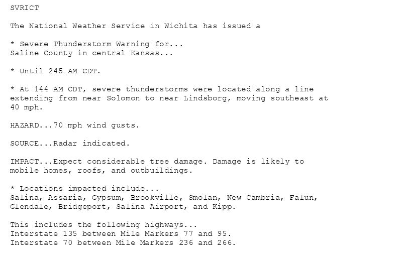
SVRICT
The National Weather Service in Wichita has issued a
* Severe Thunderstorm Warning for...
Saline County in central Kansas...
* Until 245 AM CDT.
* At 144 AM CDT, severe thunderstorms were located along a line
extending from near Solomon to near Lindsborg, moving southeast at
40 mph.
HAZARD...70 mph wind gusts.
SOURCE...Radar indicated.
IMPACT...Expect considerable tree damage. Damage is likely to
mobile homes, roofs, and outbuildings.
* Locations impacted include...
Salina, Assaria, Gypsum, Brookville, Smolan, New Cambria, Falun,
Glendale, Bridgeport, Salina Airport, and Kipp.
This includes the following highways...
Interstate 135 between Mile Markers 77 and 95.
Interstate 70 between Mile Markers 236 and 266.
🚨 Severe Thunderstorm Warning issued August 10 at 1:44AM CDT until August 10 at 2:45AM CDT by NWS Wichita KS 🚨
Additional Details Here.
10.08.2025 07:00 — 👍 0 🔁 0 💬 0 📌 0
ICT issues Severe Thunderstorm Warning [damage threat: CONSIDERABLE, wind: 70 MPH (RADAR INDICATED), hail: <.75 IN (RADAR INDICATED)] for Saline [KS] till Aug 10, 2:45 AM CDT
a... at Sun, 10 Aug 2025 06:45:10 +0000 via IEMbot
Additional Details Here.
10.08.2025 06:49 — 👍 0 🔁 0 💬 0 📌 0
WICHITA EISENHOWER NATIONAL Aug 9
Climate Report:
High: 99
Low: 76
Precip: Trace
Snow: 0.0" Snow Depth: 0"
at Sun, 10 Aug 2025 06:47:04 +0000 via IEMbot
Additional Details Here.
10.08.2025 06:49 — 👍 0 🔁 0 💬 0 📌 0
ICT updates Severe Thunderstorm Warning [damage threat: CONSIDERABLE, wind: 70 MPH (RADAR INDICATED), hail: <.75 IN (RADAR INDICATED)] (cancels Russell [KS], continues Lincoln [... at Sun, 10 Aug 2025 06:13:00 +0000 via IEMbot
Additional Details Here.
10.08.2025 06:28 — 👍 0 🔁 0 💬 0 📌 0
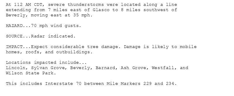
At 112 AM CDT, severe thunderstorms were located along a line
extending from 7 miles east of Glasco to 8 miles southwest of
Beverly, moving east at 35 mph.
HAZARD...70 mph wind gusts.
SOURCE...Radar indicated.
IMPACT...Expect considerable tree damage. Damage is likely to mobile
homes, roofs, and outbuildings.
Locations impacted include...
Lincoln, Sylvan Grove, Beverly, Barnard, Ash Grove, Westfall, and
Wilson State Park.
This includes Interstate 70 between Mile Markers 229 and 234.
🚨 Severe Thunderstorm Warning issued August 10 at 1:12AM CDT until August 10 at 1:30AM CDT by NWS Wichita KS 🚨
Additional Details Here.
10.08.2025 06:15 — 👍 0 🔁 0 💬 0 📌 0
ICT continues Severe Thunderstorm Warning [damage threat: CONSIDERABLE, wind: 70 MPH (RADAR INDICATED), hail: <.75 IN (RADAR INDICATED)] for Lincoln, Russell [KS] till 1:30 AM C... at Sun, 10 Aug 2025 05:56:38 +0000 via IEMbot
Additional Details Here.
10.08.2025 06:08 — 👍 0 🔁 0 💬 0 📌 0
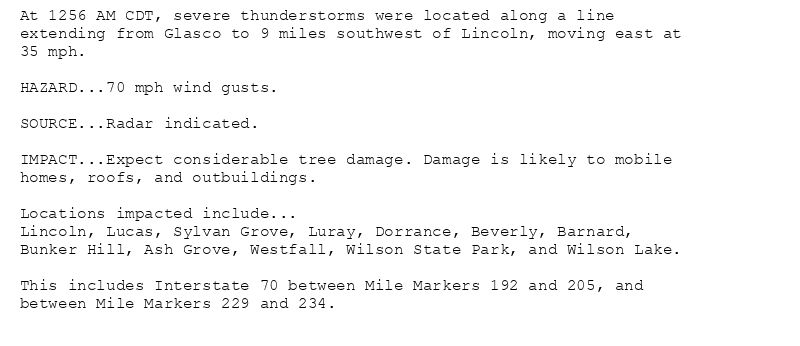
At 1256 AM CDT, severe thunderstorms were located along a line
extending from Glasco to 9 miles southwest of Lincoln, moving east at
35 mph.
HAZARD...70 mph wind gusts.
SOURCE...Radar indicated.
IMPACT...Expect considerable tree damage. Damage is likely to mobile
homes, roofs, and outbuildings.
Locations impacted include...
Lincoln, Lucas, Sylvan Grove, Luray, Dorrance, Beverly, Barnard,
Bunker Hill, Ash Grove, Westfall, Wilson State Park, and Wilson Lake.
This includes Interstate 70 between Mile Markers 192 and 205, and
between Mile Markers 229 and 234.
🚨 Severe Thunderstorm Warning issued August 10 at 12:56AM CDT until August 10 at 1:30AM CDT by NWS Wichita KS 🚨
Additional Details Here.
10.08.2025 06:00 — 👍 0 🔁 0 💬 0 📌 0