Desert EcoStats
Welcome! This project is a learning lab and code collection for applying ecological statistics and spatial analysis to desert ecosystems. It includes small, focused projects using R, Python, QGIS, and...
Just setting up my first OSF Project. #Desert EcoStats. Plan to make this my work area for sharing my learnings with geospatial ecology statistics, etc., with a desert ecosystems vibe. Think I have it structured well. Take a look: osf.io/q8zkd/ #Science #rstats
#Biogeography #EnvSci #GISchat
07.05.2025 19:39 — 👍 3 🔁 0 💬 0 📌 0
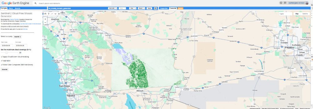
That's cool! I was just messing with the code, and made one for California Counties. Recent NDVI for Imperial County, California. Ah, agriculture in the desert! 🥗🏜️
28.03.2025 23:57 — 👍 1 🔁 0 💬 1 📌 0
That's cool! I was just in Dominica the other day, and thinking about just this sort of thing.
20.03.2025 16:09 — 👍 1 🔁 0 💬 1 📌 0
More great projects to get into. Thanks for sharing @milos-makes-maps.bsky.social #GISchat
06.01.2025 17:15 — 👍 2 🔁 1 💬 0 📌 0
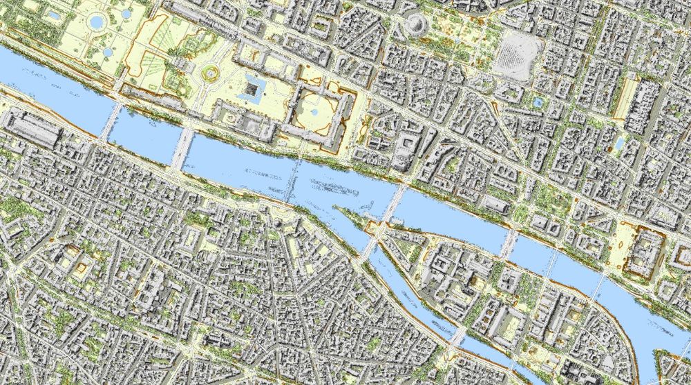
Welcome to my cartographic tour of France, with #LiDAR #mapping ! It starts from Paris here:
➡️ jgaffuri.github.io/CartoHD_webm...
#cartography #gis #gischat #map #maps #dataviz #datavis
05.01.2025 20:09 — 👍 72 🔁 16 💬 6 📌 1
That’s very cool!
05.01.2025 20:36 — 👍 0 🔁 0 💬 0 📌 0
Great tutorials to make some awesome maps!!
22.12.2024 16:44 — 👍 5 🔁 1 💬 0 📌 0
Oh cool! I can use this in my day to day workflow. Thanks for the great tutorials, you really explain things well!
22.12.2024 16:43 — 👍 2 🔁 0 💬 1 📌 0
Also playing around wit @polyhaven.com , looks like a real rabbit hole!! So many choices, it was a little overwhelming.
14.12.2024 00:08 — 👍 0 🔁 0 💬 0 📌 0
Also thanks to @tterence.bsky.social for {rayshader}, it's been an amazing R package so far.
14.12.2024 00:01 — 👍 0 🔁 0 💬 0 📌 0
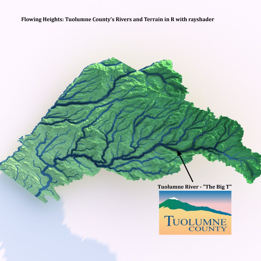
Flowing Heights: Tuolumne County's Rivers and Terrain in R with rayshader 🌊⛰️
Huge thanks to @milos-makes-maps.bsky.social for the tutorial that made this visualization possible! Proud to showcase the natural beauty of @VisitTuolumneCo. #Rayshader #DataViz #TuolumneCounty #CaliforniaNature
13.12.2024 23:23 — 👍 11 🔁 1 💬 3 📌 0
View of Review of A Draught of the South Land: Mapping New Zealand from Tasman to Cook
Thrilled to share my review of A Draught of the South Land by Paul Moon in Cartographic Perspectives #105 (coming soon)! A fascinating look at historical cartography & exploration. 🌍🗺️
GIS & map enthusiasts, stay tuned! #GISchat #GIS #NZ
🔗 tinyurl.com/2zc4xxty
11.12.2024 17:07 — 👍 1 🔁 0 💬 0 📌 0
@geo-coe.bsky.social work is always so inspiring!!
08.12.2024 21:16 — 👍 0 🔁 0 💬 0 📌 0
That is so very cool!!
08.12.2024 21:15 — 👍 1 🔁 0 💬 0 📌 0
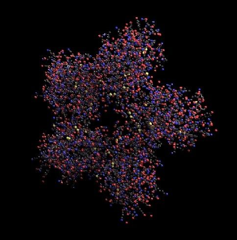
Day 30: The Final Map! 🐍 Rattlesnake venom lectin (1muq), a galactose-specific C-type lectin, visualized in 3D. Went deep into micromapping, and it paid off! Big thanks to
& the {raymolecule} R package. #30DayMapChallenge #Micromapping 🧬✨
07.12.2024 00:27 — 👍 8 🔁 2 💬 0 📌 1
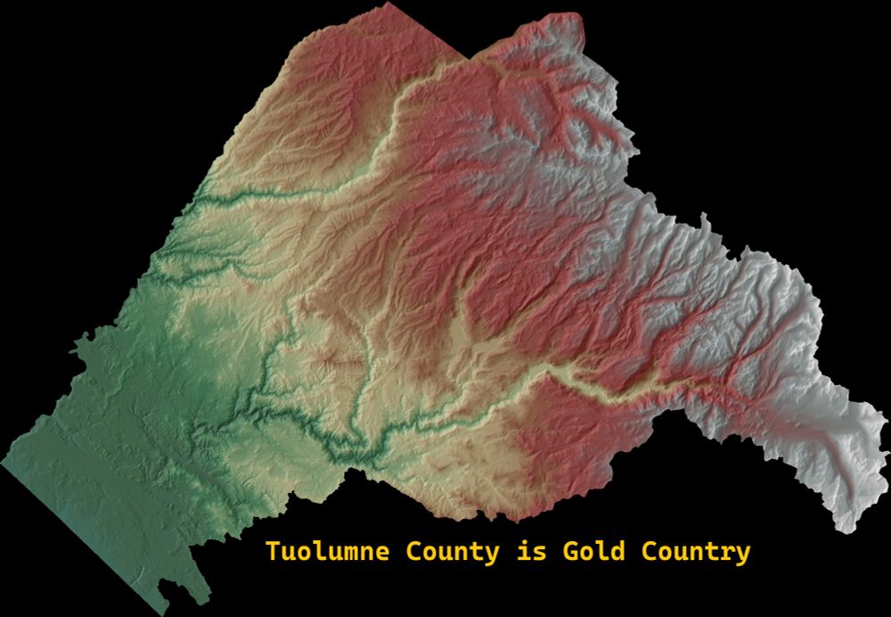
My home county! Tuolumne County, California! Made this with R, to show the elevation ... all the way up to the High Sierra! #rstats, #GIS, #California
07.12.2024 00:10 — 👍 3 🔁 1 💬 0 📌 0
Official BlueSky account of MetPy, a Python toolkit for meteorology. Sponsored by Unidata and NSF-funded. Community discussions at: https://github.com/Unidata/MetPy/discussions
Scientist | Collaborative Leadership Consultant for STEM Leaders and Organizations at BridgUs Lab
Just an ole t-test in a GLMM world. #statistics #healthcare #rstats
#python, #rstats, #shiny, #datascience training and consultancy. We help organisations extract the most from their data.
Asst Prof at Univ. of Nevada, Reno. Ecohydrology and Ecosystem Processes (EEP!) Lab. Amateur Sculptor. He/Him. tinyurl.com/EEPLabAllenUNR
Research and data to make progress against the world’s largest problems. Based out of Oxford University (@ox.ac.uk), founded by @maxroser.bsky.social.
images from 1977 to 1997 from archive dot org
http://lookcaitlin.tumblr.com/archive
lookcaitlin@gmail.com
https://archive.org/donate
You don’t need a PhD in statistics or years of coding experience to learn R, the most powerful tool for data analysis and visualization.
https://rfortherestofus.com/
I was TheGISDiva (at that other place) 🧭 Enthusiast for all things geo, data viz, cartography, photography, deserts, wetlands, wildlife, herps, and birds.
Author of GIS for Dummies (2nd Edition) https://amzn.to/4iGhayd
International bestselling author of The Book of Doors from Transworld Books (UK) and Wm Morrow (USA). Human servant to two Skye terriers. Living near Edinburgh, Scotland. Agent: @harryillingworth.bsky.social
Helped build NYS's Forest Carbon Assessment. Currently helping build public water data infrastructure. PhD in Environmental Science.
#rstats, ML, Boston and spatial data.
Opinions my own. RTs imply causation.
https://mm218.dev
github.com/mikemahoney218
We make free, open-source software for data scientists like the RStudio IDE.
We're formerly known as RStudio. You can always download our open-source IDE here. https://posit.co/download/rstudio-desktop/
Demographics | Geospatial | Data Science | Open Source
The 19th is an independent, nonprofit newsroom reporting at the intersection of gender, politics and policy. http://19thnews.org/newsletters
Reporting at the intersection of climate and gender for 19th News.
World's best cloud-native GIS
The California Department of Forestry and Fire Protection. Serving and safeguarding the people and protecting the property and resources of California.
https://linktr.ee/calfire_official
A #DataViz challenge 📊 by @cedricscherer.com and @drxeo.eu
Supported by @wendyshijia.bsky.social and @ansgarw.bsky.social
More info on Github: https://github.com/30DayChartChallenge/Edition2024
Out July/August hiking 500 miles! | ✨Freelance Science Reporter & Editor✨| Once-Upon-A-Time Scientist👩🔬 | Clips in Nature, Science, The New York Times, Nat Geo, NPR, et al. 📰 | I love a good sea beast 🦀🐙🐚 | She/Her 🏳️🌈 | Signal: aheidt.16 | amandaheidt.com


