GSP issues Area Forecast Discussion (AFD) at Aug 11, 7:48 PM EDT
at Mon, 11 Aug 2025 23:48:18 +0000 via IEMbot
Additional Details Here.
12.08.2025 00:06 — 👍 0 🔁 0 💬 0 📌 0
CHARLOTTE NC Aug 11
Climate Report:
High: 81
Low: 73
Precip: 0.33"
Snow: 0.0" Snow Depth: 0"
at Mon, 11 Aug 2025 20:35:40 +0000 via IEMbot
Additional Details Here.
11.08.2025 20:46 — 👍 0 🔁 0 💬 0 📌 0
GSP continues Flood Advisory for Gaston [NC] till Aug 11, 7:15 PM EDT
at Mon, 11 Aug 2025 20:10:58 +0000 via IEMbot
Additional Details Here.
11.08.2025 20:26 — 👍 0 🔁 0 💬 0 📌 0
GSP expires Flood Advisory for Cleveland, Rutherford [NC]
at Mon, 11 Aug 2025 20:11:52 +0000 via IEMbot
Additional Details Here.
11.08.2025 20:26 — 👍 0 🔁 0 💬 0 📌 0
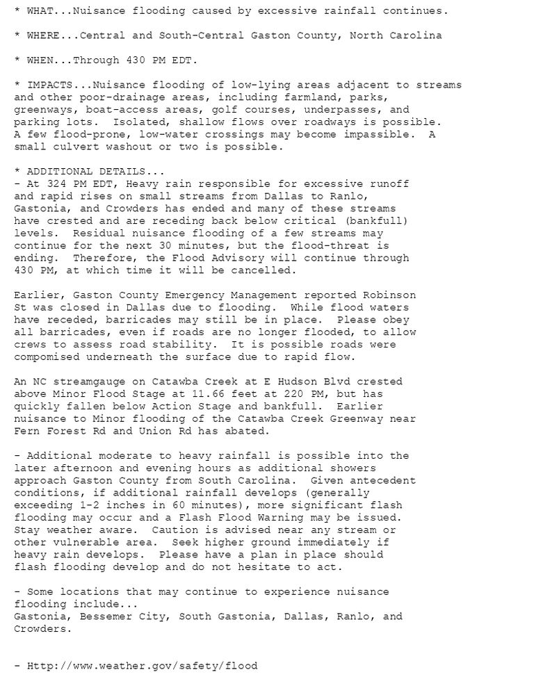
* WHAT...Nuisance flooding caused by excessive rainfall continues.
* WHERE...Central and South-Central Gaston County, North Carolina
* WHEN...Through 430 PM EDT.
* IMPACTS...Nuisance flooding of low-lying areas adjacent to streams
and other poor-drainage areas, including farmland, parks,
greenways, boat-access areas, golf courses, underpasses, and
parking lots. Isolated, shallow flows over roadways is possible.
A few flood-prone, low-water crossings may become impassible. A
small culvert washout or two is possible.
* ADDITIONAL DETAILS...
- At 324 PM EDT, Heavy rain responsible for excessive runoff
and rapid rises on small streams from Dallas to Ranlo,
Gastonia, and Crowders has ended and many of these streams
have crested and are receding back below critical (bankfull)
levels. Residual nuisance flooding of a few streams may
continue for the next 30 minutes, but the flood-threat is
ending. Therefore, the Flood Advisory will continue through
430 PM, at which time it will be cancelled.
Earlier, Gaston County Emergency Management reported Robinson
St was closed in Dallas due to flooding. While flood waters
have receded, barricades may still be in place. Please obey
all barricades, even if roads are no longer flooded, to allow
crews to assess road stability. It is possible roads were
compomised underneath the surface due to rapid flow.
An NC streamgauge on Catawba Creek at E Hudson Blvd crested
above Minor Flood Stage at 11.66 feet at 220 PM, but has
quickly fallen below Action Stage and bankfull. Earlier
nuisance to Minor flooding of the Catawba Creek Greenway near
Fern Forest Rd and Union Rd has abated.
- Additional moderate to heavy rainfall is possible into the
later afternoon and evening hours as additional showers
approach Gaston County from South Carolina. Given antecedent
conditions, if additional rainfall develops (generally
exceeding 1-2 inches in 60 minutes), more significant flash
flooding may occur and a Flash Flood Warning may be issued.
Stay weather aware. Caution is advised near any stream or
other vulnerable area. Seek higher ground immediately if
heavy rain develops. Please have a plan in place should
flash flooding develop and do not hesitate to act.
- Some locations that may continue to experience nuisance
flooding include...
Gastonia, Bessemer City, South Gastonia, Dallas, Ranlo, and
Crowders.
- Http://www.weather.gov/safety/flood
Flood Advisory issued August 11 at 4:10PM EDT until August 11 at 7:15PM EDT by NWS Greenville-Spartanburg SC
Additional Details Here.
11.08.2025 20:15 — 👍 0 🔁 0 💬 0 📌 0
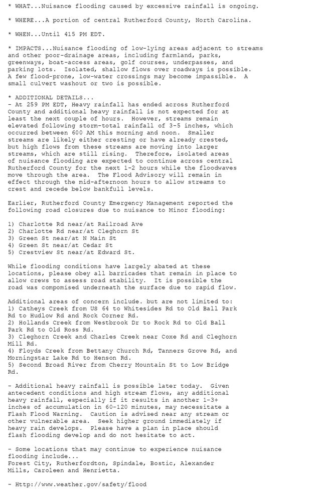
* WHAT...Nuisance flooding caused by excessive rainfall is ongoing.
* WHERE...A portion of central Rutherford County, North Carolina.
* WHEN...Until 415 PM EDT.
* IMPACTS...Nuisance flooding of low-lying areas adjacent to streams
and other poor-drainage areas, including farmland, parks,
greenways, boat-access areas, golf courses, underpasses, and
parking lots. Isolated, shallow flows over roadways is possible.
A few flood-prone, low-water crossings may become impassible. A
small culvert washout or two is possible.
* ADDITIONAL DETAILS...
- At 259 PM EDT, Heavy rainfall has ended across Rutherford
County and additional heavy rainfall is not expected for at
least the next couple of hours. However, streams remain
elevated following storm-total rainfall of 3-5 inches, which
occurred between 600 AM this morning and noon. Smaller
streams are likely either cresting or have already crested,
but high flows from these streams are moving into larger
streams, which are still rising. Therefore, isolated areas
of nuisance flooding are expected to continue across central
Rutherford County for the next 1-2 hours while the floodwaves
move through the area. The Flood Advisory will remain in
effect through the mid-afternoon hours to allow streams to
crest and recede below bankfull levels.
Earlier, Rutherford County Emergency Management reported the
following road closures due to nuisance to Minor flooding:
1) Charlotte Rd near/at Railroad Ave
2) Charlotte Rd near/at Cleghorn St
3) Green St near/at N Main St
4) Green St near/at Cedar St
5) Crestview St near/at Edward St.
While flooding conditions have largely abated at these
locations, please obey all barricades that remain in place to
allow crews to assess road stability. It is possible the
road was compomised underneath the surface due to rapid flow.
Additional areas of concern include. but are not limited to:
1) Catheys Creek from US 64 to Whitesides Rd to Old Ball Park
Rd to Hudlow Rd and Rock Corner Rd.
2) Hollands Creek from Westbrook Dr to Rock Rd to Old Ball
Park Rd to Old Ross Rd.
3) Cleghorn Creek and Charles Creek near Coxe Rd and Cleghorn
Mill Rd.
4) Floyds Creek from Bettany Church Rd, Tanners Grove Rd, and
Morningstar Lake Rd to Henson Rd.
5) Second Broad River from Cherry Mountain St to Low Bridge
Rd.
- Additional heavy rainfall is possible later today. Given
antecedent conditions and high stream flows, any additional
heavy rainfall, especially if it results in another 1-3+
inches of accumulation in 60-120 minutes, may necessitate a
Flash Flood Warning. Caution is advised near any stream or
other vulnerable area. Seek higher ground immediately if
heavy rain develops. Please have a plan in place should
flash flooding develop and do not hesitate to act.
- Some locations that may continue to experience nuisance
flooding include...
Forest City, Rutherfordton, Spindale, Bostic, Alexander
Mills, Caroleen and Henrietta.
- Http://www.weather.gov/safety/flood
Flood Advisory issued August 11 at 3:15PM EDT until August 11 at 4:15PM EDT by NWS Greenville-Spartanburg SC
Additional Details Here.
11.08.2025 19:30 — 👍 0 🔁 0 💬 0 📌 0
GSP continues Flood Advisory for Rutherford [NC] till Aug 11, 4:15 PM EDT
at Mon, 11 Aug 2025 19:15:57 +0000 via IEMbot
Additional Details Here.
11.08.2025 19:26 — 👍 0 🔁 0 💬 0 📌 0
GSP continues Flood Advisory for Cleveland, Rutherford [NC] till Aug 11, 4:15 PM EDT
at Mon, 11 Aug 2025 18:54:30 +0000 via IEMbot
Additional Details Here.
11.08.2025 19:06 — 👍 0 🔁 0 💬 0 📌 0
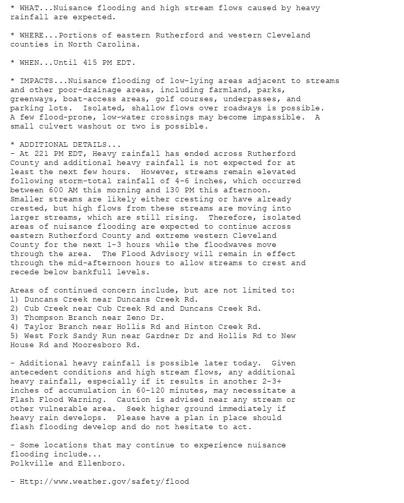
* WHAT...Nuisance flooding and high stream flows caused by heavy
rainfall are expected.
* WHERE...Portions of eastern Rutherford and western Cleveland
counties in North Carolina.
* WHEN...Until 415 PM EDT.
* IMPACTS...Nuisance flooding of low-lying areas adjacent to streams
and other poor-drainage areas, including farmland, parks,
greenways, boat-access areas, golf courses, underpasses, and
parking lots. Isolated, shallow flows over roadways is possible.
A few flood-prone, low-water crossings may become impassible. A
small culvert washout or two is possible.
* ADDITIONAL DETAILS...
- At 221 PM EDT, Heavy rainfall has ended across Rutherford
County and additional heavy rainfall is not expected for at
least the next few hours. However, streams remain elevated
following storm-total rainfall of 4-6 inches, which occurred
between 600 AM this morning and 130 PM this afternoon.
Smaller streams are likely either cresting or have already
crested, but high flows from these streams are moving into
larger streams, which are still rising. Therefore, isolated
areas of nuisance flooding are expected to continue across
eastern Rutherford County and extreme western Cleveland
County for the next 1-3 hours while the floodwaves move
through the area. The Flood Advisory will remain in effect
through the mid-afternoon hours to allow streams to crest and
recede below bankfull levels.
Areas of continued concern include, but are not limited to:
1) Duncans Creek near Duncans Creek Rd.
2) Cub Creek near Cub Creek Rd and Duncans Creek Rd.
3) Thompson Branch near Zeno Dr.
4) Taylor Branch near Hollis Rd and Hinton Creek Rd.
5) West Fork Sandy Run near Gardner Dr and Hollis Rd to New
House Rd and Mooresboro Rd.
- Additional heavy rainfall is possible later today. Given
antecedent conditions and high stream flows, any additional
heavy rainfall, especially if it results in another 2-3+
inches of accumulation in 60-120 minutes, may necessitate a
Flash Flood Warning. Caution is advised near any stream or
other vulnerable area. Seek higher ground immediately if
heavy rain develops. Please have a plan in place should
flash flooding develop and do not hesitate to act.
- Some locations that may continue to experience nuisance
flooding include...
Polkville and Ellenboro.
- Http://www.weather.gov/safety/flood
Flood Advisory issued August 11 at 2:54PM EDT until August 11 at 4:15PM EDT by NWS Greenville-Spartanburg SC
Additional Details Here.
11.08.2025 19:00 — 👍 1 🔁 0 💬 0 📌 0
WCO issues Area Hydrological Discussion (AHD) at Aug 11, 12:40 PM CDT
at Mon, 11 Aug 2025 17:58:53 +0000 via IEMbot
Additional Details Here.
11.08.2025 18:06 — 👍 0 🔁 0 💬 0 📌 0
GSP issues Area Forecast Discussion (AFD) at Aug 11, 2:02 PM EDT
at Mon, 11 Aug 2025 18:03:49 +0000 via IEMbot
Additional Details Here.
11.08.2025 18:06 — 👍 0 🔁 0 💬 0 📌 0
GSP issues Flood Advisory for Gaston [NC] till Aug 11, 7:15 PM EDT
at Mon, 11 Aug 2025 17:26:35 +0000 via IEMbot
Additional Details Here.
11.08.2025 17:46 — 👍 0 🔁 0 💬 0 📌 0
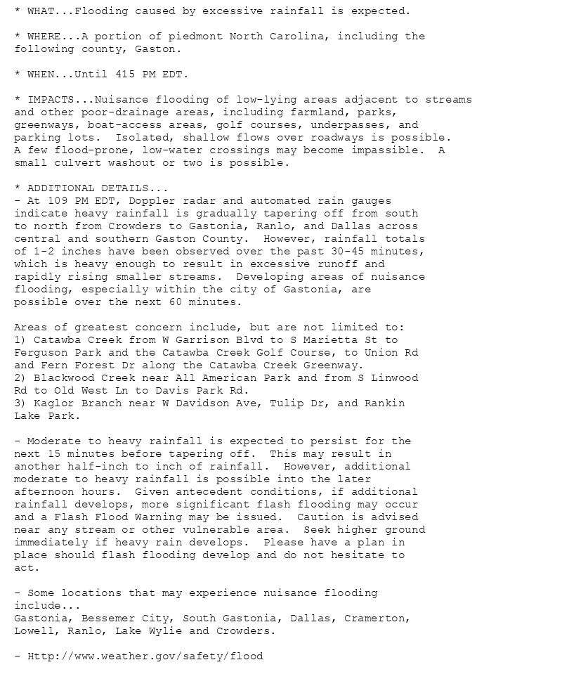
* WHAT...Flooding caused by excessive rainfall is expected.
* WHERE...A portion of piedmont North Carolina, including the
following county, Gaston.
* WHEN...Until 415 PM EDT.
* IMPACTS...Nuisance flooding of low-lying areas adjacent to streams
and other poor-drainage areas, including farmland, parks,
greenways, boat-access areas, golf courses, underpasses, and
parking lots. Isolated, shallow flows over roadways is possible.
A few flood-prone, low-water crossings may become impassible. A
small culvert washout or two is possible.
* ADDITIONAL DETAILS...
- At 109 PM EDT, Doppler radar and automated rain gauges
indicate heavy rainfall is gradually tapering off from south
to north from Crowders to Gastonia, Ranlo, and Dallas across
central and southern Gaston County. However, rainfall totals
of 1-2 inches have been observed over the past 30-45 minutes,
which is heavy enough to result in excessive runoff and
rapidly rising smaller streams. Developing areas of nuisance
flooding, especially within the city of Gastonia, are
possible over the next 60 minutes.
Areas of greatest concern include, but are not limited to:
1) Catawba Creek from W Garrison Blvd to S Marietta St to
Ferguson Park and the Catawba Creek Golf Course, to Union Rd
and Fern Forest Dr along the Catawba Creek Greenway.
2) Blackwood Creek near All American Park and from S Linwood
Rd to Old West Ln to Davis Park Rd.
3) Kaglor Branch near W Davidson Ave, Tulip Dr, and Rankin
Lake Park.
- Moderate to heavy rainfall is expected to persist for the
next 15 minutes before tapering off. This may result in
another half-inch to inch of rainfall. However, additional
moderate to heavy rainfall is possible into the later
afternoon hours. Given antecedent conditions, if additional
rainfall develops, more significant flash flooding may occur
and a Flash Flood Warning may be issued. Caution is advised
near any stream or other vulnerable area. Seek higher ground
immediately if heavy rain develops. Please have a plan in
place should flash flooding develop and do not hesitate to
act.
- Some locations that may experience nuisance flooding
include...
Gastonia, Bessemer City, South Gastonia, Dallas, Cramerton,
Lowell, Ranlo, Lake Wylie and Crowders.
- Http://www.weather.gov/safety/flood
Flood Advisory issued August 11 at 1:26PM EDT until August 11 at 7:15PM EDT by NWS Greenville-Spartanburg SC
Additional Details Here.
11.08.2025 17:30 — 👍 0 🔁 0 💬 0 📌 0
GSP issues Airport Weather Warning (AWW) at Aug 11, 1:02 PM EDT ...AIRPORT WEATHER WARNING FOR CHARLOTTE DOUGLAS AIRPORT... via IEMbot
Additional Details Here.
11.08.2025 17:06 — 👍 1 🔁 0 💬 0 📌 0
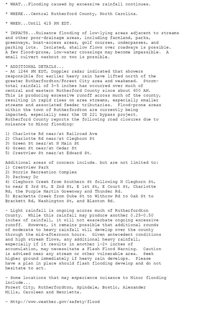
* WHAT...Flooding caused by excessive rainfall continues.
* WHERE...Central Rutherford County, North Carolina.
* WHEN...Until 415 PM EDT.
* IMPACTS...Nuisance flooding of low-lying areas adjacent to streams
and other poor-drainage areas, including farmland, parks,
greenways, boat-access areas, golf courses, underpasses, and
parking lots. Isolated, shallow flows over roadways is possible.
A few flood-prone, low-water crossings may become impassible. A
small culvert washout or two is possible.
* ADDITIONAL DETAILS...
- At 1244 PM EDT, Doppler radar indicated that showers
responsible for earlier heavy rain have lifted north of the
greater Rutherfordton/Forest City area and weakened. Storm-
total rainfall of 3-5 inches has occurred over much of
central and eastern Rutherford County since about 600 AM.
This is producing excessive runoff across much of the county,
resulting in rapid rises on area streams, especially smaller
streams and associated feeder tributaries. Flood-prone areas
within the town of Rutherfordton are currently being
impacted, especially near the US 221 bypass project.
Rutherford County reports the following road closures due to
nuisance to Minor flooding:
1) Charlotte Rd near/at Railroad Ave
2) Charlotte Rd near/at Cleghorn St
3) Green St near/at N Main St
4) Green St near/at Cedar St
5) Crestview St near/at Edward St.
Additional areas of concern include. but are not limited to:
1) Crestview Park
2) Norris Recreation Complex
3) Parkway Dr
4) Cleghorn Creek from Southern St following N Cleghorn St,
to near E 3rd St, E 2nd St, E 1st St, E Court St, Charlotte
Rd, the Purple Martin Greenway and Thunder Rd.
5) Bracketts Creek from Duke St to Withrow Rd to Oak St to
Brackett Rd, Washington St, and Blanton Rd.
- Light rainfall is ongoing across much of Rutherfordton
County. While this rainfall may produce another 0.25-0.50
inches of rainfall, it will not exacerbate ongoing excessive
runoff. However, it remains possible that additional rounds
of moderate to heavy rainfall will develop over the county
through the mid-afternoon hours. Given antecedent conditions
and high stream flows, any additional heavy rainfall,
especially if it results in another 1-2+ inches of
accumulation, may necessitate a Flash Flood Warning. Caution
is advised near any stream or other vulnerable area. Seek
higher ground immediately if heavy rain develops. Please
have a plan in place should flash flooding develop and do not
hesitate to act.
- Some locations that may experience nuisance to Minor flooding
include...
Forest City, Rutherfordton, Spindale, Bostic, Alexander
Mills, Caroleen and Henrietta.
- Http://www.weather.gov/safety/flood
Flood Advisory issued August 11 at 12:44PM EDT until August 11 at 4:15PM EDT by NWS Greenville-Spartanburg SC
Additional Details Here.
11.08.2025 17:00 — 👍 0 🔁 0 💬 0 📌 0
GSP extends time of Flood Advisory for Rutherford [NC] till Aug 11, 4:15 PM EDT
at Mon, 11 Aug 2025 16:45:11 +0000 via IEMbot
Additional Details Here.
11.08.2025 16:46 — 👍 0 🔁 0 💬 0 📌 0
GSP extends time of Flood Advisory for Cleveland, Rutherford [NC] till Aug 11, 4:15 PM EDT
at Mon, 11 Aug 2025 16:11:03 +0000 via IEMbot
Additional Details Here.
11.08.2025 16:26 — 👍 0 🔁 0 💬 0 📌 0
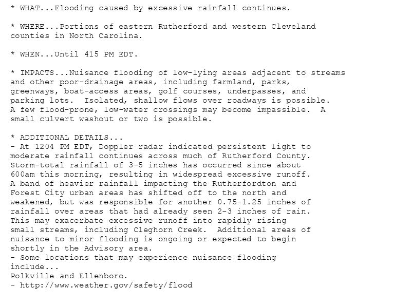
* WHAT...Flooding caused by excessive rainfall continues.
* WHERE...Portions of eastern Rutherford and western Cleveland
counties in North Carolina.
* WHEN...Until 415 PM EDT.
* IMPACTS...Nuisance flooding of low-lying areas adjacent to streams
and other poor-drainage areas, including farmland, parks,
greenways, boat-access areas, golf courses, underpasses, and
parking lots. Isolated, shallow flows over roadways is possible.
A few flood-prone, low-water crossings may become impassible. A
small culvert washout or two is possible.
* ADDITIONAL DETAILS...
- At 1204 PM EDT, Doppler radar indicated persistent light to
moderate rainfall continues across much of Rutherford County.
Storm-total rainfall of 3-5 inches has occurred since about
600am this morning, resulting in widespread excessive runoff.
A band of heavier rainfall impacting the Rutherfordton and
Forest City urban areas has shifted off to the north and
weakened, but was responsible for another 0.75-1.25 inches of
rainfall over areas that had already seen 2-3 inches of rain.
This may exacerbate excessive runoff into rapidly rising
small streams, including Cleghorn Creek. Additional areas of
nuisance to minor flooding is ongoing or expected to begin
shortly in the Advisory area.
- Some locations that may experience nuisance flooding
include...
Polkville and Ellenboro.
- http://www.weather.gov/safety/flood
Flood Advisory issued August 11 at 12:10PM EDT until August 11 at 4:15PM EDT by NWS Greenville-Spartanburg SC
Additional Details Here.
11.08.2025 16:15 — 👍 0 🔁 0 💬 0 📌 0
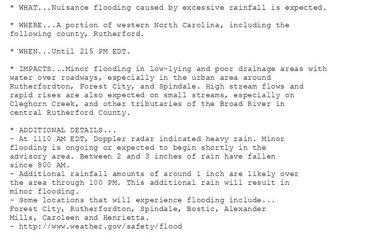
* WHAT...Nuisance flooding caused by excessive rainfall is expected.
* WHERE...A portion of western North Carolina, including the
following county, Rutherford.
* WHEN...Until 215 PM EDT.
* IMPACTS...Minor flooding in low-lying and poor drainage areas with
water over roadways, especially in the urban area around
Rutherfordton, Forest City, and Spindale. High stream flows and
rapid rises are also expected on small streams, especially on
Cleghorn Creek, and other tributaries of the Broad River in
central Rutherford County.
* ADDITIONAL DETAILS...
- At 1110 AM EDT, Doppler radar indicated heavy rain. Minor
flooding is ongoing or expected to begin shortly in the
advisory area. Between 2 and 3 inches of rain have fallen
since 800 AM.
- Additional rainfall amounts of around 1 inch are likely over
the area through 100 PM. This additional rain will result in
minor flooding.
- Some locations that will experience flooding include...
Forest City, Rutherfordton, Spindale, Bostic, Alexander
Mills, Caroleen and Henrietta.
- http://www.weather.gov/safety/flood
Flood Advisory issued August 11 at 11:15AM EDT until August 11 at 2:15PM EDT by NWS Greenville-Spartanburg SC
Additional Details Here.
11.08.2025 15:30 — 👍 0 🔁 0 💬 0 📌 0
GSP issues Flood Advisory for Rutherford [NC] till Aug 11, 2:15 PM EDT
at Mon, 11 Aug 2025 15:15:50 +0000 via IEMbot
Additional Details Here.
11.08.2025 15:26 — 👍 0 🔁 0 💬 0 📌 0
GSP issues Flood Advisory for Cleveland, Rutherford [NC] till Aug 11, 12:15 PM EDT
at Mon, 11 Aug 2025 13:10:50 +0000 via IEMbot
Additional Details Here.
11.08.2025 13:26 — 👍 0 🔁 0 💬 0 📌 0
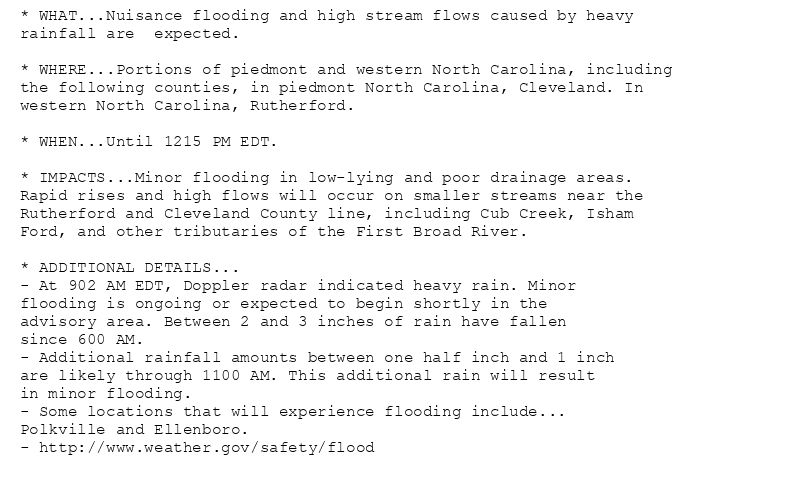
* WHAT...Nuisance flooding and high stream flows caused by heavy
rainfall are expected.
* WHERE...Portions of piedmont and western North Carolina, including
the following counties, in piedmont North Carolina, Cleveland. In
western North Carolina, Rutherford.
* WHEN...Until 1215 PM EDT.
* IMPACTS...Minor flooding in low-lying and poor drainage areas.
Rapid rises and high flows will occur on smaller streams near the
Rutherford and Cleveland County line, including Cub Creek, Isham
Ford, and other tributaries of the First Broad River.
* ADDITIONAL DETAILS...
- At 902 AM EDT, Doppler radar indicated heavy rain. Minor
flooding is ongoing or expected to begin shortly in the
advisory area. Between 2 and 3 inches of rain have fallen
since 600 AM.
- Additional rainfall amounts between one half inch and 1 inch
are likely through 1100 AM. This additional rain will result
in minor flooding.
- Some locations that will experience flooding include...
Polkville and Ellenboro.
- http://www.weather.gov/safety/flood
Flood Advisory issued August 11 at 9:10AM EDT until August 11 at 12:15PM EDT by NWS Greenville-Spartanburg SC
Additional Details Here.
11.08.2025 13:15 — 👍 0 🔁 0 💬 0 📌 0
GSP issues Area Forecast Discussion (AFD) at Aug 11, 6:48 AM EDT
at Mon, 11 Aug 2025 10:48:19 +0000 via IEMbot
Additional Details Here.
11.08.2025 11:06 — 👍 0 🔁 0 💬 0 📌 0
CHARLOTTE NC Aug 10
Climate Report:
High: 86
Low: 68
Precip: Trace
Snow: 0.0" Snow Depth: 0"
at Mon, 11 Aug 2025 06:33:23 +0000 via IEMbot
Additional Details Here.
11.08.2025 06:46 — 👍 0 🔁 0 💬 0 📌 0
GSP issues Area Forecast Discussion (AFD) at Aug 11, 1:46 AM EDT
at Mon, 11 Aug 2025 05:47:36 +0000 via IEMbot
Additional Details Here.
11.08.2025 06:06 — 👍 0 🔁 0 💬 0 📌 0
GSP issues Area Forecast Discussion (AFD) at Aug 10, 7:54 PM EDT
at Sun, 10 Aug 2025 23:54:41 +0000 via IEMbot
Additional Details Here.
11.08.2025 00:06 — 👍 0 🔁 0 💬 0 📌 0
GREENVILLE-SPARTANBURG SC Aug 10
Climate Report:
High: 83
Low: 69
Precip: Trace
Snow: 0.0" Snow Depth: 0"
at Sun, 10 Aug 2025 20:41:39 +0000 via IEMbot
Additional Details Here.
10.08.2025 20:46 — 👍 0 🔁 0 💬 0 📌 0
GSP issues Area Forecast Discussion (AFD) at Aug 10, 1:57 PM EDT
at Sun, 10 Aug 2025 17:58:13 +0000 via IEMbot
Additional Details Here.
10.08.2025 18:06 — 👍 0 🔁 0 💬 0 📌 0
GSP issues Area Forecast Discussion (AFD) at Aug 10, 6:47 AM EDT
at Sun, 10 Aug 2025 10:47:14 +0000 via IEMbot
Additional Details Here.
10.08.2025 11:06 — 👍 0 🔁 0 💬 0 📌 0
GREENVILLE-SPARTANBURG SC Aug 9
Climate Report:
High: 82
Low: 68
Precip: 0.0"
Snow: 0.0" Snow Depth: 0"
at Sun, 10 Aug 2025 06:31:09 +0000 via IEMbot
Additional Details Here.
10.08.2025 06:46 — 👍 0 🔁 0 💬 0 📌 0