The meandering planform of the Purus River (a tributary if the Amazon), shown as white wiggles on a black background. The width of the river and the size of the meanders are increasing downstream (top to bottom, left to right).
What if you laid out all the meanders of a river along a straight line, so that you can break the river into straight-ish segments and fill arbitrary spaces? This is the Purus River in Brazil; you can see how it is getting wider and the meanders are getting larger in the downstream direction
23.05.2025 01:29 — 👍 74 🔁 11 💬 2 📌 0

🐱New Paper Alert: Some Work on Cat and Geomorphology🐱
Bridging Gaps in Satellite Observations of River and Delta Landscapes Using Image Warping, by Youwei Wang, Yuan Li, and Ajay Limaye (Water Resources Research, 2025).
OA paper: doi.org/10.1029/2024...
Quick overview: AGU 2024 poster attached.
07.05.2025 23:11 — 👍 2 🔁 0 💬 0 📌 0
YouTube video by Landscapes Live
Sinead Lyster: LL 24.04.25
The talk by @sineadlyster.bsky.social is uploaded to youtube!
The impact of vegetation on delta landscapes and stratigraphy: Insights from physical experiments
🌱🌱🌱
🟨🟨🟨🟦🟦
🟨🟨🟨🟨🟦
youtu.be/1xGKVL-2HMc
24.04.2025 17:31 — 👍 4 🔁 2 💬 0 📌 0

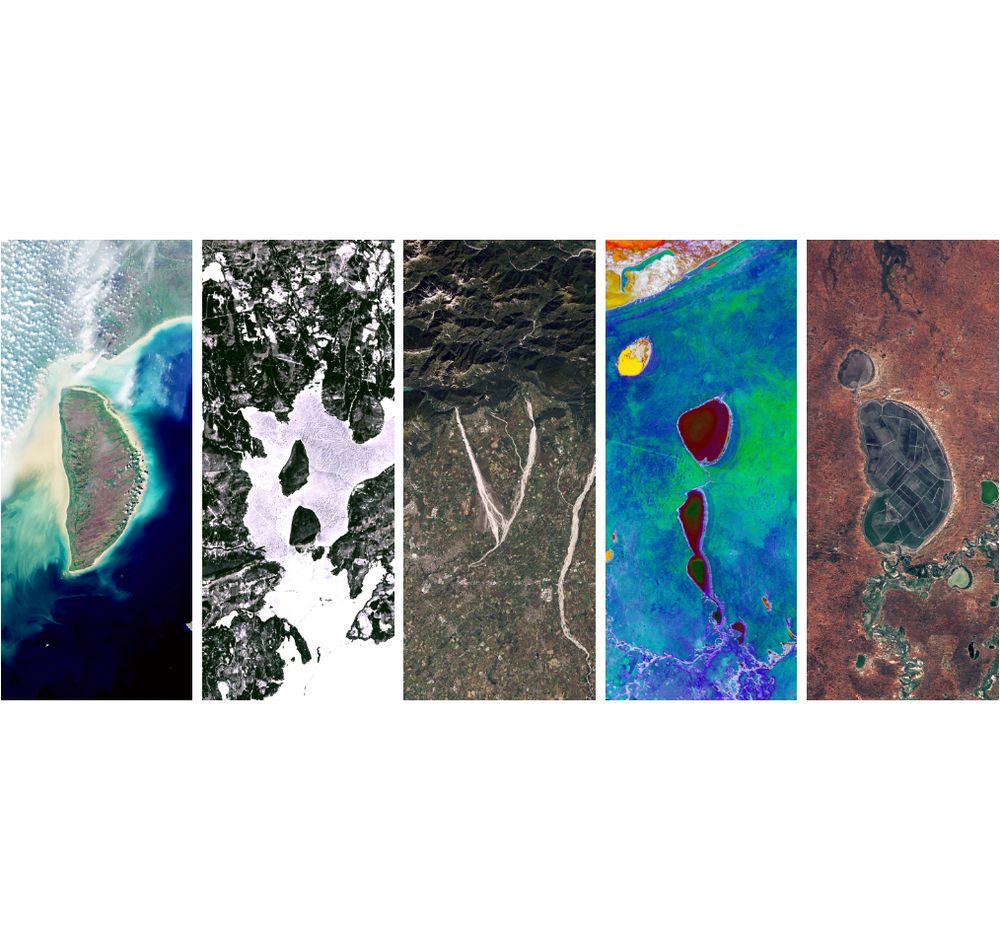
A series of five satellite images showcasing diverse landscapes: an island with turquoise waters, a snowy terrain, mountainous regions with winding roads, colorful lakes, and a dry, arid area with circular features. More importantly, they spell out DAVID with their landscape images.
Psst…You want to know about the NASA website that spells out your name in Landsat imagery. 🧪
landsat.gsfc.nasa.gov/apps/YourNam...
31.08.2024 02:00 — 👍 1537 🔁 508 💬 96 📌 367

Landscapes Live
Landscapes Live is a weekly online seminar series freely accessible to the international scientific community interested in various aspects of geomorphology. Our talks take place on Zoom every Thursda...
LL Season opener with @paul-bierman.bsky.social this Thursday March 13th!
"A landscape under the ice: Camp Century, Greenland"
🧊🧊🧊
🏞️🏞️🏞️
ℹ️🔗 www.landscapeslive.org
20:30 Mumbai
16:00 Paris
15:00 London
12:00 Rio
11:00 NYC
08:00 LA
10.03.2025 14:13 — 👍 5 🔁 5 💬 0 📌 3

Landscapes Live
Landscapes Live is a weekly online seminar series freely accessible to the international scientific community interested in various aspects of geomorphology. Our talks take place on Zoom every Thursda...
Hello Bluesky! 🦋🏞️
We are organizing weekly seminars for scientists to present their research in and around geomorphology.
Affiliated with @eurogeosciences.bsky.social GM
More information on our website: www.landscapeslive.org
23.02.2025 16:06 — 👍 15 🔁 6 💬 1 📌 3

Part of a computer screenshot. Shows a map of topography that is output from a landscape evolution model, with a highly dissected landscape in this case

Screenshot showing Python code and the heading, "Using the Model" at the top
Landscape evolution modeling with Landlab in my 300-level geomorph class this week. I like to add a heavy dose of fluvial erosion at the end so it turns into a Loess Plateau/Loess Canyons of Nebraska kind of landscape. I can't say enough good things about Landlab and the people who developed it
12.02.2025 22:23 — 👍 36 🔁 9 💬 3 📌 0

Two meanders of the Ural River, with green vegetation on the point bars. The trees seem to be larger and older on the older parts of the bars. Scroll patterens are fairly well defined by variability in the vegetation. Screenshot from Apple Maps.

Two meanders created using the 'meanderpy' and 'meandergraph' Python packages, with point bars color coded by age (green = older, yellow = younger).
A couple of meanders on the Ural River, Kazakhstan and similar geometries + age distribution on the point bars in a simple model of #meandering 🧪⚒️
11.01.2025 22:19 — 👍 67 🔁 11 💬 2 📌 2
Meanders as wrinkles in time. Every time step in the animation is a 3D-printable object 🧪⚒️
21.12.2024 18:54 — 👍 88 🔁 18 💬 3 📌 2

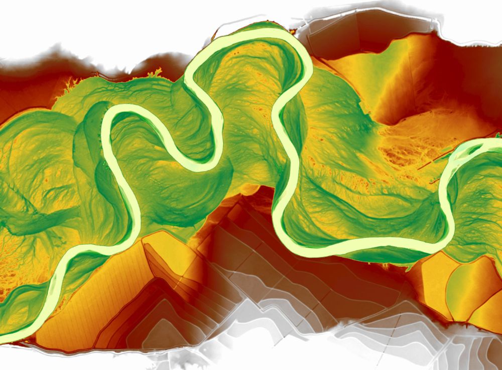
Relative elevation model of Powder River near Broadus, Montana. So fun to see the floodplain features pop with a bit of color!
19.11.2024 22:45 — 👍 41 🔁 6 💬 0 📌 0
Thanks for the encouragement!
26.11.2024 00:49 — 👍 0 🔁 0 💬 0 📌 0
I would love to be added. Thank you!
13.11.2024 02:17 — 👍 0 🔁 0 💬 1 📌 0

Using reconstructed images, we create synthetic stratigraphy for the Ucayali River based on estimated aggradation and channel preservation rates. Though not fully realistic, it might be helpful for comparing with field data. Spot the two 5m-tall (unrealistic for sure) geologists for scale? :)
12.11.2024 14:49 — 👍 7 🔁 0 💬 1 📌 0
Image warping offers powerful solutions for reconstructing landscape evolution, even with incomplete satellite data. Check out these examples: from simple head-turning motions in cats to detailed reconstructions of the Ucayali River and Wax Lake Delta, all using just two input images!
12.11.2024 14:42 — 👍 3 🔁 0 💬 0 📌 0
Geology tragic, thermochronology devotee, fission track dating, planets. Professor Emeritus, FAA https://findanexpert.unimelb.edu.au/profile/16040-andy-gleadow
Geoscientist working at the intersection of subsurface energy resources and storage. Currently banished to the frozen north.
Postdoctoral oceanographer studying the ocean carbon sink 🦈🤿🕹️
🏠 @imev-mer.fr (CNRS-Sorbonne Université) as part of the Horizon Europe @tricuso.bsky.social project
💻 https://louisedelaigue.owlstown.net/
🚀 http://bit.ly/3HWFD5I
PhD student, Earth and Marine Sciences.
Global Hydrology Lab at University of North Carolina at Chapel Hill #EarthObservation
The Seismological Society of America (SSA), founded in 1906, is an international scientific society devoted to the advancement of earthquake science.
Climate scientist; ocean carbon cycle and climate solutions. Professor, University of Hawaiʻi at Mānoa; Visiting Faculty, Arizona State University. https://linktr.ee/david_ho
Research Fellow in Glaciology at Monash University, Australia 🇦🇺 Home country Georgia 🇬🇪 Glacial-geomorphological studies ❄️🗻 Cosmogenic nuclide dating 💥☄️Remote Sensing 🛰 Cartography and GIS 🗺 Father of three cubs 🐯🐺🦁
PhD in Geology. Geomorphology, karst and geological hazards researcher. IPE-CSIC postdoc.
https://jorgesevilaguareles.quarto.pub/
Assistant Professor at EPFL. Chasing the power of water 🌊💡. Nature enthusiast. SAFL Alumnus. 🇮🇹 moved to 🇺🇸 now living in 🇨🇭. Opinions are my own. He/him/his.
Assistant Professor at Wageningen University. Hydrodynamics & biogeomorphology. Tipping points & self-organization. River deltas & coastal wetlands. https://www.wur.nl/en/persons/roeland-van-de-vijsel.htm. Sharks, cycling & salsa music. Views are my own.
Assistant Professor / PhD in Earth Sciences
Geoscientist, environmental historian, professor, author who cares deeply about our planet. Obsessed with snow, ice sheets, climate, and science as a way of knowing. Passionate about teaching, equality, and explaining Earth. https://www.paulbierman.net
Every week during our Spring and Fall series, we host a presentation by a geoscientist on their work in and around geomorphology. Part of EGU GM family.
Homepage: https://www.landscapeslive.org/
Youtube page: https://www.youtube.com/@landscapeslive1326
UW Madison Geography, opinions are mine. Geomorphology, soils, dunes, loess, in the Midwest, Great Plains, northern China. He/him. Living on Ho-Chunk lands.
Bardd, daearyddwr, geomorffolegydd, awdur
Poet, geographer, geomorphologist, author
Assistant Professor in Natural Hazards @CamUniGeography &
@EarthSciCam | Fellow @CaiusCollege | All hazards are multihazards, but are any of them natural?
Lecturer in Physical Geography at the University of Liverpool.
Fluvial geomorphology, remote sensing and river-related hazards.
MMU River Science: Seds, bugs and rocks that roll - who'd have thought river gravel was so much fun? Geordie dad in Scouseland. He/him.


