Photo of Dr Somnath Chaudhuri
🌍 Counting Everyone, Everywhere: The Power of Small Area Population Data
🗓 Date: November 18, 2025
🕐 Time: 1:00 PM (London)
🌍 Organiser: #OpenGeoHub
🔗 Register: https://us02web.zoom.us/webinar/register/WN_vpY1J1NaRd-Esgqhv4GA9A#
Join WorldPop Research […]
[Original post on mapstodon.space]
05.11.2025 15:28 — 👍 0 🔁 0 💬 0 📌 0

Photo of Dr Sarchil Qader leading a population estimation workshop in Beirut, Lebanon
A population estimation workshop was held in Beirut last week with Lebanon’s Central Administration of Statistics, ministries & UN partners.
With no census since 1932 geospatial modelling can fill major data gaps to guide Lebanon's recovery & planning.
#WorldPop #Lebanon #DataForDevelopment
04.11.2025 10:05 — 👍 0 🔁 0 💬 0 📌 0

Photo of man wearing mask by Jeyaratnam Caniceus via Pixabay https://pixabay.com/photos/man-face-mask-covid19-road-mask-6153671/
🔬 A new #MOOD #HorizonEU study reveals how #COVID19 modelling, data use & collaboration evolved across #Europe - offering key lessons for future pandemics.
📖 🔊Read more + listen: https://www.worldpop.org/blog/lessons-from-covid-19-how-data-and-modelling-evolved-during-the-pandemic/
@REA
27.10.2025 13:34 — 👍 2 🔁 0 💬 0 📌 0

Photo of Dr Chris Nnanatu speaking remotely at Data Science Nigeria AI Bootcamp 2025
🌍 “The future is geospatial.”
Dr. Chris Nnanatu at #DSNAIBootcamp2025 shared how #AI + Location Intelligence can power Africa’s growth through data-driven innovation. 🚀
#DataForGood #Africa #Geospatial #Innovation #DataScienceNigeria […]
[Original post on mapstodon.space]
24.10.2025 12:19 — 👍 0 🔁 0 💬 0 📌 0

Photo of street in Lilongwe, Malawi N J Spicer 2006 CC BY 2.0 https://flic.kr/p/9v3jcc
🛰️📊We're piloting AI and satellite data with Malawi’s NSO to update census areas ahead of 2028. Boosting accuracy while cutting costs.
#DataForDevelopment #FundedByFCDO #Malawi #Census2028 #InnovationInStats
🔗 https://www.worldpop.org/current-projects/fcdo-malawi/
16.10.2025 08:41 — 👍 0 🔁 0 💬 0 📌 0
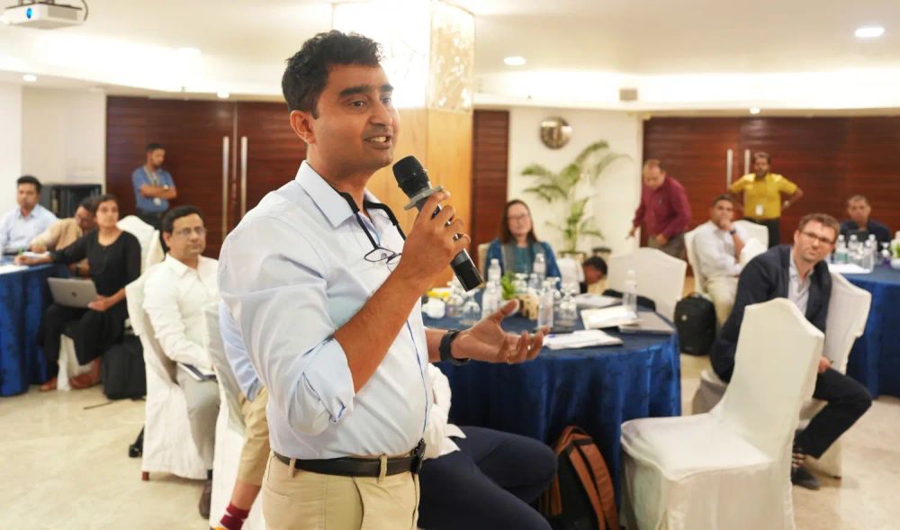
Photo of Dr Somnath Chaudhuri speaking at the stakeholders’ engagement meeting, Dhaka, Bangladesh
Dr Somnath Chaudhuri joined #Dhaka stakeholders last week to boost wastewater surveillance & population mapping. Showing how we support planning for emergency response.🌍📊
#PublicHealth #PopulationData #UrbanHealth #WastewaterSurveillance #DataForDevelopment […]
[Original post on mapstodon.space]
15.10.2025 11:11 — 👍 0 🔁 0 💬 0 📌 0

Photo of Evidence25 speakers and delegates
🎤📊#Evidence25 Conference in #Benin spotlights how #Africa is embedding local data & research into smarter policy.
Dr Jessica Espey keynote calls for stronger regional collaboration, institutional links & centring African voices in evidence systems […]
[Original post on mapstodon.space]
07.10.2025 13:25 — 👍 1 🔁 0 💬 0 📌 0

Maps showing comparison between raw floating-point data and integerized data produced by the traditional round, WorldPop stochastic integerization, and LandScan residual redistribution methods.
🚀New research in International Journal of Geographical Information Science - innovative method converts fractional population estimates into accurate integers, preserving totals, spatial detail & demographic consistency.
🌍#GeoData #PopulationStats
🔗🔊Report […]
[Original post on mapstodon.space]
07.10.2025 10:54 — 👍 1 🔁 0 💬 0 📌 0

Photo of Dr Mollie Van Gordon (Gates Foundation) with senior WorldPop team at the University of Southampton
We're thrilled to welcome Dr Mollie Van Gordon, Senior Program Officer -Geospatial Insights (Gates Foundation) to WorldPop this week! Her visit focuses on aligning research with geospatial data priorities, shaping future collaboration, and setting a vision […]
[Original post on mapstodon.space]
25.09.2025 15:10 — 👍 0 🔁 2 💬 0 📌 0

Screen capture of Google Flood Hub: Significant flood event information, 25 September 2025
🌊 With climate risks rising, AI + human‑centred data is making waves. Discover how WorldPop’s high-resolution population data helps Google’s Flood Hub predict floods and identify who’s at risk, covering 700M+ people in 100+ countries.
#ClimateTech […]
[Original post on mapstodon.space]
25.09.2025 13:59 — 👍 0 🔁 0 💬 0 📌 0

Photo of WorldPop Senior Research Fellows Dr Sarchil Qader and Dr Gianluca Boo with AI Assisted Sampling Workshop participants at the Pakistan Bureau of Statistics.
🚀 We’re thrilled to support Pakistan Bureau of Statistics and #UNFPA in modernising survey sampling in #Pakistan ! From #AI to #satellite data, our #training boosts capacity for smarter, faster, & more inclusive data - key for disaster response & national […]
[Original post on mapstodon.space]
24.09.2025 10:01 — 👍 1 🔁 0 💬 0 📌 0
Original post on mapstodon.space
📹 Dr Natalia Tejedor Garavito presents WorldPop’s cutting-edge work at CrisisReady’s Café Catastrófico ☕
🌍 From mapping war-torn Ukraine to guiding flood relief, this data saves lives.
Watch her talk (🇪🇸 w/ 🇬🇧 subs) […]
17.09.2025 14:54 — 👍 0 🔁 0 💬 0 📌 0

Map showing building and population counts observed in the 213 micro-census clusters located within the modelling environment categorised by settlement class
🚨 New study: A Bayesian model maps population in Kasaï-Oriental, #DRC with 1-hectare detail, the first of its kind! Estimated 4.1M people.
An important advance for #health planning, #vaccines & emergency response.
Read & listen […]
[Original post on mapstodon.space]
11.09.2025 10:31 — 👍 0 🔁 0 💬 0 📌 0

Screen capture of The Power of Population Data webinar, showing Dr Maksym Bondarenko, Dr Jessica Espey and Professor Andy Tatem.
Missed The Power of Population Data webinar?
🎥 The recording & presentation slides are now available! Dive into the latest on WorldPop’s Global 2 dataset and how it's shaping smarter decisions worldwide. 🌍📊
🔗 […]
[Original post on mapstodon.space]
09.09.2025 15:45 — 👍 0 🔁 2 💬 0 📌 0
🌍 Released today: WorldPop's Global 2 (2015-2030) dataset! High-res (100m), open-access global population estimates (2015–2030) by age & sex across 242 countries.
Smarter modelling, better accuracy, and new census data.
👉 […]
[Original post on mapstodon.space]
04.09.2025 08:50 — 👍 0 🔁 1 💬 0 📌 0

An image of WorldPop Global2 population estimates overlaid on satellite imagery for Northern Europe showing high population numbers in white and lower numbers in red. 2025
🌍 Tomorrow we launch WorldPop Global 2: A new era of global high-resolution population data (2015–2030)!
Built with AI & satellite imagery, it's open, powerful & ready for use in health, planning & disaster response.
🔗 […]
[Original post on mapstodon.space]
03.09.2025 14:45 — 👍 0 🔁 0 💬 0 📌 0

Screen capture of Somalia National Bureau of Statistics dashboard
🚀Pioneering data for Somalia’s future!
WorldPop, SNBS & UNFPA are training Somali statisticians in geospatial tools to map pre‑census areas in key districts. Helping build a modern census from the ground up.
#DataForDevelopment #Somalia #Census #PreEA
🔗 […]
[Original post on mapstodon.space]
03.09.2025 08:22 — 👍 0 🔁 0 💬 0 📌 0

Photo of a Malawi village by leliebloem, 2018 CC BY-NC-SA 2.0 https://flic.kr/p/29rg4KQ
🚀 Exciting news! In partnership with the UK’s ONS & funded by FCDO, we're introducing automated mapping tech to Malawi’s National Statistics Office.
Streamlining the 2028 #census for fast, cost-efficient, and accurate enumeration.
#DataForGood #Malawi
🔗 […]
[Original post on mapstodon.space]
02.09.2025 11:08 — 👍 0 🔁 0 💬 0 📌 0

Photo of an Adhoc Registrar, supports a mother during a digital birth registration drive in Port Harcourt, Nigeria, part of a nationwide effort to ensure every child has a legal identity. © UNICEF 2024
WorldPop & #UNICEF team up to map zero‑dose children using #AI, #satellite #data & #geospatial analytics so we can locate and vaccinate those who've never received routine immunisations.
Turning high‑resolution data into lifesaving action.
#vaccination […]
[Original post on mapstodon.space]
01.09.2025 14:20 — 👍 0 🔁 0 💬 0 📌 0

Maps showing cluster level estimates of proportions of children aged 12-23 months and 9-35 months who had received DTP1 and MCV1, respectively, obtained using the 2018 Nigeria Demographic and Health Survey.
Where are vaccines missing the mark?
🧭🩺 A new study maps vaccine coverage using geostatistics & machine learning - revealing the best tools to find and fix coverage gaps in low-data regions. 🌍📊
#DataForGood #Geostatistics #LeaveNoOneBehind
🔗 […]
[Original post on mapstodon.space]
28.08.2025 10:40 — 👍 0 🔁 0 💬 0 📌 0

Front cover of ReliefWeb report on Pakistan floods, August 2025
Using #WorldPop data, UNOSAT estimates ~41,000 people remain exposed to floodwaters in KP as of Aug 20, despite receding levels. Pakistan’s monsoon floods since June have caused 785 deaths & widespread damage.
#PakistanFloods2025 […]
[Original post on mapstodon.space]
27.08.2025 16:03 — 👍 0 🔁 0 💬 0 📌 0

Maps showing predicted malaria prevalence in children under five and number of infected children in regions of very low to moderate transmission in Senegal (excluding Dakar for visibility purposes). a, b show the posterior predicted prevalence and uncertainty estimates as a standard deviation (SD) on a 1 × 1 km resolution grid, respectively. c shows the number of infected children under five per health district, obtained by combining the predicted prevalence and child counts. d shows population-adjusted prevalence aggregated to health district level.
🚨New study co-authored by WorldPop researchers maps malaria risk in #Senegal in detail - combining environment + vulnerability data to pinpoint hotspots.
🚀 A powerful tool as the country races toward malaria elimination by 2030.
🔗 […]
[Original post on mapstodon.space]
21.08.2025 14:50 — 👍 0 🔁 1 💬 0 📌 0

veryspatial.com logo superimposed on population estimate map
How do you map populations where no recent census exists? 🌍📊
In this VerySpatial podcast, we share how we use geospatial & satellite data to fill gaps, support UN agencies, and power decisions in crisis zones.
🔊 Listen now […]
[Original post on mapstodon.space]
21.08.2025 10:47 — 👍 0 🔁 1 💬 0 📌 0

Photo of JSM 2025 conference hall at Music City Center, Nashville
🌍📊 Big strides in population mapping!
At #JSM2025, WorldPop's Dr Chris Nnanatu unveiled cutting-edge research using satellite data to improve global population estimates - especially where data is scarce.
📡 49% less bias.
📍 Smarter models.
🚀 Better […]
[Original post on mapstodon.space]
19.08.2025 14:19 — 👍 0 🔁 0 💬 0 📌 0

Graphic showing the WorldPop logo and the title of a webinar: The Power of Population Data: Introducing WorldPop Global 2015-2030, 3pm BST, 4 September 2025.
🌍 Big data, big impact! Join us on 4 Sep for the launch of WorldPop Global 2015–2030 - a new open-access, high-res, age & sex-disaggregated population estimate dataset covering 242 countries
📅 4 Sep | 🕒 3 pm BST
🔗 Register: https://www.eventbrite.co.uk/e/1374590861269
#PopulationData #OpenData
13.08.2025 09:05 — 👍 0 🔁 1 💬 0 📌 0

Maps of Europe showing heat-related excess mortality projected annual average heat-related excess deaths per million population at a 1.5 °C, b 2.0 °C, c 3.0 °C, and (d) 4.0 °C.
🔥 Europe faces a deadly future as extreme heat and an aging population collide. A new study using WorldPop population data warns heat-related deaths could soar - especially among the elderly - unless urgent, bold adaptation measures are taken.
#ClimateCrisis […]
[Original post on mapstodon.space]
12.08.2025 17:46 — 👍 1 🔁 1 💬 0 📌 0

Photorealistic image of a child in a refugee camp
🌍 How can data save lives during disasters?
WorldPop co-produced high-resolution population data for a new UN study, helping map how vulnerable groups across Latin America & the Caribbean face risks from floods, earthquakes, and more.
Smarter data = smarter […]
[Original post on mapstodon.space]
07.08.2025 09:08 — 👍 0 🔁 0 💬 0 📌 0

AI art image of globe on a stage with 'Global 2' sign watched by a large audience
📊 Discover The Power of Population Data! 🌍
Join WorldPop’s free webinar on Sept 4 to learn about our new high-res, open-access population datasets (2015–2030) for 242 countries.
Learn from experts + get your questions answered!
🔗 Register now […]
[Original post on mapstodon.space]
06.08.2025 09:36 — 👍 1 🔁 0 💬 0 📌 0

Graphic image showing comparison of population count estimates modelled from new covariates (year 2024) and population count estimates modelled from 2020 covariates for Luanda (Angola)
🌍 We’re excited to share the release of 73 high-resolution, multi-temporal global geospatial open access datasets.
Led by Dorothea Woods, this ground breaking collection is set to transform how we model and understand human population distribution.
📅 […]
[Original post on mapstodon.space]
05.08.2025 09:59 — 👍 0 🔁 0 💬 0 📌 0
Graphic map comparing different methods of integerisation.
🚀 New Development in Population Mapping!
No more confusing 2.3 people per grid cell — the new integerisation method from WorldPop turns fractional data into whole numbers without losing accuracy.
✅ Accurate totals & demographic consistency
✅ Easier-to-read […]
[Original post on mapstodon.space]
31.07.2025 08:42 — 👍 0 🔁 4 💬 0 📌 0