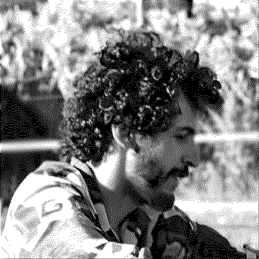
Relief visualization in perspective style showing elevation data from D 130 at coordinates 48.7953, 5.6632 with elevation range from 229m to 391m.
//\ Relief #255
Location: D 130, Grand Est, France
Coordinates: 48.7953, 5.6632
Elevation Range: 229m to 391m
Terrain type: hilly
#ReliefOfTheDay #DataViz #Geography
25.02.2026 11:44 — 👍 0 🔁 0 💬 0 📌 0

Relief visualization in perspective style showing elevation data from Каларский муниципальный округ at coordinates 56.7586, 115.6690 with elevation range from 625m to 1761m.
//\ Relief #254
Location: Каларский муниципальный округ, Забайкальский край, Россия
Coordinates: 56.7586, 115.6690
Elevation Range: 625m to 1761m
Terrain type: high-mountainous
#ReliefOfTheDay #DataViz #Geography
24.02.2026 11:45 — 👍 0 🔁 0 💬 0 📌 0

Relief visualization in perspective style showing elevation data from Area C (South Skeena) at coordinates 53.9668, -129.6276 with elevation range from 1m to 1383m.
//\ Relief #253
Location: Area C (South Skeena), British Columbia, Canada
Coordinates: 53.9668, -129.6276
Elevation Range: 1m to 1383m
Terrain type: mountainous
#ReliefOfTheDay #DataViz #Geography
23.02.2026 11:43 — 👍 0 🔁 0 💬 0 📌 0

Relief visualization in perspective style showing elevation data from Yukon at coordinates 61.7973, -140.7608 with elevation range from 774m to 1188m.
//\ Relief #252
Location: Yukon, Yukon, Canada
Coordinates: 61.7973, -140.7608
Elevation Range: 774m to 1188m
Terrain type: hilly
#ReliefOfTheDay #DataViz #Geography
22.02.2026 11:27 — 👍 0 🔁 0 💬 0 📌 0

Relief visualization in perspective style showing elevation data from B115 at coordinates 47.9090, 14.4509 with elevation range from 335m to 1145m.
//\ Relief #251
Location: B115, Oberösterreich, Österreich
Coordinates: 47.9090, 14.4509
Elevation Range: 335m to 1145m
Terrain type: mountainous
#ReliefOfTheDay #DataViz #Geography
21.02.2026 11:28 — 👍 0 🔁 0 💬 0 📌 0

Relief visualization in perspective style showing elevation data from Сёйкинское сельское поселение at coordinates 51.9270, 86.6875 with elevation range from 427m to 819m.
//\ Relief #250
Location: Сёйкинское сельское поселение, Республика Алтай, Россия
Coordinates: 51.9270, 86.6875
Elevation Range: 427m to 819m
Terrain type: hilly
#ReliefOfTheDay #DataViz #Geography
20.02.2026 11:37 — 👍 0 🔁 0 💬 0 📌 0

Relief visualization in perspective style showing elevation data from Municipio de El Carril at coordinates -25.2131, -65.3029 with elevation range from 1300m to 2193m.
//\ Relief #249
Location: Municipio de El Carril, Salta, Argentina
Coordinates: -25.2131, -65.3029
Elevation Range: 1300m to 2193m
Terrain type: high-mountainous
#ReliefOfTheDay #DataViz #Geography
19.02.2026 11:42 — 👍 0 🔁 0 💬 0 📌 0

Relief visualization in perspective style showing elevation data from Kabba/Bunu at coordinates 7.7469, 6.1611 with elevation range from 250m to 600m.
//\ Relief #248
Location: Kabba/Bunu, Kogi, Nigeria
Coordinates: 7.7469, 6.1611
Elevation Range: 250m to 600m
Terrain type: hilly
#ReliefOfTheDay #DataViz #Geography
18.02.2026 11:44 — 👍 1 🔁 0 💬 0 📌 0

Relief visualization in perspective style showing elevation data from عين رقاد at coordinates 36.5192, 10.2242 with elevation range from 206m to 513m.
//\ Relief #247
Location: عين رقاد, ولاية بن عروس, تونس
Coordinates: 36.5192, 10.2242
Elevation Range: 206m to 513m
Terrain type: hilly
#ReliefOfTheDay #DataViz #Geography
17.02.2026 11:43 — 👍 1 🔁 0 💬 1 📌 0

Relief visualization in perspective style showing elevation data from Yukon at coordinates 63.8806, -131.4088 with elevation range from 1266m to 1981m.
//\ Relief #246
Location: Yukon, Yukon, Canada
Coordinates: 63.8806, -131.4088
Elevation Range: 1266m to 1981m
Terrain type: high-hilly
#ReliefOfTheDay #DataViz #Geography
16.02.2026 11:43 — 👍 1 🔁 0 💬 1 📌 0

Relief visualization in perspective style showing elevation data from 柴旦镇 at coordinates 37.7768, 95.5397 with elevation range from 3784m to 4733m.
//\ Relief #245
Location: 柴旦镇, 青海省, 中国
Coordinates: 37.7768, 95.5397
Elevation Range: 3784m to 4733m
Terrain type: high-mountainous
#ReliefOfTheDay #DataViz #Geography
15.02.2026 11:28 — 👍 1 🔁 0 💬 0 📌 0

Relief visualization in perspective style showing elevation data from Rua Nico Ferreira at coordinates -19.8198, -42.6846 with elevation range from 274m to 476m.
//\ Relief #244
Location: Rua Nico Ferreira, Minas Gerais, Brasil
Coordinates: -19.8198, -42.6846
Elevation Range: 274m to 476m
Terrain type: hilly
#ReliefOfTheDay #DataViz #Geography
14.02.2026 11:29 — 👍 1 🔁 0 💬 0 📌 0

Relief visualization in perspective style showing elevation data from Khumbupasanglahmu-03 at coordinates 27.7592, 86.8538 with elevation range from 4314m to 6401m.
//\ Relief #243
Location: Khumbupasanglahmu-03, कोशी प्रदेश, नेपाल
Coordinates: 27.7592, 86.8538
Elevation Range: 4314m to 6401m
Terrain type: high-mountainous
#ReliefOfTheDay #DataViz #Geography
13.02.2026 11:37 — 👍 1 🔁 0 💬 1 📌 0

Relief visualization in perspective style showing elevation data from 南川 at coordinates 29.7295, 114.4024 with elevation range from 52m to 503m.
//\ Relief #242
Location: 南川, 湖北省, 中国
Coordinates: 29.7295, 114.4024
Elevation Range: 52m to 503m
Terrain type: low-hilly
#ReliefOfTheDay #DataViz #Geography
12.02.2026 11:44 — 👍 0 🔁 0 💬 0 📌 0

Relief visualization in perspective style showing elevation data from 2014 at coordinates 33.6675, -86.7615 with elevation range from 118m to 274m.
//\ Relief #241
Location: 2014, Alabama, United States
Coordinates: 33.6675, -86.7615
Elevation Range: 118m to 274m
Terrain type: low-hilly
#ReliefOfTheDay #DataViz #Geography
11.02.2026 11:50 — 👍 1 🔁 0 💬 0 📌 0

Relief visualization in perspective style showing elevation data from Polillo at coordinates 14.8853, 121.9166 with elevation range from 27m to 233m.
//\ Relief #240
Location: Polillo, Quezon, Philippines
Coordinates: 14.8853, 121.9166
Elevation Range: 27m to 233m
Terrain type: low-hilly
#ReliefOfTheDay #DataViz #Geography
10.02.2026 11:54 — 👍 0 🔁 0 💬 0 📌 0

Relief visualization in perspective style showing elevation data from محافظة العلا at coordinates 26.4977, 37.3342 with elevation range from 1252m to 1539m.
//\ Relief #239
Location: محافظة العلا, منطقة المدينة المنورة, السعودية
Coordinates: 26.4977, 37.3342
Elevation Range: 1252m to 1539m
Terrain type: high-hilly
#ReliefOfTheDay #DataViz #Geography
09.02.2026 11:51 — 👍 0 🔁 0 💬 0 📌 0

Relief visualization in perspective style showing elevation data from Pitiquito at coordinates 30.4203, -111.8892 with elevation range from 437m to 718m.
//\ Relief #238
Location: Pitiquito, Sonora, México
Coordinates: 30.4203, -111.8892
Elevation Range: 437m to 718m
Terrain type: hilly
#ReliefOfTheDay #DataViz #Geography
08.02.2026 11:29 — 👍 0 🔁 0 💬 0 📌 0

Relief visualization in perspective style showing elevation data from Chama District at coordinates -11.3743, 33.1383 with elevation range from 748m to 1053m.
//\ Relief #237
Location: Chama District, Eastern Province, Zambia
Coordinates: -11.3743, 33.1383
Elevation Range: 748m to 1053m
Terrain type: hilly
#ReliefOfTheDay #DataViz #Geography
07.02.2026 11:27 — 👍 0 🔁 0 💬 0 📌 0

Relief visualization in perspective style showing elevation data from Namsang at coordinates 27.1361, 95.6304 with elevation range from 357m to 1310m.
//\ Relief #236
Location: Namsang, Arunachal Pradesh, India
Coordinates: 27.1361, 95.6304
Elevation Range: 357m to 1310m
Terrain type: mountainous
#ReliefOfTheDay #DataViz #Geography
06.02.2026 11:39 — 👍 0 🔁 0 💬 0 📌 0

Relief visualization in perspective style showing elevation data from Kalaallit Nunaat at coordinates 73.1536, -27.7892 with elevation range from 49m to 2008m.
//\ Relief #235
Location: Kalaallit Nunaat, Kalaallit Nunaat
Coordinates: 73.1536, -27.7892
Elevation Range: 49m to 2008m
Terrain type: mountainous
#ReliefOfTheDay #DataViz #Geography
05.02.2026 11:40 — 👍 0 🔁 0 💬 0 📌 0

Relief visualization in perspective style showing elevation data from ทุ่งหลวง at coordinates 13.4175, 99.5746 with elevation range from 129m to 592m.
//\ Relief #234
Location: ทุ่งหลวง, อำเภอปากท่อ, ประเทศไทย
Coordinates: 13.4175, 99.5746
Elevation Range: 129m to 592m
Terrain type: hilly
#ReliefOfTheDay #DataViz #Geography
04.02.2026 11:38 — 👍 0 🔁 0 💬 0 📌 0

Relief visualization in perspective style showing elevation data from Хайрхан ᠬᠠᠶᠢᠷᠬᠠᠨ at coordinates 48.7129, 101.7803 with elevation range from 1418m to 1758m.
//\ Relief #233
Location: Хайрхан ᠬᠠᠶᠢᠷᠬᠠᠨ, Архангай ᠠᠷᠤ ᠬᠠᠩᠭ᠋ᠠᠢ, Монгол улс ᠮᠤᠩᠭᠤᠯ ᠤᠯᠤᠰ
Coordinates: 48.7129, 101.7803
Elevation Range: 1418m to 1758m
Terrain type: high-hilly
#ReliefOfTheDay #DataViz #Geography
03.02.2026 11:40 — 👍 0 🔁 0 💬 0 📌 0

Relief visualization in perspective style showing elevation data from Moxico at coordinates -13.2435, 20.2130 with elevation range from 1192m to 1374m.
//\ Relief #232
Location: Moxico, Moxico, Angola
Coordinates: -13.2435, 20.2130
Elevation Range: 1192m to 1374m
Terrain type: high-hilly
#ReliefOfTheDay #DataViz #Geography
02.02.2026 11:39 — 👍 0 🔁 0 💬 0 📌 0

Relief visualization in perspective style showing elevation data from 柳林汊 at coordinates 28.7882, 111.0222 with elevation range from 54m to 311m.
//\ Relief #231
Location: 柳林汊, 湖南省, 中国
Coordinates: 28.7882, 111.0222
Elevation Range: 54m to 311m
Terrain type: low-hilly
#ReliefOfTheDay #DataViz #Geography
01.02.2026 11:27 — 👍 0 🔁 0 💬 0 📌 0

Relief visualization in perspective style showing elevation data from غات at coordinates 25.4763, 10.4770 with elevation range from 771m to 1005m.
//\ Relief #230
Location: غات, غات, ليبيا
Coordinates: 25.4763, 10.4770
Elevation Range: 771m to 1005m
Terrain type: hilly
#ReliefOfTheDay #DataViz #Geography
31.01.2026 11:27 — 👍 0 🔁 0 💬 0 📌 0

Relief visualization in perspective style showing elevation data from сельское поселение Зареченск at coordinates 66.9213, 30.8217 with elevation range from 79m to 312m.
//\ Relief #229
Location: сельское поселение Зареченск, Мурманская область, Россия
Coordinates: 66.9213, 30.8217
Elevation Range: 79m to 312m
Terrain type: low-hilly
#ReliefOfTheDay #DataViz #Geography
30.01.2026 11:35 — 👍 0 🔁 0 💬 0 📌 0

Relief visualization in perspective style showing elevation data from Maevatanana at coordinates -16.9840, 47.0741 with elevation range from 247m to 427m.
//\ Relief #228
Location: Maevatanana, Betsiboka, Madagasikara / Madagascar
Coordinates: -16.9840, 47.0741
Elevation Range: 247m to 427m
Terrain type: hilly
#ReliefOfTheDay #DataViz #Geography
29.01.2026 11:37 — 👍 0 🔁 0 💬 0 📌 0

Relief visualization in perspective style showing elevation data from Otgon - Tsakhir at coordinates 47.8457, 98.4052 with elevation range from 2323m to 2833m.
//\ Relief #227
Location: Otgon - Tsakhir, Архангай ᠠᠷᠤ ᠬᠠᠩᠭ᠋ᠠᠢ, Монгол улс ᠮᠤᠩᠭᠤᠯ ᠤᠯᠤᠰ
Coordinates: 47.8457, 98.4052
Elevation Range: 2323m to 2833m
Terrain type: high-hilly
#ReliefOfTheDay #DataViz #Geography
28.01.2026 11:29 — 👍 0 🔁 0 💬 0 📌 0

Relief visualization in perspective style showing elevation data from Анадырский район at coordinates 63.2755, 178.2571 with elevation range from 117m to 623m.
//\ Relief #226
Location: Анадырский район, Чукотский автономный округ, Россия
Coordinates: 63.2755, 178.2571
Elevation Range: 117m to 623m
Terrain type: hilly
#ReliefOfTheDay #DataViz #Geography
27.01.2026 11:29 — 👍 0 🔁 0 💬 0 📌 0