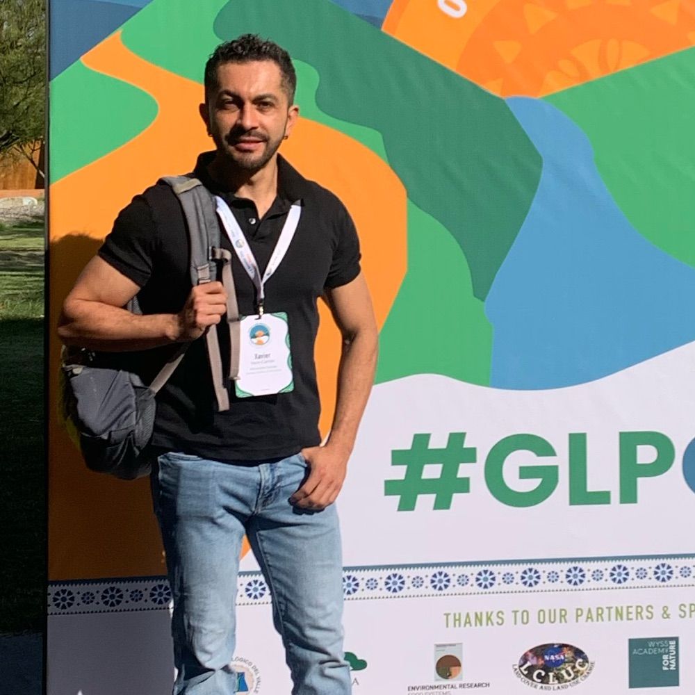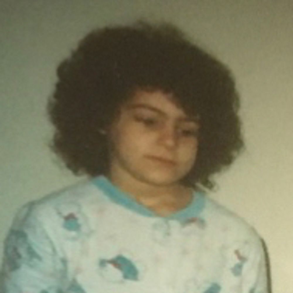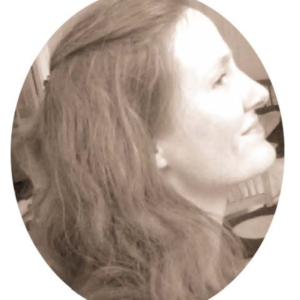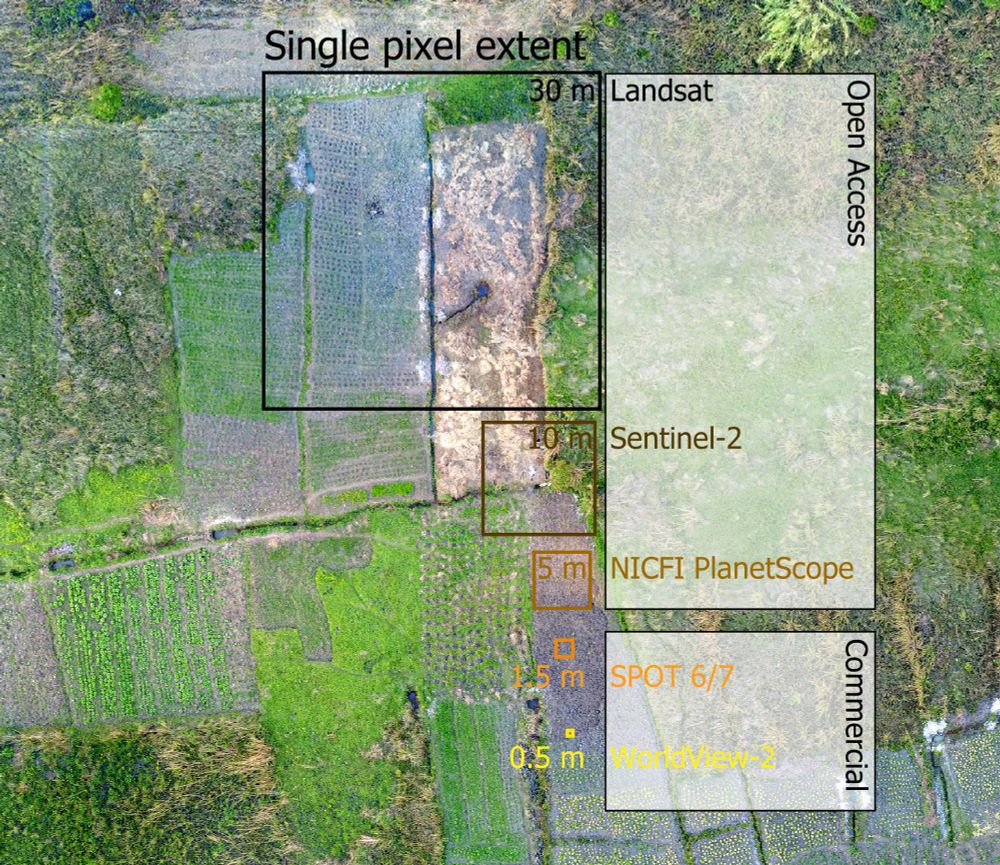
A drone capture of a smallholder farming landscape. Overlaid are squares of the size of typical optical satellite missions. Openly accessible data (e.g. Landsat or Sentinel-2) is often not sufficient to capture the landscape complexity in full detail, for example when trying to delineate individual fields. Here, one Landsat pixel contains fractions of multiple fields. Commercial data come at higher spatial resolution, offering potential to discriminate indivudual landscape components.
📣PNAS piece led by @philrufin.bsky.social: commercial very-high-resolution EO data is needed for monitoring SDG 2 indicators in smallholder landscapes but costs are prohibitive. A call for open access for sustainability-centered research: doi.org/10.1073/pnas... @humboldtuni.bsky.social
13.02.2025 09:28 — 👍 40 🔁 13 💬 0 📌 2

If you are looking for geospatial jobs or customers have a look at the geospatial-companies list. Around 700 companies from all over the world, working with 🌎 GIS 🛰️ Earth Observation ☁️️ Climate ✈️ UAV etc. New platform, maybe someone doesn't know it yet :) github.com/chrieke/awes...
11.11.2024 15:10 — 👍 18 🔁 5 💬 1 📌 1
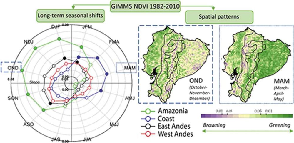
#Ecuador, #greening, #browning, #NDVI, #tropics, #remotesensing, #geography
30.12.2024 18:44 — 👍 0 🔁 0 💬 0 📌 0
Making out while the world collapses
he/him - Mni Sóta Makoce - 🇵🇸🇺🇦
GIScientist; Map Muser; Spatial Pattern Seeker; Language Enthusiast. TRELIS Fellow. Faculty @BrownUniversity . 🇹🇷 in 🇺🇸. she/her/O
Earth scientist. Poet. Editor. Black Canadian & white settler. 🪨🌊 Geology, Arctic, carbon cycle, hydrology, geohumanities. ✍🏼 Attic Rain (NeWest) & I'll Get Right On It! (Roseway). Greyhound enthusiast. Coffee, jokes, memes. https://linktr.ee/JonesYYC
PhD Student in Geography at Pennsylvania State University | Agrarian Political Ecology | Farmer Debt | Climate Adaptation | Sri Lanka
•••
Links to my work 👇🏼
https://linktr.ee/nethmisachy
Wildlife, Biodiversity, Ecosystems, Nature Conservation
The International Association for the Study of Environment, Space, and Place dialogues on the nature of place/space & the geographical moment of experience. IASESP's journal: https://www.upress.umn.edu/journals/environment-space-place/
Scientist, measurer of trees with tape and from outer space, thinker, windsurfer, Research Ecologist, Philadelphia & Knoxville. Views my own.
The Working Group of Vegetation Classification of the International Association of Vegetation Science (IAVS)
Sen. Sanders of Vermont, Ranking Member of the U.S. Senate Committee on Health, Education, Labor & Pensions, is the longest-serving independent in congressional history.
geo. space. tech. geopolitics.
Communicating science and data, I illuminate the interconnectedness of climate action, biodiversity conservation, and energy policy. I translate complex information into clear narratives to drive informed decisions for sustainable solutions.
Forest and landscape ecologist. Associate Professor at University of Copenhagen.
Postdoctoral researcher at the Norwegian University of Life Sciences. Focused on large-scale biodiversity monitoring in tropical rainforest ecosystems. 🌴🐆🦜🦗🐍🐸
Professor of Landscape Ecology and Conservation @usponline, editor in chief @PerspectEcolCon, #biodiversity & #human_well-being, #science-policy interface
CEO @Spatial Bytes | Research Scientist & Senior Geospatial Engineer @DRI | Creator, GEE Community Catalog | Google Dev Expert for Google Earth Engine | NSF NEON Advisor | Faculty @UH Mānoa | Geospatial Innovation 🌍
#AllDataIsSpatial #DataIsPlural #KiwiInColorado | Spatial Data Scientist / Researcher | Sharing (Mainly) GIS, Spatial and Geology 'Stuff' | Personal Account, Not Specifically Related To My Employer
Professor for Earth observation, Technical University of Munich.
Geographer interested in 🛰️ EarthObservation for 🌿agriculture, 💧water resources, and 🌍 sustainable land management.
F.R.S. FNRS Postdoctoral Fellow 🇪🇺
Earth & Life Institute - UCLouvain 🇧🇪
Earth Observation Lab - HUBerlin 🇩🇪