🌡️ Rares voire rarissimes en France au XXe siècle, les températures dépassant localement les 40 degrés sont devenues fréquentes depuis l’an 2000. Voici une carte animée localisant chaque année où les stations de Météo-France ont relevé ou dépassé 40 degrés (données au 17 août).
25.08.2025 11:00 — 👍 765 🔁 579 💬 19 📌 32

Jane Fonda dans une robe rose à rayures noires, le poing levé, tient sa récompense sur scène lors de la cérémonie des récompenses la Screen Actors Guild
Jane Fonda à la Screen Actors Guild : "Ne vous y trompez pas, l'empathie n'est pas une faiblesse ou un truc woke. Et d'ailleurs, être woke signifie juste que vous en avez quelque chose à foutre des gens autour de vous." Cette dame est le fer de lance de la résistance à Hollywood et l'a toujours été.
24.02.2025 12:08 — 👍 2328 🔁 546 💬 18 📌 13

Data Viz Project
Collection of data visualizations to get inspired and find the right type
Data Viz Project | Collection of data visualizations to get inspired and find the right type
datavizproject.com
06.02.2025 11:11 — 👍 4 🔁 4 💬 0 📌 0

Photo from an early Apple II ad in the 1970s
The PC is Dead: It's Time To Make Computing Personal Again
My new essay on how we lost control of personal computing to Internet surveillance, DRM, and extractive business models—and how we can launch the era of Personal Computer 2.0
www.vintagecomputing.com/index.php/ar...
18.01.2025 01:18 — 👍 619 🔁 167 💬 22 📌 17
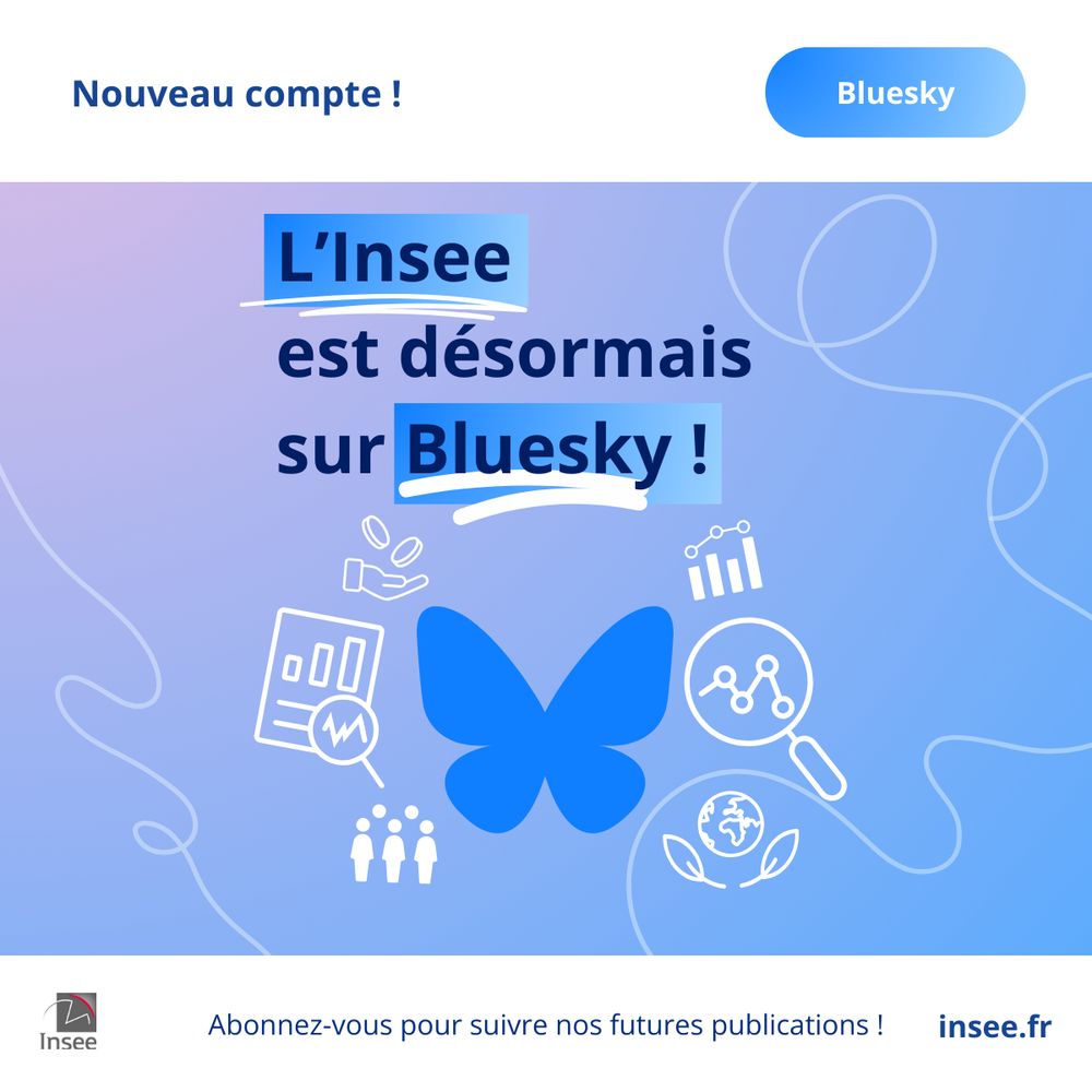
L’Insee est désormais sur Bluesky ! Dorénavant, vous pouvez également retrouver nos publications en suivant notre compte @insee.fr. Abonnez-vous !
26.02.2025 11:28 — 👍 802 🔁 292 💬 17 📌 20
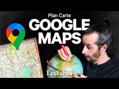
YouTube video by Les Echos
Comment Google Maps modifie le monde | Plan carte
🗺🌍📹Le Plan Carte™ nouveau est arrivé !
Dedans, il y a :
- un mastodonte de la cartographie
- des frontières qui apparaissent et disparaissent
- une chanson absolument nécessaire
Comment Google redessine le monde ? @lesechosfr.bsky.social
www.youtube.com/watch?v=DRfi...
09.02.2025 17:24 — 👍 57 🔁 14 💬 4 📌 5
It's time for #gischat !
How did you come to work in the geospatial industry or use geospatial tools? What drew you here? What was your journey to get here?
Remember to use the hashtag in your replies!
22.01.2025 18:00 — 👍 18 🔁 6 💬 37 📌 1
Le seul qui n'est pas clair est assembleenationale (aucun tweet) bsky.app/profile/did:...
Les autres n'ont pas forcément un annonce officielle mais sont actifs donc au pire officieux mais portés par les institutions officielles
23.01.2025 14:19 — 👍 0 🔁 0 💬 0 📌 0
En plus @insee.bsky.social, @ignfrance.bsky.social @datagouvfr.bsky.social @assembleenationale.bsky.social @cnrs.bsky.social @ehess-fr.bsky.social @brgm.bsky.social
23.01.2025 14:08 — 👍 3 🔁 0 💬 1 📌 0
D'où la création du fameux PostGIS day en référence au GIS day d'ESRI qui s'approprie le monopole un peu facilement
23.01.2025 14:02 — 👍 2 🔁 0 💬 0 📌 0
Using DuckDB’s Hilbert Function with GeoP
DuckDB continues to be my go to tool for geospatial processing, after I discovered it over a year ago. Since that time its functionality…
Pour afficher plus rapidement encore des couches cartographiques volumineuses avec le format #Geoparquet, pensez à les trier avec la fonction ST_Hilbert() de #DuckDB Spatial : cet article de @opencholmes.bsky.social l'explique de façon lumineuse.
cholmes.medium.com/using-duckdb...
16.01.2025 11:00 — 👍 12 🔁 5 💬 0 📌 0

Couverture du livre « RESSOURCES »
Un peu de douceur (et d’intelligence) dans un monde de pétrole brut. #ConseilBD
16.01.2025 08:43 — 👍 303 🔁 42 💬 11 📌 2

SPOT - the easy way to verify locations
Spot is a tool for finding combinations of objects in the public space world-wide.
After a @Bellingcat workshop years ago, a participant built a geolocation tool to find locations that all had i.e. a library and a cafe in a 20m radius. Now, there's a supercharged version of that tool! Thanks @sanjanamv.bsky.social for flagging it. www.findthatspot.io
13.01.2025 16:55 — 👍 305 🔁 91 💬 8 📌 4
Just published in JOSS: 'antimeridian: A Python package for correcting geometries that cross the 180th meridian' https://doi.org/10.21105/joss.07530
08.01.2025 20:54 — 👍 12 🔁 5 💬 0 📌 1

Buckminster Fuller’s Airocean projection (image made with D3).
The Airocean projection in Proj.4 at last!
github.com/OSGeo/PROJ/i...
(thanks to @ Pierre Louvart)
08.01.2025 21:23 — 👍 11 🔁 6 💬 0 📌 0
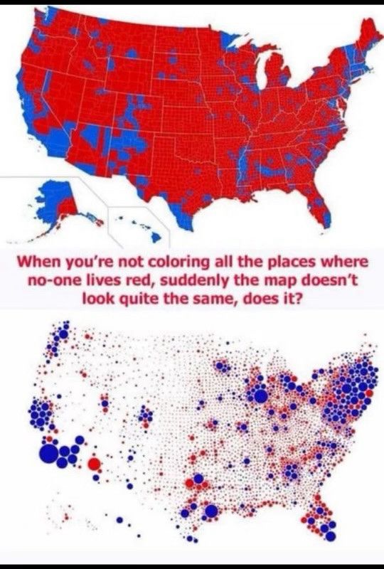
Land doesn’t vote. Stop pretending it does.
14.12.2024 21:08 — 👍 58449 🔁 12981 💬 1550 📌 621

I'm doing more & more research on the history of GPS and I'm amazed by the official US Gov's dedicated website for GPS: gps.gov
It's so old school it actually looks cool
And it ends up quite easy to navigate (would have been ironic otherwise)
08.01.2025 10:12 — 👍 12 🔁 1 💬 0 📌 0
Lien donne une 404
08.01.2025 11:47 — 👍 0 🔁 0 💬 0 📌 0
Avec l'abandon de toute politique de modération par Meta, Bluesky va mécaniquement accueillir du monde, donc attirer l'attention des trolls.
Pour garder ce site potable :
Do not engage.
Block.
08.01.2025 11:38 — 👍 662 🔁 211 💬 19 📌 7

Interface du site Attrap, moteur créé par la Quadrature du Net.
.
La Quadrature du Net lance Attrap ("Automate de Traque de Termes et de Recherche dans les Arrêtés Préfectoraux").
CP : laquadrature.net/2024/12/19/c...
Attrap : attrap.fr
19.12.2024 14:22 — 👍 62 🔁 36 💬 2 📌 5

Always normalize you data
I recently came across a map from the National Atlas of Spain showing the number of libraries by municipality. However, one thing directly caught my attention. There’s a saying that many maps show onl...
I am starting 2025 with a completely renewed blog based on Quarto. I have also updated all the previous posts. The first post addresses the issue of the lack of data normalization I observed in the Spanish National Atlas.
#rstats #dataviz
dominicroye.github.io/blog/2025-01...
06.01.2025 10:35 — 👍 106 🔁 27 💬 6 📌 1
The Douglas-Peuker algorithm for cartographic line simplification in 60s #GISchat
07.01.2025 03:49 — 👍 55 🔁 10 💬 3 📌 1
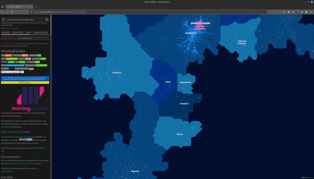
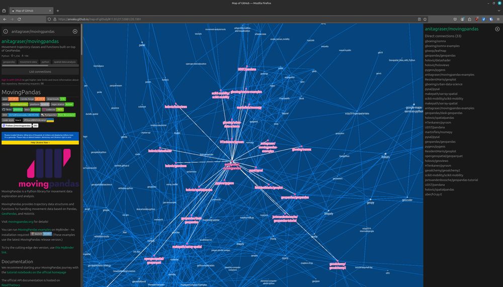
Interesting to see the distance between Maplands (home of
@qgis) and Geosppytiallia (home of @movingpandas) in #MapOfGithub https://anvaka.github.io/map-of-github/#11.91/27.53081/20.1991
Why are Lidaria and Carto3Dica in between?
It's all #AI(Landia) 😜 […]
[Original post on fosstodon.org]
03.01.2025 09:39 — 👍 4 🔁 4 💬 0 📌 0
Ne manquez aucun de nos articles,
abonnez-vous à notre newsletter !
👉 https://regards.fr/newsletter/ 👈
I work on Mapillary, OpenStreetMap, Overture, computational geometry, spatial computing, GIS, and maps at Meta Reality Labs.
🇺🇸 living in 🇨🇭
Blog: https://worldbuilder.substack.com
#openstreetmap #geospatial #switzerland #ski #maps #data
weeklyOSM - news from the #OpenStreetMap world in a lot of languages https://weeklyosm.eu
Mastodon: @weeklyosm@en.osm.town
submit news: http://osmbc.openstreetmap.de
howto submit news: http://bit.ly/3Dc2J10
weeklyOSM is operated by: https://t1p.de/gor0
Public Access to Public Data is a Public Good. We want to ensure our data are not gone forever. Read more about our efforts: https://www.datarescueproject.org/press/
Média indépendant, en accès libre, sans publicité, à but non lucratif, dédié à l'urgence écologique. 📸 🌳
Financé exclusivement par les dons de ses lecteurs.
https://reporterre.net/
Compte officiel de l’Insee. #Statistiques et études sur l'#économie et la #société françaises.
https://www.insee.fr/fr/accueil
L’Institut national de l'information géographique et forestière produit des données et représentations du territoire national pour observer, comprendre et anticiper ses évolutions. 🗺️🌳
🔗 https://kytelink.com/ign
#Opendata #Carte #Géographie #Forêt
La plateforme ouverte des données publiques françaises. Le meilleur endroit pour trouver ou publier des données. www.data.gouv.fr
Opérée et animée par la Direction interministérielle du numérique.
L'EHESS soutient le développement des sciences humaines et sociales en favorisant la prise de risque intellectuelle et les démarches interdisciplinaires.
🌐 Site : https://www.ehess.fr/fr
🎉 Festival Allez Savoir : https://www.allez-savoir.fr/
A platial and geospatial data science research lab at McGill University
https://platial.science
GIScience conference series #giscience2025.
The 13th International Conference on Geographic Information Science, Christchurch, New Zealand August 26-29 2025.
https://giscience2025.org
AI and cognitive science, Founder and CEO (Geometric Intelligence, acquired by Uber). 8 books including Guitar Zero, Rebooting AI and Taming Silicon Valley.
Newsletter (100k subscribers): garymarcus.substack.com
Enseignant de Géographie-Histoire en bord de Loire. Amateur de cartes pour apprendre, transmettre et faire comprendre le Monde et son histoire !
https://www.concourscarto.com/
@concourscarto.bsky.social
#teamhg #concourscarto #lefigurécestlavie
Geography & GISc assistant prof. @sorbonneparis1.bsky.social / Research @ UMR PRODIG
Centre de sauvegarde agréé pour l'espèce Erinaceus europaeus.
Association pour la protection et la sauvegarde du Hérisson d'Europe.
Artist, "Lourd est le Parpaing de la Réalité sur la Tartelette aux Fraises de nos Illusions"
Maps, mapping, geoviz. No politics.
Fellow @RGS_IBG
Board member @wmsmapsociety
Adjunct Professor @georgetownsfs
www.thinkinginspace.net
Simple Orthographic Map Creator with MetBrewer colors:
https://www.mapspam.net/MetOrtho.html
GIS and Cartography at Eurostat.
Exploring new ways of making maps.
observablehq.com/@joewdavies
I make posts about making videos about making maps about stuff.