Imelda and Humberto are churning only about 580 miles from each other tonight. Only 9 other named storms have ever come as close or closer in the Atlantic in the satellite era (since 1966). The last occurrence was Philippe and Rina around this time in 2023.
29.09.2025 23:33 — 👍 45 🔁 13 💬 1 📌 2
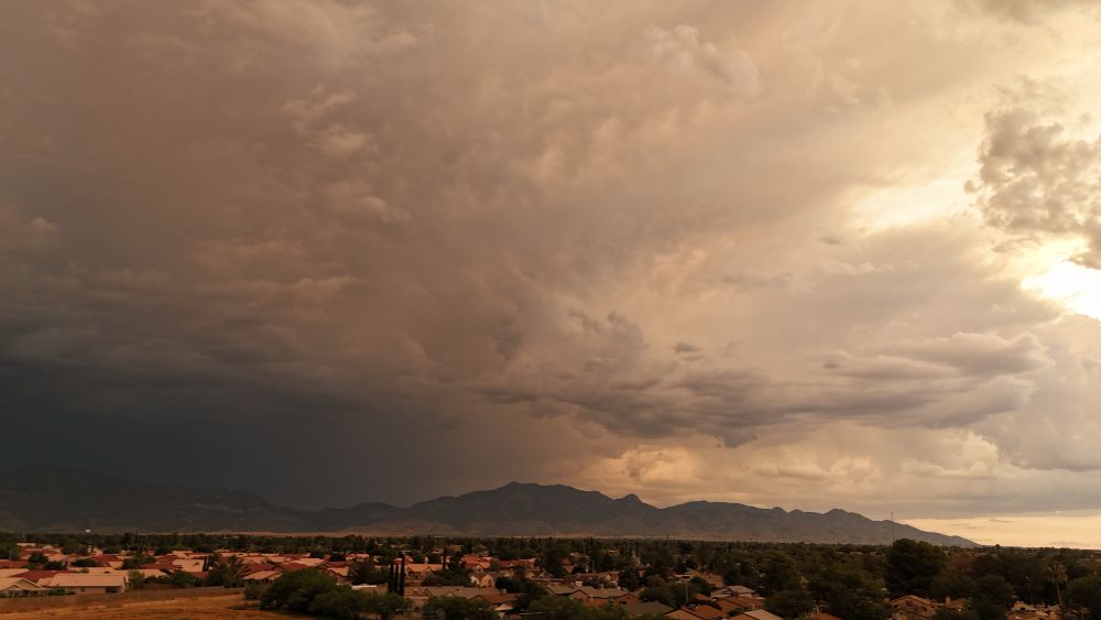
Quick loop & 360-deg of Severe Thunderstorm northeast of Ft. Huachuca - Sierra Vista, Arizona. #severethunderstorm #AZwx #blowingdust #haboob #bldu despite stabilized soils from recent rainfall, outflow winds are still lofting particulates/dust! #TUSwx #PHXwx
25.09.2025 21:01 — 👍 1 🔁 0 💬 0 📌 0
Another #haboob inbound for Sierra Vista/Ft. Huachuca, Arizona! #BLDU
01.09.2025 00:16 — 👍 5 🔁 1 💬 0 📌 0

C'mon lil fella..... #AZwx
20.08.2025 20:24 — 👍 4 🔁 0 💬 0 📌 0

Left: Maximum observed AR Scale along the coast for the 7-day period ending 11 PM PDT 17 Aug 2025 (based on 6-hourly GEFS control analyses). Right: National Weather Service (NWS) Stage IV quantitative precipitation estimate (QPE) for the 48-hour period ending 5 PM PDT 16 Aug 2025.
An unusually strong summertime #AtmosphericRiver brought AR 3 conditions and heavy rainfall to portions of western Washington last week. #WAwx
See our latest quick summary for a brief synopsis of this event: cw3e.ucsd.edu/wp-content/u....
19.08.2025 23:33 — 👍 7 🔁 4 💬 0 📌 0


Booming in the vicinity. 🤠 #VCTS #AZwx ##TUSwx
19.08.2025 22:49 — 👍 2 🔁 0 💬 1 📌 0


This wind field is nuts. Maximum flight-level winds in Hurricane Erin a mere 110 miles from its center. Paging H*Wind, we're about to see some serious IKE 📈
19.08.2025 17:24 — 👍 20 🔁 7 💬 0 📌 0
Here’s a good one folks! Blowing dust inbound to Ft. Huachuca, Sierra Vista, AZ, off to the northeast. large #thunderstorms moved down from the Rim, to points south. #AZwx #TUSwx #BLDU #Haboob #Duststorm #monsoon2025
13.08.2025 03:29 — 👍 0 🔁 0 💬 0 📌 0
Prolific Lightning maker tonight! #AZWX #monsoon2025 #TUSwx #lightning
12.08.2025 03:55 — 👍 2 🔁 0 💬 0 📌 0

SPC RAP valid +6 holds H5 heights at 594 dam, maybe holding subsidence but despite that, instability is enough to overcome the CAP along our ranges with orographic lift. TCU's & a couple CB's w/ strikes in the AO already.
09.08.2025 21:25 — 👍 1 🔁 0 💬 0 📌 0
My first to hit town in 5 yrs here.
14.07.2025 02:32 — 👍 1 🔁 0 💬 1 📌 0
Time lapse of the #thunderstorm that sparked the blowing dust warning for Fort Huachuca / Sierra Vista, AZ from TUS WFO. Big cell inbound from northeast; kicked up hella dust! #AZwx #TUSwx #Monsoon2025 #haboob #blowingdust
14.07.2025 02:15 — 👍 3 🔁 0 💬 1 📌 0

Dawn. New York Harbor. July 3, 1996.
Incomprehensible.
#ID4
03.07.2025 10:30 — 👍 99 🔁 22 💬 5 📌 6
I was sad the past few days b/c I could not find this delightful profile on X anymore. Behold - they are alive and well here on Blue Sky. #ID4 #independenceday
04.07.2025 01:19 — 👍 1 🔁 0 💬 0 📌 0
Brief time lapse of developing thunderstorm over the Huachuca mountains. #azwx #monsoon
02.07.2025 22:41 — 👍 2 🔁 1 💬 1 📌 0
Quick time lapse of nearby downburst & outflow. East of Canyon Vista Hosp; kicking up some dust. Got the drone in the hangar just in time to avoid the gusts. #BLDU #AZwx #Monsoon2025 #TUSwx
01.07.2025 00:04 — 👍 1 🔁 0 💬 0 📌 0
Yesterday afternoon, a severe thunderstorm in northern Colorado dropped a swath of hail that could be seen by GOES-18.
Hail is in the darker red color.
05.06.2025 18:38 — 👍 31 🔁 8 💬 1 📌 0

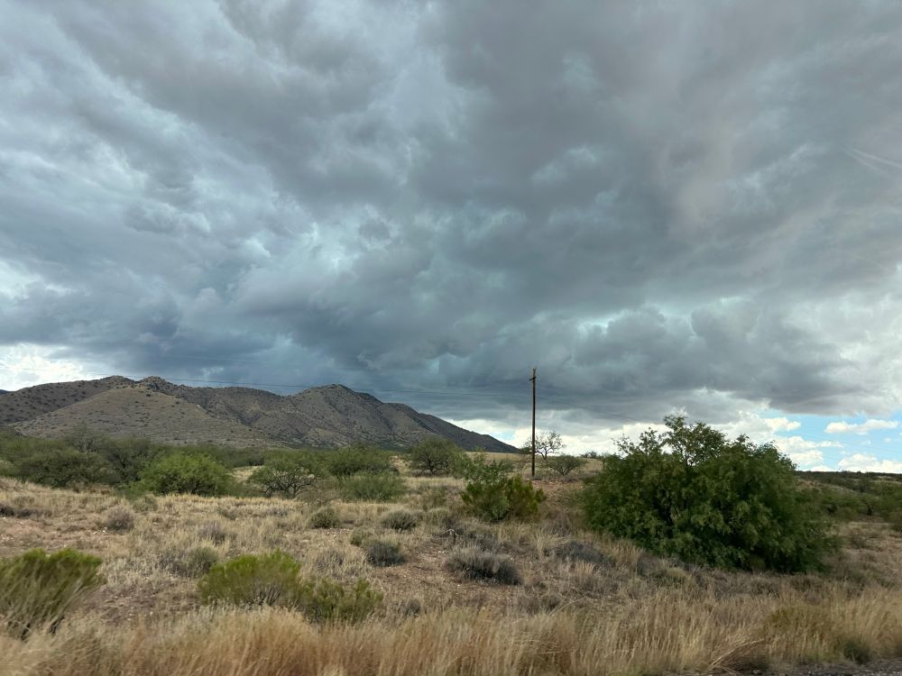
Another round of scary dark clouds 🤠#AZwx
02.06.2025 22:10 — 👍 2 🔁 0 💬 0 📌 0
First drone storm loiter of the warm season. Trying to stay on target with 25-30kt winds. 16x. Southeastern AZ High Country. Sierra Vista, Arizona. #AZwx #thunderstorm #Arizona #Arizonaweather #TUSwx
02.06.2025 02:06 — 👍 3 🔁 0 💬 0 📌 0
Which hurricane models should you trust in 2025? » Yale Climate Connections
How the models did last year, and why you should pay the most heed to the National Hurricane Center forecast.
For hurricane nerds only: my annual roundup of which models did the best. The European and GFS models were the top track models in 2024, with the GFS making better four- and five-day forecasts. The official NHC forecast was tough to beat. yaleclimateconnections.org/2025/05/whic...
26.05.2025 23:26 — 👍 109 🔁 28 💬 2 📌 4
Haha. Thought so. 😁
02.05.2025 17:05 — 👍 1 🔁 0 💬 0 📌 0

One of the books that helped guide my childhood passion into a career where work doesn't ever really feel like work. #NCwx #AZwx #wxtwitter Miles gets his own copy, I try to keep my copy from Dad in decent shape (circa. 1998).
27.04.2025 21:11 — 👍 4 🔁 0 💬 1 📌 0
Looks like a city of SV prescribed burn. Was concerned b/c I didn't see on the state AZDEQ prescribed burn page for today.
25.02.2025 17:10 — 👍 1 🔁 0 💬 0 📌 0
Chief Meteorologist | Founder of Inspire Weather, LLC. | National Weather Service (Retired) | Former Meteorologist-in-Charge, NWS Tampa, Florida.
InspireWeather.com
BDL ➡️ CRP ➡️ DCA ➡️ LBB ➡️ TPA
Climate scientist, paleoclimatologist, dendrochronologist, University of Arizona | https://kanchukaitis.github.io/ | Opinions are mine and not that of my employer
*Regardless of the method or source, you should ALWAYS STAY WEATHER AWARE as weather is ALWAYS changing*
(All weather, all the time)
TikTOK: https://www.tiktok.com/@alwaysstayweatheraware?lang=en
Satellite hydrologist, ASU Global Futures Professor, water and climate science communicator, leader of the WISE Research Group @wisegrouporg.bsky.social. Formerly NASA JPL Senior Water Scientist and ‘What About Water’ podcast host.
Join the largest #CitizenScience #earthquake network with your #seismograph. Mobile App: #ShakeNet. Discord Server: http://raspberryshake.org/discord
CIRA Deputy Associate Director - Global Systems Laboratory - Boulder, CO
Here for meaningful and intentional conversations about how to move the weather enterprise forward.
Meteorologist running for Congress to represent Virginians from Chesterfield County to the Chesapeake Bay (VA-01).
More science.
No conspiracies.
To simplify healthcare,
Reduce the cost of living,
Act on climate,
And get our freedoms back.
seanforva.com
Satellite meteorologist, NOAA Cooperative Institute for Meteorological Satellite Studies, University of Wisconsin - Madison. Personal account, all opinions ©2025. Probably woke af.
We facilitate international research on the Antarctic and Southern Ocean and provide independent scientific advice.
www.scar.org
Climatologist, clouds, warm weather, rock and roll. You may know me from my greatest hits: Assistant State Climatologist of Colorado. Now feeling my way around consulting.
A feed of posts from the bad place so I don't have to go there to see them.
**UNOFFICIAL**
Is this helpful? Buy me a coffee to help cover costs! https://ko-fi.com/weatherbots
Made by @mrmcnamerica.bsky.social with EchoFeed
Reliable, no-hype coverage of tropical storms and hurricanes across the Atlantic from the team at Space City Weather! https://theeyewall.com/
Climate scientist and geochemist
@UnivofStAndrews
| CO2 & ocean circulation past & present | Social & Environmental justice
"an upbeat atmospheric science professor" -- theverge | sometimes it snows in April | Fort Collins, Colorado | personal account
Skeeting the sights, sounds, & news from 1996's historic alien attack & subsequent global (read: American) military response in real time. #IndependenceDay #ID4
Spatial data geek and Balboa/lindy hop dancer
Weather/climate, March Mammal Madness, and music groupie
@n.goshawk on Instagram
https://linktr.ee/A.MontrossPhoto85
Capturing the beauty of Photography
Content Creator | Videographer | WX Photographer | YouTuber | Landscape Photographer
AMS Certified Consulting Meteorologist (#771) | Forensic Meteorologist | Outreach Specialist | Trivia Host | Marathoner | Game Show Champion
Philanthropic organisation bringing together governments, funders, businesses and campaigners for a world where everyone breathes clean air 🌍 #CleanAirNow
cleanairfund.org