Alas, it is not.
25.01.2026 21:51 — 👍 0 🔁 0 💬 0 📌 0
For those who don’t yet know, I’ve assumed a new role as Manager of Meteorology Operations for @xcelenergy with a focus on wildfire mitigation. The reason for the announcement is not to proclaim the new role, but to admit that I have a lot to learn in this space and welcome conversation.
22.01.2026 00:27 — 👍 11 🔁 0 💬 1 📌 0
Stability in the shot is most important and ensuring enough light is entering the lens, but nothing special.
15.12.2025 21:21 — 👍 2 🔁 0 💬 1 📌 0
This was simply an iPhone.
15.12.2025 21:18 — 👍 1 🔁 0 💬 1 📌 0

Hurricane Melissa produced the fastest hurricane winds to be recorded by a dropsonde, verified by reviewing data at NSF NCAR! Hurricane Melissa’s 252 mph wind gust surpassed the previous record from Typhoon Megi over the Western Pacific in 2010, where a dropsonde measured wind gusts of 248 mph.
19.11.2025 17:37 — 👍 175 🔁 91 💬 3 📌 8

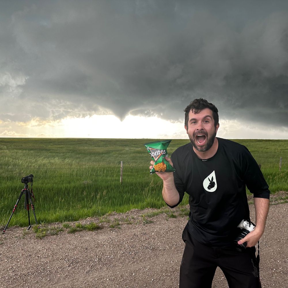
Sometimes the best events are the unexpected ones. The green embedded within the reds/pinks was the best I’ve ever seen.
From Lafayette, CO.
12.11.2025 03:56 — 👍 126 🔁 14 💬 1 📌 1

Out of all the stats that will be in history books from Melissa, this is the most astounding to me.
GLM data was recording a peak flash rate of 700 strikes per minute — nearly 12 per second — as it made landfall on Jamaica. That’s rewriting our understanding flash density in tropical cyclones.
06.11.2025 23:46 — 👍 67 🔁 26 💬 2 📌 4
Dream job alert!
03.11.2025 23:56 — 👍 1 🔁 2 💬 0 📌 0

25-115 AWIPS II Software Engineer
The individual in this position will be part of a team responsible for the design and development of AWIPS II applications in Java and Python. Applications will involve graphical tools that assist for...
We're hiring for a Software Engineer @cira-csu.bsky.social! I can personally attest to the team that the candidate would be joining - they're knowledgeable, humble, and genuine. If you are interested or know anyone that might be, reach out to me! PD here:
jobs.colostate.edu/postings/168...
03.11.2025 23:06 — 👍 11 🔁 5 💬 1 📌 1
Via @ttrogdon.bsky.social
27.10.2025 19:05 — 👍 5 🔁 1 💬 0 📌 0
I couldn’t unsee it
07.08.2025 03:34 — 👍 0 🔁 0 💬 0 📌 0

 07.08.2025 03:27 — 👍 85 🔁 8 💬 3 📌 0
I strongly believe that siloing is contributing to the problem and both platforms are effectively a silo. Remaining constant on both shows objectivity and increases generic “reach” of important information.
02.07.2025 17:58 — 👍 4 🔁 0 💬 0 📌 0

A beautiful loop illustrating forward-propagation versus supercells moving right against the mean wind and ultimately the difference in net motion.
21.06.2025 15:34 — 👍 7 🔁 0 💬 0 📌 0

Given the storm environment, this is an almost guaranteed derecho across the northern plains. Eventual absorption of the pair of supercells ahead of the line will occur over the next hour w/ an exceptional damaging wind threat continuing w/ episodic tornadoes through tonight as the bow echo matures.
21.06.2025 03:38 — 👍 8 🔁 0 💬 0 📌 0
Snap peas and homemade blue cheese dressing
30.05.2025 18:24 — 👍 0 🔁 0 💬 0 📌 0
Streamers vs operational meteorologists:
I want to make something very clear. Holding the responsibility of issuing a tornado warning while balancing accuracy and expediency is diametrically opposed to sitting in your Secretlab gaming chair pretending to understand the weight of those decisions.
18.05.2025 18:42 — 👍 22 🔁 3 💬 1 📌 0
Not my low.
07.05.2025 16:23 — 👍 3 🔁 0 💬 0 📌 0

Central Oklahoma wildfire outbreak.
14.03.2025 21:55 — 👍 4 🔁 0 💬 0 📌 0

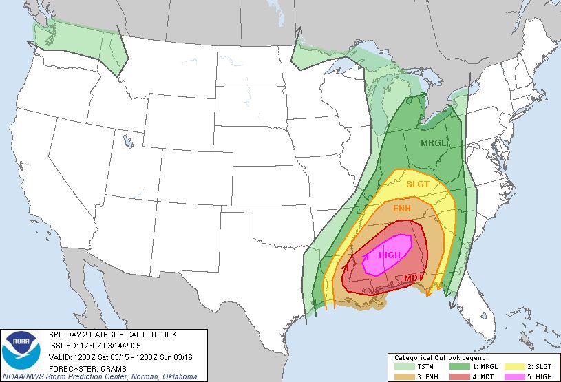
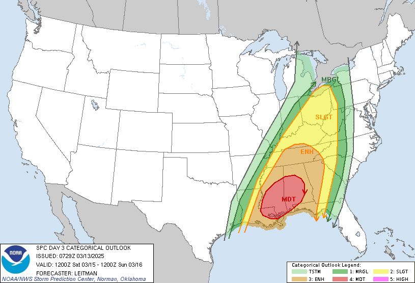
Today and tomorrow have the potential to be one of the worst consecutive day outbreaks in the US in a long time.
Day 2 High Risk issued for Saturday.
While you may check the weather often, friends or family may not. Reach out to them. You could be the voice they need to hear.
14.03.2025 17:47 — 👍 8 🔁 3 💬 0 📌 1
Brendon
18.02.2025 23:38 — 👍 2 🔁 0 💬 1 📌 0

Look at the density!
18.02.2025 18:58 — 👍 8 🔁 0 💬 0 📌 0

This morning was the most significant (and coolest) hoar frost event I’ve seen in Colorado and perhaps anywhere outside of the mountains. Absolutely beautiful.
18.02.2025 18:12 — 👍 25 🔁 3 💬 2 📌 0
These are the events when I wish I had time and space to explore how incredible it was/is in writing.
21.01.2025 23:50 — 👍 1 🔁 0 💬 0 📌 0

We officially have thundersnow near the Gulf Coast - what an incredible event.
21.01.2025 15:25 — 👍 4 🔁 0 💬 0 📌 0

An extreme event is setting for the greater New Orleans area. The maximum 3-day snowfall I can find is 2.7" which occurred on New Years eve in 1963. The official forecast calls for 3-6" in New Orleans which would shatter this record.
20.01.2025 03:23 — 👍 14 🔁 4 💬 0 📌 0
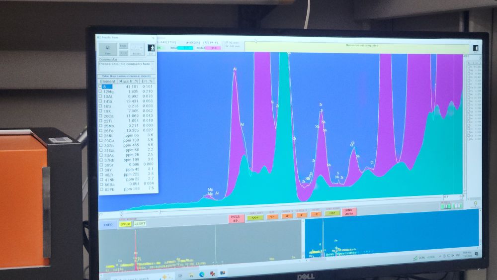
A computer screen with a display showing output from an xray diffraction spectrometer.
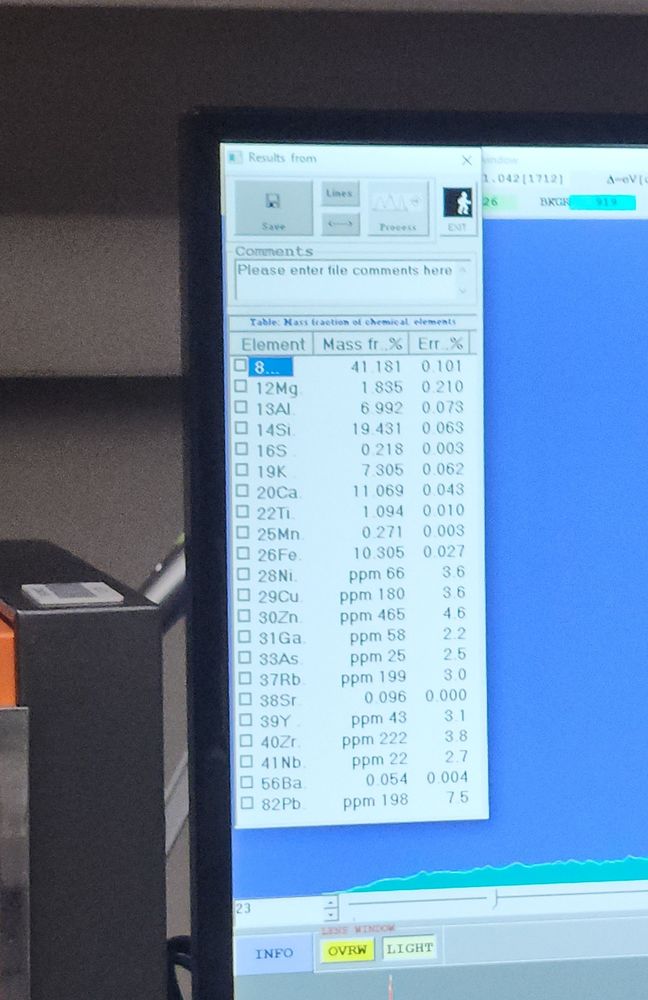
Close up view showing fraction of metals. Fun stuff.
Just had a sample of the Eaton Fire ash that is in my driveway run on the department XRF. Is there titanium (new house paint)? Yup. Lead (old house paint)? You betcha. Heavy metals? Check. Treat that ash like it's toxic folks (because it is)
17.01.2025 19:49 — 👍 4714 🔁 2069 💬 116 📌 144
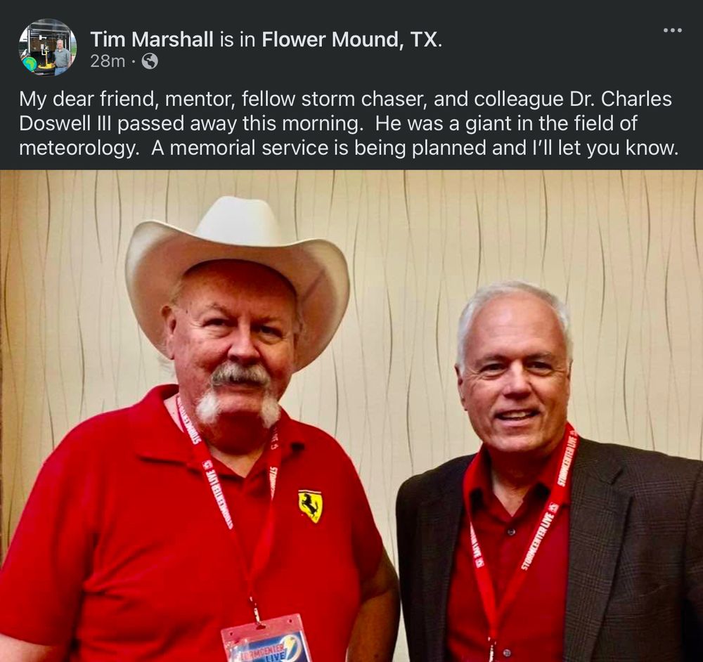
Very sad news. I learned more about severe local convective storms from Chuck Doswell than anyone else. He was a friend and mentor.
18.01.2025 18:40 — 👍 127 🔁 33 💬 2 📌 19
#AMS2025 was as energizing as always, connecting with so many and seeing the incredible research originating from great minds within this community. What I’m taking home with me this year was a quote that I saw on the side of a random building:
“You can do anything, but you can’t do everything.”
17.01.2025 20:01 — 👍 18 🔁 0 💬 0 📌 0