Definitely fighting a losing battle on Hwy 12 on the Outer Banks. Comparison this AM vs. yesterday AM from Hurricane #Erin overwash.
20.08.2025 12:14 — 👍 17 🔁 9 💬 0 📌 1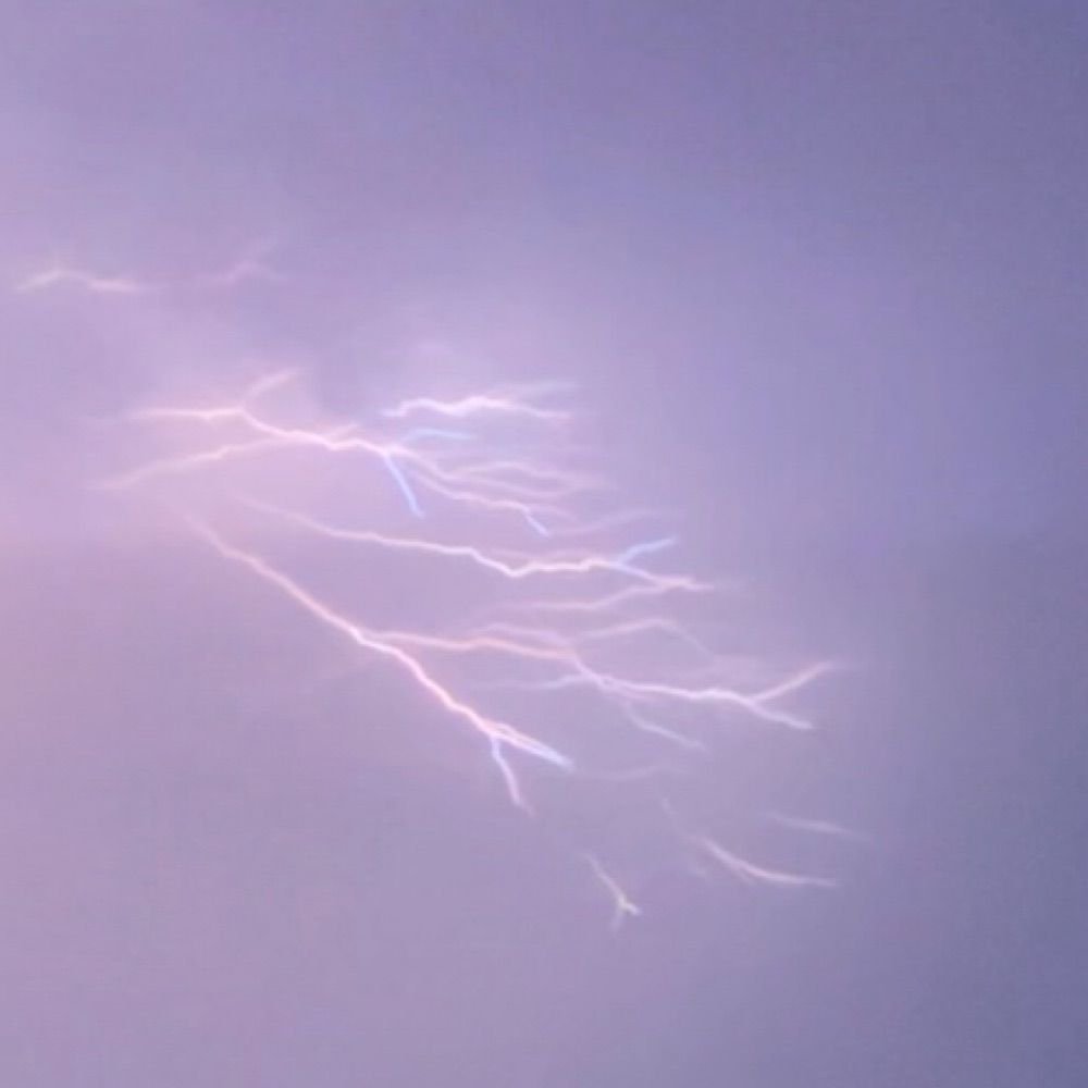
@joeycristwx.bsky.social
Just a 19 year old from West Virginia majoring in Operational & Broadcast Meteorology through Mississippi State University
Definitely fighting a losing battle on Hwy 12 on the Outer Banks. Comparison this AM vs. yesterday AM from Hurricane #Erin overwash.
20.08.2025 12:14 — 👍 17 🔁 9 💬 0 📌 1
ERIN Beach Impacts (VA/MD/DE)
⏰ Worst: Wed night → Fri AM (peaking Thu PM)
💨 Gusts 35–50 mph (see image)
🌊 Waves 7–14 ft (highest VA)
🌊 Coastal flooding likely Thu → Fri AM
⚠️ Rip currents & erosion
Full update ⬇️
🔗 www.washingtonpost.com/weather/2025...
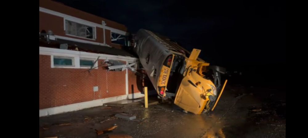
A photo of a school bus picked up and smashed onto the lower roof of a brick High School.
Last night a tornado hit a trailer park just miles from where I used to live. In Talladega, a bus was thrown into the roof of a high school. Several schools in the path would have been out on the roads at Prom if not for the warnings of the National weather service last night. Thank NWS.
16.03.2025 12:52 — 👍 313 🔁 76 💬 2 📌 9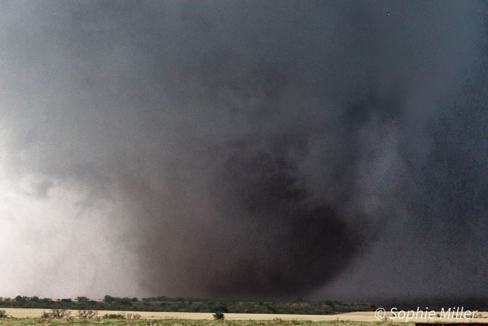
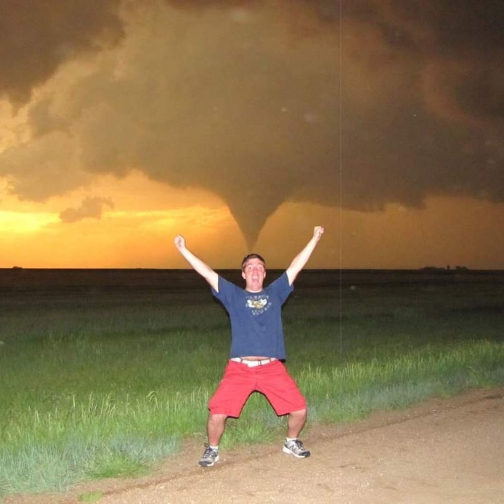
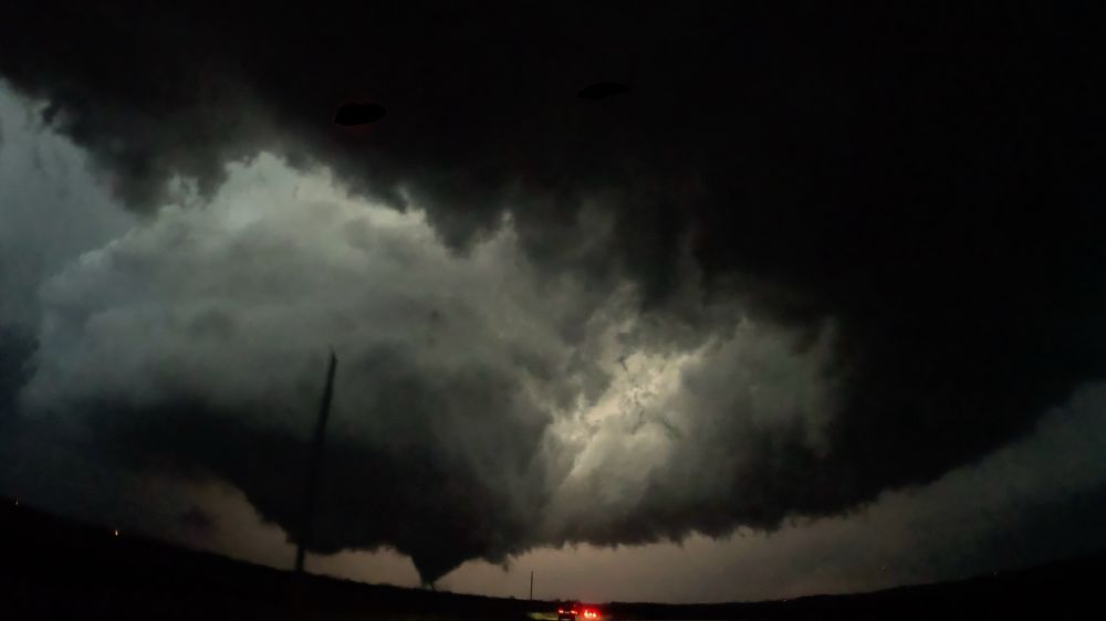
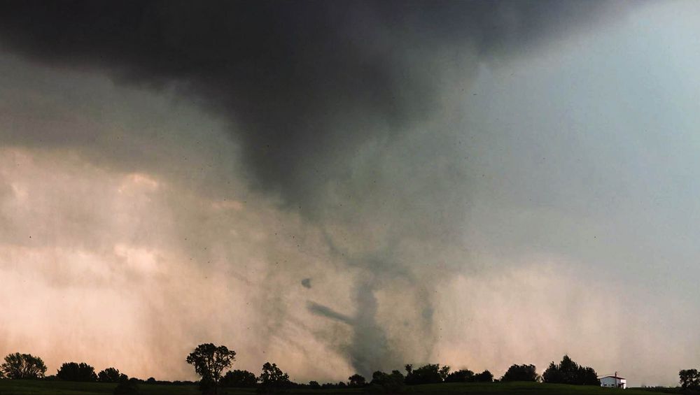
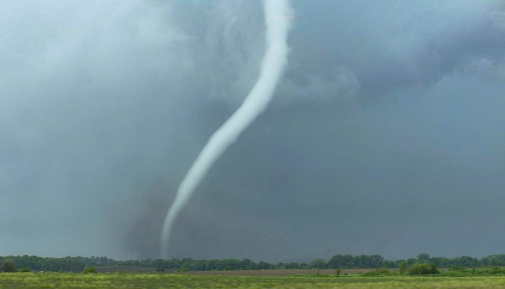
Eldorado, OK tornado
I spent forever editing this photo of the Eldorado, OK, tornado tonight. I enjoy how this image turned out, as originally, it was difficult to even see the tornado on the unedited image. #wxsky #tornado
11.11.2024 04:51 — 👍 41 🔁 3 💬 1 📌 0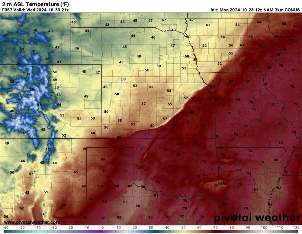
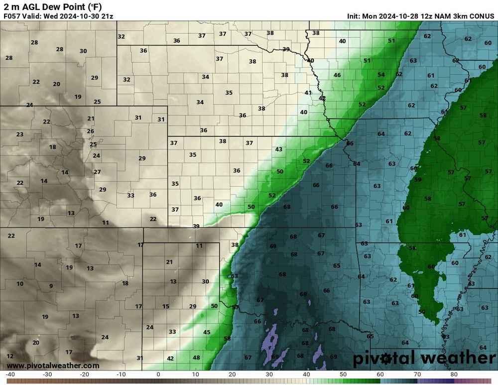
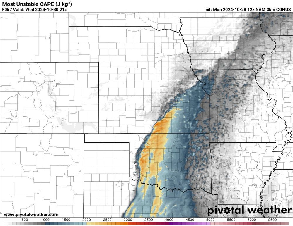
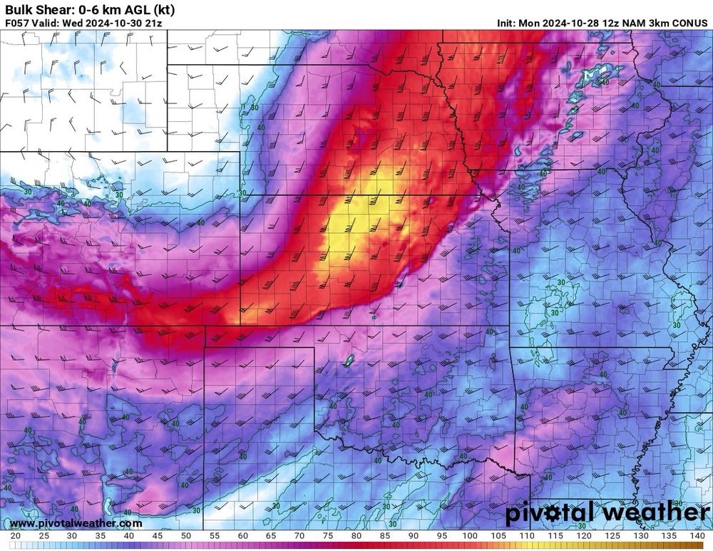
Severe thunderstorms are expected Wednesday across the Southern Plains, Ozarks, and Lower Missouri Valley. A cold front and dryline, with strong instability and wind shear, will support supercells, producing large hail and damaging winds.
Stay Weather Aware!
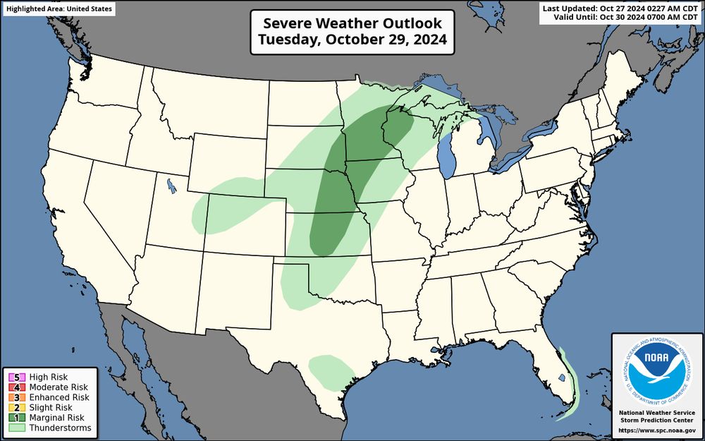
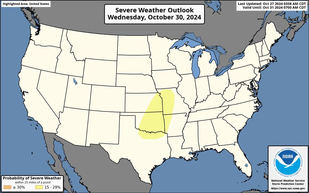
Watching the next few days for Severe Weather. The 30th is the day I am most concerned about, more information on this will be posted this afternoon
27.10.2024 13:43 — 👍 1 🔁 0 💬 0 📌 0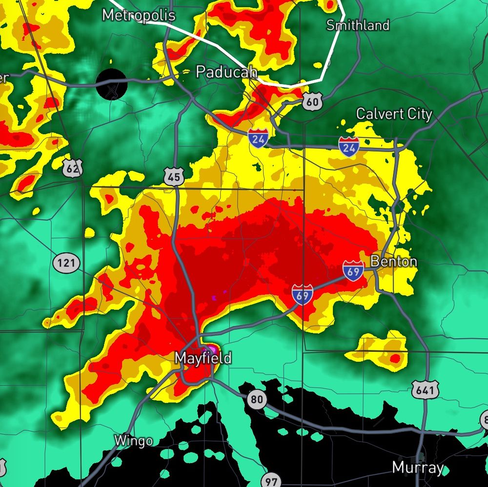
Mayfield, KY EF-4 12/10/2021
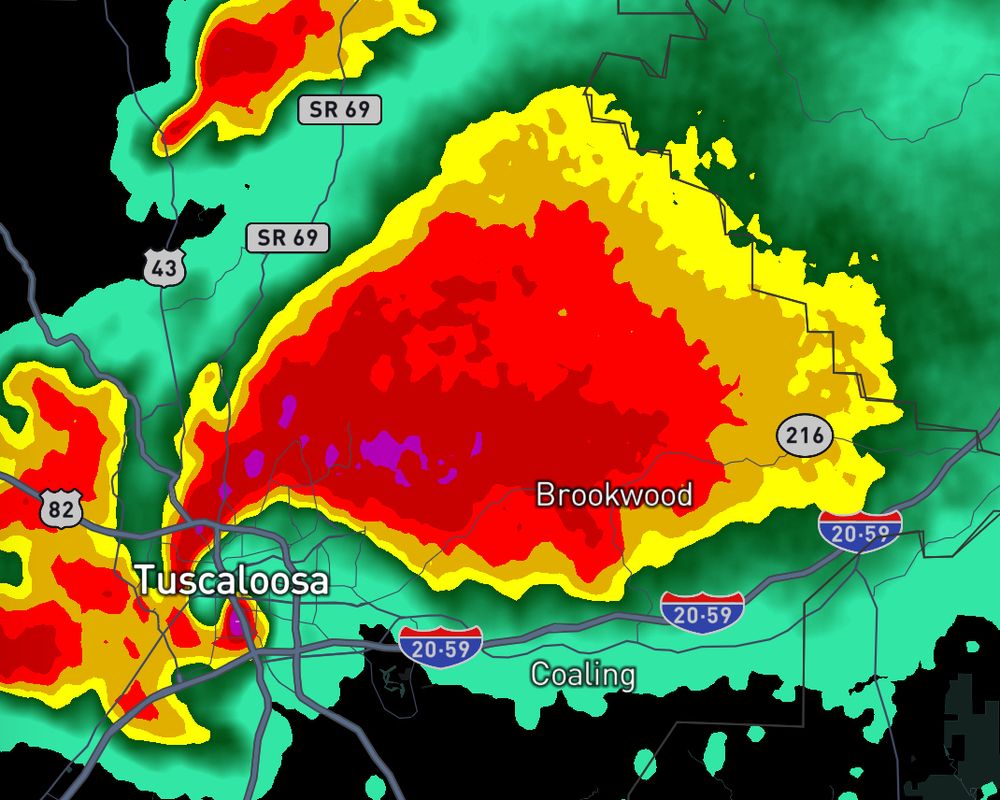
Tuscaloosa, AL EF-4 4/27/2011
Moore, OK EF-5 5/20/2013
These have to be three of the most disturbing radar images I have ever seen! What radar images do you find disturbing?
21.10.2024 21:40 — 👍 1 🔁 0 💬 0 📌 0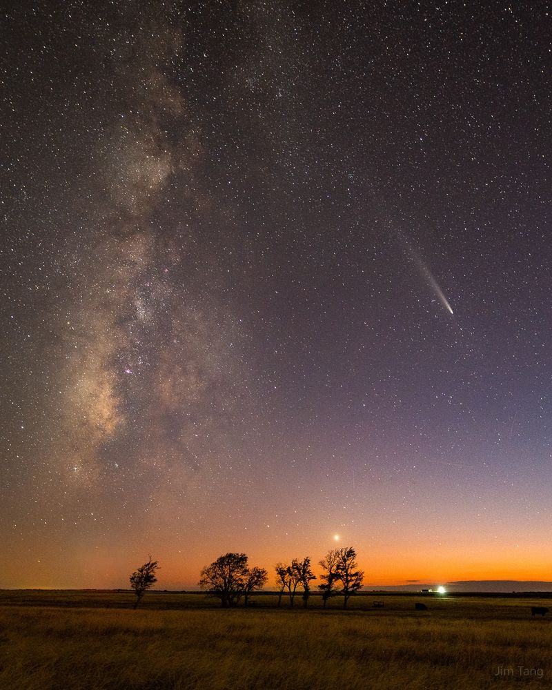
Bluesky, meet the night sky.
21.10.2024 14:07 — 👍 14917 🔁 1294 💬 127 📌 21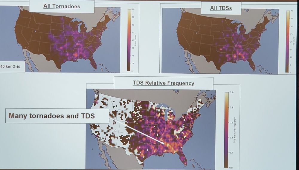
Harry Weinman (SPC): Many more tornadoes produce TDSs in the Southeast than on the Plains owing to land use - forests in the SE and grasslands on the Plains. #31SLS
21.10.2024 21:27 — 👍 29 🔁 7 💬 2 📌 0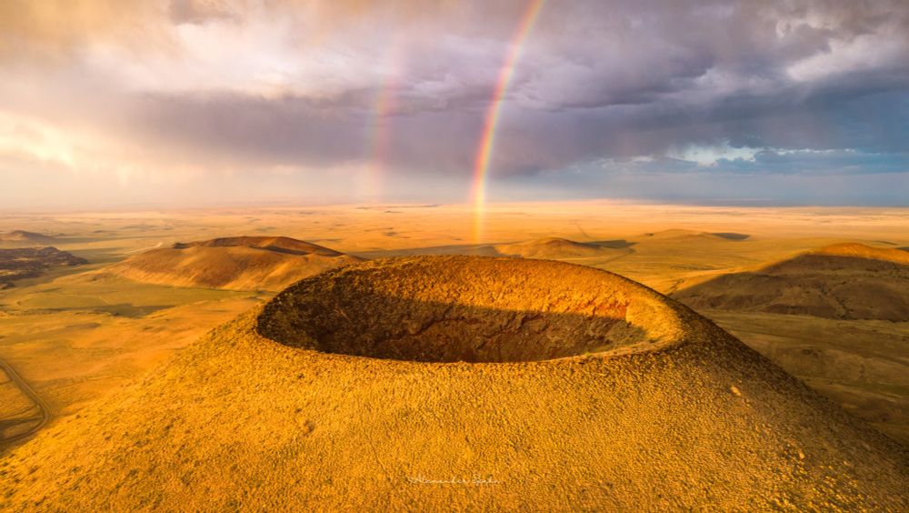
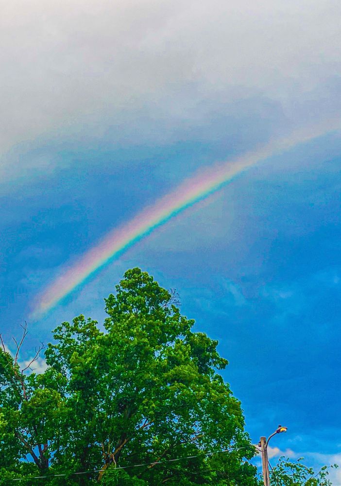
A drone view of a double rainbow over the crater of SP crater (a cinder cone volcano) at sunset.
After fighting some rain and significant winds on the hike up to the rim, I was blessed with a sunset double rainbow over SP Crater - a nearly perfectly cinder cone in the San Francisco volcanic field of northern Arizona.
19.10.2024 23:16 — 👍 396 🔁 45 💬 10 📌 2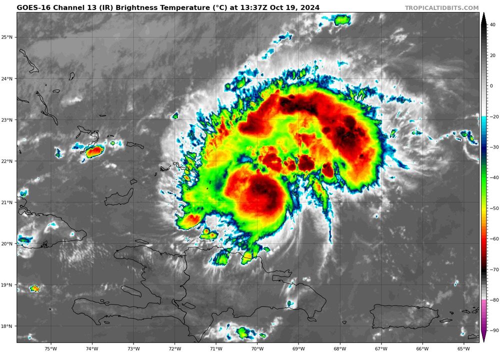
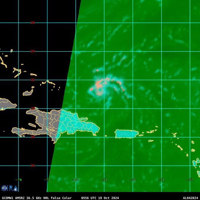
Oh hello there #94L
19.10.2024 13:56 — 👍 13 🔁 1 💬 0 📌 0Do you post photos/video here? You should "subscribe" to this list that auto-blocks content scraping accounts that steal content and regularly post it without credit. The fewer eyes they have on them, the less power they have (and thus the more original content we'll see).
bsky.app/profile/did:...
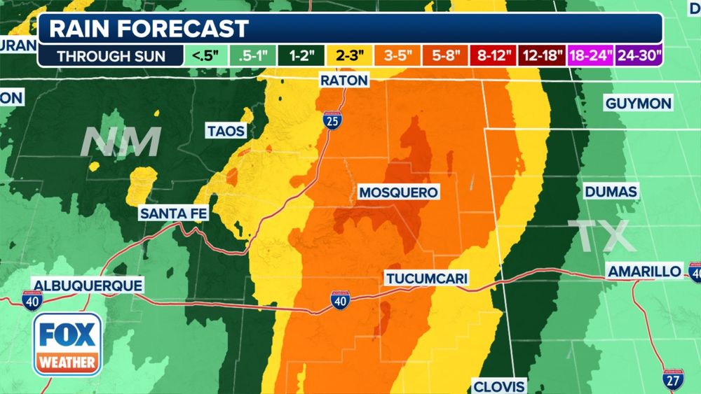
Bit of an unusual heavy rain event to set up across NE New Mexico this weekend. Some places could see as much rain in two days as they average over the next 5-8 months!
Mosquero, NM
Forecast: 5-8"
Avg rain Oct-May: 6.38"
Tucumcari, NM
Forecast: 3-5"
Avg rain Oct-Mar: 3.98"
This week I was able to use Sentinel-2 imagery in order to highlight the impact Helene had on the Appalachians. Comparing images from this time last year to now clearly shows the dramatic changes in the landscape after hundreds of landslides.
18.10.2024 19:13 — 👍 26 🔁 9 💬 0 📌 0If you see this, post a weather.
18.10.2024 18:07 — 👍 1 🔁 0 💬 0 📌 0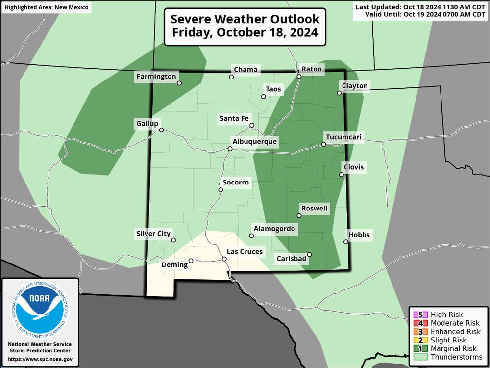
The Severe Weather Outlook for Friday, October 18, 2024, highlights potential weather risks across New Mexico. A Marginal Risk (dark green) is identified for parts of the state, including Albuquerque, Gallup, Roswell, and Tucumcari, indicating the possibility of isolated severe storms. The remainder of the region is under a general thunderstorm risk (light green), suggesting non-severe thunderstorms may occur. The forecast, issued by the NOAA Storm Prediction Center, remains valid until October 19, 2024, at 7:00 AM CDT. Residents in the affected areas should stay weather-aware, as even marginal risk zones can experience hazards like strong winds, small hail, or localized downpours.
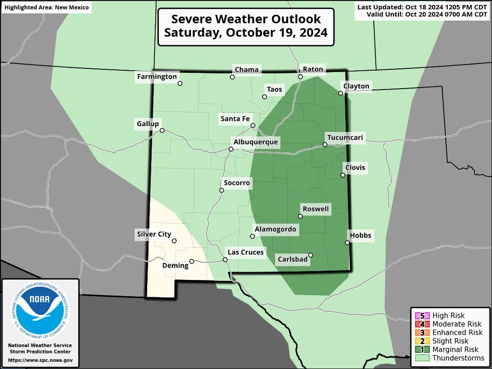
The Severe Weather Outlook for Saturday, October 19, 2024, indicates a Marginal Risk (dark green) for severe storms across central and southeastern New Mexico, including areas such as Albuquerque, Roswell, Alamogordo, and Tucumcari. A general thunderstorm risk (light green) covers the rest of the state, suggesting the potential for non-severe thunderstorms. This forecast, issued by the NOAA Storm Prediction Center, is valid until October 20, 2024, at 7:00 AM CDT. While severe weather is not widespread, residents within the marginal risk areas should remain alert for possible isolated hazards like strong winds, hail, or localized heavy rainfall.
Today (Oct 18) & tomorrow (Oct 19) there are Marginal Risks of severe weather for portions of the four-corners region, While severe weather will remain isolated, conditions are favorable for isolated tornadoes, damaging winds and hail. #WXsky
18.10.2024 18:01 — 👍 2 🔁 2 💬 0 📌 0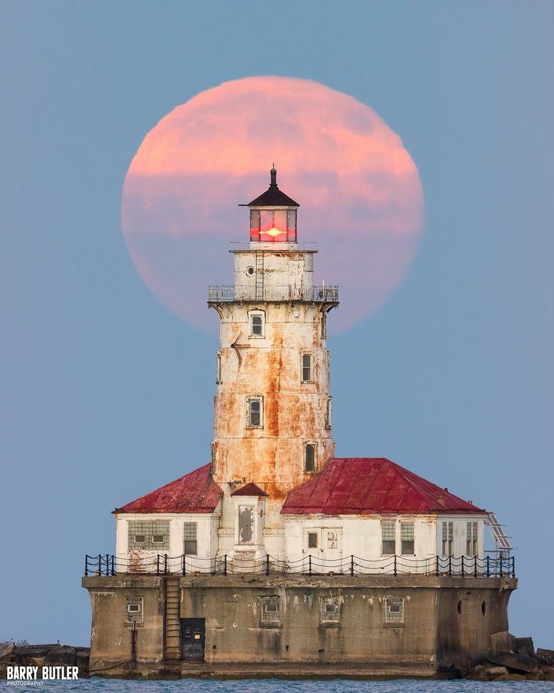
Tonight with the Supermoon in Chicago.
18.10.2024 00:33 — 👍 126 🔁 17 💬 5 📌 1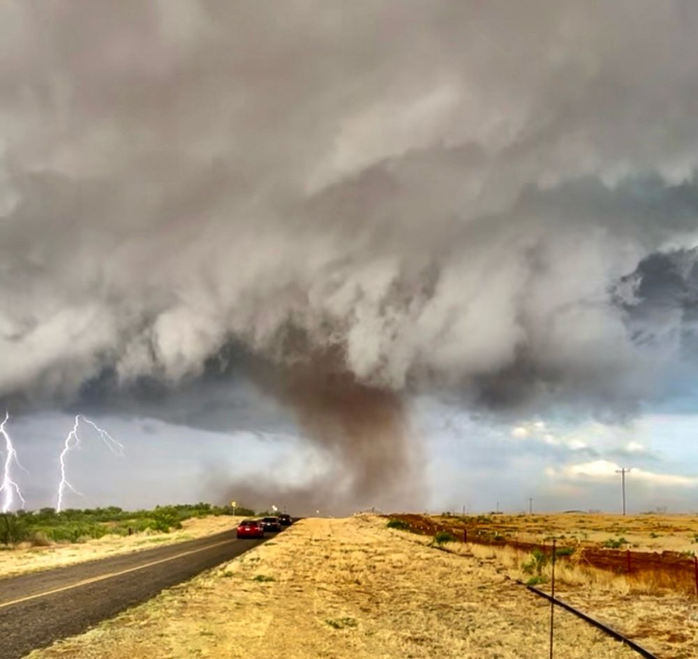
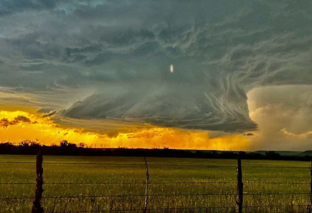
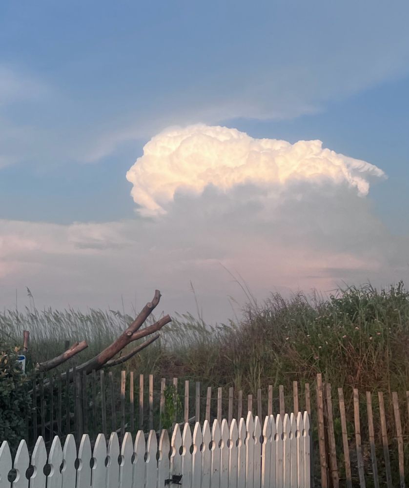
My favorite ever weather pics!! What are some of y’all’s? #WxSky
18.10.2024 02:53 — 👍 23 🔁 2 💬 2 📌 0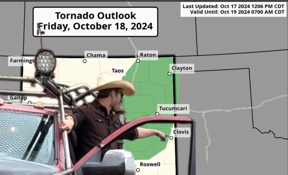 18.10.2024 02:24 — 👍 105 🔁 11 💬 7 📌 0
So is the "Other Place" officially dead?
18.10.2024 02:49 — 👍 0 🔁 0 💬 0 📌 0Today was a big inflow day for weather BlueSky #WxSky
I've made a starter pack with a bunch of folks you probably should follow if you love weather and also want to be kept up to date on real time weather. Exactly what the Skyline needed.
(follow the hashtag too)
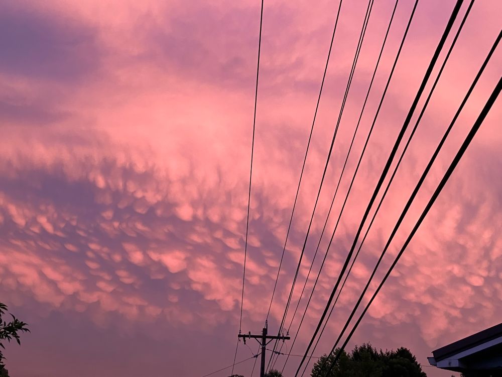
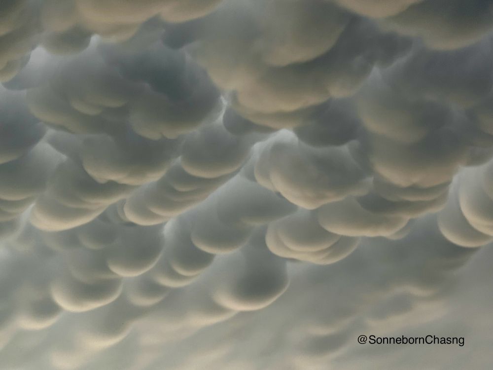
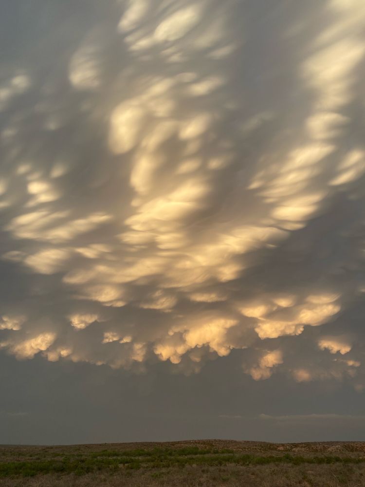
More Mamattus to bless your timeline 😂
18.10.2024 02:44 — 👍 1 🔁 0 💬 1 📌 0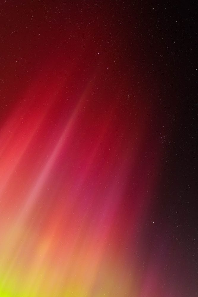
Hi Bluesky, it’s been a while. Here’s a bit of what I’ve been up to
17.10.2024 21:14 — 👍 61 🔁 10 💬 2 📌 0
A photo of myself writing "Hi! :)" on a lightboard.
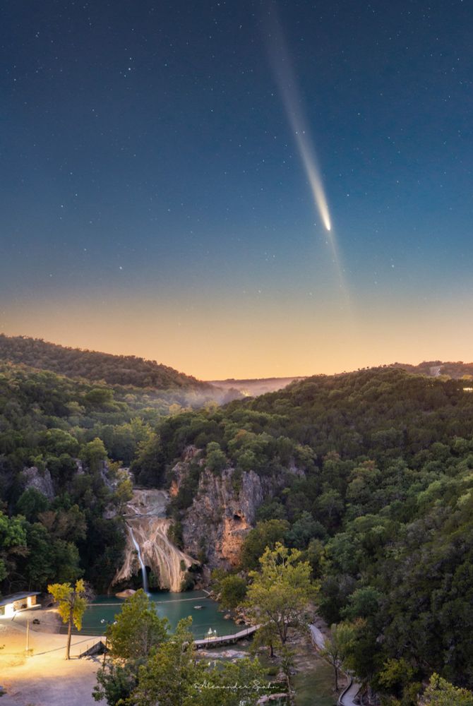
A photo of a comet just after sunset with a rocky, foggy waterfall among tree-covered hills in the foreground.
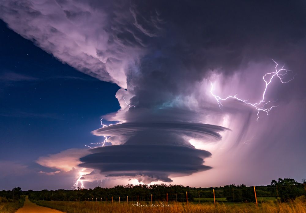
A supercell thunderstorm with pancake-stacked structure and lightning protruding out from the clouds in a few directions. A clear, starry sky sits to the left.
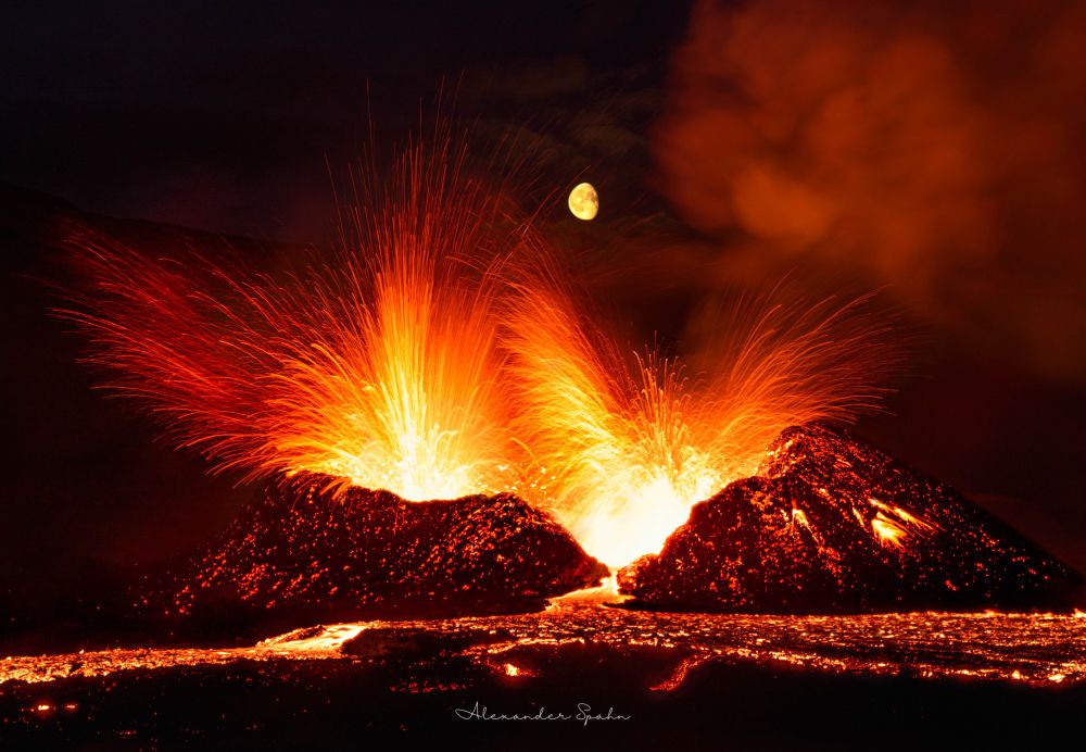
A gibbous Moon sits directly above an erupting volcano, with lava fountaining in all directions and a lava pool sitting out front.
With all the new faces here, I figured I'd also say hi and reintroduce myself. I am a professor of physics, astronomy and earth science, among other things, but most of what you'll get from me are photos of our immensely beautiful planet. Sharing that beauty is my passion; we're so lucky to be here.
18.10.2024 00:15 — 👍 1355 🔁 116 💬 68 📌 6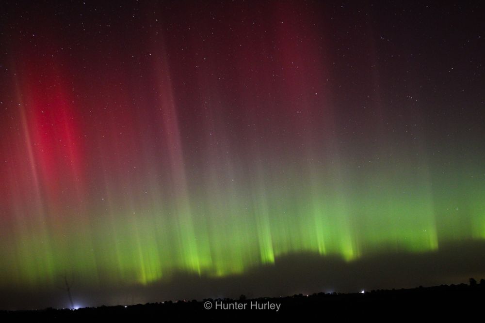
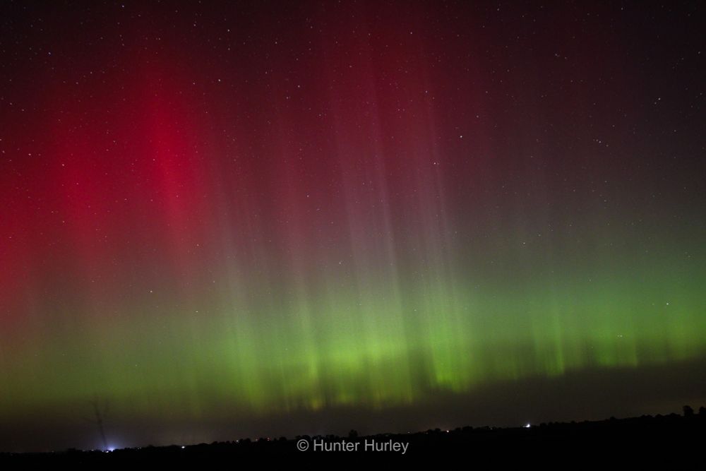
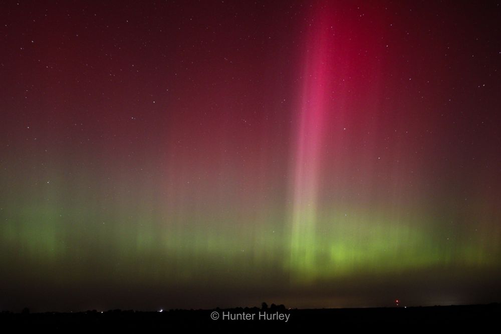
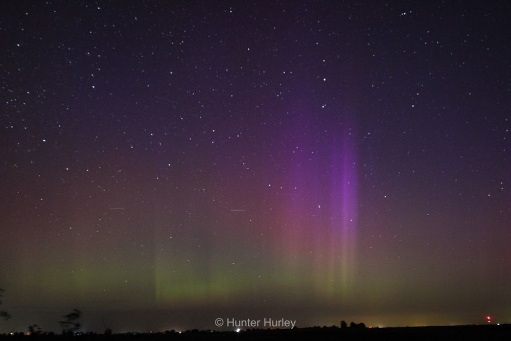
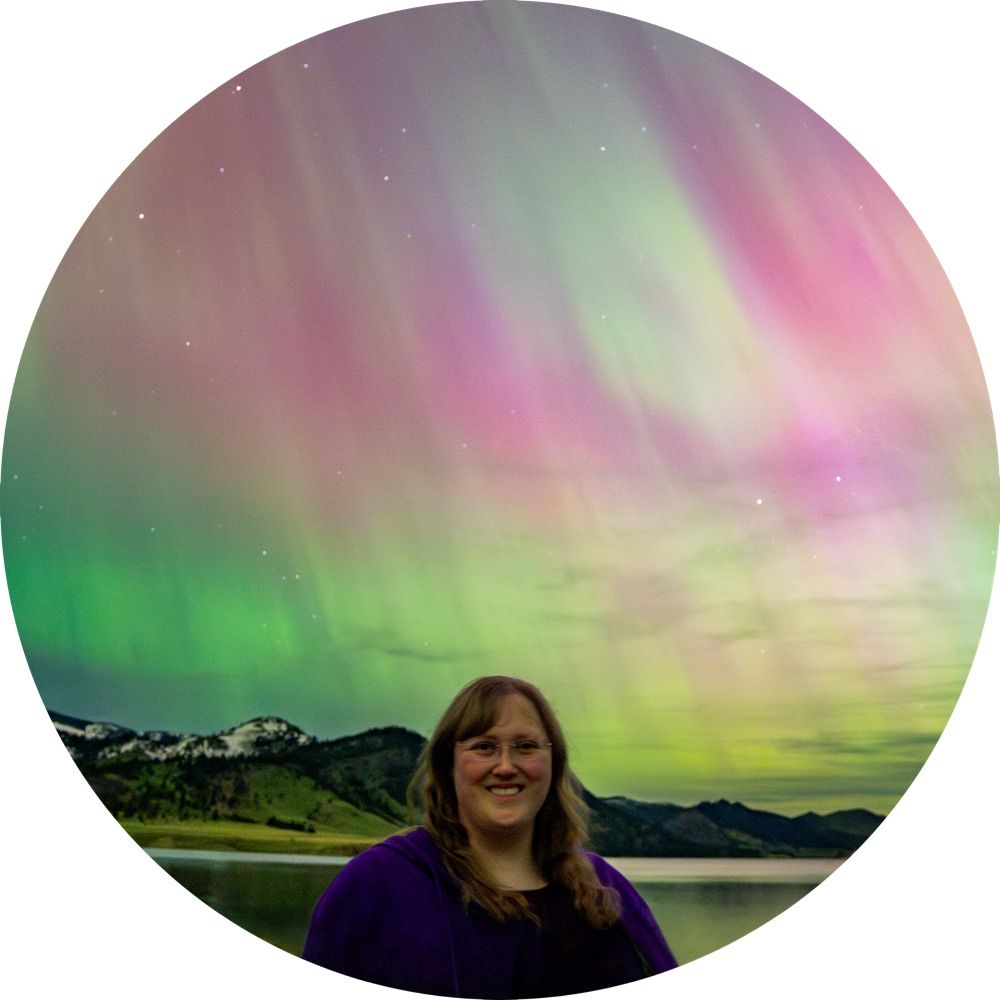
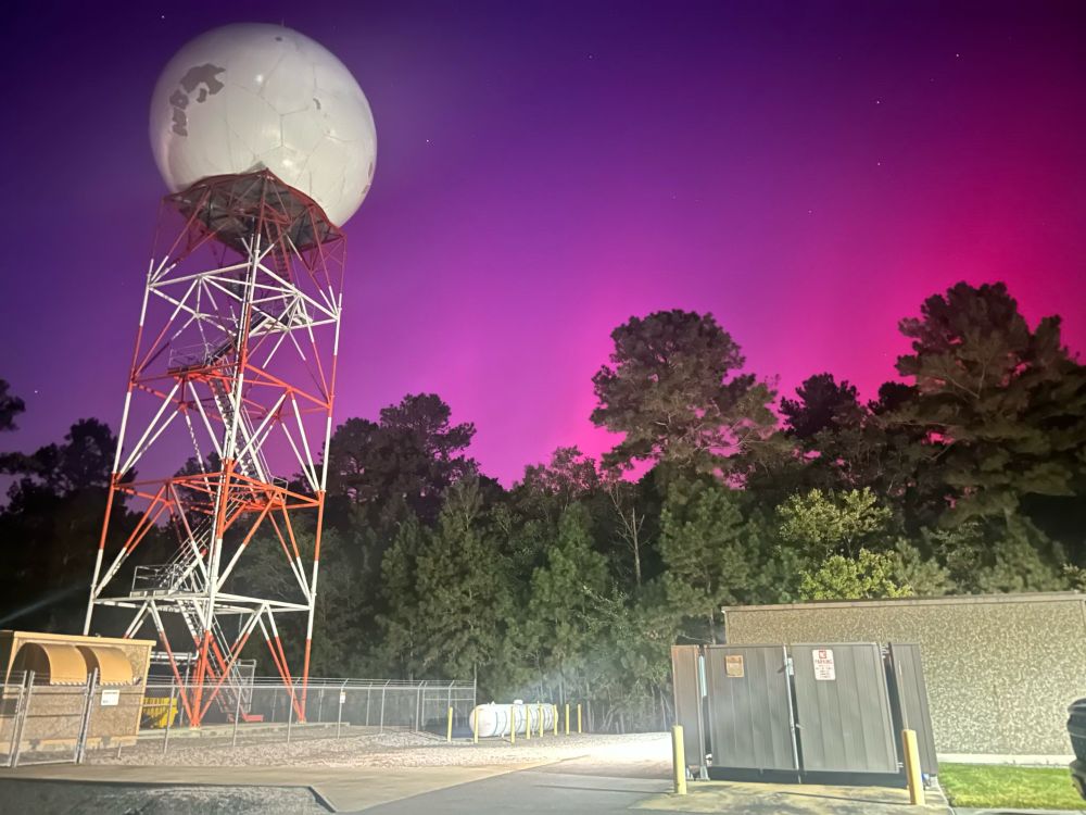
1-week ago, myself and some good friends traveled up to south-central Iowa to experience and photograph the highly anticipated G4 solar storm. Here are 4 of my favorite photos from that evening.
Did you capture the Aurora on Oct 10/11? Let me see your photos!
What’s up everyone!
17.10.2024 23:47 — 👍 1 🔁 0 💬 0 📌 0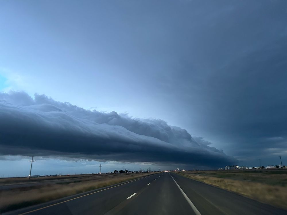
Welcome to all the new folks! Things that I enjoy…
17.10.2024 23:37 — 👍 32 🔁 2 💬 0 📌 0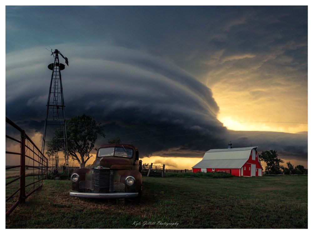
My top shot of the year so far! What's yours?
Aug 28th, 2024 - Mound City, SD tornadic supercell.
REMINDER: My team’s dual-pol, rapid-scanning X-band Radar is PUBLIC for all to view in GR2Analyst.
Add the below info to your customradars.gis -
FWLX, FWLX, 35.254963, -87.325317, 220, 1, TN, WLLX X-Band
Restart GR2, and boom! Live data achieved!
#tnwx #alwx