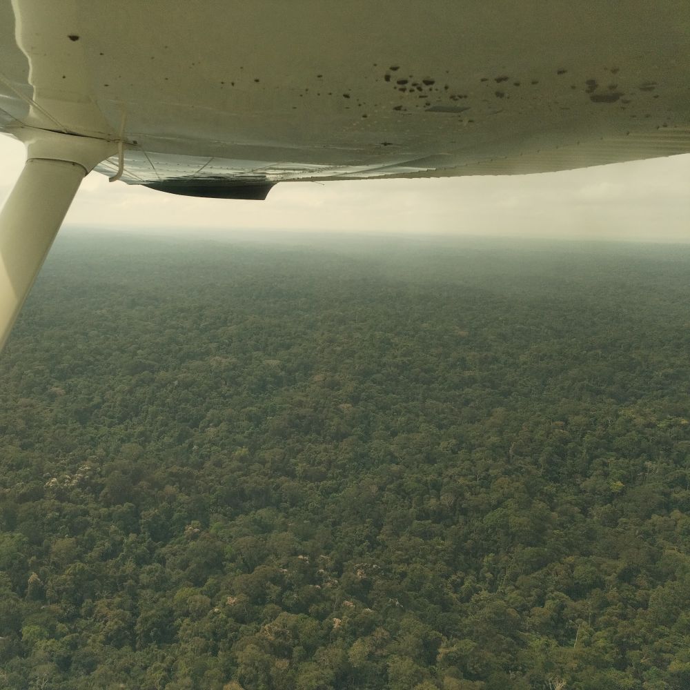
I had the opportunity to work on generating some stream data in #QGIS for a partner in the Ecuadorian Amazon today. I had forgotten how much fun it is to do remote sensing stuff 🙂
07.10.2025 18:37 — 👍 0 🔁 0 💬 0 📌 0
@rudokemper.com.bsky.social
Geographer & technologist working on digital tools for participatory mapping and data sovereignty. Also on Mastodon: fosstodon.org/@rudo
I had the opportunity to work on generating some stream data in #QGIS for a partner in the Ecuadorian Amazon today. I had forgotten how much fun it is to do remote sensing stuff 🙂
07.10.2025 18:37 — 👍 0 🔁 0 💬 0 📌 0
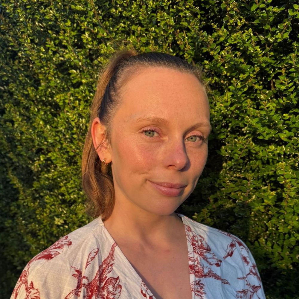
Photograph of Lydia presenting findings at a conference event
❤️ Have you shared your perspectives on the survey led by the GBIF #TaskGroup on Indigenous data governance?
This week, task group chair @1nativesoilnerd.bsky.social shared initial results of the survey at the Living Data, Living Lands event at #ClimateWeekNYC.
🔗gbif.link/Indigenous...

Climate tech / finance event tracker - I wish there were more lists like this.. airtable.com/appGQd8WKLdk...
07.09.2025 14:50 — 👍 1 🔁 0 💬 1 📌 0Btw excited to meet you there! Let's try to grab a coffee apart from organized events?
07.09.2025 14:18 — 👍 1 🔁 0 💬 1 📌 0In my experience there is like barely anything posted, and so you book your tickets only weeks before, and then suddenly there is a deluge of stuff and the FOMO sets in about the things you will miss 😆 it's tradition!
07.09.2025 14:17 — 👍 1 🔁 0 💬 1 📌 0This is amazing. Do yourself a favor and check out this report from @awana.digital jam-packed with incredible community mapping impact stories and powerful visuals!
07.08.2025 15:23 — 👍 2 🔁 1 💬 0 📌 0Given ongoing FOSS governance concerns with #OrganicMaps, I modified my "Convert Google Maps saved places" tool to explicitly support @comaps.app instead: rudokemper.github.io/google-maps-...
13.07.2025 17:14 — 👍 0 🔁 0 💬 0 📌 0
Sharing this technical blog post about our use of the FOSS data orchestration engine Windmill to build and manage backend data workflows for Indigenous community organizations! www.windmill.dev/blog/conserv...
04.06.2025 15:30 — 👍 1 🔁 1 💬 1 📌 0Delighted to announce a hiring opp at Conservation Metrics!
Come join our team in building a FOSS data sovereignty platform for communities to securely centralize, access, and derive insights from their data, stored on premises which they own entirely.
conservationmetrics.com/hiring-fulls...
Check out this great piece by Tanya Ruka and Victor Temprano about how and why @nativeland.bsky.social is centering Indigenous data sovereignty in the terms of service of our API!
nativeland.substack.com/p/native-lan...
Excited to hear how it went! And to take notes on planning a future sabbatical with my own fam :)
30.04.2025 02:55 — 👍 1 🔁 0 💬 0 📌 0Turns out this *does* exist in QGIS (somebody on Mastodon pointed it out)! It's called "Stream Digitizing" and you can activate it by clicking the arrow next to the "Digitize with Segment" button in the Digitize toolbar, or simply pressing R.
11.04.2025 22:02 — 👍 1 🔁 0 💬 0 📌 0Fallout 4 on the Steamdeck for me :) but yeah, sometimes find the itch to want to try to do something productive. Vibe-coding a QGIS plugin sounds like a fun way to do it!
11.04.2025 22:01 — 👍 2 🔁 0 💬 0 📌 0I wouldn't mind trying my hand at starting a QGIS plugin for this, and inviting others to collaborate. I'm inspired by seeing others like @opencholmes.bsky.social creating their own plugins recently. But probably could only do this at a hobby level of effort. (Typing with a newborn in my arm 😉)
08.04.2025 17:30 — 👍 1 🔁 0 💬 1 📌 0Ah cool! Yeah, I figured there are some good workflows involving use of tools outside of QGIS. I recall coming across a browser-based georeferencing tool, for example.
But I was just so surprised that freehand drawing wasn't already baked into QGIS!
GIS folks: is there a viable #QGIS plugin for freehand drawing features that will work in 3.x.x?
It looks like "BeePen" is only good for annotations, and "Freehand Editing" was last updated 12 years ago.
If not, would there be interest in one?
#GISChat @qgis.fosstodon.org.ap.brid.gy
Oh cool! Great to be connected here, excited to follow your collecting journey
21.03.2025 02:31 — 👍 1 🔁 0 💬 0 📌 0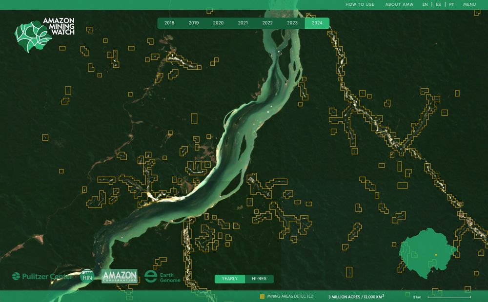
Amazon Mining Watch is now available with 2024 data, to detect and compare mining driven environmental harm across the Amazon.
amazonminingwatch.org/en
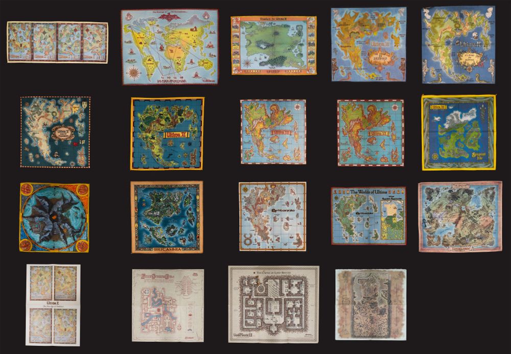
All cloth Ultima maps (plus a few paper ones)
I think I ended up completing my collection of cloth #Ultima maps, plus the map for Shroud of the Avatar which is actually quite beautiful! 🗺️
High resolution: www.easyzoom.com/embed/32d1e3...
@richardgarriott.bsky.social am I missing anything essential? 😄
A project I've been working on for the last 6 months. I feel really strongly about making geospatial technology and data available and understood by as many people as possible. And that requires getting creative with the ways we share information. This is my small contribution to that effort.
20.02.2025 14:45 — 👍 30 🔁 13 💬 1 📌 1
What if you could ask a map a question—and get a real, reliable answer?
We’ve been exploring how LLMs can make geospatial data more accessible by translating natural language into structured queries. But AI alone isn’t enough—trusted data sources and human oversight are key.
🔗 ds.io/language-in...
Moreso a storytelling than a gameplay thing, but I'd say a slight narrative shift to bring it more in-line with later Ultima lore could be really nice, but without being unfaithful to the original (e.g. don't cut out space stuff because that was an integral part of the game).
02.02.2025 17:21 — 👍 5 🔁 0 💬 1 📌 0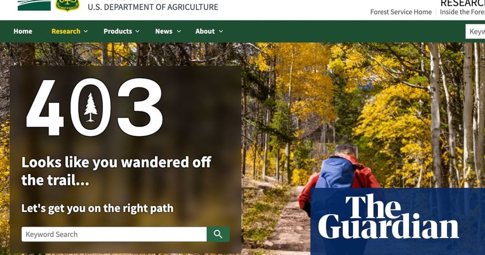
Just in case you had missed this...
By Friday, the landing pages on the United States Forest Service website for key resources, research and adaptation tools had gone dark, leaving behind an error message or just a single line: “You are not authorized to access this page.” 🌐🧪🌎
Come work with me on some cutting-edge decentralised tech with real-world applications that is directly helping communities around the world protect biodiversity and fight deforestation.
23.01.2025 18:41 — 👍 1 🔁 1 💬 0 📌 0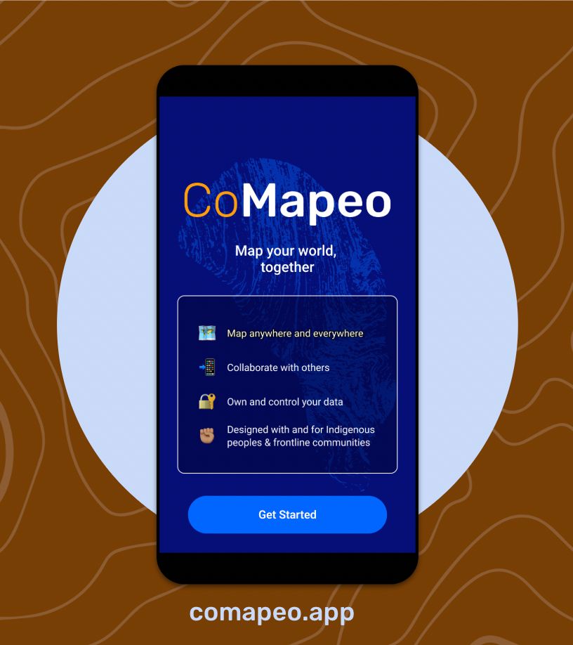
.🥳 Have you tried CoMapeo yet? We are excited for you to try our next-gen territorial monitoring & mapping tool, co-designed with #EarthDefenders.
🌱Download it and map your world, together. New features coming soon!
👉🏾Find it on the Playstore or visit comapeo.app
Check out this article about some great territorial defense work being done by the Krahô community with support by @luandro.bsky.social and @awana.digital in Brazil
14.01.2025 16:06 — 👍 6 🔁 4 💬 0 📌 0Oh, I also didn't play WoU, I don't even consider those to be canonical 😅
10.01.2025 23:12 — 👍 1 🔁 0 💬 0 📌 0As somebody who started to play beginning with Ultima 7 and 8, I just couldn't get into the lore of Ultima 2 and 3. They felt too distant from the gameworld I started in.
I played and finished all of the others though, including I and 0.
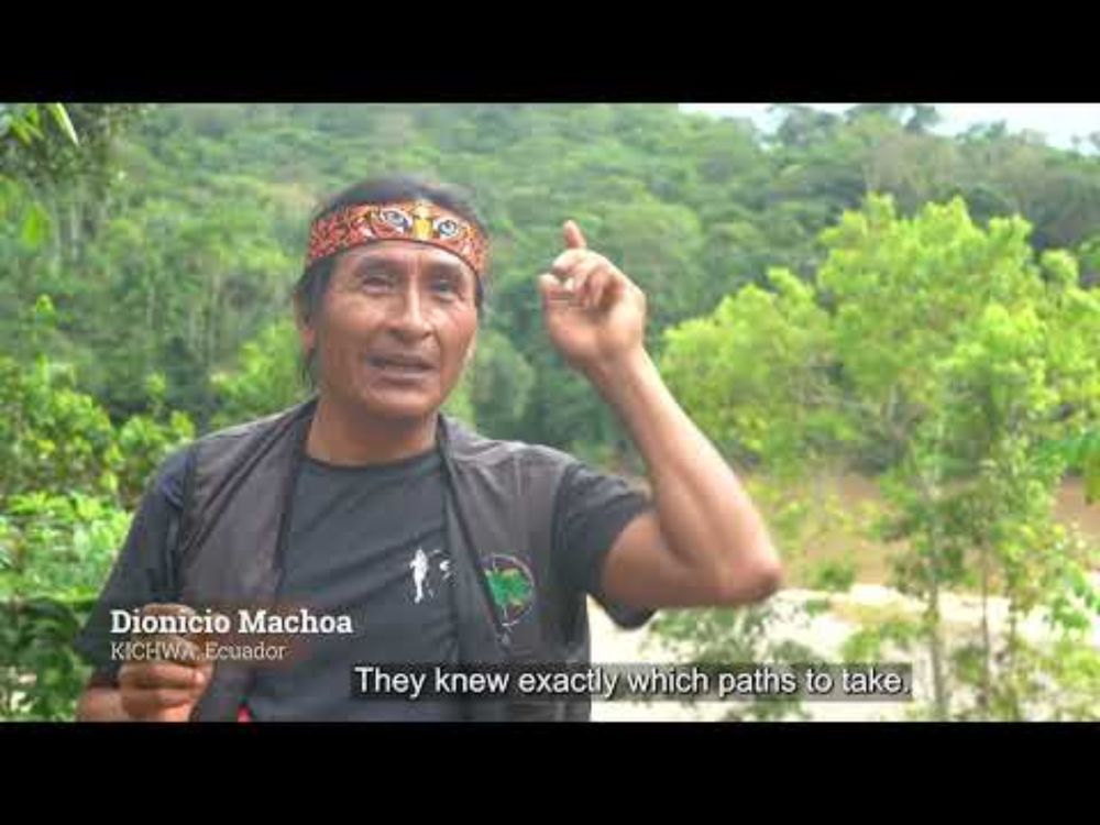
This short film explores how Indigenous communities are combining ancestral wisdom with cutting-edge technology to map and monitor their territories. From ancient traditions to modern tools, these approaches can help protect their biodiversity and heritage. @nature.org
10.01.2025 01:02 — 👍 354 🔁 86 💬 10 📌 4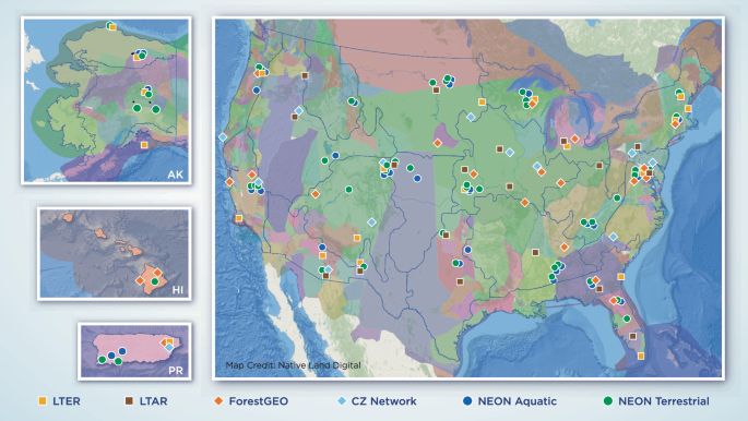
New publication alert! Check out our paper on the “Governance of Indigenous data in open Earth systems science” co- led by myself and Dr. Katie Jones. www.nature.com/articles/s41...
10.01.2025 19:00 — 👍 98 🔁 37 💬 3 📌 2