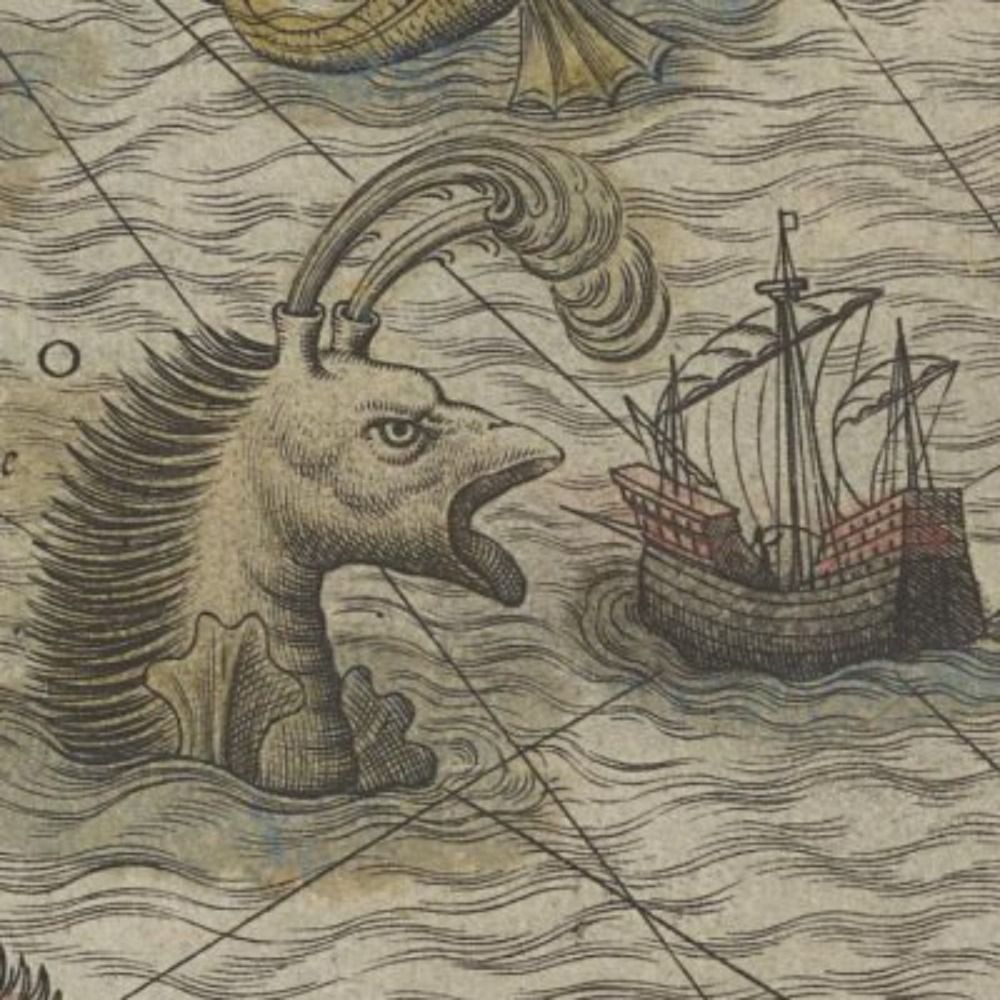
Dryad № 19: The Climbing Criteria. In which I have unkind words to say about the common hackberry. dryad.substack.com/p/19-the-cli...
07.10.2025 02:29 — 👍 3 🔁 1 💬 1 📌 0
@pinakographos.bsky.social
An arboreal, poly, gender non-participant mapmaker. • Portfolio & tutorials: somethingaboutmaps.com. • Prints: https://somethingaboutmaps.com/Storefront • You can support my art & teaching at http://patreon.com/pinakographos.
Dryad № 19: The Climbing Criteria. In which I have unkind words to say about the common hackberry. dryad.substack.com/p/19-the-cli...
07.10.2025 02:29 — 👍 3 🔁 1 💬 1 📌 0
Dryad № 19: The Climbing Criteria. In which I have unkind words to say about the common hackberry. dryad.substack.com/p/19-the-cli...
07.10.2025 02:29 — 👍 3 🔁 1 💬 1 📌 0
In continuation of my spotless record of earnestly oversharing about my career, I offer yet another blog post: www.mapcenter.com/blog/budget-...
06.10.2025 00:55 — 👍 84 🔁 16 💬 5 📌 1
Dutch zip codes (postcode) form a unique alphanumerical system in which one only needs the 4 digits and 2 letters combined with a house number to find any unique address in the country. Get the map: www.studiolegenda.com/produ... 🔹
05.10.2025 17:30 — 👍 13 🔁 6 💬 0 📌 0
"You don't get to decide when you're in a fight. If someone punches you in the face, you're in one. We're in one."
www.liberalcurrents.com/democrats-mu...

SILENCE
IS NOT AN OPTION
ACT NOW
#WoodType #Letterpress #toMake
Budget cuts come for us all. My contract with Amtrak is not being renewed and it's up tomorrow.
I'll have more time to work on the Map Center but until it's fully off the ground, I'm a GIS analyst with 12 years of experience in ESRI, open source, education and cartography.
#gigeconomy
#opentowork

A coaster showing a map of the Great Lakes. There are several major inaccuracies in how the lake boundaries are drawn, along with very unclear and inconsistent labeling.
This is a coaster at my brother's house. I'm planning to replace it with a new one that has fewer major inaccuracies.
29.09.2025 16:21 — 👍 3 🔁 1 💬 0 📌 0
Detail of the area around Trafalgar Square and Whitehall from a vintage style map of London, UK

Detail of Britain and Ireland, northern France and the Low Countries from an antique style map of Europe

A display of framed retro style maps of London Boroughs, including Tower Hamlets, Newham, Greenwich and Bexley

Detail of southern Portugal and the Algarve region from a vintage style map of the railway network in Spain and Portugal
Been a bit quiet on the ol' shop website lately. If you're looking for an original, quality map print designed by an independent artist either for yourself or a fellow cartophile, it might be worth a look.
➡️ shop.thisismikehall.com
The lowest branch was trimmed off, so I can't climb it anymore, but I achieved my main goals of: 1) seeing the tree again, and 2) finding out what species it was.
28.09.2025 03:32 — 👍 4 🔁 0 💬 1 📌 0
A northern red oak on a campus lawn. Dimly lit.
It was near sunset, but after many, many years, I finally got to revisit one of the most important trees of my life, a northern red oak on the Kalamazoo College campus.
28.09.2025 01:37 — 👍 9 🔁 0 💬 1 📌 2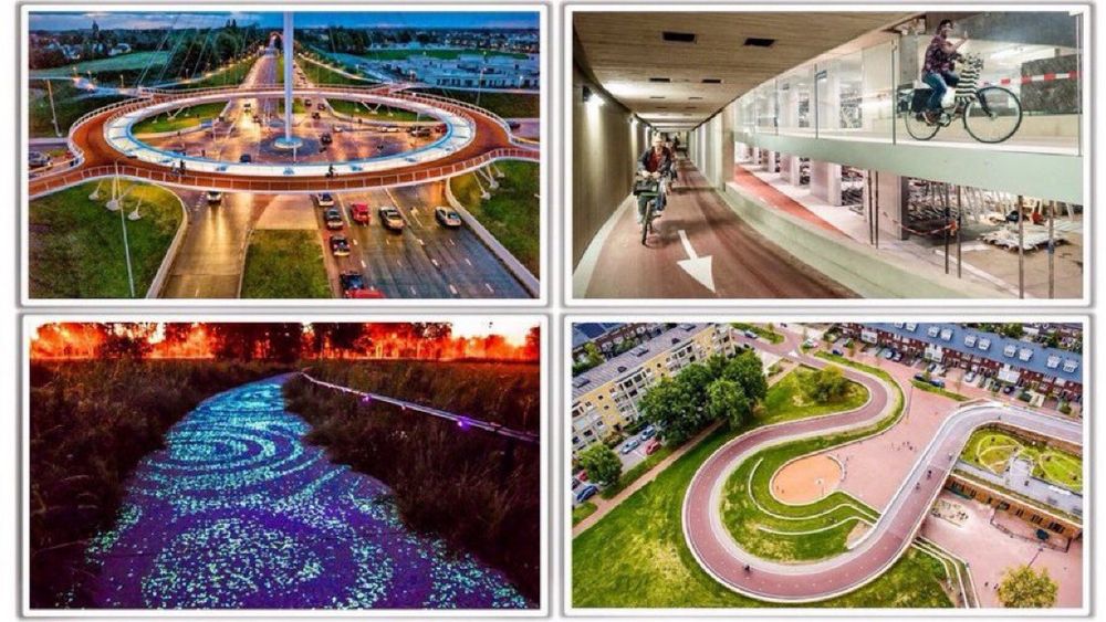
Images of Dutch bike infrastructure
IMPORTANT: The Dutch invest €595 million annually on urban biking, resulting in €19 BILLION saved in public health care costs alone. That’s how smart govts do the math on investing in better mobility.
Let’s be clear— it wastes public money to NOT do it.
#CityMakingMath HT @modacitylife.bsky.social


After months, I finally remembered to put this print on my store page, so that people know where to look if they want a charmingly distressing world map.
somethingaboutmaps.com/Storefront
And if you'll be at #NACIS2025 in Louisville, you can see it in person and deface it with dry erase markers.

Autre travail en cours 🌐
25.09.2025 17:11 — 👍 10 🔁 2 💬 1 📌 0Lovely as always. I know this is still in progress, so this might get fixed later, but the Dymaxion projection author went by "R. Buckminster Fuller."
25.09.2025 17:56 — 👍 1 🔁 0 💬 1 📌 0
A photo of the cover of the book The Boroughs of London on a wooden tabletop. The cover art includes the title at the centre within a white circle with the names of the two authors, Mike Hall and Matt Brown. Around the circle is a series of 32 colourful segments, within each of which is a small detail of a map of each London borough.

Detail of a spread from the book The Boroughs of London. On the right is a passage of text explaining the history of local government in London. On the left, spanning both pages, is a detailed and colourful map of the area administered by the London County Council in the year 1900, showing the various Metropolitan Boroughs that existed until the mid 1960s and which were mostly combined to form the present-day Lodnon Boroughs.

Detail of a map of the borough of Islington from the book The Boroughs of London. At the bottom left of the page is part of a key listing 10 key locations that are marked on the map.

Detail of a spread from the book The Boroughs of London. Across the page are arranged several paragraphs of text about various interesting locations around the London Borough of Brent. These include the Kiln Theatre, Neasden Temple, the Black Madonna of Willesden, the Welsh Harp Reservoir, Dollis Hill House, Kingsbury Lodge Coach House and Wembley Stadium. At the top centre in an orange box is a list of statistics about the borough. Several black line illustrations can be seen; on the left is an illustration of a motorbike (relating to the Ace Cafe), at the bottom left is part of an illustration of a Ganesha statue (relating to Neasden Temple), in the centre is an illustration of the Black Madonna of Willesden, and at the top right is an illustration of a sailing boat (relating to the Welsh Harp Reservoir). At the far top right can be seen another orange box with a list of famous people born within the area of the borough of Brent.
Just two weeks till our book THE BOROUGHS OF LONDON hits the shops! 📚
Full of detailed maps, fascinating history and surprising trivia, it's a guide to every one of the 32 boroughs that make up the greatest city on Earth, from Richmond to Redbridge and Barnet to Bromley.
Preorder: 🛒 bit.ly/4nIqKTW
Err “absence becoming…” (weary fingers on a phone screen)
24.09.2025 22:09 — 👍 1 🔁 0 💬 0 📌 0I think it’s a common fear of creatives: we don’t know where the spark comes from, so there’s always anxiety about its abae becoming permanent. I have gone through low periods of a year or two, but it does come back when we have a chance to care for ourselves.
24.09.2025 22:08 — 👍 1 🔁 0 💬 1 📌 0
A black and white illustration titled "Cascade Range Volcanoes," showing a 3 by 3 layout of the nine tallest peaks in the range. The art is done in a hachure sketch style.
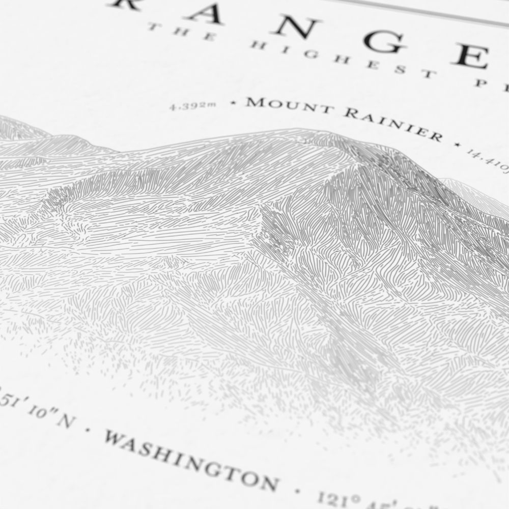
A detail image of the illustration of Mount Rainier

A detail image from the poster of Mounts Hood and Jefferson.
New poster! Hachure illustrations of the highest Cascade Range volcanoes. This one took a lot of experimentation to get the layout right. If you or someone you know loves this area, check it out. www.etsy.com/listing/4373...
23.09.2025 19:38 — 👍 31 🔁 7 💬 1 📌 2
A screenshot of the AFC website
The Alliance of Freelance Cartographers has a new website! Thanks to @alyolli.bsky.social for getting it off the ground. It hosts past editions of the survey, as well as other resources. www.freelancemaps.org/home
23.09.2025 20:28 — 👍 7 🔁 3 💬 0 📌 0
Screenshow of a monochrome representation of a DEM. There are three peaks seen in it, very close together.
To get the peaks close together for a nice group photo, I took individual DEMs and then kicked them out to Photoshop so that I could feather them together, before imaging them in Blender.
23.09.2025 19:41 — 👍 5 🔁 0 💬 0 📌 0
A black and white illustration titled "Cascade Range Volcanoes," showing a 3 by 3 layout of the nine tallest peaks in the range. The art is done in a hachure sketch style.
A detail image of the illustration of Mount Rainier
A detail image from the poster of Mounts Hood and Jefferson.
New poster! Hachure illustrations of the highest Cascade Range volcanoes. This one took a lot of experimentation to get the layout right. If you or someone you know loves this area, check it out. www.etsy.com/listing/4373...
23.09.2025 19:38 — 👍 31 🔁 7 💬 1 📌 2One of my fosters has a favorite toy and reminds me when it’s time to play with it.
23.09.2025 19:12 — 👍 13 🔁 0 💬 0 📌 0Okay yes, Raincaster’s star is a rooster, and Wooden Nickel had pretty good chickens too, but we’ll never ever top our Burly Men at Sea chickens.
23.09.2025 16:44 — 👍 4 🔁 2 💬 0 📌 0Today I found www.nauticalchartsco.com which, as far as I can see, mostly sells free NOAA charts. And then also *adds their own copyright to it*. Maybe they're doing something extra to add value; hard to tell.
22.09.2025 21:43 — 👍 4 🔁 0 💬 3 📌 0The artist thing reminds me of how I'd like to see more maps in art galleries. I co-curated a gallery one time, but making inroads with the museum/gallery scene would be useful, I think.
22.09.2025 21:36 — 👍 5 🔁 0 💬 1 📌 0
"The Geographer", by Johannes Vermeer, depicting a 17th-ish-century mapmaker at work
Me: "When did you last look at a map?"
The general public:
Thought you might :). I've long wondered about surveying what people think of as maps. I bet if asked "when did you last look at a map" many folks wouldn't think of Google/news/weather & only think of old maps. Maybe not a majority, but a lot of folks might not think of modern cartography as "maps."
22.09.2025 21:29 — 👍 3 🔁 0 💬 2 📌 0I sometimes wonder if I'd be much wealthier by not making my own maps, and instead selling prints of existing copyright-free ones. Some online stores seem to do big business.
I don't think there's anything inherently wrong with it; the market just seems to appreciate old maps more than new ones.