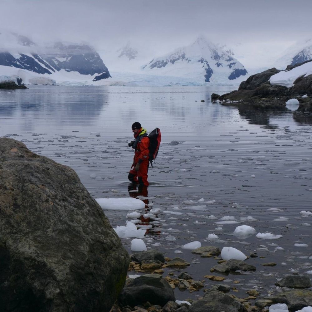
Insane conditions endured by X. Cailhol on top of Aiguille du Midi yesterday while checking temp. sensors! 😲❄️
Beautifully minimalist.
📷 Xavier Cailhol
@subfossilguy.bsky.social
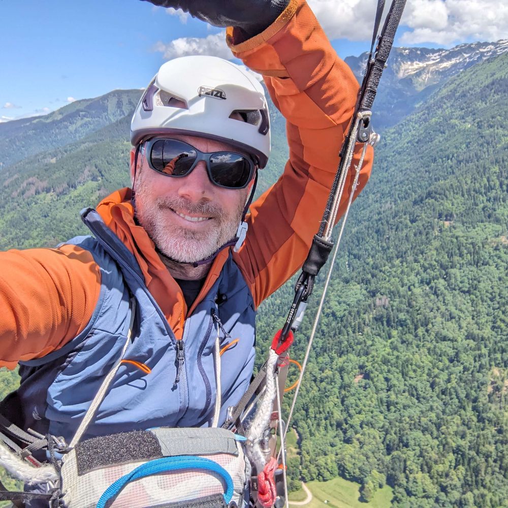
Assiduous dendroglaciologist, moraine lover, wandering geomorphologist, living in the Holocene, climate (and eco-) anxious, @edytem.bsky.social https://www.researchgate.net/profile/Melaine-Le-Roy-2?ev=hdr_xprf
Insane conditions endured by X. Cailhol on top of Aiguille du Midi yesterday while checking temp. sensors! 😲❄️
Beautifully minimalist.
📷 Xavier Cailhol

Cerros de la Plaza Glacier
2013 | 2025
One more for the history books! 😢
Extinction of this glacier de la Sierra Nevada del Cocuy is imminent! 🔥🧊✝️
📷 Via Daniel Zoque
See also this timelapse:
www.planet.com/stories/cerr...
Beautiful! 🥰
29.01.2026 12:35 — 👍 1 🔁 0 💬 0 📌 0
8200 yr-old glacier larch tree in poster! 🤩🌲💍
DM if you're interested.
🤍🤍🤍
28.01.2026 11:21 — 👍 0 🔁 0 💬 0 📌 0
Pelvoux from Sélé Glacier
1915 | 2025
One century of ice melt in Ecrins massif! 🔥
Looking NE towards Pic Sans Nom (3913 m) and Mont Pelvoux (3943 m) 🏔️
Coup de Sabre Glacier is now gone and Coolidge Couloir is totally dry in summer... 🧊💧📈
📷 Henri Ferrand and @PnEcrins

The Sierre landslide in the Rhône Valley is one of largest postglacial event in the Alps! ⛰️🌊
It spans 12 km in length and has a present-day volume of 0.9 km3! 😲
It has just been TCN-dated to 10.7 ± 1.5 ka ⏱️
sjg.pensoft.net/article/1803...

Bionnassay Glacier this morning! 🤩
No more ice present in this frontal area of the glacier forefield framed by two beautiful lateral moraines!
📷 @lomdumtblanc.bsky.social


A continuous 6 ka age depth relationship for the remainder of the Weißseespitze summit glacier (3500 m a.s.l.) 🏔️🧊⏱️
No prolonged periods of mass loss have existed at WSS within the last 6 ka, except the recent warming that already removed >400 yr of ice! 🔥
cp.copernicus.org/articles/22/...

249 yr of homogenized temperature at Innsbruck (Tirol) 📈
Climate of the 21st c. is impressively consistent in its rate of warming (especially last 40 yr) and has nothing to do with 20th c. climate! 🔥
Spoiler: Solar activity has nothing to do with it! 🤡
Data: www.zamg.ac.at/histalp/data...

150 yr of homogenized temperature at Annecy (northern French Prealps) 📈
Climate of the 21st century is impressively consistent in its rate of warming and has nothing to do with 20th century climate! 🔥
Spoiler: Solar activity has nothing to do with it! 🤡
Data: @meteofrance.com
See this paper for context:
www.cambridge.org/core/journal...
Ferdinand Glacier
2008 | 2023
Sobering repeat photos of its very sad (and rapid) demise! 🧊🔥
Svalbard last decade glacier retreat is otherworldly! 📈
📷 Jakub Małecki
Via @hazlovell.bsky.social
Link to the paper seems broken
23.01.2026 21:03 — 👍 0 🔁 0 💬 1 📌 0
Ferdinand Glacier (Svalbard)
1908 | 2018
Svalbard is the most rapidly warming place on Earth! 🔥
We are going back there to early Holocene glacier levels BUT
without the same forcings! ☀️ 🌍
We wouldn't be witnessing this colapse today without human emissions. 🏭
journals.muni.cz/CPR/article/...


Gebroulaz Glacier 2025 mass balance 🧊📈
The results for 2025 (-1.90 m w.e.) are the 3rd worst (after 2022 and 2023) since 2003 (ranked 7th!) ! 🔥
Frontal retreat since 1980s is likely one of the smallest in the Alps (-250 m) due to an heavy debris cover!
www.vanoise-parcnational.fr/fr/actualite...
Impressive rockslide at the Filo del Hombre Sentado! 🔥
NW from Cerro Chalten and shot from Camp Polacos (foot of W face of Aguja Poincenot).
Warmer summers and retreating glaciers (Torre Gl. here) left numerous walls without the support that the ice provided 🧊📈
📽️ @damiangauna90

Pic de Neige Cordier
1950 | 2025
Only 7 decades and this south-facing tributary of Glacier Blanc flowing from Neige Cordier (3614 m) has entirely gone! 🧊🔥✝️
(A red dot indicates a similar location on both images).
📷 RTM & @PnEcrins

Incredible soft and gentle light tonight! 🌥️
Shot from Barmeché (Fiz) towards Pointe Noire de Pormenaz (2323 m asl) and the Mont Blanc massif in the background! 🏔️
220 cm snowpack measured at the Moëde-Anterne refuge (2000 m asl) ❄️
📷 @lomdumtblanc.bsky.social
‘We are the last generation that can act!’ 🔥
Glaciers around the world are melting so fast that we need to store ice cores in a sanctuary so that the next generation of researchers will have raw material to study! 🧊🔬
The ICE MEMORY project facilities just opened 2 days ago in Antarctica!
📽️Via AFP
Woww 😍🥰
16.01.2026 12:34 — 👍 0 🔁 0 💬 0 📌 0


See our paper about the geomorphological aspects of the torrential flooding of the Étançons torrent at La Bérarde on June 21, 2024 🌊👇
journals.openedition.org/geomorpholog...
ONF (Office National des Forêts) / EDYTEM / Styx4D


La Bérarde one century ago!
Juillet 1926
Get a moving dive into the Roaring Twenties in the Haut Vénéon, thanks to the Maupin/Durozad family fund! 📷
This place was devastated on 20-21th June 2024 by anthropogenic climate change.... and that's only the beginning! 📈🔥🌊
🙏 Yann Durozad
INCREDIBLY massive avalanche struck the Elbrus resort (Kabardino-Balkaria, Caucasus, RU) today on the SE face of Ebrus, down to ~2300 m asl! ❄️🌊
Via @WeatherMonitors

Bossons Glacier
2022 | 2025
One of Europe's most impressive glaciated landscape is collapsing right before our eyes! 🧊🔥
Since 2022, the level of melting has reached unknown territories 📈
📷 Via Meteo Valle d'Aosta

Crazy visualisation and great mapping! 🔥
How the world is losing its forests to wildfires!
Wildfires now destroy twice as much tree cover per year as two decades ago – a crisis fuelled by climate change
www.theguardian.com/world/ng-int...

Aiguilles de Chamonix plastered with snow tonight after huge recent snowfall (>1m at these elevations) 🏔️❄️
@lomdumtblanc.bsky.social

Winter wonderland...finally! ❄️
Aiguille du Goûter and Bionnassay today from Mont Lachat.
Snow at 1800 m: 120 cm, of which 90 cm from last days! 🤍
📷 @lomdumtblanc.bsky.social

Winter wonderland...finally! ❄️
Aiguille du Goûter and Bionassay today from Mont Lachat.
Snow at 1800 m: 120 cm, of which 90 cm from last days! 🤍
📷 @lomdumtblanc.bsky.social
This is not petrified wood.
Far too young for that.
It's still wood.