6th talk of 4th session AI for Good Webinar series
AI for Earth & Sustainability Science
📅8 Dec 2025
⏰5-6 pm CET
📚 Risks and solutions when using non-stationary training data in earth system science
🧑🏫 Speaker: Joachim Denzler (@uni-jena.de)
👨🏻💻 Moderator: Ribana Roscher
🔗 loom.ly/jyU-P78
01.12.2025 14:32 — 👍 4 🔁 1 💬 0 📌 0

Mapping forest-covered landslides using Geographic Object-Based Image Analysis (GEOBIA), Jena region, Germany
Abstract. Landslide inventories are crucial for the assessment of landslide susceptibility and hazard. An analysis of old landslides can reveal periods of intensified landslide activity, but the featu...
📢 Hot off the press!
"Mapping forest-covered #landslides using Geographic Object-Based Image Analysis (GEOBIA), Jena region, Germany" by @ikram-zangana.bsky.social, Rainer Bell, Lucian Drăguţ, Flavius Sîrbu & Lothar Schrott in NHESS @egu.eu
#geosky #geomorphology
doi.org/10.5194/nhes...
02.12.2025 11:36 — 👍 4 🔁 3 💬 0 📌 0
❓Why is this important? Mountain permafrost matters for #slopestability & #waterresources. #geographymatters
✨I had developed the method for the Alps with colleagues at University of Zurich.
👨🎓Project led by Guillermo Azócar, for Dirección General de Aguas. Thanks to contributors!
@uni-jena.de
30.11.2025 20:54 — 👍 0 🔁 0 💬 0 📌 0

First Chilean mountain #permafrost model & map is out!
Preprint: egusphere.copernicus.org/preprints/20...
🌎We used the most complete compilation of permafrost evidences - mainly rock glaciers & boreholes - along with climatic+topographic data to inform a nonlinear statistical model. 📈
(1/2)
30.11.2025 20:54 — 👍 0 🔁 0 💬 1 📌 0

Humanoid robot studying a digital world map on a holographic globe
💥Kicking off my geographic information science advent calendar in my blog geods.netlify.app + Instagram in English+German.
🌍Core concepts that every #geographer... & everyone else... should know. Concepts that are also introduced in my #GIScience intro course in our #BScGeography @uni-jena.de
30.11.2025 19:57 — 👍 0 🔁 0 💬 0 📌 0

Prof. Dr. Alexander Brenning wird von der Carl-Zeiss-Stiftung im Rahmen ihres Förderprogramms „CZS Durchbrüche“ für fünf Jahre mit insgesamt rund sechs Millionen Euro unterstützt. Foto: Nicole Nerger / Uni Jena
Prof. Dr. Alexander Brenning coordinates the GENAI-X project at the @ellisunitjena.bsky.social at #UniJena together with partner institutions. The @carlzeissstiftung.bsky.social is funding GENAI-X with around six million euros over five years.
➡️ www.uni-jena.de/369974/zuver...
04.11.2025 14:40 — 👍 4 🔁 1 💬 0 📌 0

Dr. @alexanderbrenning.bsky.social + the GIScience Group (@uni-jena.de) invite you to GIS Day 2025 — focus: GeoAI for Environment.
📅 17 Nov 2025
🕐 13:00–17:30 CET
📍 Rosensäle Jena + Zoom (hybrid)
🖼️ Poster registration until 10 Nov
🔗 www.chemgeo.uni-jena.de/48059/gis-da...
04.11.2025 12:36 — 👍 2 🔁 2 💬 0 📌 0


🚀 Yesterday at Zero-to-Hero sessions at #SummerSchool2025 @ellis.eu
A) Beyond Accuracy: Understanding & Quantifying Uncertainty in Deep Learning — Aishwarya Venkataramanan 🎯
B) Scalable AI for Earth & Climate Sciences — Ioannis Papoutsis 🌍
🔗 www.ellis-jena.eu/summer-schoo...
05.09.2025 11:18 — 👍 3 🔁 1 💬 0 📌 0
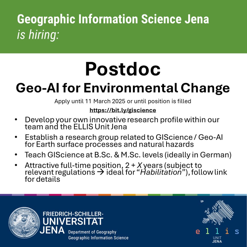
🚀Kickstart your academic career in #GIScience as a #Postdoc in my group! Looking for geospatial #machinelearning / #GeoAI for Earth surface processes & #naturalhazards. Join our team
at University of #Jena & ELLIS Unit Jena @ellisunitjena.bsky.social. 🔍 See job ad for details: bit.ly/giscience
14.02.2025 09:45 — 👍 1 🔁 0 💬 0 📌 0
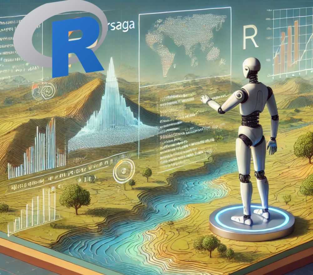
Announcing the New RSAGA Release | GeoDS
A new version of RSAGA is available, the R package that provides an interface to SAGA GIS for geospatial analysis, digital terrain analysis, and geocomputing...
📢RSAGA 1.4.2 is out! 🎉
💡My R package integrates SAGA GIS with R, facilitating #geocomputation & environmental #modeling.
🚀Fun fact: It's among the 10% most downloaded packages!
Blog: geods.netlify.app/post/rsaga-u...
#Rstats #GIS #opensource #GIScience #Geoinformatik
@ellisunitjena.bsky.social
14.02.2025 09:38 — 👍 2 🔁 1 💬 0 📌 0
7th Data Science Day Jena on May 13 at @uni-jena.de 📊 📢 Submit your abstracts by April 13:
🔗 www.fmi.uni-jena.de/12727/data-s...
Lead by our ELLIS member Joachim Giesen and the Interactive Inference group (inference.uni-jena.de?events/dsd2025).
Supported by @carlzeissstiftung.bsky.social
12.02.2025 18:26 — 👍 4 🔁 2 💬 0 📌 0
statistics, science, software
https://www.zeileis.org/
Director at OpenGeoHub / and technical director at EnvirometriX. I am a data scientist passionately promoting open data & FOSS4G, automated soil mapping, Machine Learning for environmental data, global data sets, R spatial and spatio-temporal modeling...
Passionate interest in micrometeorological phenomena, especially when caused by the hydraulic properties of the soil.
Research Scientist @ Google Research. Working on the intersection of machine learning and hydrology. Located in Vienna, Austria.
PhD student at UFZ - interested in explainable machine learning, agriculture and food security, compound climate events 🌾
Using artificial intelligence to monitor and predict soil health across Europe.
This project is funded by the EU. Posts reflect the views of the project owner
3 Museen & 12 Forschungsstandorte 🦖🦋🦐
Research Group Risk, Hazard & Climate Lab @zgis.bsky.social @unisalzburg.bsky.social
https://plus.ac.at/risk-hazard-climate
Remote Sensing and Geospatial Analysis for Natural Hazard and Risk Management. #NaturalHazards #EarthObservation #Geomorphology
Remote sensing of our living environment from space-borne to UAS/UAV, from the tropics to the Arctic -- at @uni-wuerzburg.de, Germany -- https://www.remote-sensing.org http://www.earth-observation.org - managed by Dr Martin Wegmann
Department of Geoinformatics at Paris-Lodron Universität Salzburg @unisalzburg.bsky.social
Fachbereich Geoinformatik, DAS Faculty
Leibniz Centre for Agricultural Landscape Research (ZALF)
Die Printausgabe des FELD-Magazins kostenlos abonnieren: www.zalf.de/feld
Impressum: https://t1p.de/3ykz1
#landscape #agriculture #agrifood #research
Research Assistant Professor at Pitt. Machine learning 💻 GIS 🗺 Hydrology 🏞 Remote Sensing 🌐 Opinions my own!
Activities and latest publications of researchers at the Department of Geography @unibonn.bsky.social
Research profile and focuses: http://bit.ly/2JtH4JU
Remote Sensing, Geography, Natural Science, Environment. Scientist @ Department of Geography and Regional Science @Uni-Graz.at
Geomorphologist at University of Potsdam, editor of @egu-esurf.bsky.social, developer of #TopoToolbox, cyclist
http://topotoolbox.wordpress.com, https://github.com/wschwanghart/, https://www.earth-surface-dynamics.net/
#Geoinformation, #RemoteSensing, #Maps 🌎🛰️, #IT & Sometimes other stuff / @unipotsdam
52°North is devoted to spatial information research. We support open science through open data and open source software.
Impressum: https://52north.org/impressum
fosstodon: https://fosstodon.org/@52North
Der FOSSGIS e.V. hat das Ziel Freie Software aus dem GIS-Bereich und Freie Geodaten zu fördern. Der FOSSGIS e.V. ist ein eingetragener und gemeinnütziger Verein. Der FOSSGIS e.V. veranstaltet jedes Jahr die FOSSGIS-Konferenz.
Impressum: https://fossgis.de
Computational geographer. Associate Professor at AMU, Poznan, Poland. Co-author of http://r.geocompx.org, http://py.geocompx.org, and http://tmap.geocompx.org books. #rstats #rspatial #geocompx
https://jakubnowosad.com/