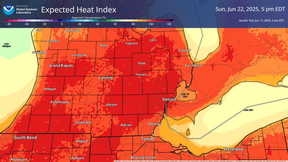
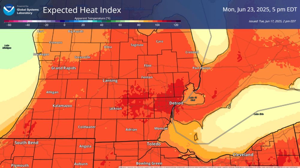
The heat index for most of the state of Michigan will be higher than 95 degrees on Sunday and Monday according to this forecast with much of the areas south of the Saginaw Bay region close to or above 100 degrees.
The heat index for most of the state of Michigan will be higher than 95 degrees on Sunday and Monday according to this forecast with much of the areas south of the Saginaw Bay region close to or above 100 degrees.
Heat enters the hazardous range on Sunday and Monday with a heat index potentially topping 100 degrees.
We've got storms tomorrow first, but don't forget about the next round of impactful weather.
17.06.2025 18:42 — 👍 0 🔁 0 💬 0 📌 0

The slight risk has expanded and an enhanced risk, 3 out of 5, has been added to the area for Wednesday evenings severe risk.
All hazards remain on the table if storms can form correctly, although damaging wind is the primary concern.
Timing continues to focus on Wednesday PM.
17.06.2025 11:32 — 👍 0 🔁 0 💬 0 📌 0
Right now it looks like we could see some early morning activity Wednesday, then we bake all day, before a line of storms arrives in the evening hours.
Make sure if you have evening plans on Wednesday that you keep an eye on the forecast.
16.06.2025 12:56 — 👍 1 🔁 0 💬 0 📌 0
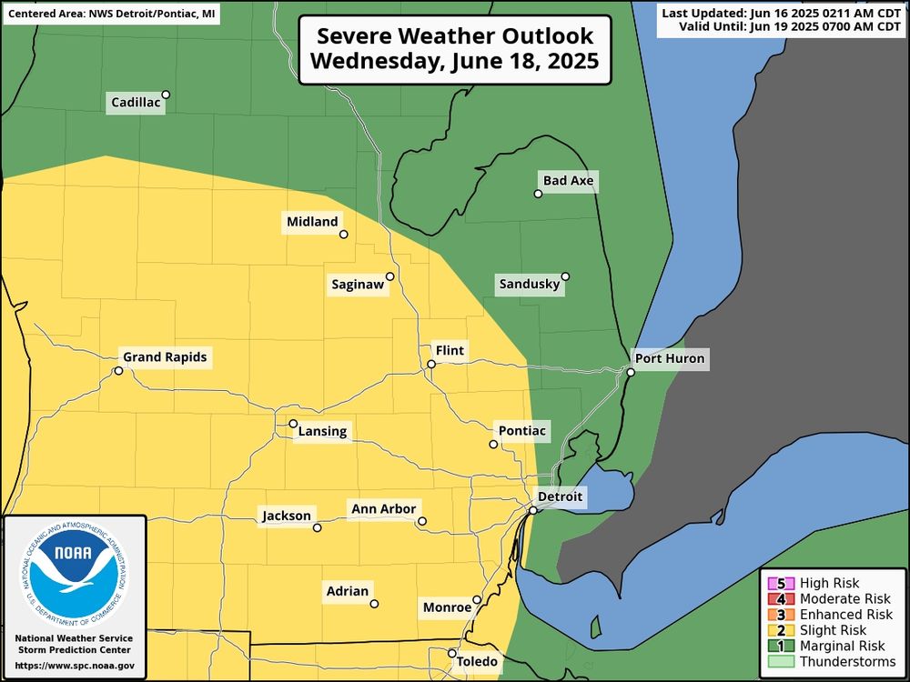
Severe weather is possible Wednesday, mainly in the evening for southeast MI. A slight risk, or 2 out of 5 category, has already been added after an extended outlook over the weekend.
We've got time for things to shift, so I expect updates to the outlook.
16.06.2025 12:56 — 👍 1 🔁 0 💬 1 📌 0
New info just came in.
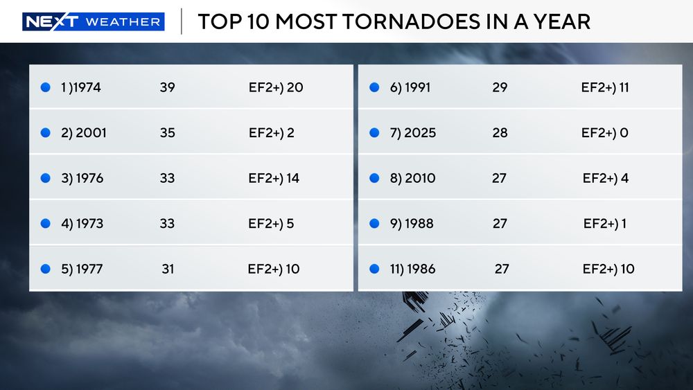
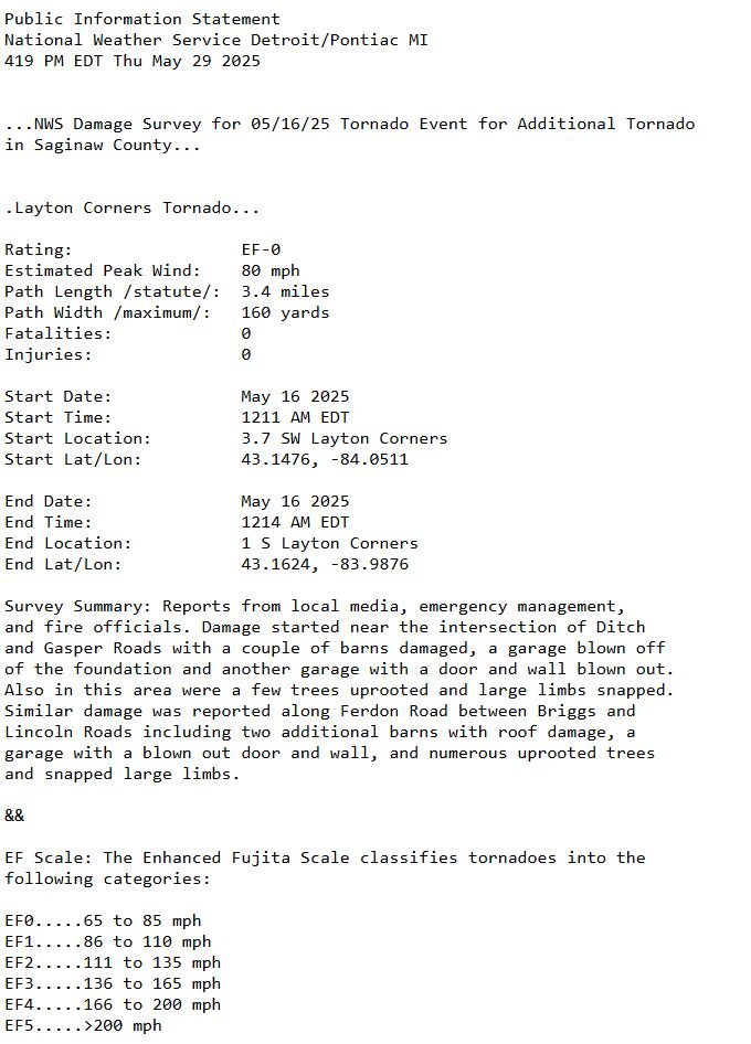
The NWS has confirmed another tornado from the severe weather on May 16th, this one in Layton Corners in Saginaw County.
We are now at the 7th Most Tornadoes in a single year for the state of Michigan.
29.05.2025 20:33 — 👍 0 🔁 0 💬 0 📌 0

With the addition of 2 confirmed tornadoes, we now sit in the Top 10 for most tornado-active years on record for Michigan.
Summer hasn't even begun yet.
19.05.2025 21:06 — 👍 0 🔁 0 💬 0 📌 0
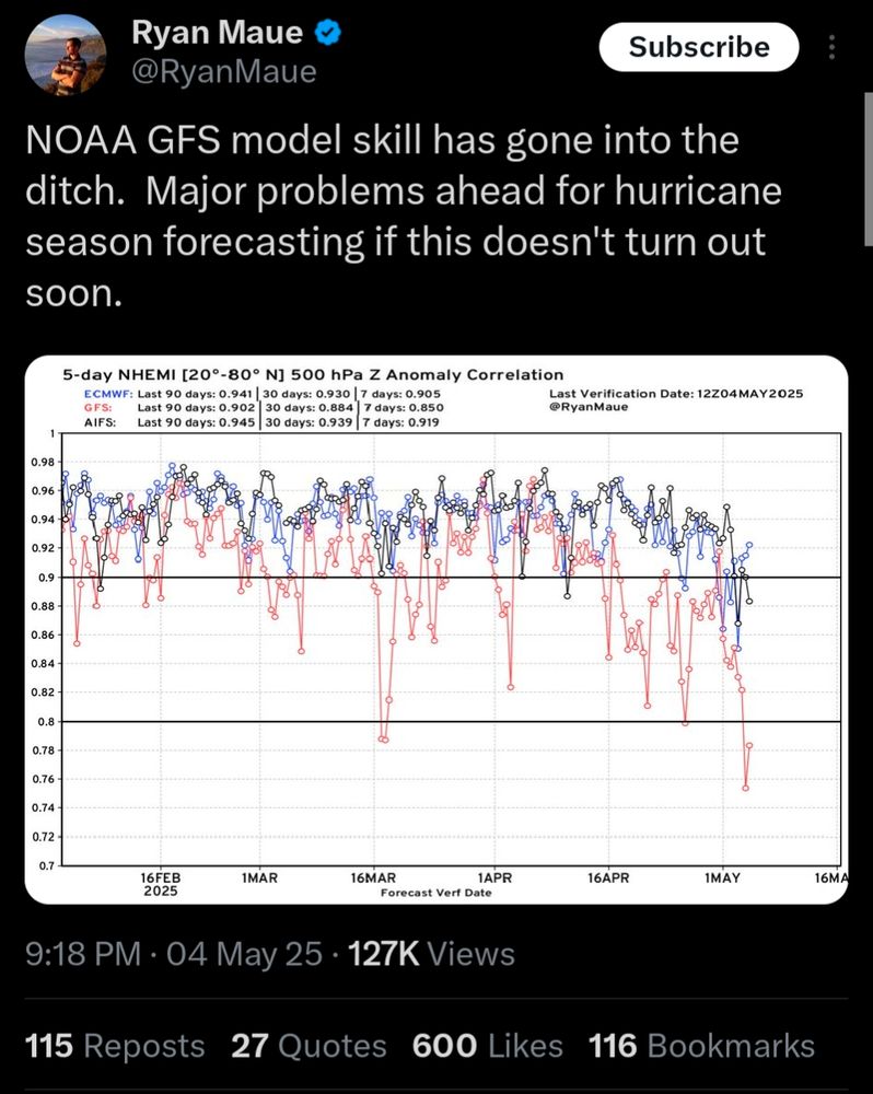
Significant issues with not just the GFS, but other models as well.
Forecasts for everything are only as good as the tools available. A lower amount of data from weather balloons and other cut info shows these are factual issues, not speculation anymore.
05.05.2025 16:55 — 👍 0 🔁 0 💬 0 📌 0
Severe roof damage at Rolladium in Waterford Township today after a strong storm and damaging winds rolled through. #severeweather #waterford #michigan #rolladium #damage
29.04.2025 22:03 — 👍 0 🔁 0 💬 0 📌 0

I'm out tonight but Stacey has the weather center.
I'm the Emcee for the Hospice Barley, BBQ, and Beats event for the 2nd year downtown tonight.
If you're looking for a fun evening out, I'll see you there!
25.04.2025 20:36 — 👍 0 🔁 0 💬 0 📌 0
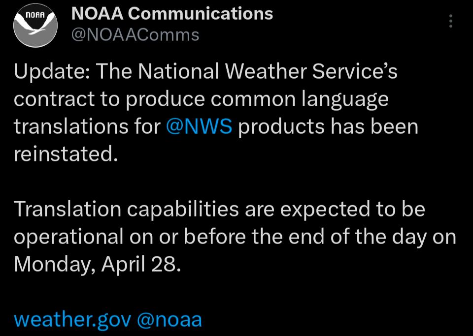
Translation services for NWS have been restored.
Warnings, etc. will again have multi-lingual translation by Monday.
#NWS #weather #NOAA
24.04.2025 19:11 — 👍 1 🔁 0 💬 0 📌 0
Translation services for NWS have been restored.
Warnings, etc. will again have multi-lingual translation by Monday.
#NWS #weather #NOAA
24.04.2025 19:09 — 👍 0 🔁 0 💬 0 📌 0
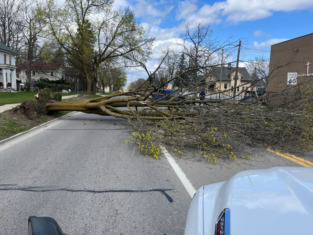
This large tree came down at M-24 (Main St) and Church St in Lapeer due to the strong winds.
Keep an eye on conditions today as winds will remain strong through the evening.
21.04.2025 19:15 — 👍 0 🔁 0 💬 0 📌 0
I spoke with several sources about this and confirmed these impacts are being seen and felt in storm and daily forecast coverage from the weather service to your phones to artificial intelligence services as well. All are seeing impacts because all use that data.
17.04.2025 15:29 — 👍 1 🔁 0 💬 0 📌 0
For those wondering yes we have seen real-world impacts from the weather balloon deductions. The ice storm up north was modeled as horrible around three-quarters of an inch, but as we know the totals were far above an inch, much higher than worst case scenarios from models.
17.04.2025 15:29 — 👍 1 🔁 0 💬 1 📌 0
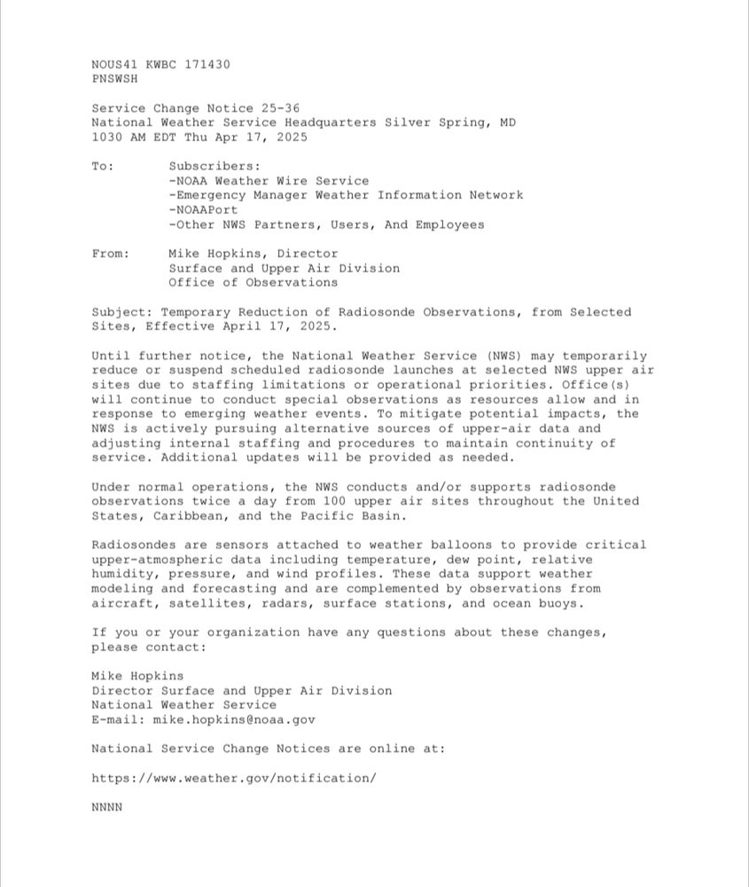
Due to critically low staffing, more weather balloon launches will be suspended or reduced in the future across multiple sites. Because the staffing is at this level, the list of sites is more than one or two so this statement covers the eventuality of a larger region as a whole would pause. #NWS
17.04.2025 15:29 — 👍 1 🔁 0 💬 1 📌 0
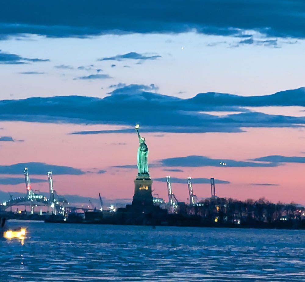
Give me your tired, your poor,
Your huddled masses yearning to breathe free,
The wretched refuse of your teeming shore.
Send these, the homeless, tempest-tost to me,
I lift my lamp beside the golden door.
A beautiful sight. I'm in New York for the few days. See you midweek!
14.04.2025 01:28 — 👍 0 🔁 0 💬 0 📌 0
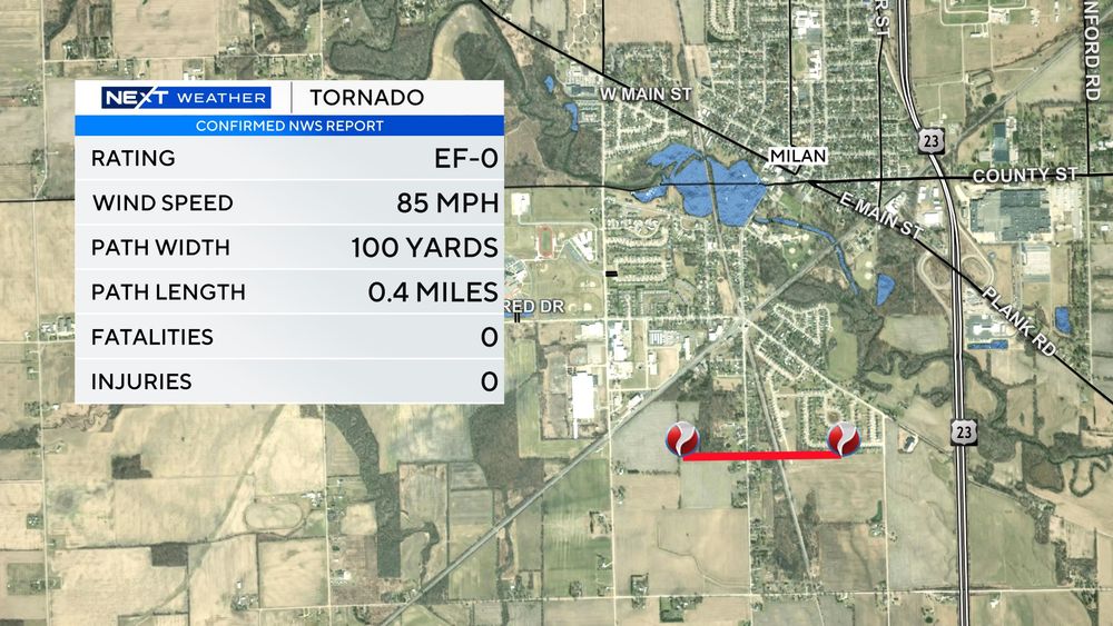
The NWS confirms a tornado touched down briefly in Milan in Monroe County on Sunday.
01.04.2025 20:59 — 👍 0 🔁 0 💬 0 📌 0
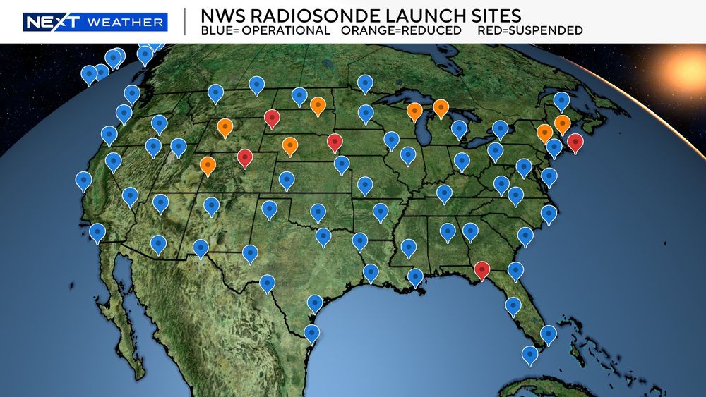
A concern for meteorologists is the gap in the northern Great Lakes, a gap in the northeast, and a large gap in the plains, in particular, where severe storms and larger events can occur.
Some locations are closer together due to being separated by mountains or different terrain.
20.03.2025 22:38 — 👍 1 🔁 1 💬 0 📌 0
All data from every single weather app, AI, all models, etc. uses this raw data to create forecasts. To put it plainly you don't have a weather forecast without them.
I'll keep you posted.
20.03.2025 21:27 — 👍 3 🔁 1 💬 0 📌 0
This will leave a 24 hour gap in upper-air and full weather column data for the UP and northern Michigan, along with data flowing downstream into western New York where some launches have already been paused.
20.03.2025 21:27 — 👍 2 🔁 0 💬 1 📌 0
This includes wind patterns over the lakes for things like lake-effect and moisture content to name a couple.
Gaylord, one of the two, will now only do launches once per day.
20.03.2025 21:27 — 👍 1 🔁 0 💬 1 📌 0
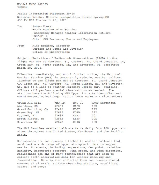
Cuts to the NWS will now be impacting operations on a larger level in Michigan.
There are 2 sites in Michigan that launch radiosondes, or weather balloon instrument packages, twice per day to get updated data from the atmosphere. #NWS #NationalWeatherService
20.03.2025 21:27 — 👍 9 🔁 6 💬 1 📌 1
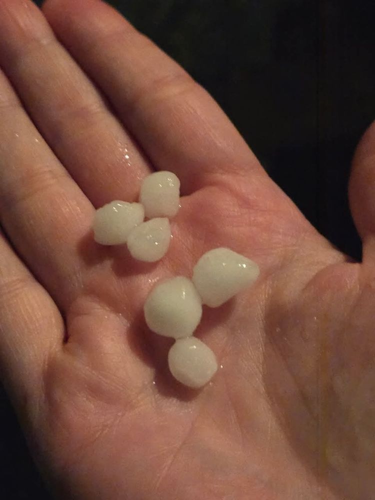
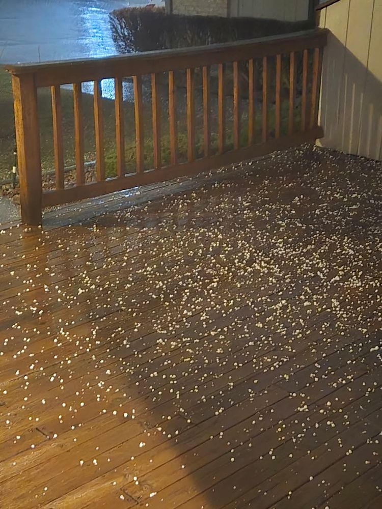
This morning had a few strong storms that rolled through Macomb County leaving small hail behind.
Thanks to Amy Slater for sending these from Sterling Heights.
15.03.2025 17:42 — 👍 1 🔁 0 💬 0 📌 0
For us specifically)
Timing: Saturday afternoon and evening
Hazards: Damaging wind gusts and small hail. An isolated spin-up is possible depending on other factors we need to monitor during the day.
Where: Green highlighted area in southern Michigan.
14.03.2025 18:14 — 👍 0 🔁 0 💬 0 📌 0
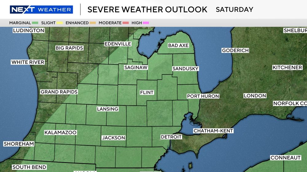
The second image shows the green, Marginal, outlook for Saturday evening here in Michigan. Depending on how things evolve down south, we may see some severe wind gusts or hail within any storms that could form later in the day. Our risk remains low, but it's worth monitoring as always.
14.03.2025 18:14 — 👍 0 🔁 0 💬 1 📌 0
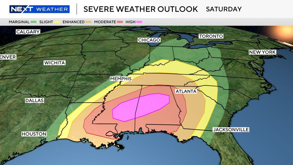
Saturday is a significant severe weather day for the south. The pink highlight is a High risk. Bottom line, these are rare.
If you have any friends or family that live within the red or pink highlighted zones, you need to check that they are aware of how serious this risk is.
14.03.2025 18:14 — 👍 0 🔁 0 💬 1 📌 0
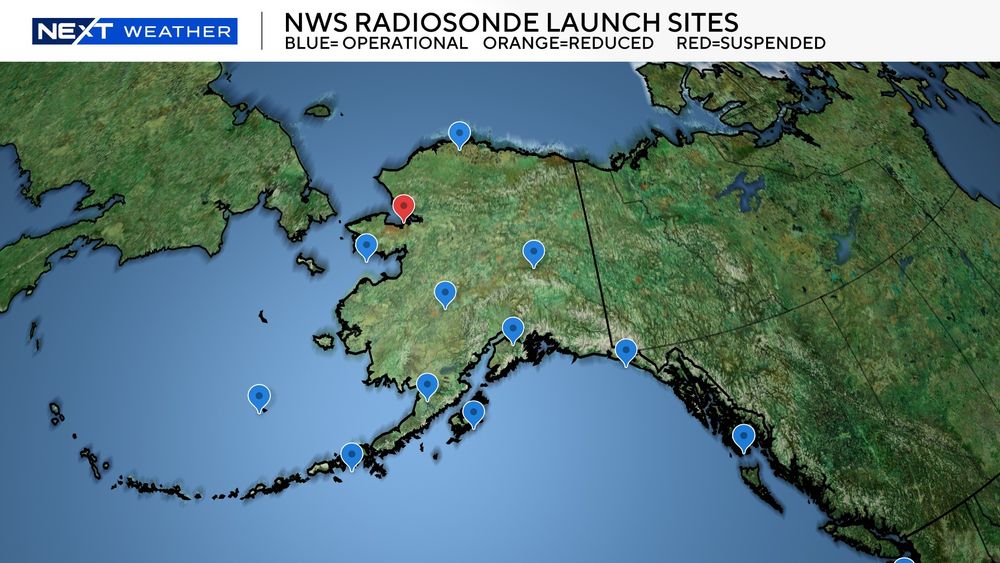
Even all AI uses this raw atmospheric data to create their models and forecasts.
One site in Alaska already has to stop which leaves a large gap in measuring all systems crossing the northern Pacific. Gaps in NY and ME would impact accuracy in eastern Great Lakes and Northeast.
07.03.2025 22:35 — 👍 0 🔁 1 💬 0 📌 0
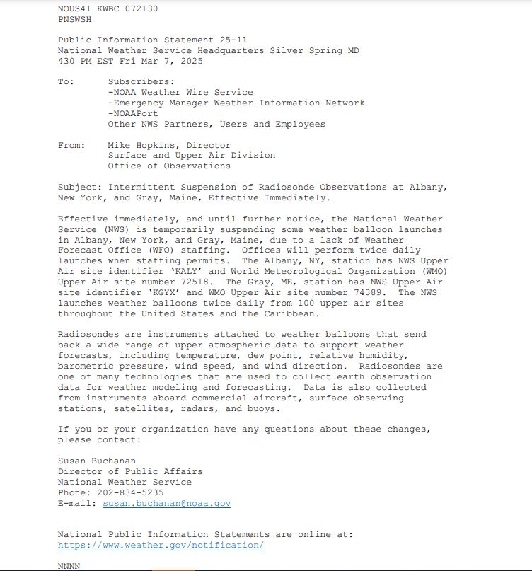
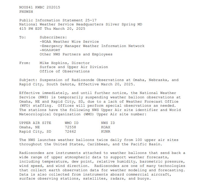
I have an update on the NWS firing information I mentioned last week.
2 more locations will be unable to launch their twice-per-day radiosondes due to the staffing cuts in Albany, New York and Gray, Maine.
All weather apps, models, forecasts, etc. use this data to forecast.
07.03.2025 22:35 — 👍 0 🔁 1 💬 1 📌 1
Meteorologist and software engineer at CSU CIRA/NWS MDL. A lead developer of the NWS WSUP Viewer. Storm chaser (occasionally), photographer, tech geek, Apple fanboy, & saxophone player. MS OU; BS Michigan | Madison, AL | N8WJE 🖖🏼
Weeknights 11/10c on Comedy Central and Paramount+
New episodes September 8th!
Meteorologist. Photographer, Coder, and Storm Chaser. Views my own.
Meteorologist at Byrd Polar and Climate research center
Grad student at The Ohio State University but a Wolverine at heart
CMU alumni
I love polar meteorology, storm chasing, and gaming.
Michigan Made
Arizona Big Sky
Born a Ω
Digital Director, Detroit Free Press
Entrepreneur
Costplusdrugs.com
#Stormchaser 20+ years based in OKC. Severe weather enthusiast, occasional stand-up comic. Former news photog. Husband to @pondert.art. Extra/videographer in Twisters. Big OU fan. Love a good #tornado pic.
mcbeewx.com
Detroit Free Press journalist covering public health, medicine and health care. Hockey mom, science nerd, politics junkie, and Michigander by way of upstate New York. Syracuse University alum.
Believe in yourself! Work hard, never give up & anything's possible! OR: Kick back, relax & aim low: You'll never be disappointed...😜 I IGNORE ALL DMs!
Maintenance Tech/Fmr Director for CBS News Detroit. SPI→JAX→DET. Cheesehead in enemy territory. ValpoU Graduate. #Brewers, #Bucks, #Badgers enthusiast, #Packers owner. #WDW Passholder.
One woman sports department, raised in Titletown, otherwise cat lady
Emmy Award Winning Meteorologist and Storm Chaser 🌪️
https://linktr.ee/weatherkatie
Trekkie 🖖🏻 Creator of the #FandomForecast CBM #918 CDM #7 Opinions are my own
Michigan's largest local news site. Read us at www.mlive.com.
Breaking Detroit news and sports since 1873.
Subscribe today ➡️: detne.ws/3UBB6IA
2xEMMY, Regional Murrow, & award winning Meteorologist @WBNS10TV. Degree: @BallStateUniversity Past: @WZZM13, @KYTXCBS19, @WNEMTV5news, @21Alive, @WCRD, @NewsLink_Indiana, @WISHTV Intern. Opinions are mine.
Storm chaser, Aurora hunter, & Photographer of neat things. Severe storm researcher and M.S. student at UND. SounderPy developer. Pythoner.
MI -> ND
Metro Detroit's award-winning alternative weekly. Founded 1980. You can contact our reporters at 313-202-8011 or tips@metrointhed.com.
#onepride
detroitlions.com