Very cool @ptfretwell.bsky.social. Nicely done - can't wait to read this.
04.10.2025 11:35 — 👍 1 🔁 0 💬 0 📌 0

The logo for the Arctic Passion project showing a map of the Arctic and the words Arctic Passion.
A long term project comes to a close. We have been in Potsdam at the last meetings of the EU Arctic Passion project. Our final reporting about improving risk information for ships in sea ice is complete, but publications are coming. More information soon. www.arcticpassion.eu.
04.10.2025 09:07 — 👍 2 🔁 1 💬 0 📌 0

We’re back from en excellent meeting at the annual International Ice Charting Working Group meeting in Tromsø. Lots of lively discussion, catching up with colleagues and we presented @bas.ac.uk work on AI for sea ice information plus the Ice Logistics Portal (www.icelogistics.info).
28.09.2025 12:53 — 👍 1 🔁 1 💬 0 📌 0
You learn something every day. Fun and instructive day out with colleagues.
01.08.2025 16:12 — 👍 0 🔁 0 💬 0 📌 0
Love this. Nicely done.
24.07.2025 19:16 — 👍 1 🔁 0 💬 0 📌 0
Amazing work.
24.07.2025 19:07 — 👍 1 🔁 0 💬 0 📌 0
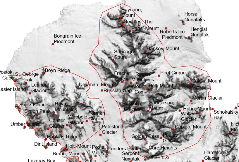
An in-progress screenshot of two polygon boundaries in northern Alexander Island - the boundaries are for the Rouen Mountains and Havre Mountains. The map contains a hillshade, and place name locations are displayed with red points.
We've been busy on a new project making polygon boundaries for place names, using Alexander Island as a case study.
Creating polygons for Antarctic names is about more than cartographic precision. It’s about improving how we understand, search, & use data in one of Earth’s most remote environments.
18.07.2025 15:54 — 👍 6 🔁 1 💬 1 📌 1
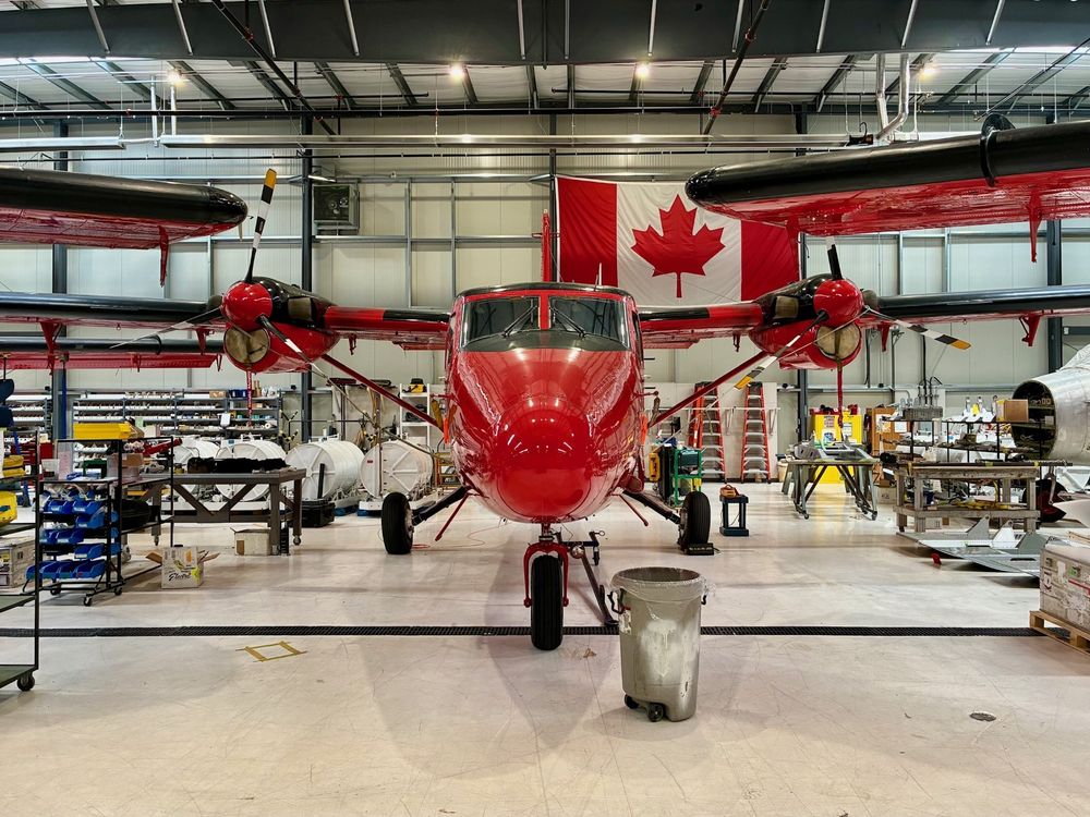
A photo of BAS's red Twin Otter plane in a hangar/workshop. A Canadian flag can be seen in the background.
We have been working along with engineers from Phase One and Rocky Mountain Aircraft over the past week to install and test our new Phase One PAS aerial camera into BAS's Twin Otter aircraft. 🛩️
1/3
14.07.2025 13:34 — 👍 7 🔁 3 💬 1 📌 0
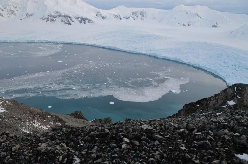
Photo looking from Stork Ridge down to Sheldon Glacier showing part of the view that our fixed cameras will capture. The image shows the view from a rocky outcrop looking down on a crevassed glacier with water in front of small icebergs are floating in the water.
This week we have been at a @polomints.bsky.social project meeting, planning details of how to use fixed stereo cameras, RPAS and our new air camera to monitor calving of the Sheldon Glacier on Adelaide Island. For more information visit polomints.ac.uk.
04.07.2025 13:50 — 👍 5 🔁 3 💬 0 📌 0
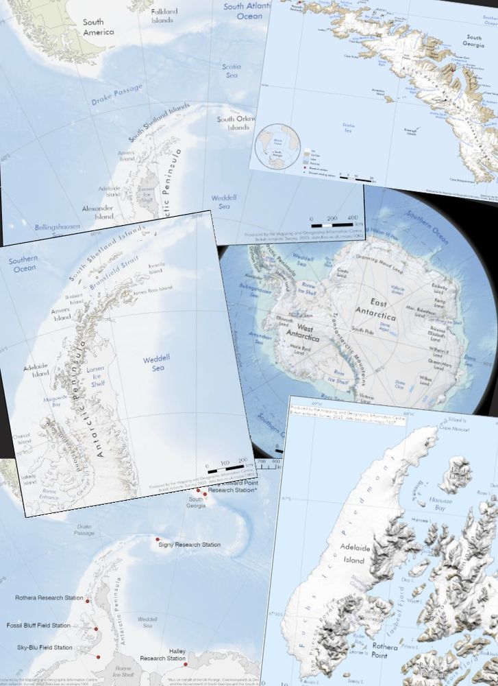
6 small maps of regions in Antarctica and South Georgia. These are examples of typical Helpdesk outputs from the job being advertised. Each map contains place names, bathymetry in shades of blue, and terrain details on land.
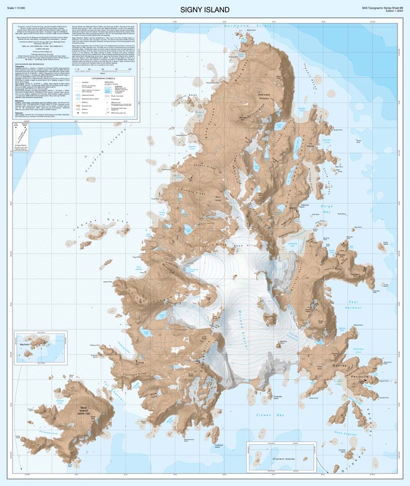
A map of Signy Island, South Orkney Islands. This map is part of our BAS Topographic Map Series. Bathymetry is shown in deepening shades of blue. Details on the land include ice and moraine extent, lakes, contours, and place names.
We're hiring a GIS and Mapping Specialist to manage our Geospatial Helpdesk and to contribute to our Topographic Map Series.
This is a really exciting opportunity at the British Antarctic Survey to support colleagues across the organisation. Details here: shorturl.at/bA4fd #GISjobs
25.06.2025 08:31 — 👍 10 🔁 10 💬 0 📌 1
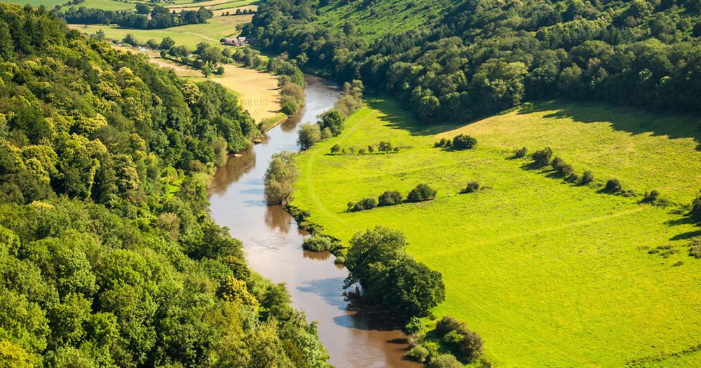
A forward look for environmental science
The newly released NERC 'Forward Look for Environmental Science' highlights Polar View (www.polarview.aq) as a vital service helping users navigate safely & efficiently in the polar regions. We've been developing Polar View for 20 years now & love hearing from all sorts of users.
shorturl.at/veId0
09.06.2025 15:46 — 👍 4 🔁 1 💬 0 📌 0
Our published Arctic map looking great. Bigger is better sometimes. Nicely done @ukarcticoffice.bsky.social.
05.06.2025 09:25 — 👍 4 🔁 0 💬 0 📌 0
Fascinating stuff.
29.05.2025 10:31 — 👍 1 🔁 0 💬 0 📌 0
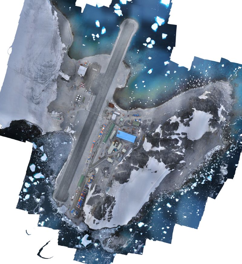
An image of Rothera Research Station, Rothera Point, on Adelaide Island. There is a bright blue building in the centre of the image which is the new Discovery Building. You can also see patches of snow on the point, and there are small icebergs floating in the surrounding water.
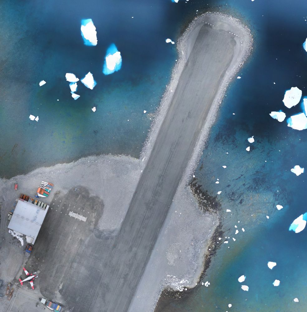
A zoomed in portion of the image, showing the northern end of the runway and the hangar. A white and red plane can also be seen, parked next to the hangar.
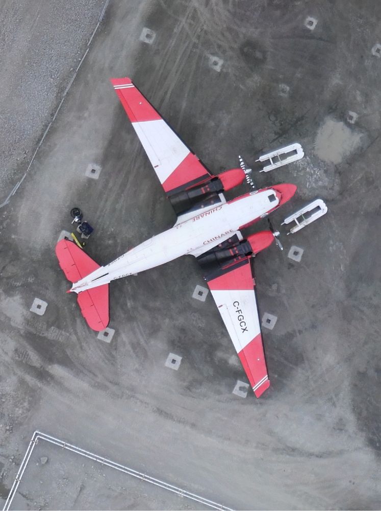
A zoomed in photo of the plane. The plane is red and white. It is possible to see skis in front of it, probably removed from the plane as it continues its journey north away from Antarctica.
A few months ago, we surveyed Rothera Point using our fixed-wing eBee-X UAV. We've now processed the data and produced this beautiful, orthorectified mosaic, as well as a Digital Elevation Model.
We carry out these surveys every year, allowing all of BAS to work with current and accurate data!
29.05.2025 09:54 — 👍 9 🔁 3 💬 0 📌 0
Nicely done MAGIC.
22.05.2025 14:27 — 👍 0 🔁 0 💬 0 📌 0
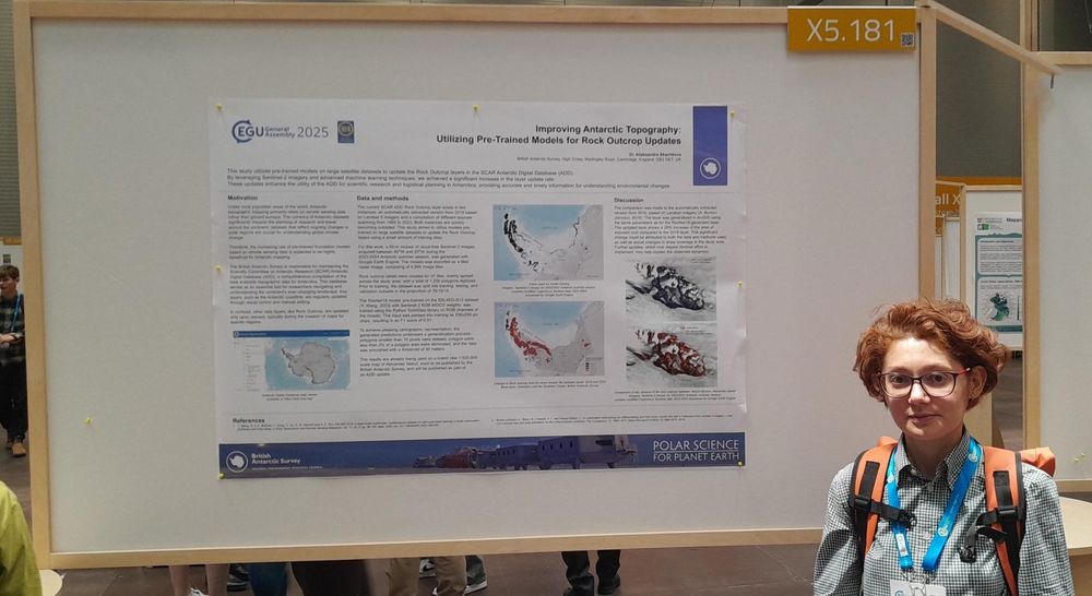
An image of a person stood in front of a large poster at the EGU conference in Vienna. The title of the poster is "Improving Antarctic Topography: Utilizing Pre-Trained Models for Rock Outcrop Updates".
If you are at #EGU25 this week, there are a lot of people from BAS to say hello to. 👋
Come and check out our poster, presenting an update to Antarctic rock outcrop, at X5. The data has been extracted from Copernicus Sentinel-2 imagery & provides a much needed update in terms of accuracy & currency!
30.04.2025 13:45 — 👍 8 🔁 2 💬 1 📌 0
Come work with us. Variety and interest guaranteed.
15.04.2025 10:53 — 👍 2 🔁 0 💬 0 📌 0
Sentinel-1 back to full capacity. Thanks @esa.int and Copernicus.
09.04.2025 14:15 — 👍 2 🔁 0 💬 0 📌 0

#throwbacktuesday to when our now BCS President Paul Naylor took a break from our conference in 2023 @bas.ac.uk 🤣
11.03.2025 19:13 — 👍 7 🔁 2 💬 0 📌 1
Little pause? Over three decades is quite a 'little pause'. 😂
05.03.2025 11:28 — 👍 0 🔁 0 💬 0 📌 0
This iceberg has a long and varied history. I’m not betting against it hanging around for a while yet. 😉
04.03.2025 14:40 — 👍 3 🔁 0 💬 0 📌 0
This iceberg has a long and varied history. I’m not betting against it hanging around for a while yet. 😉
04.03.2025 14:39 — 👍 0 🔁 0 💬 0 📌 0
Another big successful day out today. Now refuelling for tomorrow. 😬
27.02.2025 23:22 — 👍 1 🔁 0 💬 0 📌 0
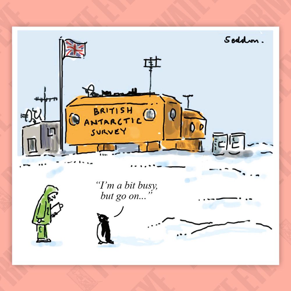
Brilliance from @privateeyenews.bsky.social !!
@bas.ac.uk
❄️🥼🧪🌊
21.02.2025 13:33 — 👍 324 🔁 74 💬 3 📌 0
Kudos @jonnydawe.github.io.
14.02.2025 16:24 — 👍 0 🔁 0 💬 0 📌 0
MAGIC in the field.
12.02.2025 12:14 — 👍 1 🔁 0 💬 0 📌 0

I’m obsessed with icebreaking: I was trained not to hit anything – now I drive my ship into ice 24/7
As the captain of a royal research ship, I break ice to get to British stations in the Antarctic. It’s great fun - but getting stuck is always a risk
"You are taught, during maritime training, how not to hit things. So to get to drive a ship that’s designed to hit the ice is great fun."
Our own Captain Will Whatley chatted to @theguardian.com about being in charge of a royal research ship in Antarctica 🚢
www.theguardian.com/environment/...
06.02.2025 16:28 — 👍 67 🔁 5 💬 2 📌 0
Glad we didn't hang around much longer on the English Coast.
04.02.2025 20:25 — 👍 1 🔁 0 💬 0 📌 0
Did you know that MAGIC support the BAS Air Unit with mapping, imagery and also 3D visualisations? Check out Rothera runway, made using the latest drone imagery draped over a digital elevation model! Visualising the runway & obstacle surfaces in 3D helps pilots better understand these remote areas ✈️
29.01.2025 19:27 — 👍 8 🔁 4 💬 0 📌 0
Brief escape from the ship to Sky-Blu.
17.01.2025 18:01 — 👍 7 🔁 1 💬 1 📌 0
Our mission is to work with the research community to secure cutting-edge capabilities and expertise that enable world-leading science.
🎧 Dive deeper into FMRI - listen to the podcast with Dr Helen Czerski
🖥️ fmri.ac.uk/podcasts
We are the National Snow and Ice Data Center at the University of Colorado Boulder. We conduct innovative research and provide open data to understand how the frozen parts of Earth affect the rest of the planet and impact society.
Climate scientist at DMI, Greenland, Antarctica, polar regions in general.
Dipping a toe in yet another social media site. Mostly on mastodon though @ruth_mottram@fediscience.org
Blogging at sternaparadisaea.net
Antarctic scientist @Geoscience Australia interested in earth observations, marine science and understanding change. Bike rider, mum, outdoor enthusiast.
Glaciologist | Antarctica and Greenland | Research Scientist, CIRES, University of Colorado Boulder 🇺🇸 | Professor, CPOM, Northumbria University 🇬🇧 | Protect Our Winters Science Alliance | National Geographic Explorer
Journalist. Former BBC Science Correspondent. Way too interested in icebergs for my own good.
News about the status of our changing climate and environment and the actions being taken to mitigate the risks of climate change. Main areas of focus are on climate politics, climate data, ecological research and renewable energy. 🇵🇸
Official Bsky Account for WomenInGIS.org
UK Centre for Polar Observation & Modelling (CPOM), primarily funded by NERC. Leading research in the polar regions from scientists at Northumbria, Lancaster, Liverpool, UCL, Reading & Bristol.
BBC climate and science correspondent. I wrote a PhD now I write news. Covering space, earth and our oceans. Got a story? Email Georgina.rannard@bbc.co.uk
🌊 ❄️ Professor @ University of Liverpool - ocean biogeochemical cycles and life in the seas - GEOTRACES SSC co-chair, IPCC AR7 & AR6 SROCC lead author, ERC grant holder, Everton - he/him
Climate scientist, juggler. Bikes etc. Blogging at https://www.realclimate.org - data visualization, explainers, and debunking.
Physicist. Atmospheric gravity waves and tides above Antarctica.
Climate change in the Polar Regions.
All views expressed are my own.
Award-winning journalism focused on #climatechange, science, energy and policy. Subscribe to our free newsletters: http://bit.ly/CBnewsletters or visit our website: https://www.carbonbrief.org/
I work at the European Space Agency as the mission scientist for the Sentinel-2 and Sentinel-3 next generation missions.
I mainly post nice pictures of the Earth from space!
Note: Not an official ESA account, opinions are my own and mine alone!
Editor and director, Carbon Brief
https://bsky.app/profile/carbonbrief.org
Professor of Glaciology and glacial geology, Newcastle University, UK. Www.AntarcticGlaciers.org.
Editor, Quaternary Science Reviews.
IPCC WGI AR7 lead author.
Chair, UK Arctic-Antarctic Partnership.
She/hers 🏳️🌈🏳️⚧️
dad, husband, engineer, submariner, triathlete - helping scientists count fish and penguins #AIMP #FMRI


