Copper River delta, Alaska. So much sediment!!
11.10.2025 02:36 — 👍 1 🔁 0 💬 1 📌 0

View of Copper River Delta, Alaska with airplane wing.

View of Copper River Delta, Alaska from airplane.
Always!
11.10.2025 02:27 — 👍 1 🔁 0 💬 1 📌 0
YouTube video by Alaska Earthquake Center
Early View of Tracy Arm Landslide Features
Alaska Earthquake Center posted a nice explainer video with some of the video reconnaissance following the recent #landslide and #tsunami in Tracy Arm, south of Juneau, Alaska. It’s a whopper! 🧪⚒️
15.08.2025 01:26 — 👍 44 🔁 21 💬 1 📌 3

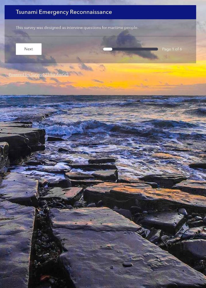
the California Geological Survey has prepared a survey to gather your observations from the M8.8 Kamchatka, Russia Tsunami
If you have been able to make any observations of the tsunami or of the evidence left behind by tsunami, we want your information:
survey123.arcgis.com/share/76979d...
30.07.2025 16:58 — 👍 29 🔁 33 💬 0 📌 1
It’s important to point out that this is because Crescent City,CA is expected to see higher wave heights due to the local topography/bathymetry and focusing of the wave energy.
30.07.2025 04:10 — 👍 8 🔁 0 💬 0 📌 0

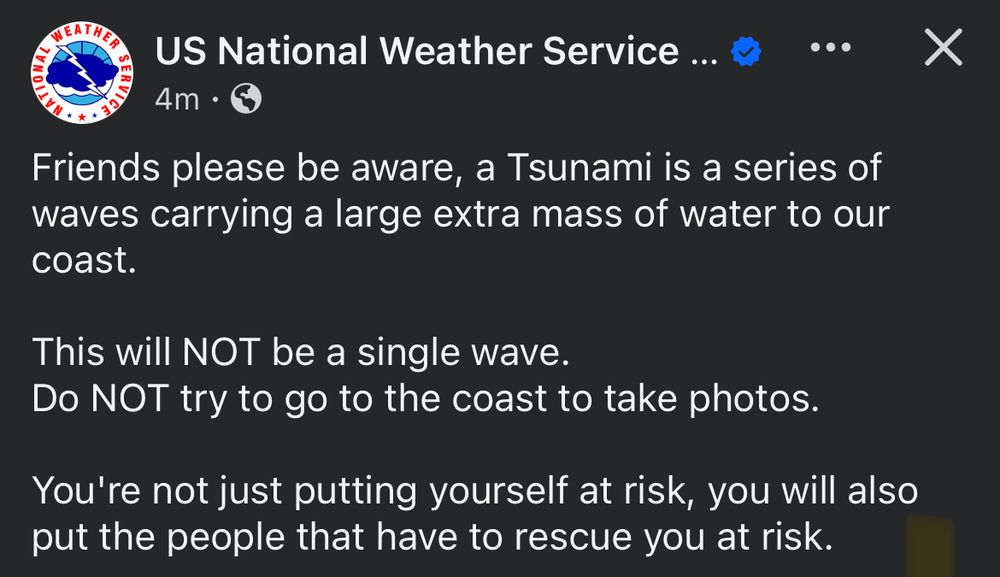
“Friends please be aware, a Tsunami is a series of waves carrying a large extra mass of water to our coast.
This will NOT be a single wave.
Do NOT try to go to the coast to take photos.
You're not just putting yourself at risk, you will also put the people that have to rescue you at risk.”
An important reminder from the US National Weather service regarding the US west coast tsunami advisories following today’s M8.8 Kamchatka quake:
30.07.2025 02:36 — 👍 79 🔁 37 💬 1 📌 1
The Ecosystems Mission area is a major component of the USGS Alaska Science Center, along with Earthquake, Landslide and Volcano Hazards, Energy & Minerals - these folks are hard working scientists who do great work. 🧪⚒️
26.06.2025 03:33 — 👍 27 🔁 10 💬 0 📌 0
“NPR reached out to the Office of Management and Budget to confirm the planned cut. In an email, a spokesperson replied, the EMA is, quote, "obviously irrelevant to science and is exactly the kind of waste President Trump ran on rooting out of the federal government."”
🧪⚒️
20.06.2025 16:39 — 👍 6 🔁 2 💬 1 📌 1

🔊 Listen Now: This federal program helps track America's ecosystems. Trump's budget would gut it
All Things Considered on NPR One | 5:02
The USGS is the only non-regulatory federal agency with a mission to conduct science in the public interest.
The President’s FY26 budget aims to zero out the Ecosystems Mission Area. The quote from the NPR story below shocked me.
See what they do: geonarrative.usgs.gov/ecosystemsmi...
🧪⚒️
20.06.2025 16:39 — 👍 13 🔁 5 💬 2 📌 0
@anthropoceneman.bsky.social Some samples to go with your word of the day.
08.06.2025 18:13 — 👍 0 🔁 0 💬 0 📌 0
Ooh I do love a good turbidite!
08.06.2025 18:11 — 👍 1 🔁 0 💬 0 📌 0
Oof, yeah the weather is gnarly today!
07.06.2025 21:34 — 👍 1 🔁 0 💬 0 📌 0
We are in Prince William Sound. 🏔️
07.06.2025 21:07 — 👍 3 🔁 0 💬 1 📌 0

Two people deploying chirp sonar from small boat in Alaska.

Two people deploying chirp sonar from small boat in Alaska.

Chirp subbottom profile across multiple buried landslide deposits.

View of mountains and water through window on a boat with a subbottom data processing computer screen in the foreground.
Rain or shine, it’s always a good day to survey submarine landslides in #Alaska! #USGS #Coastal & #Marine #Geohazards 🧪⚒️🌊
07.06.2025 20:51 — 👍 36 🔁 1 💬 2 📌 0
I picked up one when we were there 2 years ago and was psyched to see it had been updated with info about the 2018 eruptions, so we went to check those out!
17.05.2025 01:55 — 👍 2 🔁 0 💬 0 📌 0
Everytime I this video of surface rupture/offset from the recent Myanmar #earthquake it’s 🤯 and now a peek athe rupture up close from thr otber side if the fence - so cool! 🧪⚒️
Link to original video: youtu.be/77ubC4bcgRM
16.05.2025 02:54 — 👍 98 🔁 40 💬 5 📌 3
I haven’t used it since last summer’s fieldwork, but I think it was Bluetooth.
07.05.2025 03:16 — 👍 0 🔁 0 💬 0 📌 0
We use a portable monitor that has basically the same form as a tablet for bridge displays for this purpose.
07.05.2025 02:13 — 👍 1 🔁 0 💬 1 📌 0
@seaicebeth.bsky.social
@oceanandclimate.bsky.social
@micropaleo.bsky.social
Any ideas of what this might be?
02.05.2025 15:57 — 👍 0 🔁 0 💬 1 📌 0
I am pretty sure it is organic, but I got this photo from a collaborator, so I haven’t seen the sample first hand.
02.05.2025 02:26 — 👍 0 🔁 0 💬 0 📌 0

Microscope photo of sediment aggregate from the Bering Shelf with copper, brown coils of unknown origin.
Another curious specimen from marine sediment cores - anyone have thoughts on what these copper brown coils might be?
Could be terrestrial (from ice age) or marine. 👽, 🐌, 💩 have all been suggested…
This sample is from the Bering Shelf in about 40m of water.
🧪⚒️🌊
01.05.2025 23:21 — 👍 20 🔁 11 💬 4 📌 0
Check out this nice study about the cascading hazards in the Cascadia subduction zone 🧪⚒️🌊
29.04.2025 04:23 — 👍 15 🔁 3 💬 0 📌 0
USGS-authored or produced data and information are considered to be in the U.S. Public Domain.
24.04.2025 13:22 — 👍 1 🔁 0 💬 1 📌 0

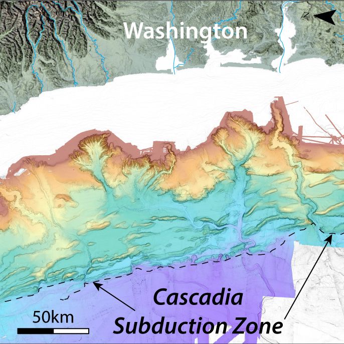
Seafloor enthusiasts! We now have a complete set of high resolution seafloor bathymetry grids for the Cascadia subduction zone (offshore Washington, Oregon & northern California) available for download! #USGS #data #science #mapping #MarineGeohazards
🧪⚒️🌊
www.usgs.gov/programs/cmh...
23.04.2025 23:31 — 👍 93 🔁 21 💬 5 📌 6
I just heard some excellent news regarding one of these datasets - the IMLGS (Index to Marine & Lacustrine Geologic Samples) - SESAR2 (www.geosamples.org) has agreed to host it going forward! 🧪⚒️🌊 This is a super valuable dataset - thanks so much to these colleagues for stepping up.
17.04.2025 16:00 — 👍 35 🔁 16 💬 0 📌 0
Notice of Changes
Notices of changes are formal public announcements of planned services changes to applications and other products.
NOAA just announced a long list of datasets that are going away🧪⚒️🌊: www.nesdis.noaa.gov/about/docume...
Download what you need asap and send comments to: ncei.info@noaa.gov
17.04.2025 00:44 — 👍 1038 🔁 958 💬 43 📌 118
We have a 30m bathymetry compilation that should be publicly available very soon! I will post the link when it comes out.
14.04.2025 01:37 — 👍 1 🔁 0 💬 0 📌 0
Ooh does that make you a submarine canyon fan? 🤣🤣
28.03.2025 01:29 — 👍 2 🔁 0 💬 0 📌 0

Bathymetric map of Astoria Canyon, located offshore of the Columbia River.
Do you like submarine canyons? Check out this nice pilot study we did in Astoria Canyon, offshore Washington and Oregon - led by graduate student Evan Lahr - that shows a dynamic sedimentary environment. 🤓 🧪⚒️
Just published in Marine Geology: authors.elsevier.com/c/1kqiT5mVe1...
28.03.2025 00:26 — 👍 58 🔁 11 💬 3 📌 1
NPR White House correspondent. Former Vox, US News and World Report. Tariff explainer. Masculinity politics expert. Native Iowan. Girlboss. Jesus freak. Pianist, writer, real piece of work.
daniellekurtzleben.substack.com
Nobody knows politics and policy like we do.
www.politico.com
The Geological Society of London is the oldest geological society in the world, and the UK's learned and professional body for Earth & Planetary scientists with ~12,000 members worldwide. www.geolsoc.org.uk
Get every sports story that matters.
Wetland scientist, ecological engineer, and climate adaptation policy maker. Jersey fresh, Philly special, and California dreaming. "oceans rise, empires fall"
News from Alaska Public Media and our partner stations across the state. Alaska Public Media is a NPR and PBS station.
Sign up for our daily newsletter: alaskapublic.org/newsletters.
Reporter and writer: https://fallows.substack.com/ and https://www.ourtownsfoundation.org/ One-time speechwriter, long-time pilot, longer-time husband of linguist/writer Deborah Fallows. Note same wristwatch in the two photos, more than 50 years apart.
Science News from Academic Journals etc.
A monthly journal aimed at collating top-quality research across the Earth and planetary sciences. Twitter/X: @NatureGeosci
Site notice: http://bit.ly/2oAyLi1 https://www.nature.com/ngeo/
Geologist | Mineralogy Curator @ the Natural History Museum, London | Creator of #365Minerals | Views are my own | She/Her
Posts about: #minerals #museums #geology #fossils #science #nature
Geology memes: #GeologistProblems
🐘 mas.to/@NadWGab
Berkeley professor, former Secretary of Labor. Co-founder of @inequalitymedia.bsky.social and @imcivicaction.bsky.social.
Substack: http://robertreich.substack.com
Buy my new book: https://sites.prh.com/reich
Visit my website: https://rbreich.com/
Earth Lover. Geology ⛏️, cartography🗺️, earth history, coastal processes 🌊 , sedimentation, volcanism🌋 , climate 🌎, soils…Oh, and bonsai🪴 and bad poetry and bad poetry about rocks 🪨
It is impossible to be bored, on such an amazing planet
seismologist. earthquakes. volcanoes. subduction. science. dinosaurs 🦖.
assistant professor at UH Mānoa.
Faculty at UCR! Earthquakes! Fault creep! InSAR! GNSS! Seismology! He/him! Executive Editor at @weareseismica.bsky.social! Yes!
Earthquake Scientist: geology, seismology
Seismic hazard - Seismology Research Centre
Affiliate - Monash Uni Earth Atmosphere Environment
Vice Pres. - Aus. Earthquake Engineering Society
Committee - Geological Society Aus. (Vic.)
Seismologist, investigates the Andes and subduction zones, currently complexly affiliated with St. Louis University and looking for new projects.
Replies to my geoscience posts that include ChatGPT content get hidden and get your account blocked.
Kiwi-Canadian, postdoc @uvicgeography.bsky.social, multibeam enthusiast. Researching landslide-generated tsunamis in lakes and fjords in New Zealand, Canada, and Alaska.
Unofficial bot sharing alerts from the National Weather Service Tsunami Warning Center.
This account is not monitored. Contact @wandrme.paxex.aero if needed.
Professor of Environmental Change at the University of Leeds
Climate, sea level, Quaternary 🔬🌍
Leading the ERC RISeR project
UoL Geosolutions Research Centre
Free time 🚵🏃⛰️🛶🏕️🚴🚐🏋🏼♀️
She/her


