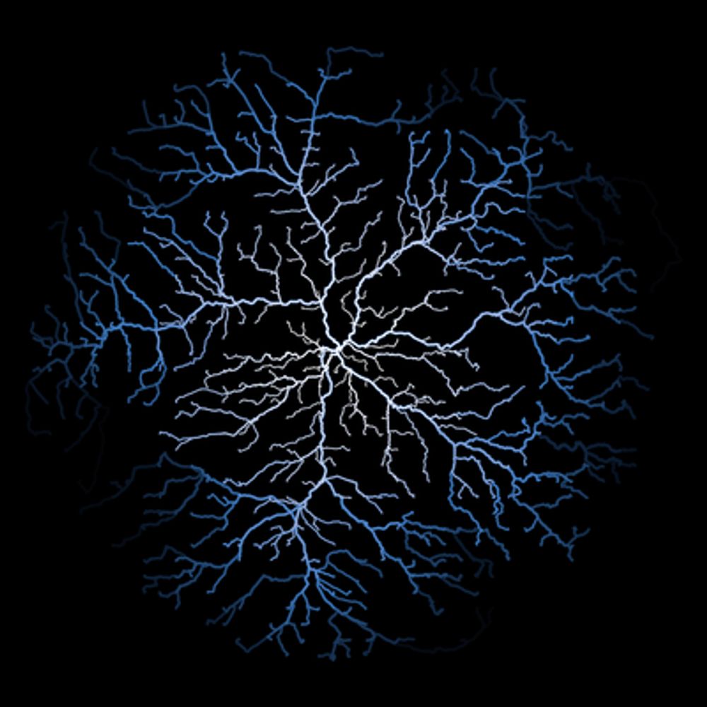
Day 03 of #30DayMapChallenge with a density choropleth and quantiles!
👏 Thanks to @Benjamin Novak's tutorial in @yan-holtz.bsky.social gallery r-graph-gallery.com/web-map-chor...
🌚 Used data from the Observatoire Statistique Tranfrontalier
#rstats #dataviz #map #ggplot2 #gis
05.11.2025 15:14 — 👍 16 🔁 4 💬 1 📌 0
Original post on hachyderm.io
📣 Save the date!!
Next Community Call: R-multiverse: a new way to publish R packages with @landau
📆 Monday, 29 September 2025 14:00 UTC
Information + find your local time + How to join: https://ropensci.org/commcalls/r-multiverse/
🙏 Please share this event with anyone who may be interested in […]
01.09.2025 15:31 — 👍 2 🔁 3 💬 0 📌 0
@mackaszechno.bsky.social {mapsf} can do points, lines and polygons.
05.07.2025 09:59 — 👍 1 🔁 1 💬 0 📌 0

A map of rental prices in Paris region. The prices are in euros per square meters. The statistical map includes map layout element such as north arrow, credits and scale bar.

cheat sheet of the mapsf package
The first major version of {mapsf} has arrived on CRAN!
mapsf is a thematic mapping R package. Its goal is to be simple and lightweight while offering all the necessary features to create beautiful statistical maps.
This release includes a revamped theming […]
[Original post on fosstodon.org]
04.07.2025 09:25 — 👍 5 🔁 5 💬 0 📌 0

A map of Berlin. The map use OpenStreetMap data. The map shows the roads between 3 points using a car, a bicycle or walking.
New package on CRAN: {valh}, an interface between R and the Valhalla API
Valhalla is a routing service based on OpenStreetMap data.
https://valhalla.github.io/valhalla
Co-authored by @mthv
#GISChat #RSpatial #RStats #OpenStreetMap
14.04.2025 13:08 — 👍 17 🔁 8 💬 1 📌 0

A map of Castries in Saint Lucia. The map is in a circle, we can see roads, buildings, water bodies and green areas. The map is colorful.

A map of Castries in Saint Lucia. The map is in a circle, we can see roads, buildings, water bodies and green areas. The map is in black and white colors.
Introducing {maposm}, an R package that extracts, modifies and merges sets of layers from OpenStreetMap for cartographic purposes.
On github: https://github.com/riatelab/maposm
The package is not on CRAN, but it is on r-universe: https://riatelab.r-universe.dev/maposm
#RStats #rspatial #GISChat
20.03.2025 16:40 — 👍 39 🔁 15 💬 1 📌 0

A map of Bielefeld. It uses regular map tiles.

A map of Bielefeld. It uses high resolution map tiles.
A new version of {maptiles} has been released on CRAN. :rstats: 📦
You can now access the high-resolution (or retina) tiles distributed by some providers.
{maptiles} is a package for downloading and composing raster tiles with R.
https://github.com/riatelab/maptiles
#GISChat #RStats #rspatial
07.02.2025 09:56 — 👍 11 🔁 6 💬 1 📌 0

A World Map of commercial trade. Madagascar is missing, New Zealand is not.
Hmm, there's something missing on this map... And no, it's not New Zealand :-)
#GIS #GISChat
22.01.2025 19:23 — 👍 2 🔁 1 💬 2 📌 0