Have always loved this composition for part of Africa for all the diversity it covers, from the coast of Senegal, to Timbuktu, to Egypt and Ethiopia. It's a dizzying cross section of lands, languages and cultures.
#maps #Africa #map #history
@oldmapgallery.bsky.social
Following the historical journey of discovery and understanding, through maps, charts and every significant data visualization we can find.

Have always loved this composition for part of Africa for all the diversity it covers, from the coast of Senegal, to Timbuktu, to Egypt and Ethiopia. It's a dizzying cross section of lands, languages and cultures.
#maps #Africa #map #history


Space Invader hasn't just made street art, but started a dialogue and community. Making his video game and pop culture inspired tile works, he put them up around cities, and made maps to curate a tour of his works. He later made an app for phones to find and log his work.
#maps #art #map #streetart

From Stone Henge (on the left, from 1953) to Burning Man (on the right, 2008), ritual/ceremonial sites are fascinating.
Humans have a track record for meeting at specific places at specific times, and sometimes they look kinda similar
#maps #science #map #history #archaeology
Interesting project for the Real-time radiation world map.
But, what's going on in Hungary?
www.gmcmap.com
#science #map #dataviz #maps #datavisualization

also very cool...
MapSCII – World map in terminal
github.com/rastapasta/m...
#maps #datavisualization #map #dataviz
So great. We had just been talking about how much longer the hummingbirds are going to be around, and where they are going. Now we know...
explorer.audubon.org/explore/spec...
#dataviz #map #datavisualization #maps #birds

Don't sleep on the U.S.G.S.
A classic masterpiece for the Grand Canyon which is easy to get absorbed into. The complexities of the region laid out in such elegant visual simplicity.
#maps #dataviz #map #datavizualition #grandcanyon

A favorite advertising map showing the Northern Pacific Line c. 1896, with that wonderful addition of that dog pointing the way west.
#maps #railroad #history #map
One of the favorite tech charts spans from Bell Labs and Shockley up to the 1980's, from the gent that coined the term "Silicon Valley"
www.davidrumsey.com/luna/servlet...
There's a number of different tech lineage charts. I think Computer History Museum (the nice folks down in Mountain View, CA.) have done some over time too. And heavens knows there are tons of tech business lineage charts too.
02.09.2025 18:22 — 👍 0 🔁 0 💬 0 📌 0
It's all the interesting chaotic moments I could hope to learn about the New York Marathon, from the time under Mayor Koch when the start cannon wouldn't work, to when the Hasidim sprayed hot runners, or the infamous runner that caught a train and got busted.
#maps #history #newyork #nyc #map

A favorite dramatic depiction that includes the "Sea of the West", a vast inland sea that was hypothesized & grew into a recurrent feature on maps of early North America.
Dr McGuirk did the definitive study years back and made a webpage for his work...https://sea-of-the-west.info/introduction


In a quick glimpse one might think, oh, a phylogenetic tree. Where are the eukaryotes?
But this instance of arborization is about computer evolution. Reaching back to Eniac and beyond, and as recent as the 1980's. Could be the roots of AGI?
#tech #computer #dataviz #technology #history

Is it a century or three overdue? Time to update our way of thinking...
www.nytimes.com/2025/08/19/w...
Check out-
correctthemap.org

From 1862, this was a comparative chart that provides you with the best of what was known for the major rivers and mountains of the world.
Great visualization let's you wander and discover, this does the job well
#maps #dataviz #map #history #datavisualization #mountains

It was the beginning of a connected world that a century or so later would be unstoppable. And it was believed that it would open an era of communication that would end war.
The first trans-Atlantic telegraph cable.
#history #maps #tech #map


From the late 1950's a colorful push for people to consider visiting Ireland.
When you think about it there's too much to do, from great music & culture to the prehistoric sites that still hold mysteries.
(Could they use an antique map dealer w/ a love for Irish music?)
#ireland #maps #Irish #map

Growing upward.
NYC before skyscrapers.
But with the recent addition of a bridge connecting to Brooklyn, change was underway. Architectural historians relates how people first walking across the bridge were amazed to look down & see birds flying beneath them.
#architecture #maps #NYC #map #history

Latest in aviation, in 1910
But we're tempted to immediately smirk at the latest inventions... one folly after another.
Another way of thinking of these attempts. They were necessary for evolution to occur.
More attempts, more momentum to the goal
#history #aviation #science

10 orbits.
Apollo 8 would be the first time humanity went around our ancient nearest neighbor, the moon. Taking about 6 days to get there & back, a massive step for humans exploring the solar system.
Looking at the arc of human history, a significant moment.
#moon #space #map #history #maps

A classic pictorial map poking at the failures of prohibition. The Bootlegger's Map of the U.S.
#map #history #maps #alcohol

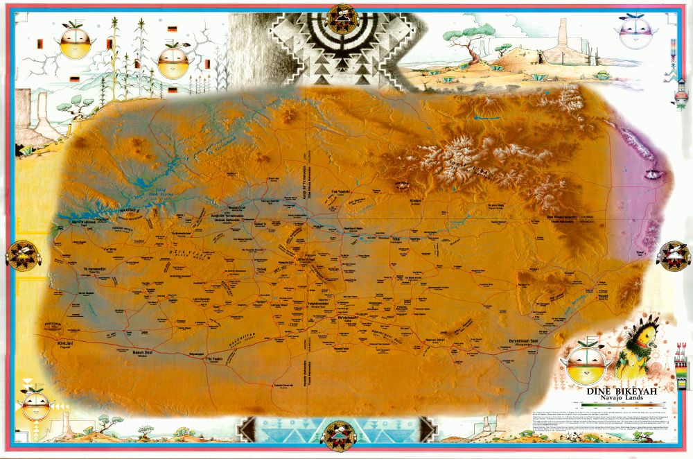
Love this Dine published map for their homeland in the Southwest where they identify and reclaim the lands identity.
#Native #maps #NativeAmerican #map #history

From 1841, a fine example of the changing West & territories. Shows intended permanent Indian lands of the plains, (wouldn't last a decade)
Also a funny data viz cheat. If you have a large "Unexplored Region" mask your ignorance, add a distance chart.
#maps #Native #map #NativeAmerican #dataviz


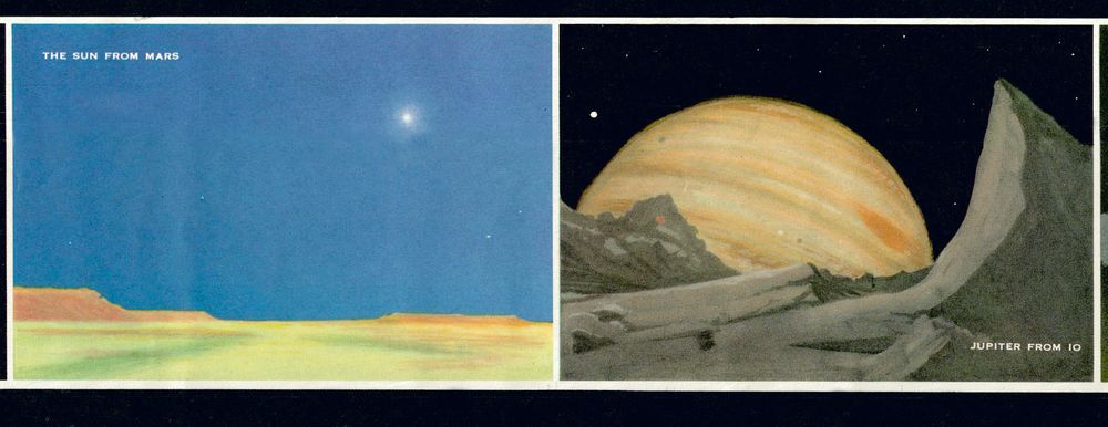
A favorite space exploration map at a time when science fiction and science fact were wonderfully and optimistically blurry...
#mars #space #maps #map

Chesley Bonestell was the artist that changed the way people thought about the future in space, even U.S. presidents.
But in his youth, he experienced and survived the San Francisco earthquake of 1906.
At age 95, here he speaks of the event...
#sanfrancisco #space
youtu.be/aooXKr8VC4c?...

The plains of Colorado had their zenith in the early 20th century, prior to the Dust Bowl. It's been declining since. But for one moment in the 1990's a few counties sought to rebrand as "Colorado's Outback", piggybacking off the Crocodile Dundee films(?).
It didn't take.
#map #Colorado #maps

Significance can get lost over time.
What was the "gunfight at ok corral"?
With a little study it comes out that it was the "Wild" lawless West being confronted by the rule of law, with officers.
Not just some romanticized cowboy thing, it was a culture clash.
#maps #law #map #dataviz #history


Love the presentation for this 1851 Tallis of West Africa, but also a clear route to Timbuctoo
#maps #africa #map

In a moment that I still can't exactly wrap my mind around, we got to talk to David Snowden. The nicest, most genuine & patient genius-of-a-person we've interacted with.
AND, he finds the topic of mapping useful in wrestling with hard topics.
#design #map #maps
www.youtube.com/watch?v=-SIT...


Can help but celebrate great work. Riddiford's map for Britain that was prolifically published by National Geographic Society. It's still accessible and abundant and a prime example of 20th century decorative cartography. (And they are CHEAP on ebay!)
#maps #unitedkingdom #britain #map #history