#Dixiealley #Tornado Season starts in 54 days. Are you prepared? #tnwx #kywx #arwx #alwx #mswx #gawx #lawx
youtu.be/9w1v0KO7N70?...
@wheelieweather.bsky.social
31 year old Disabled weather Nerd, constantly watching the skies for the next exciting thing. Skywarn Storm spotter for @NWSNashville https://weather-ready-nation.printify.me/
#Dixiealley #Tornado Season starts in 54 days. Are you prepared? #tnwx #kywx #arwx #alwx #mswx #gawx #lawx
youtu.be/9w1v0KO7N70?...


After some push from a few folks ive decided to go ahead and set up a little #merch shop. Something I haven’t necessarily looked at doing before but been asked about. Took the leap over the last couple days set it up here’s a few items on there. Feel free to check it out. Link will be in the bio #wx
23.07.2025 22:40 — 👍 0 🔁 0 💬 0 📌 0
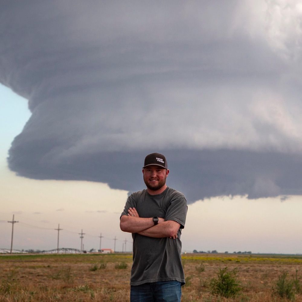
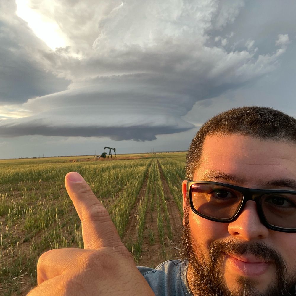
Finished a new update on Thursday’s #Severeweather risk that encompasses portions of #Minnesota #Wisconsin SW #Michigan #illinois Northern #Indiana southeast #missouri #Arkansas west #ky and NW #TN
youtu.be/9a_HvIt-wKw?...

youtube.com/shorts/5SzNa...
#tnwx #alwx #mswx #gawx #kywx #ilwx #inwx #lawx #txwx #mowx #arwx #tornadoseason

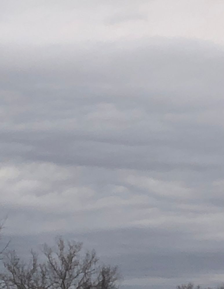
My phone absolutely nerfed these today but, #MiddleTN had a great #Asperitas cloud display this afternoon. #tnsky
08.03.2025 01:36 — 👍 0 🔁 0 💬 0 📌 0
Decided to make a late night YouTube video on a subject I felt need a bit better explanation to help some of those who don’t understand it, understand a little better. Especially with #severeweather season and #Tornadoseason looming. #SPC #Stormpredictioncenter #weathersky
youtu.be/-GJV9LqE2vg?...


We are on @bsky.app! This years contest opens on February 1st and is for all storm photographers across the globe! Read more here: mailchi.mp/2ea34dd9d6b1...
23.01.2025 00:10 — 👍 12 🔁 3 💬 0 📌 1#Snowfall around 2:15pm CST southeast of #Murfreesboro #TN. Have around 3.5” on the ground as of now with a warm nose trying to work into the area and more snow off to the west. See what final totals are later tonight/early tomorrow #tnwx #snow #winterweather #wxsky
10.01.2025 20:55 — 👍 1 🔁 0 💬 0 📌 0OHX issues Area Forecast Discussion (AFD) at Dec 7, 11:17 AM CST ...New AVIATION... via IEMbot
Additional Details Here.

Shine on you crazy diamond
07.12.2024 01:46 — 👍 113 🔁 19 💬 5 📌 0
Selma, AL F3 #Tornado – Dec 6, 1983! Occurred during early AM.13 mile track. At least 103 structures damaged/destroyed. 30-40 vehicles at a new car dealership destroyed. Numerous units at The Rangedale Housing Project demolished and 1 fatality here. www.tornadotalk.com/selma-al-f3-... #alwx
07.12.2024 01:52 — 👍 12 🔁 2 💬 0 📌 0
Double Feature Thursday with @stormcat5.bsky.social and @jordanhallwx.bsky.social at 5pmET then join Jen Watson’s Podcast Takeover with Erik Fox and Tanner Beard storm chasing the Iowa Outbreak LIVE at 9pmET/8pmCT 12/5 on YouTube.com/stormfrontfreaks
04.12.2024 04:30 — 👍 3 🔁 2 💬 0 📌 0

Taylorville, IL EF3 #Tornado – Dec 1, 2018! A regional outbreak unfolded across IL, resulting in 29 twisters in late afternoon/evening. This was the only EF3. Had a 12.73 mile path. 22 injured. 30 homes destroyed, ~500 more damaged in some capacity. tornadotalk.com/taylorville-... #ilwx
02.12.2024 01:40 — 👍 17 🔁 4 💬 0 📌 0
Already over all this snow talk and snow posts. I need a #Thunderstorm a #Mesocyclone in my life bring on #Spring already. #wxsky #Weather #Stormseason #Tornadoseason
01.12.2024 04:17 — 👍 0 🔁 0 💬 0 📌 0Happy Thanksgiving
28.11.2024 19:16 — 👍 0 🔁 0 💬 0 📌 0
A wall of water moving up the coast near Otford, NSW, Australia. This was captured at around 3.40pm this afternoon.
Licensing available via Severe Weather Australia

Rain making its way into the area as a cold front pushes through tonight. We could hear a rumble or 2 of thunder as this passes by. Nothing to worry over tho.
28.11.2024 05:15 — 👍 2 🔁 1 💬 0 📌 0
This one was fun 😅. 2016 #KentuckyLake #ParisLanding #Tennessee trying to beat an incoming Severe storm back to the boat ramp during an American Bass anglers tournament. We made it with about 3 minutes to spare before the #lightning rain and wind came though. #tnwx #wxsky
27.11.2024 21:38 — 👍 0 🔁 0 💬 0 📌 0
One of my favorite #Sunset photos I’ve taken through the years back in 2014 on #Timsfordlake in #Winchester #Tennessee after a long day of Fishing. I’ll never be convinced the water isn’t the best place for these kind’s of photos. #tnwx #wxsky
27.11.2024 21:35 — 👍 2 🔁 0 💬 0 📌 0We recently shared Bluesky’s stance on user data and AI training, which has not changed. Bluesky will not train generative AI on user data. bsky.app/profile/bsky...
27.11.2024 01:52 — 👍 11533 🔁 1392 💬 113 📌 106
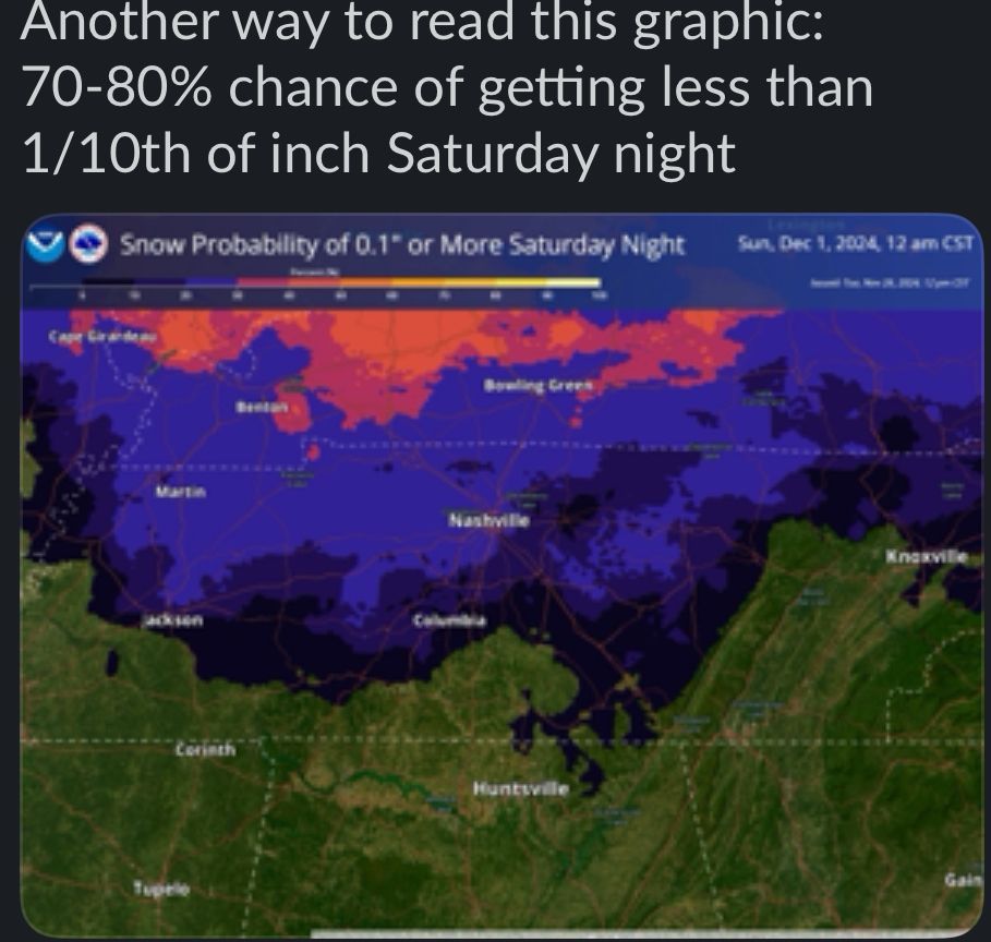
Alright everyone. The NWS has dropped the chance of the S word this weekend.
Or is the NWS says. A 70%-80% chance of getting 1/10th of an inch of snow Saturday night.
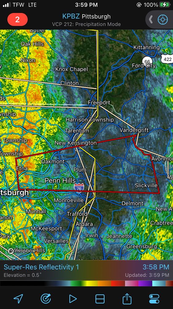
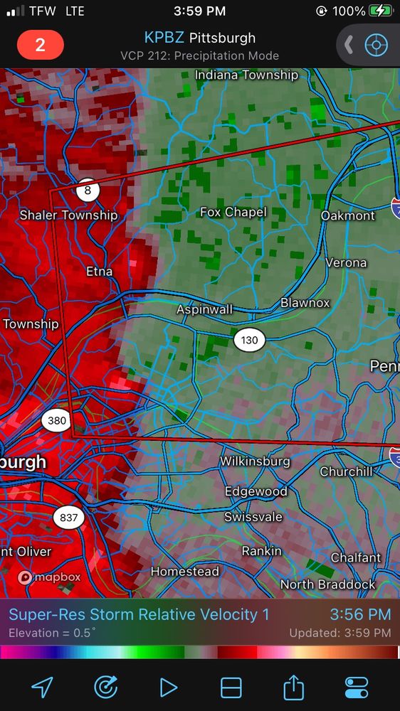
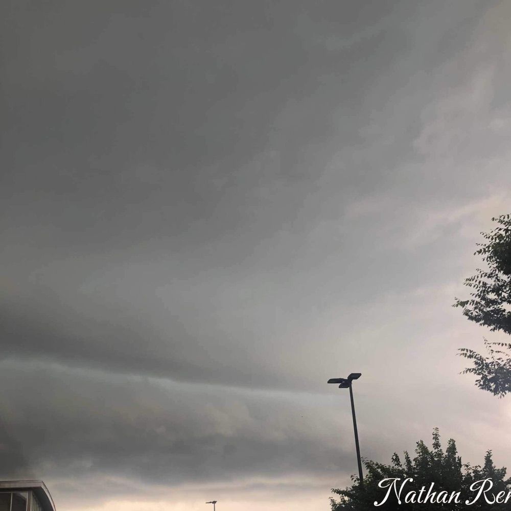
#TornadoWarning for... Allegheny County in Pennsylvania...Westmoreland County in southwestern #Pennsylvania...
Until 530 PM EST
a severe thunderstorm capable of producing a tornado was located over #Aspinwall, or near #pennhillspa, moving east at 40 mph.
Seek shelter if you’re in the path #pawx

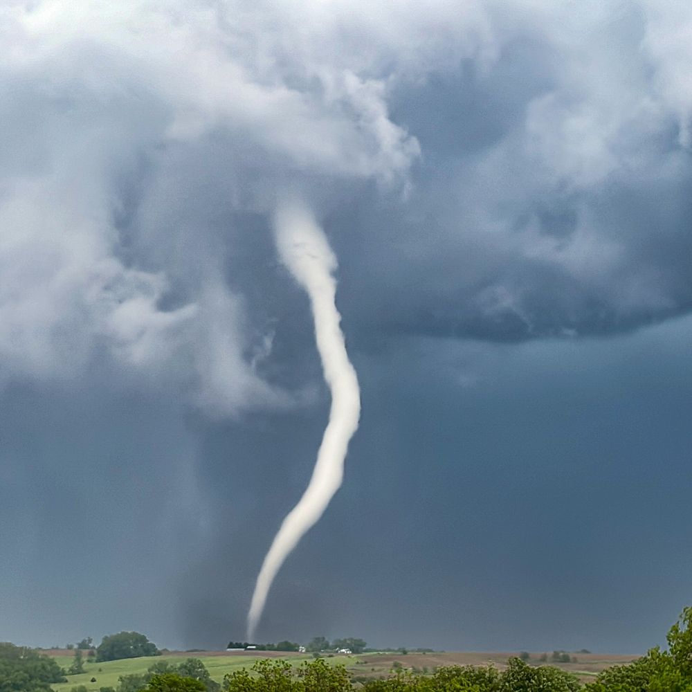
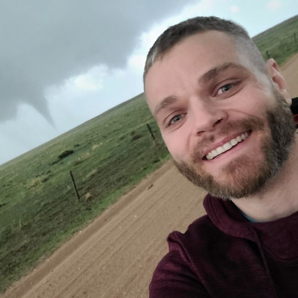
A strange little tornado near Fort Stockton, Texas on 6/2/23.
20.11.2024 17:17 — 👍 15 🔁 3 💬 0 📌 0
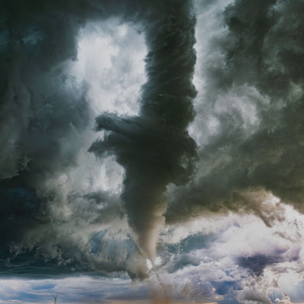
#weatherpicofday
"Night Twisters"
Various photos of nighttime tornadoes from 2003 to 2024 illuminated by lightning, power flashes, or just street lights.
My 1st tornado was after dark in October of 2000.
w/ Juston Drake, Jim Bishop, and Tom Santillo
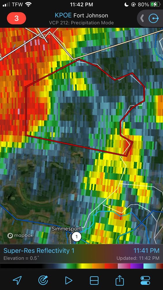

#TornadoWarning for... East central Avoyelles Parish in central #Louisiana...
Until 1215 AM CST.
At 1141 PM CST, a severe thunderstorm capable of producing a tornado was located near #Bordelonville, moving east at 30 mph.
Seek shelter if you’re in the path of this tornado warned storm #lawx


#TornadoWarning for Vernon Parish in west central #Louisiana Newton County in southeastern #Texas...
a severe thunderstorm capable of producing a tornado was located near #ToledoBendDam, moving northeast at 40 mph.
Seek shelter if you’re in the path of this tornado warned storm #lawx #txwx


#Tornadowarning for Northwest Hardin county in southeast #Texas a severe thunderstorm capable of producing a tornado was located near #Thicket, moving northeast at 35 mph.
Seek shelter if you’re in the path of this storm. #txwx #svrwx

#Tornadowatch #711 has been issued for parts of #Louisiana and #Texas until 8 PM CST
A couple tornadoes are possible
Isolated hail up to 1/2” in diameter is possible
Scattered damaging wind gusts up to 65MPH are also possible with these storms
#Deridder #Beaumont #Jasper #alexandria #txwx #lawx