🚀 The leafmap Python package just got a major usability boost — introducing the floating sidebar panel! 🎉
This new feature lets you:
✅ Effortlessly control layer visibility and style
✅ Add custom ipywidgets for interactive geospatial apps
👉 Try it out on Colab:
github.com/opengeos/lea...
08.10.2025 14:54 — 👍 6 🔁 0 💬 0 📌 0

Unlock the power of instance segmentation for buildings using the open-source GeoAI Python package! 🏗️ In this hands-on tutorial, you'll learn how to train, run, and evaluate a deep learning model that can accurately detect and separate individual buildings
www.youtube.com/@giswqs/videos
08.10.2025 13:32 — 👍 9 🔁 0 💬 0 📌 0

Need satellite training data fast? 🛰️ In this step-by-step tutorial, learn how to prepare geospatial training data for deep learning in seconds using the free open-source GeoAI Python package.
Video available on YouTube: www.youtube.com/@giswqs/videos
06.10.2025 13:41 — 👍 7 🔁 0 💬 0 📌 0
🚀 Here’s a sneak peek at instance segmentation on aerial imagery powered by the GeoAI Python package. 🌍✨
👉 Stay tuned for the full update coming next week!
🔗 GitHub: github.com/opengeos/geoai
03.10.2025 20:58 — 👍 13 🔁 0 💬 0 📌 0

GeoAI Made Easy: Learn the Python Package Step-by-Step (Beginner Friendly)
🧠 No deep learning background needed — just follow along and you'll be detecting objects in no time!
Video available on YouTube: www.youtube.com/@giswqs/videos
03.10.2025 12:53 — 👍 7 🔁 0 💬 0 📌 0
🚀 Exciting news! The GeoAI Python package just got a major upgrade. It now supports interactive geospatial data visualization powered by AI Agents. 🌍✨
GitHub: github.com/opengeos/geoai
Full tutorial: youtube.com/@giswqs
#geospatial #mapping #python #GeoAI #AI
01.10.2025 13:12 — 👍 6 🔁 0 💬 0 📌 0

🚀 The OBS Zoom-to-Mouse Bug on Linux… FINALLY Solved! 🎉
👉 Watch the full breakdown and solution here: youtu.be/relTN31l0Zo
Hopefully this helps fellow OBS users and educators who’ve been struggling with the same problem.
#OBSStudio #Linux #OpenSource
29.09.2025 14:05 — 👍 5 🔁 1 💬 0 📌 0

🚀 Thrilled to share that my Introduction to GIS Programming book is once again the #1 best-seller in the GIS & Remote Sensing category on Amazon! 📚
📖 Amazon: www.amazon.com/Introduction...
🌐 Book website: gispro.gishub.org
#GIS #Geospatial #Python #OpenSource #RemoteSensing
20.09.2025 02:47 — 👍 24 🔁 1 💬 0 📌 0
🚀 Exciting update! The GeoAI Python package is getting even smarter — soon it will support AI agents.
That means you’ll be able to use natural language to effortlessly download, analyze, and visualize geospatial data 🌍🤖
Stay tuned for the upcoming release!
🔗 GitHub: github.com/opengeos/geoai
14.09.2025 14:11 — 👍 17 🔁 1 💬 3 📌 0
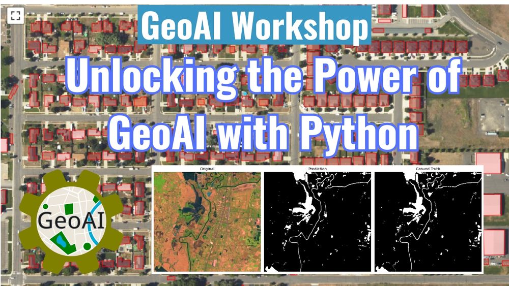
🚀 The recording of the 2-hour GeoAI Workshop is now available! 🎥✨
📺 Video: youtu.be/jdK-cleFUkc
💻 GitHub: github.com/opengeos/geoai
📓 Notebook: opengeoai.org/workshops/TN...
#geospatial #geoai #ai #satellite #python
12.09.2025 17:50 — 👍 10 🔁 1 💬 0 📌 0

I just presented at the Fifth NASA OPERA Stakeholder Engagement Workshop this week. 🌍
You can view my slides here: tinyurl.com/OPERA-Leafmap
Learn more about the workshop: www.jpl.nasa.gov/go/opera/ope...
#leafmap #geospatial #nasa #opera
11.09.2025 19:26 — 👍 12 🔁 0 💬 0 📌 0

Great to see Leafmap being used at the Fifth NASA OPERA Stakeholder Engagement Workshop 🚀
Notebook examples: github.com/OPERA-Cal-Va...
Workshop page: www.jpl.nasa.gov/go/opera/ope...
#geospatial #remotesensing #python
11.09.2025 19:18 — 👍 9 🔁 0 💬 0 📌 0
🌍 Interactive Search & Visualization of NASA OPERA Datasets with Leafmap 🚀
Notebook example: leafmap.org/maplibre/nas...
To learn more about NASA OPEAR, visit www.jpl.nasa.gov/go/opera
#NASA #OPERA #geospatial #remotesensing #leafmap
11.09.2025 15:31 — 👍 8 🔁 1 💬 0 📌 0
YouTube video by Matt Forrest
From Leafmap to GeoAI: Open Source, Education, and What’s Next with Dr. Qiusheng Wu
🎙️ My conversation with Matt Forrest is now live on the Spatial Stack podcast!
A huge thanks to Matt for the invitation and for leading such a thoughtful discussion. 🚀
📺 Watch the episode here:
youtu.be/z9G5bd8ESus?...
#geospatial #python #sql #opensource #satellite
10.09.2025 21:42 — 👍 14 🔁 1 💬 0 📌 0

🚀 Sneak peek: a powerful new capability is coming to the GeoAI Python package: finding similar features in remote sensing imagery with DINOv3.
GitHub: github.com/opengeos/geoai
#geospatial #dinov3
09.09.2025 16:24 — 👍 12 🔁 0 💬 0 📌 0
🚀 MapLibre Tutorial 23: Visualizing Flight Routes with ArcLayer 🌍
🔗 Tutorial video: youtu.be/F92_cjf7p_s
📓 Notebook example: leafmap.org/maplibre/arc...
🎥 Full playlist: www.youtube.com/playlist?lis...
#geospatial #dataviz #leafmap #mapliber #python
05.09.2025 13:24 — 👍 10 🔁 2 💬 0 📌 0
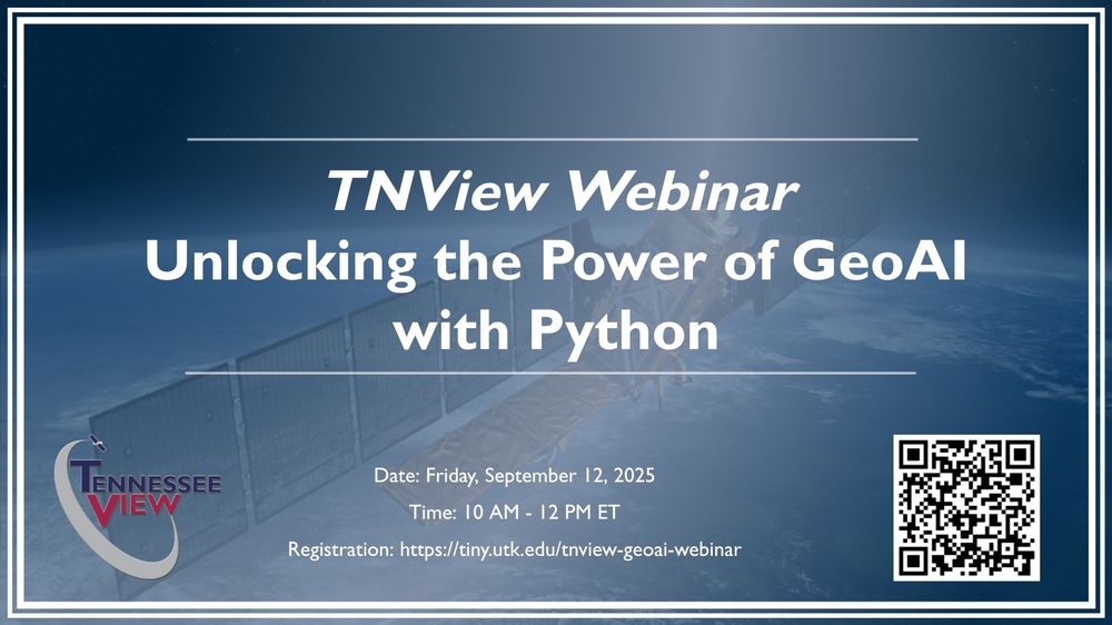
🚨 Webinar Alert 🚨
Unlocking the Power of GeoAI with Python
You are invited to join us for an interactive TNView (tnview.utk.edu) webinar introducing the GeoAI Python package (opengeoai.org)
Registration: tiny.utk.edu/tnview-geoai...
04.09.2025 15:07 — 👍 6 🔁 0 💬 0 📌 0
🚨 New Tutorial Alert 🚨
Visualizing Mapillary Street-level Images with Leafmap and MapLibre 🌍
🔗 Tutorial video: youtu.be/UHjUoQSdUxg
📓 Notebook example: leafmap.org/maplibre/map...
🎥 Full playlist: www.youtube.com/playlist?lis...
#geospatial #leafmap #maplibre #dataviz
03.09.2025 13:03 — 👍 9 🔁 0 💬 0 📌 0
🚨 New Tutorial Alert 🚨
Rendering Google Earth Engine & Cloud-Optimized GeoTIFF Tiles in 3D with Google Earth
🔗 Notebook: leafmap.org/maplibre/goo...
▶️ Video: youtu.be/UqY9Ojrgg6s
#geospatial #googleearth #dataviz #earthengine
31.08.2025 14:27 — 👍 26 🔁 6 💬 2 📌 0
🚀 New Tutorial Alert!
I just published a step-by-step guide on building an interactive dashboard with Python and Leafmap. 🌍📊
Explore the Jupyter Notebook: leafmap.org/maplibre/das...
Watch the full video tutorial: youtu.be/DEPdsJdTQN8
#leafmap #geospatial #python #dataviz
27.08.2025 00:22 — 👍 34 🔁 3 💬 0 📌 0
🚀 New Feature in Leafmap – Interactive Time-Series Visualization! 🌍🛰️
Leafmap now supports time sliders for visualizing large collections of remote sensing images.
Try it out
Web App: huggingface.co/spaces/giswq...
Notebook: leafmap.org/maplibre/tim...
#geospatial #leafmap #opensource #mapping
10.08.2025 20:08 — 👍 22 🔁 7 💬 0 📌 0
We hope to see you at our AGU session "Open Source Geospatial Workflows in the Cloud"!
**Abstracts due Wednesday, July 30th**. Check out our session landing page for details and to submit:
events.geojupyter.org/conferences/...
21.07.2025 17:47 — 👍 8 🔁 4 💬 1 📌 0
🚀 Visualizing Planet’s Tanager Hyperspectral Data in 3D! 🌍🛰️
Create an interactive image cube to explore the internal structure of all 426 spectral bands captured by Planet’s Tanager mission
📓 Notebook example: hypercoast.org/examples/tan...
💻 GitHub: github.com/opengeos/Hyp...
21.07.2025 03:20 — 👍 24 🔁 7 💬 0 📌 0
🚀 Accessing and Visualizing Planet’s Tanager Hyperspectral Data 🌍🛰️
🎥 Tutorial video: youtu.be/oQ1vauiHvuk
📓 Notebook example: hypercoast.org/examples/tan...
💻 GitHub repo: github.com/opengeos/Hyp...
📚 Documentation: hypercoast.org
#Tanager #Hyperspectral #Geospatial #OpenData #DataScience #Python
20.07.2025 14:40 — 👍 15 🔁 1 💬 0 📌 0
🚀 Sneak Peek: Interactive Visualization of the Planet Tanager Hyperspectral Data (www.planet.com/data/stac/br...) Using the HyperCoast Python package
Stay tuned for notebook examples and video tutorials.
GitHub: github.com/opengeos/Hyp...
#geospatial #Tanager #Python #DataScience
20.07.2025 02:13 — 👍 12 🔁 1 💬 0 📌 0
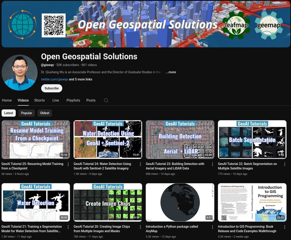
🌟 My YouTube channel just reached a major milestone:
📌 50,000 subscribers
🎬 860 videos published
📊 2.4 million total views
⏱️ 125,000+ watch hours
Subscribe for updates on open source geospatial and GeoAI:
🔗 youtube.com/@giswqs
#Geospatial #OpenSource #GeoAI #Python
19.07.2025 17:25 — 👍 12 🔁 2 💬 0 📌 0
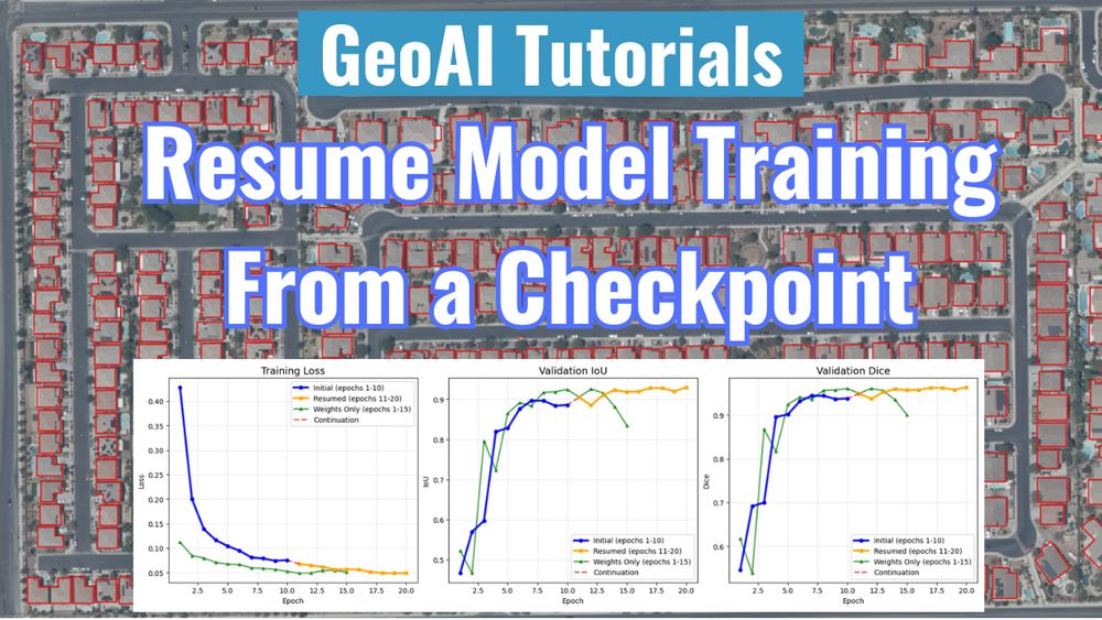
🚀 GeoAI Tutorial 25: Resuming Model Training from a Checkpoint 🏙️🛰️
🔗 Tutorial video: youtu.be/IoNaQ6swwdk
📓 Notebook example: opengeoai.org/examples/loa...
💻 GitHub repo: github.com/opengeos/geoai
📚 Documentation: opengeoai.org
🎥 Full playlist: tinyurl.com/GeoAI-Tutori...
19.07.2025 17:13 — 👍 8 🔁 0 💬 0 📌 0

AGU 2025 - GeoJupyter Events
An index of GeoJupyter events
Submit here: events.geojupyter.org/conferences/...
Invited speakers: Fernando Pérez, Tasha Snow
Session convener: Max Jones, Dr. Chelle Gentemann, Tyler Erickson, Wilson Sauthoff, Qiusheng Wu
Organizer: Matt Fisher
#geospatial #opensource #jupyter #AGU25
18.07.2025 13:36 — 👍 9 🔁 2 💬 0 📌 0
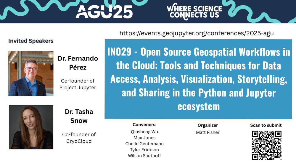
📣 Call for Submissions: AGU Session on "Open Source Geospatial Workflows in the Cloud" 🌍
We invite you to submit your work to our exciting AGU session focused on the innovative use of open-source geospatial workflows in cloud environments.
18.07.2025 13:36 — 👍 9 🔁 5 💬 1 📌 1
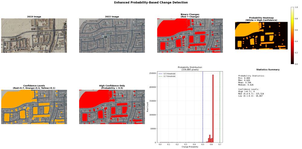
🚀 Automated change detection is coming to the GeoAI Python package. Stay tuned for demos, tutorials, and release updates!
GitHub: github.com/opengeos/geoai
Documentation: opengeoai.org
#GeoAI #Python #Geospatial #DeepLearning #OpenSource
15.07.2025 15:37 — 👍 13 🔁 2 💬 0 📌 0
☀️ Executive Director for @ucbids.bsky.social
💽 Previously: Director for #OpenSource Tools, Practices and Systems at The Alan Turing Institute
🌱 Founder @turingway.bsky.social
🌎 #Inclusive #Communities
💕 Solo mum by choice
I'm here for causality, data science, gardening, and food 🥑 topics :)
MassGIS / EOTSS / Commonwealth of MA
Maps and data for Massachusetts
ESRI, GeoServer, QGIS, Postgres, FOSS4G, open source
PhD candidate at The University of Hong Kong |personal website: hedsh3.com
🤖 The Ai Whisperer
⚛️ Creator of Frequency Wave Theory
📝 http://drewponder.substack.com
📡 #FrequencyWaveTheory
Geospatial, Environmental, Science, NFFC, Cycling, London, Sheffield, Nottingham, R, Python, Postgres, Git, Anti-Tory, Rapha, Finisterre, Green Day, Rage, Snow Patrol.
Boise State University researcher interested in remote sensing, hydrology, and machine learning.
Associate Professor@CAS, permafrost, frozen ground, cryosphere, climate change, sustainable development; 🌏 🌡️🛰️❄️🏀🏓⚽️views on my own. https://scholar.google.com/citations?user=OSX15AkAAAAJ&hl
#Geographer | Postdoc Researcher at the ENGAGE group, @univie.ac.at
PhD in #RemoteSensing from INPE (she/her/ela)
#NaturalHazards #landslide #flood #geomorphology #climatechange
PhD student, Flâneur, Photographer and robust skeptisist. All about inequality, culture and territorio/space/place/networks. Tweeting in English, Español and Français
Economic historian @UoGuelph w broad social science & historical interests: population health, First Nations demography, mobility, inequality & lives of the incarcerated 🇨🇦🇦🇺🇳🇿🏴
Editing Asia-Pacific Econ History Rev & directing https://thecanadianpeoples.com.
Earth intelligence, Living with wildlife
Systems researcher 1980-2020 retired
IFTF. org, Intel, Netscape, Apple, Atari
https://www.iftf.org/people/mike-liebhold/
#MachineLearning editor at @iopp-mlresearch.bsky.social (@ioppublishing.bsky.social). Theoretical chemist. LEGO fan. #DFT #compchem #chemistry #DogsofCompChem #Quantum
Proud member of #ChemSky
Personal+work account (all views my own)
📍Buffalo, NY
(He/Him)
I am a GIS Specialist, working from Happy Valley-Goose Bay. I love maps, cartography and cool data visualisations.
Currently finishing a PhD with MUNL on the historic landscape of the Exploits River Valley.
Wildlife ecologist & PhD student @wild-ecol-cons.bsky.social researching wolf recolonisation effects on red deer using telemetry data 🐺 🦌 🌲
Communications coordinator for the European Young Rewilders 🦫
Born at 360.67 ppm 🌍
🦋Migrated from X (@hannah__pepe)
Assistant Professor, University of Illinois Springfield
Ecohydrology, water resource management, urban heat and microclimates, remote sensing, STEM education, and JEDI
https://kyleblount.weebly.com/
https://www.uis.edu/directory/kyle-blount
Associate Professor @USC • Nonresident Senior Fellow @Brookings • Urban Networks • Geospatial Data Science
Web: https://geoffboeing.com/
LinkedIn: https://linkedin.com/in/gboeing/
Corpus Linguist, Discourse Analyst, Victorianist, Climate Science & Climate Discourse, Host of the Life & Language podcast
https://michaelamahlberg.com/


