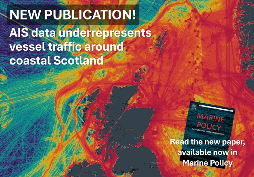
A map of Scotland and the North Atlantic, showing density of vessel tracking data (also known as AIS data), which highlights areas in red where there are a lot of AIS vessels and blue where there are less. The map shows coastal Scottish waters are very busy (i.e. coloured red) with AIS traffic.
⚓ NEW PUBLICATION! Thrilled that the first paper of the Scottish Vessel Project is now published in Marine Policy showing how AIS data only represents ~40% of coastal vessel traffic around Scotland.
🚤 Why is this important? Read below: 👇⛴
🔗 doi.org/10.1016/j.ma...
16.04.2025 07:11 — 👍 20 🔁 8 💬 0 📌 0

I'm excited to be participating in a side event panel on 'Research Data & Science Cooperation for #MarineMammal Conservation Beyond Borders' at @arcticfrontiers.bsky.social next week! I'll be speaking about @bioprotectproject.bsky.social and data driven solutions for marine conservation.
🧪🐋🌊👩💻🐟🛰️❄️
21.01.2025 11:00 — 👍 41 🔁 7 💬 0 📌 0
It would be great to be added many thanks in advance!
06.12.2024 16:05 — 👍 1 🔁 0 💬 0 📌 0

Mapping Arctic Marine Mammals: understanding the distribution of species in a rapidly changing north
New #IAPETUS UK #PhD opportunity! Mapping Arctic marine mammal distributions ❄️🐳 🐋🦭❄️ with ship & satellite surveys, investigating their interactions with vessels
Led by @heriotwattuni.bsky.social w @uniofstandrews.bsky.social, @bas.ac.uk and Hurtigruten Expeditions 🚢 ❄️ tinyurl.com/mt6vuakx. 👇👇
20.11.2024 10:07 — 👍 28 🔁 13 💬 1 📌 3
Hi Emma can you add me please and thanks for creating!
21.11.2024 19:16 — 👍 0 🔁 0 💬 1 📌 0


