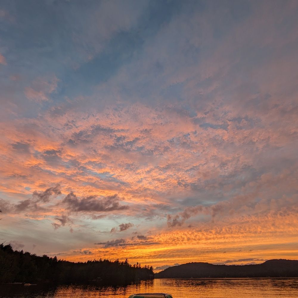
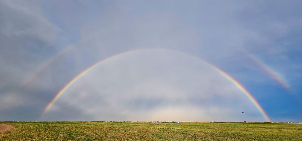
After the storm! Photo #1: post sunset Friday (July 11th), a short bike ride to open space near our home in Broomfield, CO. Photo #2: Rainbow(s) viewed July 6th from CO-52 east of Wiggins. #cowx #wx
12.07.2025 08:11 — 👍 2 🔁 0 💬 0 📌 0
@skyearthwind.bsky.social
After the storm! Photo #1: post sunset Friday (July 11th), a short bike ride to open space near our home in Broomfield, CO. Photo #2: Rainbow(s) viewed July 6th from CO-52 east of Wiggins. #cowx #wx
12.07.2025 08:11 — 👍 2 🔁 0 💬 0 📌 0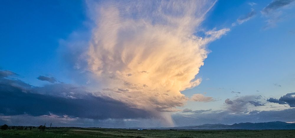
Thursday view (three minutes before sunset) looking southwest from open space adjacent to Anthem Ranch in Broomfield, Colorado. Dying weak convection! Radar showed the narrow rain shaft just right of center was near Golden.
27.06.2025 11:36 — 👍 1 🔁 0 💬 0 📌 0 15.06.2025 10:58 — 👍 1 🔁 0 💬 0 📌 0

This less than five minute military celebration (recipient at 4:53) easily trumped Trump's:
15.06.2025 08:54 — 👍 0 🔁 0 💬 0 📌 0Spot on from Canada!
15.06.2025 08:43 — 👍 0 🔁 0 💬 0 📌 0Honestly I still can’t stop laughing 😂😅🤣
15.06.2025 06:00 — 👍 38041 🔁 12263 💬 2065 📌 1881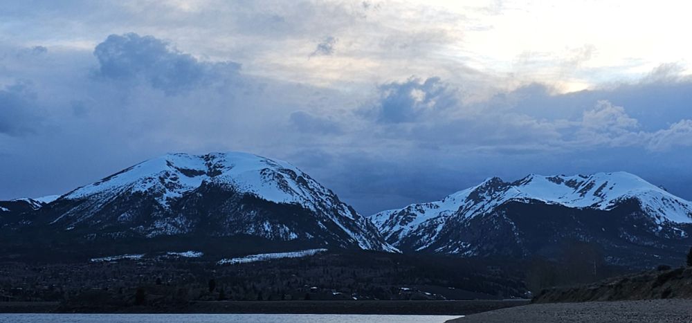
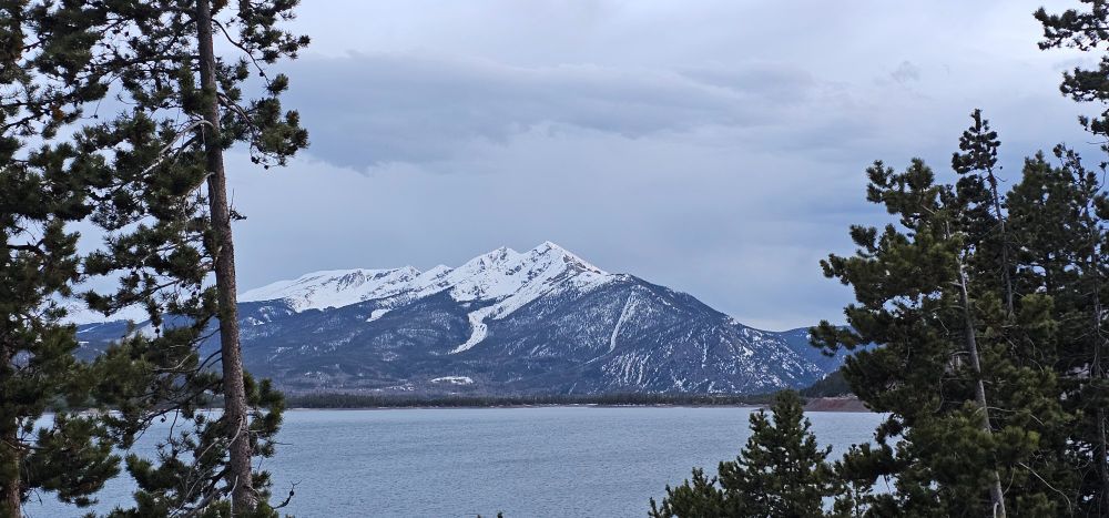
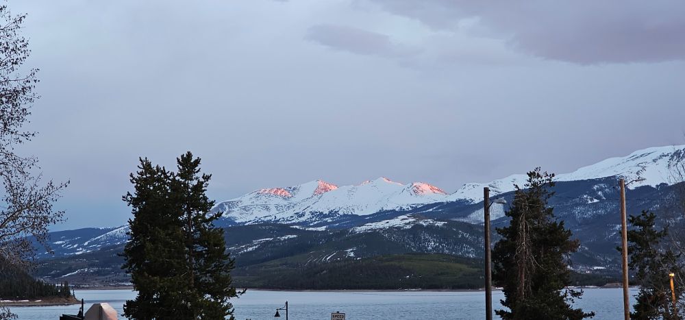
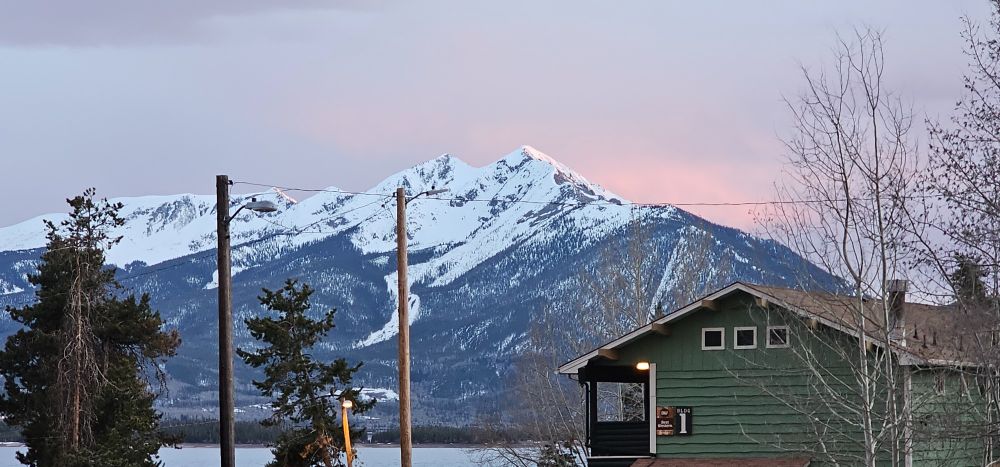
Saturday evening pre-sunset photos from Dillon, CO; looking across Dillon Reservoir. Last two photos three minutes before sunset; reflected sunlight on parts of the Tenmile Range. #co #sunset
04.05.2025 06:22 — 👍 0 🔁 0 💬 0 📌 0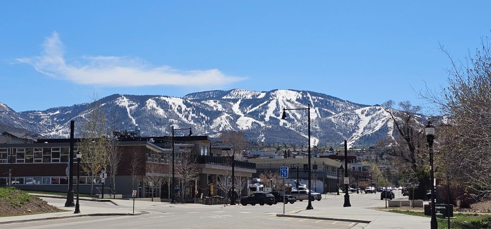
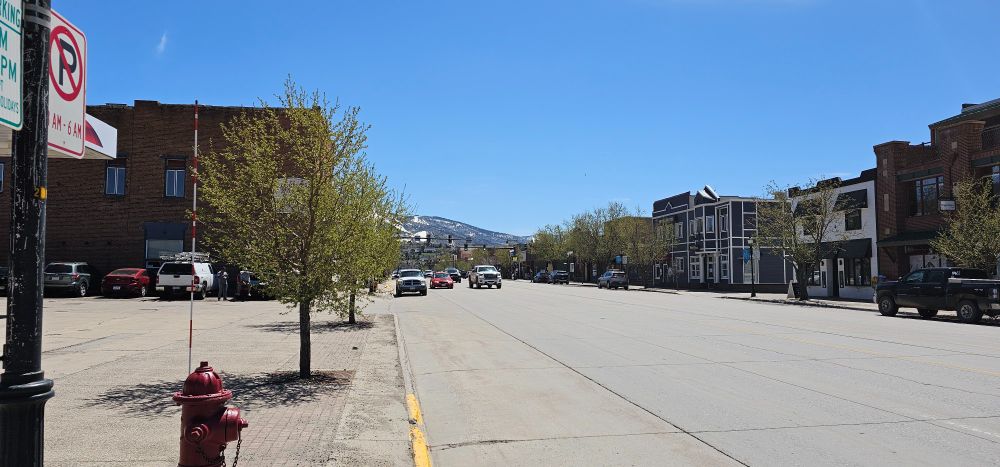
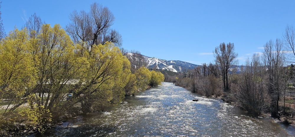
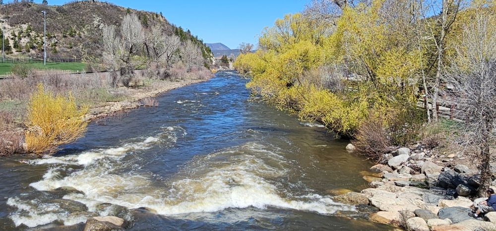
Beautiful mud season Saturday in Steamboat Springs, CO; afternoon temperatures were in the high 60s! Downtown had no crowds of people; traffic was very light, parking easy to find. And it was nice to enjoy the views and sounds of the Yampa River, full of melted snow. #CO
04.05.2025 04:18 — 👍 0 🔁 0 💬 0 📌 0
May 1, 12:09 a.m. MDT, looking east from Dillon, CO, after a spring snowfall. Cellphone vs. human eye. The horizontal cloud band/newly snowcovered mountains were invisible to the naked eye, as was most of the detail(s) in the foreground. [Best viewed landscape, full-screen.] #cowx, #wx
01.05.2025 07:32 — 👍 3 🔁 0 💬 0 📌 0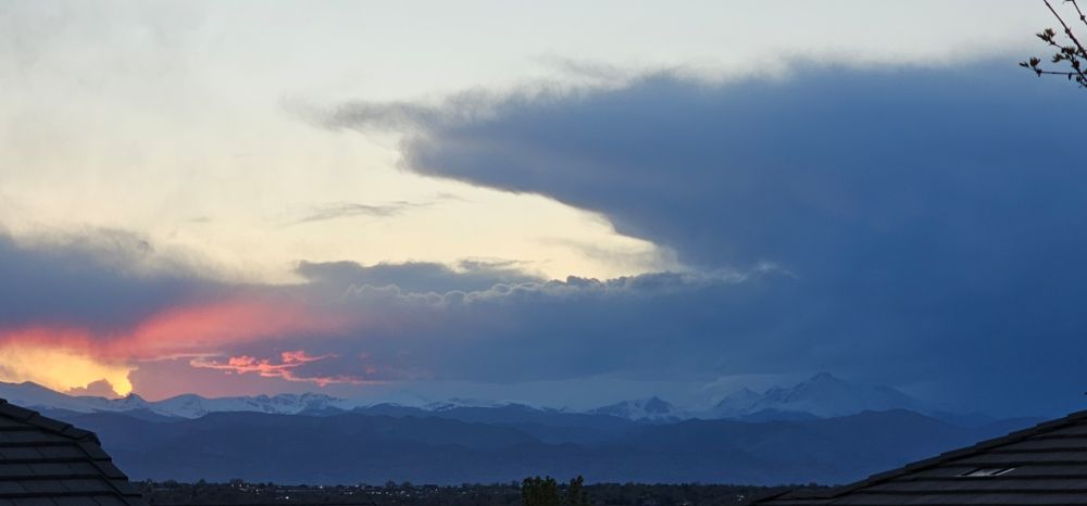
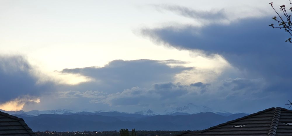
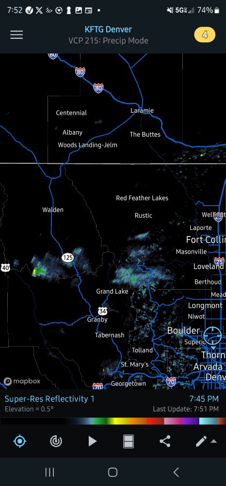
Photos at 7:49 p.m and 7:58 p.m.; radar at 7:45 p.m. Our photo locations are apparently pretty close. Mine is in Broomfield ~1.66-mi SSE of the weather instruments at KEIK.
22.04.2025 08:11 — 👍 1 🔁 0 💬 1 📌 0
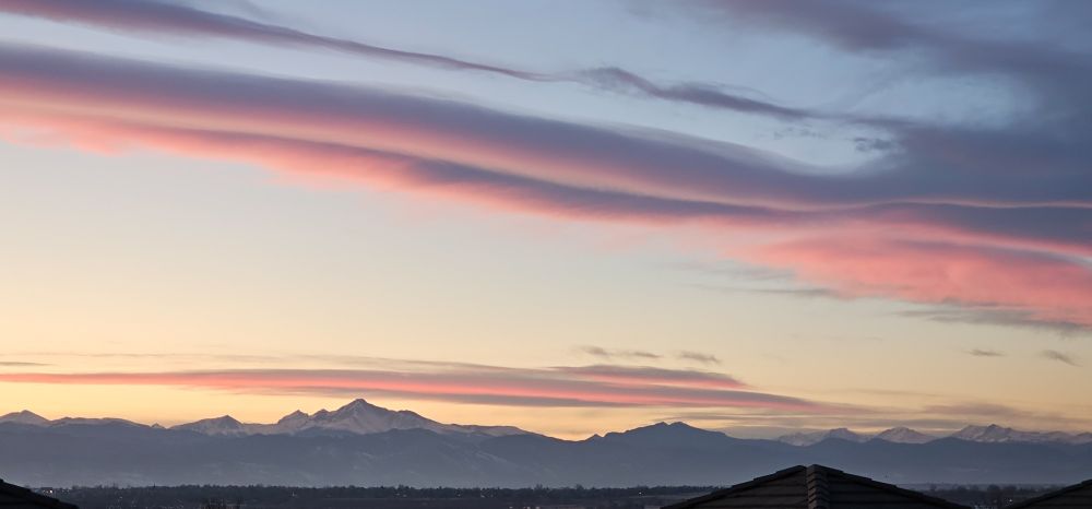
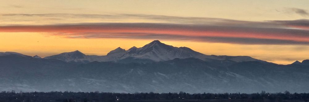
Sunset (7:18 p.m.) photo. Mount Meeker/Longs Peak center-left.
If you look closely (or zoom in), you can see a sun-illuminated contrail above and to the left of Mount Meeker/Longs Peak (center-right of photo). Photo taken at 7:20 p.m.
Zoom in photo taken a few seconds after previous photo. The contrail is from United Airlines flight 1609 on its way to San Francisco (from Newark, NJ). More information accompanies the following screen grab.
![Flight path/position of the jet responsible for the contrail is indicated by the purple solid/dashed line. The jet was 37,975' above sea level; its ground speed was 511 mph. It's position was over the Rabbit Ears Range south of Walden and north of Kremmling. [Screen grab from Flightradar24 app.]](https://cdn.bsky.app/img/feed_thumbnail/plain/did:plc:r762ivf6gcojsovlvbznk2eq/bafkreifkzdalk3jleowdq2y6ouoftxnnww4bsyyuidbkjbgnut3gvm4n4q@jpeg)
Flight path/position of the jet responsible for the contrail is indicated by the purple solid/dashed line. The jet was 37,975' above sea level; its ground speed was 511 mph. It's position was over the Rabbit Ears Range south of Walden and north of Kremmling. [Screen grab from Flightradar24 app.]
Another nice Broomfield, CO, sunset/post-sunset; many contrails visible! Photos are annotated. [Photos best viewed full-screen, landscape.]
26.03.2025 05:45 — 👍 0 🔁 0 💬 0 📌 0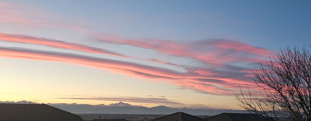
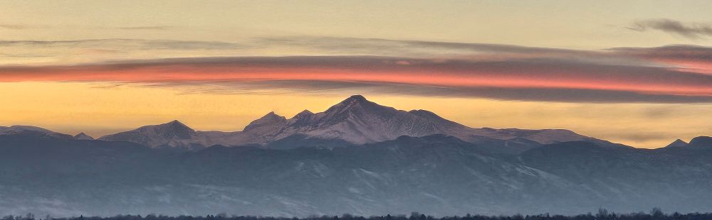
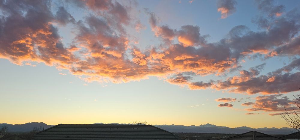
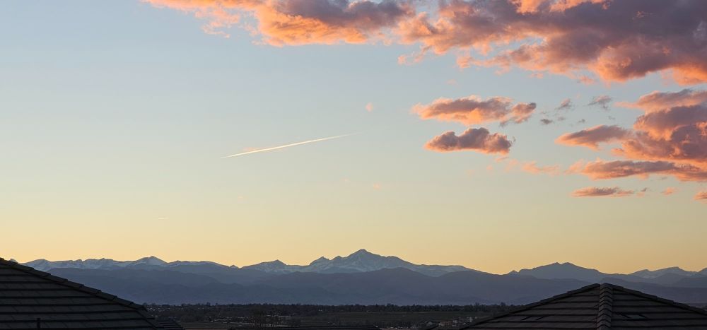
Saturday's (2/22/25) Broomfield, CO, post-sunset by 13, 15, 16, and 17 minutes. [Best viewed full-screen landscape.]
23.02.2025 04:05 — 👍 1 🔁 0 💬 0 📌 0Sharing hauntingly beautiful video taken during last Tuesday's (1/21/2025) snowstorm in Louisiana's Atchafalaya Basin:
bsky.app/profile/erin...