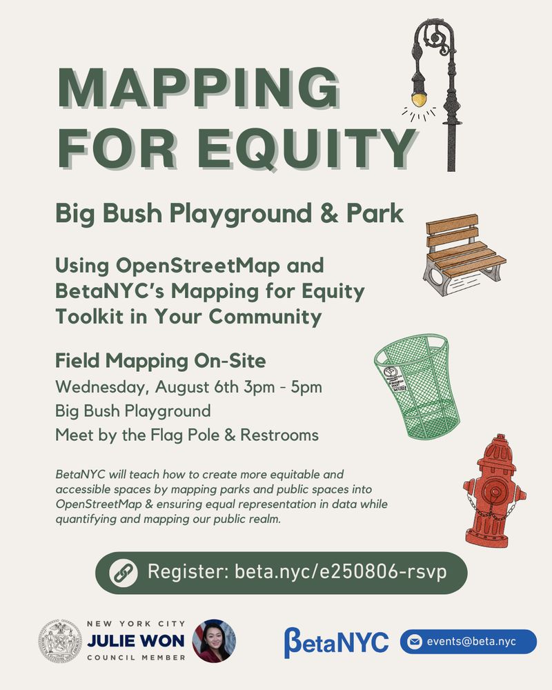
Flyer titled “Mapping for Equity – Big Bush Playground & Park,” promoting a community event using OpenStreetMap and BetaNYC’s Mapping for Equity Toolkit. The field mapping session will take place on Wednesday, August 6th, from 3 PM to 5PM at Big Bush Playground, with attendees meeting by the Flag Pole & Restrooms. The flyer includes illustrations of a lamppost, park bench, trash can, and fire hydrant. At the bottom are logos for BetaNYC, New York City Council, and Council Member Julie Won, District 26. A registration link is provided: beta.nyc/e250806-rsvp.
Come map with us and the Office of Council Member Julie Won at Big Bush Playground! 🗺️🌳
We’ll be using OpenStreetMap to document your neighborhood's public spaces and help quantify the public realm.
📅 Wednesday, August 6
📍 Big Bush Playground, Queens
🔗 RSVP: beta.nyc/e250806-rsvp
29.07.2025 21:09 — 👍 3 🔁 2 💬 0 📌 1
The deadline for the questionnaire has been extended till 7/7 - go check it out if you haven't already, and help inform the path towards equitably expanding tree canopy to 30% of NYC!
#nycurbanforest #nycurbanforestplan #nyctrees
02.07.2025 16:14 — 👍 0 🔁 0 💬 0 📌 0
Have a say in New York City's first Urban Forest Plan!
#NYC: TODAY (June 30) is the LAST DAY to fill out a questionnaire to inform development of the *first ever* NYC Urban Forest Plan!
Direct link: inform.urbanforestplan.nyc Scroll to the bottom and click "Next" to get started! Should take ~10 min or less!
#nycurbanforest #nycurbanforestplan
30.06.2025 15:51 — 👍 0 🔁 0 💬 0 📌 1
Geez... I thought that was bad and then saw the other photo in the reddit thread. What a crazy and sad scene 😔
19.04.2025 01:55 — 👍 1 🔁 0 💬 0 📌 0
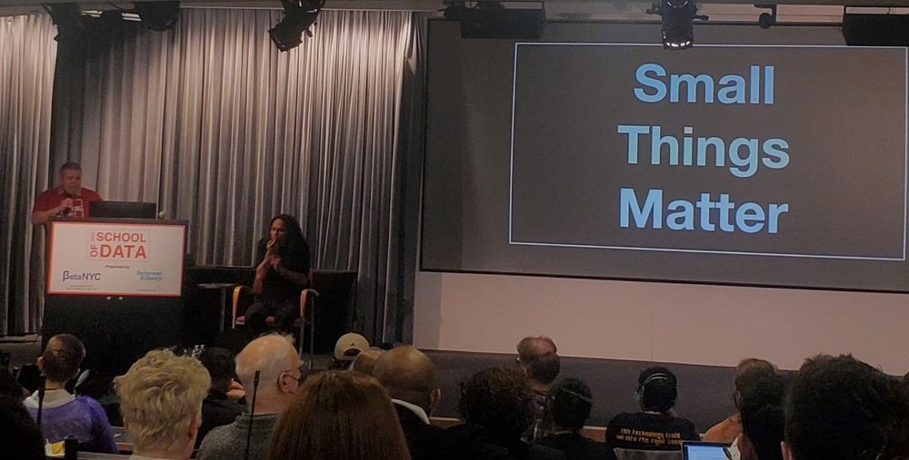
Speaker at podium giving presentation in front of slide that says "small things matter"
It's been a few years since my last @schoolofdata.nyc from @beta.nyc and a number of awesome partners. Forgot how inspiring it can be! Here's @noneck.org giving some of the remarks, with an incredible combination of insights and humility
29.03.2025 14:54 — 👍 6 🔁 3 💬 1 📌 0
Love it! While I don't really miss my commute from SI to MN overall, the ferry part and occasional bike rides were always a points of relative calm :-) Enjoy!
26.03.2025 14:09 — 👍 1 🔁 0 💬 0 📌 0
I'm in an #opendata week session and realizing that NYC's "Language Access Law" doesn't focus on American Sign Language because Sign Language is considered part of a disability...
Where can I find data on ASL in NYC?
25.03.2025 14:55 — 👍 2 🔁 2 💬 1 📌 0

NYC School of Data 2025: Learning about the NYC Urban Forest thro...
View more about this event at NYC School of Data 2025
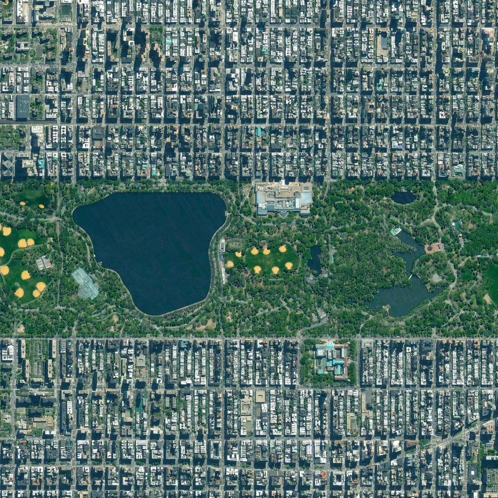
#NYCOpenData - Come learn about the latest NYC tree canopy data at @schoolofdata.nyc where I'll present on my work at @nature.org in collaboration with Uma Bhandaram from @nycgovparks.org
nycsodata25.sched.com/event/1xJzP/...
👏 to @beta.nyc, NYC OTI & others for making #NYCOpenDataWeek happen!
26.03.2025 03:15 — 👍 3 🔁 1 💬 1 📌 0
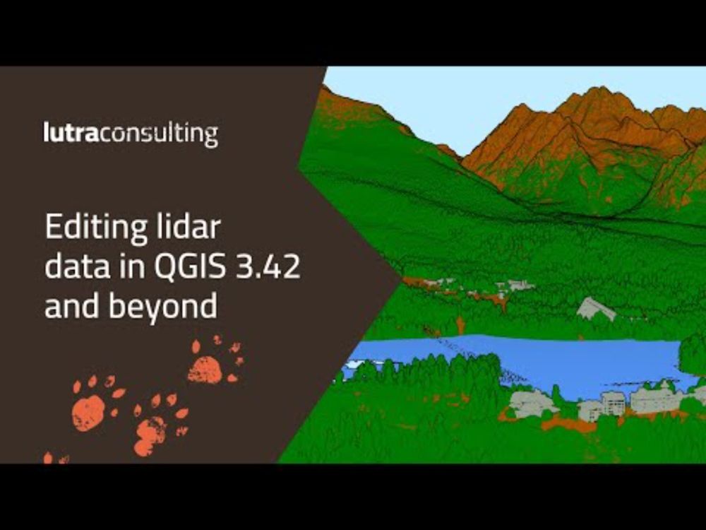
Editing LiDAR data in QGIS 3.42 and beyond
YouTube video by Lutra Consulting
Have you missed our webinar Editing LiDAR data in QGIS 3.42 and beyond?
No worries! You can now watch the recording here:
www.youtube.com/live/TRxW-g0...
20.03.2025 12:14 — 👍 5 🔁 2 💬 0 📌 0
(if you need performance gains... but I also realize it can work fine to let things run for a while while you do other things too)
04.03.2025 16:17 — 👍 1 🔁 0 💬 1 📌 0
Its been a while since I've done big vector operations in R, but a while back I went pretty all-in on using PostgreSQL/PostGIS, in part for big vector analyses, finding it to be the most performant. There's definitely overhead in getting things set up but could be worth a try?
04.03.2025 16:16 — 👍 1 🔁 0 💬 1 📌 0
#qgis users - anyone aware of a way to bookmark a specific file in the Browser Panel? e.g., if there's a COG available on the internet more broadly or in an S3 bucket that I often want - any way I can "favorite" that or otherwise have it more readily available when I open QGIS?
#gischat
28.02.2025 19:44 — 👍 0 🔁 0 💬 1 📌 0
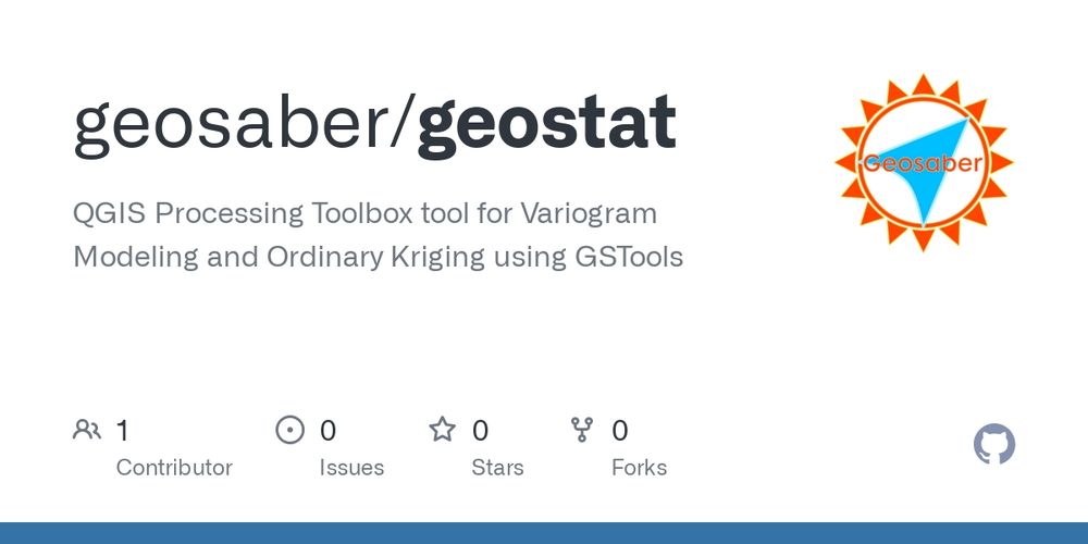
GitHub - geosaber/geostat: QGIS Processing Toolbox tool for Variogram Modeling and Ordinary Kriging using GSTools
QGIS Processing Toolbox tool for Variogram Modeling and Ordinary Kriging using GSTools - geosaber/geostat
QGIS Processing Toolbox tool for Variogram Modeling and Ordinary Kriging using GSTools
This tool automates variogram modeling and kriging within QGIS, providing a user-friendly interface for spatial interpolation.
#qgis #geostatistics #kriging #prediction #variogram
github.com/geosaber/geo...
14.02.2025 00:44 — 👍 4 🔁 4 💬 0 📌 0
Have you had a smooth experience getting big datasets from open data lately? It seems like the backend workflow for readying data to download changed and it's struggling. Was trying to get shapefiles of forestry work orders and building footprints, and it goes to "export initiated" and just hangs 😒
17.01.2025 02:41 — 👍 0 🔁 0 💬 0 📌 0
Oh, that's neat - I've gone to using gdal directly via command line more, at least for larger datasets, when it meets my needs, but awesome that the functionality is in terra!
(And great to see ya here @mdsumner.bsky.social!)
20.12.2024 14:41 — 👍 1 🔁 0 💬 0 📌 0
Thanks again @postholer.com - that was so simple and effective! Can't believe it's been years of me trying to figure out an easy approach that did that.
16.12.2024 18:56 — 👍 1 🔁 0 💬 1 📌 0
Ooh, that's neat! I'll have to give that a whirl. The less setup and dependencies, the better
10.12.2024 21:00 — 👍 0 🔁 0 💬 1 📌 0
Looks like I'm finally finding a solution through python/gdal gis.stackexchange.com/a/325751/25195 Curious to hear other approaches too though.
10.12.2024 18:10 — 👍 3 🔁 0 💬 1 📌 0
#gischat folks: any tips on exporting a geotiff with a defined color palette? e.g., in the US, NLCD opens in software with standard colors by class.
Ideally would like a #foss4g solution - an example of using #gdal or #qgis would be awesome and ideal, but welcome other tools too.
10.12.2024 18:05 — 👍 3 🔁 1 💬 3 📌 0
That a *lot* of what I do isn't that complicated... Yeah, some of the how I do things is tough because of big datasets and such, but I think GIS sometimes is sometimes unnecessarily mystified and made to feel less accessible than it can be. The dominance of expensive software doesn't help #gischat
07.11.2024 00:46 — 👍 1 🔁 0 💬 0 📌 0
Been using #qgis for so many years at this point and *just discovered* that you can turn on/off any panels and toolbars by right-clicking in the toolbar area. 🤯
#gischat
04.12.2023 00:14 — 👍 3 🔁 1 💬 0 📌 0
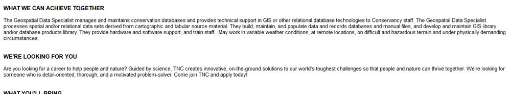
WHAT WE CAN ACHIEVE TOGETHER
The Geospatial Data Specialist manages and maintains conservation databases and provides technical support in GIS or other relational database technologies to Conservancy staff. The Geospatial Data Specialist processes spatial and/or relational data sets derived from cartographic and tabular source material. They build, maintain, and populate data and records databases and manual files, and develop and maintain GIS library and/or database products library. They provide hardware and software support, and train staff. May work in variable weather conditions, at remote locations, on difficult and hazardous terrain and under physically demanding circumstances.
WE'RE LOOKING FOR YOU
Are you looking for a career to help people and nature? Guided by science, TNC creates innovative, on-the-ground solutions to our world’s toughest challenges so that people and nature can thrive together. We’re looking for someone who is detail-oriented, thorough, and a motivated
#gischat - awesome opportunity with The Nature Conservancy in NY
careers.nature.org/psp/tnccaree...
Some summary points about the position in the attached image
30.11.2023 20:39 — 👍 1 🔁 0 💬 0 📌 0
Figured it out - exceeded the GitHub LFS free tier... for now have just bitten the bullet to have 1 packet of data and bandwidth so it "just work" in Chrome and Firefox without having to further mess with CORS issues and such. Thanks again for the suggestion to just use github for the storage!
27.11.2023 00:37 — 👍 1 🔁 0 💬 0 📌 0
Eh... disregard... thought I had that working, and now it's not
25.11.2023 02:54 — 👍 0 🔁 0 💬 1 📌 0
tnc-ny-science.github.io/nys_cities_s...
25.11.2023 02:43 — 👍 0 🔁 0 💬 1 📌 0
Took a bit of trial and error to figure out how to get the file path for github lfs that works for this but this works in both Chrome and Firefox for me
25.11.2023 02:43 — 👍 0 🔁 0 💬 1 📌 0
Good to know! It looks like it should just fit in the 2 GB file size limit. 🤞. And nice to know I'm not alone in cors issues 🙃
23.11.2023 20:20 — 👍 0 🔁 0 💬 1 📌 0
Yay! Yeah... I went way deeper into dev tools exploration in Chrome than I ever want, so kinda know what's going on but fixing it is pretty beyond my knowledge at the moment. I'll have to try from another source though and see what works
23.11.2023 17:22 — 👍 0 🔁 0 💬 1 📌 0
Official Bluesky account for NOAA's National Weather Service.
Clipping geometries into specific geometric or fanciful shapes
Data analyst, geographer, traveler
Based in Santa Cruz, SC, Bolivia
Deputy Director for MassGIS
Geospatial Technology 4 Life.
Ecologist / GIS analyst. Usually outside somewhere.
I do data, map, and programming things to help my local school district better ask and answer “Where?” questions.
Geospatial, Environmental, Science, NFFC, Cycling, London, Sheffield, Nottingham, R, Python, Postgres, Git, Anti-Tory, Rapha, Finisterre, Green Day, Rage, Snow Patrol.
Climate data scientist, analyst and communicator. I use open-source tools, open data, open science and open geospatial for good. Climatebase + Climatematch alum. I help with FedGeoDay + FOSS4G NA. Former science/env. journalist (WaPo, C&EN, Science, etc.)
Professor of ecology and evolution @ UConn. Studies adaptation, evolutionary immunology, speciation, genomics, foraging, parasite ecology and more.
Hikes, rock climbs, tango, history buff, photographer & parent
Maps, Data, Code, Open Source, Music, Birbs
#GIS #Geospatial #Mapping #FOSS4G #OpenStreetMap #Cartography
The Institute for Geospatial Understanding through an Integrative Discovery Environment (I-GUIDE, https://i-guide.io) advances convergence and geospatial sciences for sustainability solutions. Platform, Summer Schools, Spatial AI.
Conservation Biologist, Herpetology enthusiast, podcast host (Let’s Talk Turtles)! If you like turtles and/or football I think we’ll be friends!
NOT SPAM. But I was reported and nothing I can do. So this account will be inactive: find me on LinkedIn, the only platform working well.
At least the bots can flourish here. Sigh.
Director General/
Natural Resources Canada
On earth to reimagine the status quo. Founder of The Living World + Biki Gala. Co-Founder Montclair Bike Bus. Bike community organizer. Social impact advisor. Brand builder.
https://www.thelivingworld.co/
Climate, extinction, and biodiversity scientist at UMaine, researching Earth’s past for a better future. Writer and podcaster for the planet. Chaotic good professor. Forever DM. Working to be a good ancestor. She/her. #BiInSci
Colono mestizo en Abya Yala. Cartógrafo, biólogo y traductor. Software libre
#cartografía #ecología #Panamá
I make Dad jokes on NPR and also write books and other things.
The GRI (at University of Canterbury, New Zealand) provides a unique opportunity for all branches of the geospatial community to communicate and collaborate. https://geospatial.ac.nz/
Currently working on: modeling homelessness in mid-sized midwestern cities, espresso drinking, reading every book ever recommended by lewis lapham, and training to outlift my enemies