Researchers captured video of sea wolves pulling crab traps out of the sea by their lines to eat the bait inside. Wolves are so cool...
www.cbc.ca/news/canada/...
@birgybit.bsky.social
Mountain enthousiast. Scientist of the ocean, ice, climate variety. Crafter. Based at the British Antarctic Survey. Views my own.

Researchers captured video of sea wolves pulling crab traps out of the sea by their lines to eat the bait inside. Wolves are so cool...
www.cbc.ca/news/canada/...
Another favorite quote: "the greatest danger to our future is apathy."
Thank you for being the first woman scientist I looked up to as a kid and for spreading curiosity and hope.


Autumn is in full swing in the Lake District! Chanterelles, hedgehog mushrooms, boletes, amanitas and more.
23.09.2025 18:49 — 👍 1 🔁 0 💬 0 📌 0![Comic. [Two people on shore looking at body of water] PERSON 1: Hey, where’s that big island we were looking at this morning? PERSON 2 with short hair: Oh, it’s underwater. The ocean’s depth here goes up and down by like ten feet every day. PERSON 1: What? PERSON 2: It’s because the planet has a big moon orbiting near the surface. It causes weird gravity effects. PERSON 1: *What???* [caption] People here are used to them, but tides are one of the weirdest and most sci-fi elements of life on Earth.](https://cdn.bsky.app/img/feed_thumbnail/plain/did:plc:cz73r7iyiqn26upot4jtjdhk/bafkreidj2tdqhkgoamiqf5reqt7kvbpt26x3cgjxsp4rtwwb46qumcltdq@jpeg)
Comic. [Two people on shore looking at body of water] PERSON 1: Hey, where’s that big island we were looking at this morning? PERSON 2 with short hair: Oh, it’s underwater. The ocean’s depth here goes up and down by like ten feet every day. PERSON 1: What? PERSON 2: It’s because the planet has a big moon orbiting near the surface. It causes weird gravity effects. PERSON 1: *What???* [caption] People here are used to them, but tides are one of the weirdest and most sci-fi elements of life on Earth.
Sea Level
xkcd.com/3135/
Watch the seismic waves from the magnitude 8.8 earthquake off the coast of Russia sweep beneath seismic stations in North America.
By the time the waves reached North America, they are far too small to be felt by people, but can still be detected by seismic instruments. 🧪


Greenland (Kalaallit Nunaat) and Baffin Island (Qikiqtaaluk) from the sky on the way to North America. Who could sleep when there's an ice sheet, coastal glaciers, and sea ice floes to stare at!
31.05.2025 21:28 — 👍 3 🔁 0 💬 0 📌 0
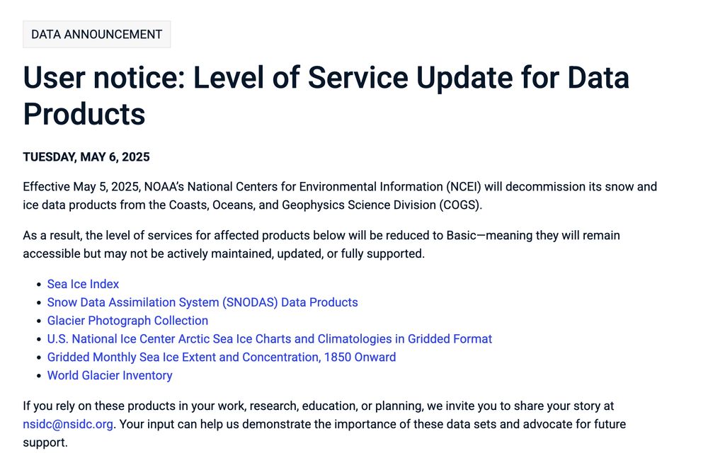
Effective May 5, 2025, NOAA’s National Centers for Environmental Information (NCEI) will decommission its snow and ice data products from the Coasts, Oceans, and Geophysics Science Division (COGS). As a result, the level of services for affected products below will be reduced to Basic—meaning they will remain accessible but may not be actively maintained, updated, or fully supported. This includes Sea Ice Index, Snow Data Assimilation System (SNODAS) Data Products, Glacier Photograph Collection, U.S. National Ice Center Arctic Sea Ice Charts and Climatologies in Gridded Format Gridded Monthly Sea Ice Extent and Concentration, 1850 Onward World Glacier Inventory. If you rely on these products in your work, research, education, or planning, we invite you to share your story at nsidc@nsidc.org. Your input can help us demonstrate the importance of these data sets and advocate for future support.
This is horrible. I don't even know what to say. Some of our most key polar data.
"As a result, the level of services for affected products below will be reduced to Basic—meaning they will remain accessible but may not be actively maintained, updated, or fully supported."
nsidc.org/data/user-re...
Happy to share that the final chapter of my PhD is published! 🥳
We built an ocean Pb model and:
(1) Identified the continued impact of pollution on Pb concentrations in the western Arctic Ocean
(2) Traced pathways of warm Atlantic Water in Baffin Bay and onto the West Greenland shelf using Pb.
It took me more than 10 years but today I was in a meeting of entirely female ice-ocean modellers (4) for what I believe is the first time
28.02.2025 11:42 — 👍 39 🔁 3 💬 0 📌 0Pine Island Glacier accounts for a large proportion of recent Antarctic ice loss. This 7.5 year animation from Sentinel-1 shows the weakening of the lateral margins and the stochastic nature of the calving process. Grab a full-screen version here: aluckman4.wixsite.com/ade-s-world-...
26.02.2025 15:30 — 👍 13 🔁 8 💬 0 📌 0