LinkedIn
This link will take you to a page that’s not on LinkedIn
Would you like to know how we build #MerginMaps to run on your phone?
Mergin Maps is #QGIS running on your phone with a simplified UI for touch screens. It's a long and difficult journey.
Are you curious? Read about it here: www.lutraconsulting.co.uk/blogs/how-we...
10.09.2025 07:06 — 👍 0 🔁 0 💬 0 📌 0

QGIS 3D for Open Source Digital Twins | Lutra Consulting
Join our crowdfunding campaign to enhance QGIS 3D tools for open-source digital twins, bringing improved performance, features, and community-driven innovation.
🚨 Last call for the QGIS 3D crowdfunding campaign! 🚨
We’re so close to the goal!
This upgrade will bring some powerful new tools to open-source GIS:
🌐 3D vector points
🌐 I3S
🌐 Point cloud support
🌐 Cross sections in orthographic view
🌐 and more!
🔗 www.lutraconsulting.co.uk/crowdfunding...
30.06.2025 11:50 — 👍 1 🔁 1 💬 0 📌 0

📍 Day 24: ESRI Scene Layers (I3S)
Like 3D Tiles, the I3S format also recognizes several data types - we will focus on supporting 3D Objects and Integrated Mesh, as these are by far the most popular ones.
👉 Help us make this reality here: www.lutraconsulting.co.uk/crowdfunding...
#QGIS
24.06.2025 13:41 — 👍 0 🔁 0 💬 0 📌 0
QGIS 3D for Open Source Digital Twins | Lutra Consulting
Join our crowdfunding campaign to enhance QGIS 3D tools for open-source digital twins, bringing improved performance, features, and community-driven innovation.
Help improve QGIS!
We are 13 days away from the end of the crowdfuning.
Support the campaign to enhance 3D vector data, ESRI Scene Layers (I3S), Point Clouds and more!
Every share and donation counts!
Learn more here: www.lutraconsulting.co.uk/crowdfunding...
#crowdfunding #QGIS #PointClouds
17.06.2025 09:55 — 👍 1 🔁 0 💬 0 📌 1
QGIS 3D for Open Source Digital Twins | Lutra Consulting
Join our crowdfunding campaign to enhance QGIS 3D tools for open-source digital twins, bringing improved performance, features, and community-driven innovation.
We are 19 days away from ending our QGIS 3D for Open Source Digital Twins campaign and every share counts! 🌐
Here are a few features this crowdfunding will bring:
📍 Add a library of 3D models.
📍 Make vector layers work in globe scenes.
📍 Add anti-aliasing
📍 Improved background
and so much more!
11.06.2025 08:57 — 👍 2 🔁 1 💬 0 📌 0
QGIS 3D for Open Source Digital Twins | Lutra Consulting
Join our crowdfunding campaign to enhance QGIS 3D tools for open-source digital twins, bringing improved performance, features, and community-driven innovation.
Crowdfunding alert!
QGIS is going 3D - and you can help make it happen.
Lutra Consulting and Northroad is crowdfunding to bring native 3D rendering+open digital twin support to QGIS.
🔗 www.lutraconsulting.co.uk/crowdfunding...
#QGIS #OpenSource #3DGIS #DigitalTwins
29.05.2025 11:22 — 👍 2 🔁 0 💬 0 📌 0

Peter Petrík and Patrik Mizera are attending #FOSSGIS2025 🙌 If you're attending too, don’t hesitate to say hello!
26.03.2025 10:44 — 👍 0 🔁 0 💬 0 📌 0
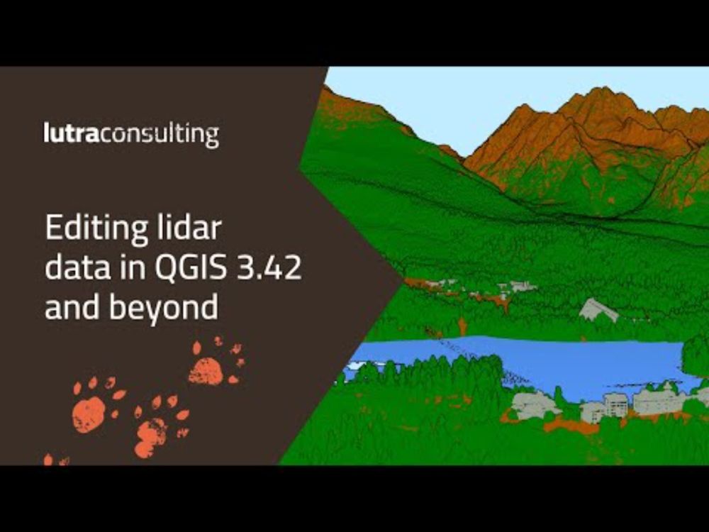
Editing LiDAR data in QGIS 3.42 and beyond
YouTube video by Lutra Consulting
Have you missed our webinar Editing LiDAR data in QGIS 3.42 and beyond?
No worries! You can now watch the recording here:
www.youtube.com/live/TRxW-g0...
20.03.2025 12:14 — 👍 5 🔁 2 💬 0 📌 0
📢 Reminder
Editing LiDAR data in QGIS 3.42 and beyond webinar starts in 90 minutes 🕧
We can't wait to see you all!
Link to the webinar: www.youtube.com/live/TRxW-g0...
#QGIS #Lidar #dataprocessing #webinar
20.03.2025 09:58 — 👍 4 🔁 1 💬 0 📌 1
Editing LiDAR data in QGIS 3.42 and beyond
YouTube video by Lutra Consulting
Less than 24 hours left before Lutra Consulting Editing lidar data in QGIS 3.42 and beyond.
We hope you are as excited as we are!
Link to the webinar (20.3.2025 11:30 UTC ): youtube.com/live/TRxW-g0...
Add event to your calendar: bit.ly/4ivcATH
19.03.2025 14:42 — 👍 1 🔁 0 💬 0 📌 0
Editing LiDAR data in QGIS 3.42 and beyond
YouTube video by Lutra Consulting
Editing lidar data in QGIS 3.42 and beyond WEBINAR💻
Date: 🗓️ 20.3.2025 11:30 UTC
Duration: 🕧30 minutes + 15 minutes Q&A session
Link to the webinar (20.3.2025 11:30 UTC ): youtube.com/live/TRxW-g0...
Add event to your calendar: bit.ly/4ivcATH
#QGIS #Webinar #LiDAR #lutraconsulting
11.03.2025 13:42 — 👍 11 🔁 4 💬 0 📌 0
Point clouds editing coming to @qgis.fosstodon.org.ap.brid.gy
22.01.2025 07:59 — 👍 8 🔁 3 💬 0 📌 0
New video: segment anything in #QGIS with the Geo-SAM plugin. With examples to segment solar panels in cities and parcels in rural areas. :qgis:
#GeoAI
https://youtu.be/GSKmK7qERUw
17.01.2025 07:03 — 👍 3 🔁 2 💬 0 📌 0

Thank you father Xmas aka @lutraconsulting.bsky.social - I was bummed out that I could not join this year, but this makes it better! #qgis
25.12.2024 23:12 — 👍 13 🔁 2 💬 0 📌 0
Adding an autoclose option to Freehand mode in Terra Draw - when your cursor reenters the starting point it will close the polygon automatically #geojson #leaflet #maplibre #gischat
06.12.2024 23:14 — 👍 5 🔁 1 💬 0 📌 0

@geoskeptic.bsky.social is presenting state of #STAC during foss4g 2024.
05.12.2024 13:01 — 👍 1 🔁 0 💬 0 📌 0

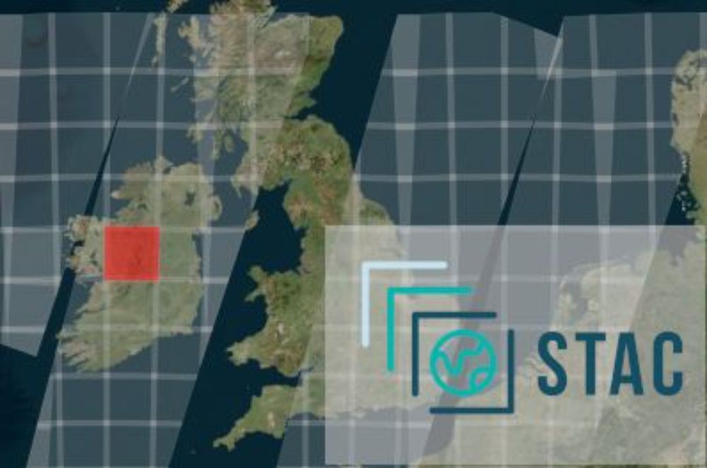
Making #STAC a first class citizen in QGIS, Saber Razmjooei at Lutra Consulting gives a live demo connecting and filtering from a STAC API #FOSS4G2024
04.12.2024 17:15 — 👍 13 🔁 2 💬 0 📌 0
Anybody up to test out my new QGIS plugin and confirm it works? I'm waiting for approval on plugins.qgis.org/plugins/qgis... but you can download and add as a zip from github.com/cholmes/qgis.... Enables download of the viewport of Overture, source.coop or any GeoParquet URL.
02.12.2024 19:44 — 👍 30 🔁 6 💬 3 📌 1
During @foss4g in Belem, we will be presenting SpatioTemporal Asset Catalogs (STAC) integration in @QGIS. Join us to see the latest development.
03.12.2024 15:37 — 👍 4 🔁 1 💬 0 📌 0
Working on geospatial software? Let me know so I can add you to the Geospatial Developers starter pack: go.bsky.app/cnR8bN #gischat #leafletjs #geojson #maplibre #openlayers
18.11.2024 12:44 — 👍 54 🔁 19 💬 33 📌 1
Please add me too 🙂
19.11.2024 20:32 — 👍 0 🔁 0 💬 1 📌 0
OpenStreetMap has announced support for vector tiles. To add the data in
@qgis.fosstodon.org.ap.brid.gy
, you can use vector.openstreetmap.org/shortbread_v...
as source and pnorman.github.io/tilekiln-sho... as style.
#qgis #osm
19.11.2024 09:56 — 👍 2 🔁 0 💬 0 📌 0
Geographer who now spends his time on cloud architecture. Engineering Director @Trimble for workflows.
Lifelong baseball fan, proud supporter of the San Francisco Giants, and a devoted thalassophile.
My Twitter Archive resides at @cageyjames.bsky.social
An orienteer living in Kansas.
🔥🗺️ Pyrogeographer.
🛰️🛩️🔥 #RemoteSensing of #Wildfire.
❤️🚒 Passionate about finding ways to help emergency responders.
📣 #SciComm
👩💻 https://www.kristaleewest.com/
📍 Colorado, USA
he/him; Geospatial, Geology, Geophysics, Software Engineering, Open Source, Open Data, Proj, GDAL, Ocean Mapping, etc. Cofounder of Global Fishing Watch, Whale Alert, NOAA's Environmental Response Management Application (ERMA), NASA Ames Viz&StereoPipe
🤔 Pensando la ciencia 💫
Jorge A. Vázquez, artista de los planetarios desde 1996.
Investigo comunicación e historia de la ciencia en UV.
Yo también renuncié a dirigir un máster en UNIR, en mi caso el de astrofísica.
Socio de AEC2 y SEO Birdlife.
Coastal scientist, @UOW, Director Environmental Futures, cancer survivor. Passionate about family, science, nature 🌏 🌳 🌊 🧪
Field CTO, product, customers, strategy at Dizzion. 3 x start-up acquisition. Microsoft MVP, NVIDIA NGCA, ex-Citrix CTP & VMware vExpert, Christian, Dutch
Geographer with a strong dedication to geoinformatics. GIS expert @dbsystel
Tinkering with geospatial tech, mainly Esri. Hobbyist map maker, usually of or around Melbourne.. Love bikes and homelab experiments.
🌐 spatial data, 🎮 games, 🐕 dog
The Cat in the Hat Can Map This and That!
#data #maps #GIS #baci #condivisione.
Orgoglioso di essere presidente di onData
Geologo, apasionado del GIS, a veces programo cosas en python para QGIS.
🐶🌍🌎🌏🗺
Principal Engineer @ Parkopedia | Machine Learning. Geospatial. Mapping. Python. Occasional Rust 🦀 | Views my own.
Institutional investor, software background
- VC @ http://Broom.Ventures
- Personal: http://danvk.com
- Forest restoration project: http://OrangeWoods.US
- Formerly JP Morgan, http://Chain.link, multiple startup founder & operator. AI/ML/NLP since 1996.
I work with: #linux #mysql #php (sadly) #nodejs #docker #typescript #angular #ionic #capacitor #maplibre #graphhopper #android, #ios ... and more
Motorcycles: #K100RS, #R1100S, #DR650SE
Sailboat: #SunOdyssey 44
I've also been known to write, reluctantly